Pennsylvania County Maps
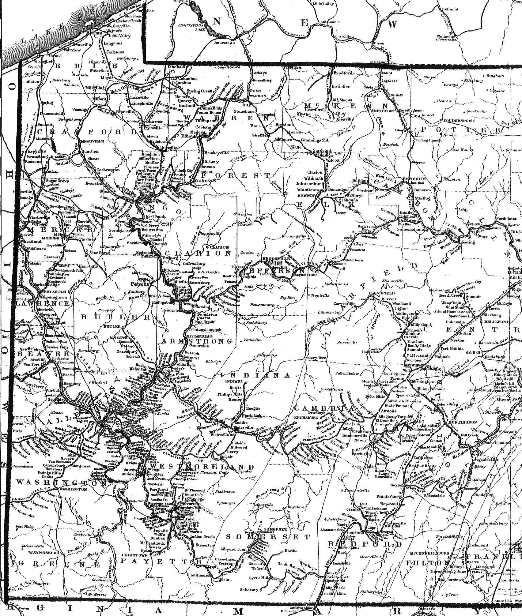
Western PA 1876 (525kb)
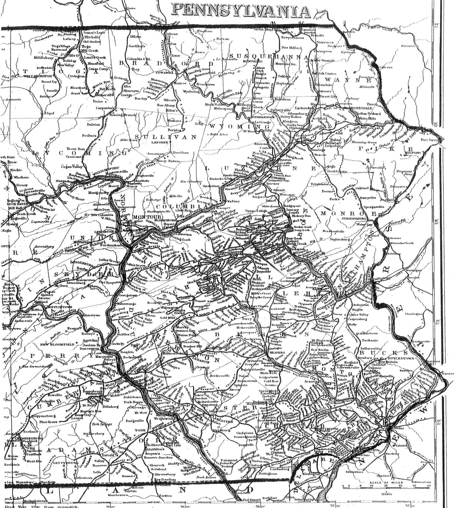
Eastern PA 1876 (565kb)
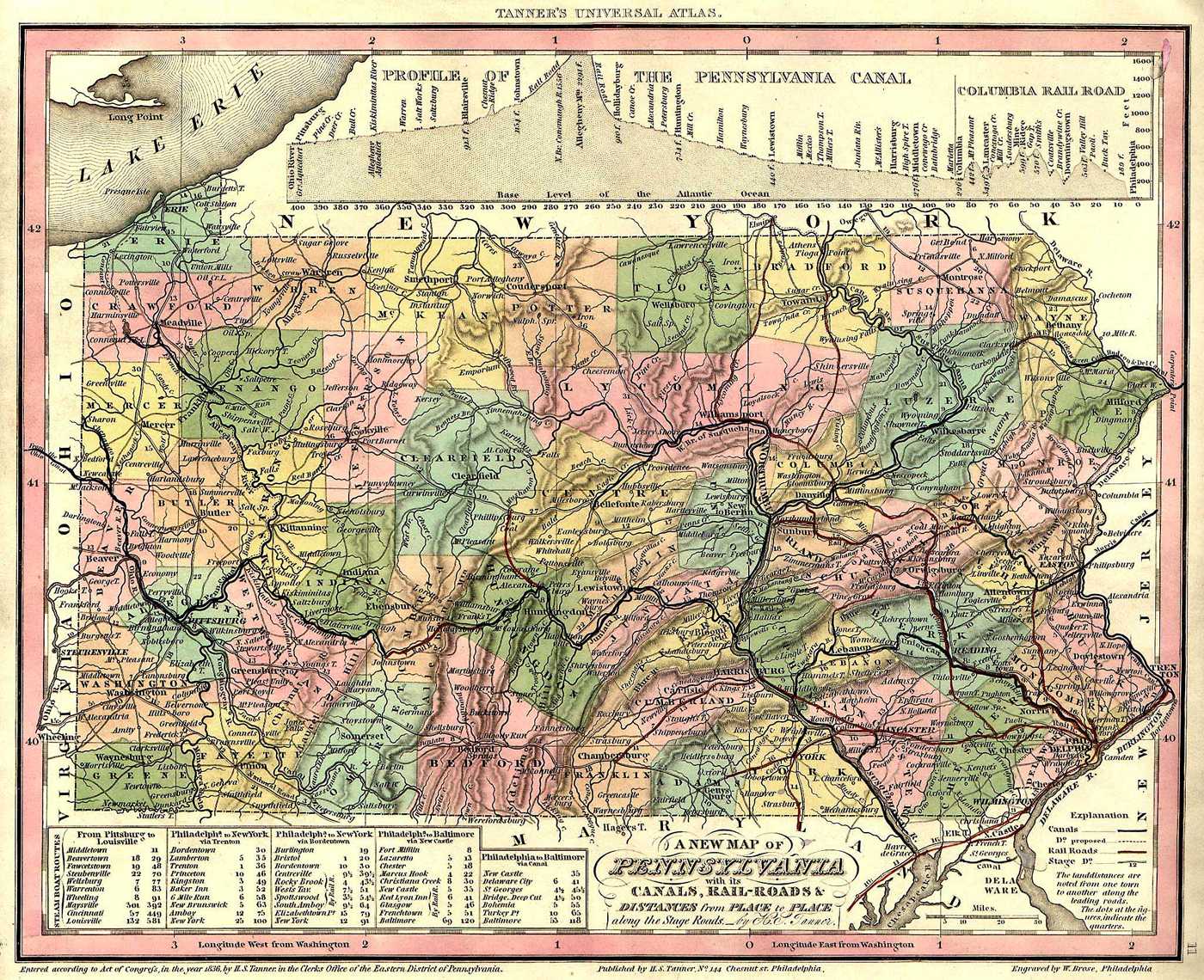
Pennsylvania 1836 (401kb)
PA USGS Map Index
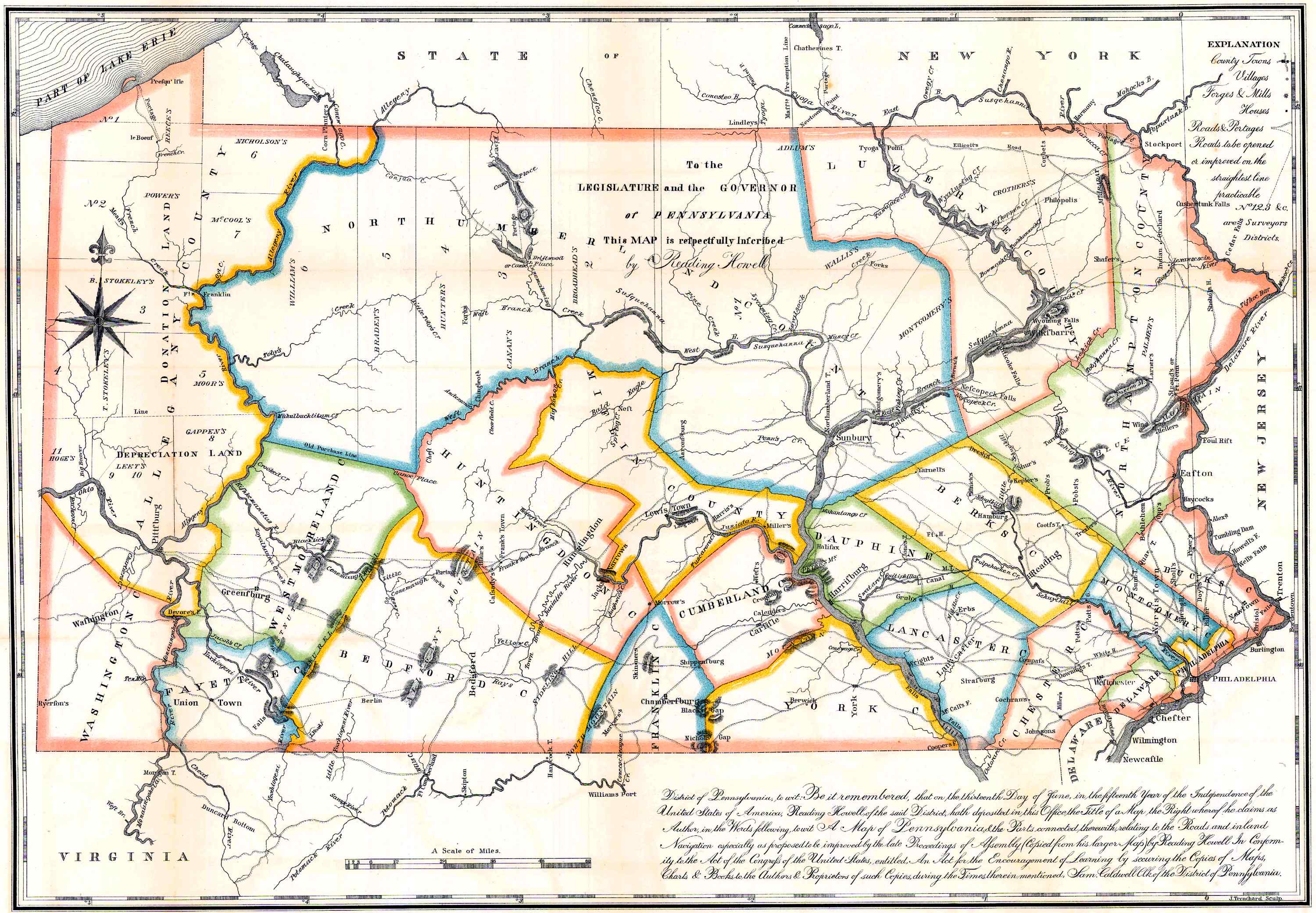
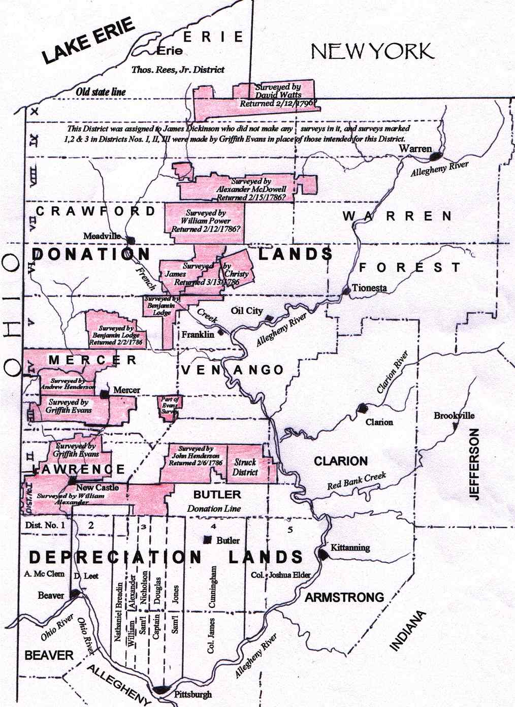
Pa. Survey Map 1791 (705kb)
Donation/Depreciation Lands Map
Township Search
Town Search
Township List
Ancestor Tracks
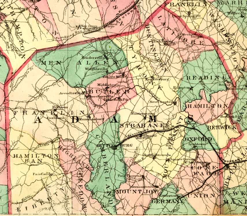
Adams County
Gettysburg
USGS Township Maps
Adams County 1872 Outline
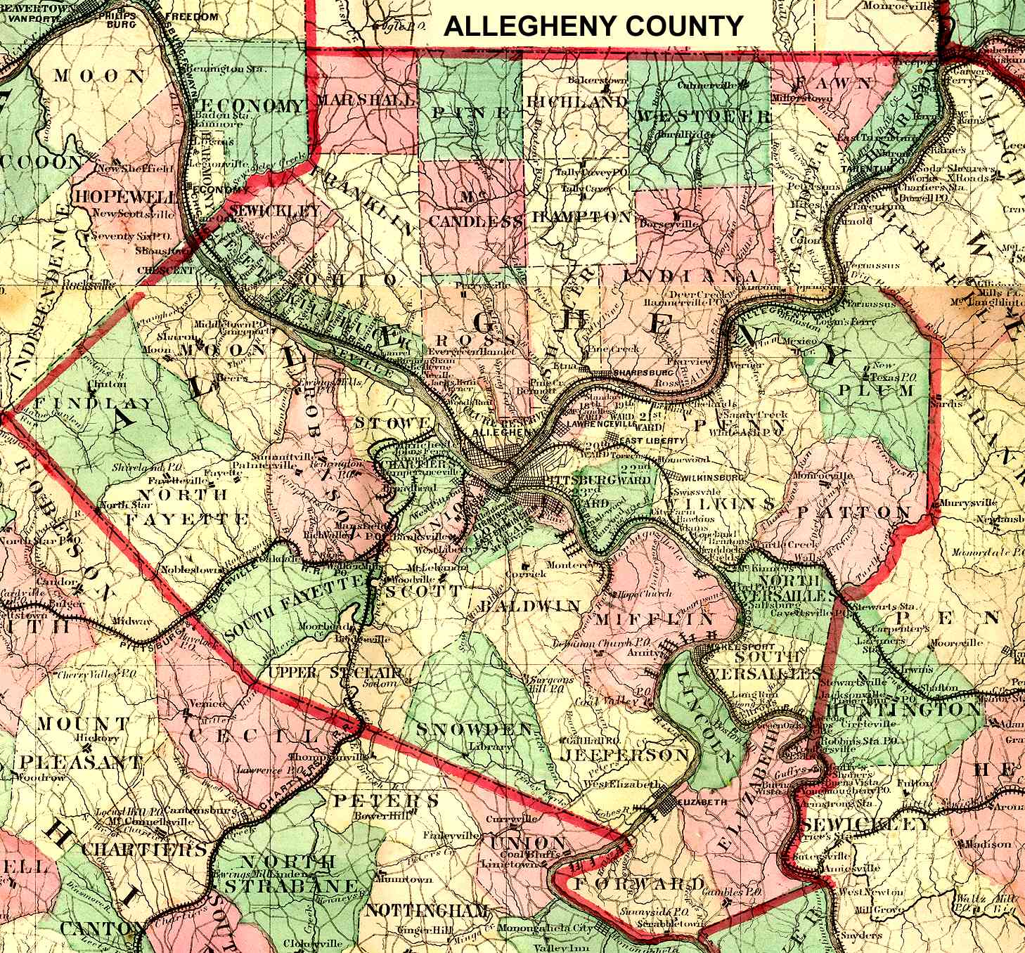
Allegheny County
Pittsburgh
USGS Township Maps
Allegheny County 1872 Outline
Allegheny/Pgh Plats, Pitt Library
Allegheny Map 1889
Depreciation Lands
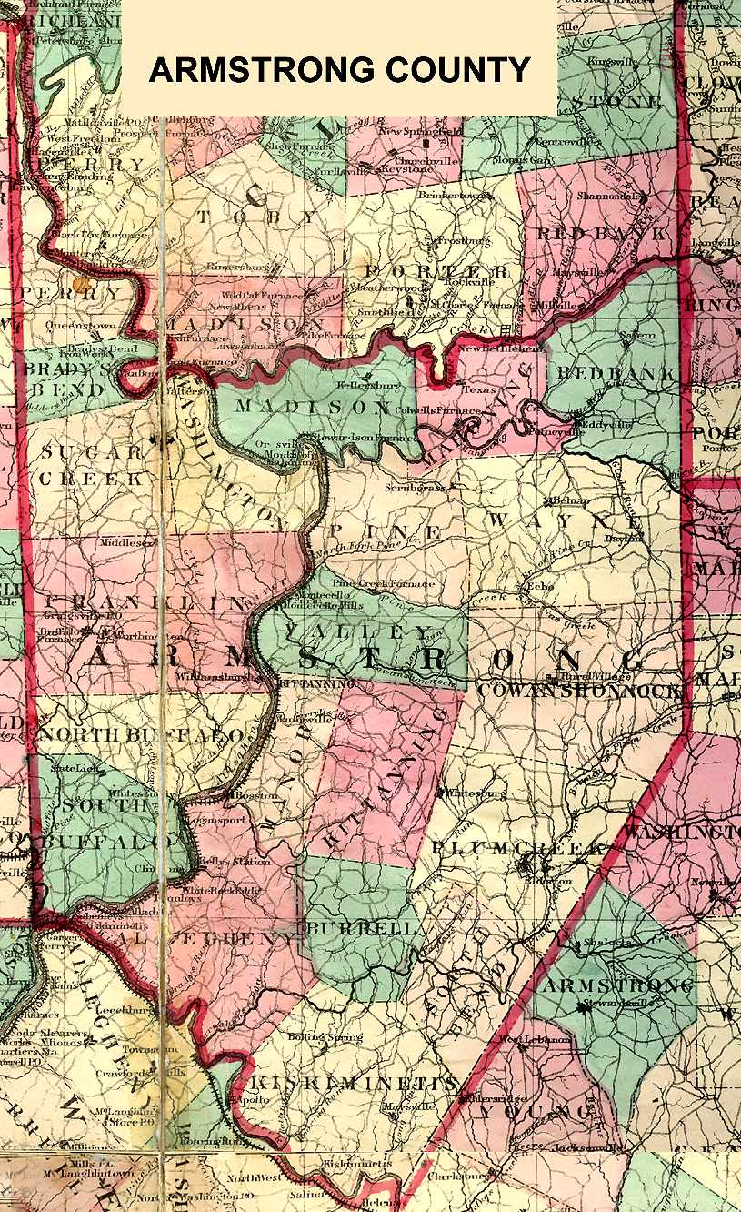
Armstrong County
Kittanning
USGS Township Maps
Armstrong County 1872 Outline
1876 Armstrong Co. Atlas
1861 Pomeroy Map of Armstrong County
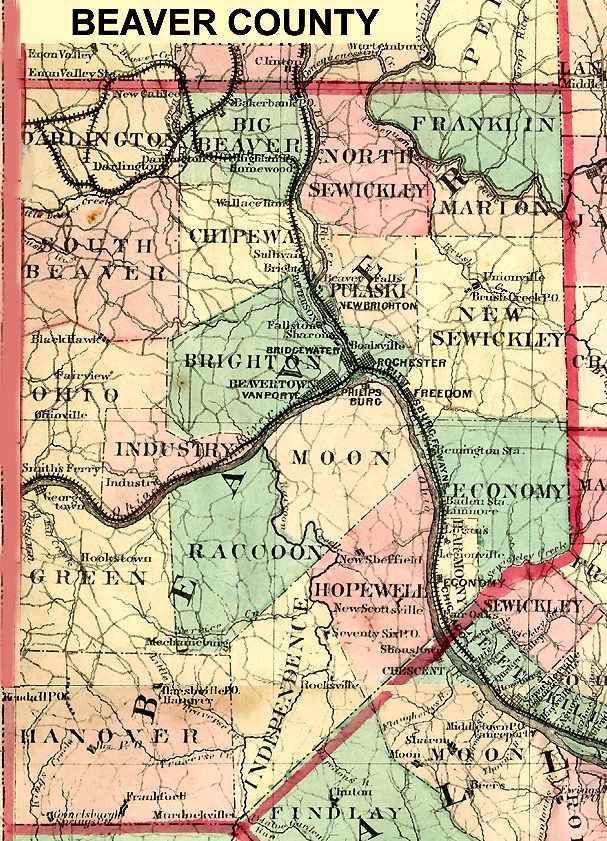
Beaver County
Beaver
USGS Township Maps
Beaver County 1872 Outline
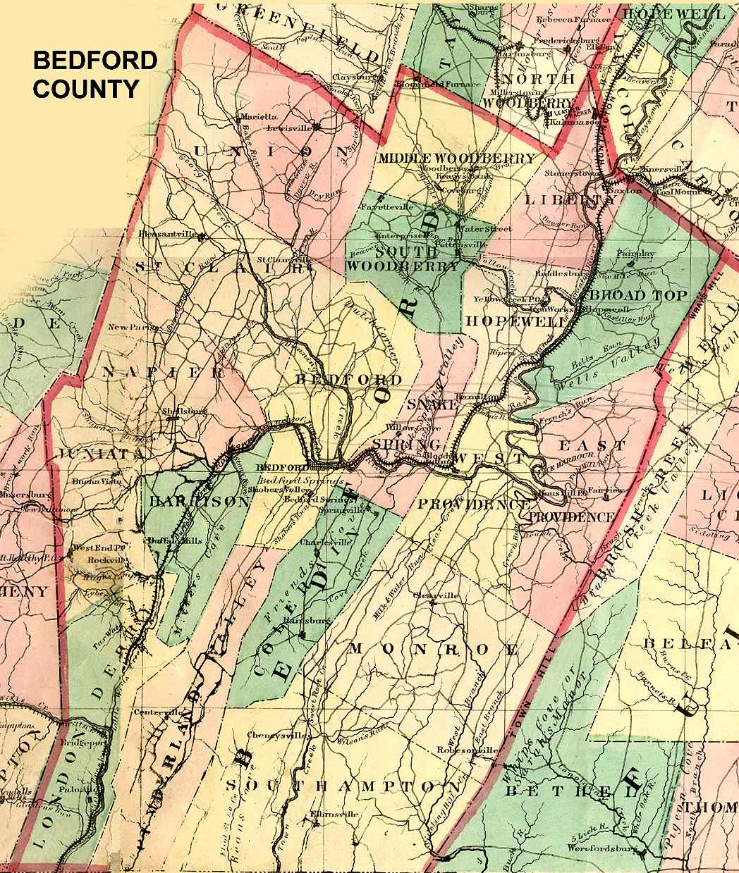
Bedford County
Bedford
USGS Township Maps
Bedford County 1872 Outline
Berks County
Reading
USGS Township Maps
1876 Berks County Atlas
Berks County Township Maps
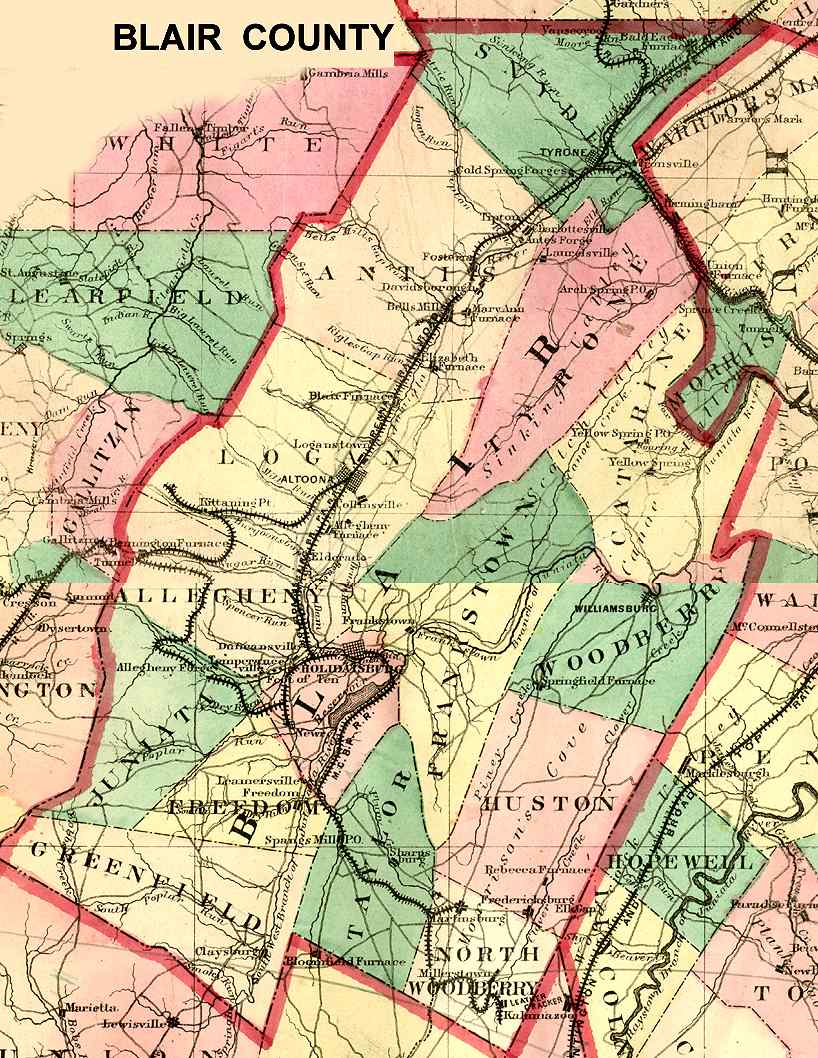
Blair County
Hollidaysburg
USGS Township Maps
1873 Blair County Atlas
Blair County 1872 Outline
Bradford County
Towanda
USGS Township Maps
Bradford County 1891 Outline
Bucks County
Doylestown
USGS Township Maps
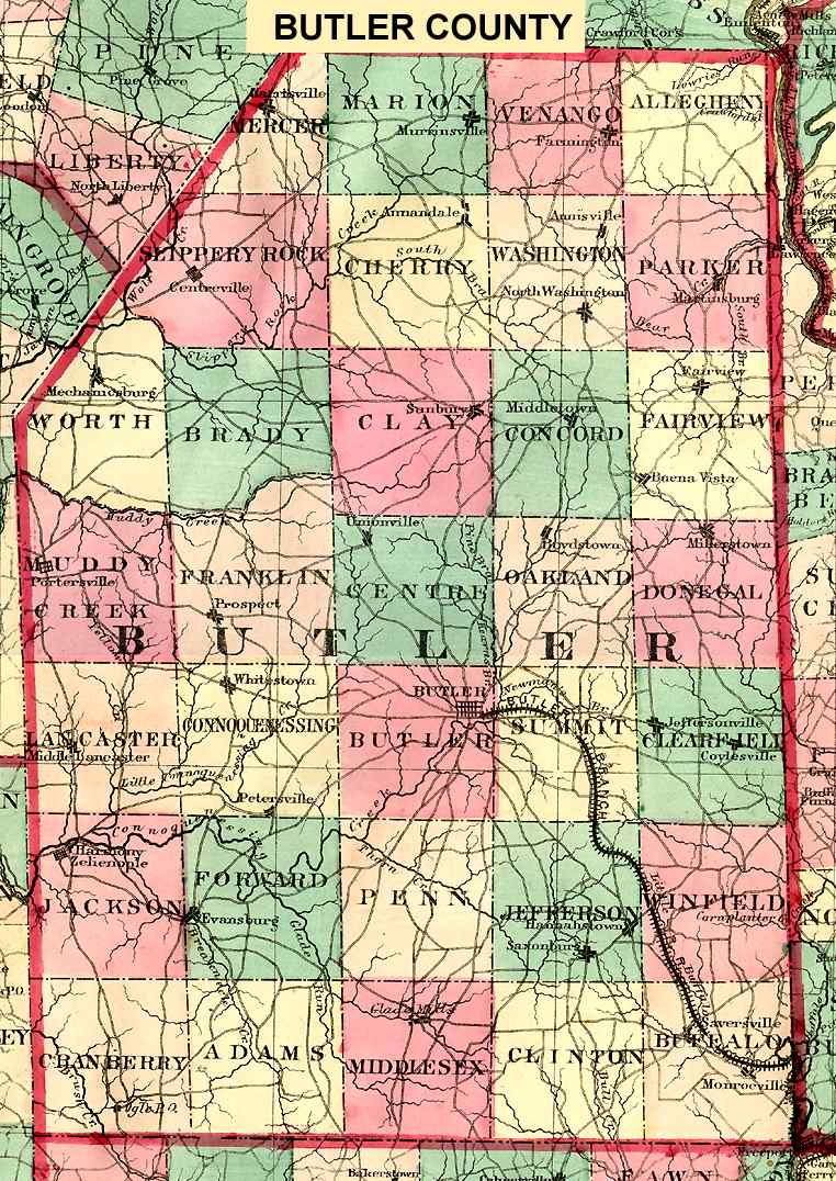
Butler County
Butler
USGS Township Maps
Butler County 1872 Outline
1874 Butler County Atlas
Survey Maps of Butler County
Depreciation Lands
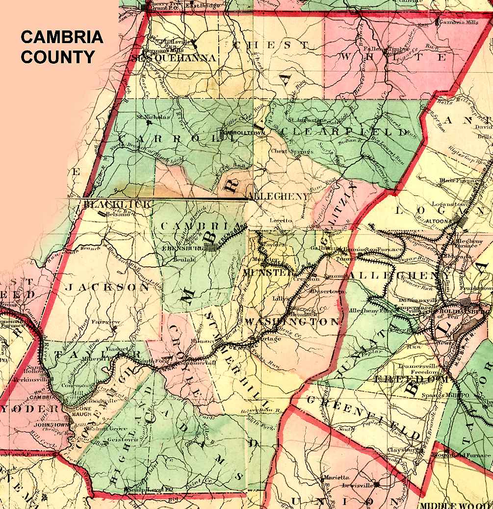
Cambria County
Ebensburg
USGS Township Maps
Cambria County 1872 Outline
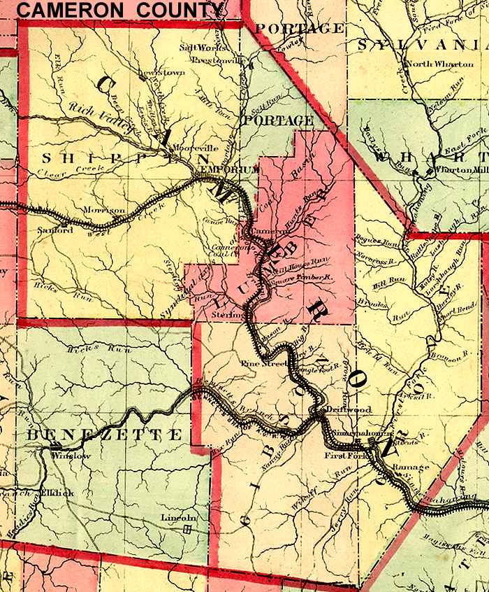
Cameron County
Emporium
USGS Township Maps
Cameron County 1872 Outline
Carbon County
Jim Thorpe
USGS Township Maps
Carbon County Atlas, Beers 1875
Centre County
Bellefonte
USGS Township Maps
Chester County
West Chester
USGS Township Maps
London Grove Township (large)
London Grove Township (small)
West Marlborough Township (large)
West Marlborougn Township (small)
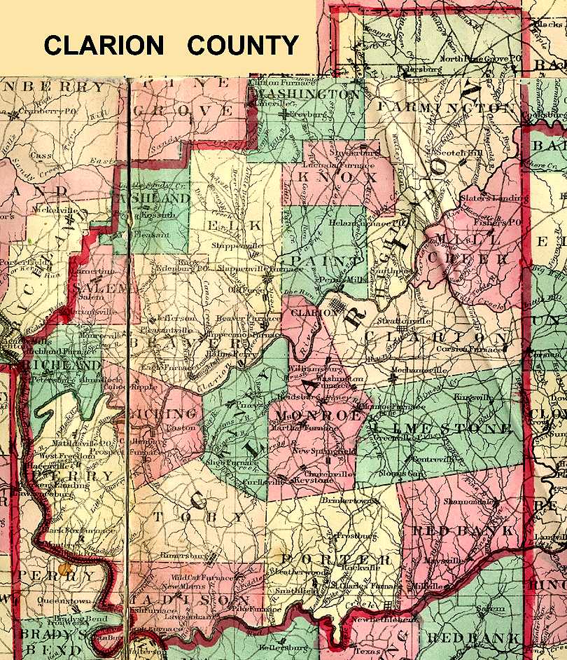
Clarion County
Clarion
USGS Township Maps
Clarion County 1872 Outline
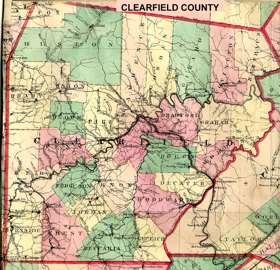
Clearfield County
Clearfield
USGS Township Maps
Clearfield County 1872 Outline
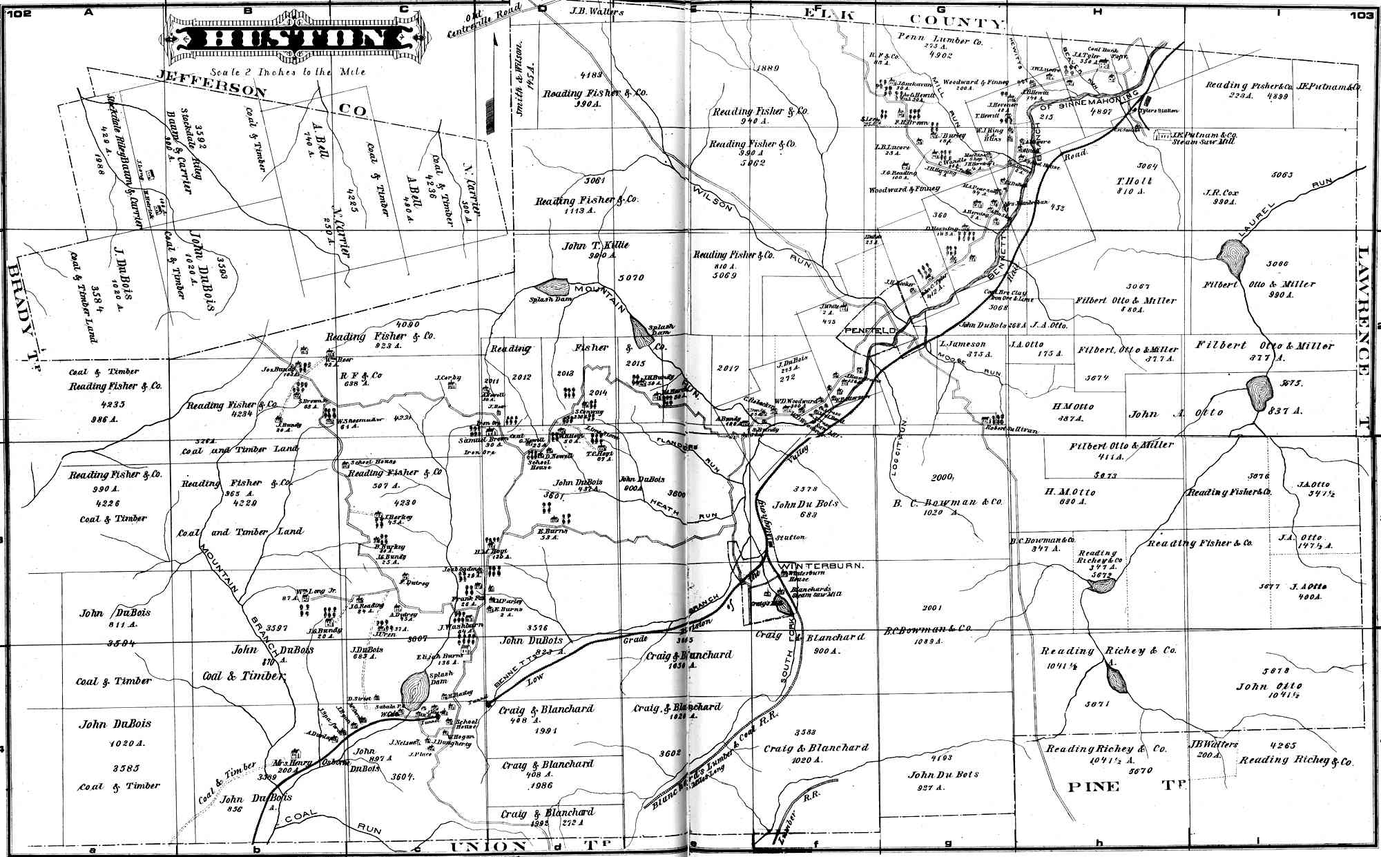
Huston Township
Clinton County
Lock Haven
USGS Township Maps
Columbia County
Bloomsburg
USGS Township Maps
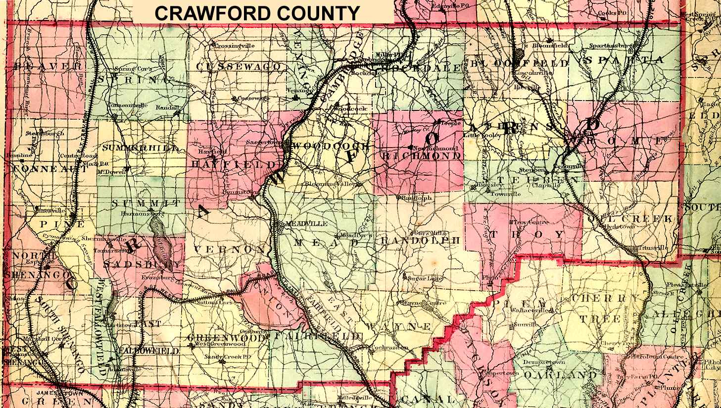
Crawford County
Meadville
USGS Township Maps
1876 Crawford County Atlas (partial)
Crawford County 1872 Outline
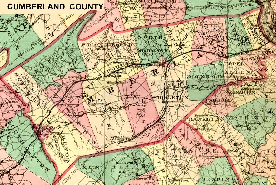
Cumberland County
Carlisle
USGS Township Maps
Cumberland County 1872 Outline
Dauphin County
Harrisburg
USGS Township Maps
Dauphin County Outline 1875
Delaware County
Media
USGS Township Maps
Delaware County 1870 (Andys Atlases)
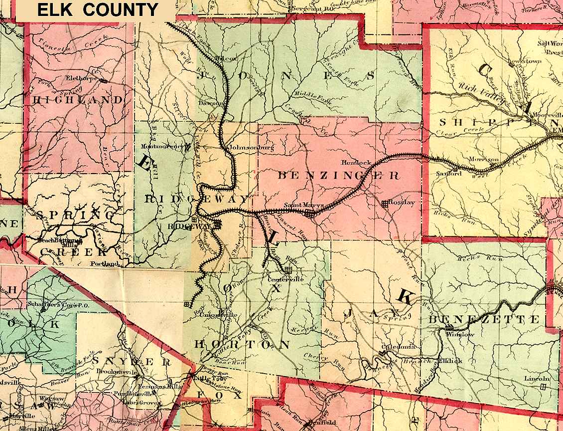
Elk County
Ridgeway
USGS Township Maps
Elk County 1872 Outline
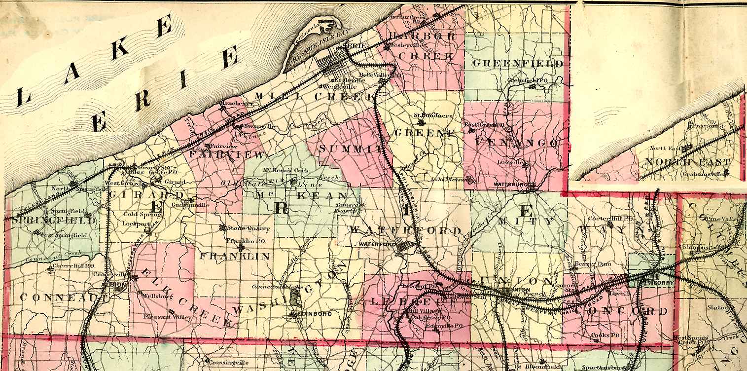
Erie County
Erie
USGS Township Maps
Erie County 1872 Outline
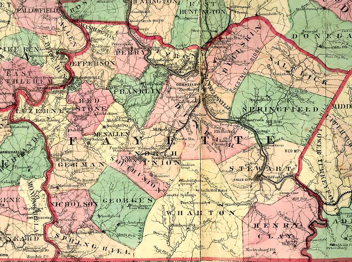
Fayette County
Uniontown
USGS Township Maps
Fayette County 1872 Outline
1872 Fayette County Atlas
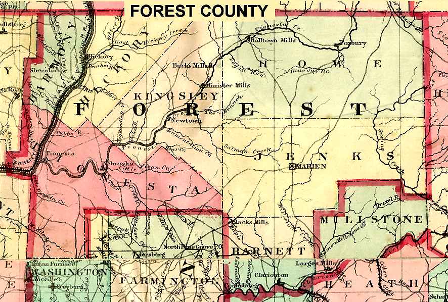
Forest County
Tionesta
USGS Township Maps
Forest County 1872 Outline
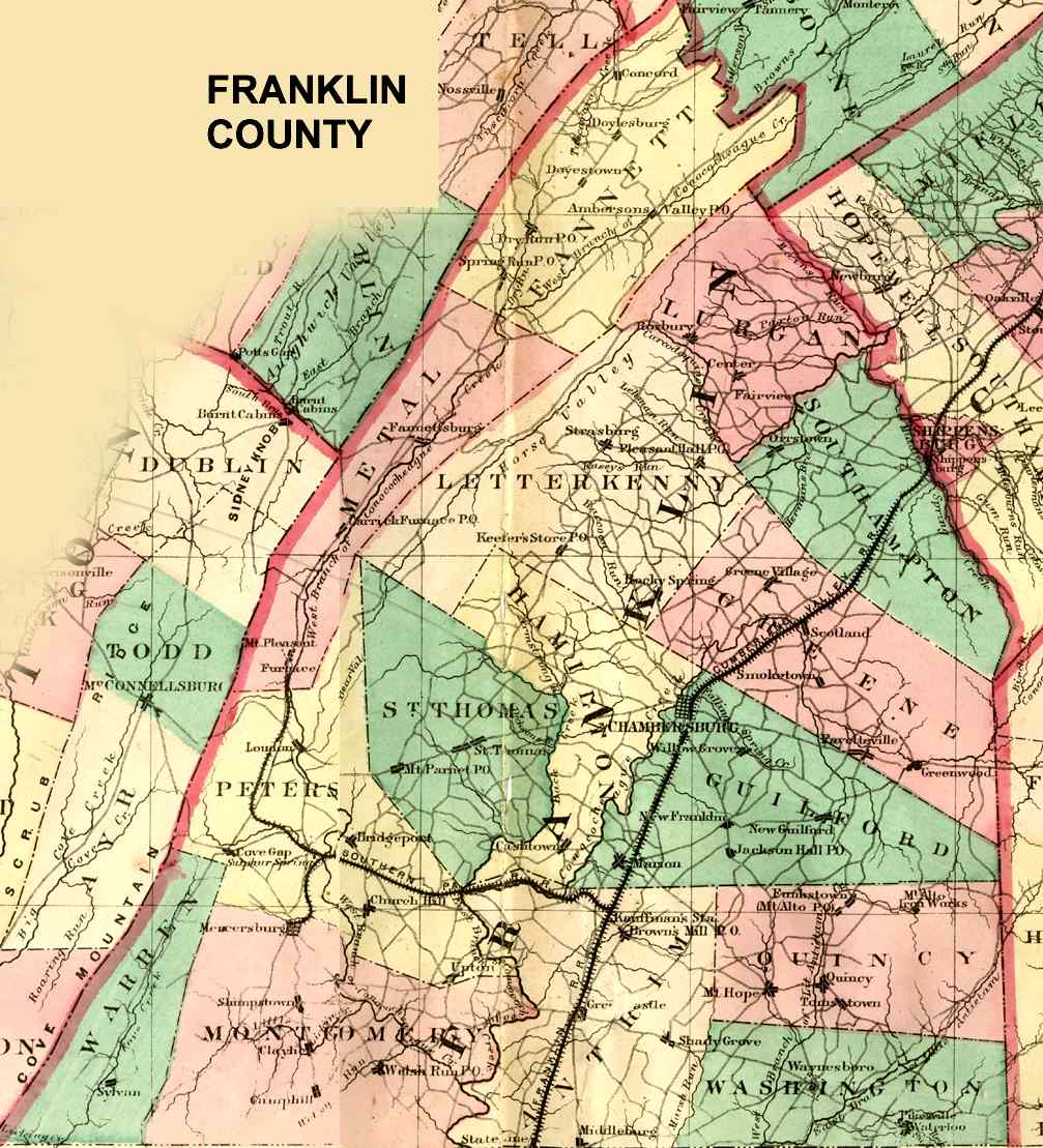
Franklin County
Chambersburg
USGS Township Maps
Franklin County 1872 Outline
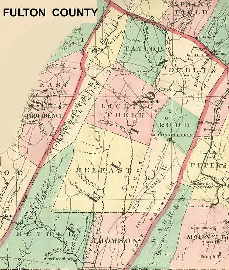
Fulton County
McConnellsburg
USGS Township Maps
1916 Fulton County Atlas
Fulton County 1872 Outline
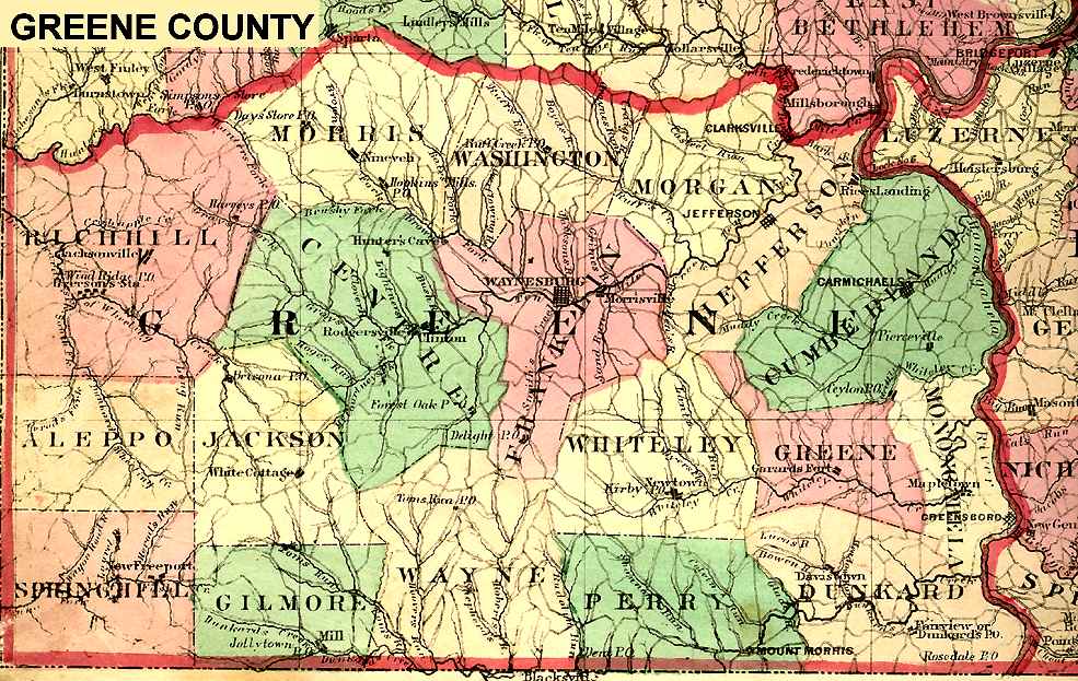
Greene County
Waynesburg
USGS Township Maps
Greene County 1872 Outline
Huntingdon County
Huntingdon
USGS Township Maps
1873 Huntingdon County Atlas
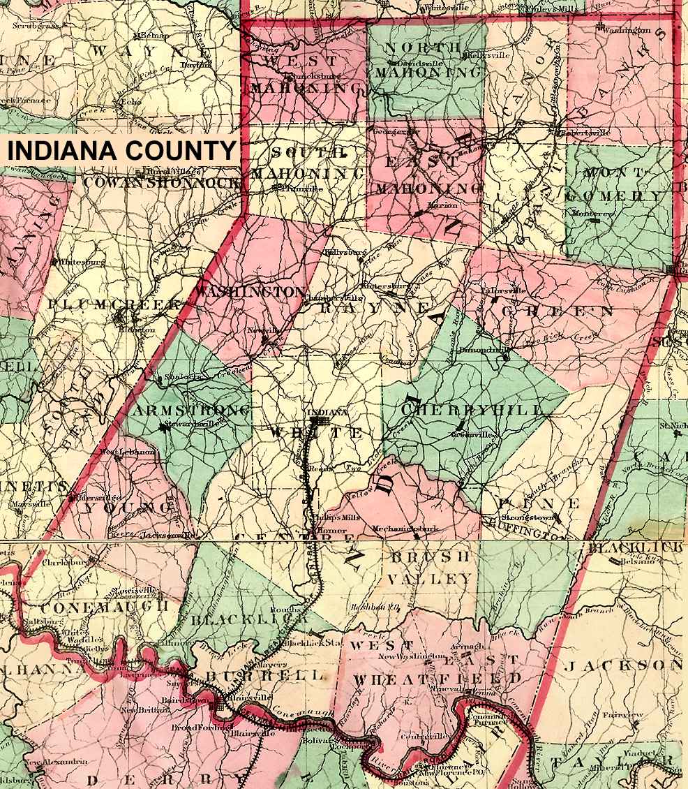
Indiana County
Indiana
USGS Township Maps
Indiana County 1872 Outline
1871 Indiana County Atlas
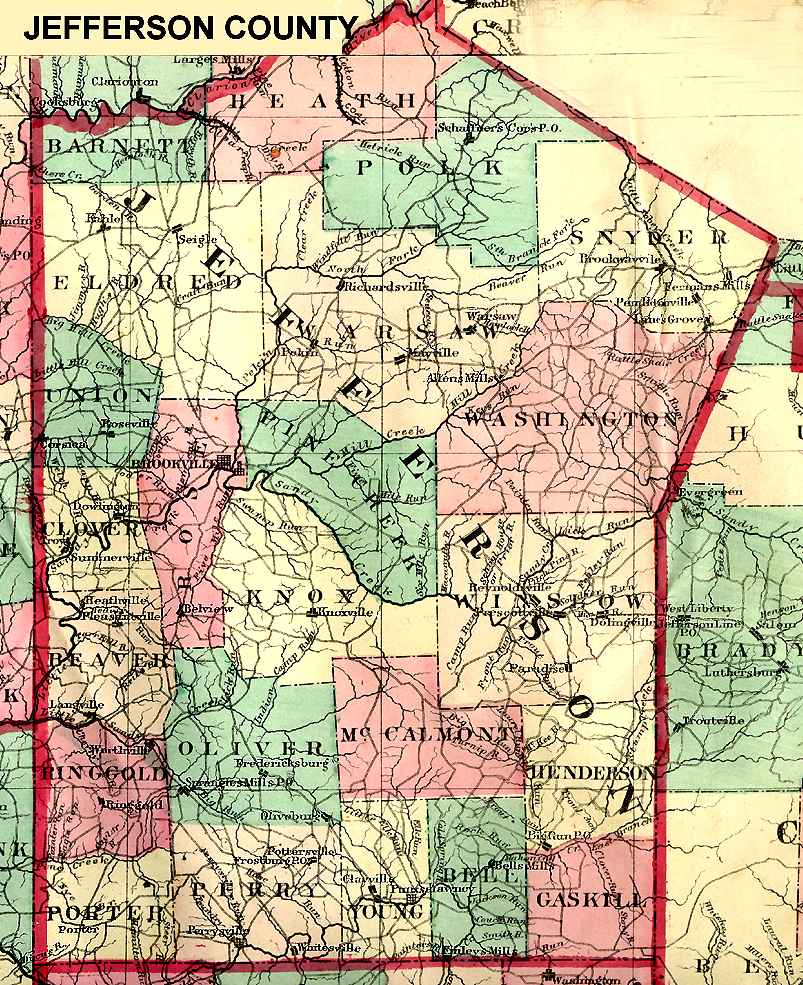
Jefferson County
Brookville
USGS Township Maps
Jefferson County 1872 Outline
1878 Jefferson County Atlas
Juniata County
Mifflintown
USGS Township Maps
Lackawana County
Scranton
USGS Township Maps
Lackawana/Luzerne 1873 Beers
Lackawana Outline 1884
Lancaster County
Lancaster
USGS Township Maps
Lawrence County
New Castle
USGS Township Maps
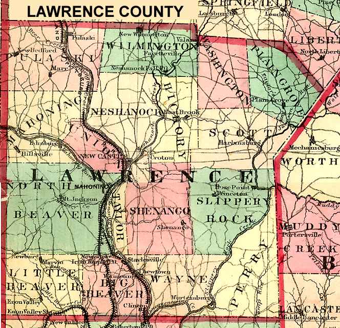
Lawrence County 1872 Outline
1872 Atlas of Lawrence County
Depreciation/Donation Lands
Lebanon County
Lebanon
USGS Township Maps
Lehigh County
Allentown
USGS Township Maps
Luzerne County
Wilkes-Barre
USGS Township Maps
1873 Luzerne County Atlas
Lycoming County
Williamsport
USGS Township Maps
Lycoming County Outline 1892
McKean County
Smethport
USGS Township Maps
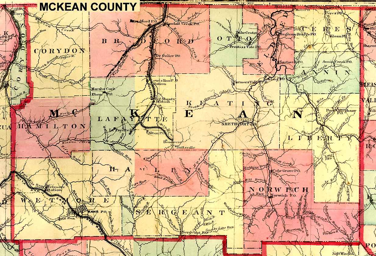
McKean County 1872 Outline
Mercer County
Mercer
USGS Township Maps
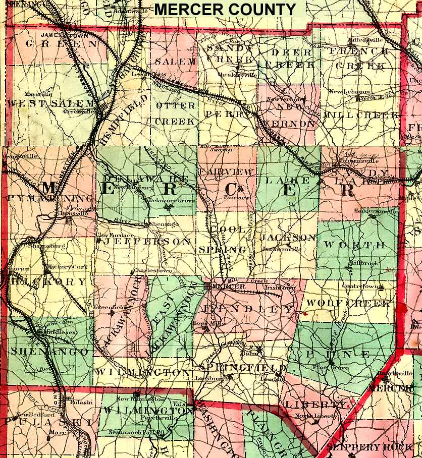
Mercer County 1872 Outline
Mifflin County
Lewistown
USGS Township Maps
Monroe County
Stroudsburg
USGS Township Maps
Montgomery County
Norristown
USGS Township Maps
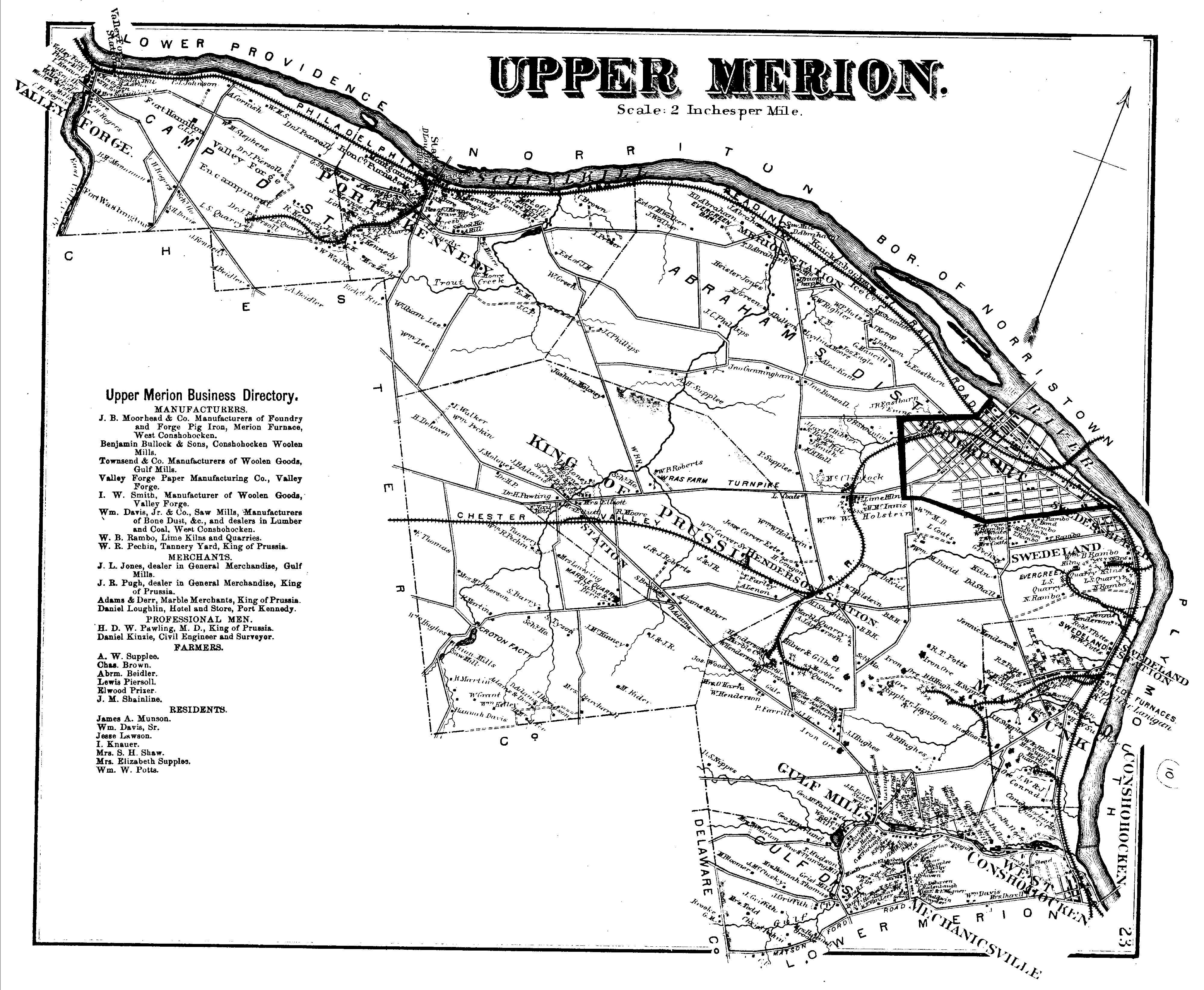
Upper Merion (from old atlas)
Montgomery County and Pa. Atlases
Montour County
Danville
USGS Township Maps
Northampton County
Easton
1874 Northampton County Atlas
USGS Township Maps
Northumberland County
Sunbury
USGS Township Maps
Perry County
New Bloomfield
USGS Township Maps
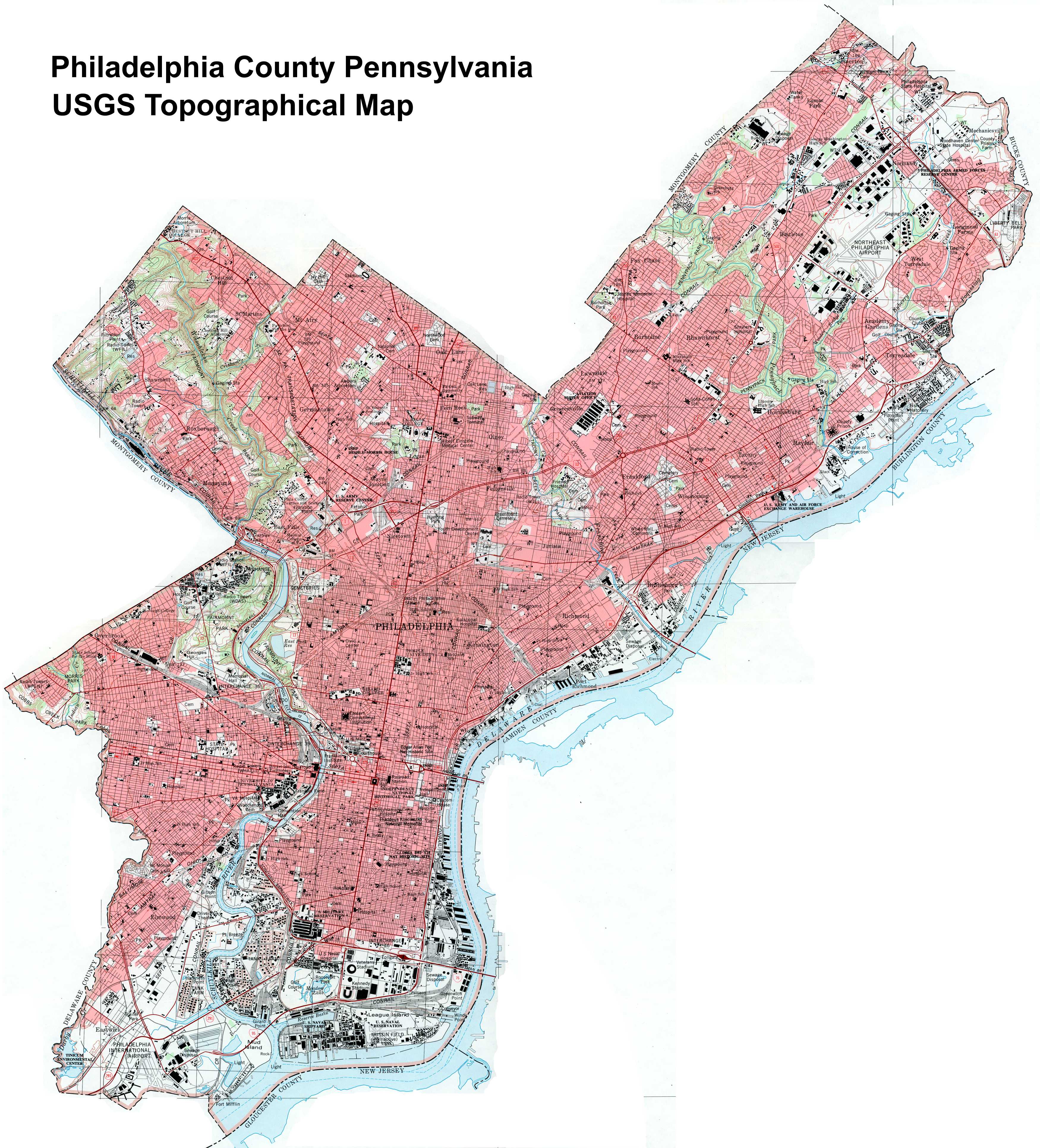
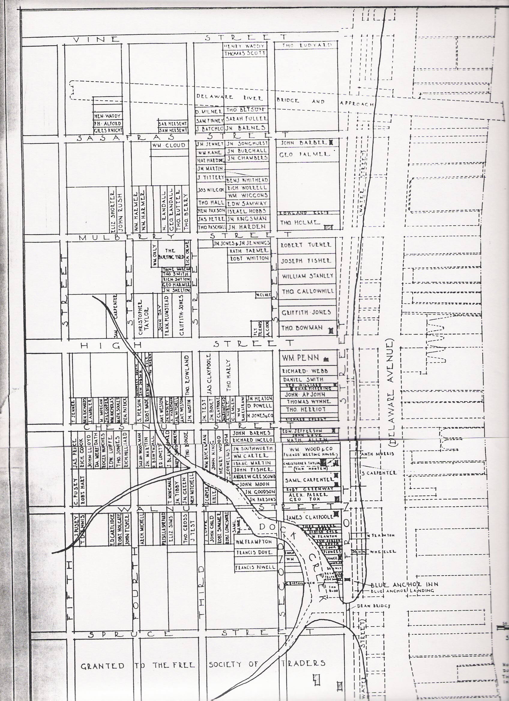
Philadelphia County
Philadelphia
USGS County Map
1684 Philadelphia Atlas
Pike County
USGS Township Maps
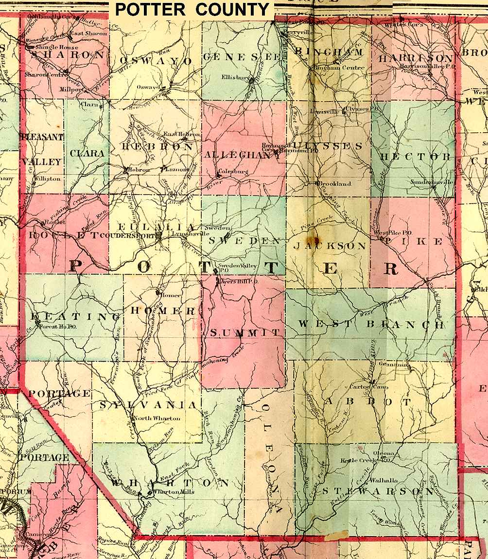
Potter County
Coudersport
USGS Township Maps
Potter County 1872 Outline
Schuylkill County
Pottsville
USGS Township Maps
Schuylkill Outline Map
Snyder County
Middleburg
USGS Township Maps
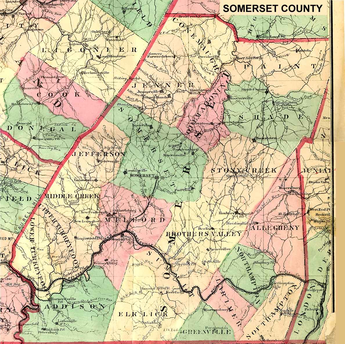
Somerset County
Somerset
USGS Township Maps
Somerset County 1872 Outline
Sullivan County
Laporte
USGS Township Maps
Susquehanna County
Montrose
USGS Township Maps
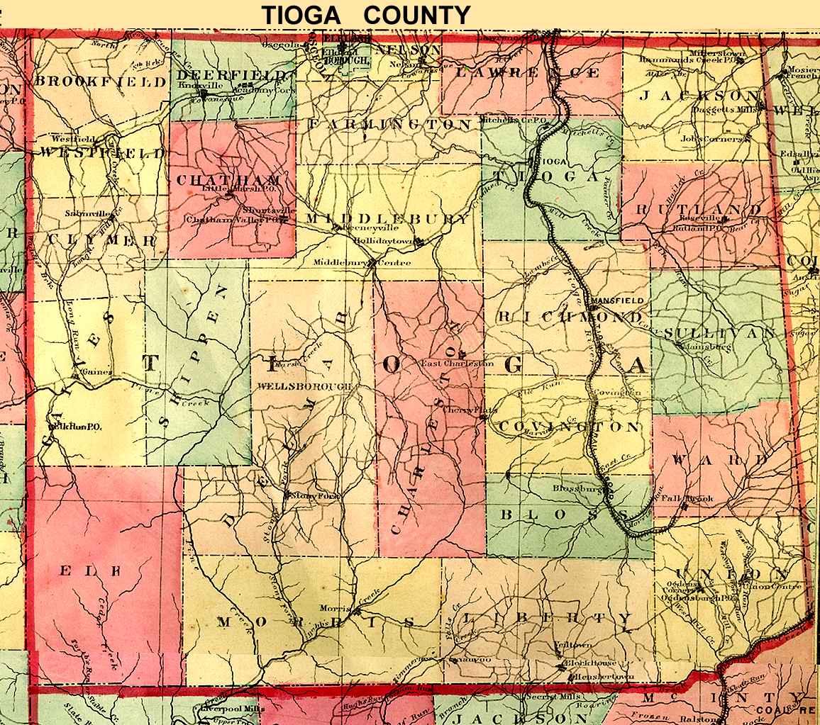
Tioga County
Wellsboro
USGS Township Maps
Tioga County 1872 Outline
Union County
Lewisburg
USGS Township Maps
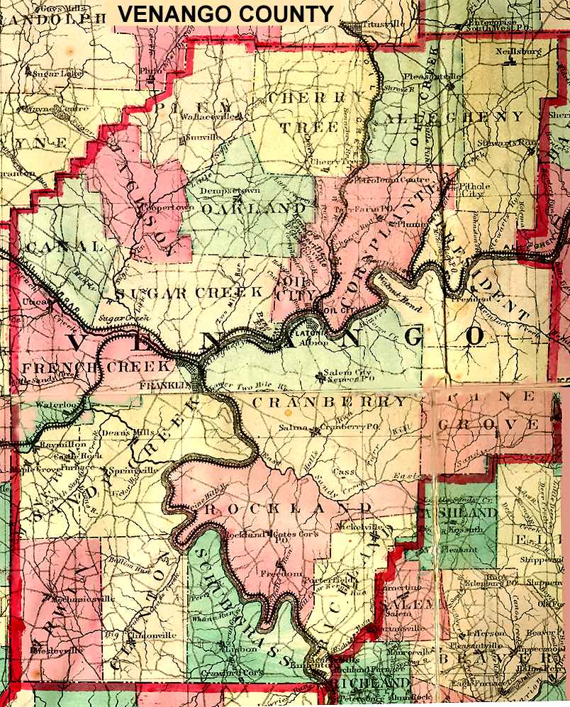
Venango County
Franklin
USGS Township Maps
Venango County 1872 Outline
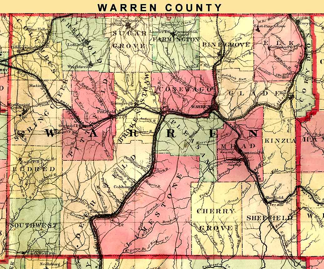
Warren County
Warren
USGS Township Maps
Warren County 1872 Outline
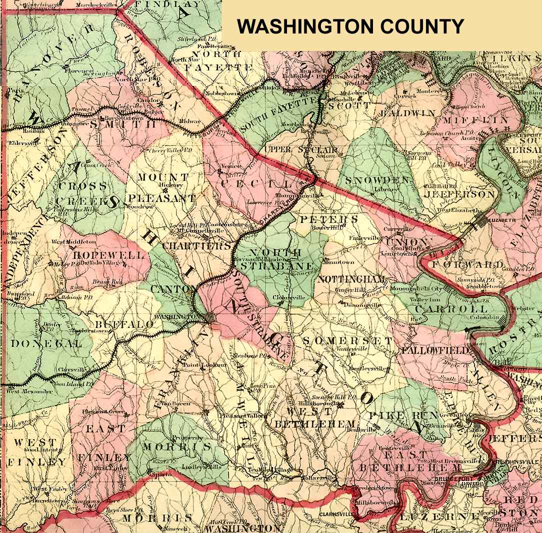
Washington County
Washington
USGS Township Maps
Washington County 1872 Outline
Wayne County
Honesdale
USGS Township Maps
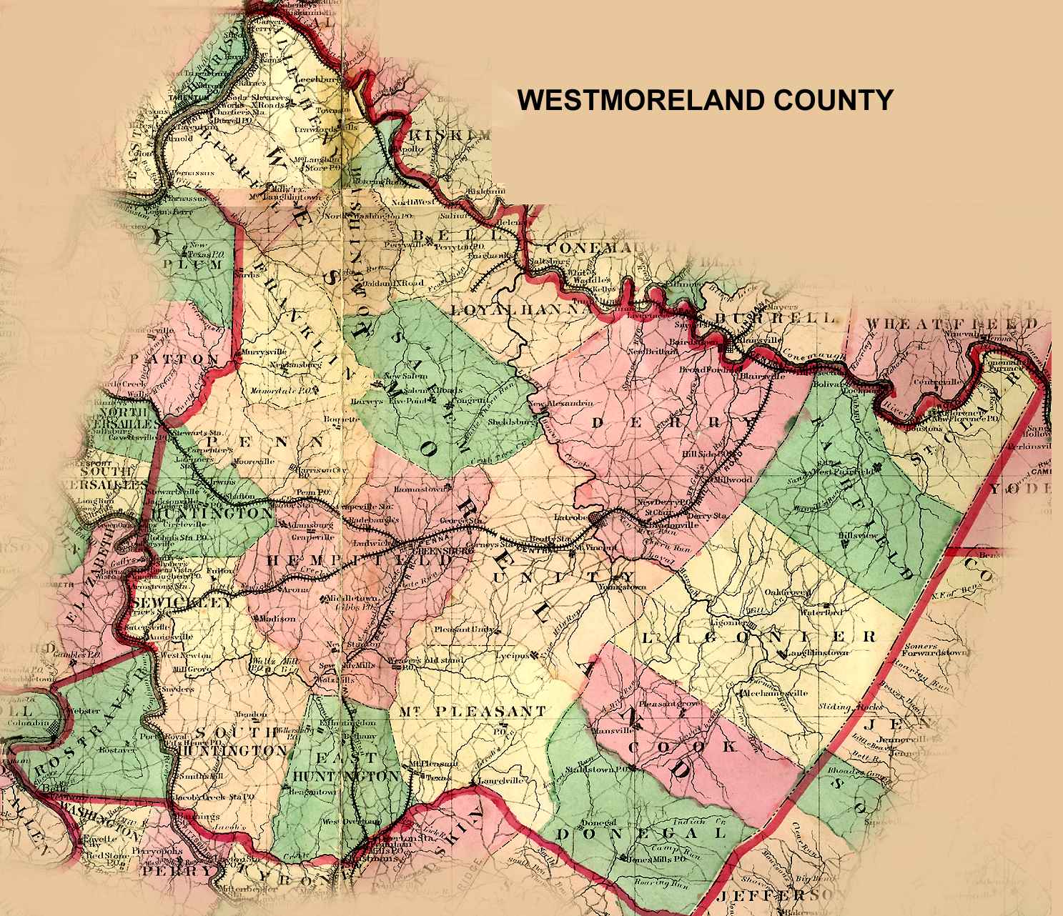
Westmoreland County
Greensburg
USGS Township Maps
Westmoreland County 1872 Outline
1867 Westmoreland County Atlas
Wyoming County
Tunkhannock
USGS Township Maps
Wyoming County Outline
York County
York
USGS Township Maps
Pennsylvania County Genealogy Sites
Adams
Allegheny
Armstrong
Beaver
Berks
Bedford
Blair
Bradford
Bucks
Butler
Cambria
Cameron
Carbon
Centre
Chester
Clarion
Clearfield
Clinton
Columbia
Crawford
Cumberland
Dauphin
Delaware
Elk
Erie
Fayette
Forest
Franklin
Fulton
Greene
Huntingdon
Indiana
Jefferson
Juniata
Lackawanna
Lancaster
Lawrence
Lebanon
Lehigh
Luzerne
Lycoming
McKean
Mercer
Mifflin
Monroe
Montgomery
Montour
Northampton
Northumberland
Perry
Philadelphia
Pike
Potter
Schuylkill
Snyder
Somerset
Sullivan
Susquehanna
Tioga
Union
Venango
Warren
Washington
Wayne
Westmoreland
Wyoming
York
Back to Pennsylvania Map Archive