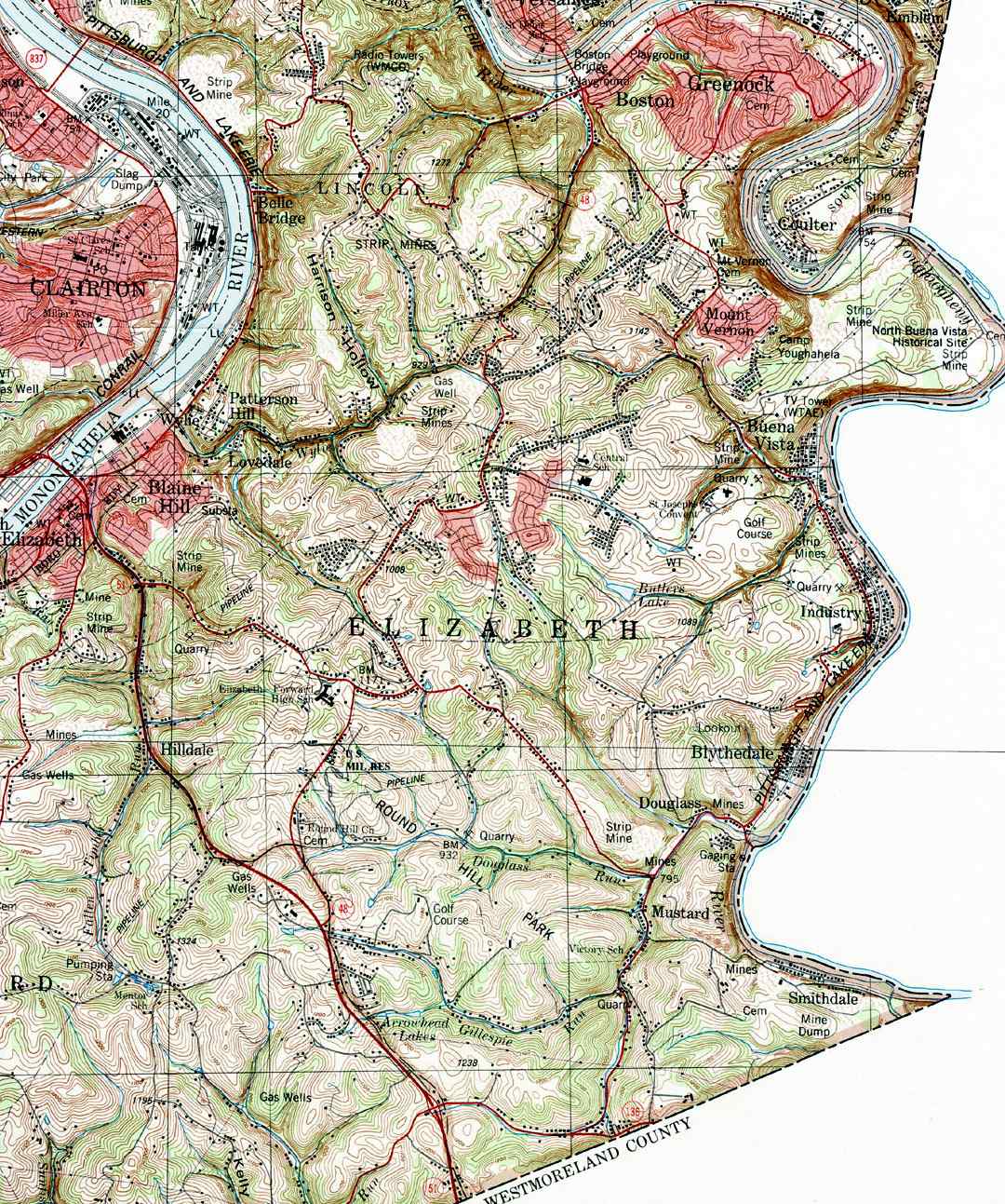
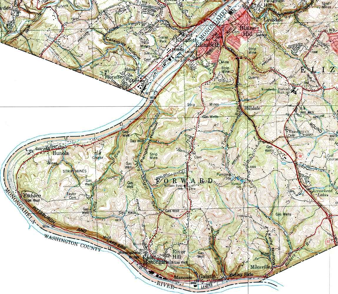
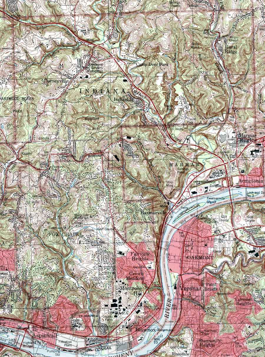
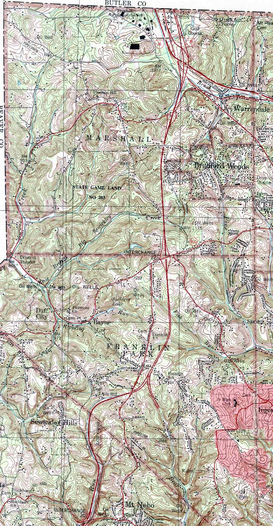
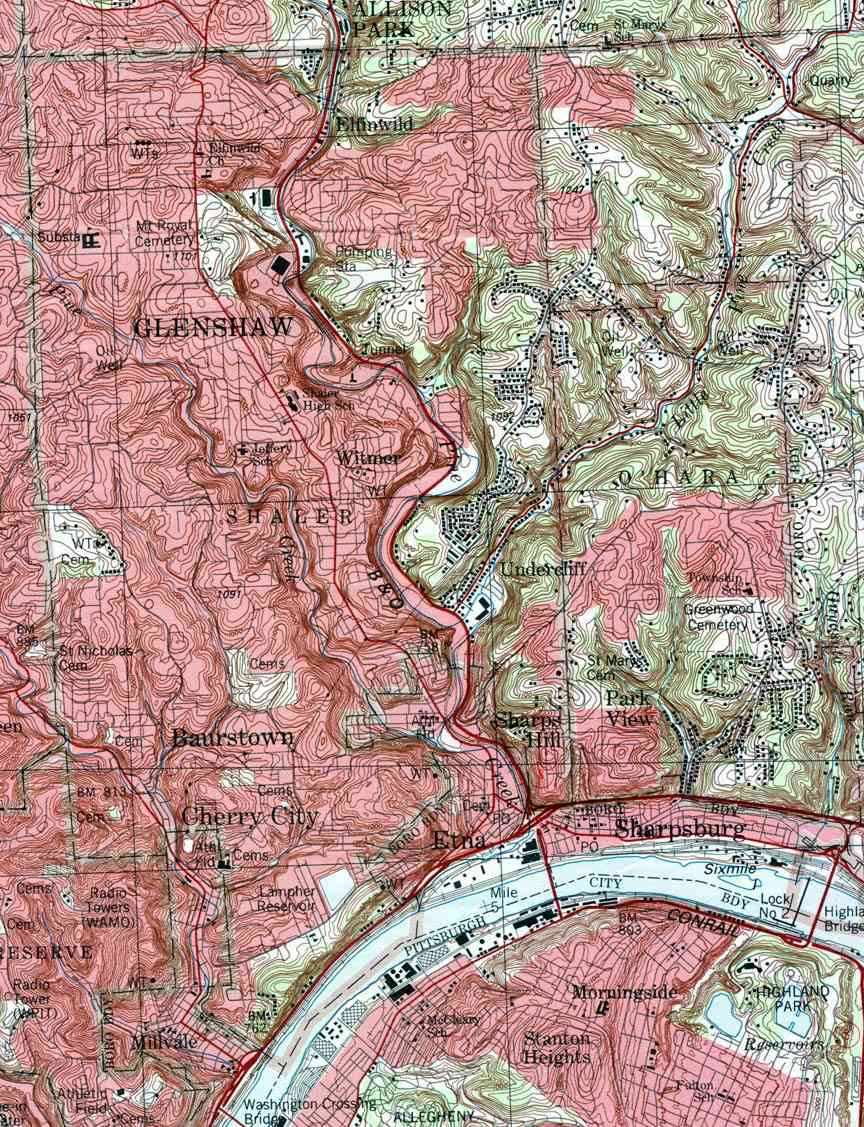
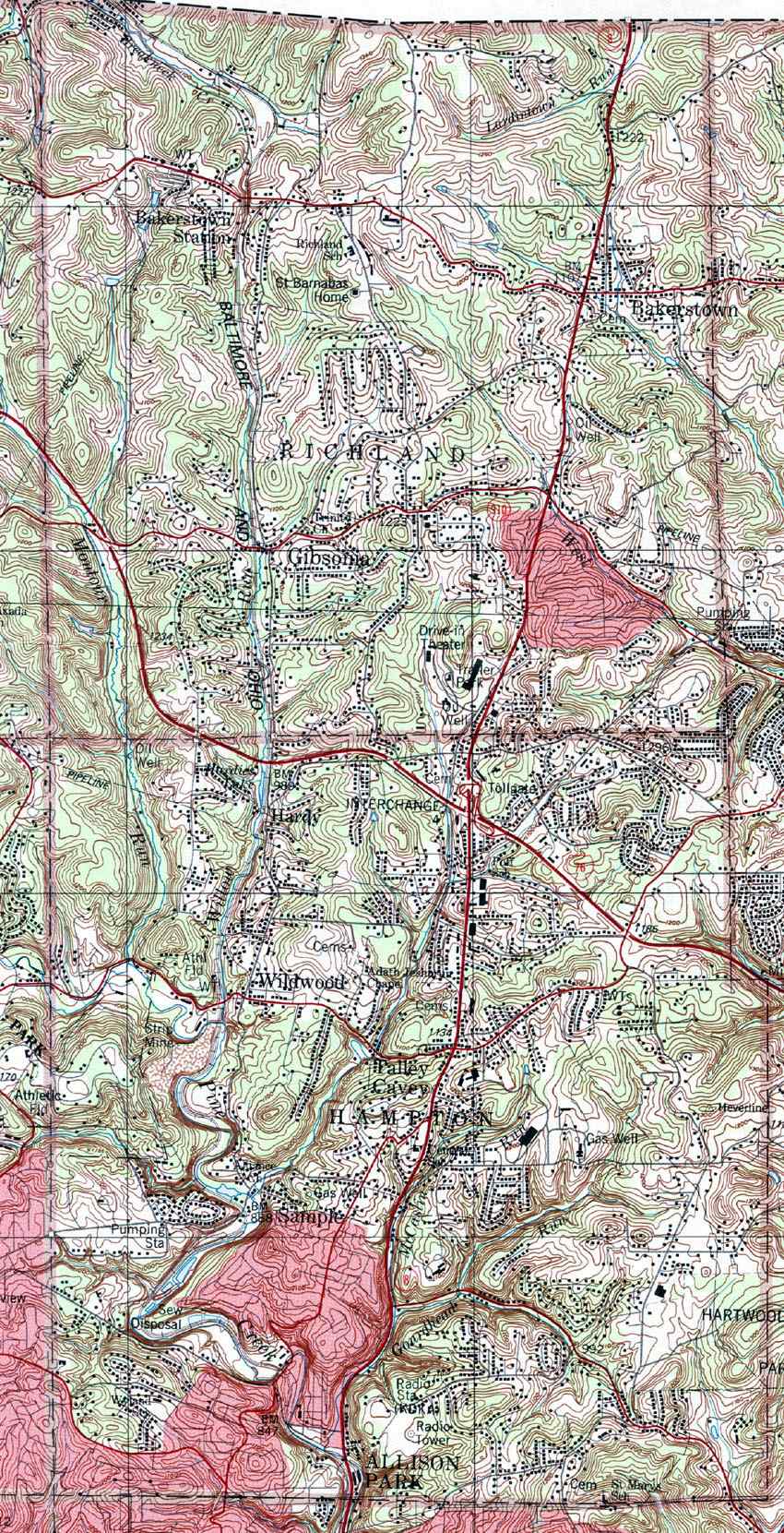
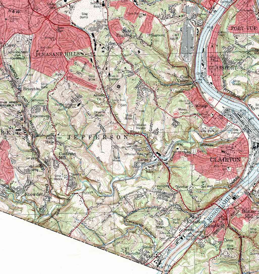
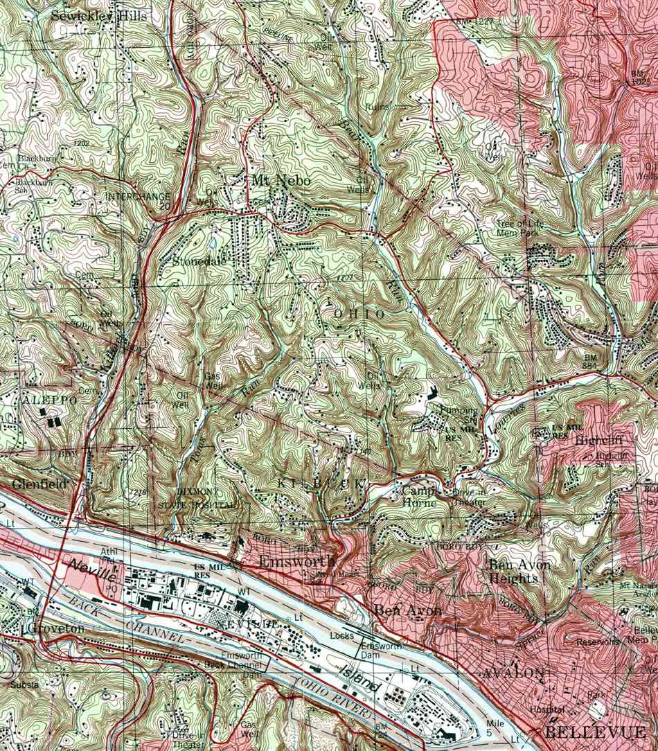
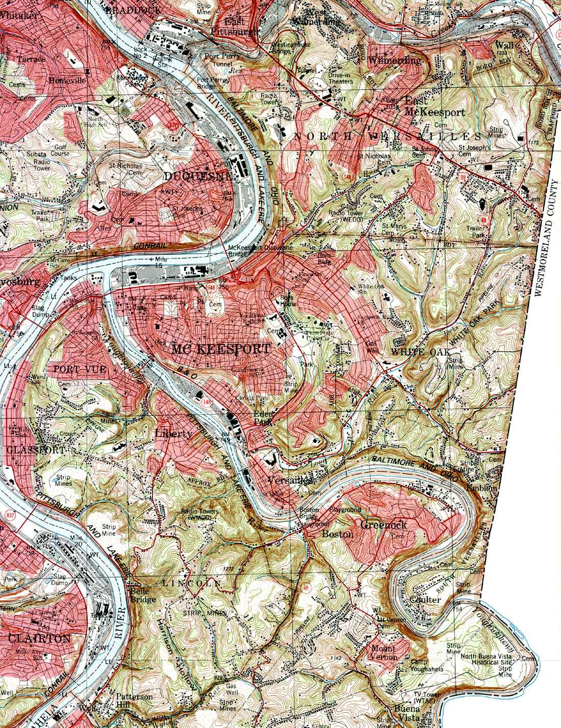
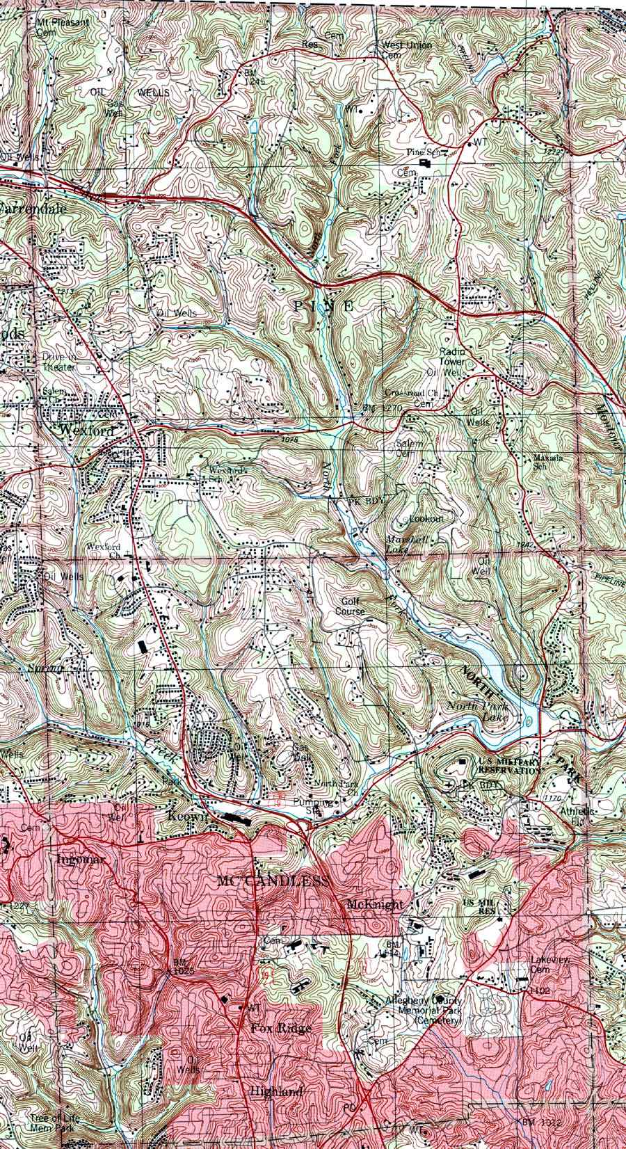
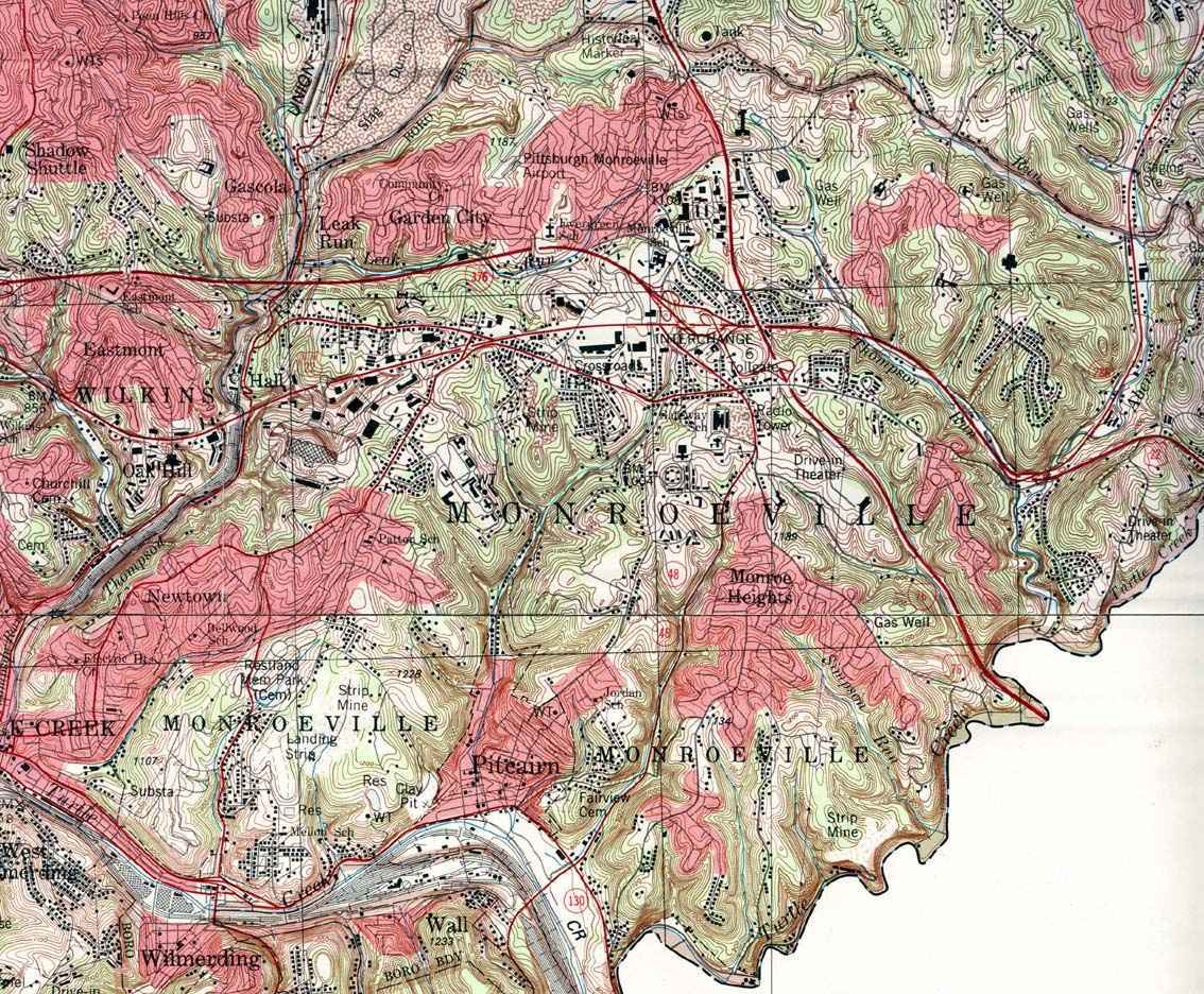
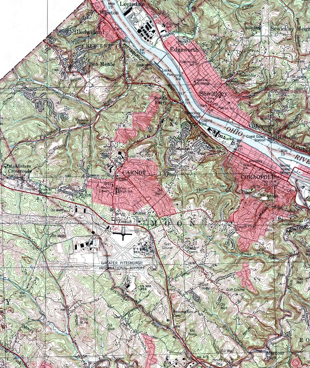
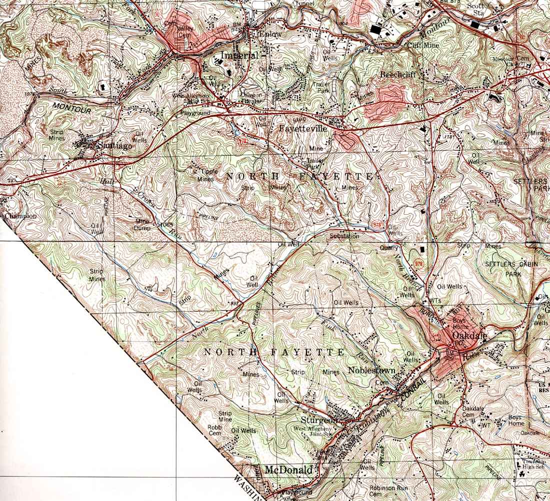
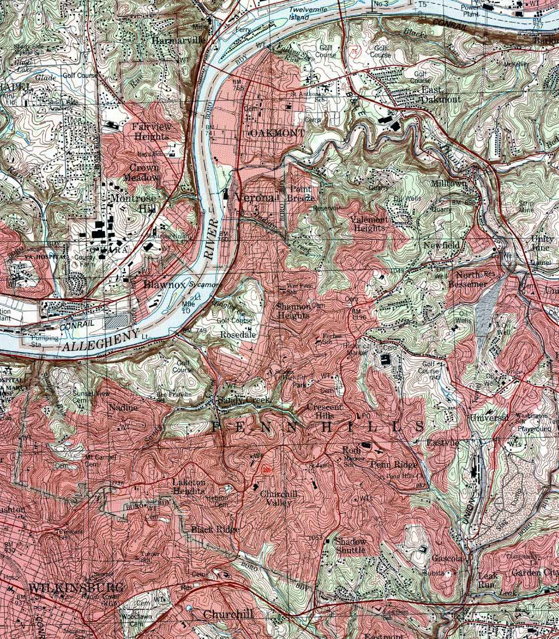
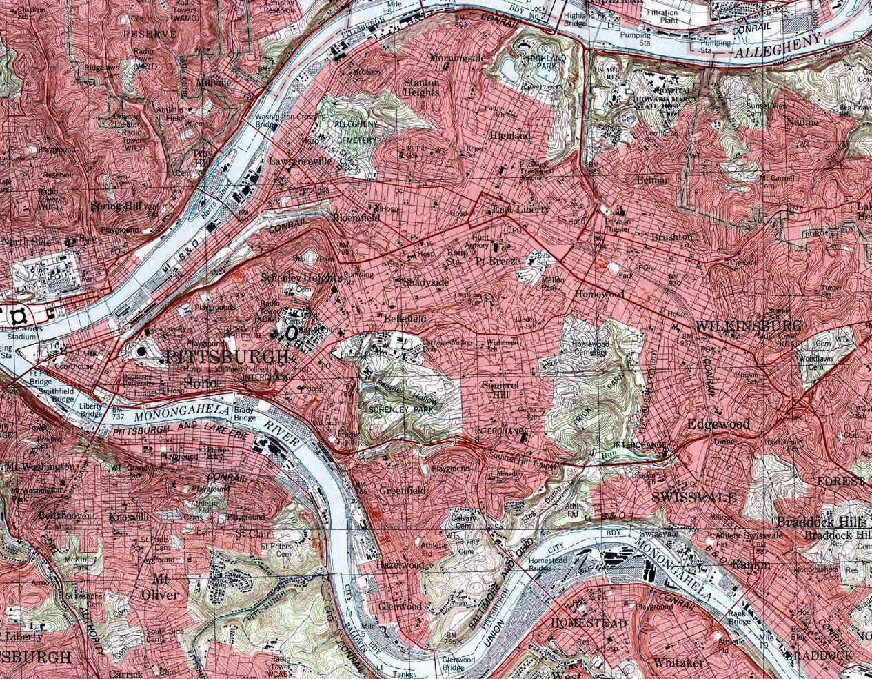
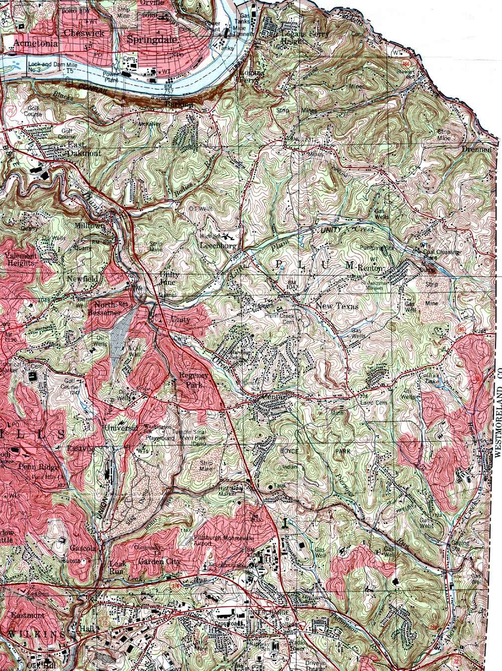
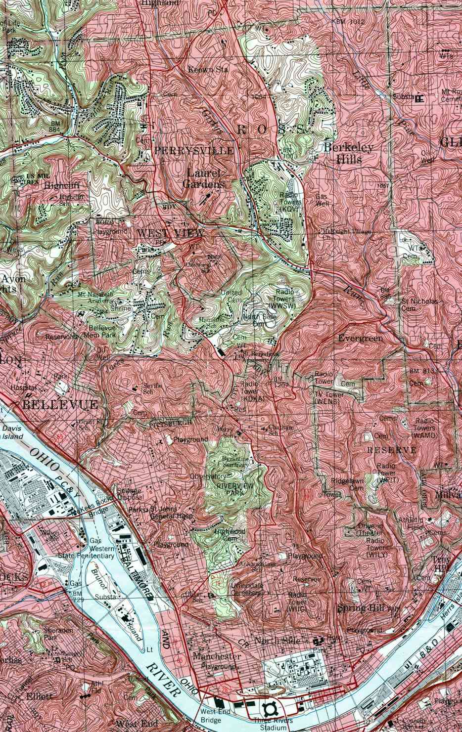
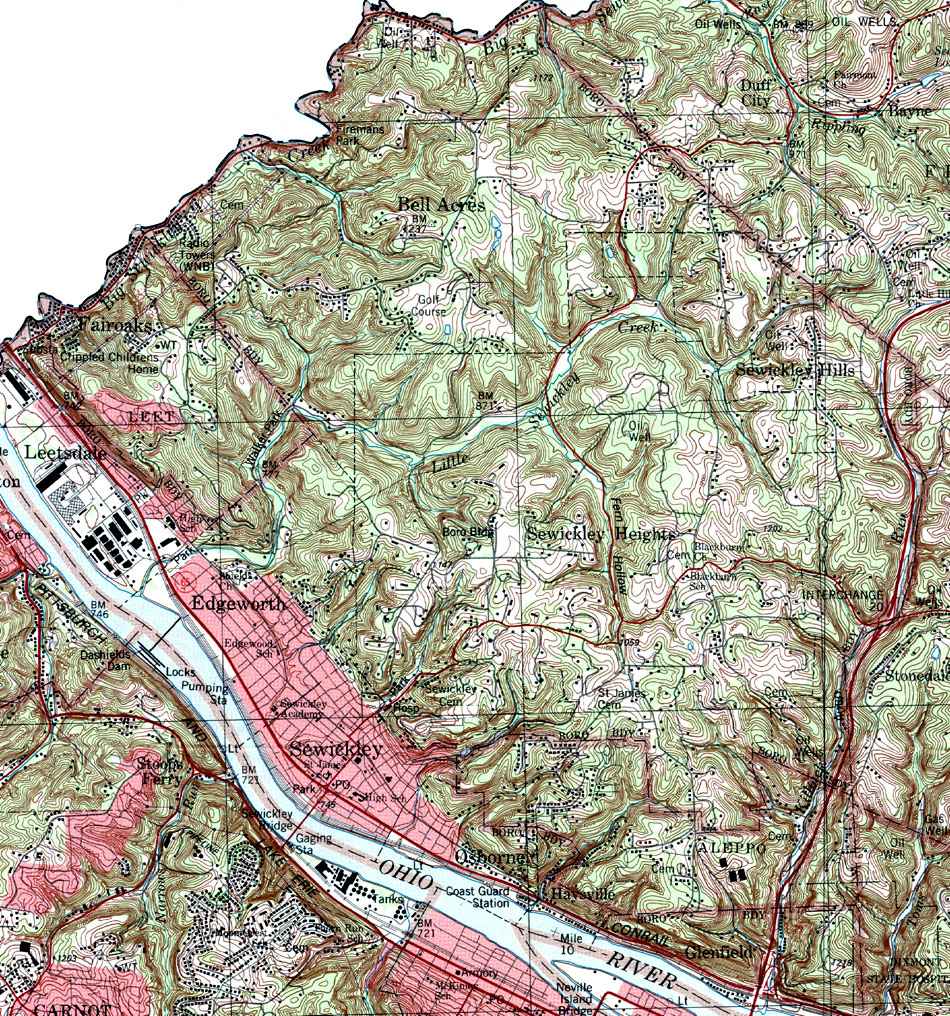
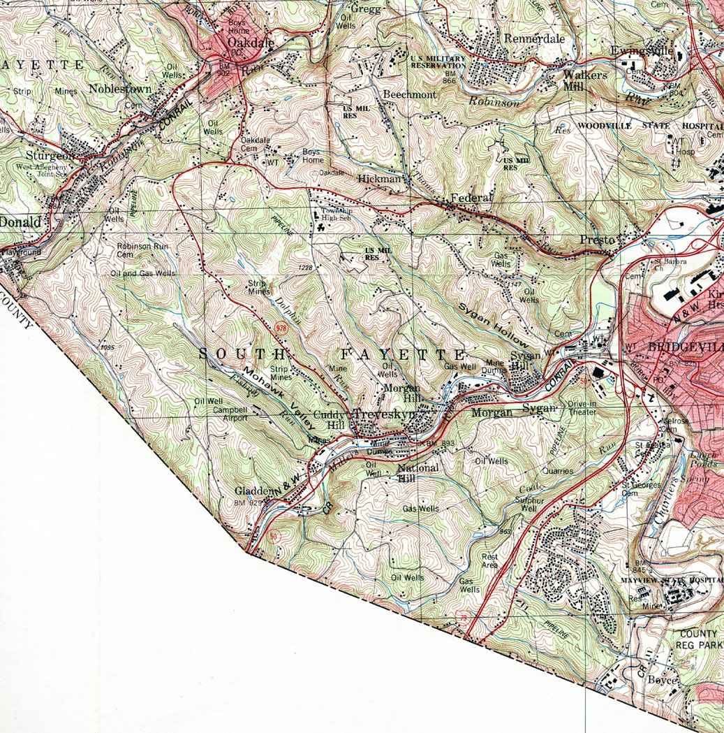
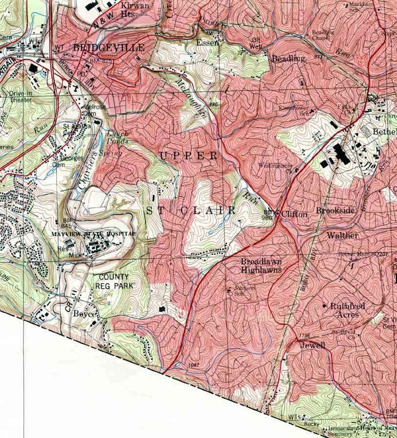
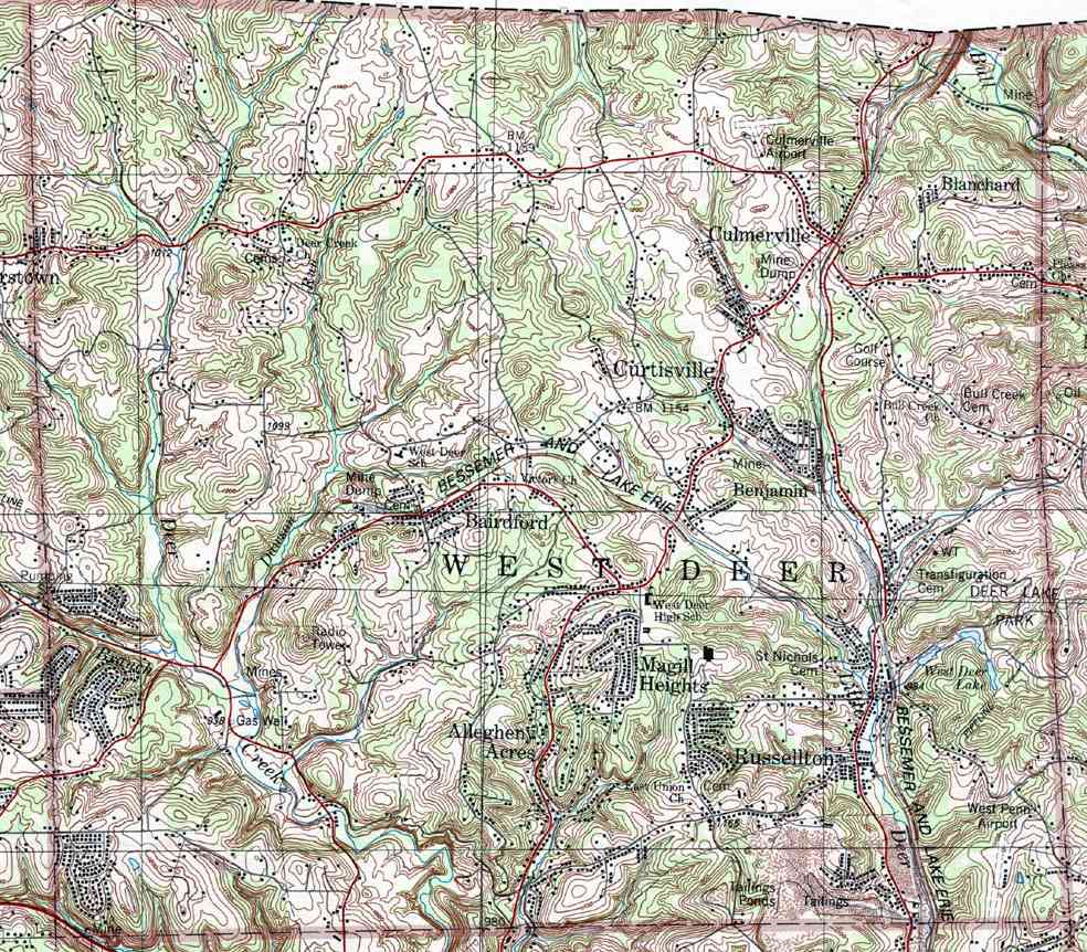
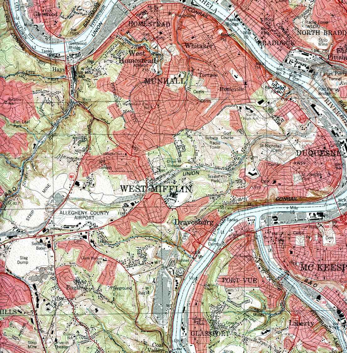
Image Map:
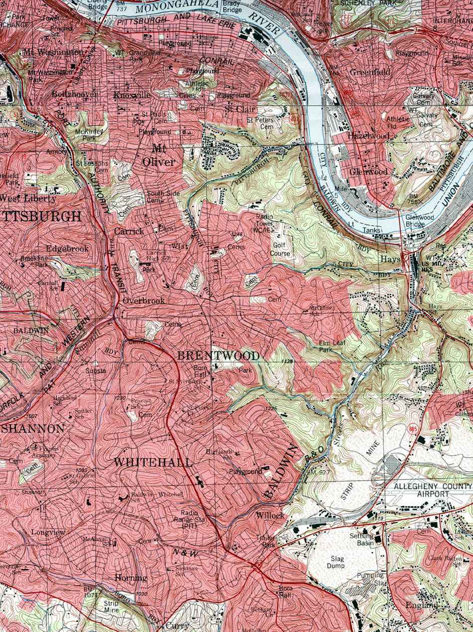
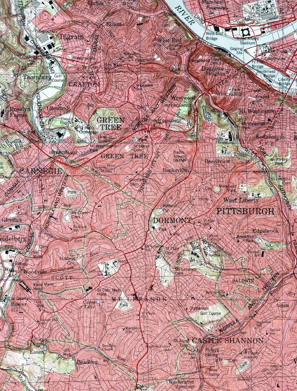
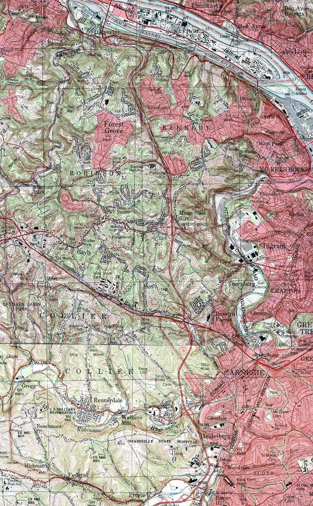
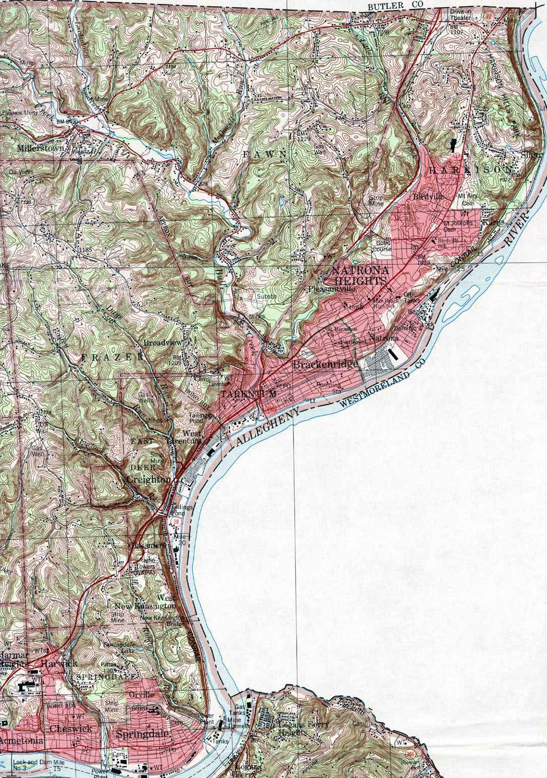
This is a clickable image map of townships in Allegheny County Pennsylvania. A text list of the township maps is shown below. The township images are cropped from a 1/50,000 USGS Geological Survey Map of Allegheny County dated 1983. The 1/24,000 maps which are the basis of the county map are dated 1982. The adjacent counties shown on the image map are links to their USGS maps.
Allegheny County USGS Map (whole county 8.9MB)
County Genealogy Sites:
Link to Pennsylvania county USGenWeb sites at the bottom of the Pennsylvania Map Index page.