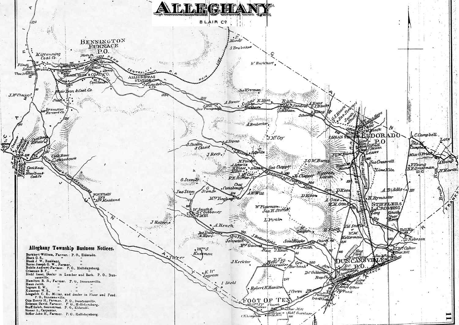
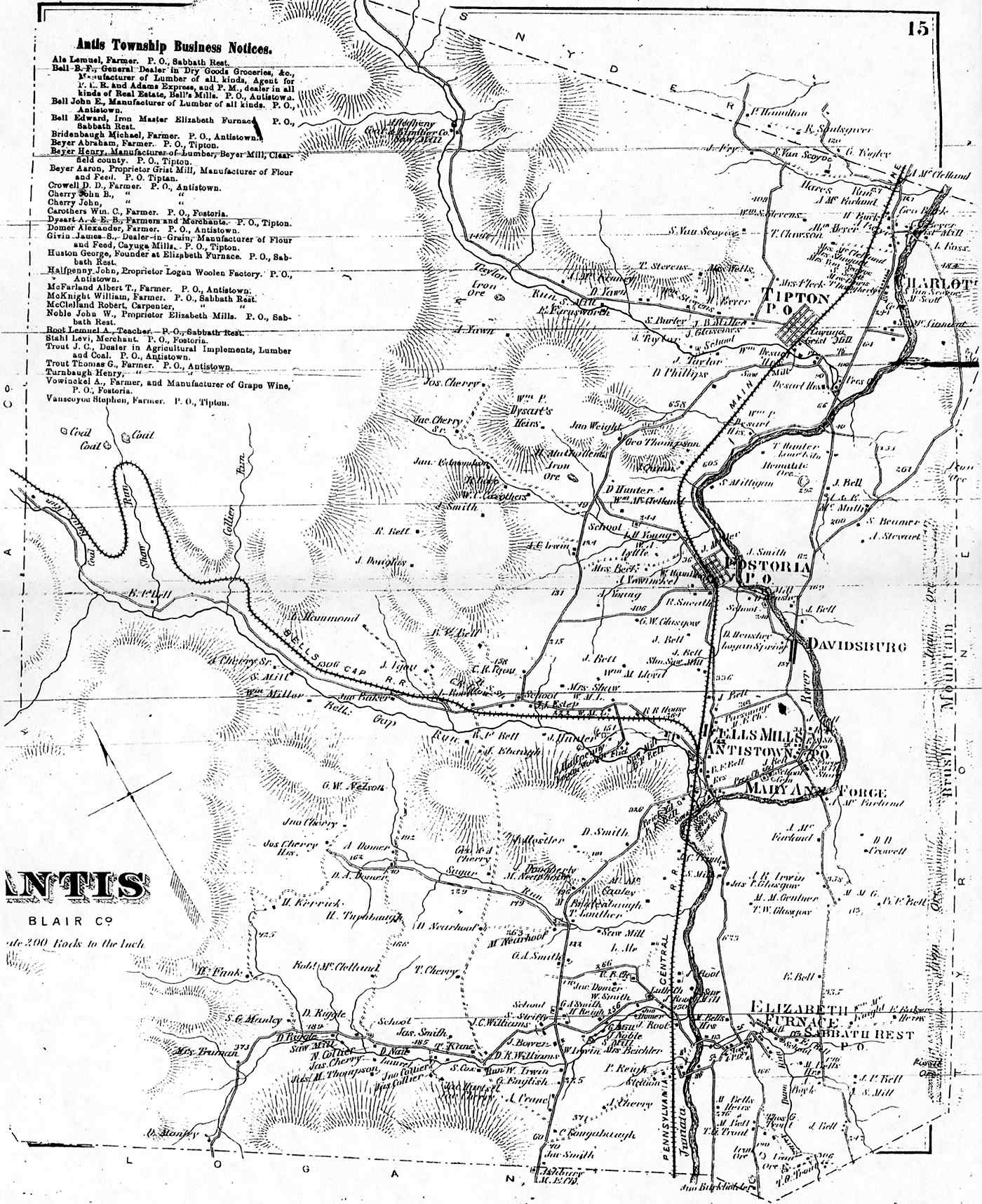
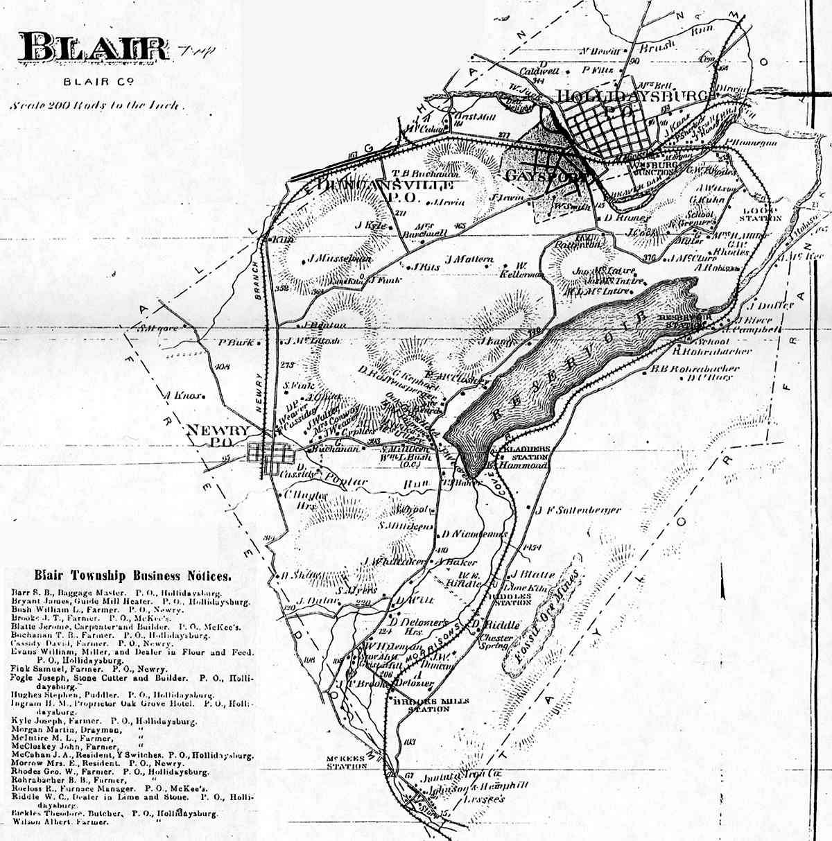
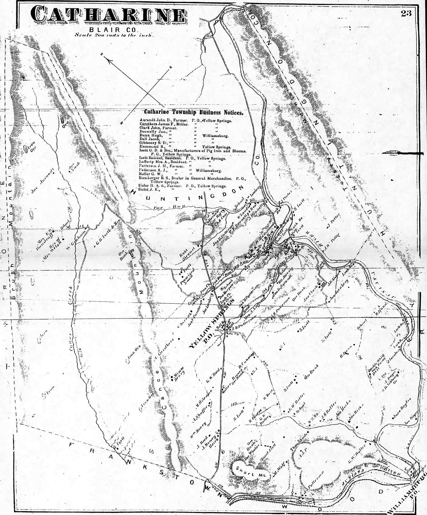
| TOWNSHIPS | BOROUGHS |
|---|---|
|
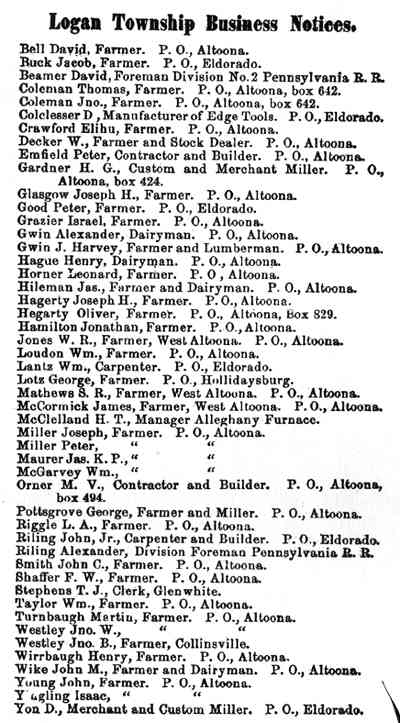
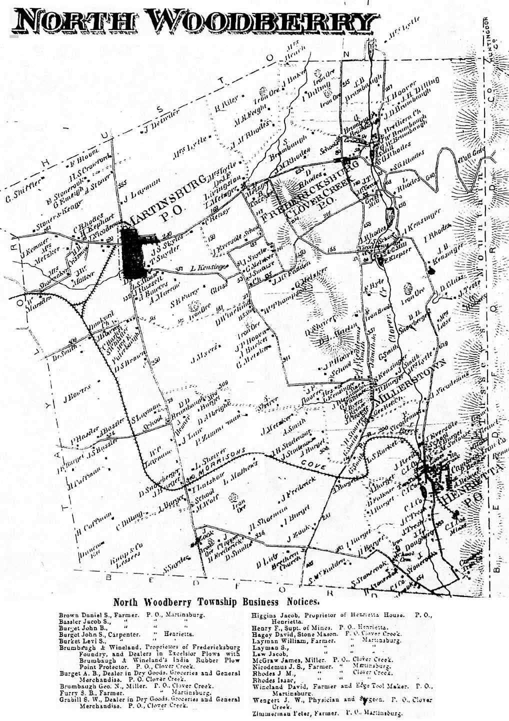
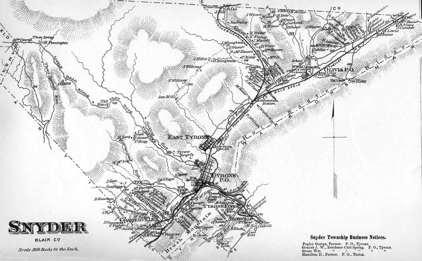
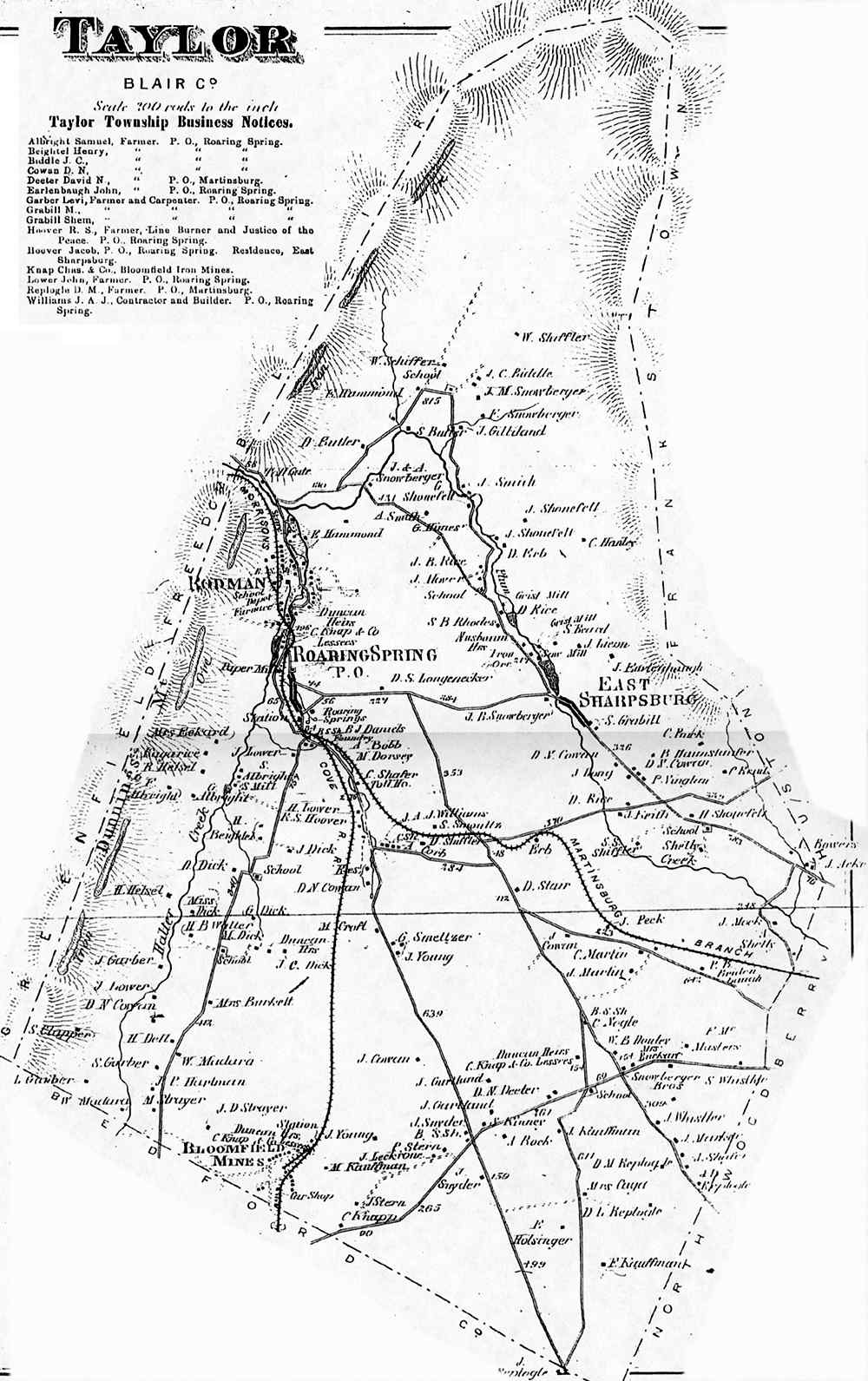
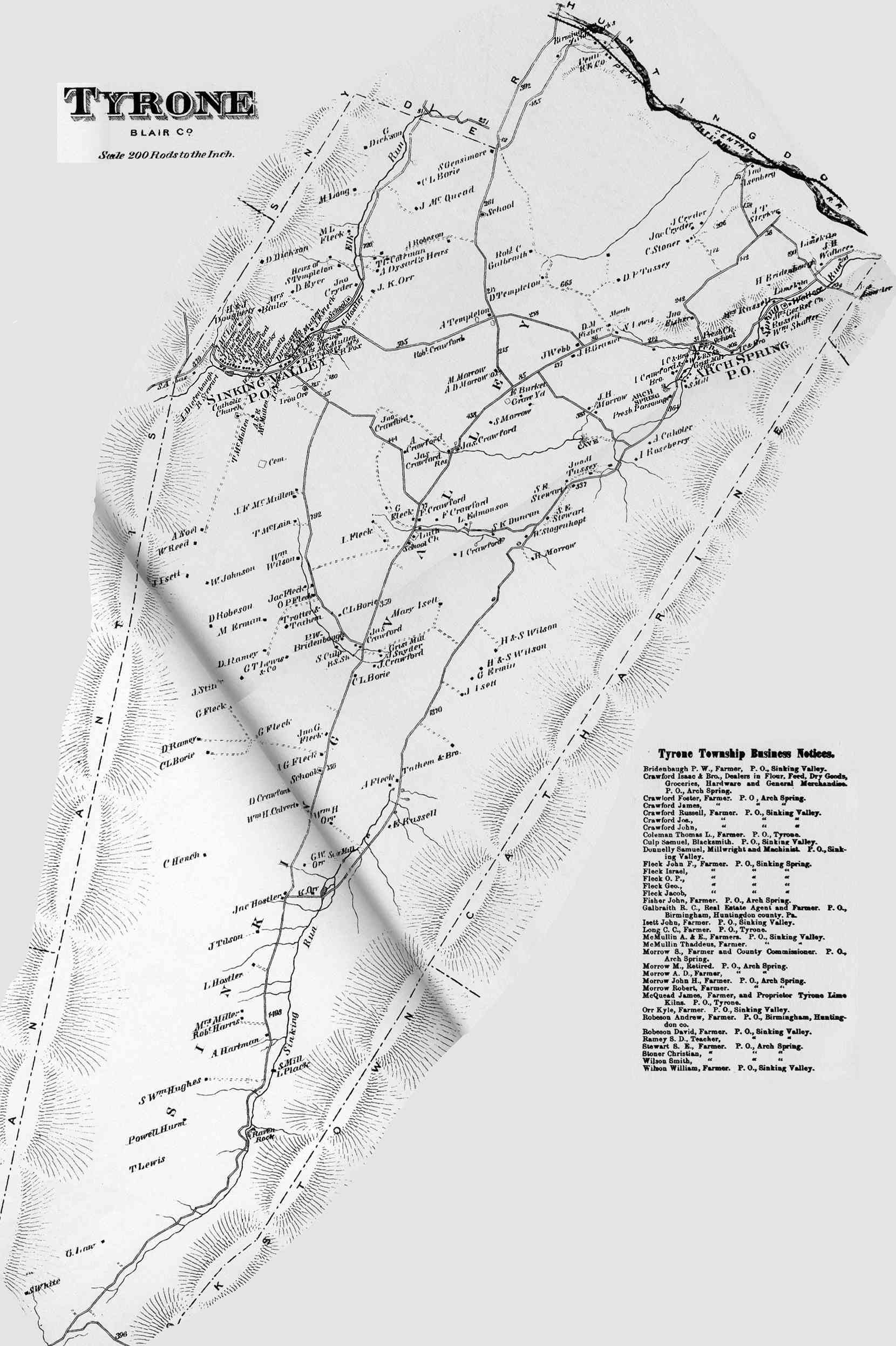
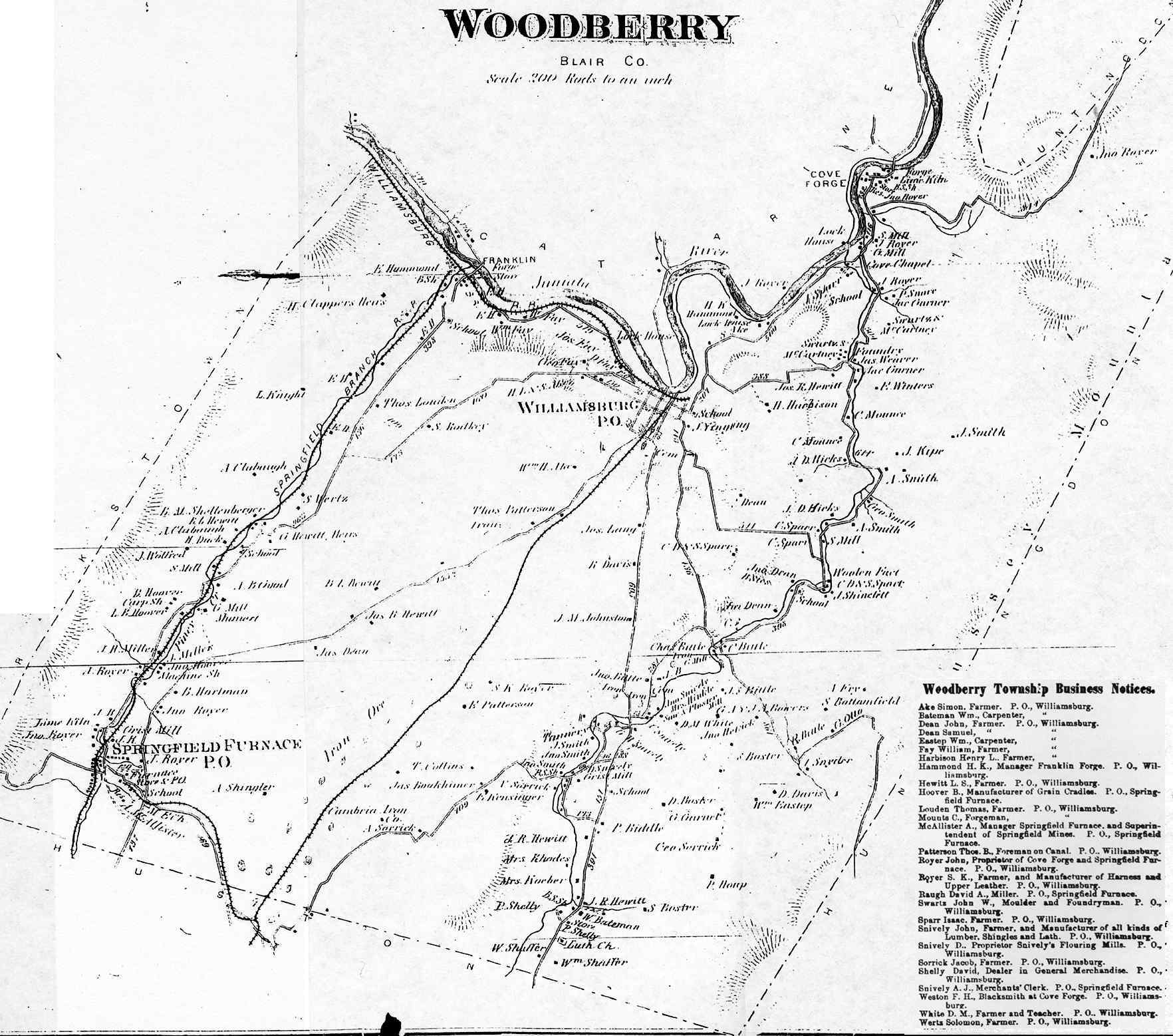
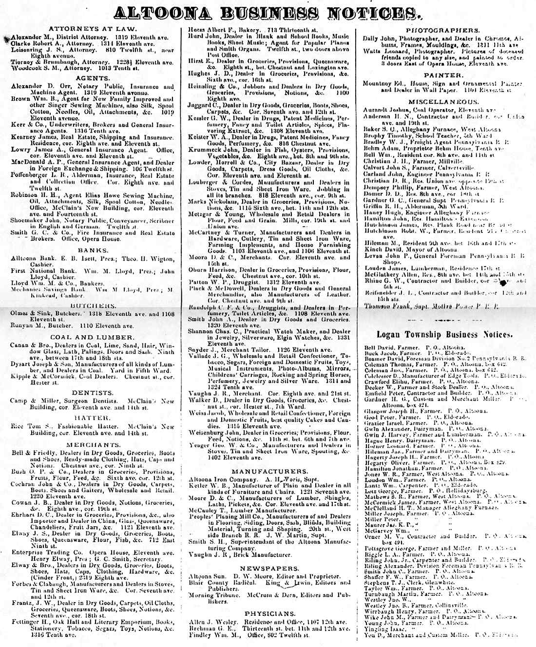
Allegheny Antis Blair Catharine Frankstown Freedom Greenfield Huston Juniata Logan Logan Business North Woodberry Snyder Taylor Tyrone Woodberry |
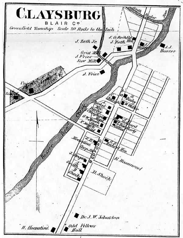
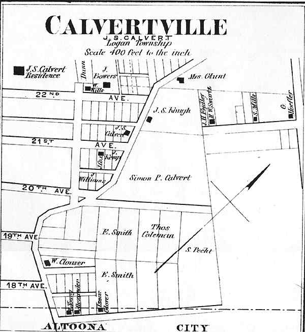
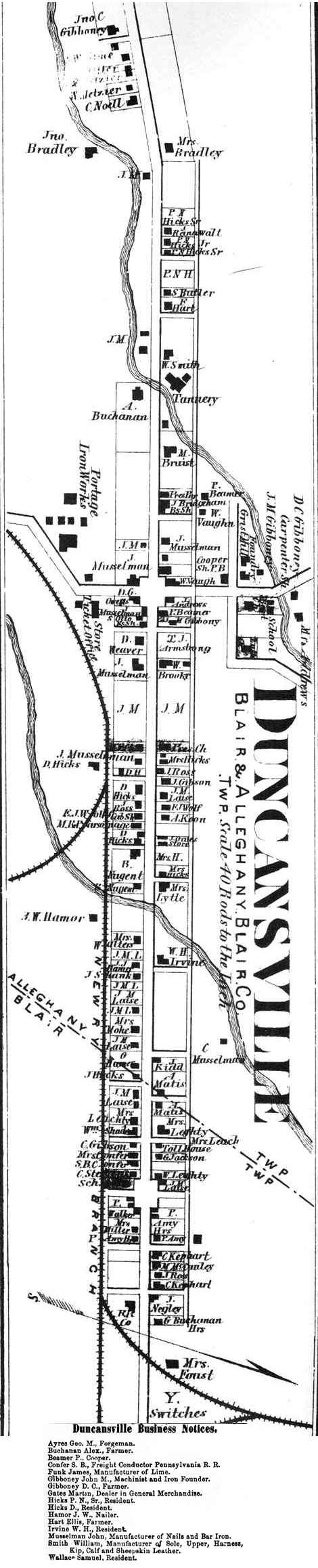
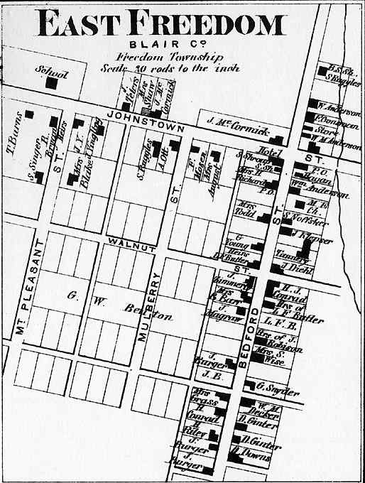
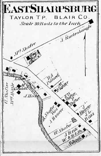
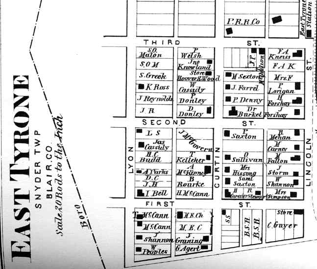
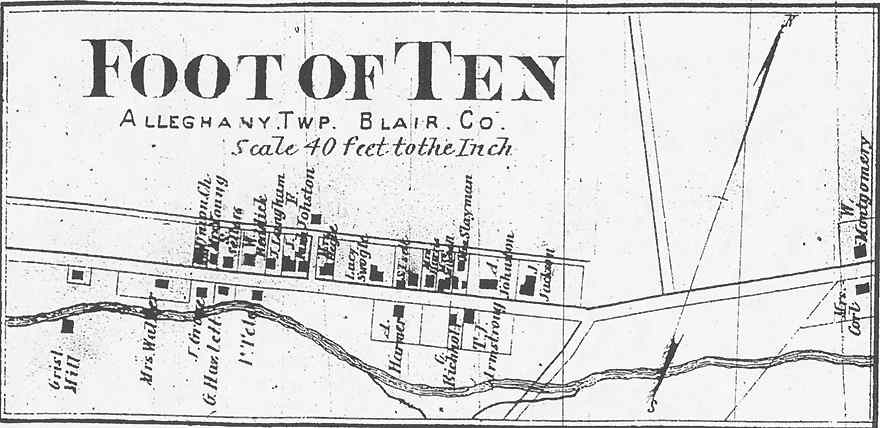
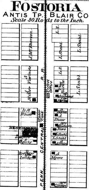
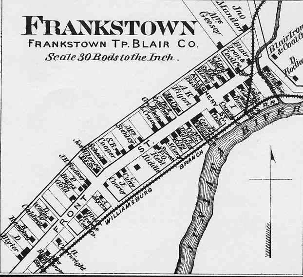
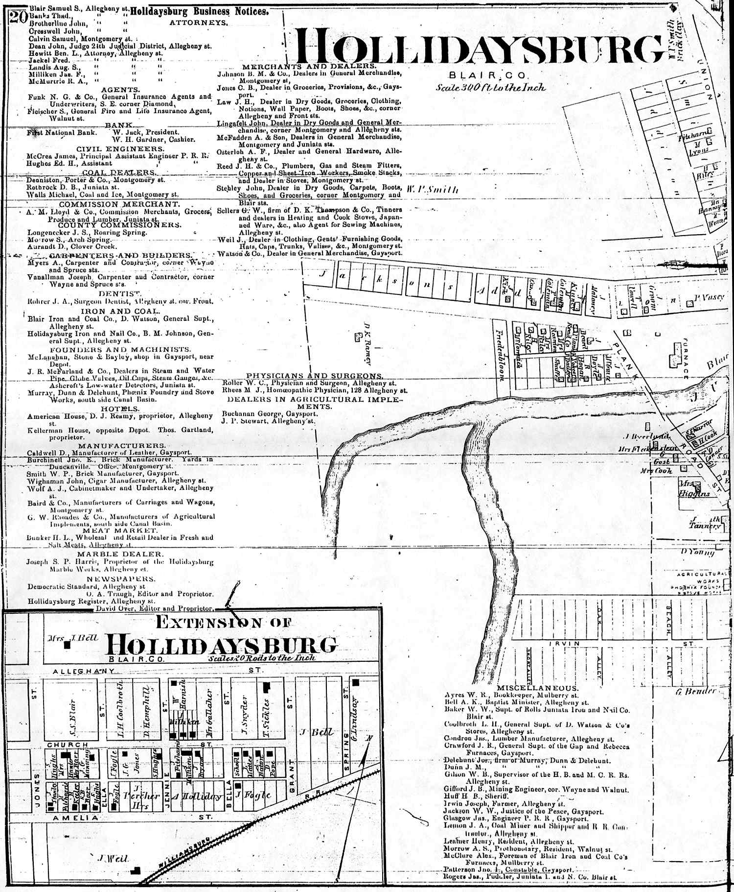
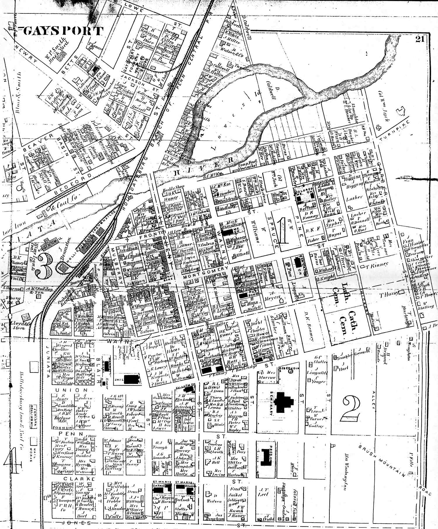
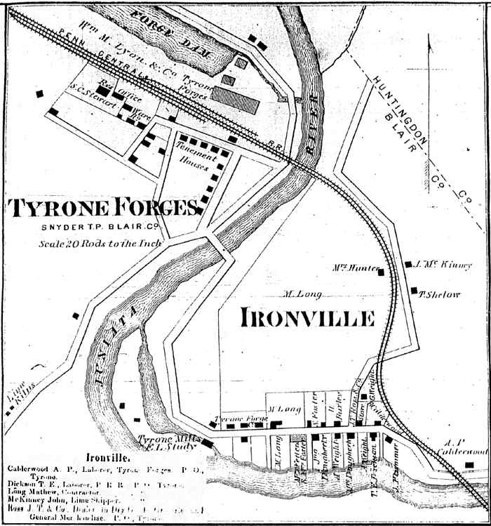
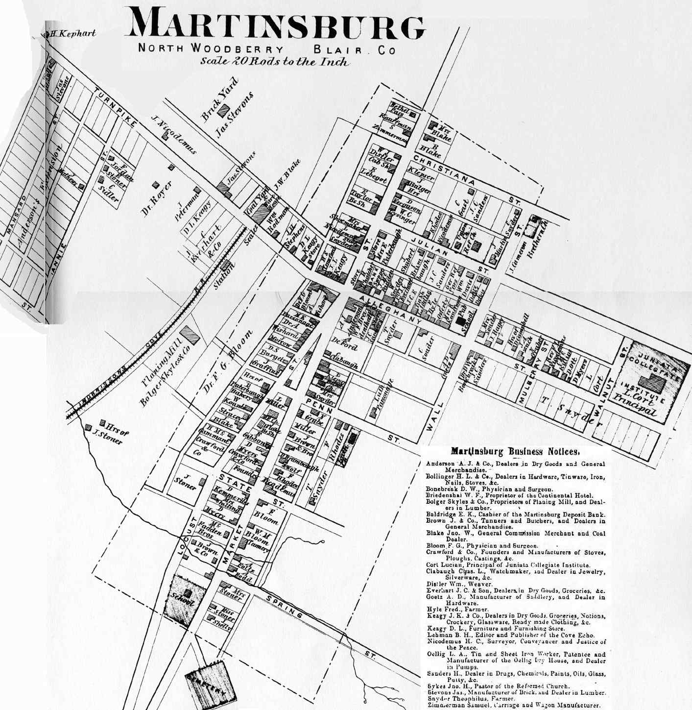
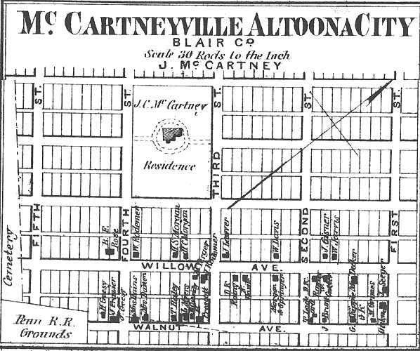
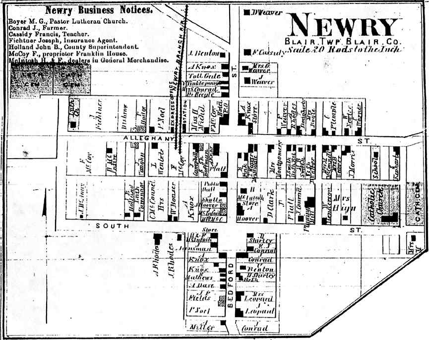
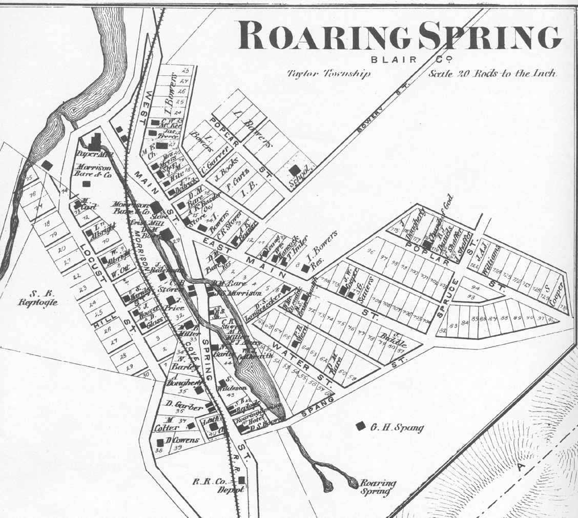
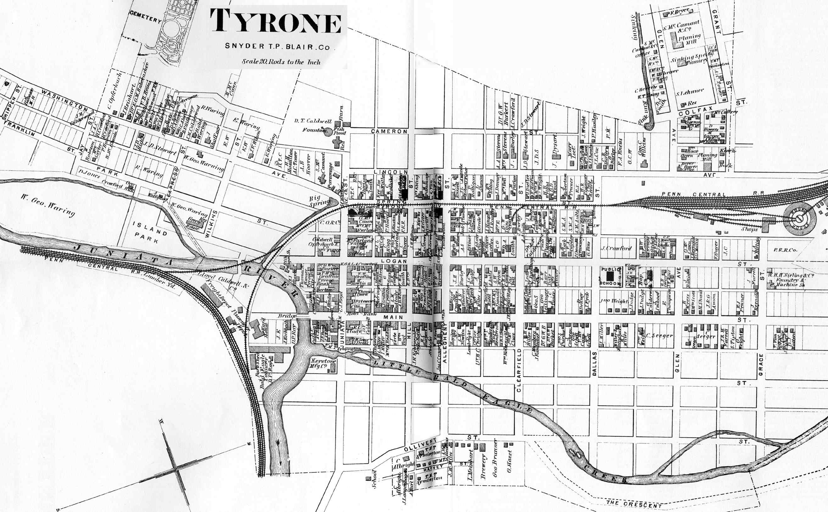
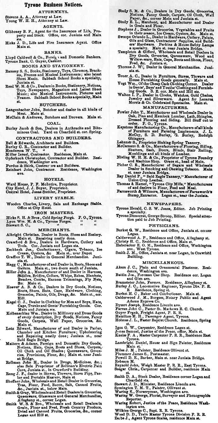
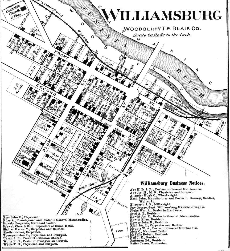
Altoona Business Claysburg (Greenfield) Calvertville (Logan) Duncansville (Allegheny) East Freedom (Freedom) East Sharpsburg (Taylor) East Tyrone (Snyder) Foot Of Ten (Allegheny) Fostoria (Antis) Frankstown (Frankstown) Hollidaysburg (1) (Blair) Hollidaysburg(2) (Blair) Ironville (Snyder) Martinsburg (N. Woodberry) McCartneyville Newry (Blair) Roaring Springs (Taylor) Tyrone Forge (Snyder) Tyrone (Snyder) Tyrone Business Williamsburg (Woodberry) |
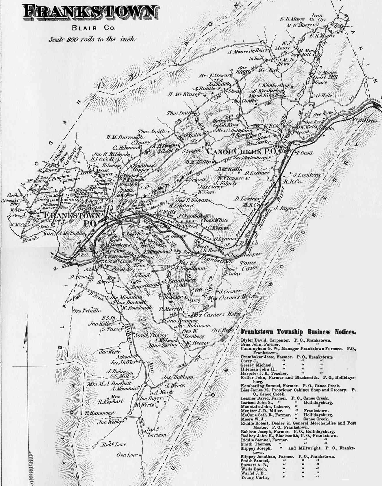
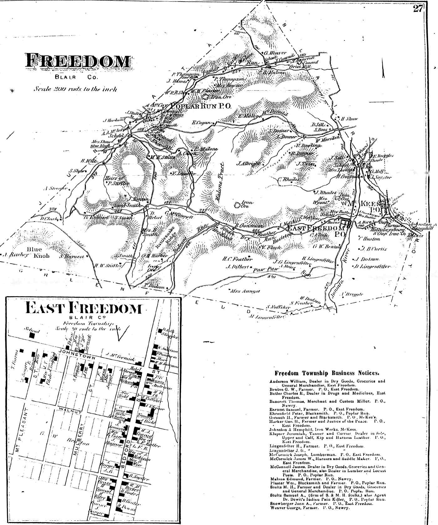
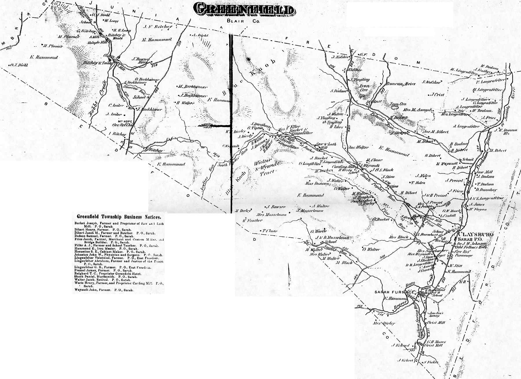
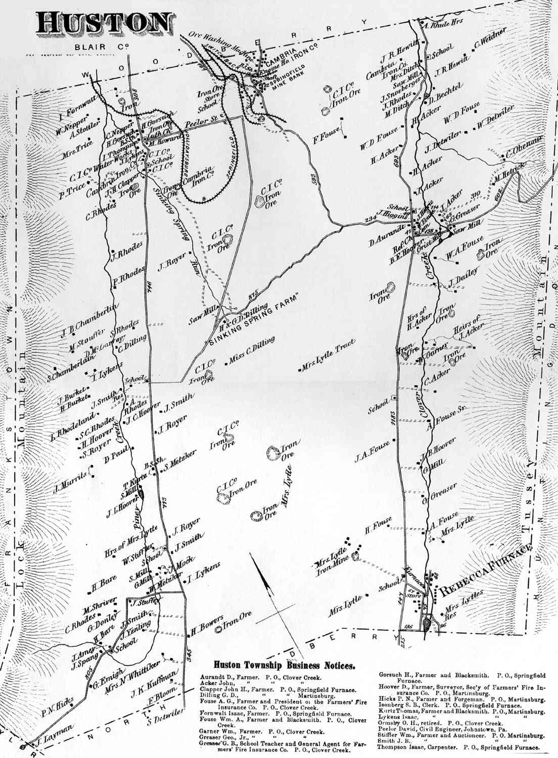
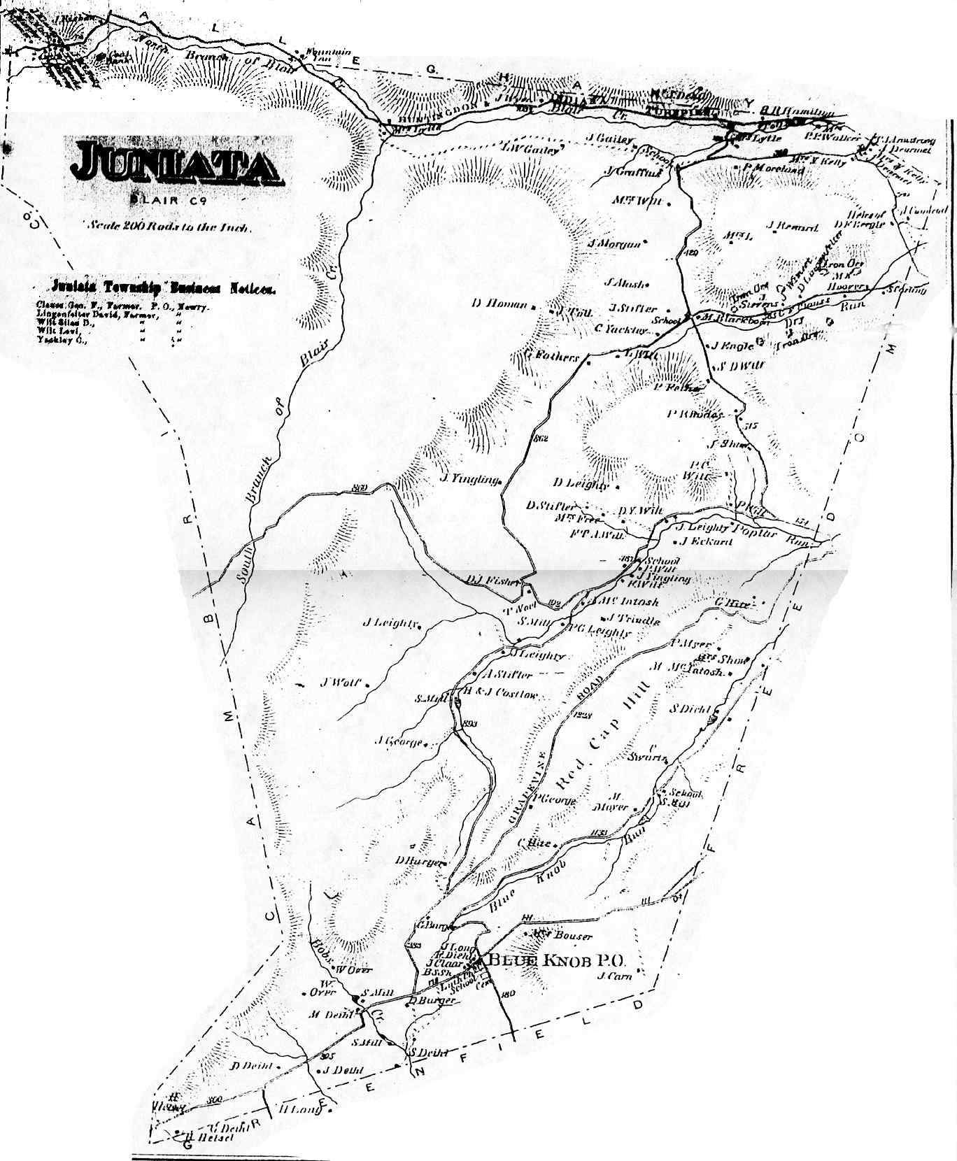
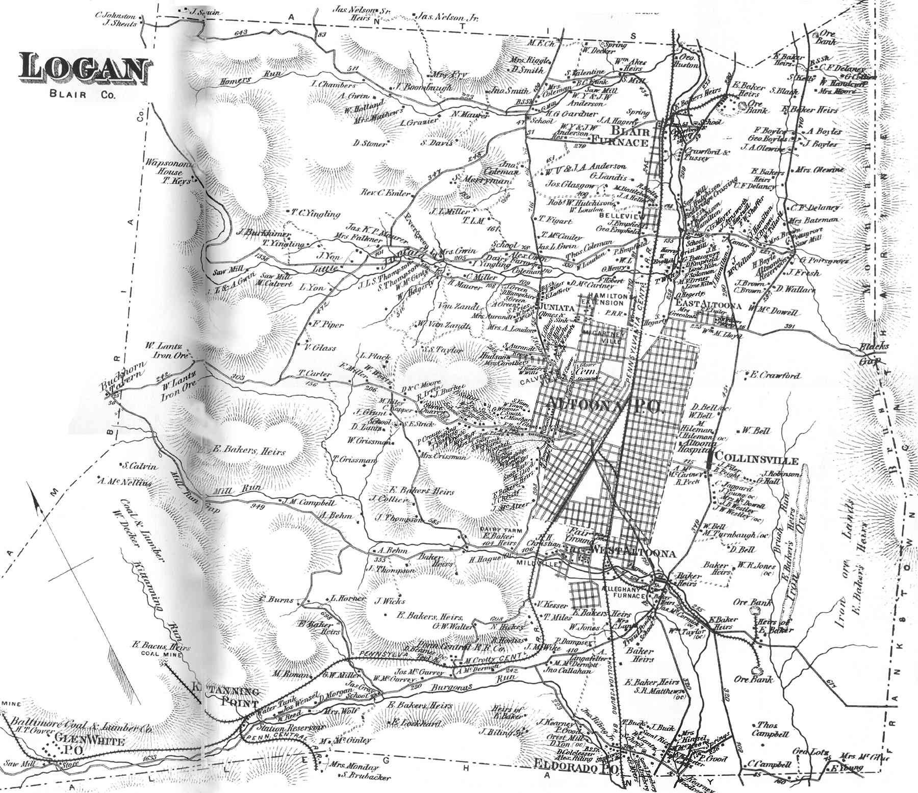
ATLAS of BLAIR AND HUNTINGDON COUNTIES PENNSYLVANIA From actual Surveys by and under the direction of BEACH NICHOLS Published by A. POMEROY & Co. 31 So. Sixth St. PHILADELPHIA 1873. Eng'd. by Worley & Beacher 31 So. Sixth St. Philad'a. Printed by F. Bourquin 31 So. Sixth St. Philad'a. Entered according to act of Congress in the year 1873 by a. Pomeroy & Co. in the Office of the Librarian of Congress Washington.
Not all of the boroughs were scanned. Some of the smaller boroughs had practically no population, others were of such poor quality they could not be read. The poor quality is due to the fact that these were scanned from microfilm copies. If anyone could loan an original of the 1873 Atlas or an early same-size reproduction to ![]() the poor images could be replaced with better ones.
the poor images could be replaced with better ones.
Back to Blair County Map Index
Back to Pennsylvania Map Archive
Updated: 10 May 2006