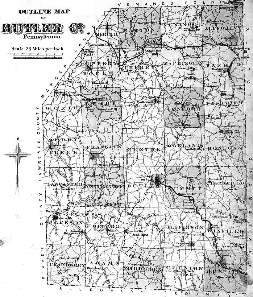
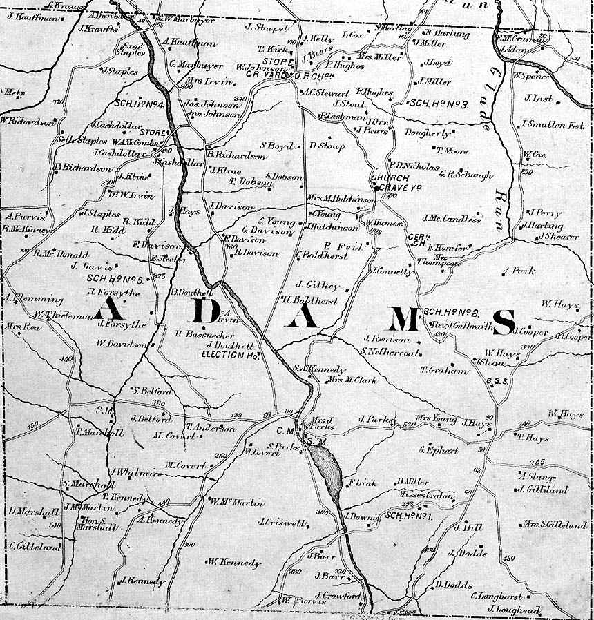
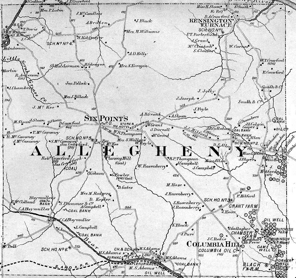
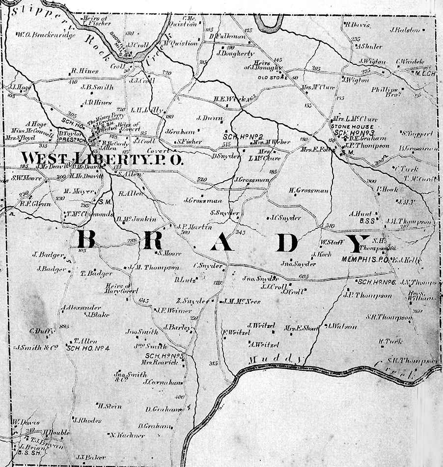
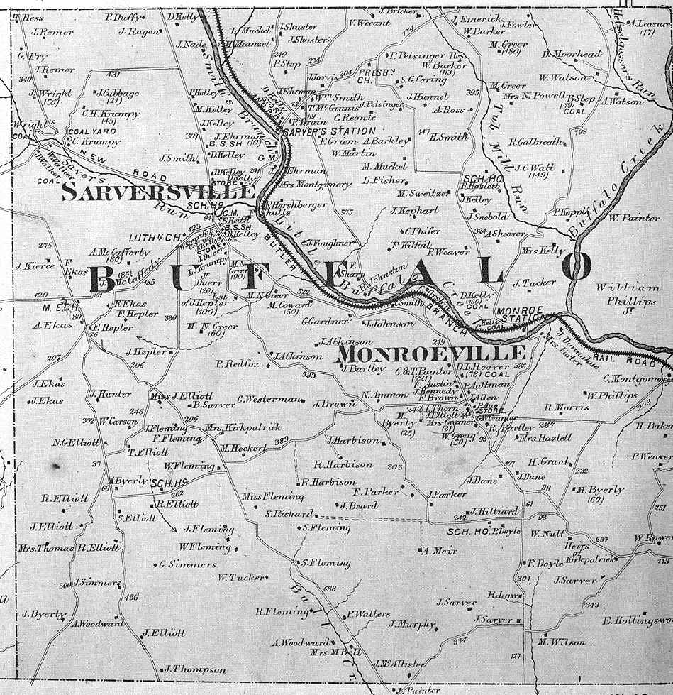
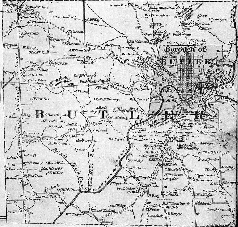
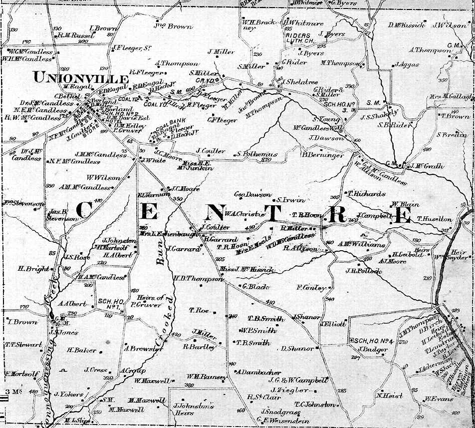
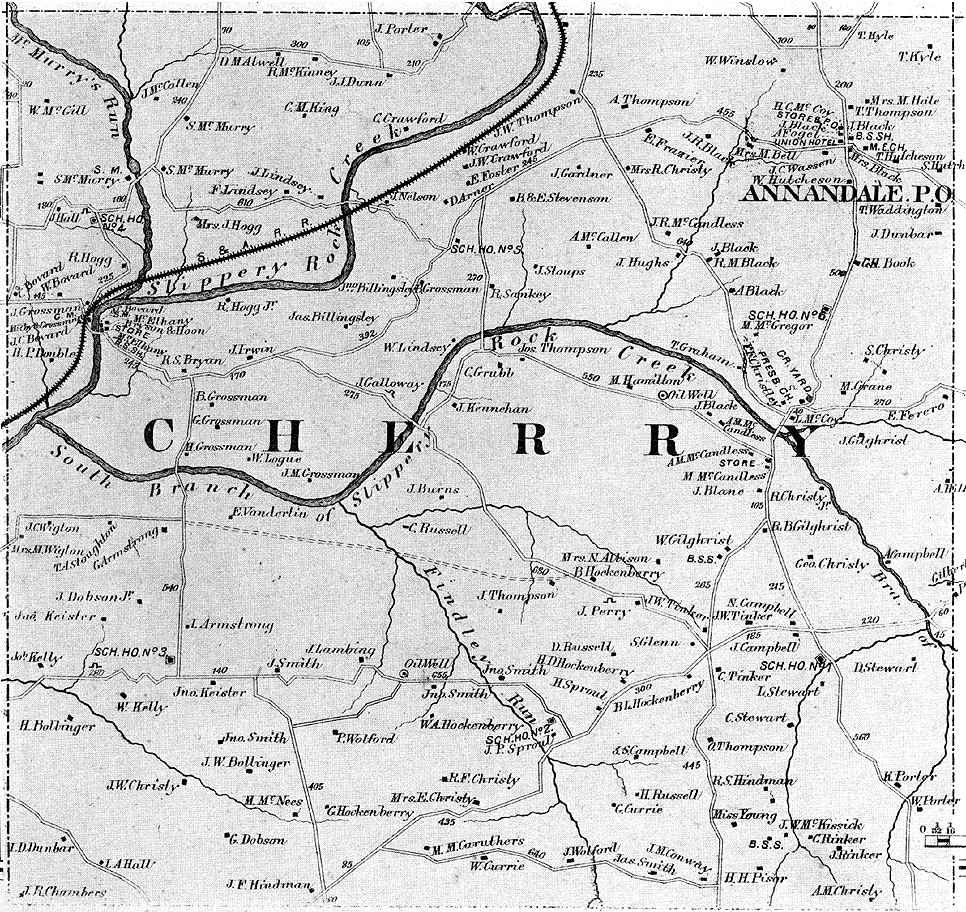
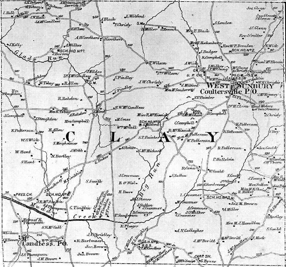
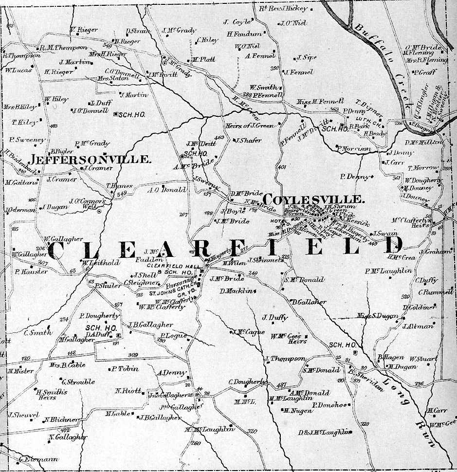
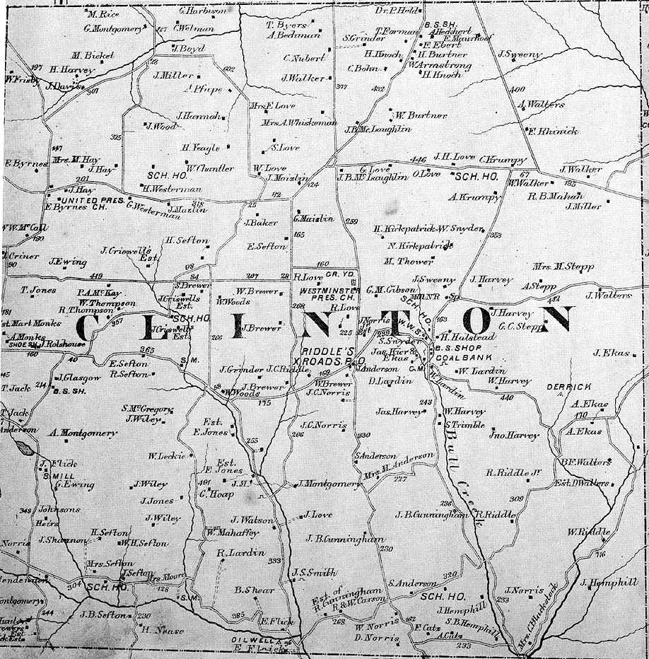
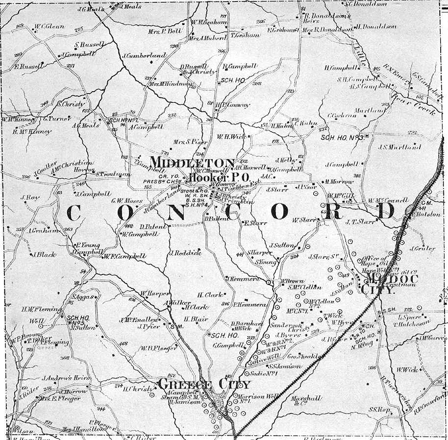
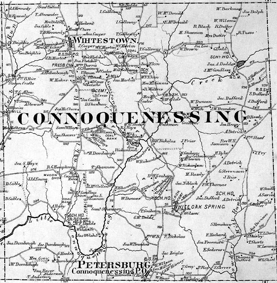
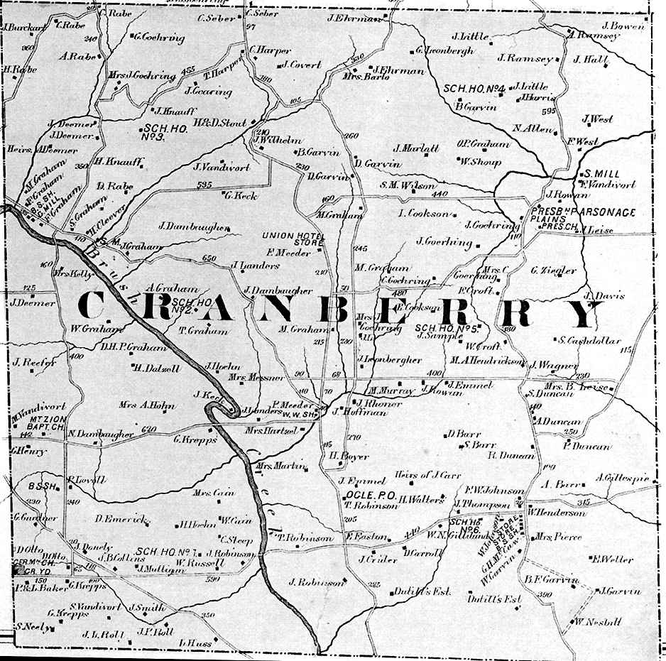
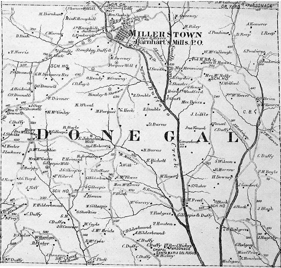
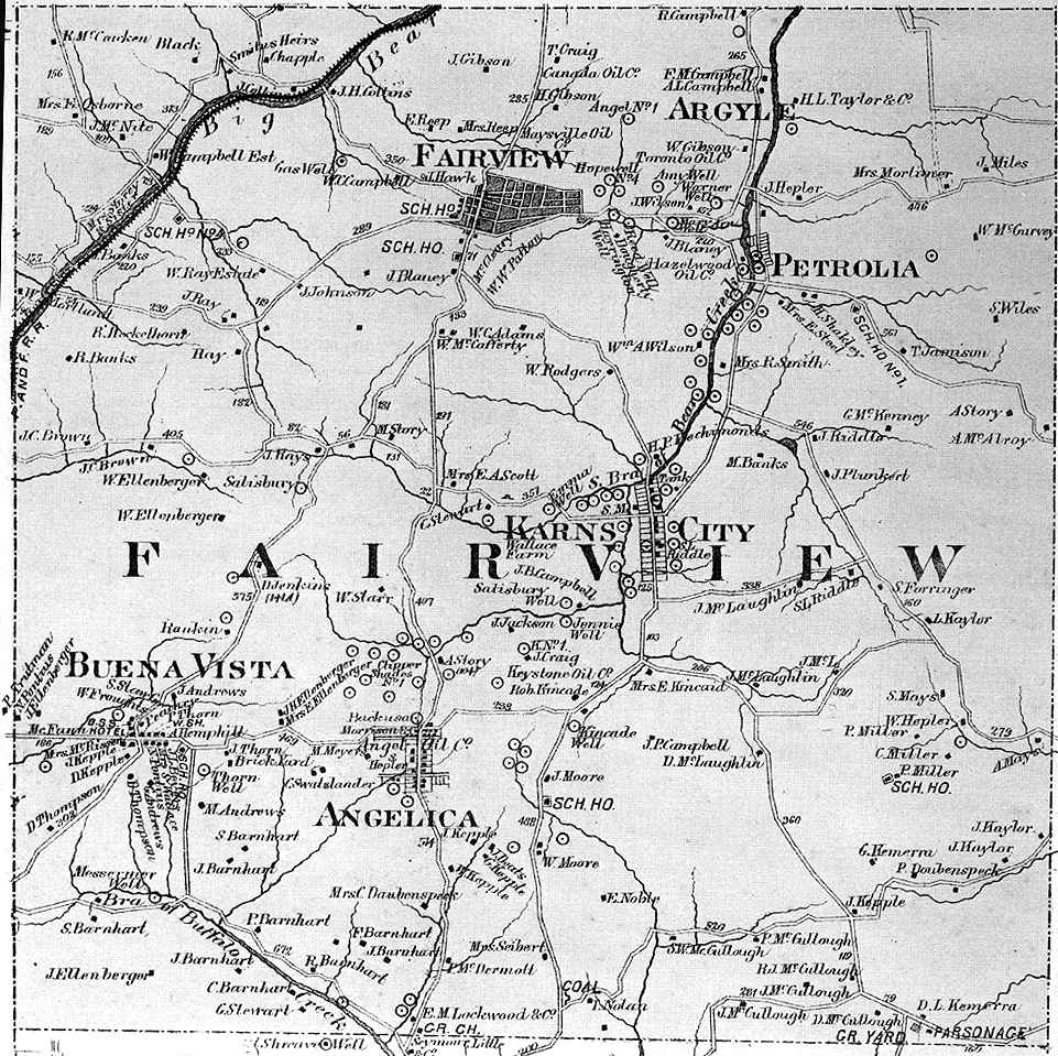
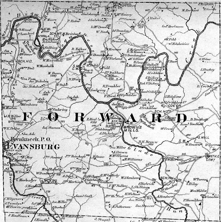
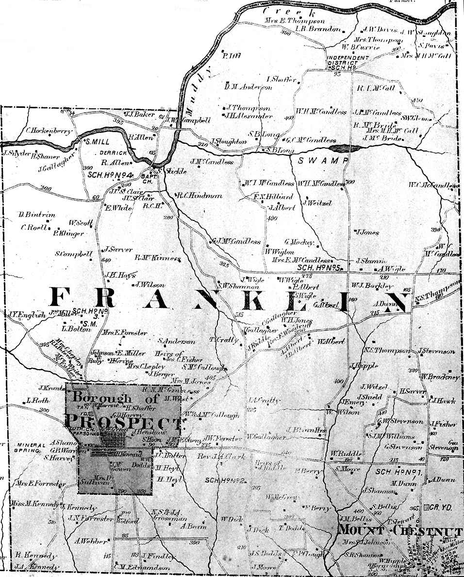
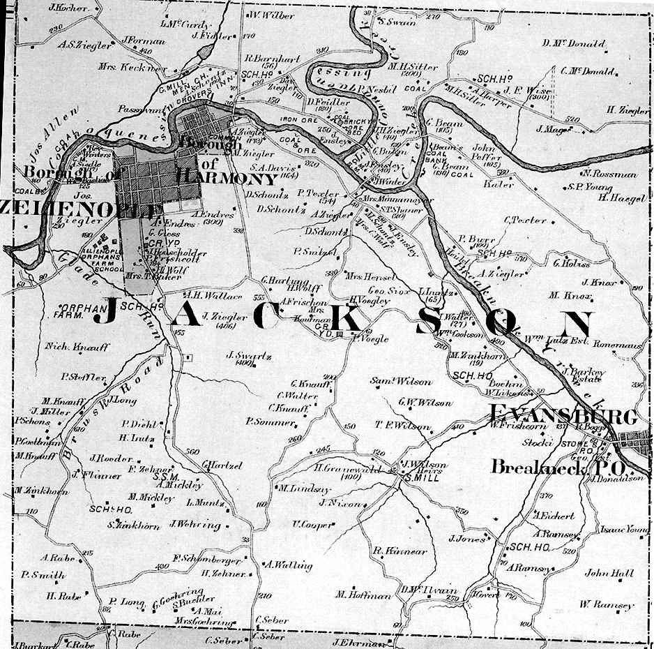
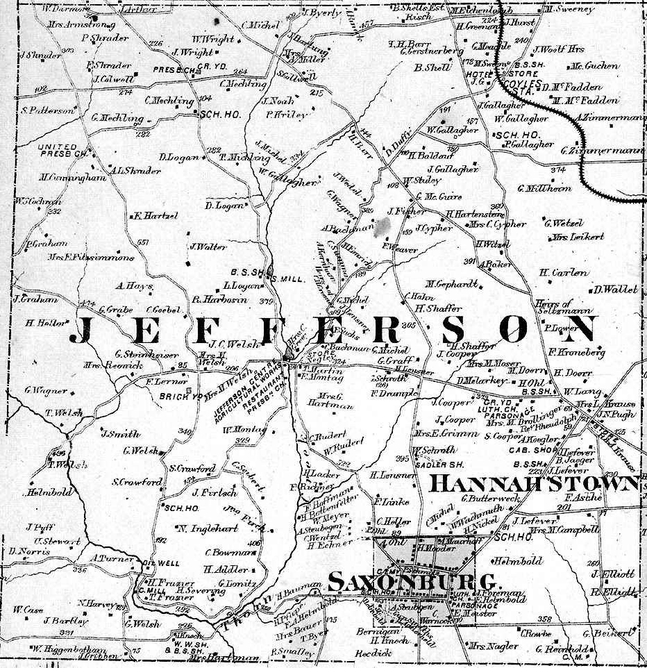
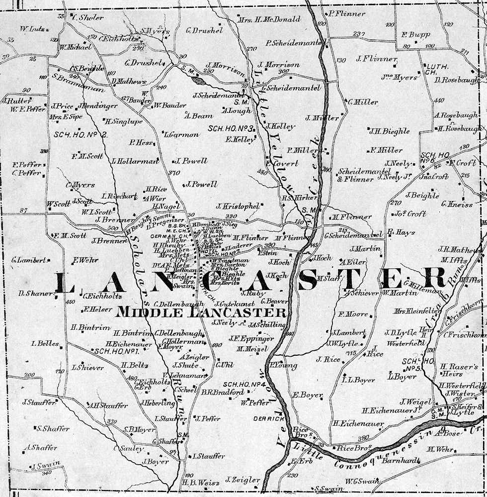
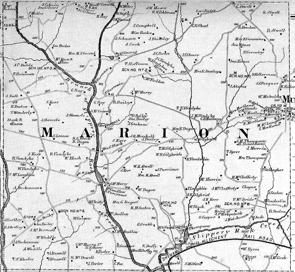
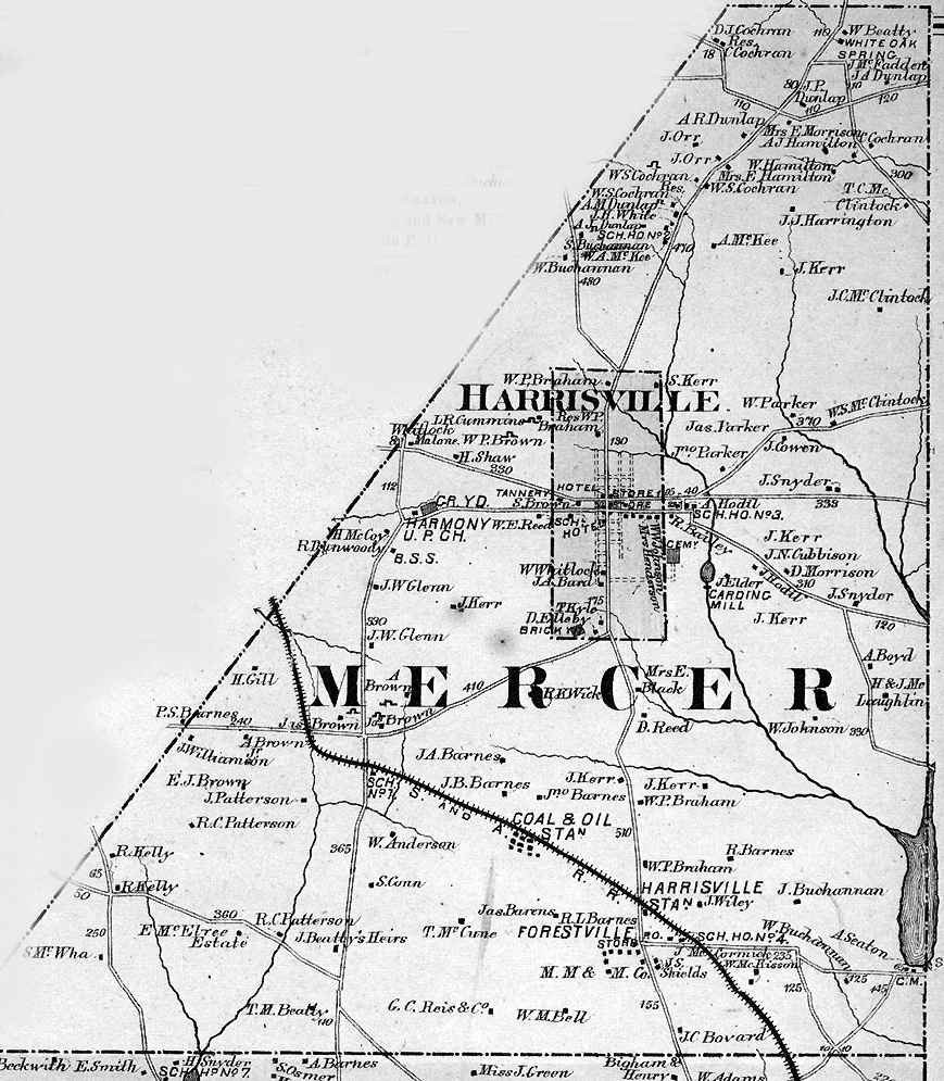
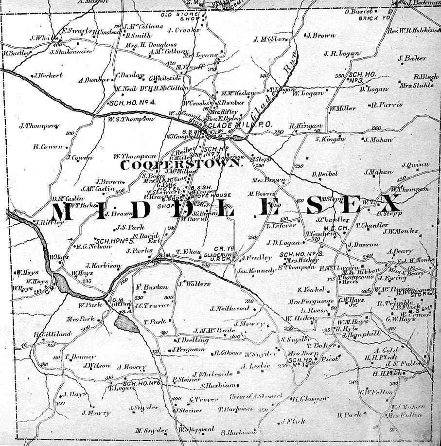
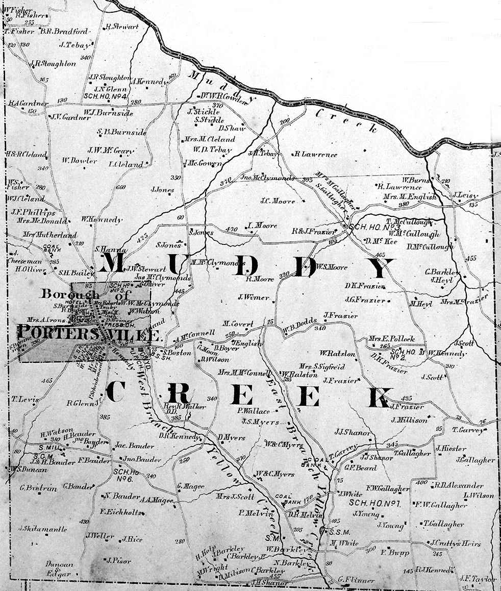
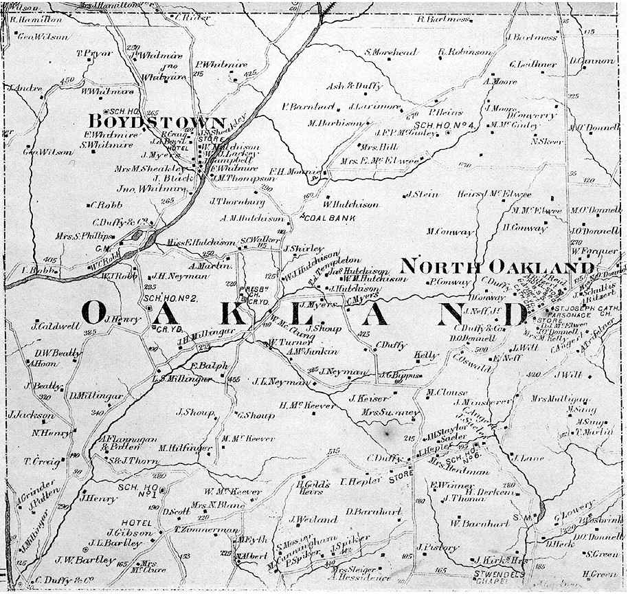
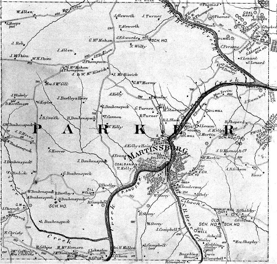
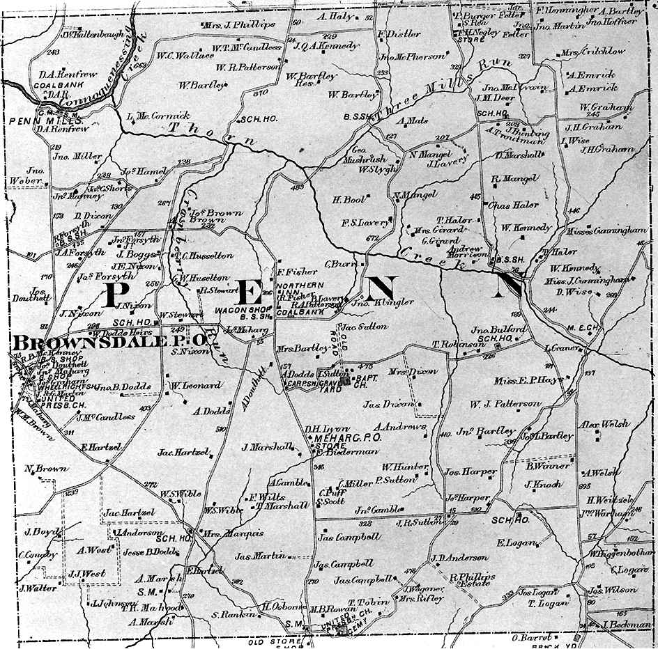
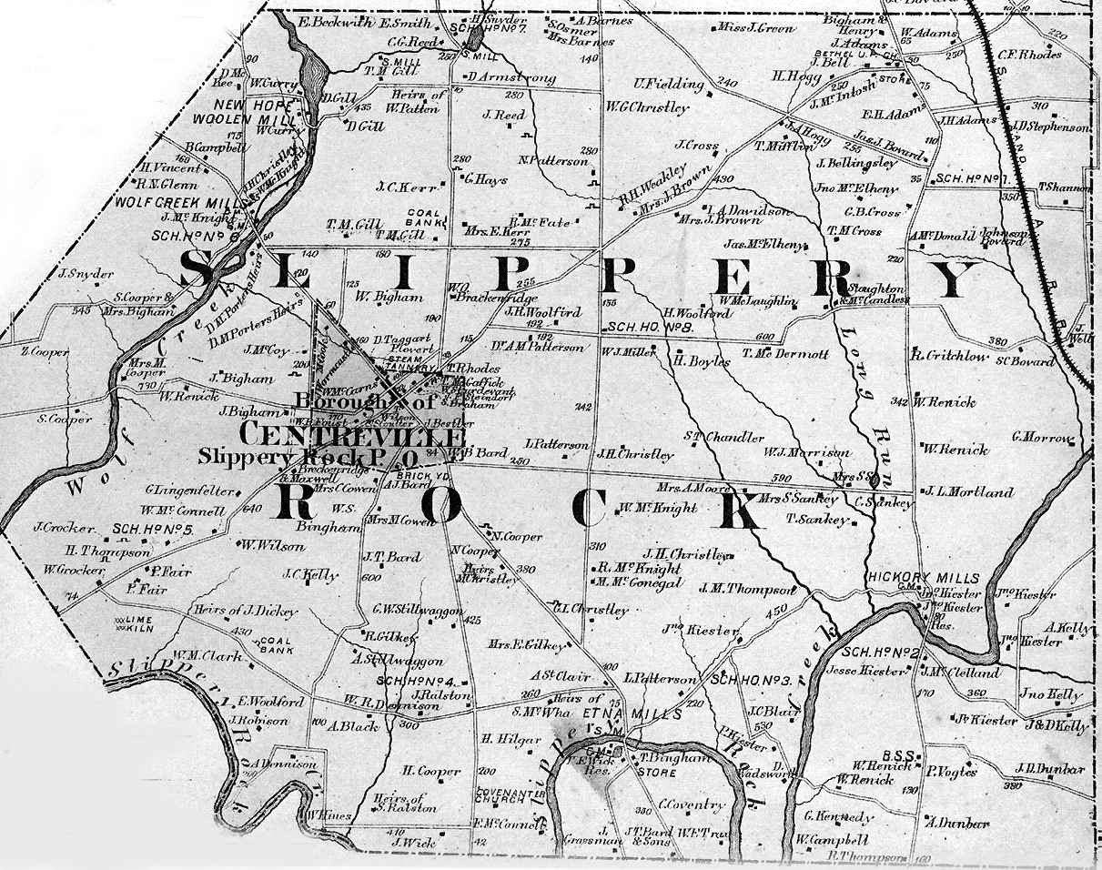
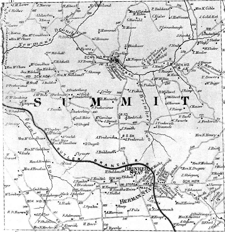
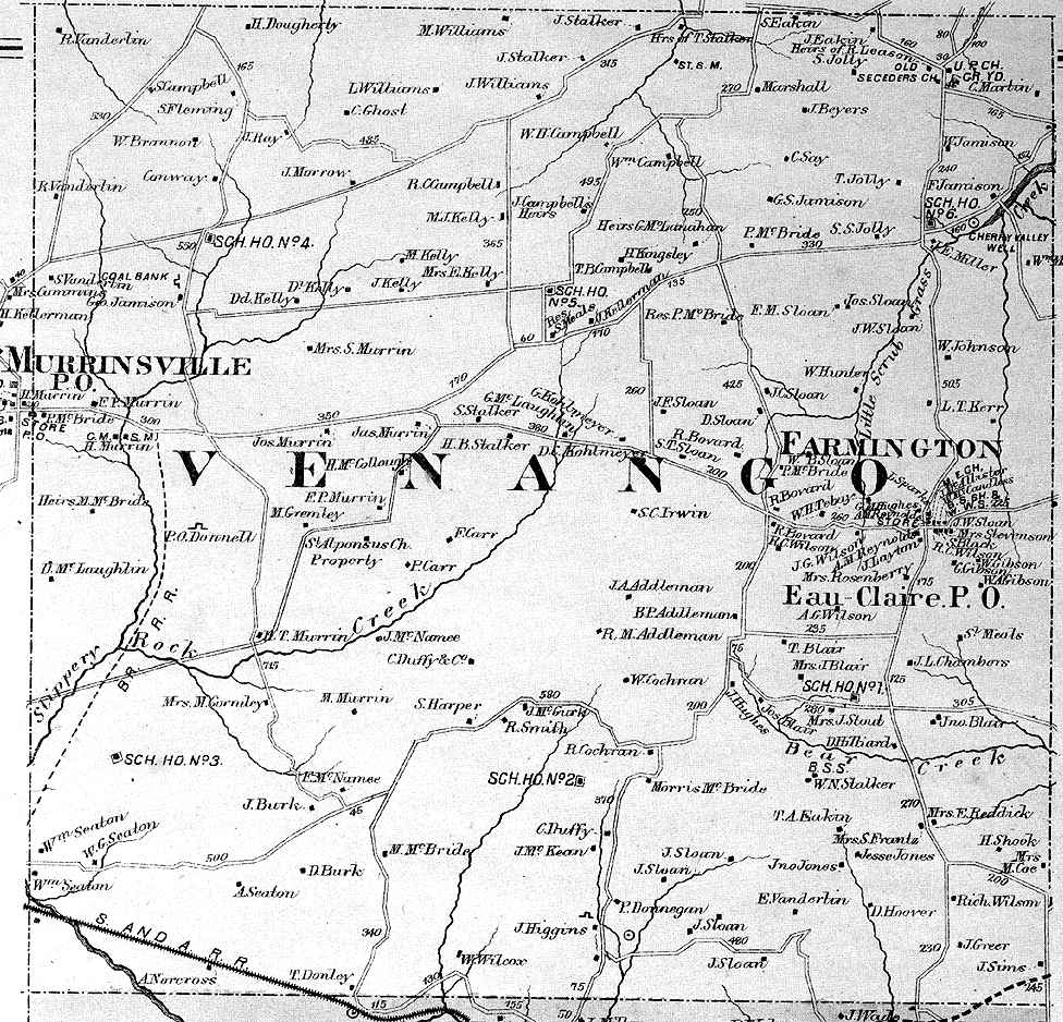
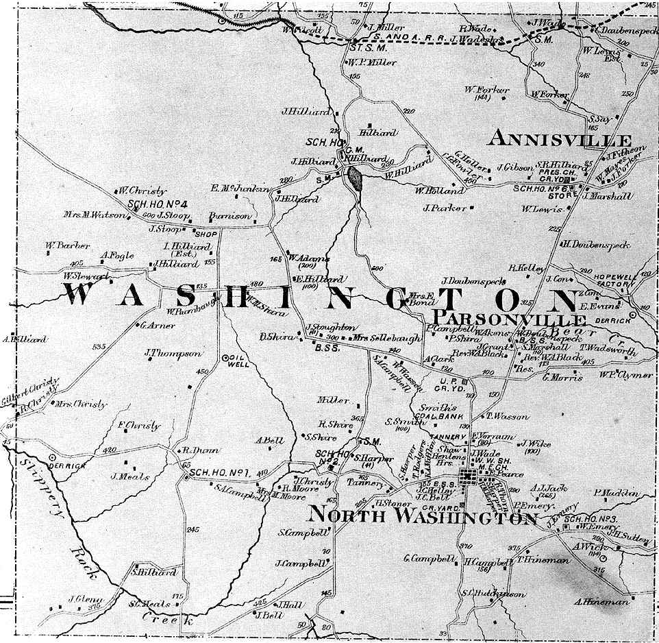
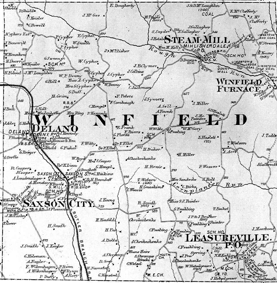
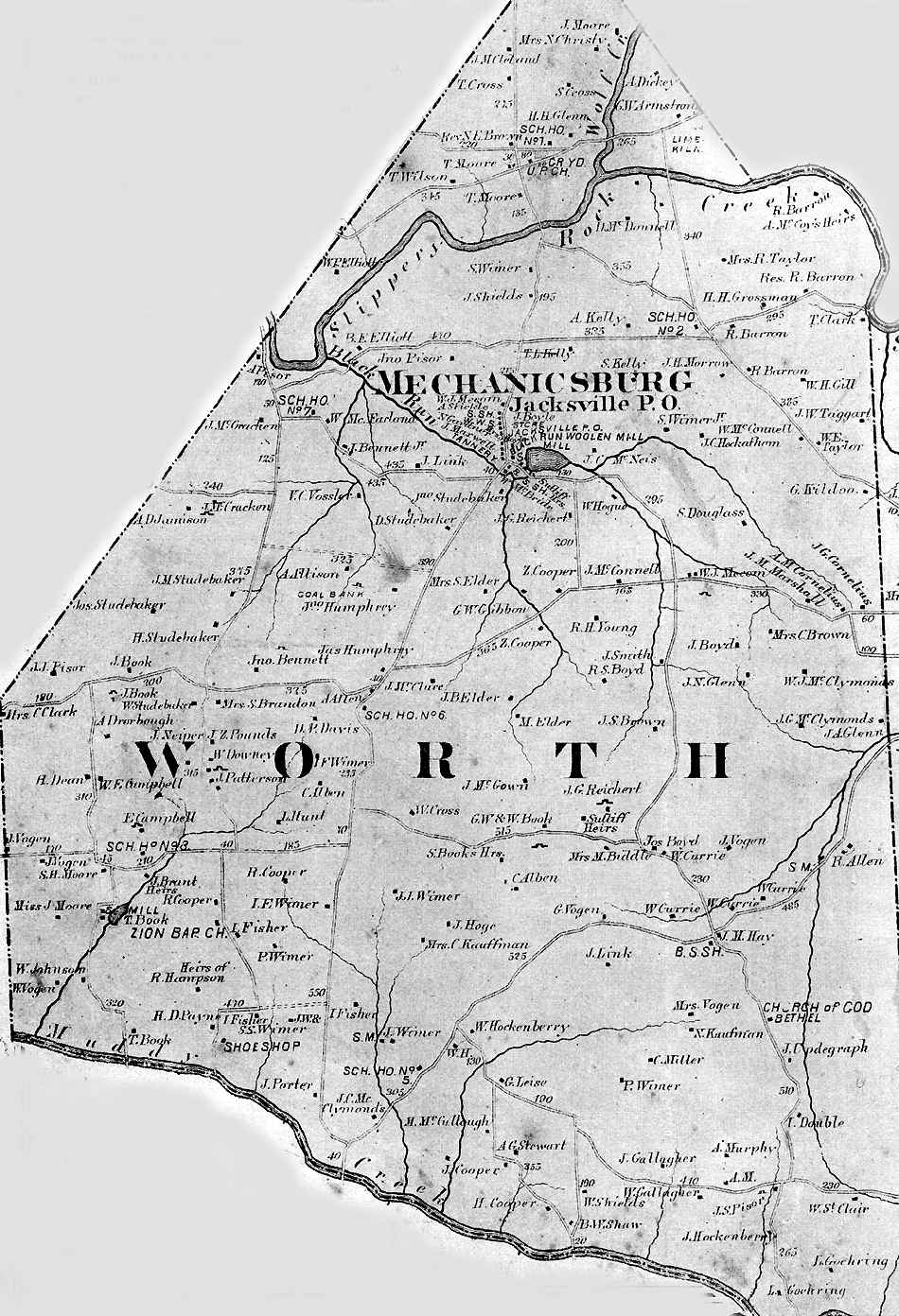
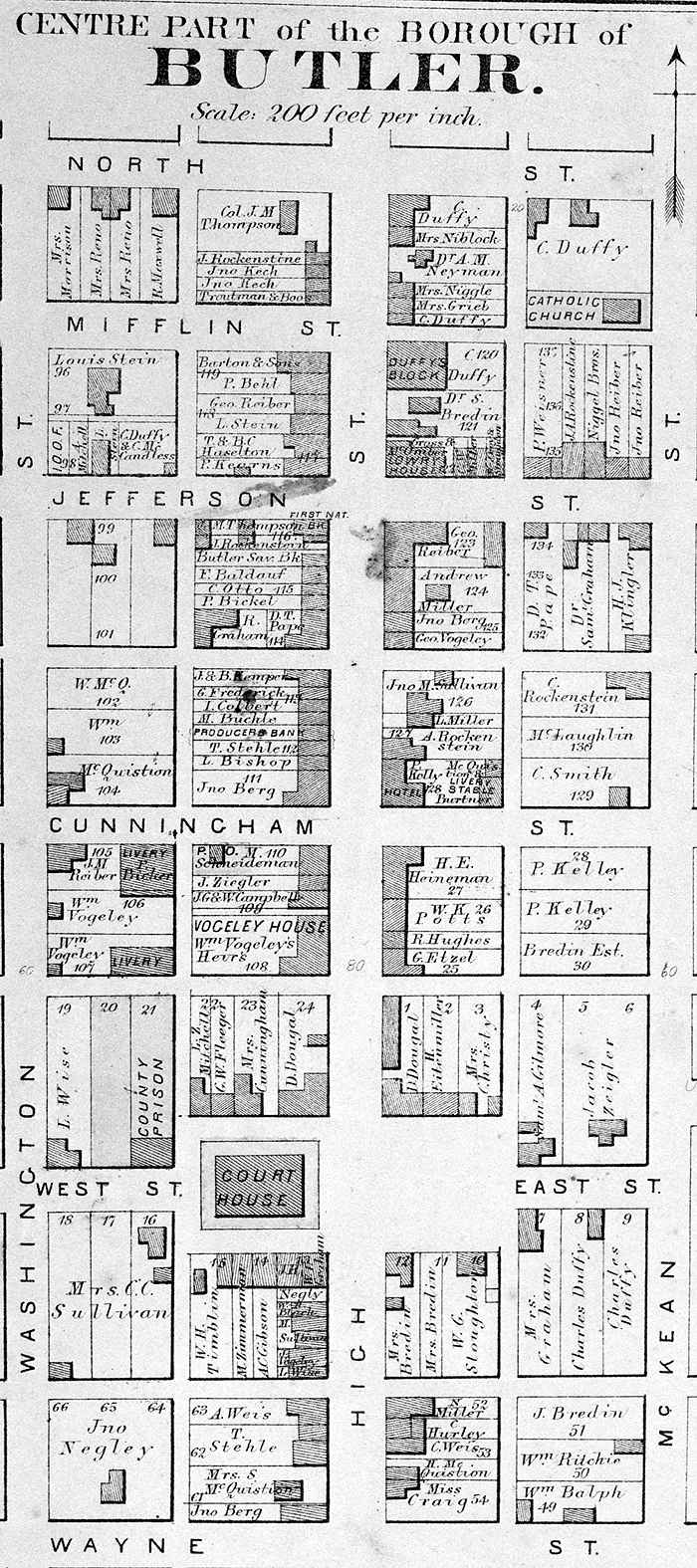
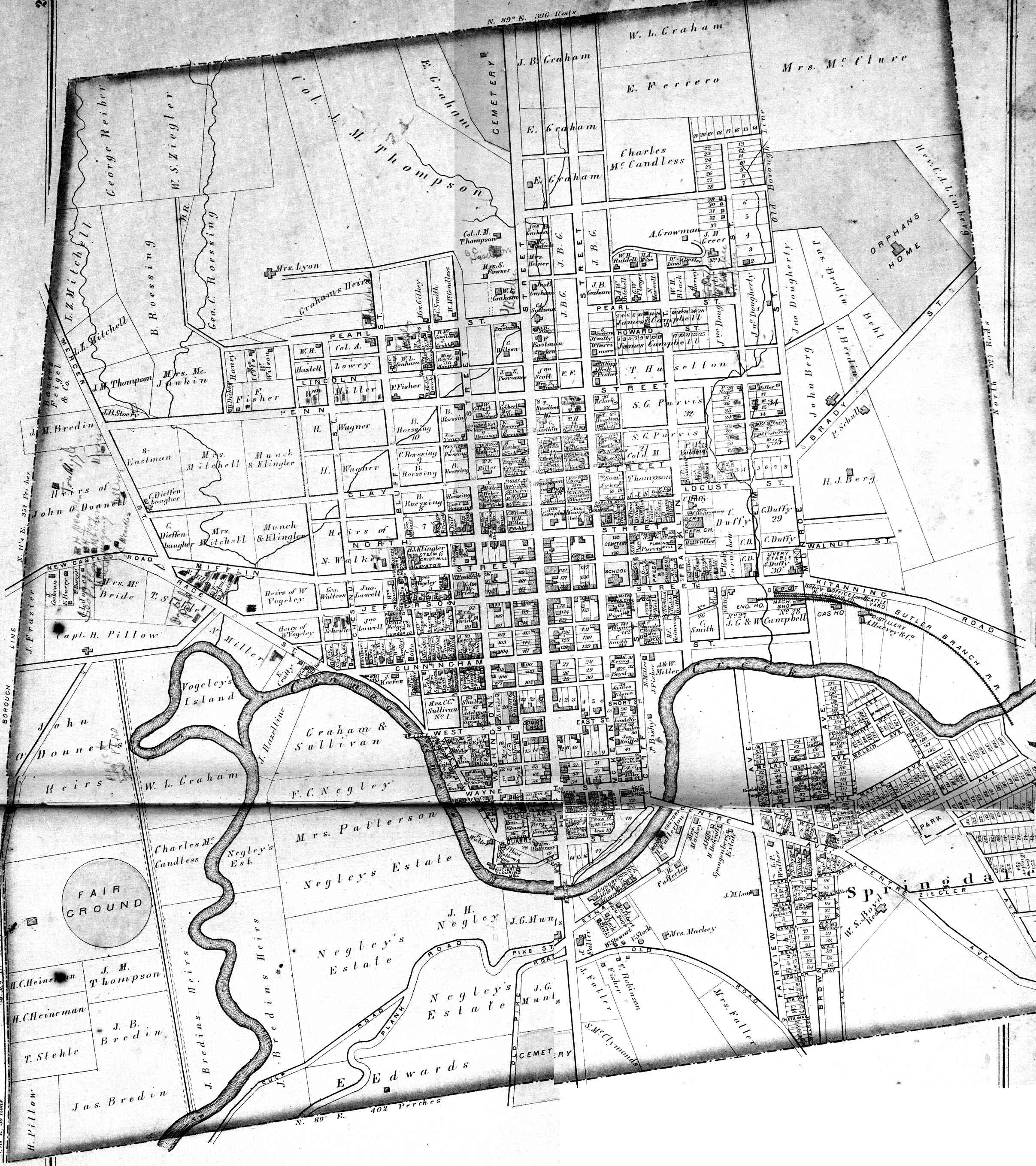
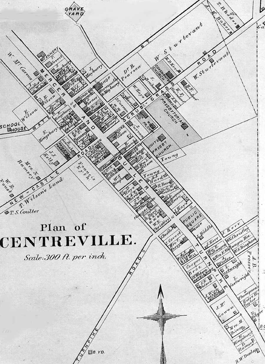
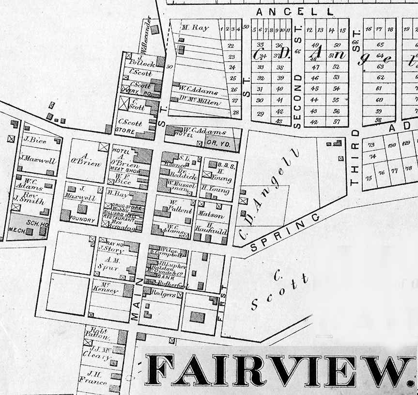
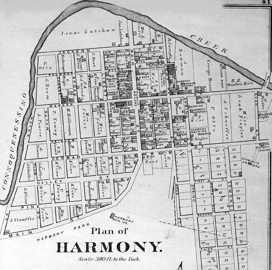
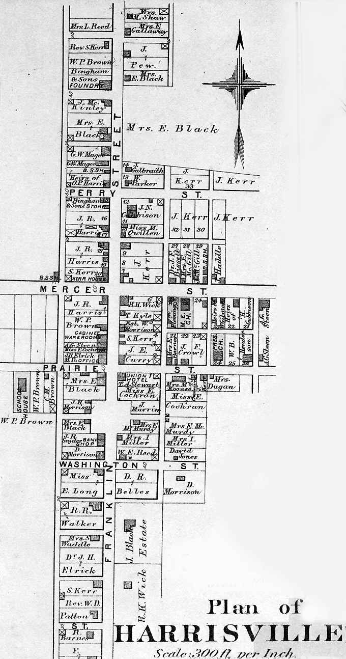
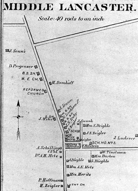
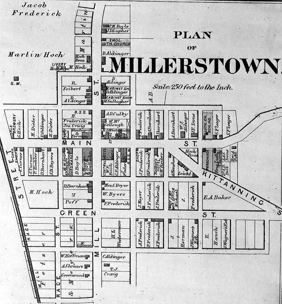
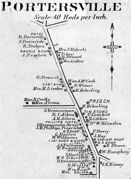
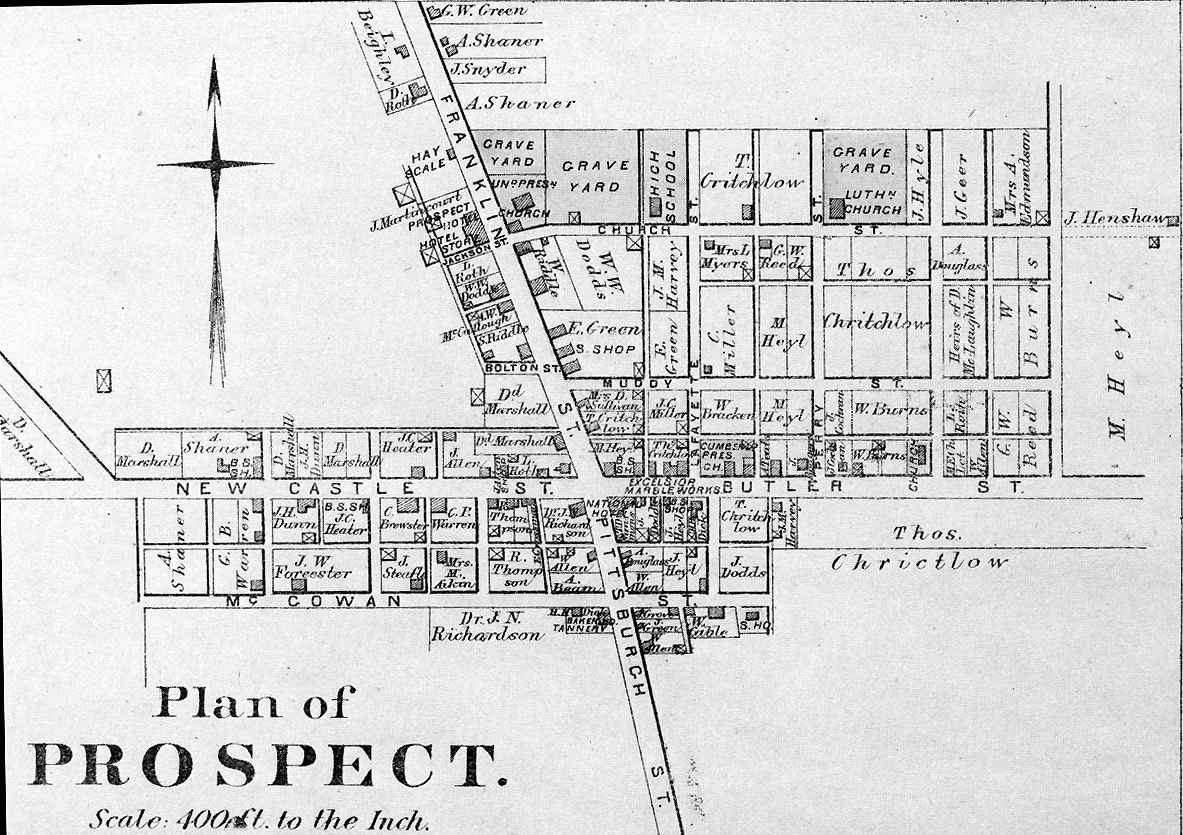
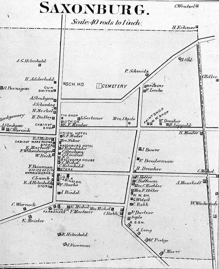
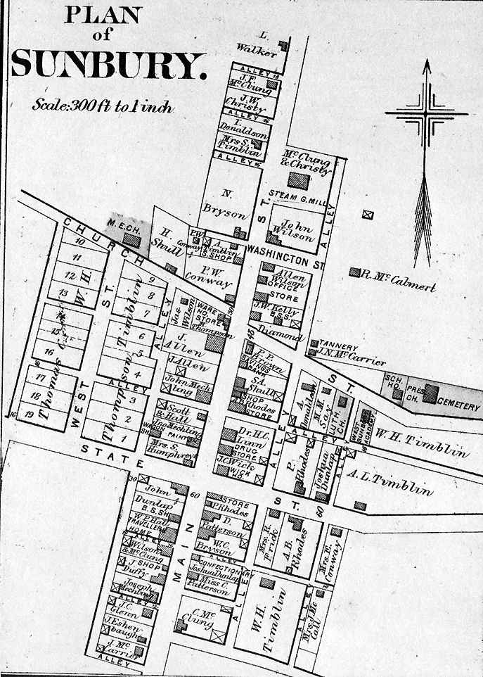
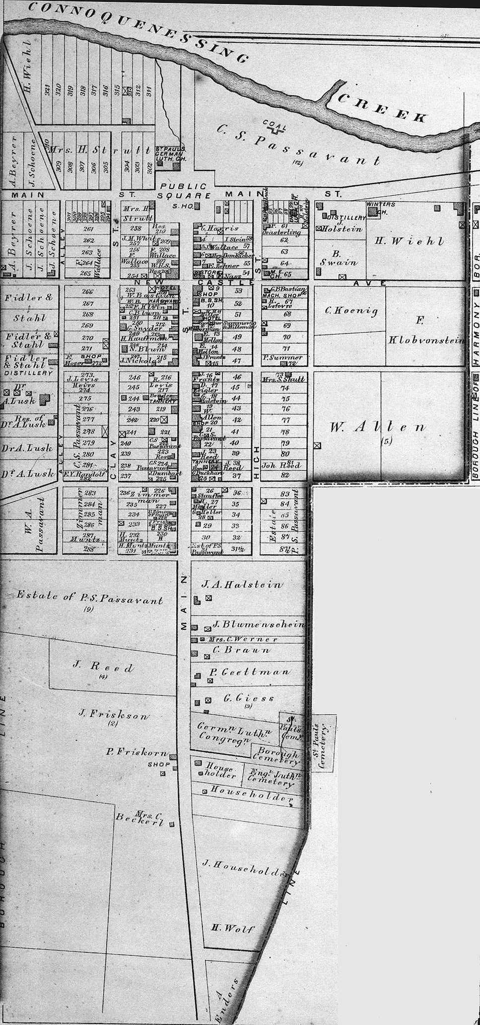
Township and borough maps of Butler County Pennsylvania from the 1874 Atlas of the County of Butler, and the State of Pennsylvania, by G.M. Hopkins & Co., Philadelphia.
|
BOROUGH MAPS Note: Some boroughs are combined on a page or appear with the township map. |
|||
|---|---|---|---|
| TOWN | TOWNSHIP | TOWN | TOWNSHIP |
|
Butler (downtown) Butler (750kb) Centerville Fairview Harmony Harrisville Middle Lancaster |
Butler Slippery Rock Fairview Jackson Mercer Lancaster |
Millerstown Portersville Prospect Saxonburg Sunbury Zelienople |
Donegal Muddy Creek Franklin Jefferson Clay Jackson |
Click on map to see larger map.
Go to Butler County 1883 History.
Go to Butler County 1895 History
Back to: Butler County Map Archive
Back to: Pennsylvania Map Archive