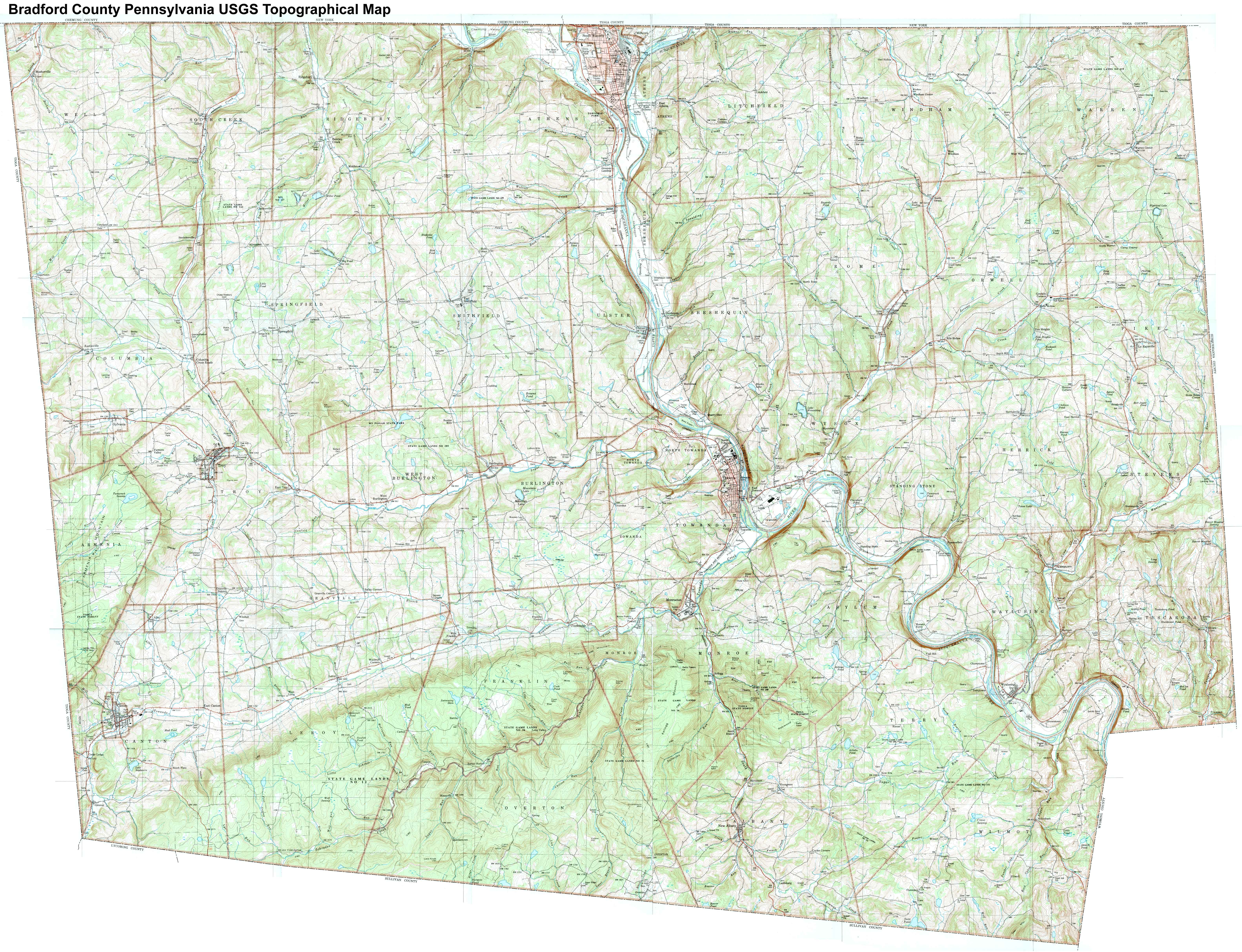
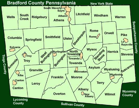
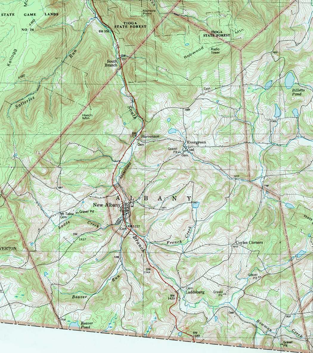
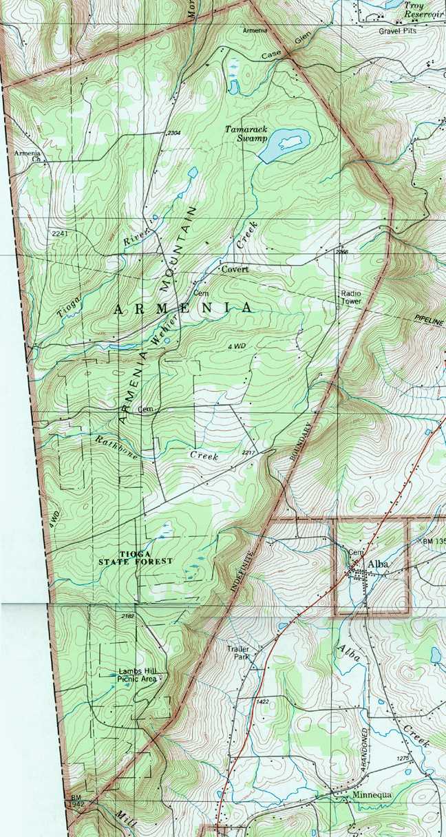
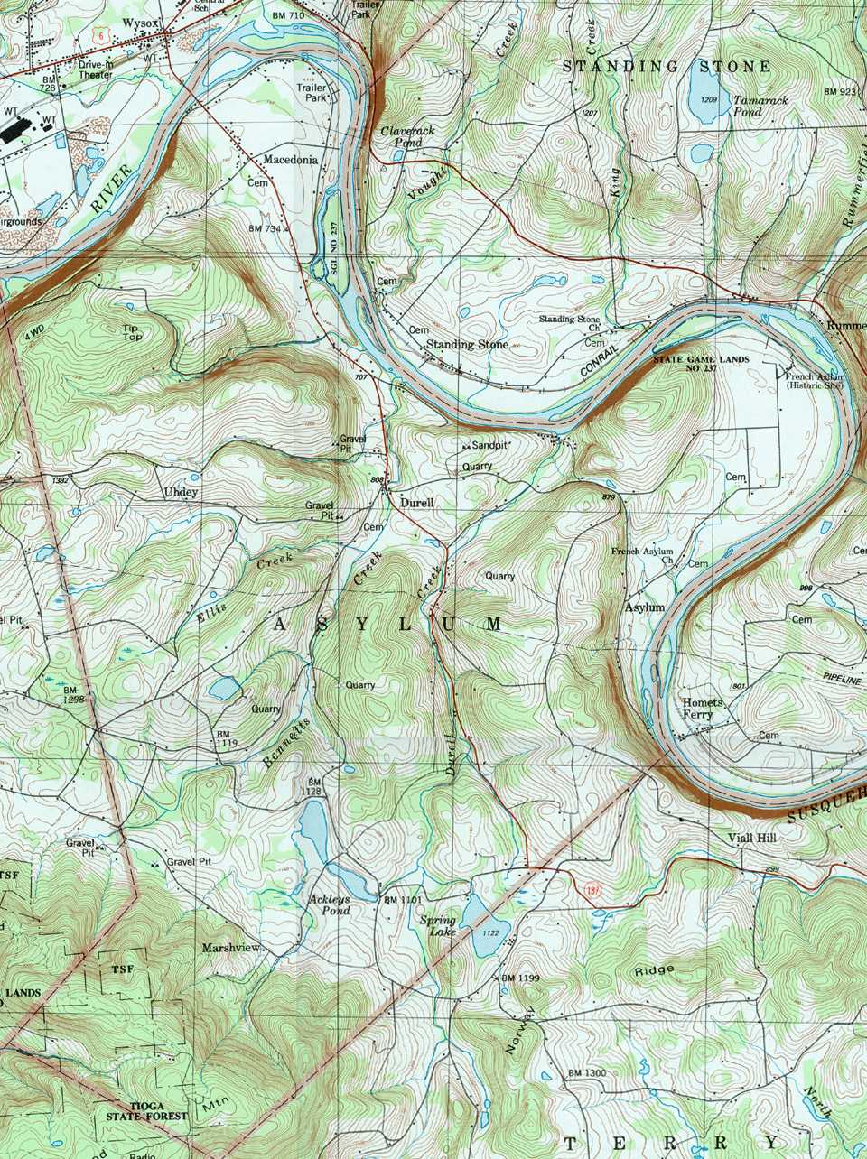
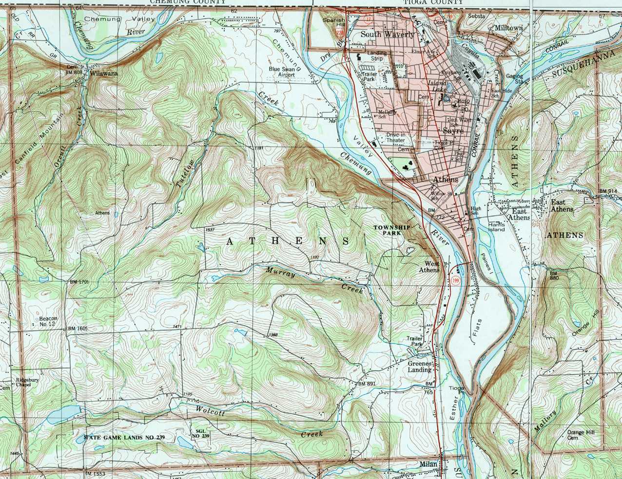
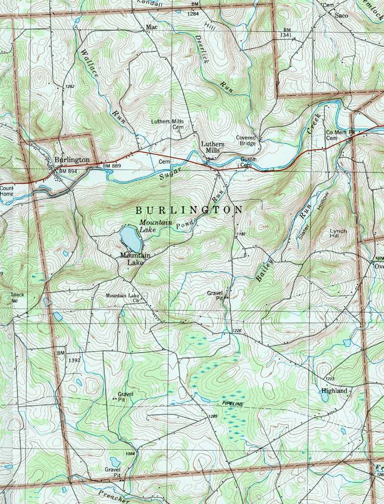
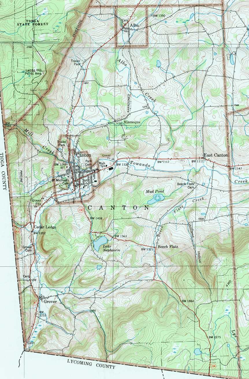
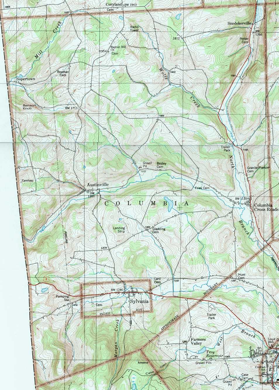
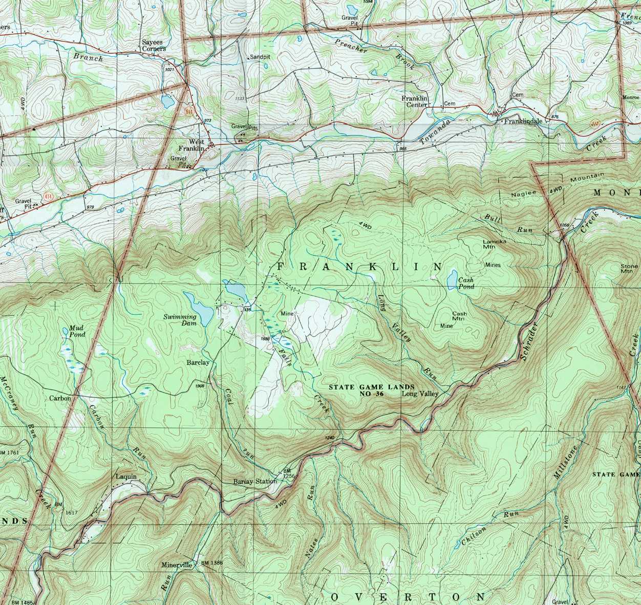
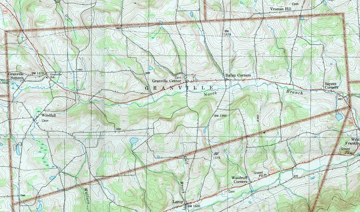
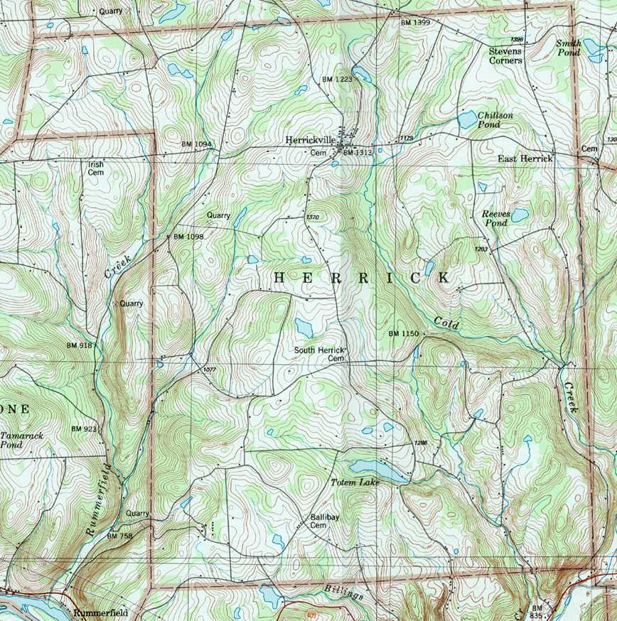
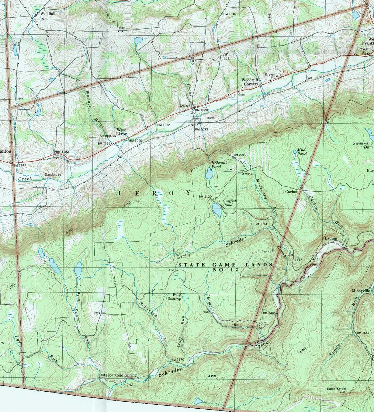
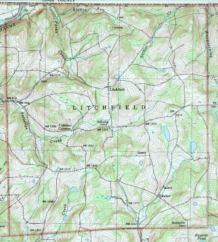
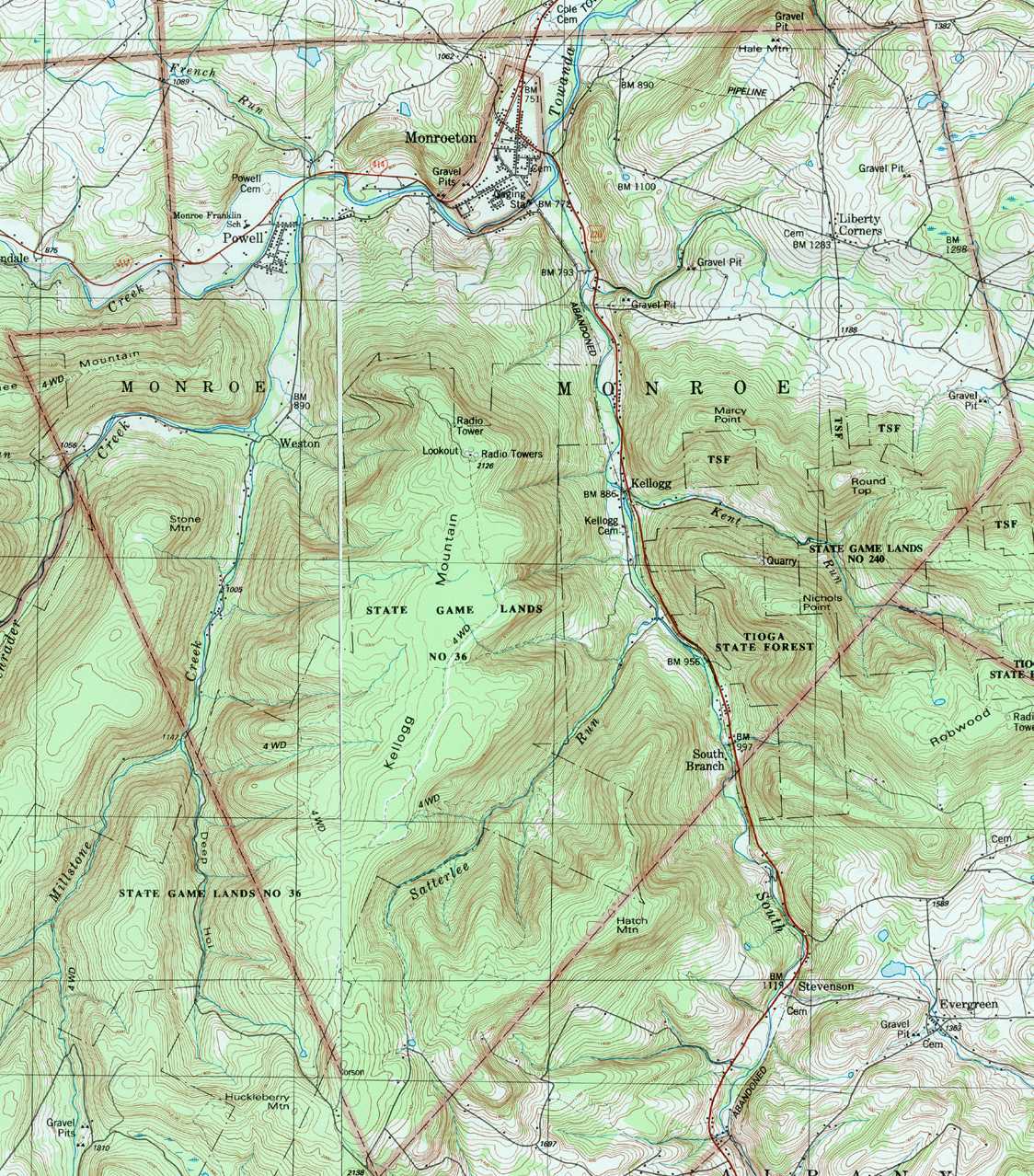
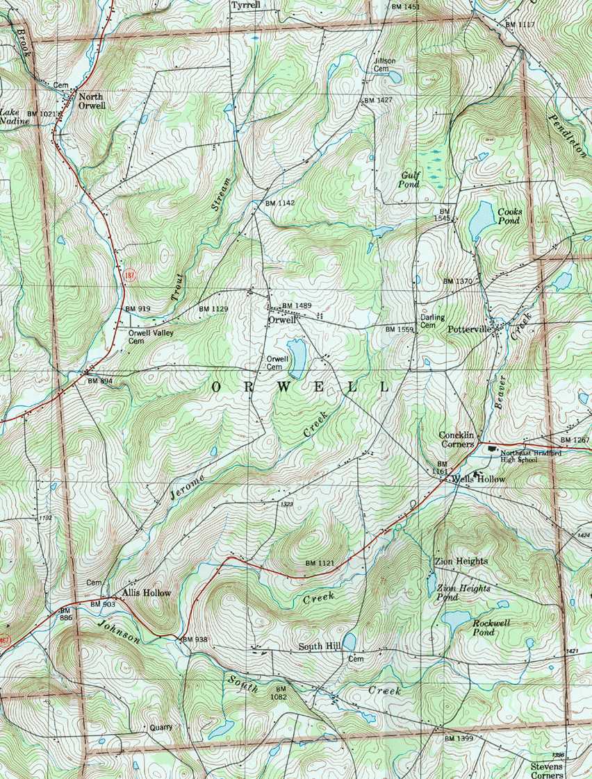
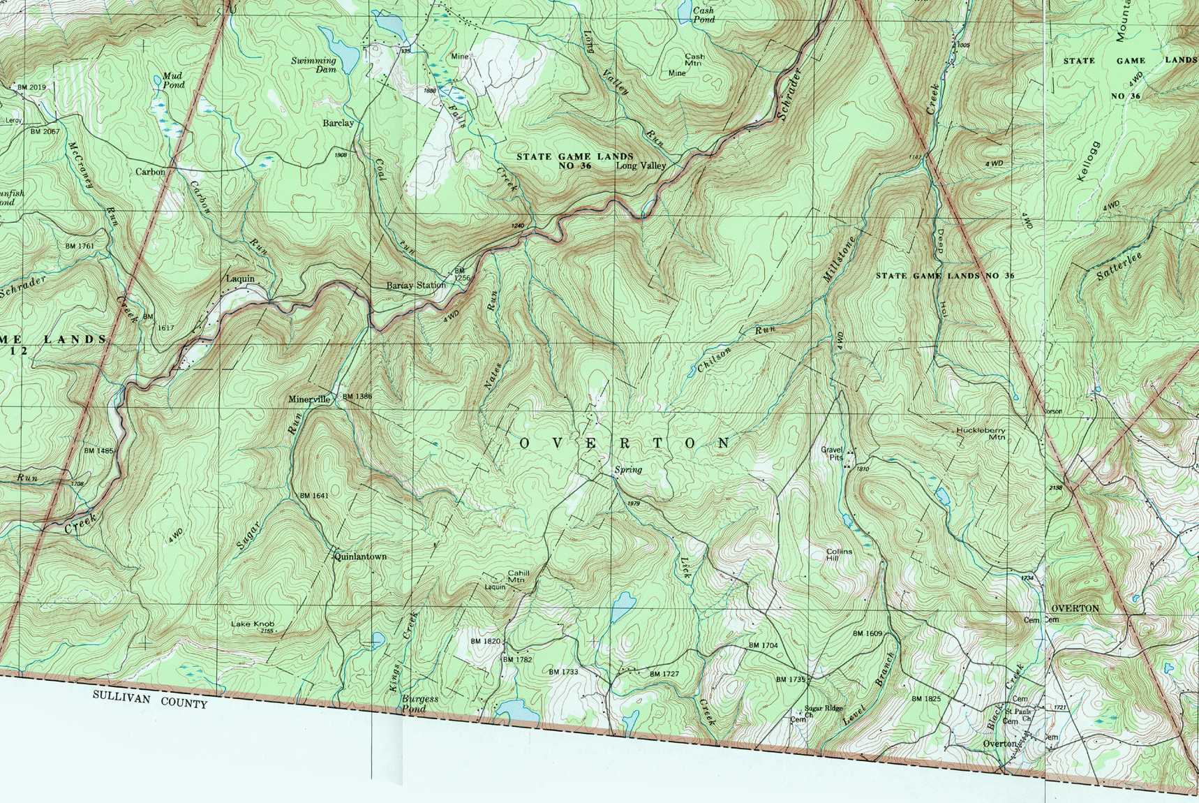
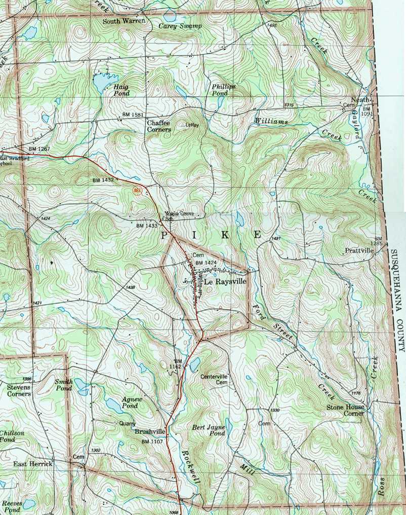
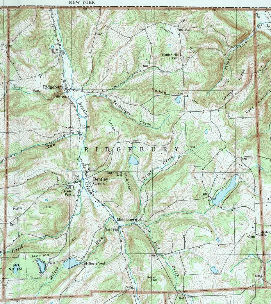
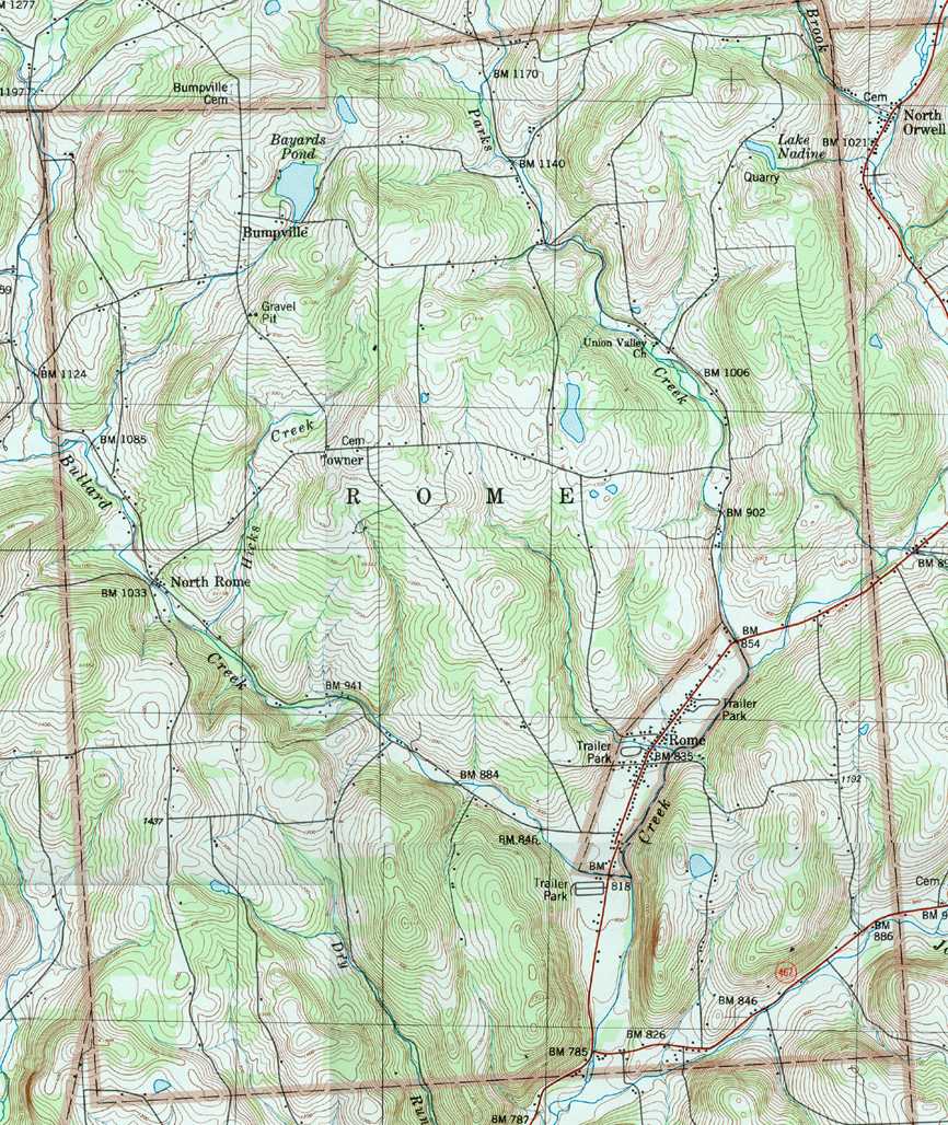
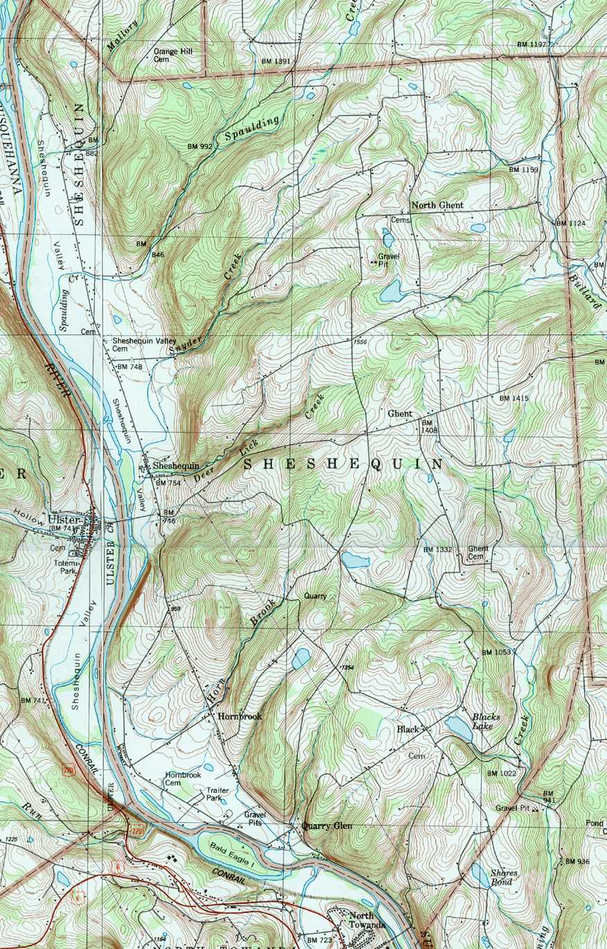
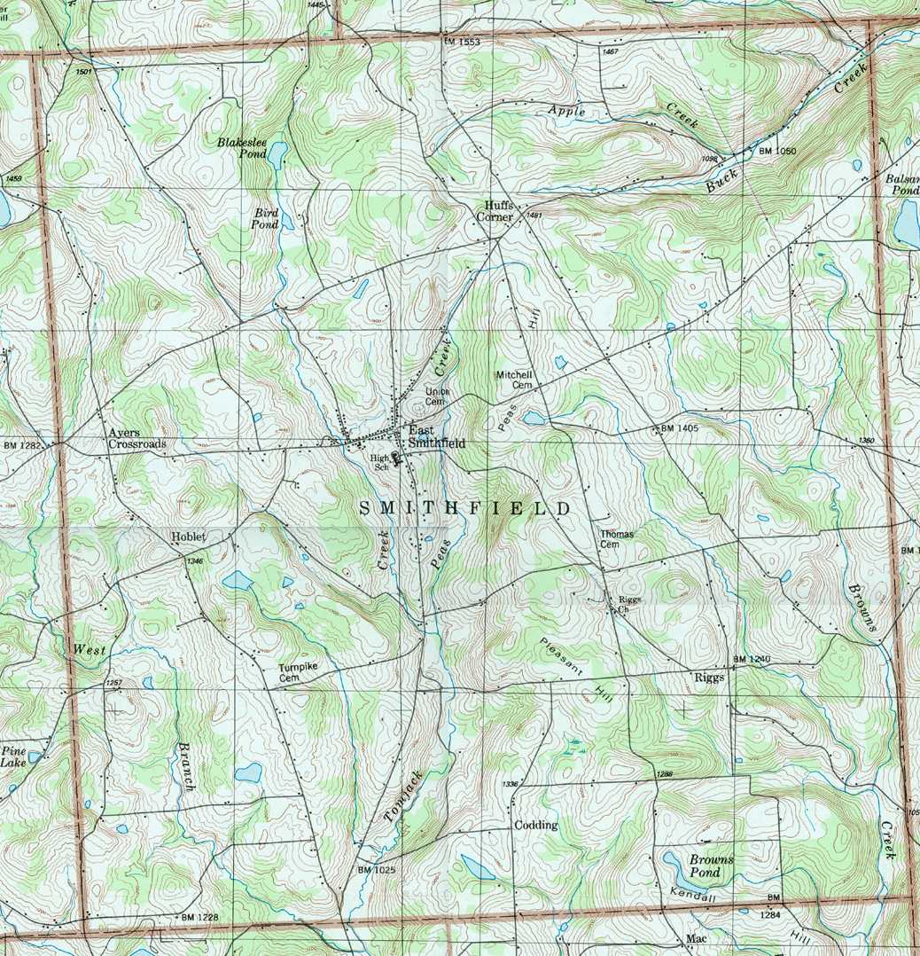
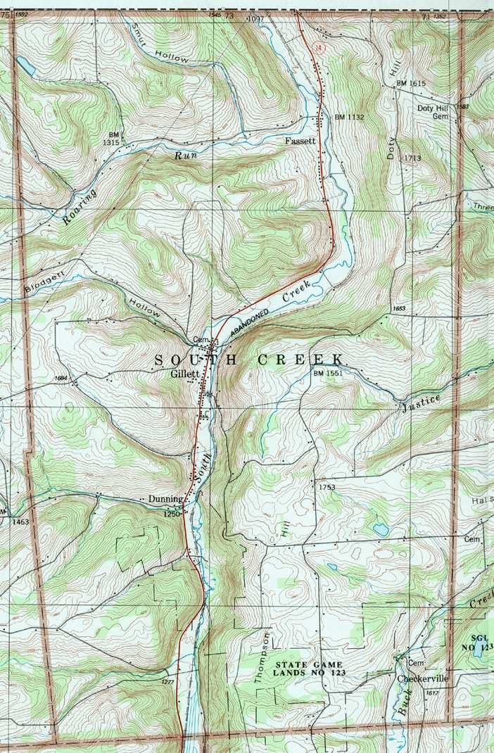
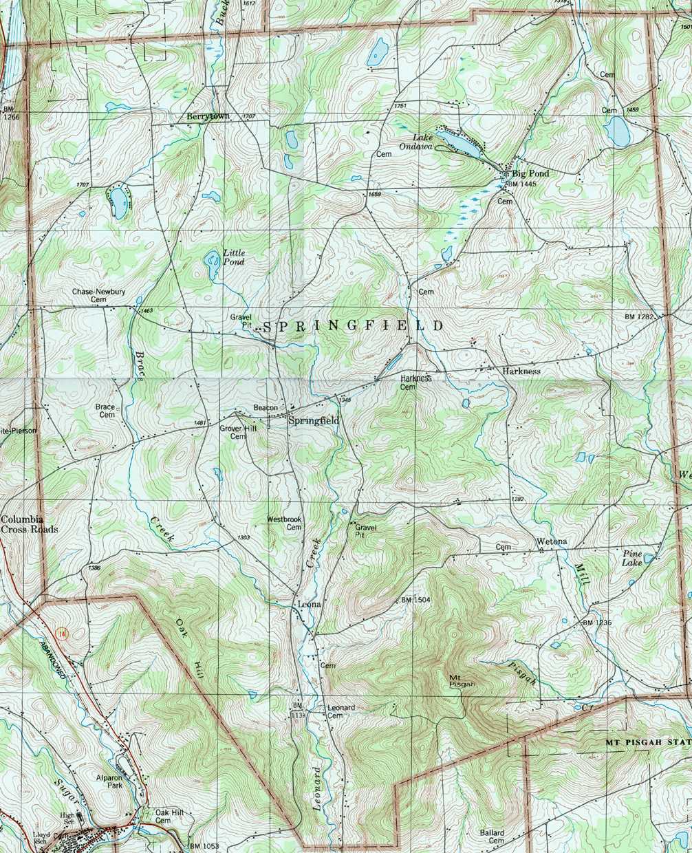
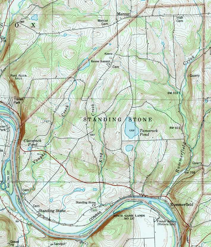
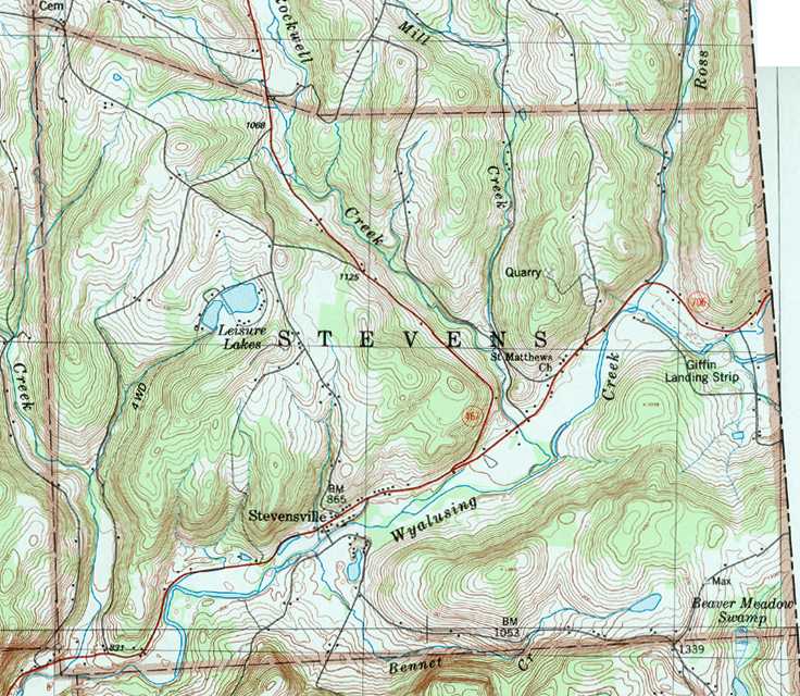
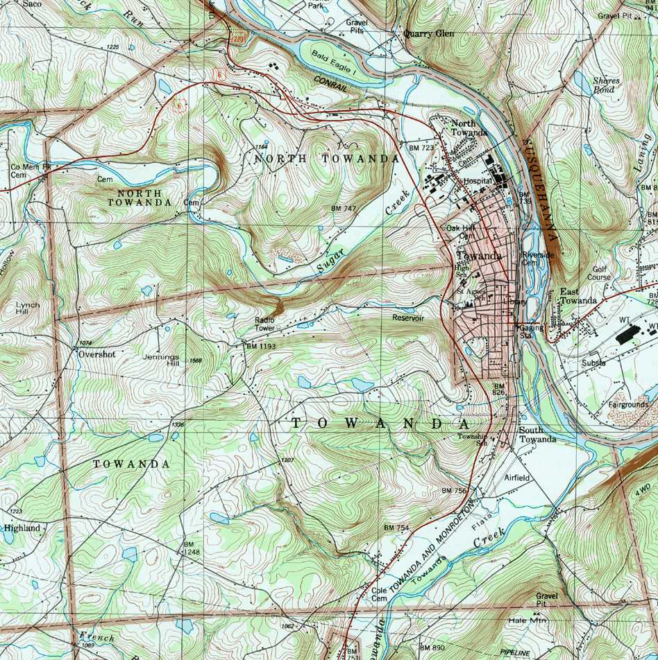
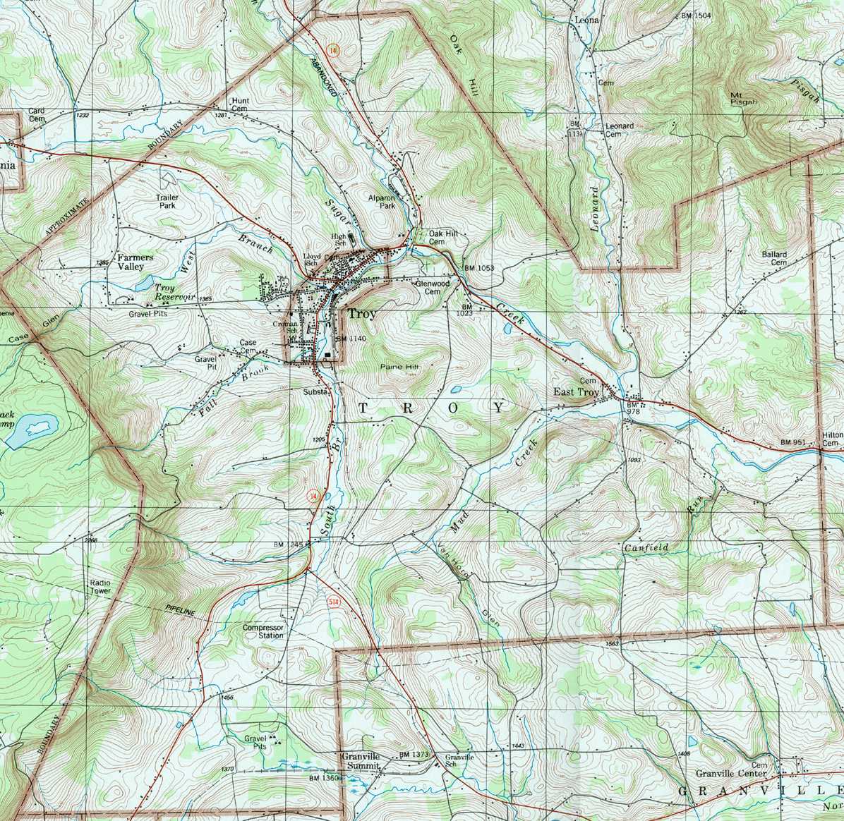
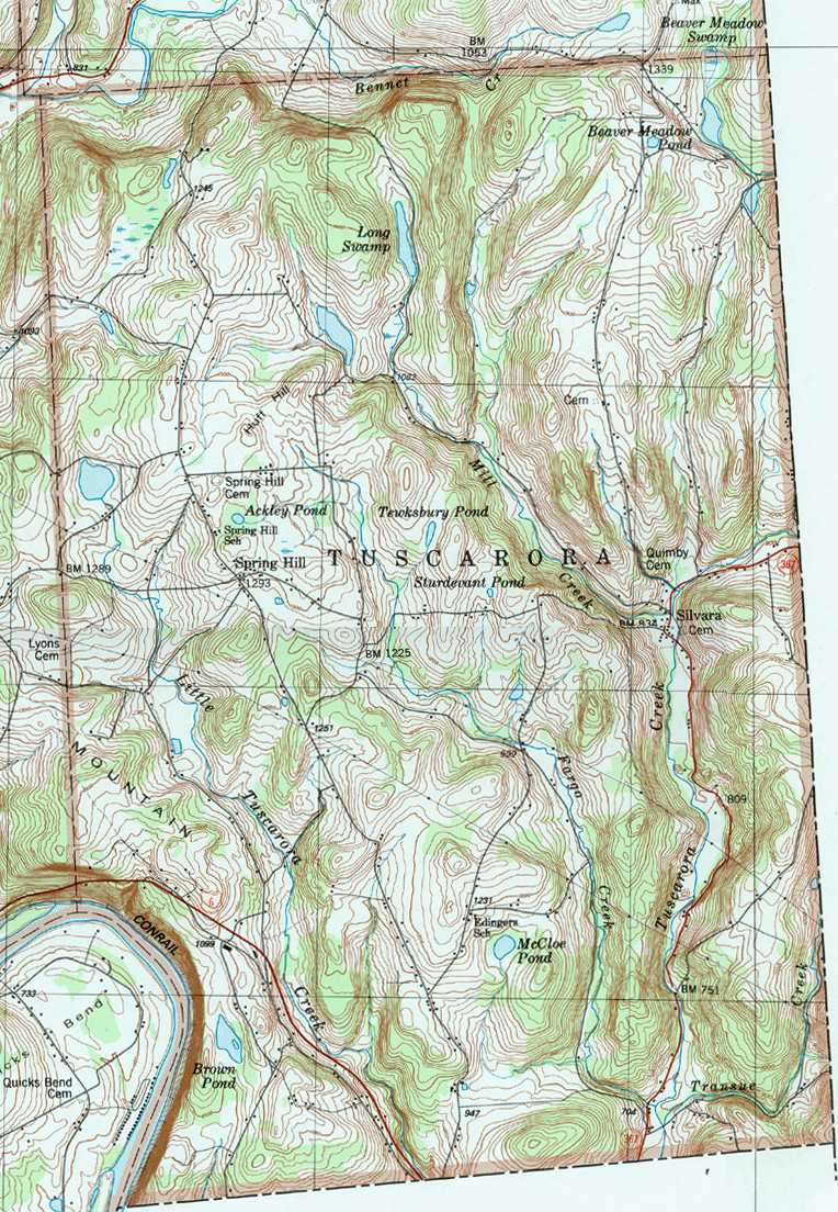
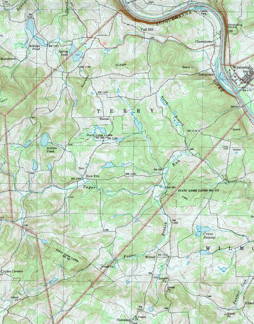
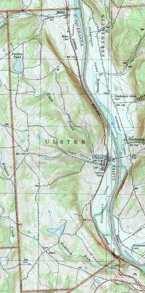
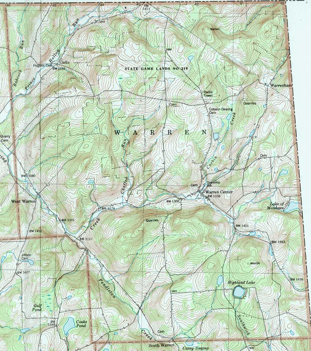
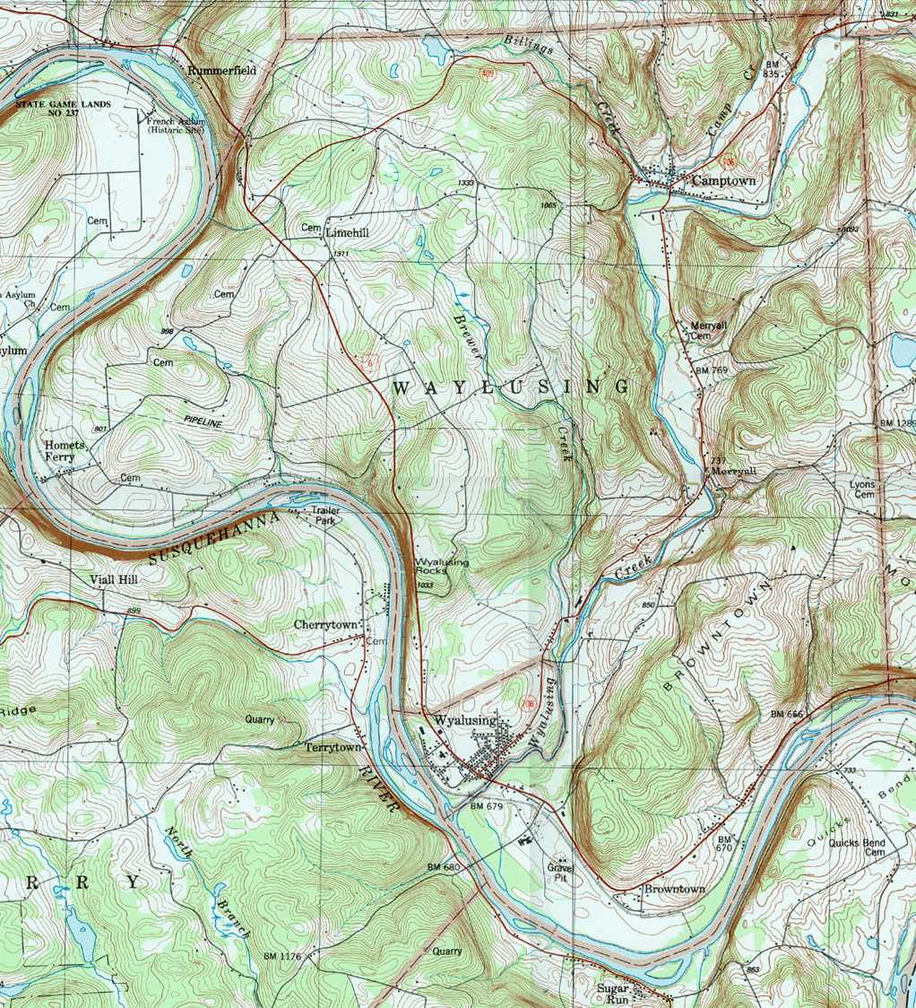
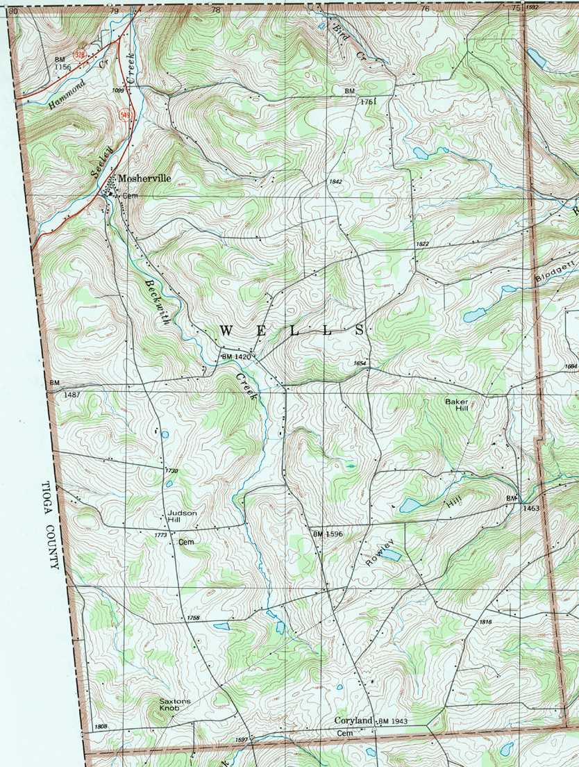
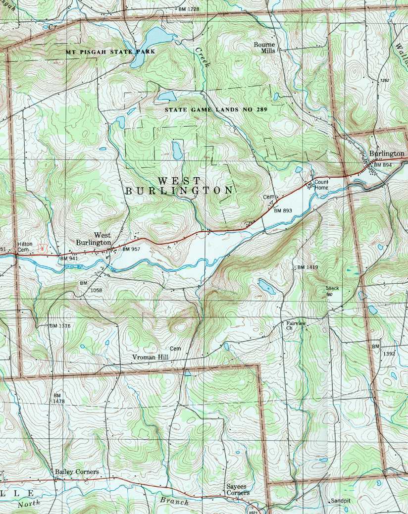
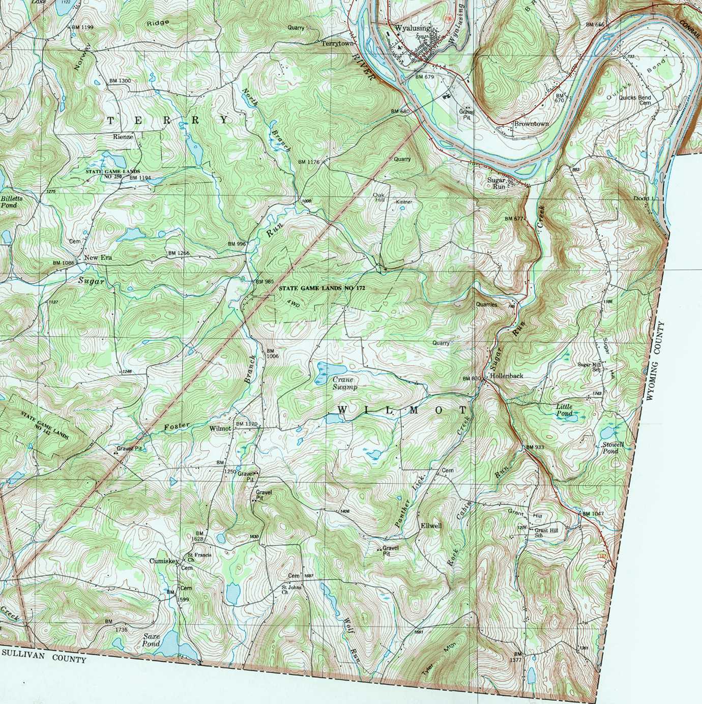
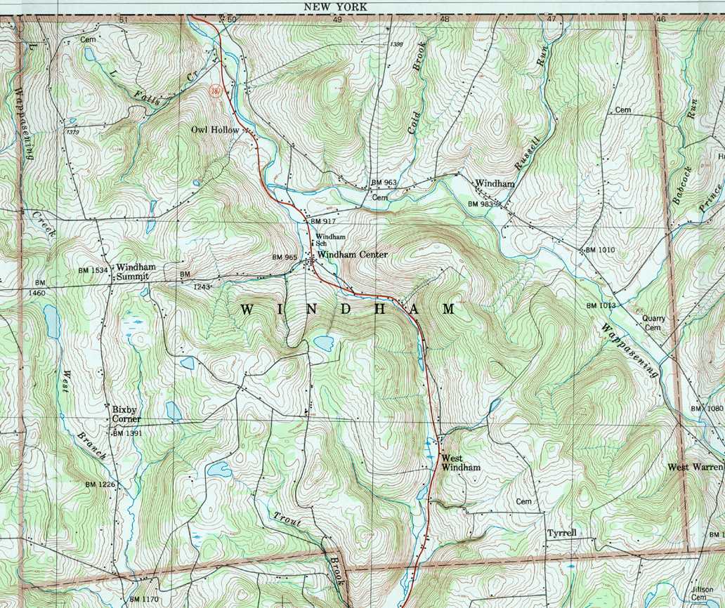
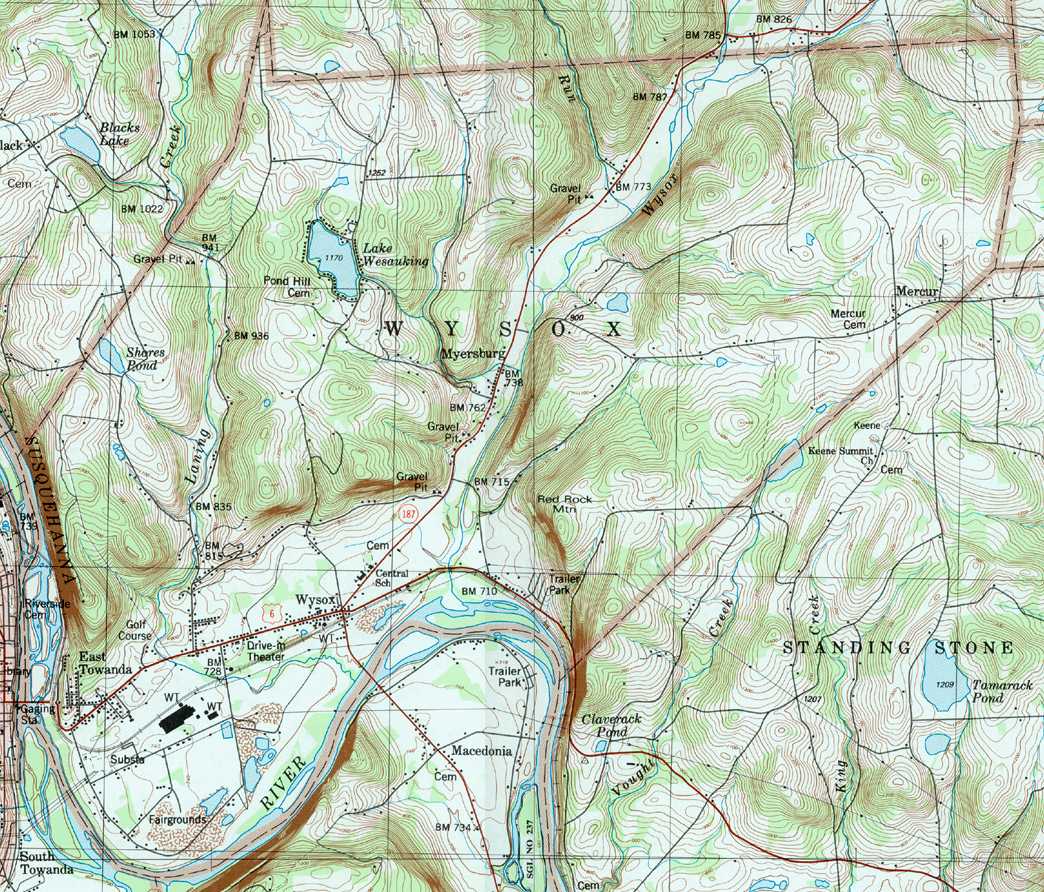
Image Map: This is a clickable image map of townships and boroughs in Bradford County Pennsylvania. A text list of the township maps is shown below. The township images are cropped from a 1/50,000 USGS Geological Survey Map of Bradford County dated 1987; based on 1/24,000 maps dated 1945 (69PR) through 1970. Adjacent counties shown on the image map have active links to their USGS maps.
County Genealogy Sites: There are links to Pennsylvania county USGenWeb sites at the bottom of the Pennsylvania Map Index page.
To see the whole county map click here (4.5MB).
Tri-Counties Genealogy & History (Bradford and Tioga Counties in PA and Chemung County, NY)