|
|
|
|
|
|
|
|
This page is sponsored by the East Texas Genealogical Society
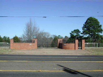
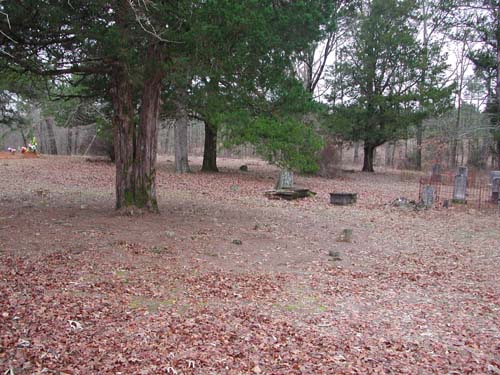
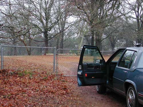
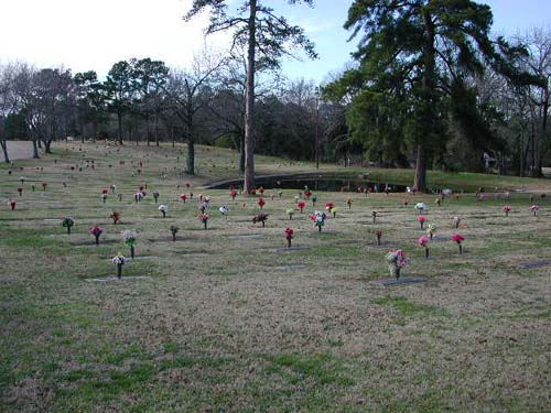
| Roadside sign |
View from gate extreme right |
View from gate right center |
|
View from gate left center |
View from gate extreme left |
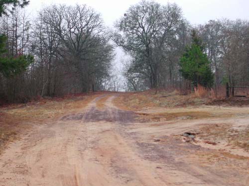
Extreme left over brow of hill |
|
Extreme left over brow of hill to the right |
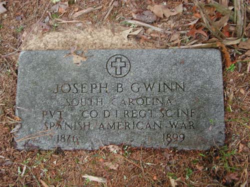
Joseph B Gwinn South Carolina, Pvt, Co D, 1 Regt, SC Inf Spanish American War 1876-1899 |
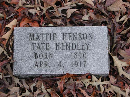
Mattie Henson Tate Hendley born 1890 - Apr. 4, 1917 |
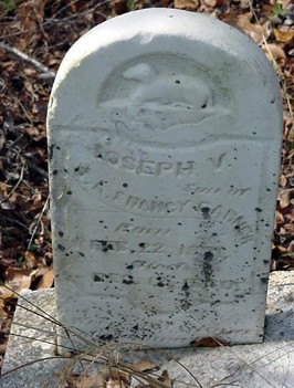
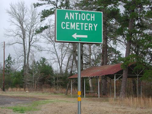
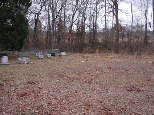
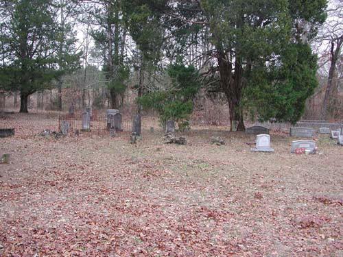
Antioch Cemetery
(African-American)
SE-49
Latitude: N 32:11:54.6
Longitude: W 095:16:25.5
This cemetery is directly south of Tyler, Texas. From Tyler, take US69S to
the intersection of FM346 and turn left (east). Proceed east until you come to
the intersection of CR15S and turn right. Follow CR15S until it dead ends into
CR29. At this intersection, a driveway goes south & uphill - this is the
entrance to the cemetery.
by
Lawrence E. Oliver
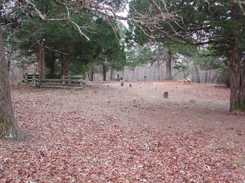
located at top of hill |
to gate |
from the gate area |
from the gate area |
from the gate area |
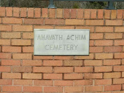
Argenbright Cemetery
NE-21
by
.
| No pictures are available yet. |
| No pictures are available yet. |
| No pictures are available yet. |
Asbury Cemetery
(African-American)
SE-33
by
.
| No pictures are available yet. |
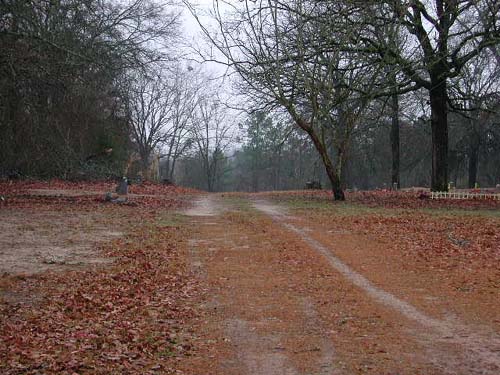
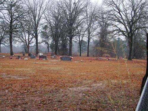
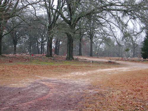
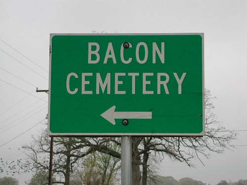
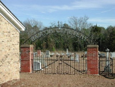
Bacon Cemetery
SE-24
Latitude: N 32:19:36.3
Longitude: W 095:06:29.7
This cemetery is located east of Tyler, Texas, off FM850, east of the
intersection of FM850 & CR3226. It is in a pasture, down an oil and
gas lease road, about 3/10 miles from FM850.
by
Lawrence E. Oliver
to the oil & gas lease road. |
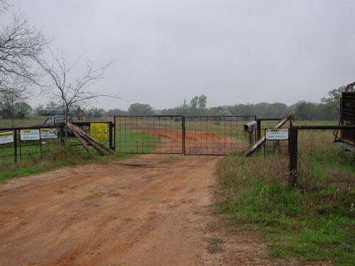
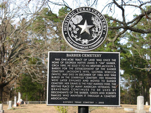
Barber Cemetery
NE-05
Latitude:
Longitude:
From Tyler take Highway 271 north, go one mile past I-20 and turn left on to
FM757. Go about two miles to Highway 16. Then turn right and go one mile to
CR369. Turn left on CR369 and go approximately 2.3 miles to the Barber Cemetery.
by
ah -
Anna Hockaday
em - Elaine Martin
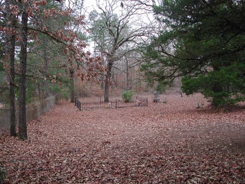
|
Entrance Gate (ah) |
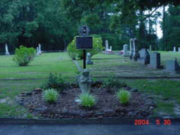
Historical Monument (ah) |
|
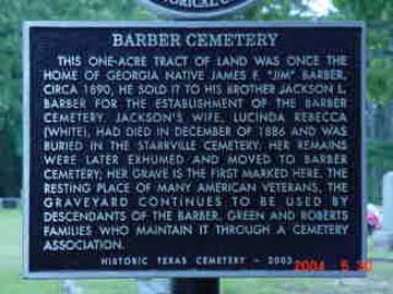
Close-up of Historical Monument (ah) |
2nd Close-up of Historical Monument (em) |
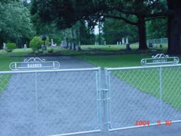
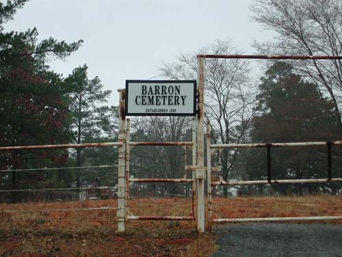
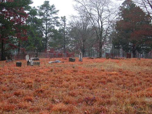
Barron
Cemetery
Copeland Community, TX
SE-17
Latitude: N 32:14:21.2
Longitude: W 095:18:06.8
This cemetery is directly south of Tyler, Texas. From Tyler, take US69S to
the intersection of CR2813 and turn left (east). This cemetery is about 1.5
miles along CR2813 and is on the north side of the road. It is directly east of
and shares a common fence with the New Bethal Cemetery (African-American).
The cemetery was established in 1891.
by
(lo) - Lawrence E. Oliver
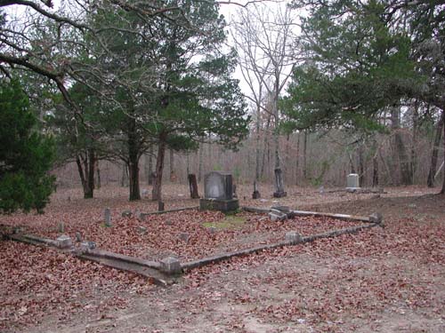
(lo) |
(lo) |
The fence seen in background is between this cemetery and the New Bethel Cemetery (African-American). (lo) |
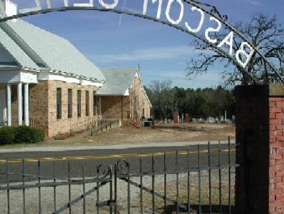
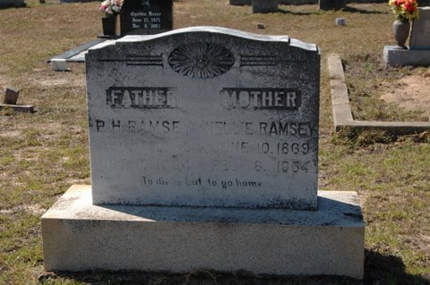
Bascom (East) Cemetery
Bascom Community, TX
SE-43
Latitude: N 32:17:48.3
Longitude: W 095:12:28.9
This cemetery is located southeast of Tyler on FM848 in the Bascom Community.
It is located on the east side of the highway, behind the church.
by
(lo) - Lawrence E. Oliver
(bm) - Bobette Mauck
(lo) |
Looking from Bascom West Cemetery (lo) |
P. H. & Nellie
Ramsey |
Bascom (West) Cemetery
Bascom Community, TX
SE-44
Latitude: N 32:17:48.4
Longitude: W 095:12:30.6
This cemetery is located southeast of Tyler on FM848 in the Bascom Community.
It is located on the west side of the highway, across from the church.
by
(lo) - Lawrence E. Oliver
(bb) - Bryant Brewer
Bauman-Robbs Cemetery
AKA "Mechanicsville Cemetery"
Beaird Cemetery
Dixie Community, TX
NW-29
Latitude: N 32:21:39.1
Longitude: W 095:23:05.6
From Tyler, take Hwy64 west to the intersection with CR4134 and turn right
(northwest). The cemetery is on the right (north) side of the road about 150
yards from the intersection. This cemetery is outside the city limits of Tyler.
No deed establishing the cemetery was ever filed. At the time of the
earliest recorded burial (1859), the land on which the cemetery now sits appears
to have spanned the property line of Starling R. PRICE (north) and Silas GAMMON
(south). Benjamin Bryant BEAIRD, for whom the cemetery was eventually
named, did not acquire the property until the mid 1870s.
Belcher Cemetery
NW-40
USGS GNIS Coordinates: Latitude: 322114N Longitude: 0951406W
by
.
| No pictures are available yet. |
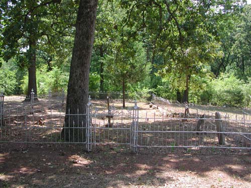
Bell Cemetery
NE-39
Latitude: N 32:21:56.3
Longitude: W 095:13:27.3
From Tyler, take the Old Kilgore Highway (FM2767). Go past Loop323 about 3.8
miles and the cemetery is on the right side (south side) of the road. The
Cemetery is about 20 yards inside the wood line.
This small cemetery is
fenced with a three foot high white, metal picket fence.
by
Lawrence E. Oliver
|
Cemetery As seen from the roadside |
Cemetery As seen from just outside the front gate |
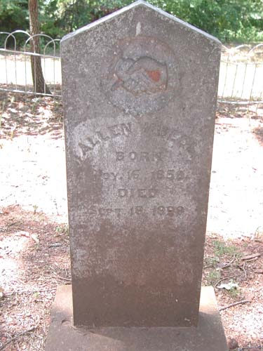
Allen W Bell Nov 16 1859 - Sept 18 1898 Farewell my wife & children ... |
|
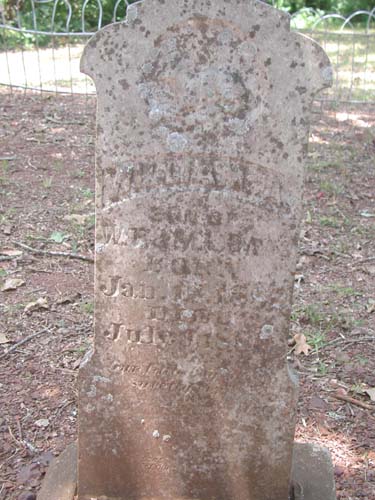
William A Davis Jan 12 1882 - July 9 1886 Son of W. T. & M. L. Davis |
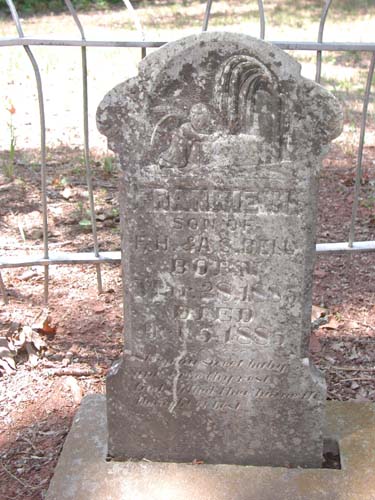
Frankie H Bell Mar 28 1885 - Oct 5 1885 Son of F. H. & A. S. Bell |
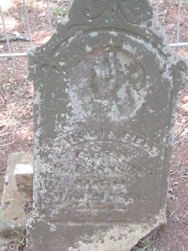
Sarah A Bell Mar 18 1830 - May 21 1892 |
|
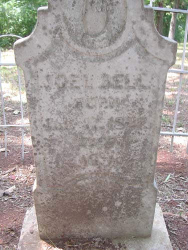
Joel Bell July 17 1827 - Jan 16 1892 |
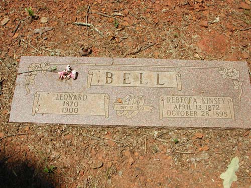
Leonard & Rebecca Kinsey Bell 1870-1900 & April 13 1872 - October 28 1895 Married Dec 17 1893 |
Bethesda Cemetery
NW-03
Latitude: N 32:32:49.9
Longitude: W 095:21:36.4
From Lindale, take East Hubbard Street (FM16) east to intersection of CR2710.
Turn left (north) at the intersection and proceed to CR4126. The cemetery is
behind the Bethesda Presbyterian Church on the west side of the road (left side)
at the intersection.
| Click to Enter Cemetery |
Bethlehem Cemetery
(African-American)
SW-23
by
.
| No pictures are available yet. |
Black Fork Cemetery
AKA "Wood-Verner Cemetery"
Blackjack Cemetery
(African-American)
AKA "New Canaan Cemetery (A.A.)"
Bowie Cemetery
(African-American)
SW-28
by
.
| No pictures are available yet. |
Bowman Cemetery
(African-American)
AKA "Village Creek Cemetery (A.A.)"
NW-26
USGS GNIS Coordinates: Latitude: 323506N Longitude: 0953337W
by
.
| No pictures are available yet. |
| No pictures are available yet. |
Bradford Cemetery
Troup, TX
SE-03
Latitude: N 32:08:58.8
Longitude: W 095:07:24.7
Take State Hwy 110 southeast from Tyler, Texas, proceed through Whitehouse,
Texas, to Troup, Texas. Inside the city limits of Troup, turn left (north) on
State Hwy 346. The cemetery is about one half mile from Hwy 110 on the
east side of the road. It is immediately behind a small city park.
Established in 1872 with the interment of Wm. M. Bradford, who donated the land.
The oldest grave found is that of Mary D. Tarbutton b. 3/18/1804, d. 3/29/1824 with the inscription "Our Mother".
| Click to Enter Cemetery |
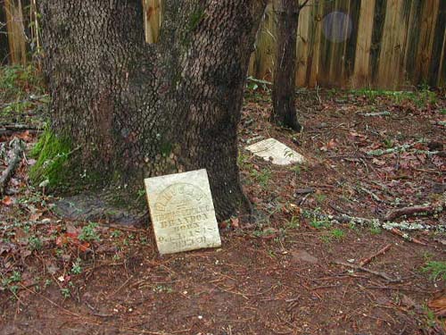
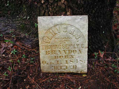
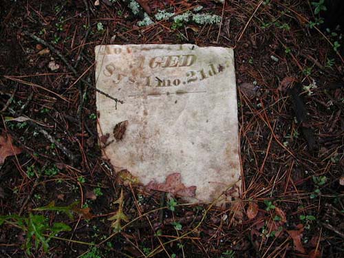
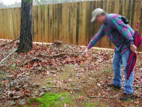
Brandon Family Cemetery
SE-45
Latitude: N 32:13:18.8
Longitude: W 095:07:11.8
This cemetery is located NW of Omen about 1 or 1½ miles. Almost due
north of Shiloh Cemetery, on what was the old Brandon farm place.
DIRECTIONS: West from Omen on FM345, right into East Shore Estates Subdivision (CR2143 - Old Whitehouse Road), right on N. Lakeview Drive, right on Sunshine Lane, right on Cardinal Lane, right on N. Ramp Drive, right on Fisherman’s Drive. On the east side of Fisherman’s Drive between the addresses of 15680 and 15700 is a path leading to the cemetery - 75 feet inside wood line, next to wooden fence of compressor oil well.
NOTE - Feb 15, 2003: This cemetery appears to have been disturbed
sometime in the last two years due to the drilling of an oil well.
by
Lawrence E. Oliver
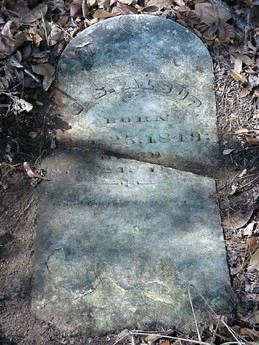
both pieces of broken tombstone |
top half of tombstone |
|
bottom half of tombstone |
Mr. Ron Keeling pointing to one possible unmarked grave - grave lined with piled rocks |
Mr. Ron Keeling standing at site of both unmarked graves |
seen from end of oil well board fence (looking north). Individual in blue standing at extant tombstone. Unmarked graves 15 feet further north. Entrance trail to the left of individual in picture. |
~ |
Britton
Cemetery
AKA "Britton Grave (A.A.)"
NE-46
USGS GNIS Coordinates: Latitude: 322426N Longitude: 0950207W
by
.
| No pictures are available yet. |
Bullard Cemetery
SW-31
Latitude: N 32 08 09.2
Longitude: W 095 19 54.1
From Tyler, take Hwy69 south and go to the intersection of FM344. Turn right
(west) and proceed through Bullard. The cemetery is located approximately 1/2
mile West of the center of the town on FM 344.
There are a few markers that are worn smooth and so remain unidentified. There are other graves that are marked with only a brick or stone.
| Click to Enter Cemetery |
Bunkley Cemetery
(African-American)
NW-53
USGS GNIS Coordinates: Latitude: 323236N Longitude: 0953212W
by
.
| No pictures are available yet. |
Burns Cemetery
NE-41
Latitude: N 32:22:39.1
Longitude: W 095:14:25.3
From Tyler, take the Old Longview Road (CR384). Go past Loop323 and proceed to
intersection with CR380 (approx 2 miles), turn left (north) on CR380 and go to
top of second hill (approx. 1/2 mile). The cemetery is approximately 25-30 yards
inside the wood line to the right (east).
The map coordinates given are
of the road at the woods entrance, as the site is heavily overgrown and
coordinates could not be obtained under the tree cover.
by
.
| No pictures are available yet. |
| No pictures are available yet. |
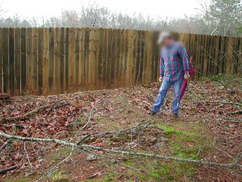
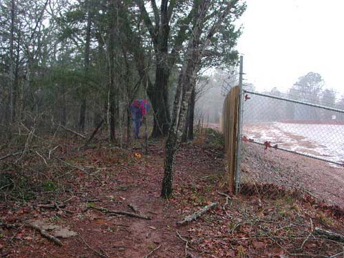
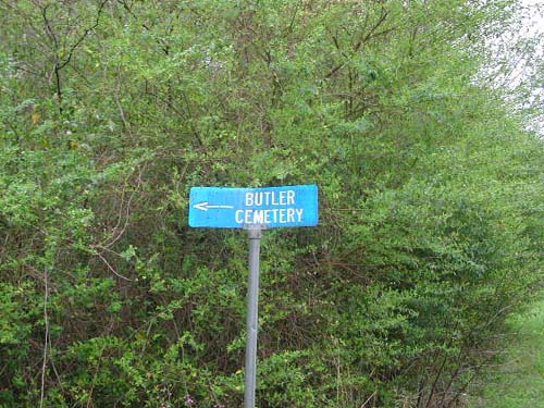
Butler Cemetery
(African American)
SE-05
Latitude: N 32:18:37.9
Longitude: W 095:00:20.8
This cemetery is east of Tyler and south of Hwy 31. It is located on CR26,
approximately one-half mile east of the intersection with CR29 and 50 yards
north of the road. There is a blue cemetery sign on the north side of CR26 at
the entrance trail.
by
Lawrence E. Oliver
as seen from entrance trail |
as seen from entrance trail |
Carmel Cemetery
AKA "Carmel (White) Cemetery"
NW-08
by
.
| No pictures are available yet. |
Carmel Cemetery
(African-American)
NW-09
by
.
| No pictures are available yet. |
| No pictures are available yet. |
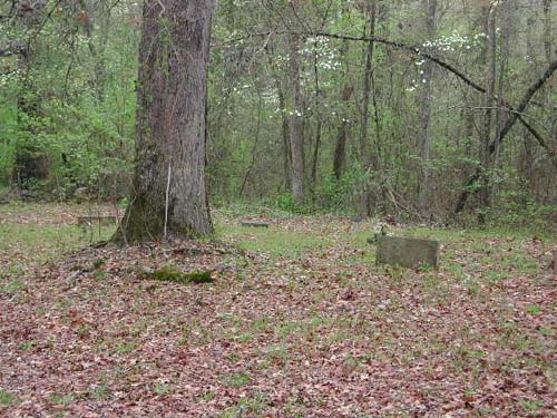
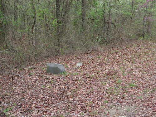
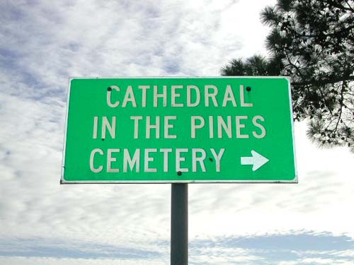
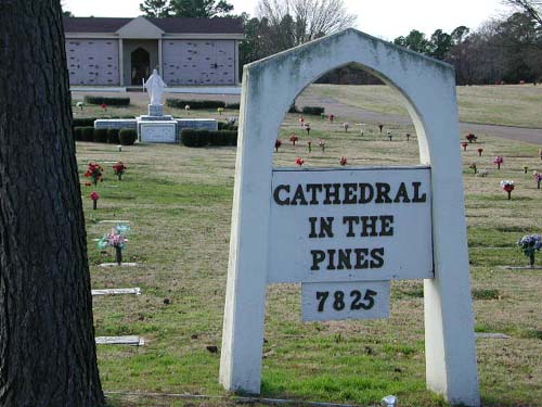
Cathedral in The Pines
Cemetery
Tyler, TX
SW-16
Latitude: N 32:15:48.9
Longitude: W 095:18:28.3
This cemetery is inside the city of Tyler, Texas. The address is 7825
S. Broadway Ave. It is located in the southern part of the city on South
Broadway Avenue, which is the main north-south street in Tyler.
by
Lawrence E. Oliver
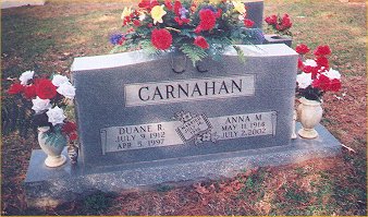
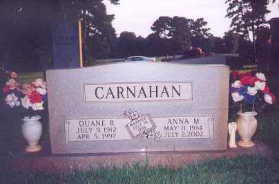
section k garden of peace lot 284 and 285 Anna died 07-02-2002 (Photo 2) |
section k garden of peace lot 286 |
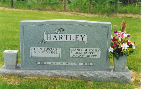
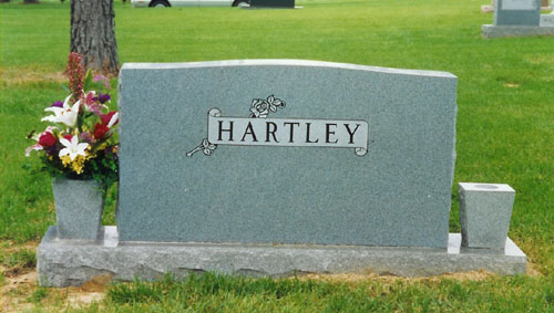
by Olin Hartley
| Olin & Janet Vogel Hartley | Olin
& Janet Vogel Hartley reverse side |
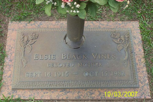
Elsie Black Vines |
Cemetery
Point Cemetery
SE-64
Latitude: 32:14:12.4
Longitude: 095:06:56.3
From Tyler, take Hwy 64E to the bridge over Lake Tyler East. Proceed on Hwy64E
to the intersection of CR230 and turn right (south). Proceed on CR230 for a
distance of 2.66 miles. The cemetery is 0.655 mile on a bearing of 284 degrees
true from CR230.
This cemetery apparently consists of a single marked, unnamed grave, facing east, and is on a tract of land as follows: land in the Wilson L. Parmer Survey, Abstract No. 767, 5-3/4 acres of land conveyed to E. H. Toncray by Henry Floore et ux by deed dated Nov. 25, 1896, recorded in Vol. 58, page 99, Deed Records of Smith County, Texas.
NOTE - Oct 26, 2004: The following information was provided by Charles Musselwhite of Whitehouse, Smith County, Texas. This information is from his family verbal history. There is no other verifying information on this data. **START PROVIDED INFO** There are actually 4 graves in the cemetery - only one was marked - it is believed that this is an African-American cemetery. If so, it might be the grave of a Thomas McKay, enumerated as a laborer with the family of Steven Christopher Columbus Musselwhite on the US Census, 1900: Smith Co. Tex, Pct 2, vol. 97, e.d. 99, sh. 22, line 1, Soundex. **END PROVIDED INFO**
by
Lawrence E. Oliver
|
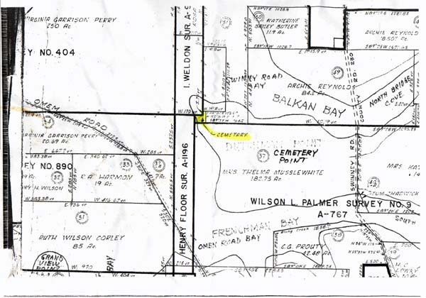
Land map showing location of cemetery |
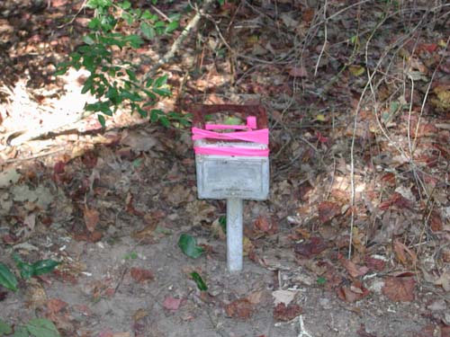
Funeral Home Grave Marker name insert missing |
|
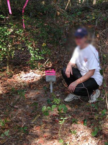
Mrs. Teresa Goss kneeling next to Funeral Home Grave Marker |
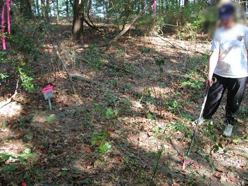
Mrs. Goss pointing to what appears to be a metal
marker indicating the foot of the grave |
| No pictures are available yet. |
Center Cemetery
(African-American)
NE-14
by
.
| No pictures are available yet. |
Clear
Springs Cemetery
(African-American)
NW-27
by
.
| No pictures are available yet. |
Community Cemetery
(African-American)
AKA "Rucker Cemetery (A.A.)"
Crow Cemetery
(African-American)
SE-20
USGS GNIS Coordinates: Latitude: 321140N Longitude: 0951725W
by
.
| No pictures are available yet. |
| Cemetery Listings: Main Page |
| Cemetery Listings: A - C |
| Cemetery Listings: D - G |
| Cemetery Listings: H - K |
| Cemetery Listings: L - M |
| Cemetery Listings: N - R |
| Cemetery Listings: S |
| Cemetery Listings: T - Z |
![]()
![]()
Copyright ©
2005 - 2009
East Texas Genealogical Society and the Individual Contributors


