|
|
|
|


This page is sponsored by the East Texas Genealogical Society
|
|
|
|
This page is sponsored by the East Texas Genealogical Society
New Bethel Cemetery
(African-American)
Copeland Community, TX
SE-18
Latitude: N 32:14:21.1
Longitude: W 095:18:09.3
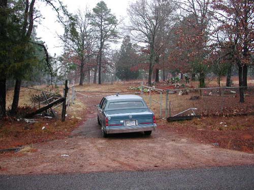
This cemetery is directly south of Tyler, Texas. From Tyler, take US69S to
the intersection of CR2813 and turn left (east). This cemetery is about 1.5
miles along CR2813 and is on the north side of the road. It is directly west of
and shares a common fence with the Barron (Shackelford) Cemetery.
by
Lawrence E. Oliver
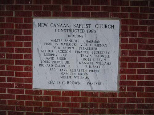
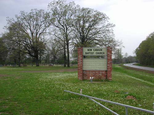
New Canaan Cemetery
(African-American)
AKA "Blackjack Cemetery (A.A.)"
SE-35
Latitude: N 32:12:21.9
Longitude: W 095:10:49.0
This cemetery is located southeast of Whitehouse. From Tyler, take Hwy 110 to
Whitehouse. At stoplight, turn east (left) on FM346. follow FM346 to New Canaan
Church which is a short distance outside the city limits. Cemetery is beside the
church on the right side (south) of the road.
by
Lawrence E. Oliver
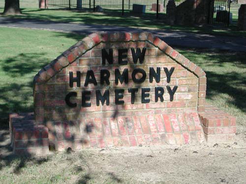
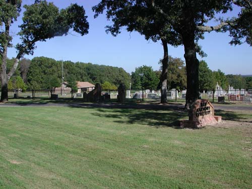
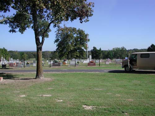
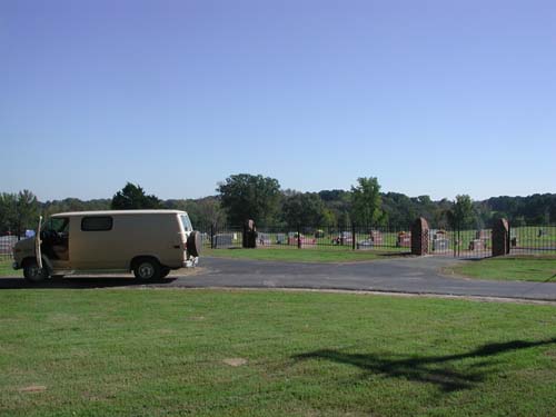
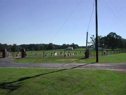
New
Harmony Cemetery
NW-30
Latitude: N 32:24:40.5
Longitude: W 095:27:57.3
From Tyler take Hwy64 west to intersection with CR724. Turn right (north)
and proceed to the second intersection (northern most) with CR414 (Gimble Road).
On the southeast corner of this intersection is the cemetery.
by
Lawrence E. Oliver
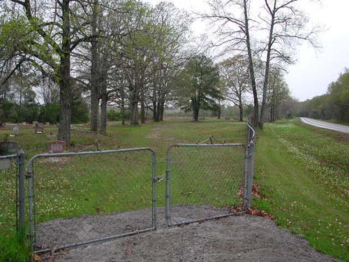
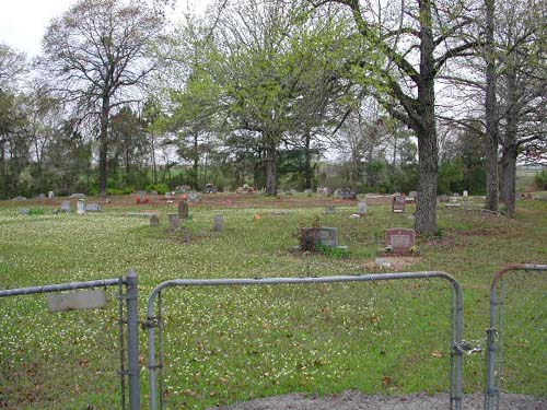
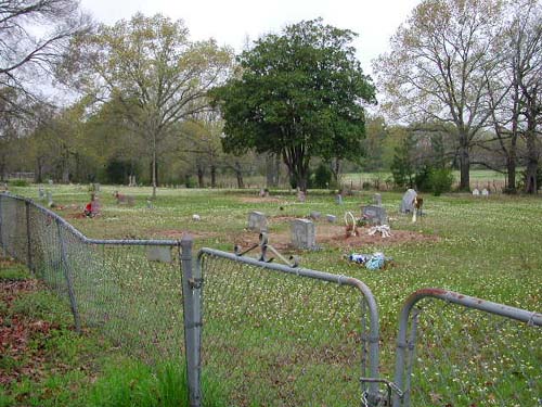
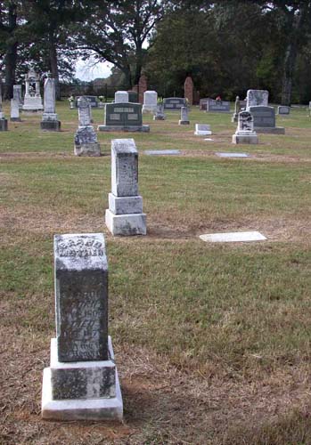
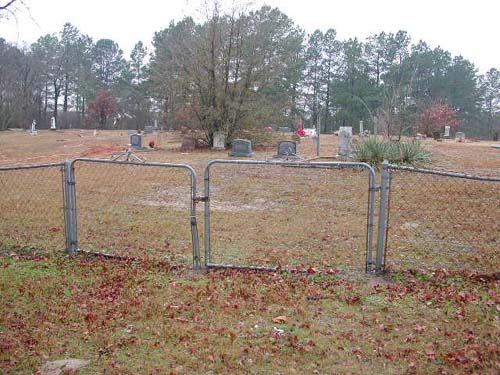
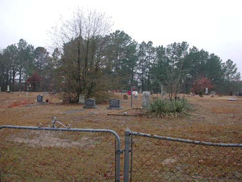
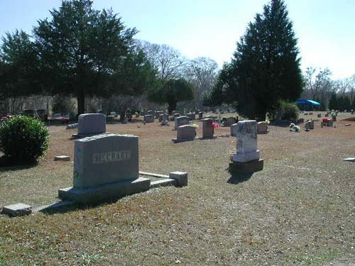
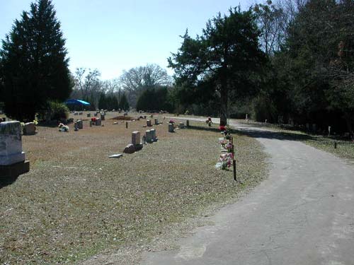
| Main Cemetery Sign | Cemetery Information Sign | Cemetery Left View |
| Cemetery Center View | Cemetery Right View | Cemetery Extreme Right View |
| Tombstones Henry & Martha Cook, son Joseph Cook & grandsons Claud & Charlie Cook |
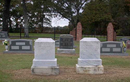
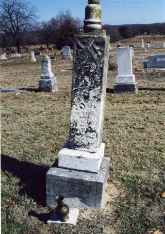
E. A. Barron 1828-1903 |
J. W. Barron 1832-1894 |
| Mary Stanley 1823-1901 |
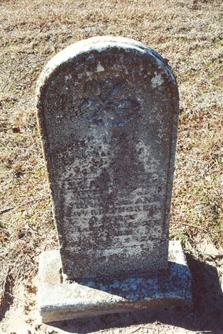
Sarah G. Barron 1804-1879 Daughter, Mary Stanley's grave just behind |
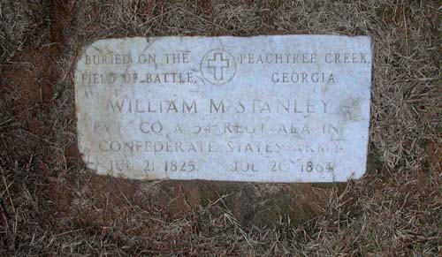
William M. Stanley 1825-1864 Memorial Marker "Buried on the Field of Battle" "Peachtree Creek, Georgia" |
by
Paul A. Tucker
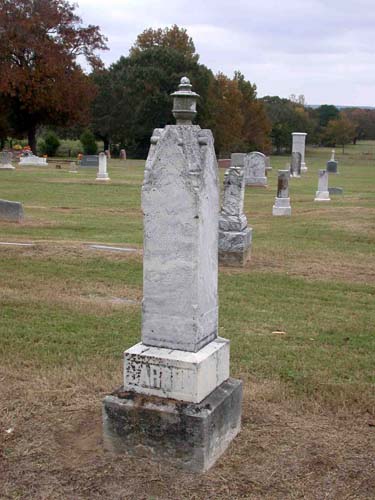
| J.
W. Barron Feb. 14, 1832-Jan. 27, 1894 |
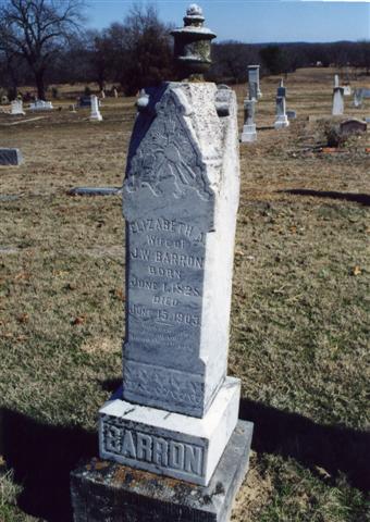
Elizabeth A. Barron June 1, 1828-June 15, 1903 Wife of J. W. Barron |
Beatrice Tucker 23 Aug 1873-23 Sep 1876 Daughter of Jeremiah & Laura Tucker |
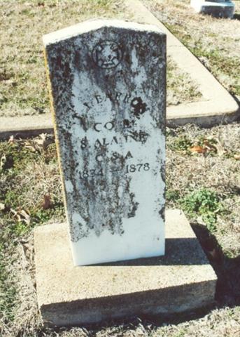
| T.
J. Barron 1834-1878 Co E, 8 Ala. Inf, CSA |
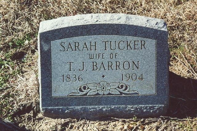
Sarah Isabell (Tucker) Barron 1836-1904 Wife of T. J. Barron |
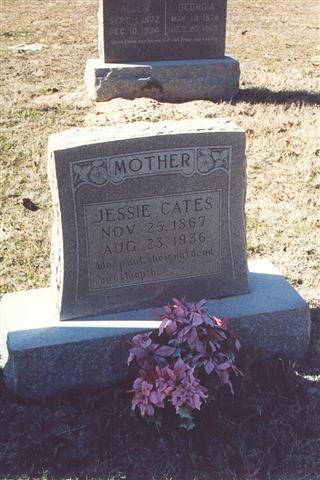
Jessie Barron Cates Nov 25, 1867-Aug 23, 1936 Mother |
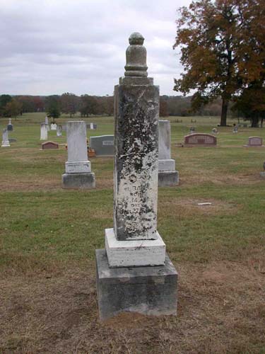
|
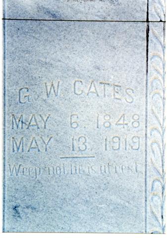
George W. Cates May 6, 1848-May 13 1919 |
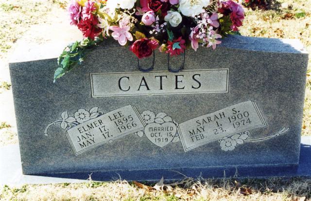
Elmer Lee & Sarah Cates Jan 17 1895-May 17 1966 & May 1 1900-Feb 23 1974 Married: Oct 15 1919 |
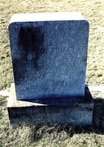
Joseph Smith & Mary A. Barron June 2 1838-Sept 18 1923 & June 7 1842-Oct 3 1918 Married: Aug 16 1865 |
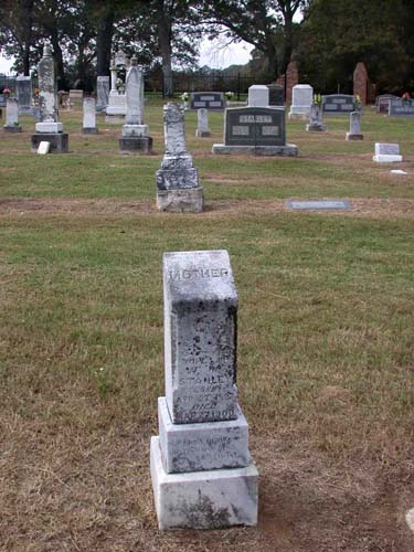
|
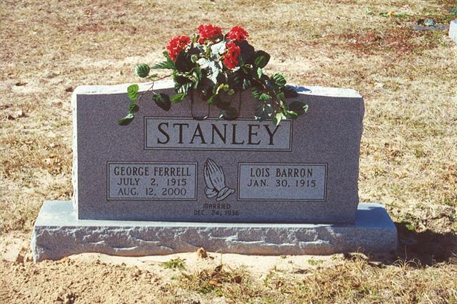
George Ferrell & Lois Barron Stanley July 2 1915-Aug 12 2000 &Jan 30 1915- ? Married: Dec 24, 1936 |
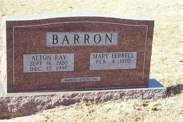
Alton Ray & Mary Ferrell Barron Sept 16 1920-Dec 12 1997 & Feb 4 1920 - ? Married Aug 30, 1941 |
~ |
by
Kathy Hatch
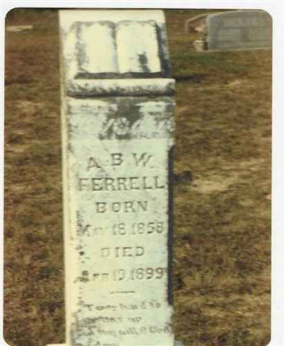
| A.
B. W. Ferrell May 18 1858 - Apr 19 1899 |
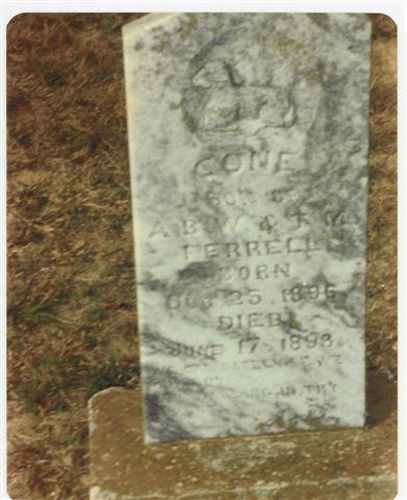
Cone
Ferrell Son of A B W & T M Ferrell Dec 26 1896 - June 17 1898 |
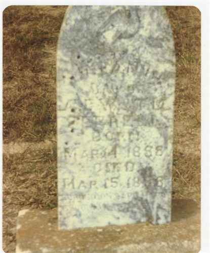
Infant Daughter of A B W & T M Ferrell March 14 1888 - March 15 1888 |
|
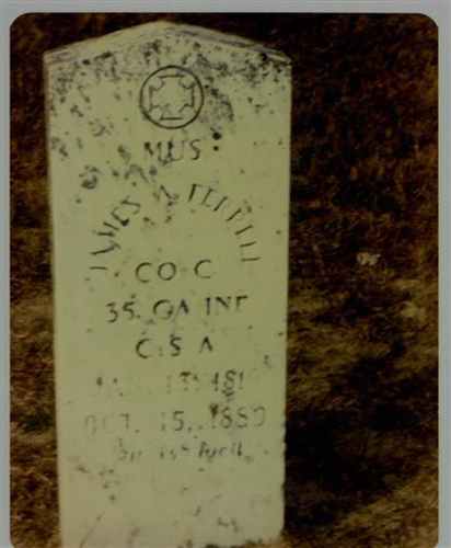
James A Ferrell MUS Co C 35 GA Inf. CSA June 13 1819 - Oct 15 1889 |
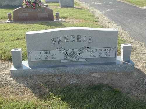
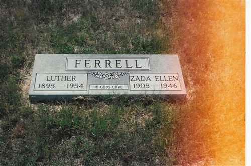
Luther & Zada Ellen Ferrell June 6 1895 - Sept 18 1955 & Oct 26 1905 - Aug 12 1946 |
Luther & Zada Ellen Ferrell Additional Stone with wrong death date for Luther |
|
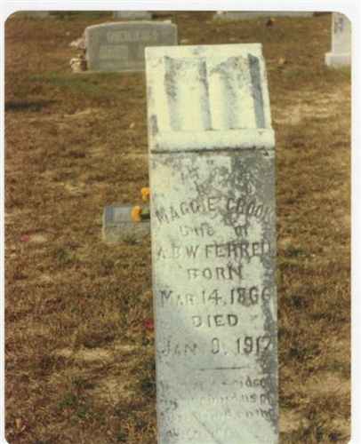
Maggie Crook Ferrell Wife of A B W Ferrell Mar 14 1866 - Jan 9 1917 |
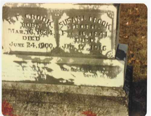
R F
& Susan L Crook March 16 1834 - June 24 1900 & Feb 16 1841 - Jan 17 1916 |
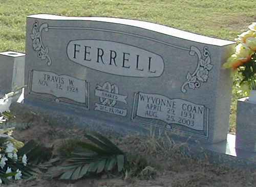
Travis W & Wyvonne Coan Ferrell Nov 12, 19 28 - & Apr 29 1931 - Aug 25 2003 Married Dec 23 1947 |
|
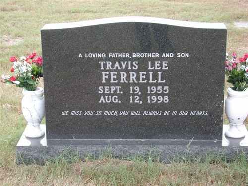
Travis Lee Ferrell Sept 19 1955 - Aug 12 1998 |
Travis Lee Ferrell (Backside of Tombstone) |
New
Home (Northeast) Cemetery
(African-American)
NE-51
by
.
| No pictures are available yet. |
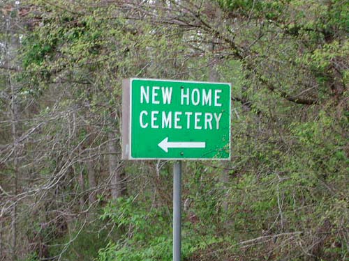
New Home (Southeast)
Cemetery
(African-American)
SE-23
Latitude: N 32:16:48.9
Longitude: W 095:01:05.4
This cemetery is located West of Overton. At FM850 and CR227 (cemetery
direction sign at this intersection), turn south and go about 50 yards. Cemetery
is on the west side of the road.
by
Lawrence E. Oliver
| Road sign at FM850 & CR227 |
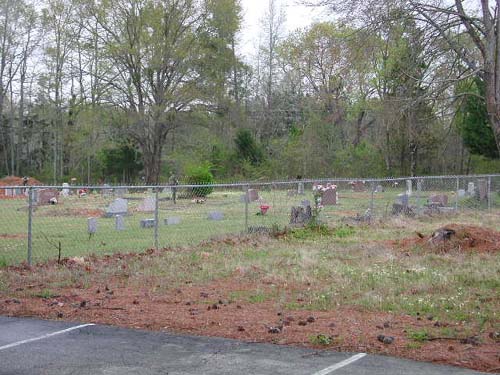
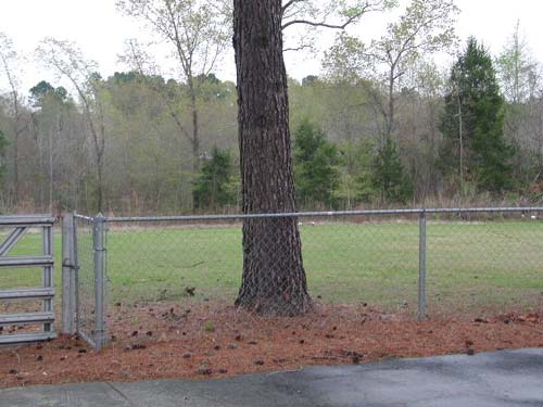
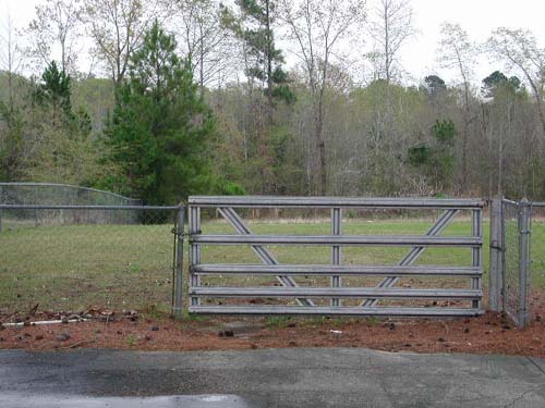
New Hope (Southeast)
Cemetery
(African-American)
SE-34
Latitude: N 32:11:13.9
Longitude: W 095:07:12.8
Located SE of Whitehouse. Take Hwy110 to Whitehouse, left on FM346 until you
dead-end at CR2142. Left on CR2142 to second road, CR2152, turn right. Cemetery
is down this road, on right behind the New Hope Conglee Baptist Church.
by
Lawrence E. Oliver
New Hope (Southwest)
Cemetery
(African-American)
New Hope Community, TX
SW-29
Latitude: N 32:10:24.5
Longitude: W 095:19:06.8
Take US Hwy 69 south from Tyler, Texas, to the small community of New Hope.
Go through the community to the intersection of CR145. Turn right (west) on
CR145 and near the top of the hill is the New Hope Baptist Church - the cemetery
is behind the church.
Zach and Martha Moseley and G. B. Bowie sold four acres to Mark Bowie, J.
W. Taylor, and Alex Walker, trustees for New Hope Church, for "Baptist
Church and Cemetery" in 1891.
by
Lawrence E. Oliver
| No pictures are available yet. |
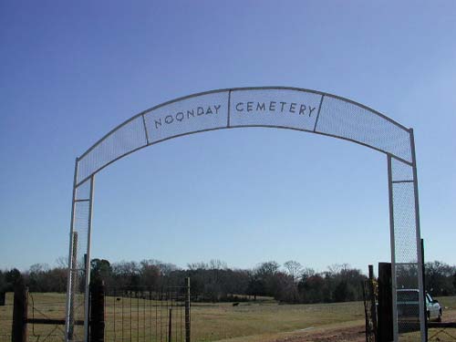
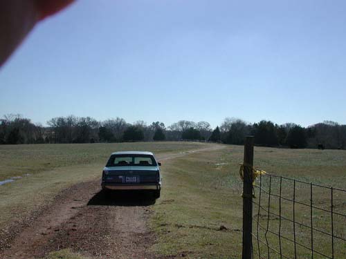
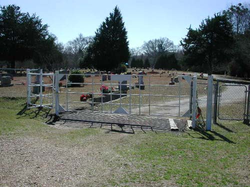
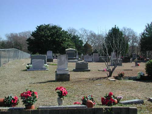
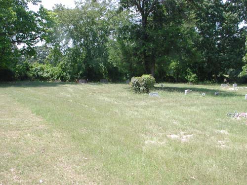
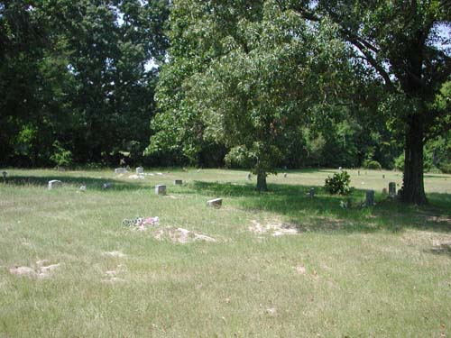
Noonday Cemetery
Noonday Community, TX
SW-21
Latitude: N 32:14:38.7
Longitude: W 095:23:40.1
From Tyler, take Hwy 155 southwest to the community of Noonday. Just north of
the center of Noonday, the cemetery is on the left (southeast side) of the road.
The sign is on the highway - the cemetery is about 100 yards through a pasture.
by
Lawrence E. Oliver
|
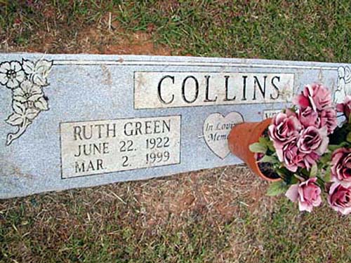
Ruth Green Collins June 22, 1922 - Mar. 2, 1999 |
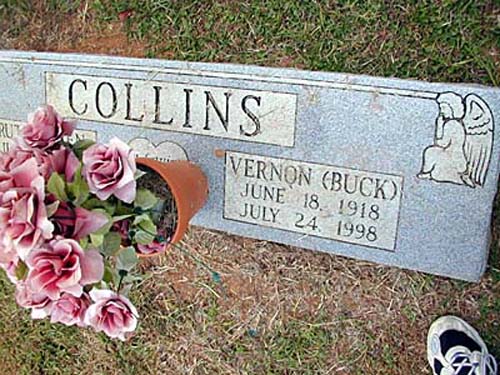
Vernon (Buck) Collins June 18, 1918 - July 24, 1998 |
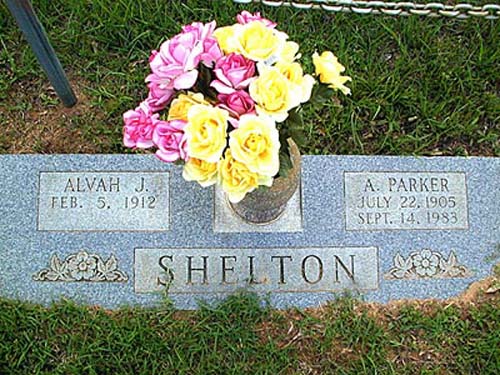
Alvah J. & A. Parker Shelton Feb. 5, 1912 - & July 22, 1905 - Sept. 14, 1983 |
|
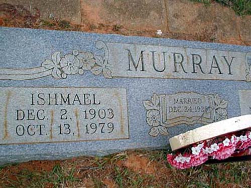
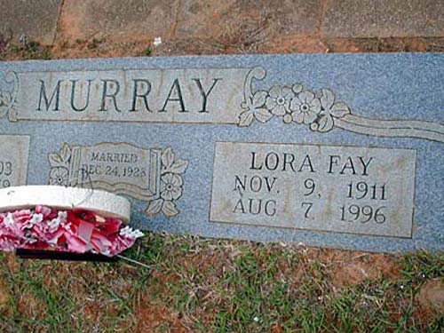
Ishmael Murray Dec. 2, 1903 - Oct. 13, 1979 |
Lora Fay Murray Nov. 9, 1911 - Aug 7, 1996 Married Dec. 24, 1928 |
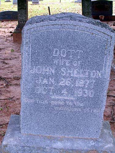
Dott Shelton Wife of John Shelton Jan 26, 1877 - Oct. 4, 1930 |
|
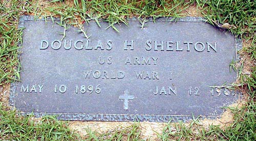
Douglas H Shelton US Army World War I May 10, 1896 - Jan 12 1981 |
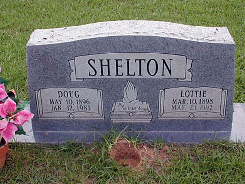
Doug & Lottie Shelton May 10, 1896 - Jan. 12, 1981 & Mar. 10, 1898 - May 23, 1992 |
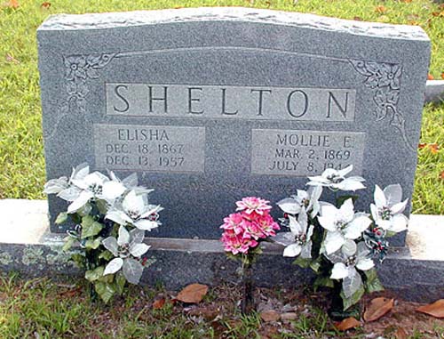
Elisha & Mollie E. Shelton Dec. 18, 1867 - Dec. 13, 1957 &Mar.2, 1869 - July 8, 1944 |
|
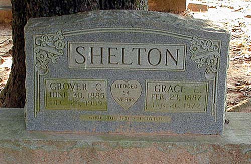
Grover C. & Grace E. Shelton June 30, 1885 - Dec. 26, 1959 &Feb. 23, 1887 - Jan 26, 1972 |
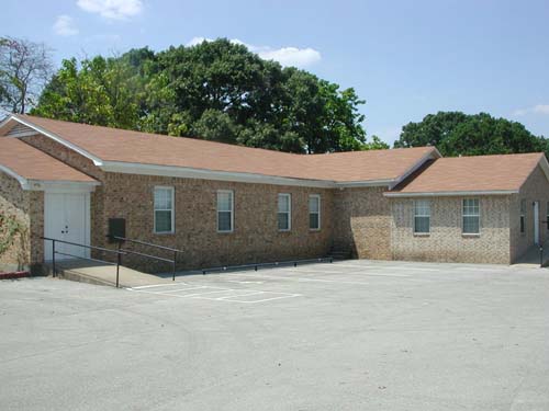
Oakwood Cemetery
Tyler, TX
TT-01
Latitude: N 32:21:12.1
Longitude: W 095:18:36.9
This cemetery is located inside the city limits of Tyler, Texas. It is
northwest of the city center. The cemetery is at the intersection of North
Palace Avenue and West Oakwood Street. The main gate is on North Palace Avenue.
| Click to Enter Cemetery |
Old Butler Cemetery
AKA "Butler (Old) Cemetery"
NE-07
USGS GNIS Coordinates: Latitude: 322540N Longitude: 0951511W
by
.
| No pictures are available yet. |
| No pictures are available yet. |
Old Hopewell
Cemetery
AKA "Hopewell (Old) (Northeast) Cemetery"
NE-48
USGS GNIS Coordinates: Latitude: 322333N Longitude: 0950142W
by
.
| No pictures are available yet. |
Oliver's Chapel Cemetery
(African-American)
SE-63
Latitude: N 32:20:38.6
Longitude: W 095:09:34.0
From Tyler, take Hwy31 east. At the intersection with FM850, turn right
(south). Continue on FM850 for 2 miles and turn left (east) on CR-26 (Old
Jamestown Road). The cemetery is about 1.7 miles on the right. The gate is
behind, and to the right of, the "Oliver's Chapel AME Church".
| Click to Enter Cemetery |
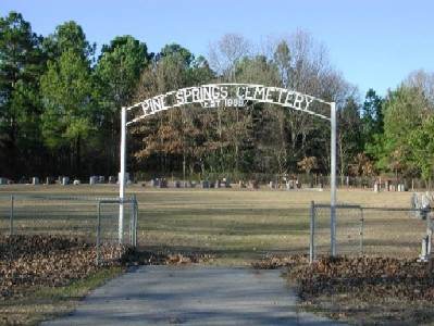
Pine Springs Cemetery
Pine Springs, TX
NE-31
Latitude: N 32:24:37.2
Longitude: W 095:16:13.3
Take US271 northeast from Tyler, Texas, to CR334 and turn left (north).
Follow CR334 to the intersection of CR328. The Pine Springs Church cemetery is
on the northwest corner of this intersection. The cemetery is behind the church.
by
Lawrence E. Oliver
by
Rex Kirby
|
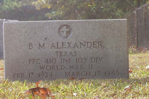
BM Alexander Texas Pfc 410 Inf 103 Div World War II Feb 17 1924 - March 15 1945 |
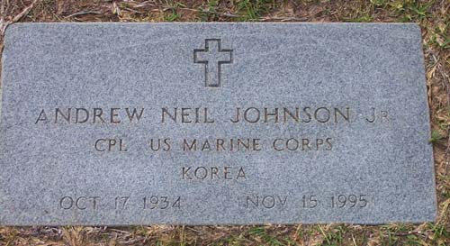
Andrew Neil Johnson Jr Cpl US Marine Corps Korea Oct 17 1934 - Nov 15 1995 |
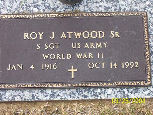
Roy J Atwood Sr SSgt US Army World War II Jan 4 1916 - Oct 14 1992 |
|
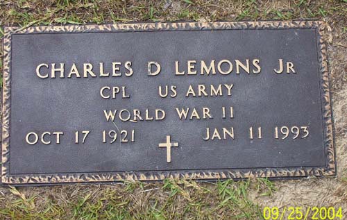
Charles D Lemons Jr Cpl US Army World War II Oct 17 1921 - Jan 11 1993 |
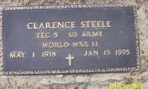
Clarence Steele TEC5 US Army World War II May 1 1918 - Jan 19 1995 |
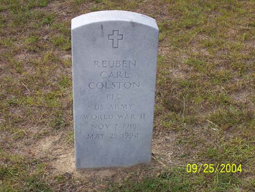
Reuben Carl Colston PFC US Army World War II Nov 7 1918 - May 25 1994 |
|
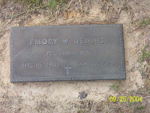
Emory W Dennis PFC US Army Apr 16 1903 - Jan 22 1980 |
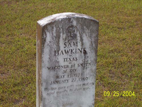
Sam Hawkins Texas Wagoner 111 SN TN 36 Div May 15 1891 - January 22 1940 |
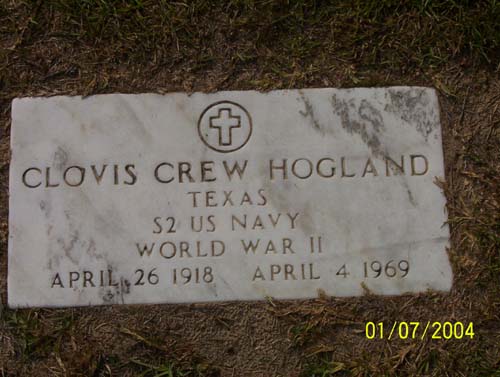
Clovis Crew Hogland Texas S2 US Navy World War II April 26 1918 - April 4 1969 |
|
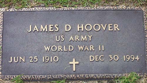
James D Hoover US Army World War II Jun 25 1910 - Dec 30 1994 |
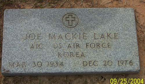
Joe Mackie Lake A1C US Air Force Korea Mar 30 1934 - Dec 20 1976 |
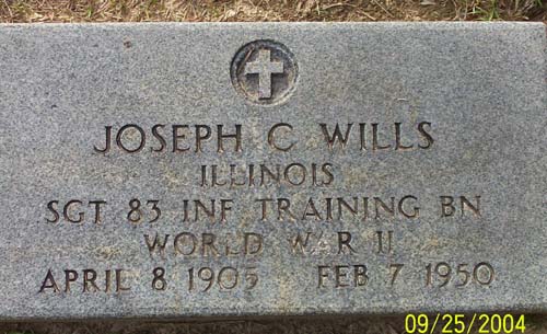
Joseph C Wills Illinois Sgt 83 Inf Training Bn World War II April 8 1905 - Feb 7 1950 |
|
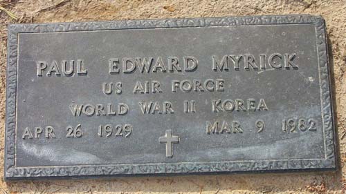
Paul Edward Myrick US Air Force World War II Korea Apr 26 1929 - Mar 9 1982 |
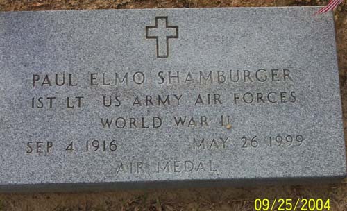
Paul Elmo Shamburger 1st LT US Army Air Force World War II Air Medal Sep4 1916 - May 26 1999 |
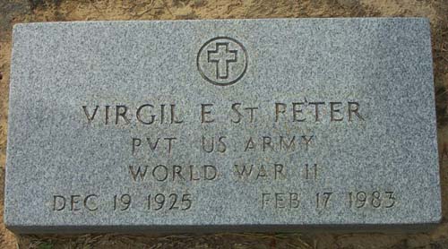
Virgil E St Peter Pvt US Army World War II Dec 19 1925 - Feb 17 1983 |
|
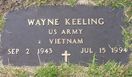
Wayne Keeling US Army Vietnam Sep 2 1943 - Jul 15 1994 |
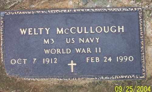
Welty McCullough M3 US Navy World War II Oct 7 1912 - Feb 24 1990 |
by
David Foster
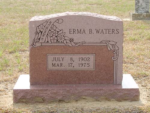
| Erma Agnes
Burson Waters July 8, 1902 - March 17, 1975 |
Pinecrest Cemetery
Troup, TX
SE-13
Latitude: N 32:09:06.5
Longitude: W 095:08:48.9
This cemetery is located on Hwy 110 northwest of the City of Troup, Smith
County, Texas. Traveling west-northwest from Troup, the cemetery is on the left
(south) side of the road, approximately 1 mile outside the city limits.
| Click to Enter Cemetery |
Piney
Grove Cemetery
(African-American)
AKA "Piney Grove Community Cemetery (A.A.)"
NE-43
by
.
| No pictures are available yet. |
Pinkston Cemetery
(African-American)
NE-24
USGS GNIS Coordinates: Latitude: 322914N Longitude: 0950225W
by
.
| No pictures are available yet. |
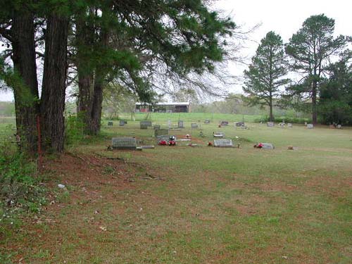
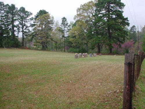
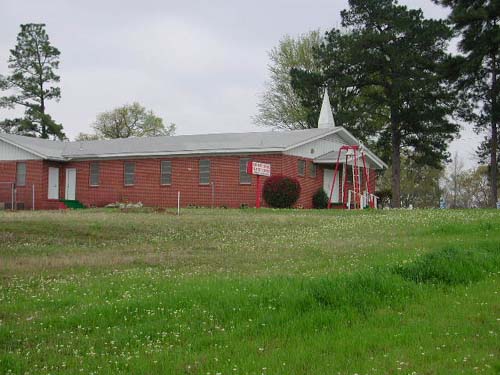
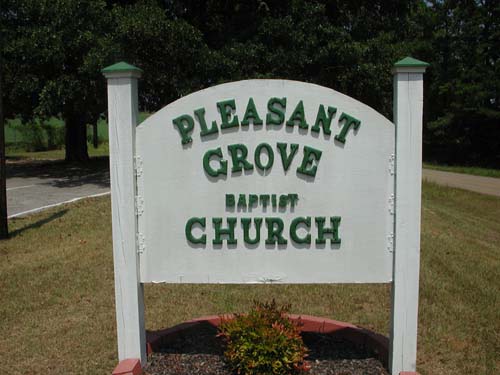
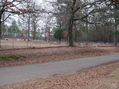
Pleasant
Grove Cemetery
(African-American)
AKA "Pleasant Grove Community Cemetery (A.A.)"
NE-35
Latitude: N 32:23:06.5
Longitude: W 095:13:16.5
From Tyler, take the Old Longview Road (CR384). Go past Loop323 and proceed
approx 4 miles. The cemetery is on the left-side (north side) behind the
Pleasant Grove Baptist Church. The cemetery is approximately 20 yards behind
(north) of the church.
by
Lawrence E. Oliver
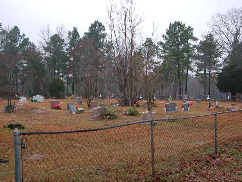
| Church sign at roadside | Pleasant Grove Baptist Church | Entrance gates to cemetery |
| Cemetery view left | Cemetery view center left | Cemetery view center right |
| Cemetery view right |
Pleasant
Retreat Cemetery
SW-01
Lat: N 32:20:41.1
Long: W 95:23:50.7
From Tyler, take Hwy31 west to CR1125 and turn right (north). Proceed to the
intersection of CR1125 & CR1143 & turn left (west) onto CR1143. Proceed
northwest on CR1143 to the intersect with Pleasant Retreat Road and turn left
(west). Proceed to 13781 Pleasant Retreat Road which is the cemetery - it is on
the left (south) side of the road.
| Click to Enter Cemetery |
| No pictures are available yet. |
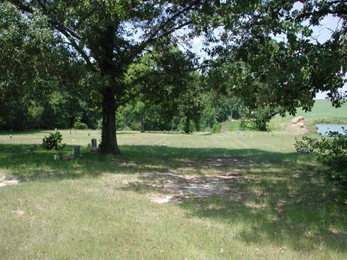
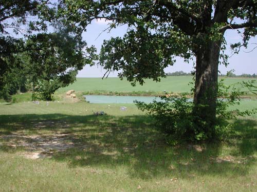
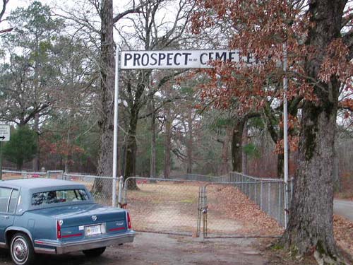
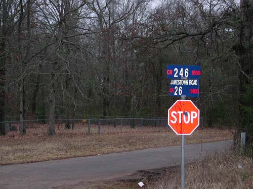
Prospect Cemetery
(African America)
SE-39
Latitude: N 32:20:25.1
Longitude: W 095:02:40.0
Take Hwy 31E from Tyler to County Road (CR) 246S (about 3+/- miles shy of the
county line). Follow CR246S to CR26 (Jamestown Road). At intersection of CR246S
and CR26: Northeast corner - Prospect Cemetery - has sign - surrounded by
chain-link fence.
by
Lawrence E. Oliver
Cemetery is on northeast corner |
Shows most of cemetery Entrance gate to left. |
Providence Cemetery
NW-20
by
.
| No pictures are available yet. |
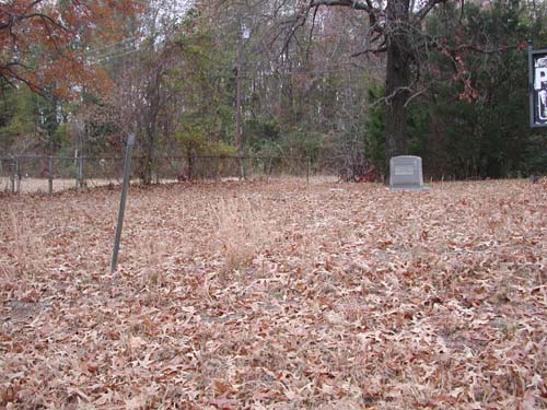
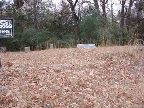
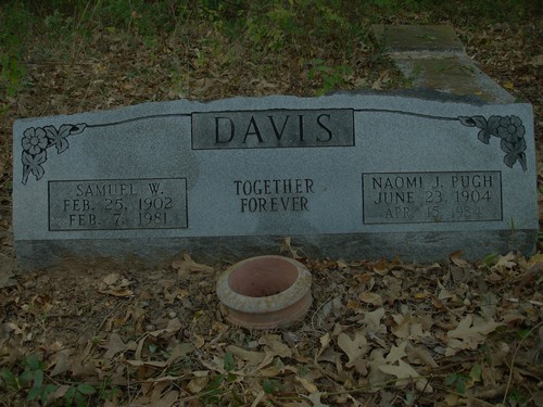
Pugh-Goss Cemetery
(African America)
NW-56
Lat: N 32:22:57.9
Long: W 095:18:55.3
Go to intersection of N Loop 323 and Texas College Road in North Tyler. Proceed
south on Texas College Road to where it becomes 34th Street. At this point, on
the west side of the street, is the cemetery. The cemetery name sign is on the
curb.
by
(lo) - Lawrence E.
Oliver
(ssk) - Sam & Sherry Kidd
| Cemetery Sign (lo) |
View to left of
sign (lo) |
View to right of
sign (lo) |
|
Samuel W. & Naomi J. Pugh Davis (ssk) |
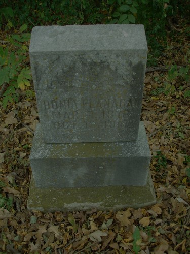
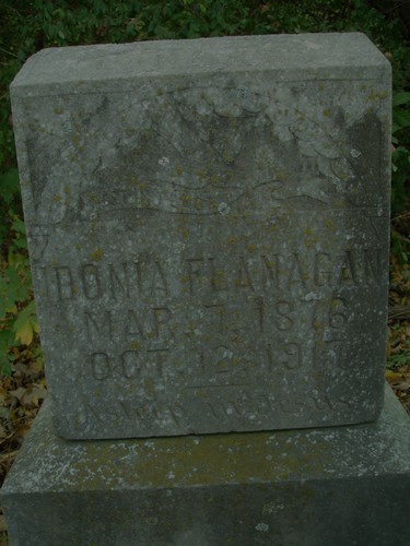
Idonia Flanagan (ssk) |
Idonia Flanagan (Close-up) (ssk) |
|
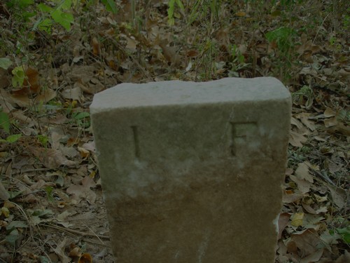
Idonia Flanagan (Footstone) (ssk) |
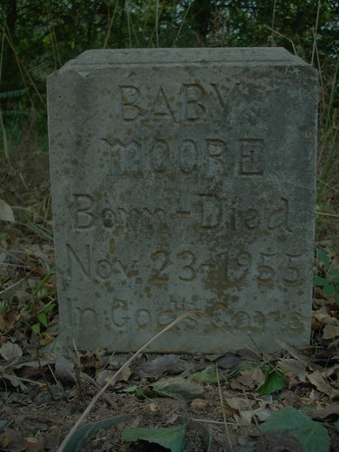
Baby
Moore (ssk) |
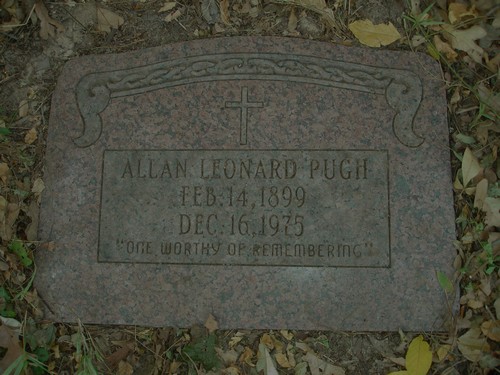
Allan Leonard Pugh (ssk) |
|
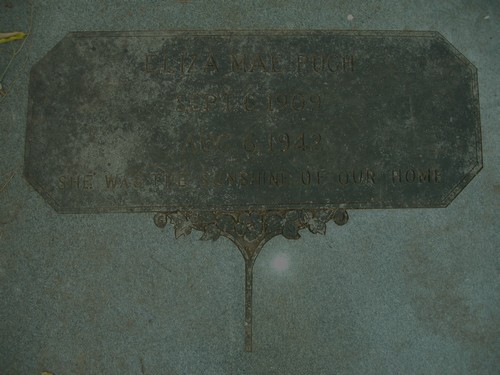
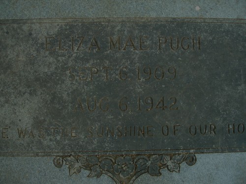
Eliza Mae Pugh (ssk) |
Eliza Mae Pugh (Close-up) (ssk) |
Eliza Mae Pugh (Close-up 2) (ssk) |
|
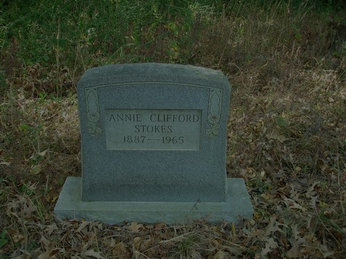
Annie Clifford Stokes (ssk) |
Annie Clifford Stokes (Footstone) (ssk) |
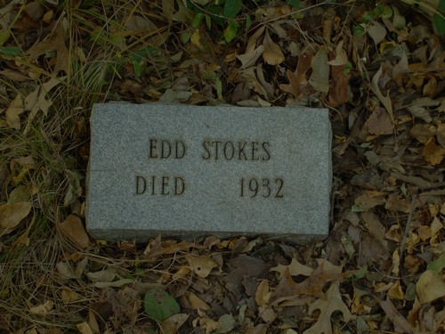
Edd
Stokes (ssk) |
|
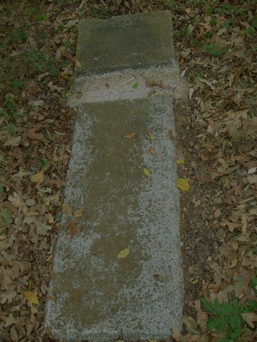
Unknown Burial (ssk) |
Unknown Burial (Close-up of head area) (ssk) |
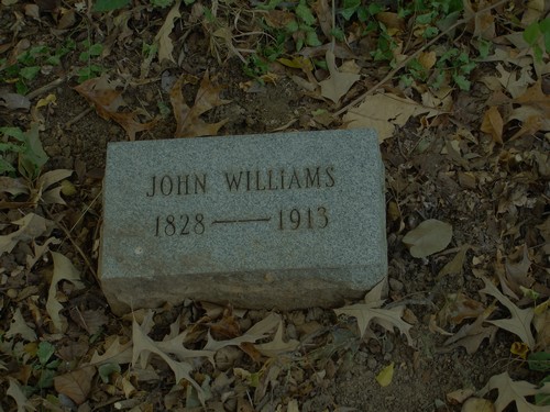
John
Williams (ssk) |
|
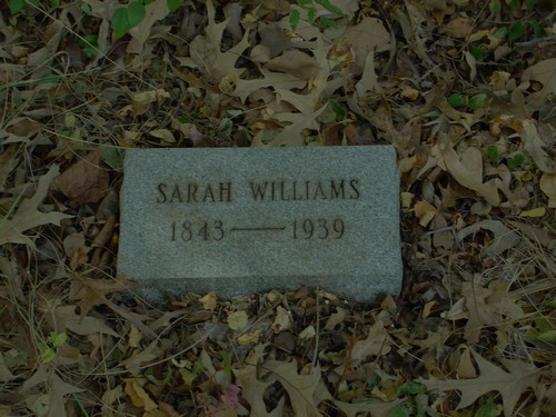
Sarah Williams (ssk) |
Rather Cemetery
SW-27
USGS GNIS Coordinates: Latitude: 321046N Longitude: 0951939W
by
.
| No pictures are available yet. |
Ray
Family Cemetery
SE-26
USGS GNIS Coordinates: Latitude: 320855N Longitude: 0951554W
by
.
| No pictures are available yet. |
Red Springs Free Cemetery
AKA "Red Springs Cemetery"
NW-32
Latitude: N 32:31:54.5
Longitude: W 095:16:19.0
From Tyler, take State Road 14 north to the intersection with State Road 16.
This is the small community of Red Springs. On the southwest corner of this
intersection is the Red Springs Baptist Church - the cemetery is behind the
church.
E. W. and Eva Winters sold this land to Red Springs Baptist Church in
1937. Cemetery established June 30, 1940.
| Click to Enter Cemetery |
Rogers/Hebron Cemetery
NE-36
by
.
| No pictures are available yet. |
Rose Hill Cemetery
Tyler, TX
2400 South Donnybrook
TT-02
Latitude: N 32:19:23.9
Longitude: W 095:17:52.1
This cemetery is located in the City of Tyler, Texas. South Donnybrook runs
parallel to South Broadway, the main north/south street in Tyler, and is one
street to the east of it.
by
Lawrence E. Oliver
| Click to Enter Cemetery |
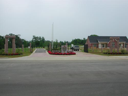
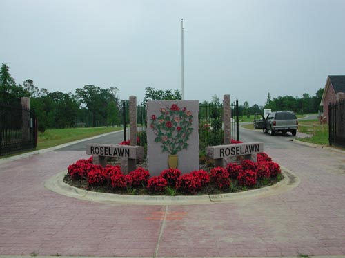
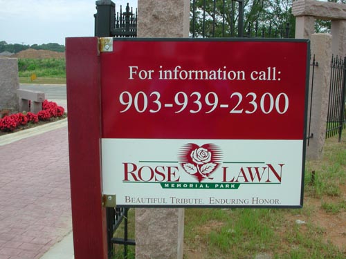
Rose Lawn Memorial Park Cemetery
Smith County, Texas
Address is 2003 Blue Mountain Blvd
SW-35
Latitude: N 32 15 19.5
Longitude: W 095 20 19.3
From Tyler, take SSW Loop 323 to the intersection of Old Jacksonville Road. Go
southwest on Old Jacksonville Road 3.5 miles to Blue Mountain Blvd & turn left
(southeast). Go 2 miles & it is on the leftside of the road.
by
Lawrence E. Oliver
| Roadside Directional Sign | Entrance (wide view) | Entrance (close up) |
| Information Sign | View into cemetery from entrance |
Rousseau Cemetery
SW-04
Latitude:
Longitude:
Located west of Dean Community. South on FM #2661 about one mile west of Dean.
Cemetery is about one-half mile west, and just north of railroad. On land owned
by Horace B. Clark and Roy Clark.
On land bought by P. W. Rousseau in 1869.
by
.
| No pictures are available yet. |
Rucker Cemetery
Troup, TX
SE-30
Latitude: N 32:09:18.5
Longitude: W 095:08:53.6
From Tyler, go south on Hwy110 through Whitehouse almost to the city of
Troup, Texas. Turn left (northeast) on CR2146. The cemetery is only about 1-2
hundred yards from Hwy110.
Begun 28 January 1870 with the burial of James E. Rucker on land given by
him.
| Click to Enter Cemetery |
Rucker Cemetery
(African-American)
AKA "Community Cemetery (A.A.)"
Troup, TX
SE-14
Latitude: N 32:08:13.6
Longitude: W 095:09:11.1
From Troup, Texas, take Hwy135 southwest to County Line Road (CR4914) and
turn right (west). The cemetery is about 1.5 miles and is on the north (right)
side of the road. It is about 1/4 mile before the intersection of CR2186. There
is a small, damaged sign reading "cemetery" beside the path leading to
the cemetery.
| Click to Enter Cemetery |
| Cemetery Listings: Main Page |
| Cemetery Listings: A - C |
| Cemetery Listings: D - G |
| Cemetery Listings: H - K |
| Cemetery Listings: L - M |
| Cemetery Listings: N - R |
| Cemetery Listings: S |
| Cemetery Listings: T - Z |
![]()
![]()
Copyright ©
2005 - 2009
East Texas Genealogical Society and the Individual Contributors