Maps Access
This is the main page to access the maps collections. There are currently three main sections of maps available with a new section on Civil War maps coming soon. If you have any problem accessing these pages or if you have ideas for other maps that we can include in here, be sure to contact Adrian Williams.
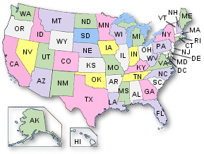
State and County MapsThis collection represents the bulk of the library and contains the most commonly accessed files we have. Please choos a state from either the map or the table and you will be taken to the page for that state.
United States MapsThis section displays maps of national interest. Maps that show our westward expansion, our land survey systems, and more will be included here.
North America, 1845 (544k)
This 1845 French map shows an Independent Texas and the U. S. southwest as 100% “Mexique” (Mexico). It is from the Atlas Universel Illustré. The map is titled Amérique Septentrionale. The map measures about 7 x 8 inches, while the printed area is about 17 x 11 inches. Printed outside the actual map but within the borders are various American animals (not shown here). A thumbnail version is used in our masthead design.
US Principal Meridians and Base Lines - small (761k)
United States Department of the Interior, Bureau of Land Management, 1988. Submitted by Dan Rathbun.
US Principal Meridians and Base Lines - large (1,111k)
United States Department of the Interior, Bureau of Land Management, 1988. Submitted by Dan Rathbun.
U. S. Meridians and Baselines (479k)
In many parts of the United States, land is surveyed with respect to an initial point defined by the intersection of a Prime Meridian and a Base Parallel of Latitude. Many such systems have been established at different times to cover different territories. This map shows the ones in use for the 48 contiguous states.
National Geographic Vol. 26 - July-Dec, 1914 (278k)
Map of Grand Canyon from Green River Wyoming to mouth of ado River in Mexico
Western United States, circa 1897 (742k)
Includes Arizona, California, Idaho, Nevada, Oregon, Utah, Washington, and parts of Colorado, Montana, New Mexico, and Wyoming from "Natural Elementary Geography", Redway and Hinman, American Book Company
Pacific States and Territories (647k)
James Monteith, 1884 - This is a neat map which includes Arizona, California, Colorado, Idaho, Montana, Nevada, New Mexico, Oregon, Utah, Washington and Wyoming.
Map of Idaho Montana and Wyoming
International Cyclopaedia: Vol VII (1892), Dodd, Mead & Company
The New Reference Atlas of the World, -1910 (1.4 mb)
"A new series of phisical, political and historical maps compliled from government surveys exibiting the latest results of geographical research. With special chapters on the discovery of the North Pole, the Panama Canal, ect" New York, C. S. Hammond & Company. Scanned and donated by George Stephan.
Indian Land Cessions to the United States Treaty MapsThis collection provides maps of the land cessions made by American Indian Nations during the interval between the formal establishment of the United States and 1894. Go to the Maps -->