Virginia Digital Map Library
State Map Coordinator: Available
 The following maps of Virginia and the surrounding territories are online in the United States Digital Map Library, and are available for you to download.
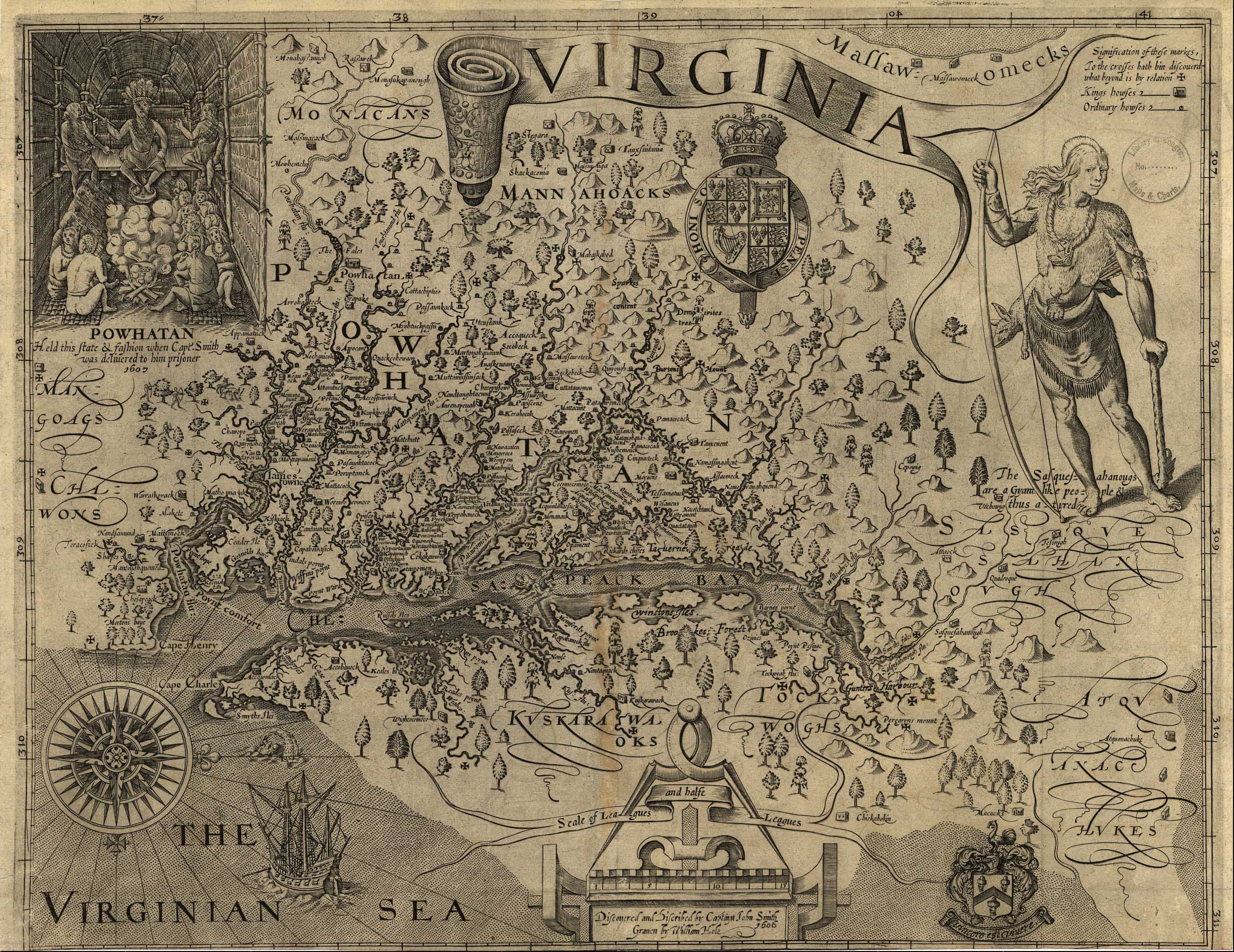
Virginia 1624 Map Native American Tribes and their locations.
[Size 1MB]
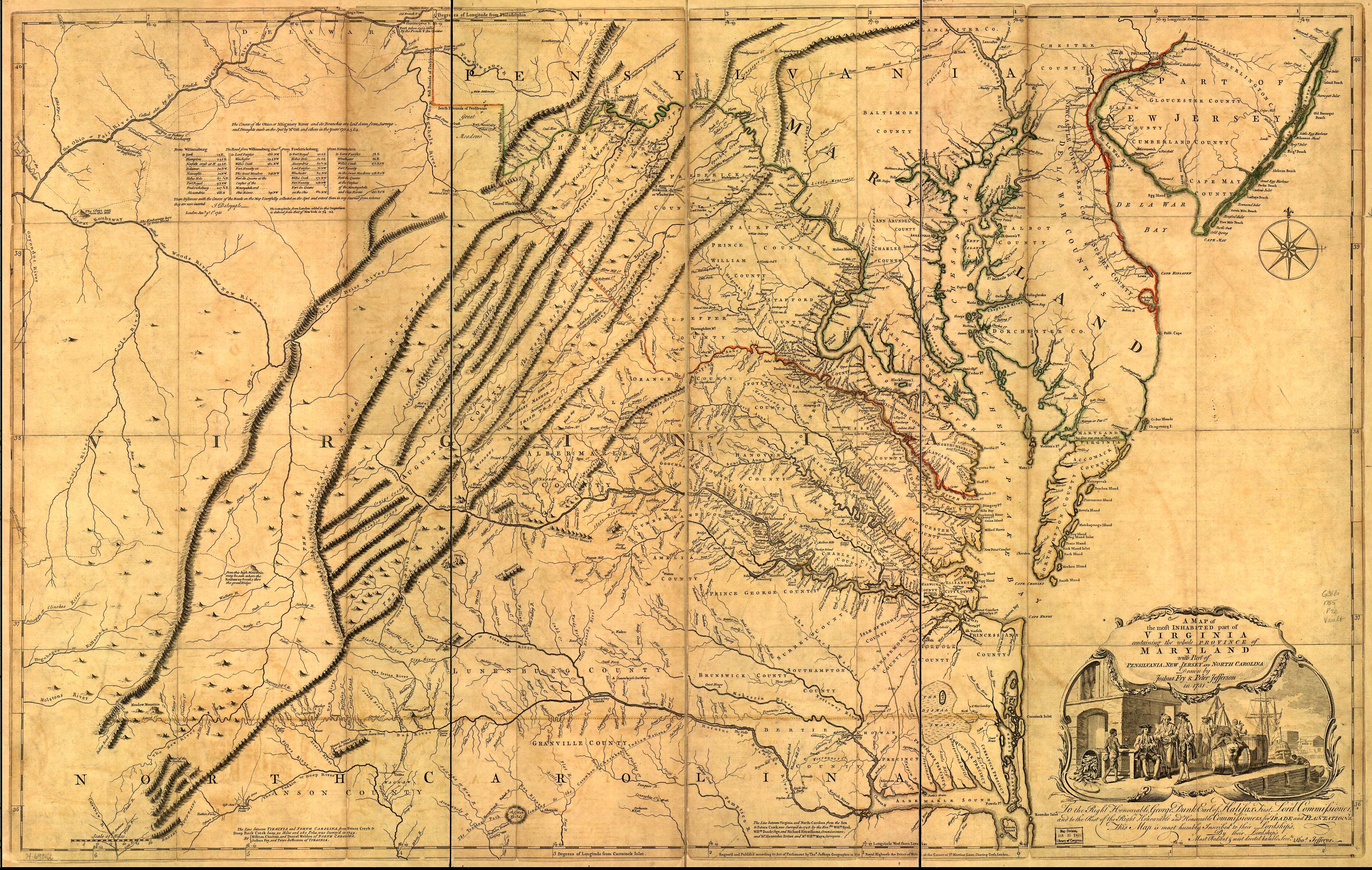
Virginia 1751 Map Drawn by Joshua Fry and Peter Jefferson in 1751.
[Size 1.7MB]
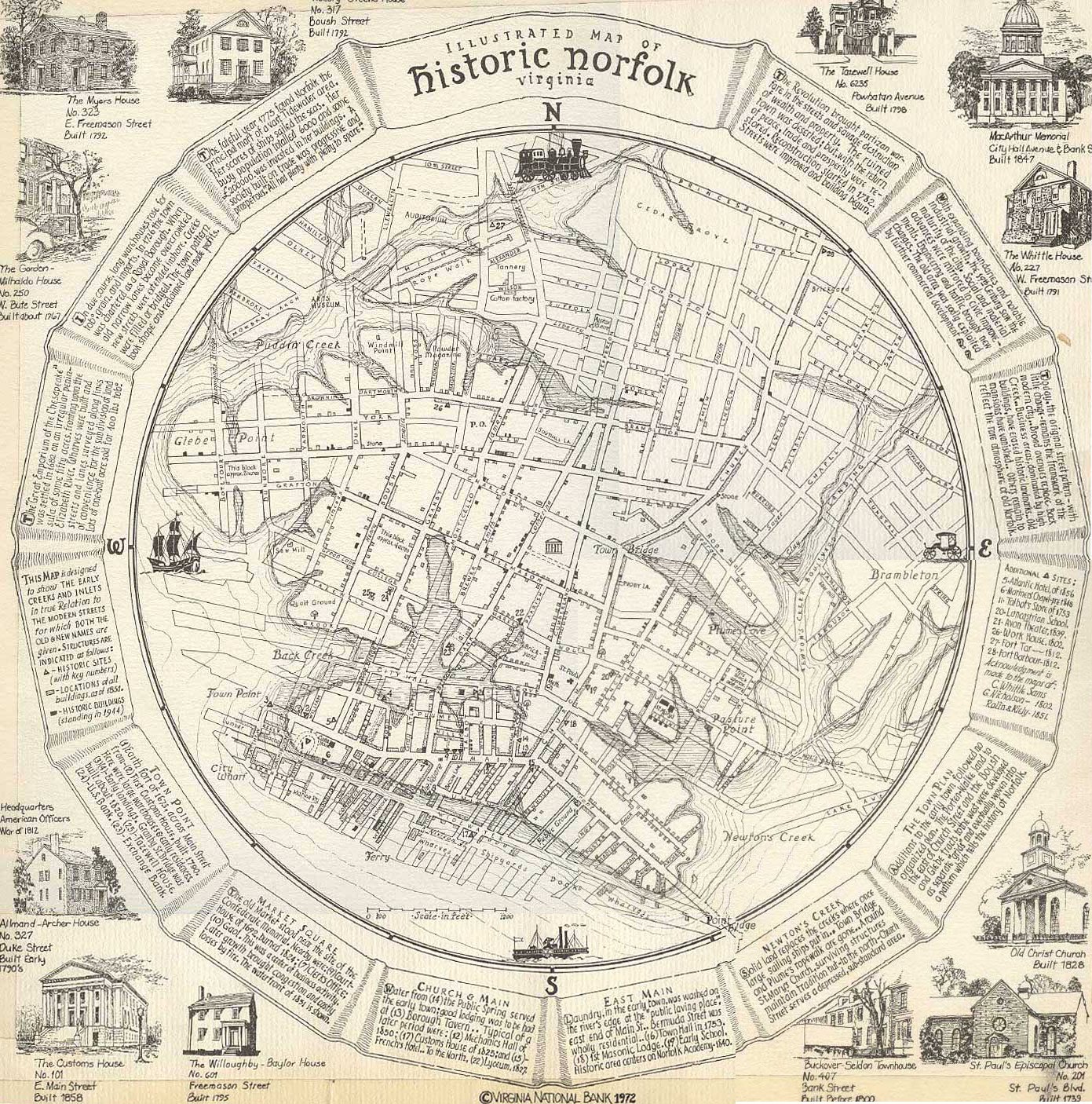
Illustrated Map of Historic Norfolk, Virginia. Copyright, Bank of America Corporate Archives.
(Not for commercial use or reproduction without permission.)
[Size 845KB]
Virginia 1861 Map. Washington to Bull Run. Drawn under the supervision of C.H. Ambler. From the Atlas of American History, 1943. By James Truslow Adams, published by Charles Scribner’s Sons.
[Size 400KB]
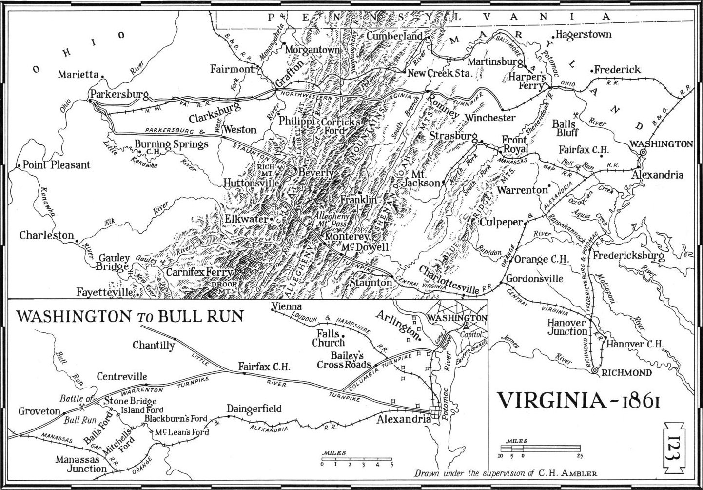
Military Map of Suffolk and Vicinity."Atlas to Accompany the Official Records of the Union and Confederate Armies, 1861-1865.
Julius Bien & Co., NY, 1894.
[Size 1.9MB]
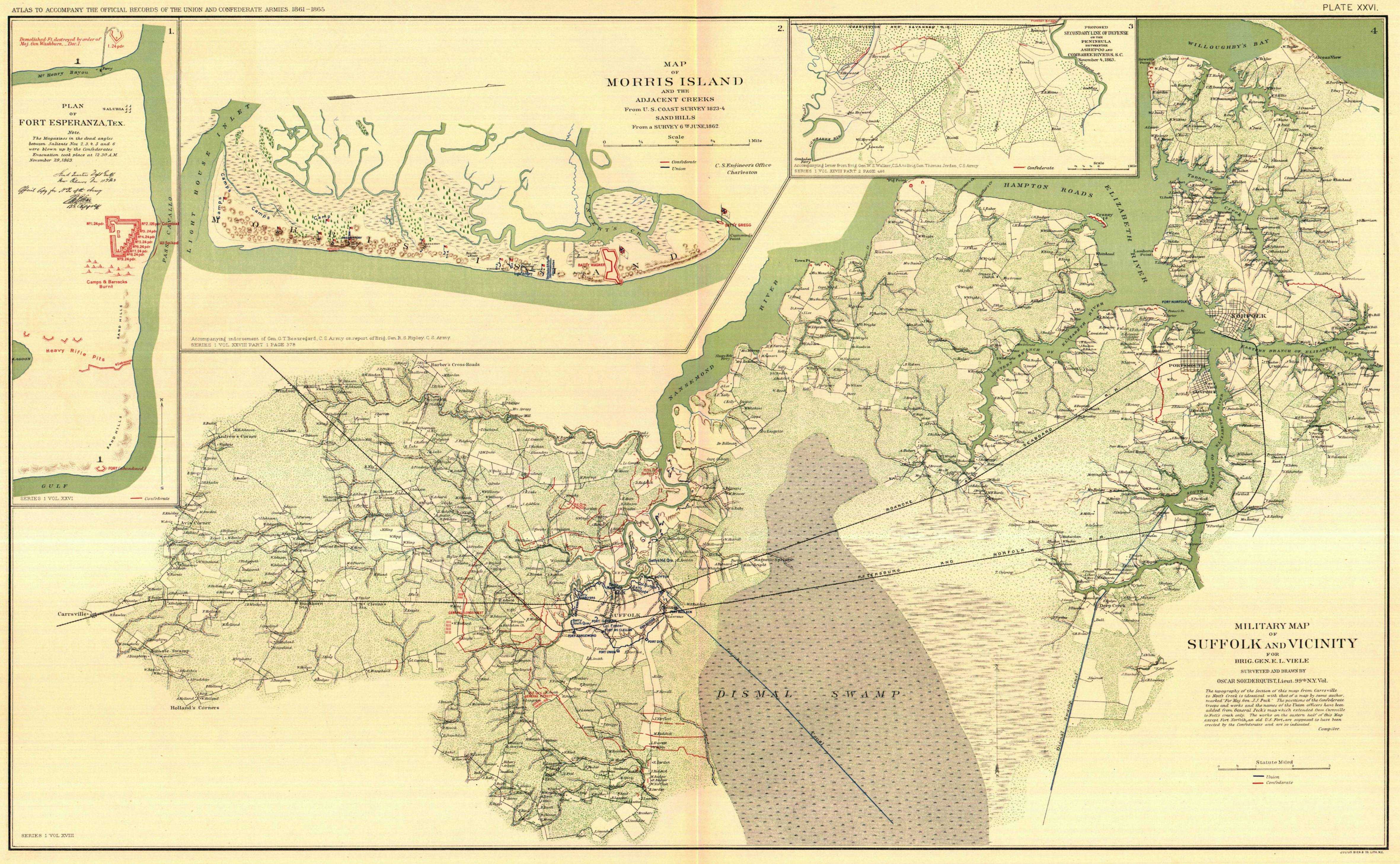
Gray's New Map of Norfolk, Portsmouth and Berkley. Drawn from special surveys 1877.
[Size 646KB]
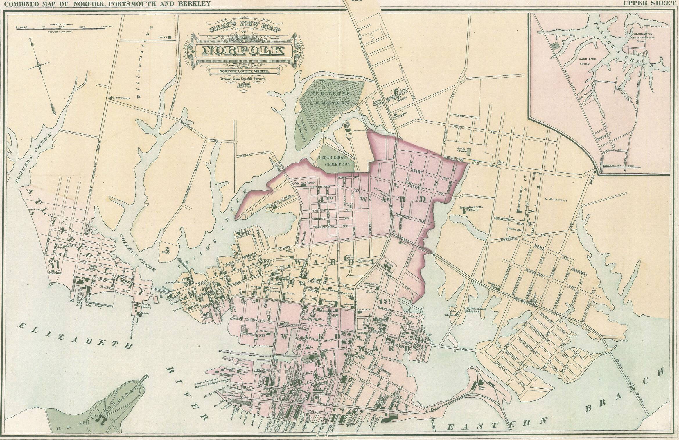
Sketch Book of Portsmouth, Virginia, Its People And Its Trade. by Edward Pollock, Portsmouth, 1886.
[Size 132KB]
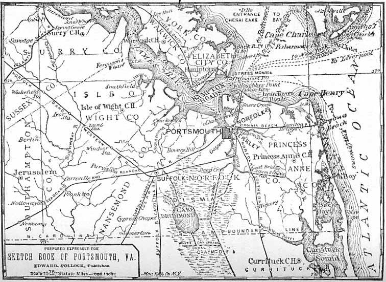
U.S. DIGITAL MAP LIBRARY INDEX
Linda Russell Lewis
Coordinator
Joy Fisher
Assistant Coordinator