
Utah Digital Map Library
State Map Coordinator:
 The following maps of Utah and the surrounding territories are
online in the United States Digital Map Library, and are available for you
to download.
The following maps of Utah and the surrounding territories are
online in the United States Digital Map Library, and are available for you
to download.
Utah State Maps
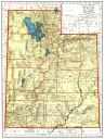
Utah Territory and its counties around 1874. From a Warner and Bates map of the Four Corners territory, scanned by the Library of Congress's American Memory project
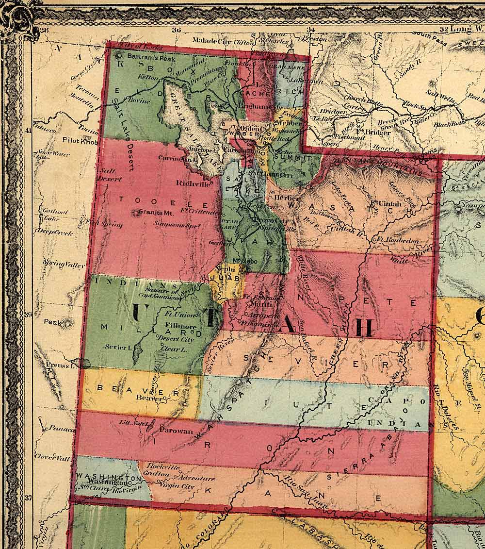
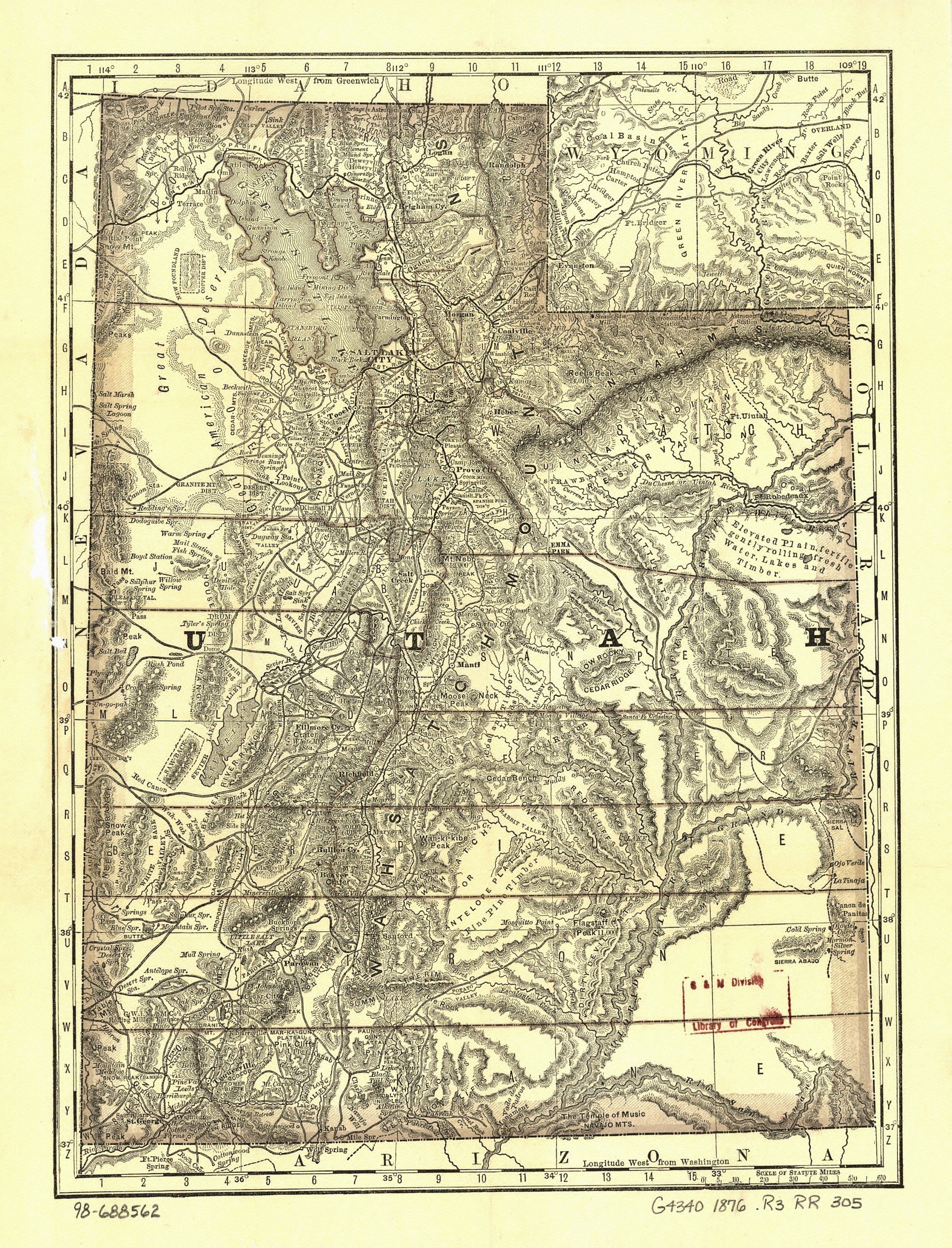
Utah in 1876. A Rand McNally map in the Library of Congress, with much data from Utah's most famous cartographer, Bernard A. M. Froiseth.
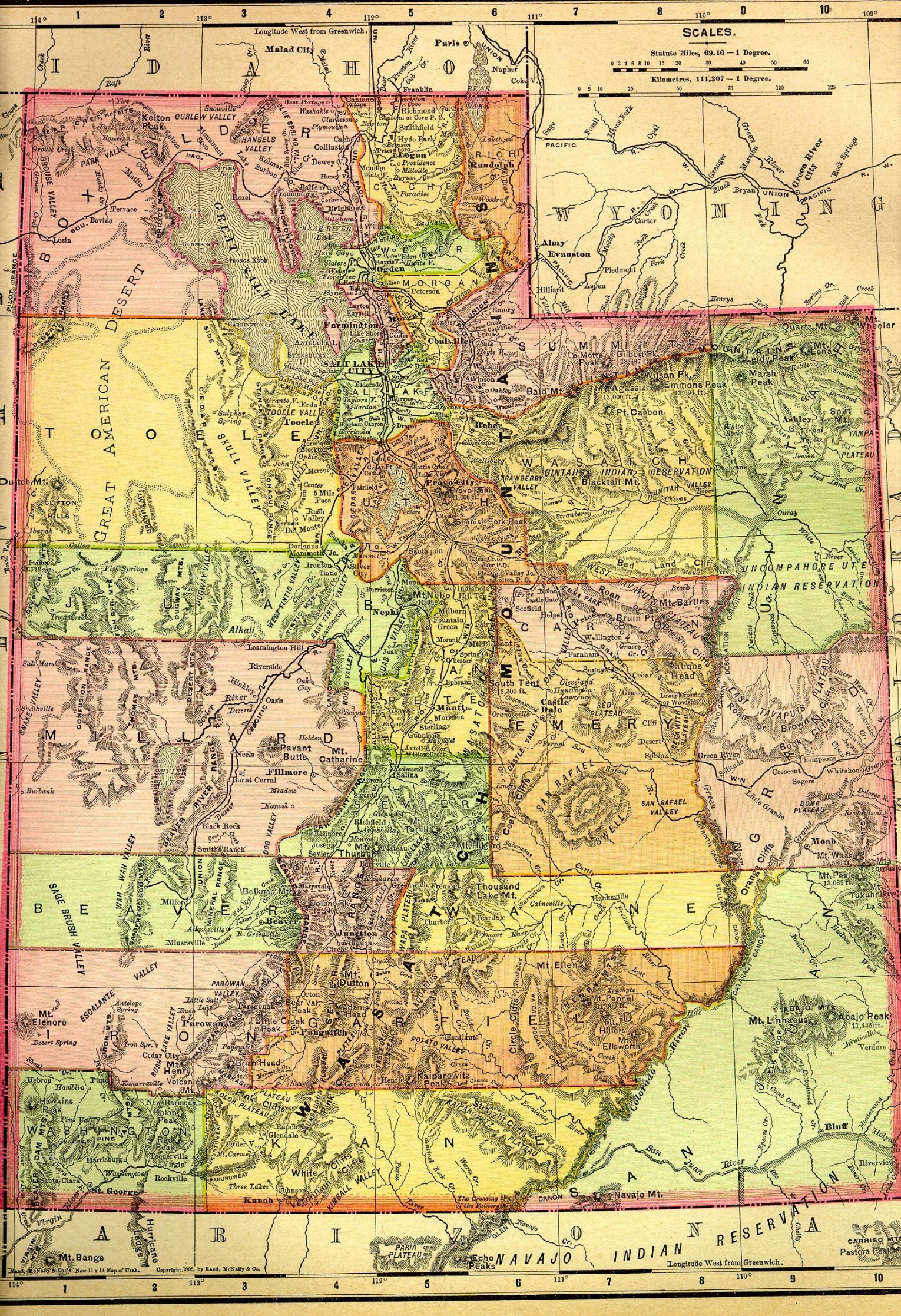
Utah in 1895. From Rand McNally's magnificent U.S. Atlas, 1895, edited by Pam Reitsch for the Livingston County, Michigan USGenWeb project .
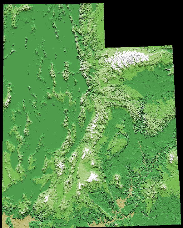
Utah Physical Geography. Modern shaded relief map by the US Geological Survey
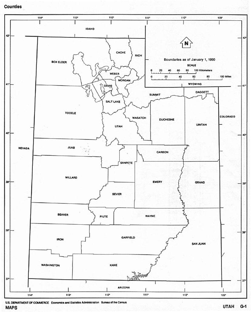
Current Utah County Boundaries. U.S. Census Bureau, 1990.
Utah Counties in 1895. Individual maps scanned by the Livingston County, Michigan USGenWeb project
Ogden [1875]. Panoramic map by E.S. Glover, published by Strobridge in Cincinnati. Library of Congress, American Memory project.
![Ogden [1875].](images/ogden.jpg)
Salt Lake City in 1891. Panorama by H[enry] Wellge. Milwaukee: American Map Co.
Salt Lake City in 1920. Automobile Blue Book Co.
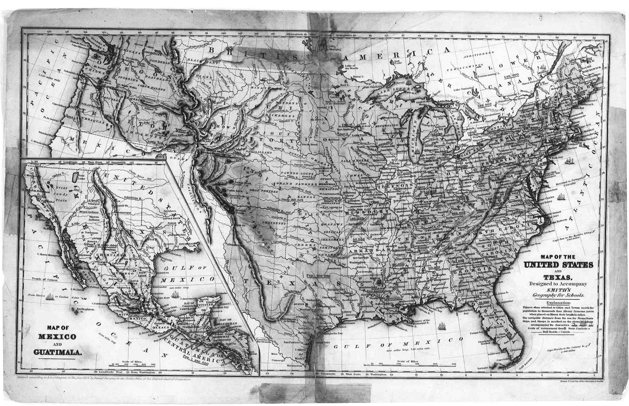
The U.S., Texas, and Indian Territory. 1839 map to accompany Smith's Geography for Schools
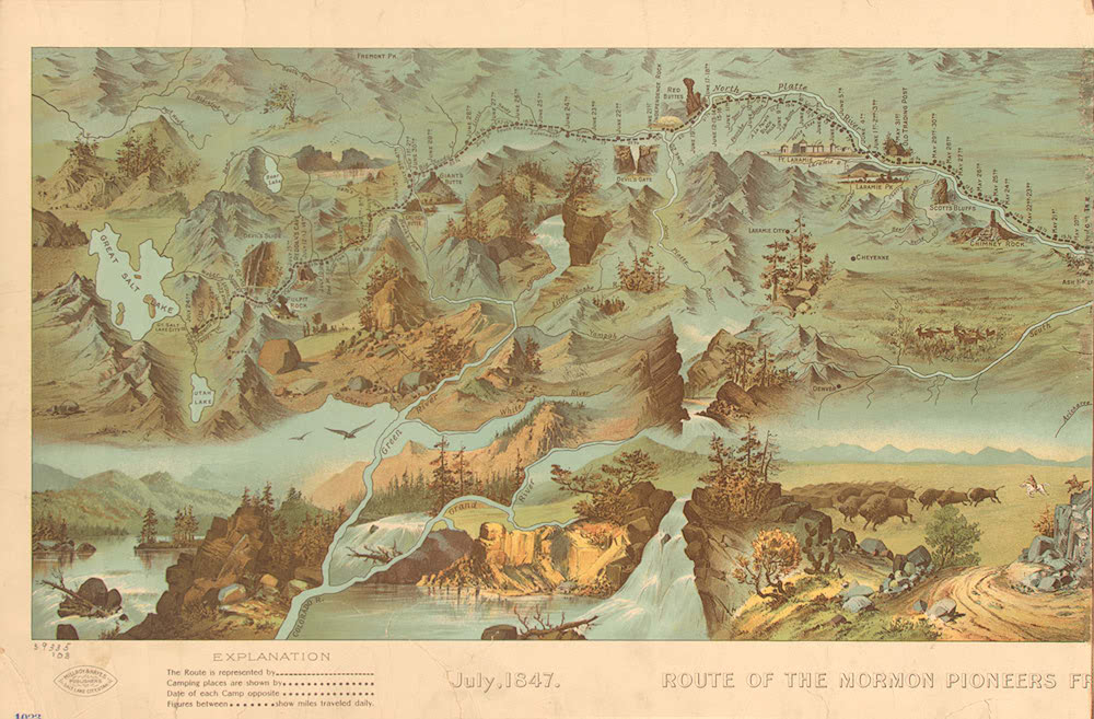
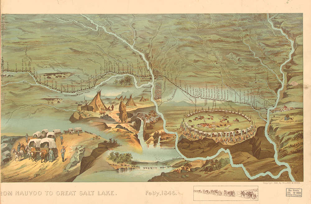
 Route of the Mormon Pioneers 1846.
. . Right half. By Millroy and Bates, 1899. American Memory project.
The West in 1875. Southern Pacific Railroad map, by G.W. & C.B. Colton, New York. Library of Congress, American Memory project
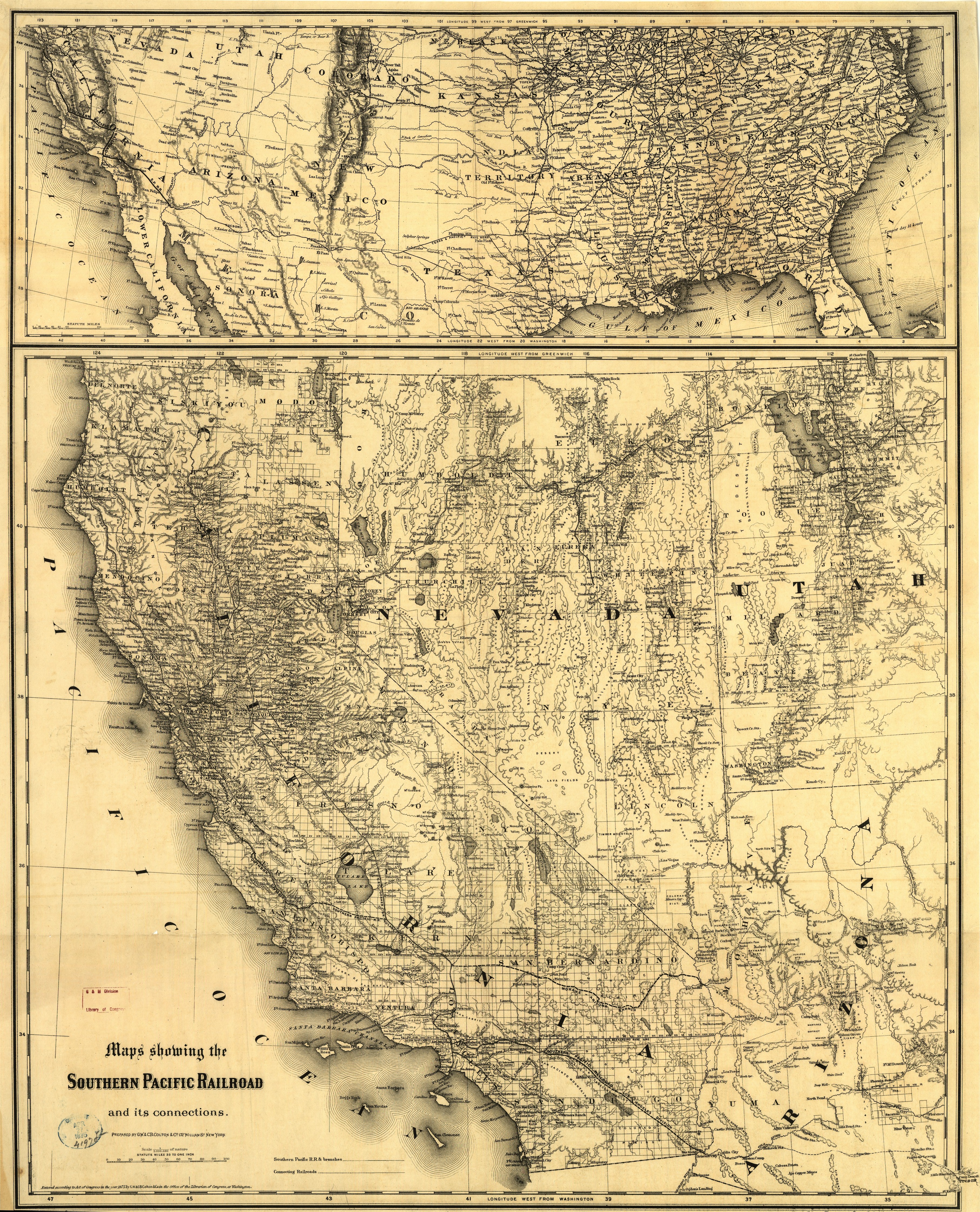
U.S. DIGITAL MAP LIBRARY INDEX
Joy Fisher
Coordinator
Rebecca Maloney
Special Projects Coordinator


Copyright © 1999- USGenWeb Archives Project