
State Map Coordinator
Washington State Maps
Washington County Maps
Cram’s Superior Map of Washington, 1909
Scans of individual counties from the original map.
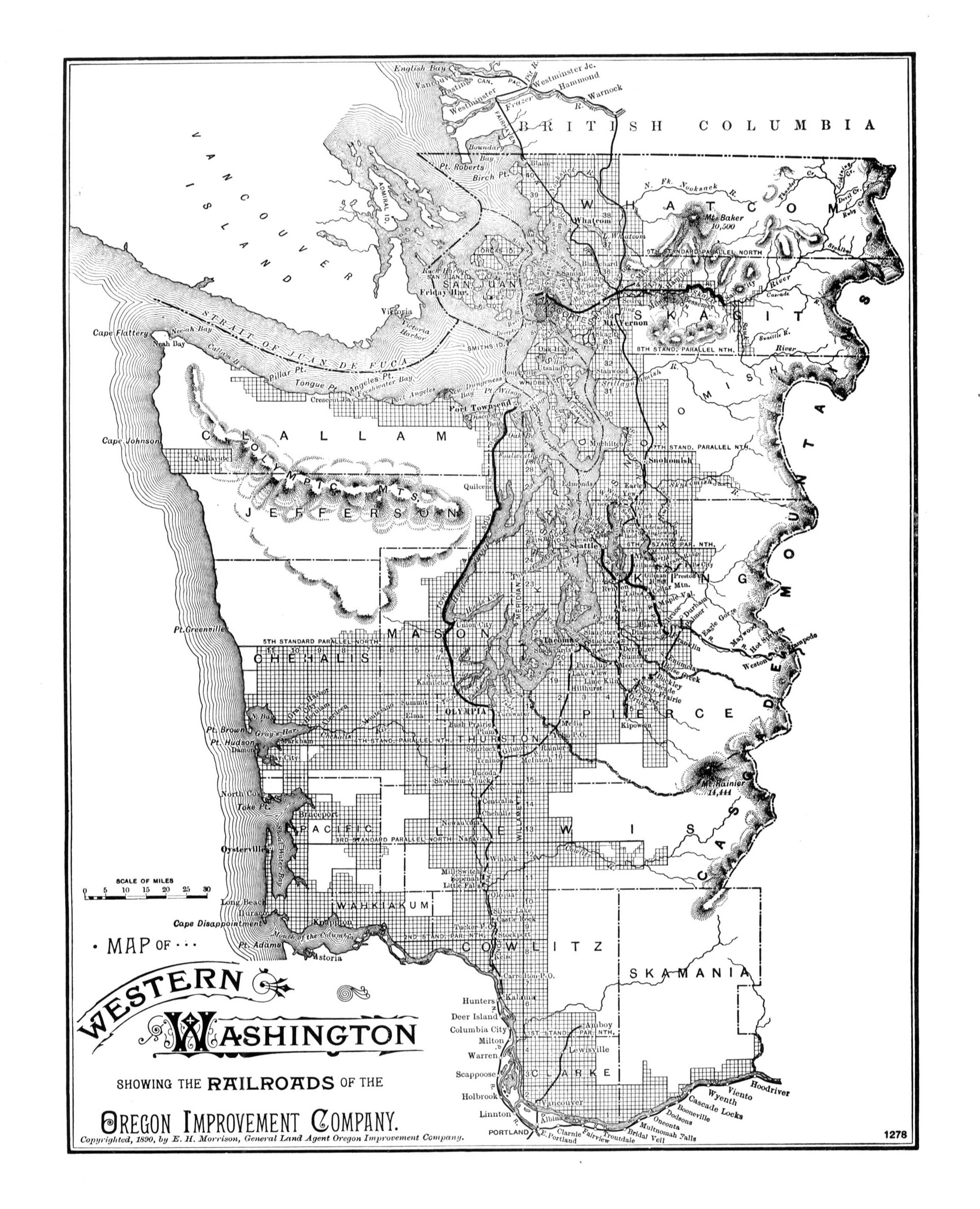
Map of Western Washington Showing the Railroads of Oregon Improvement Company, 1890, E. H. Morrison
Submitted by Joy Fisher, 2008.
Please visit our Indian Land Cessions Maps
for links to four maps showing Indian Land Cessions in Washington.
(Numbers, 60, 61, 62, and 63.)
 |
 |
 |
This page was first posted on:
2 June 1999
USGenWeb Archives
Joy Fisher
Coordinator
Rebecca Maloney
Special Projects Coordinator


Copyright © 1999- USGenWeb Archives Project