MAPS OF THE TIMES
Provided by the Kirn Library Sargeant Memorial Room
unless stated otherwise.
Compiled by DONNA BLUEMINK
Note: Click link below each picture for enlarging and clarity.
Warning: These maps
are very large.
Suggestion: Set screen resolution to 1024-768 pixels for best view.
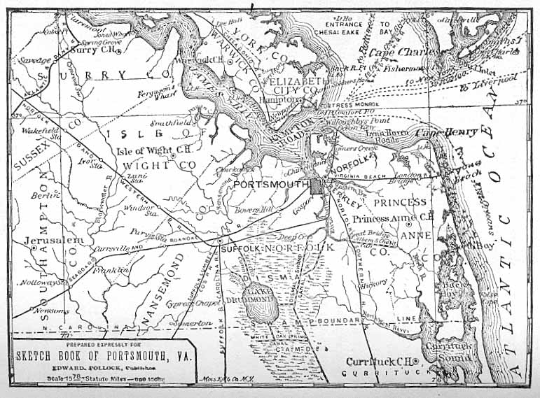
Sketch
Book of Portsmouth, Virginia, Its People And Its Trade,
by Edward Pollock, Portsmouth, 1886, page 13.
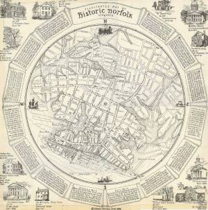
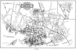
Illustrated
Map of Historic Norfolk, Virginia.
Bank of America Corporate Archives.
(Not for commercial use or reproduction without permission.)
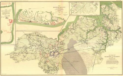
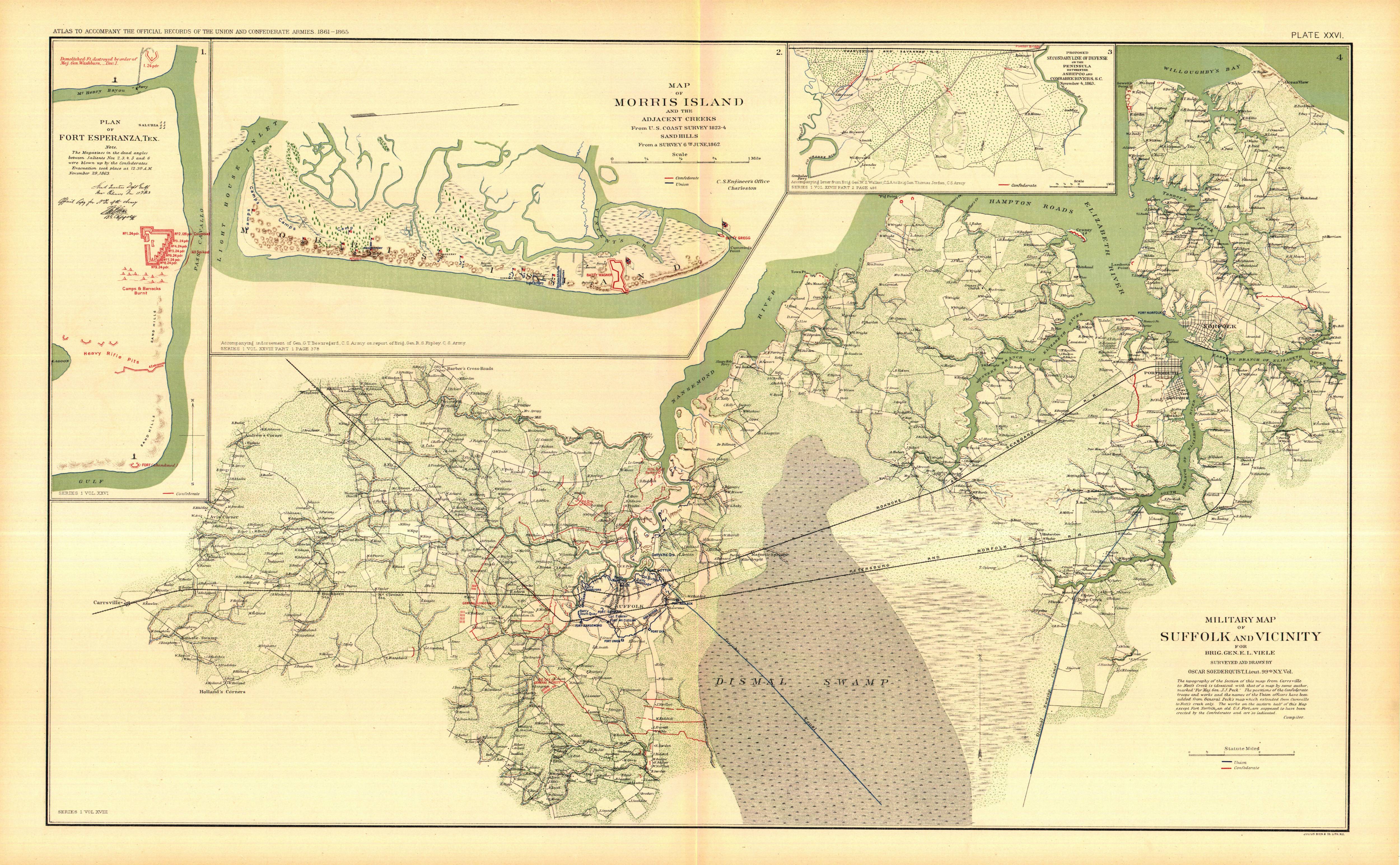
Military
Map of Suffolk and Vicinity
"Atlas to Accompany the Official Records
of the Union and Confederate Armies, 1861-1865.
Julius Bien & Co., NY, 1894.
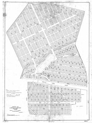
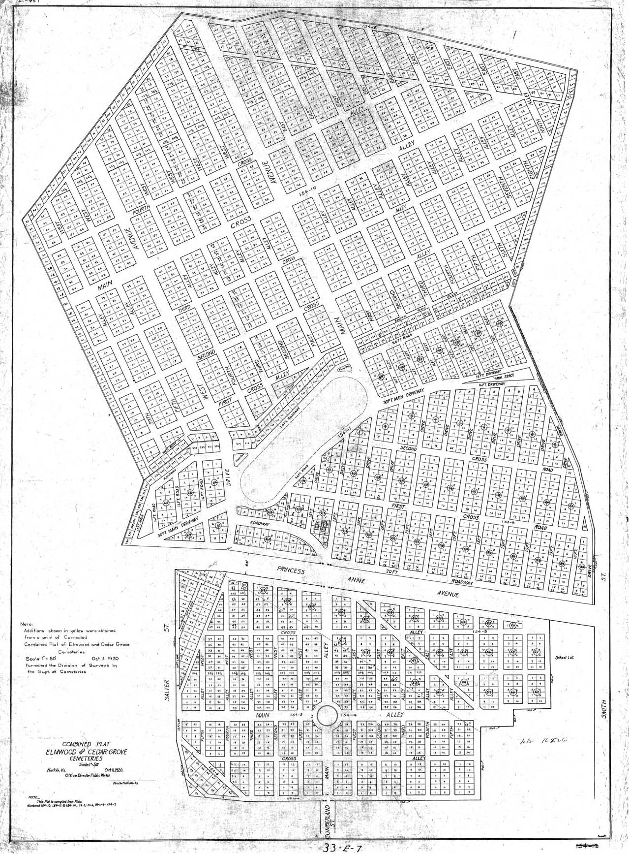
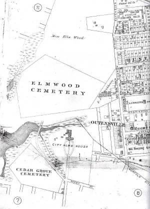
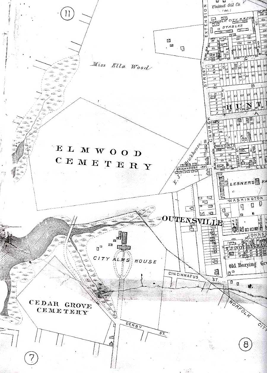
Combined
Plat Elmwood & Cedar Grove Cemeteries,
Norfolk, Virginia. October 11, 1920.
Courtesy of Norfolk's Department of Public Works, Division of Surveys.
Gray's
New Map of Norfolk, 1877.
Courtesy of Norfolk's Department of Public Works, Division of Surveys.
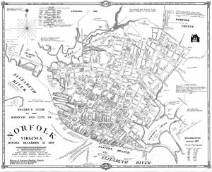
Reader's Guide to the Borough
& City of Norfolk, Virginia, before December 31, 1899.
Courtesy of Norfolk's Department of Public Works, Division of Surveys.
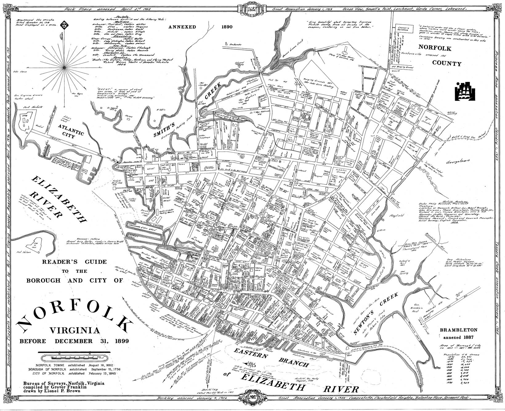
Atlas
of Norfolk & Portsmouth & Vicinity,
Published by G. M. Hopkins, C. E., Philadelphia, PA, 1889.
Plate 10, bottom left corner
( Continued)
* * * * * *
Table
of Contents