
State Map Coordinator:
 The
following maps of Wisconsin and the Wisconsin Territory are online in the
United States Digital Map Library, and are available for you to download. If
you would like to be part of the Digital Map Library team and/or make
contributions, please e-mail me
Rebecca Maloney. Your contributions are both needed and appreciated!
The
following maps of Wisconsin and the Wisconsin Territory are online in the
United States Digital Map Library, and are available for you to download. If
you would like to be part of the Digital Map Library team and/or make
contributions, please e-mail me
Rebecca Maloney. Your contributions are both needed and appreciated!
Wisconsin State Maps
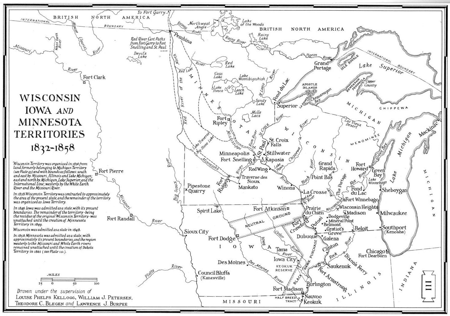
Drawn under the supervision of Louise Phelps Kellogg, William J. Petersen, Theodore C. Blegen and Lawrence J. Burpee
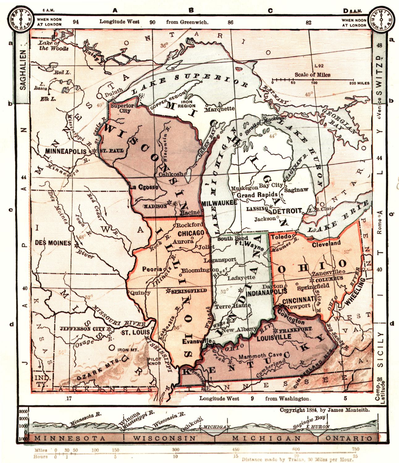
Midwest Map, circa 1884 (462kb)
James Monteith, 1884 - this is a neat map which includes Wisconsin, Illinois, Ohio, Kentucky, Michigan, Minnesota, Iowa and Missouri.
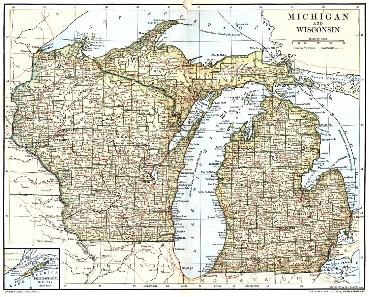
Michigan and Wisconsin, circa 1891 (565kb)
International Cyclopædia
Struthers & Co., Engr's, N.Y.
Published by Dodd, Meade, & Co.
Rand McNally Popular Map of Wisconsin, circa 1944 (509kb)
Chicago
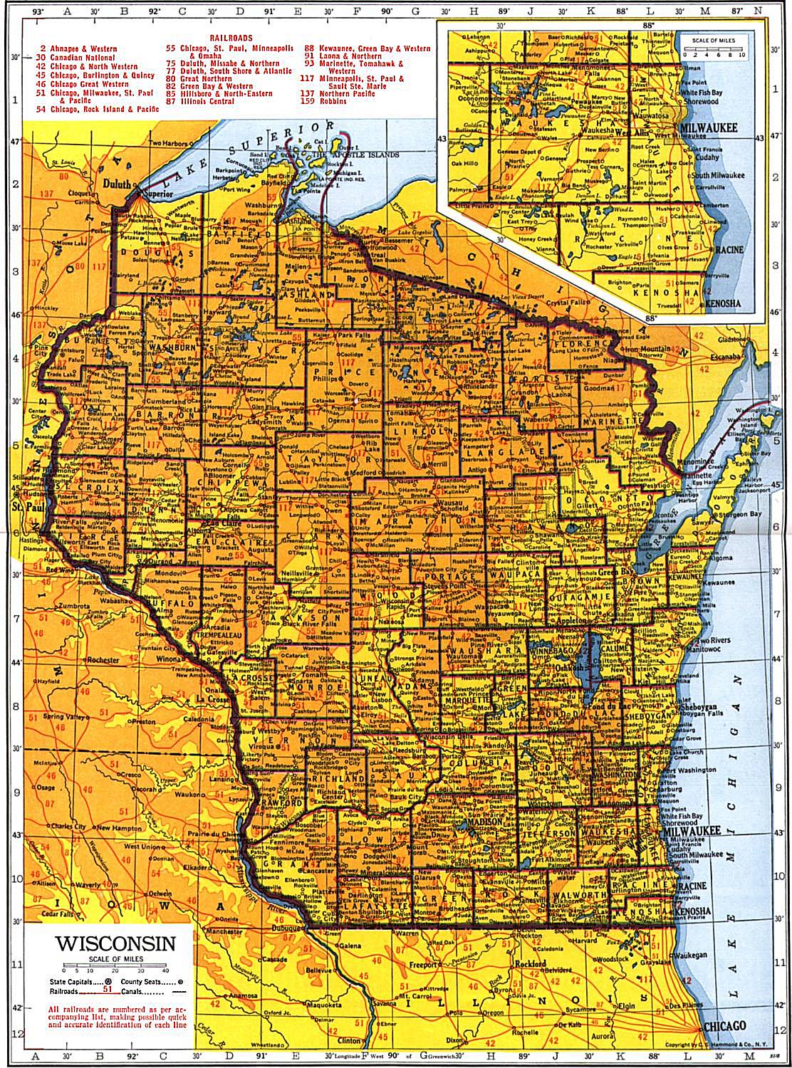
1943 Railroads (450k) C.E. Hammond & Co., N.Y. - Unfortunately, the resolution isn't a little better on this railroad map, but hopefully it is useful anyway.
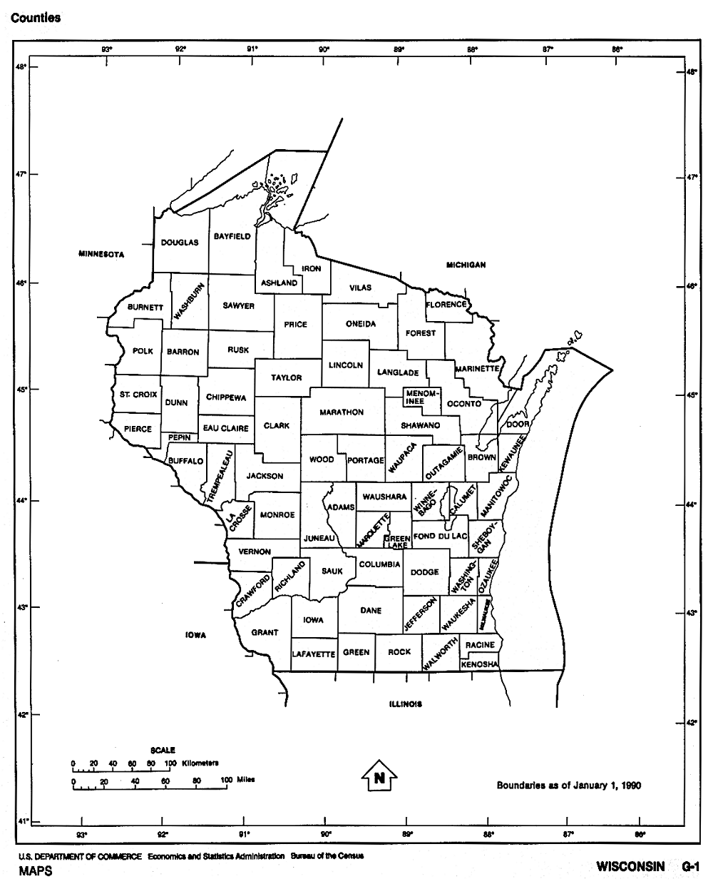
Wisconsin County Boundaries, 1990 U.S. Dept. of Commerce, Bureau of the Census (139kb)
Compiled and Published by Otto Nelson, Sturgeon Bay, Wisconsin
1937. Submitted by Joy Fisher.
Wisconsin City Maps
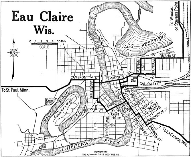
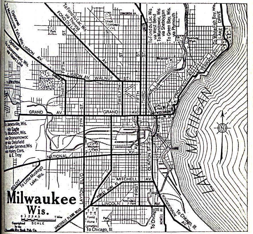
Milwaukee - The Automobile Blue Book Company, circa 1920 (251k)
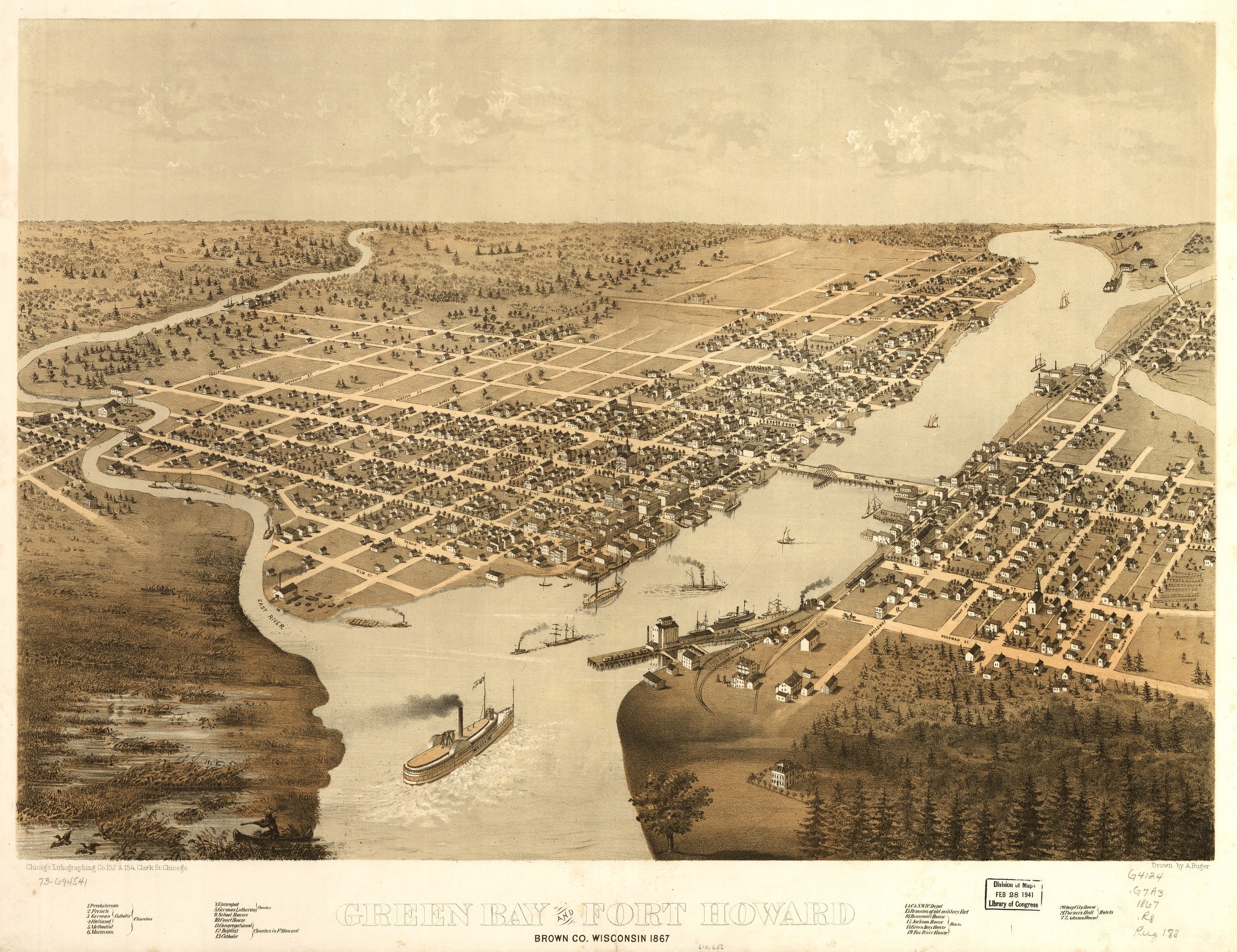
Published by J.J. Stoner, Madison, WI
Source: Geography & Map Division, Library of Congress
Panorama: Green Bay and Fort Howard, Brown County, circa 1867. (1.18 megs) Drawn by A. Ruger., Published by the Chicago Lithographing Co., Chicago
Source: Geography & Map Division, Library of Congress
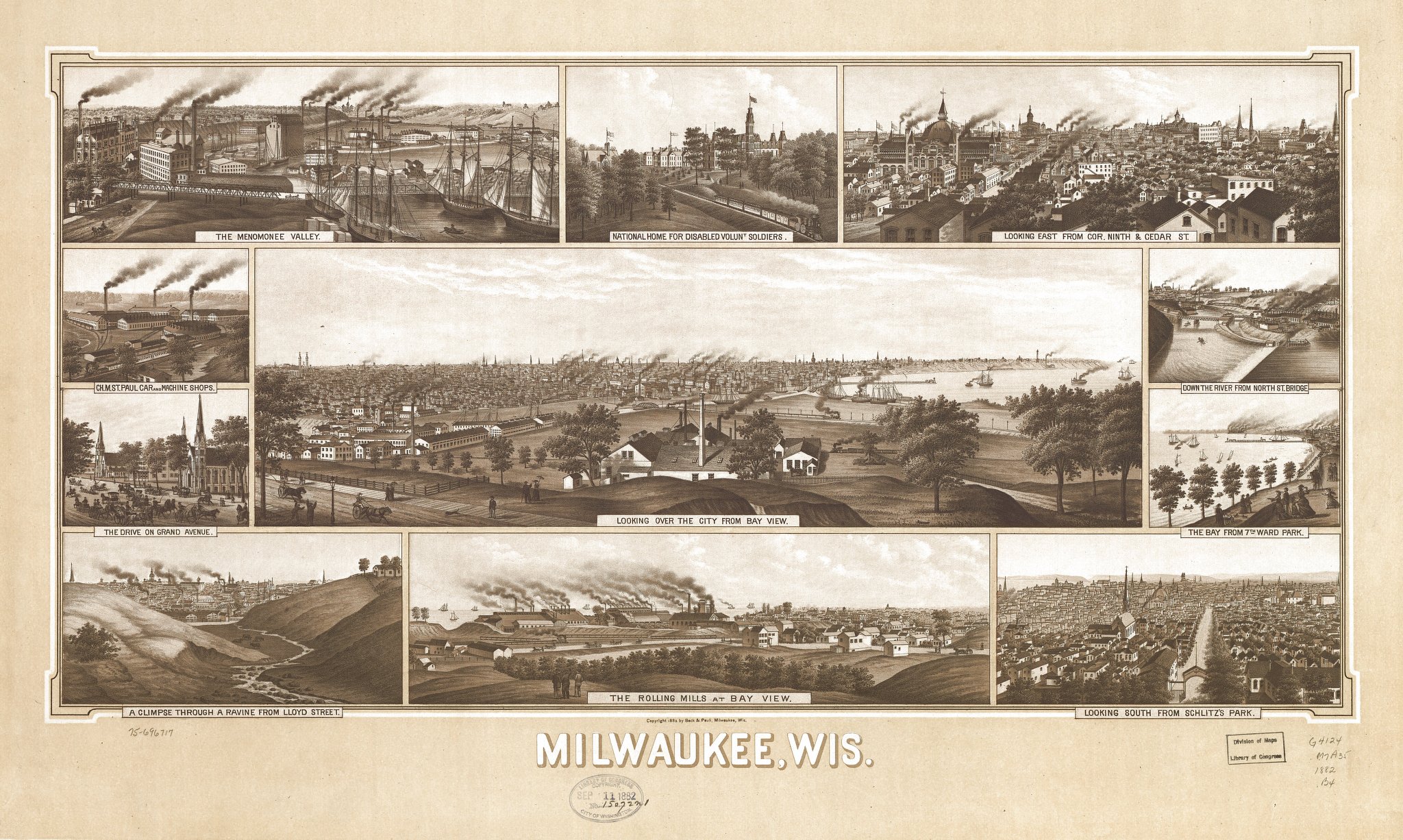
Panorama: Milwaukee, circa 1882. Beck & Pauli, Milwaukee, WI (737k)
Source: Geography & Map Division, Library of Congress
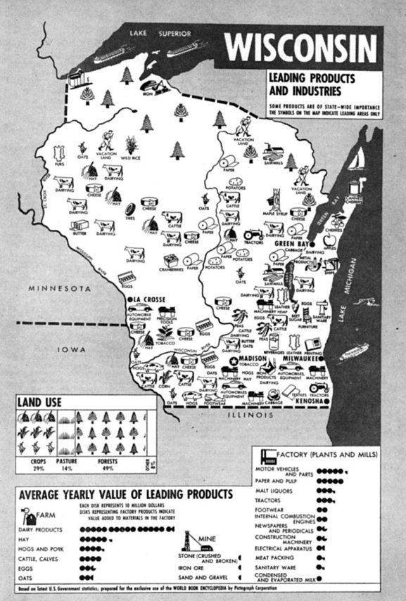
Leading Products Industries, circa 1943 (123kb)
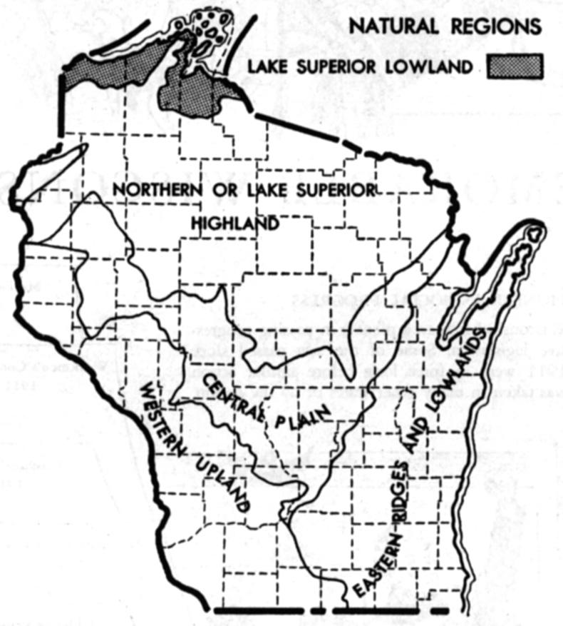
Natural Regions of Wisconsin, circa 1943 (85kb)
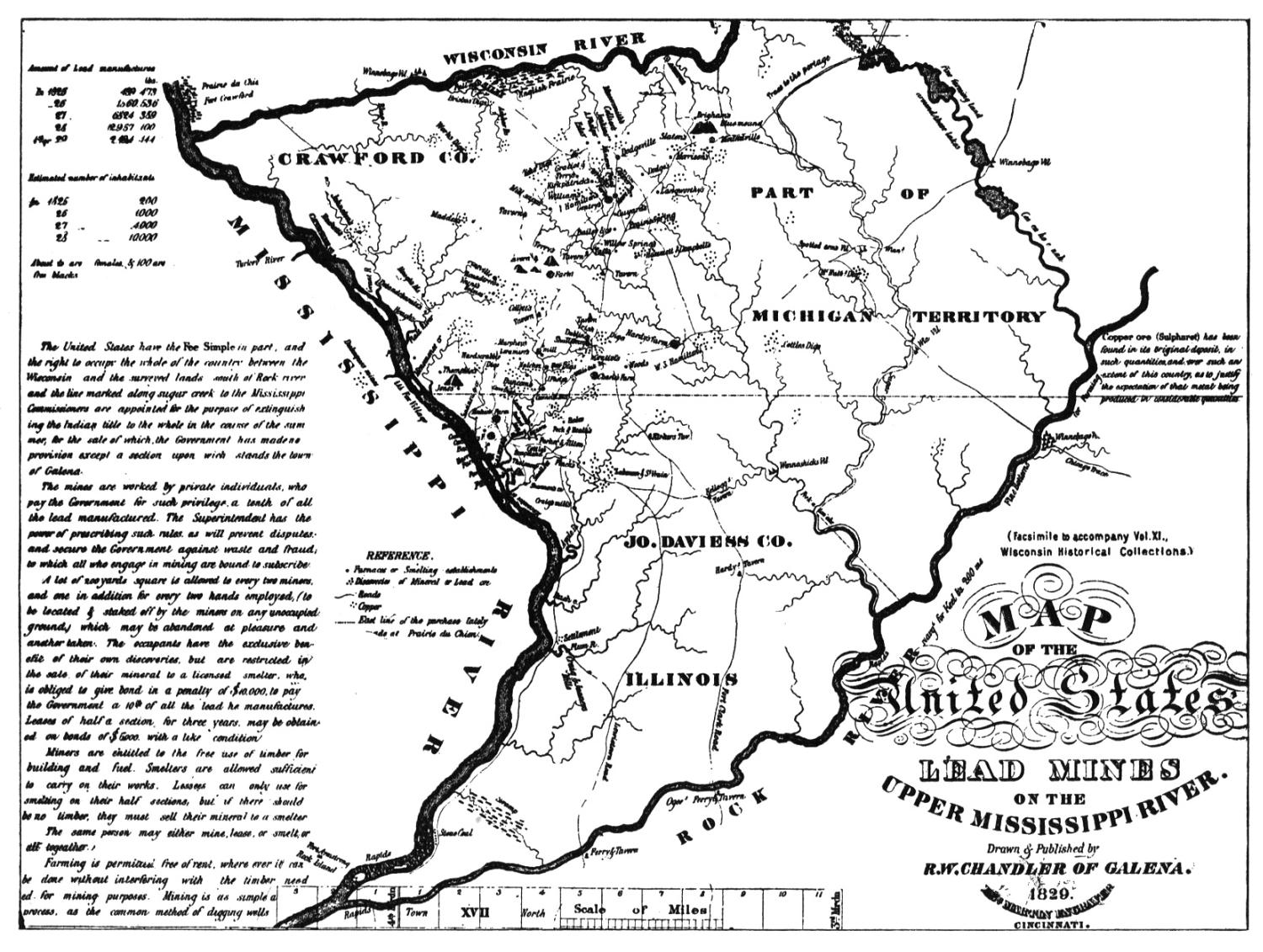
Lead Mines on the Mississippi, circa 1829 (320kb)
Joy Fisher
Coordinator
Rebecca Maloney
Special Projects Representative


Copyright © 1999- USGenWeb Archives Project