
State Map Coordinator:
 The following maps of Wisconsin and the Wisconsin Territory are online in the United States Digital Map Library, and are available for you to download. If you would like to be part of the Digital Map Library team and/or make contributions, please e-mail me, . Your contributions are both needed and appreciated!
Waushara County Maps
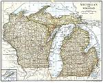
Waushara County
Coloma
Coloma Station
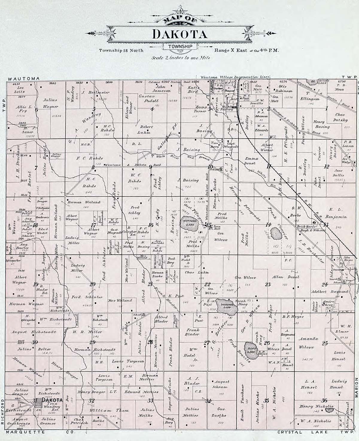
Dakota
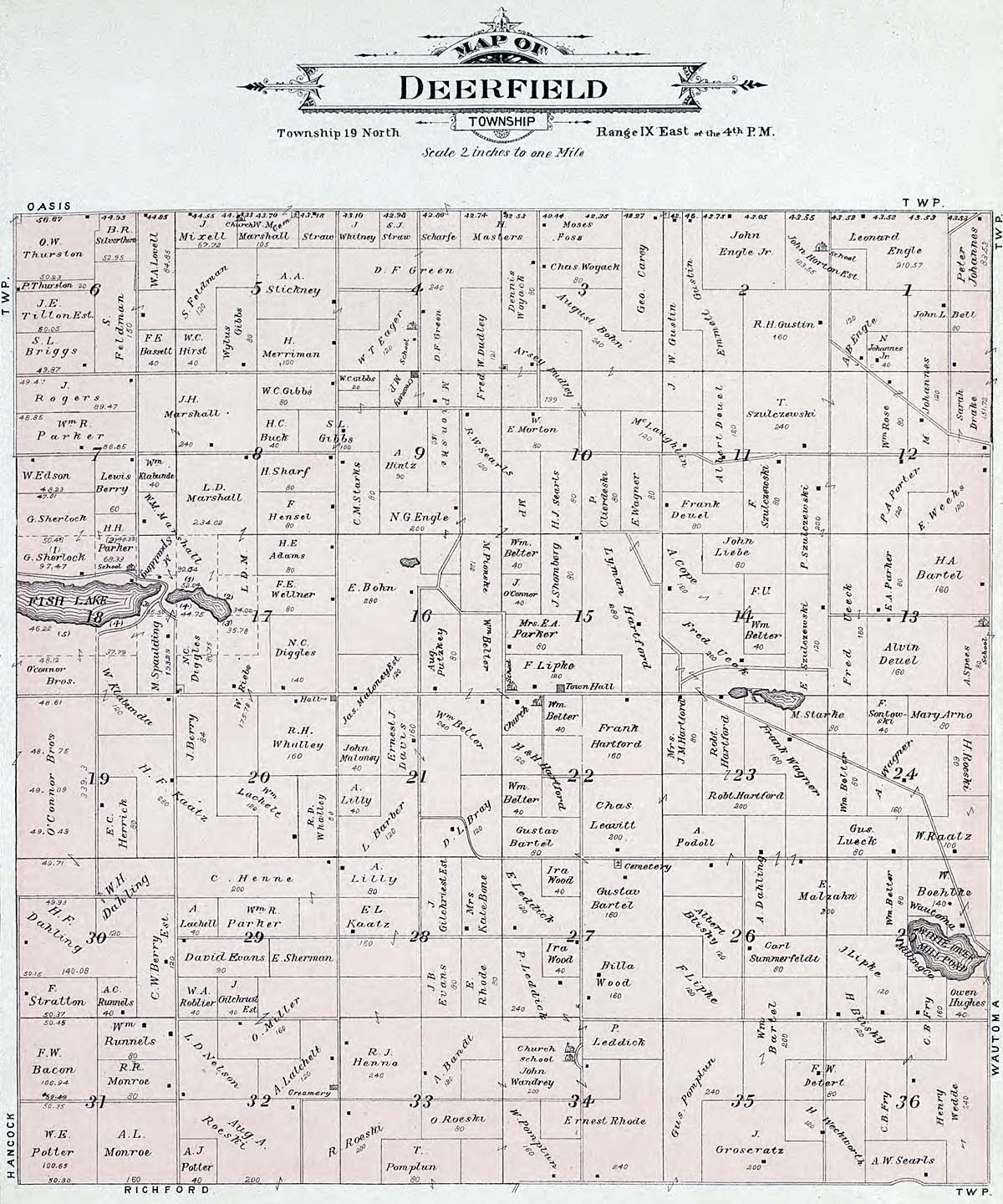
Deerfield
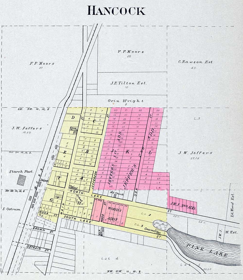
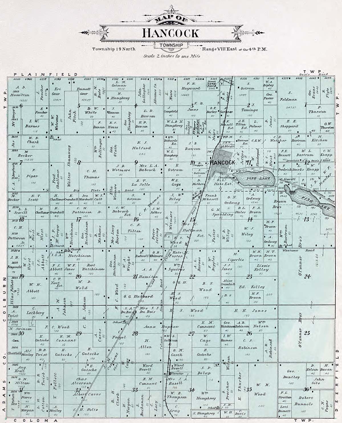
Hancock
Hancock Township
Leon
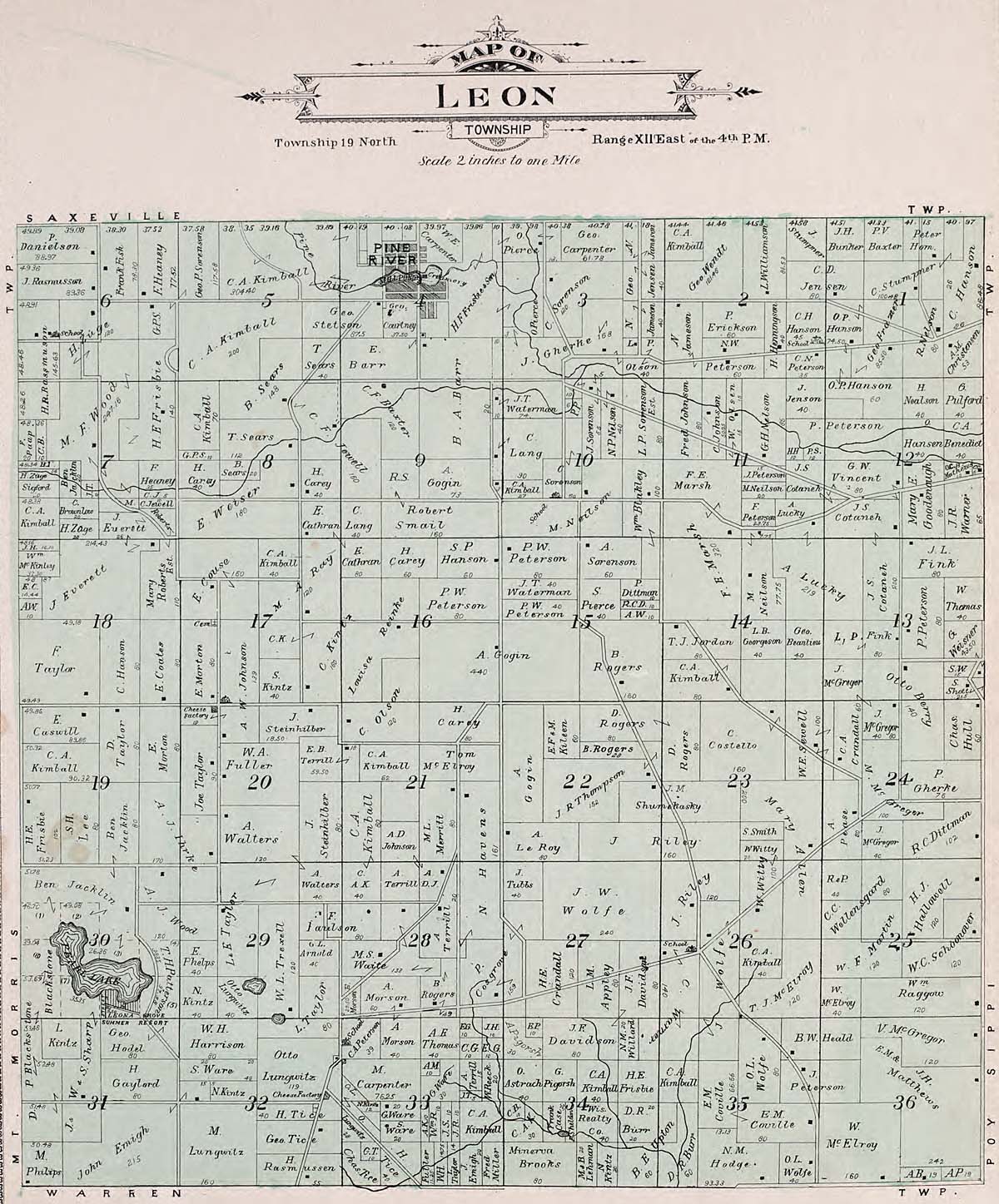
Marion
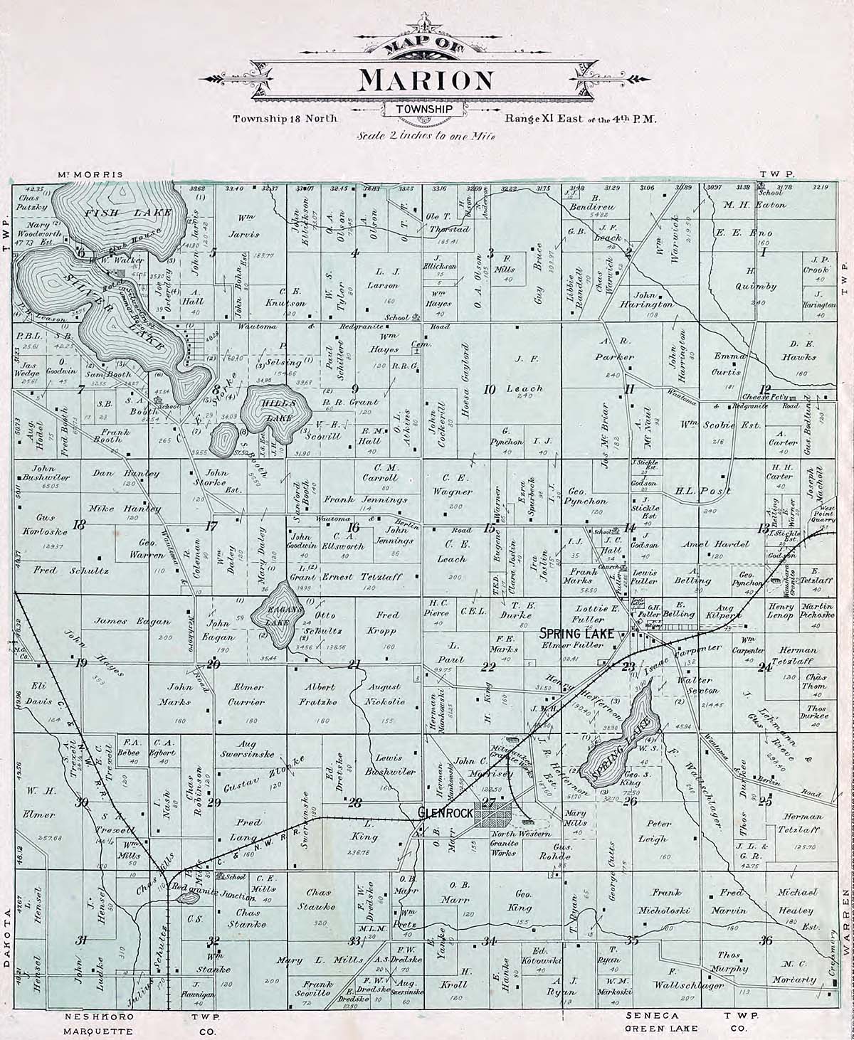
Mt Morris
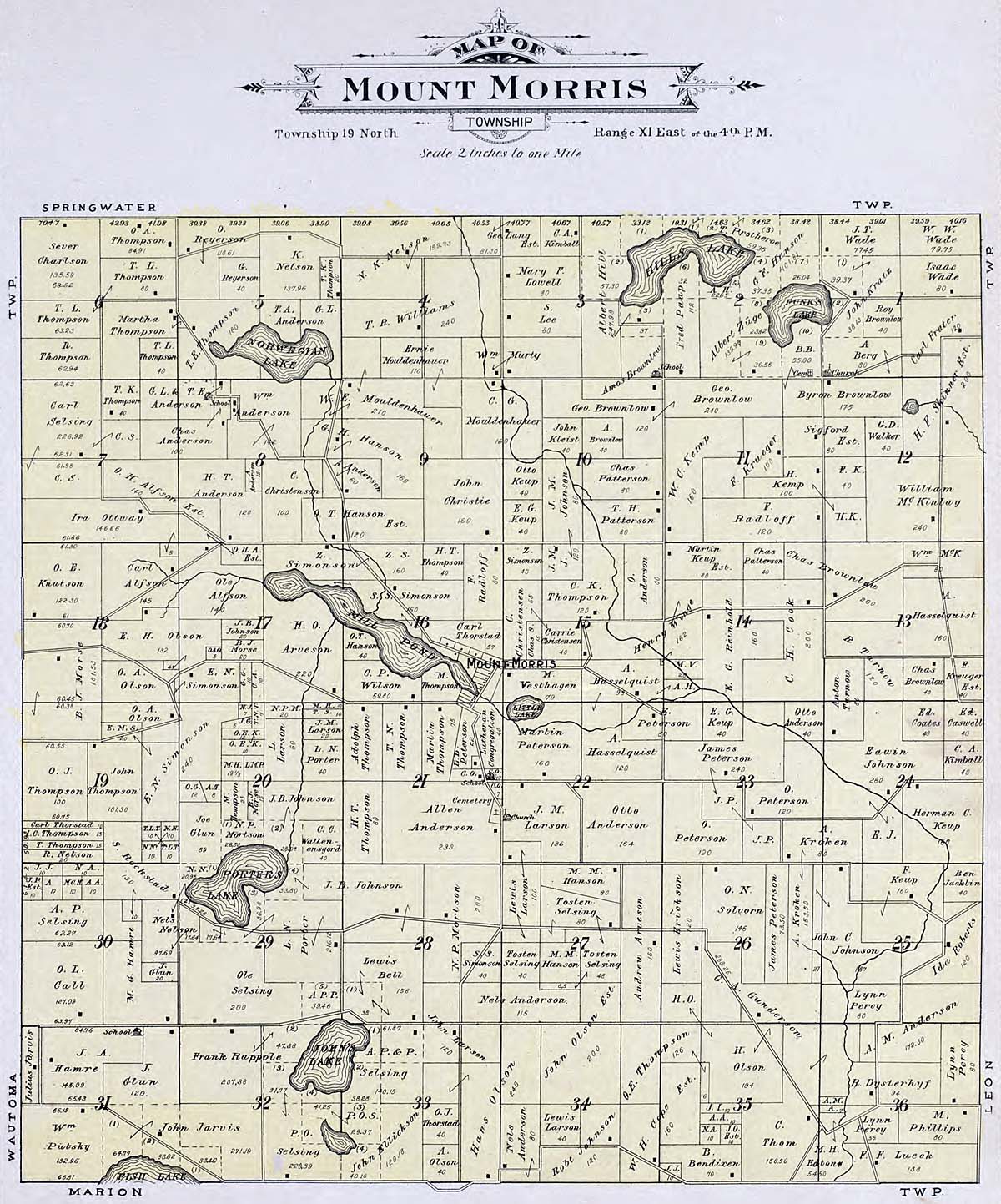
Oasis
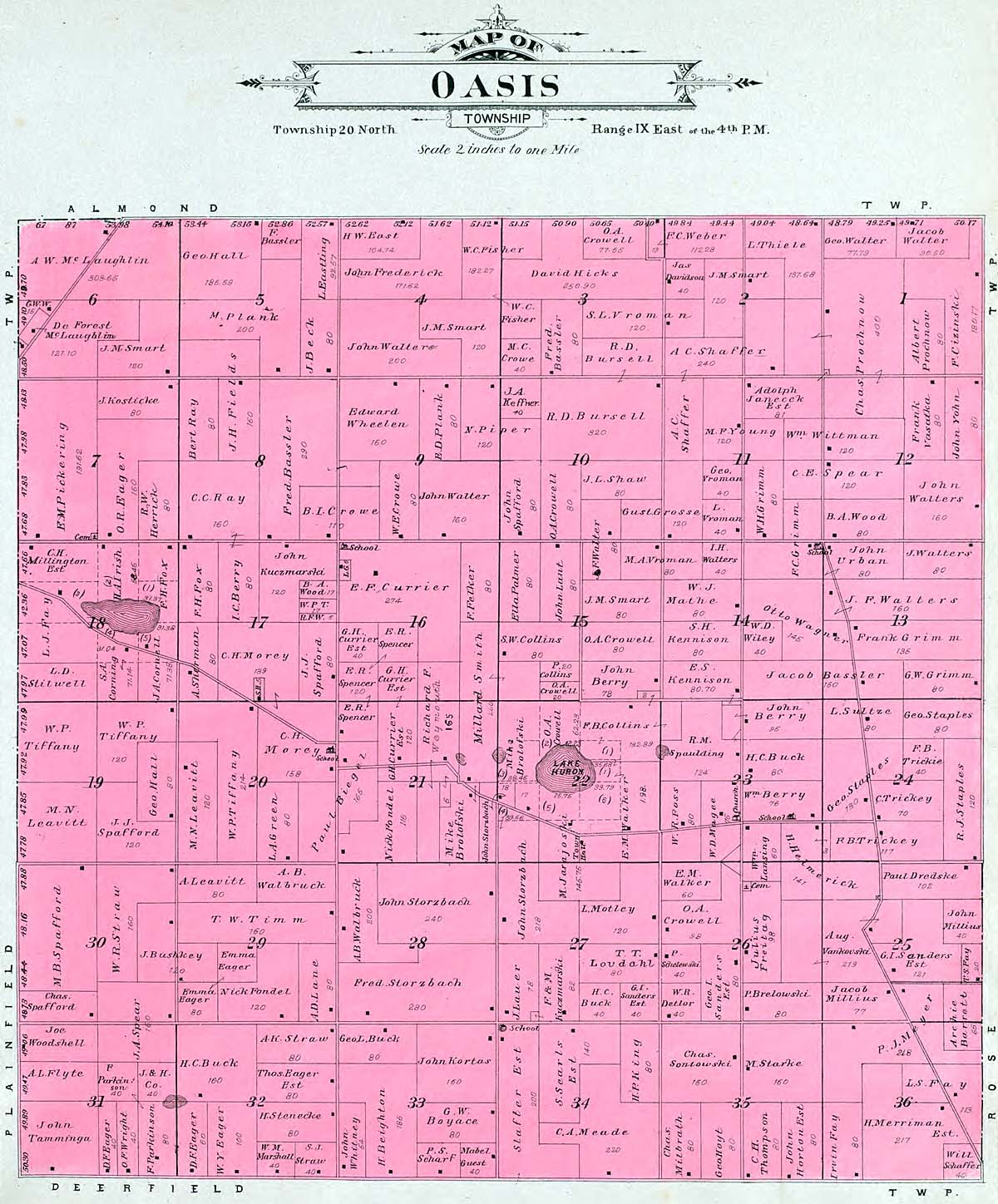
Pine-River
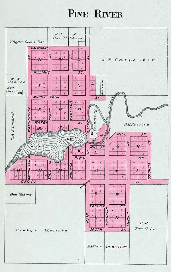
Plainfield
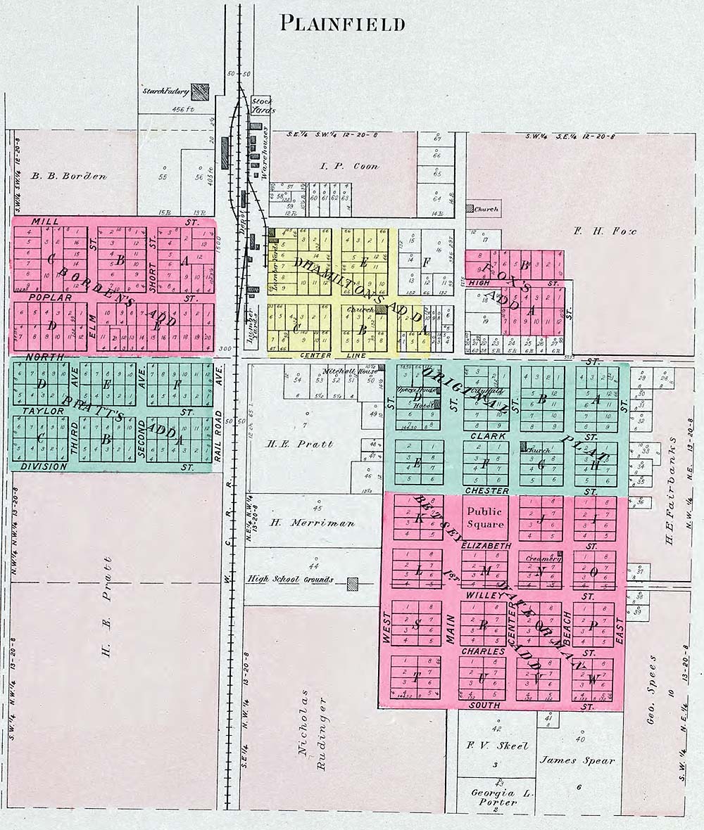
Plainfield Township
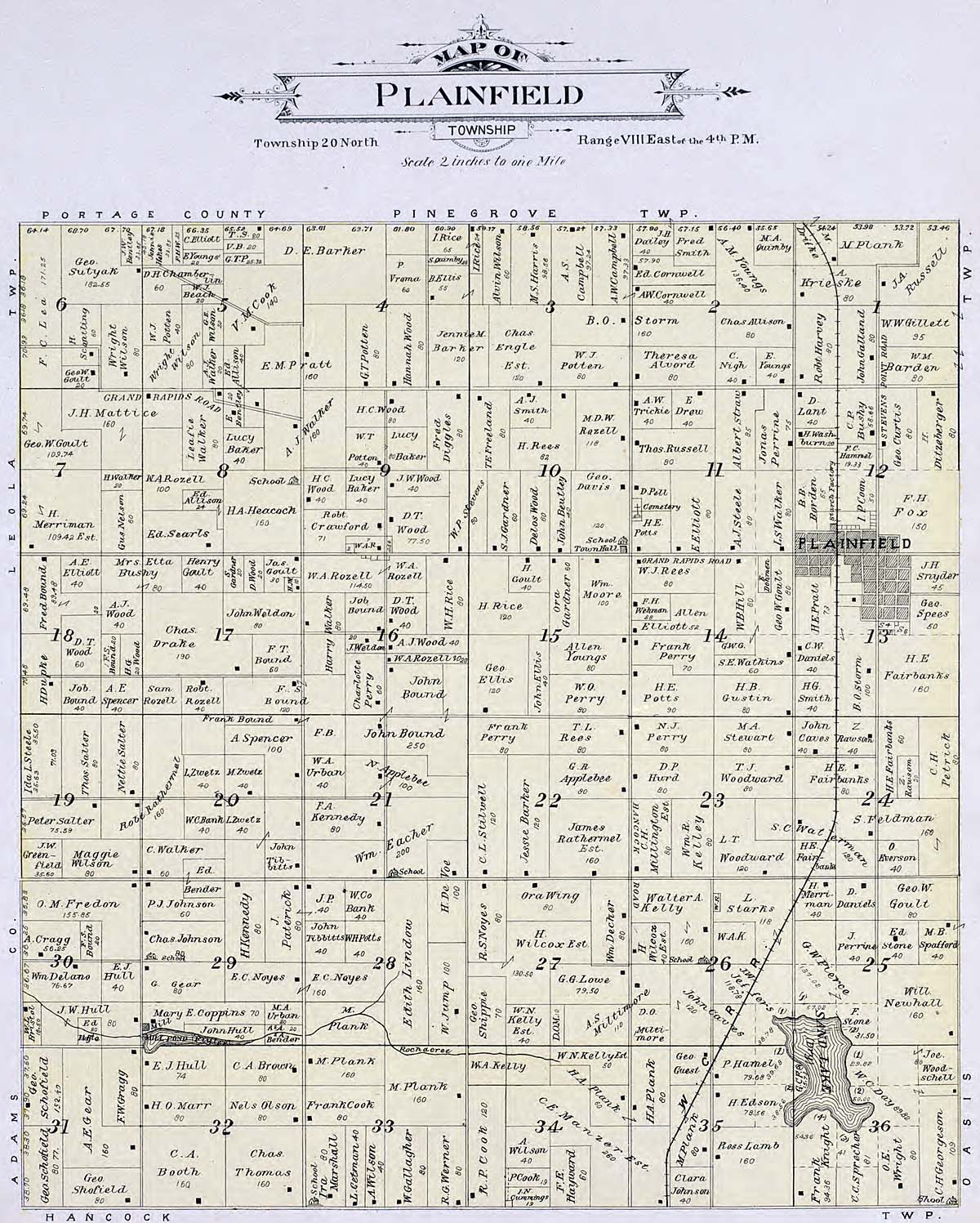
Poy-Sippi
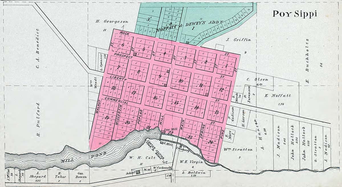
Poy-Sippi Township
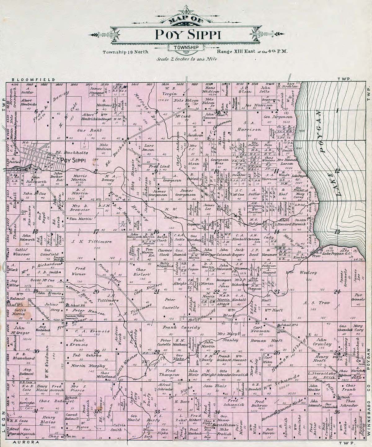
Red Granite
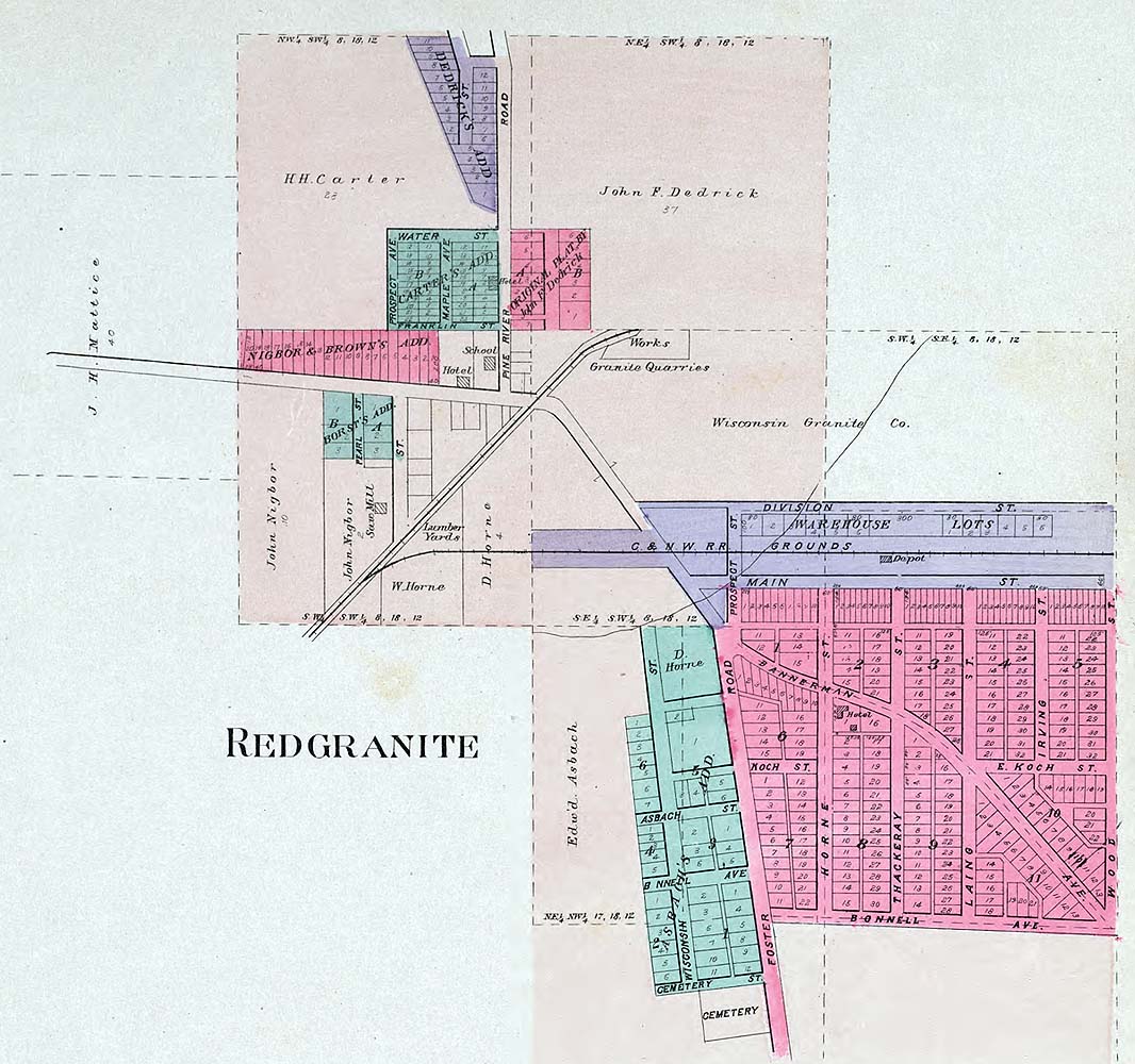
Richford
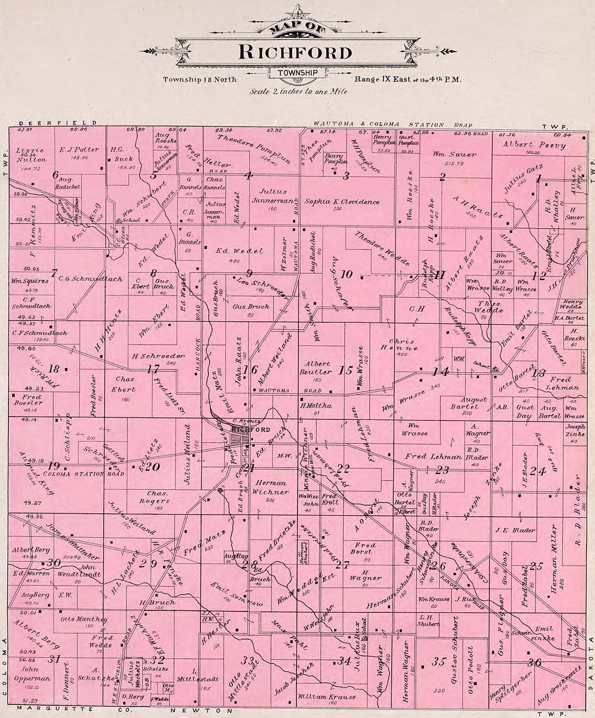
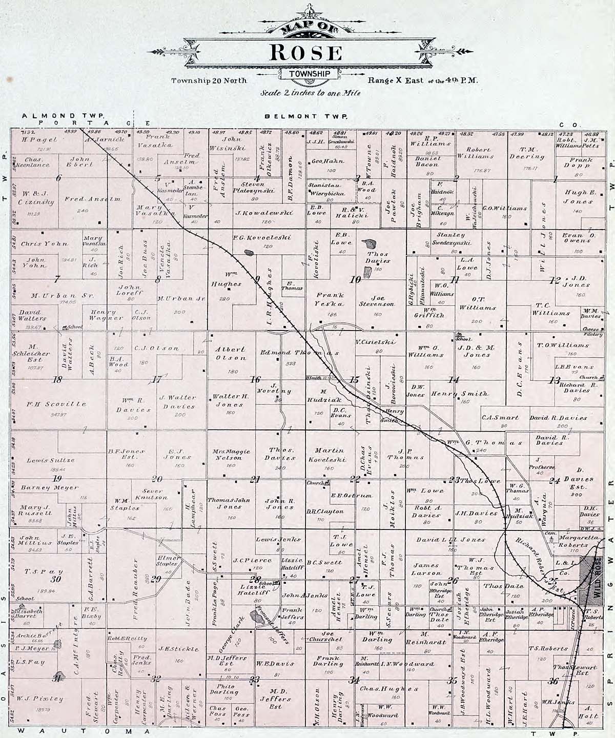
Rose
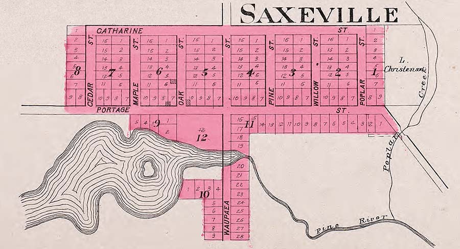
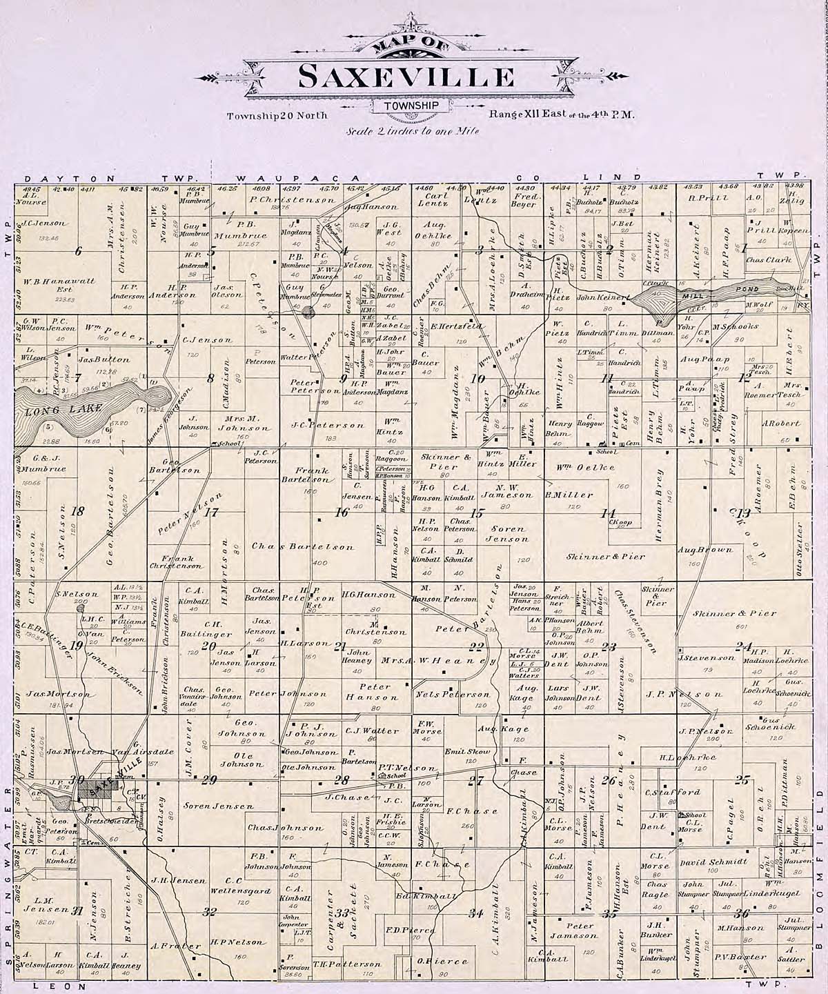
Saxeville
Saxeville Township
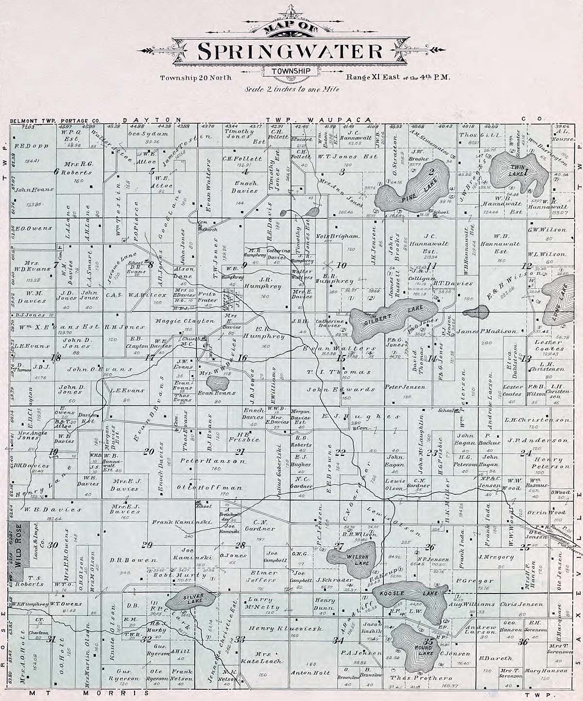
Springwater
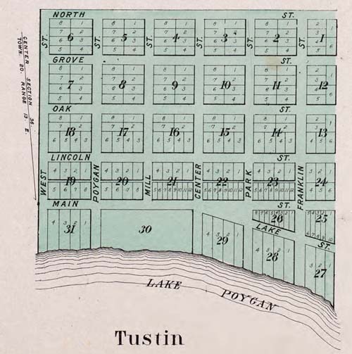
Tustin
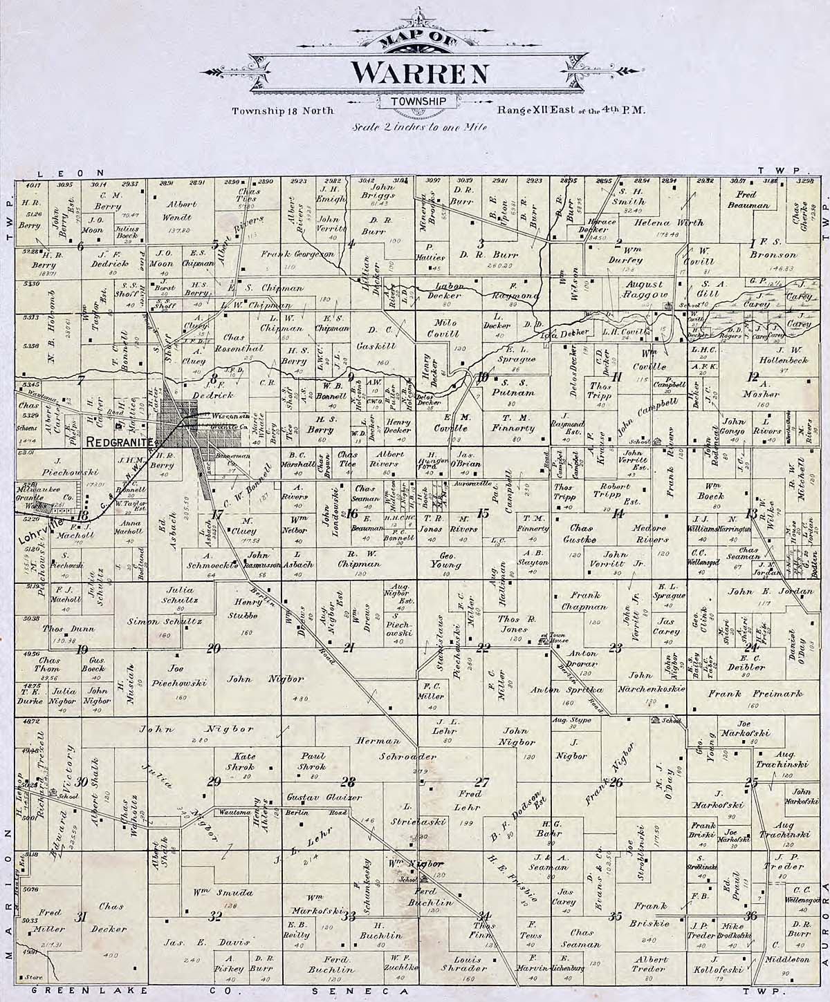
Warren
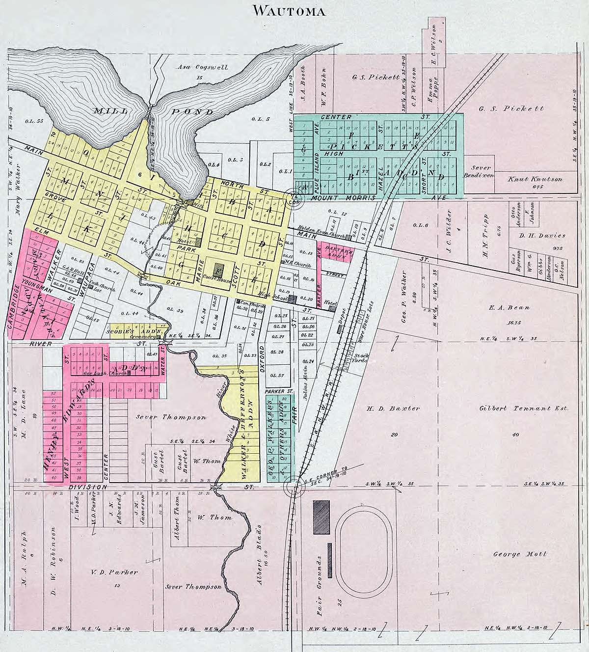
Wautoma
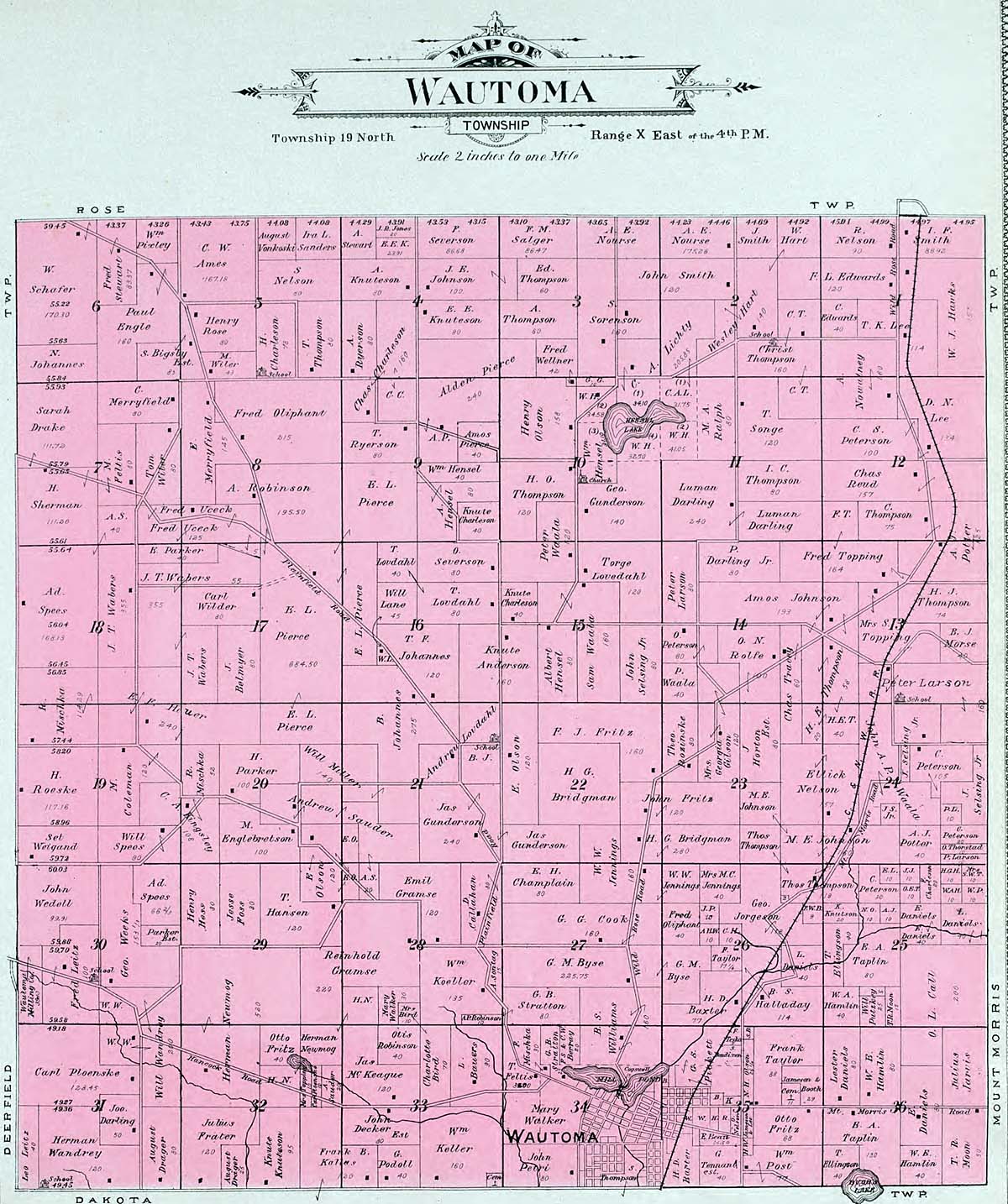
Wautoma Township
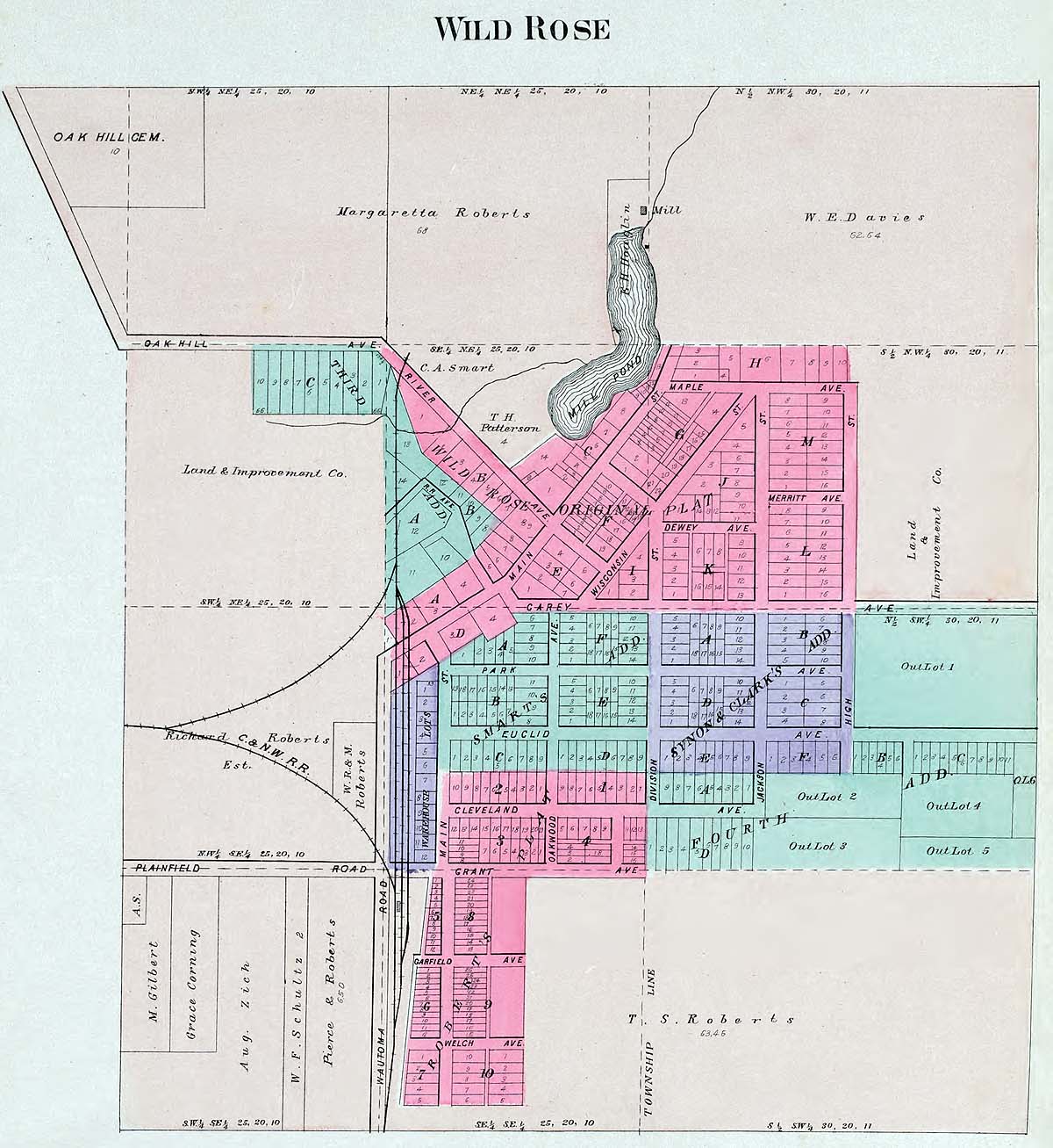
Wild Rose
Linda Russell Lewis
Coordinator
Joy Fisher
Assistant Coordinator