
State Map Coordinator:
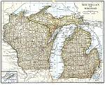 The following maps of Wisconsin and the Wisconsin Territory are online in the United States Digital Map Library, and are available for you to download. If you would like to be part of the Digital Map Library team and/or make contributions, please e-mail me, . Your contributions are both needed and appreciated!
Sawyer County Maps
Divided by Row & Column. (88-138 Kb each):
| 9 | 8 | 7 | 6 | 5 | 4 | 3 | |
|---|---|---|---|---|---|---|---|
| Row 37 | |||||||
| Row 38 | |||||||
| Row 39 | |||||||
| Row 40 | |||||||
| Row 41 | |||||||
| Row 42 | |||||||
Linda Russell Lewis
Coordinator
Joy Fisher
Assistant Coordinator