Pennsylvania USGenWeb Archives


1804 - 1904

Clearfield County's Centennial


Raftsman's Journal

Clearfield, Pa.


Pages 0 - 9


transcribed for the Clearfield County PA USGenWeb by

Ellis Michaels


Copyright

This page was last updated on 29 Nov 2012

Contribute


1804 1904
CLEARFIELD COUNTY'S CENTENNIAL

CELEBRATED AT
CLEARFIELD, PA.
July 26, 27, 28 and 29.

Population Clearfield County
1804 685
1904 100,000
One Hundred Years Old

RAFTSMAN'S JOURNAL
Clearfield, Pa.


printer friendly version


CORRESPONDENCE.


     The Centennial Executive Committee, having chosen J. Frank Snyder, Esq., to prepare a History of the County, the following correspondence took place.

Clearfield, Pa., June 3, 1904
J. Frank Snyder, Esq.,
Glen Cove, L. I.
Dear Sir:
     The committee having in charge the management of the forthcoming celebration of Clearfield County's 100th Anniversary have decided upon a printed History covering the 100 years of our county's growth, and have by resolution unanimously selected you as one well qualified to prepare such history.
     Will you kindly indicate at your earliest convenience whether or not you will undertake the task assigned you.
Very truly yours,
ALLISON 0. SMITH, CHAIRMAN.
J. H. CRISSMAN, SECRETARY.

Glen Cove, L. I., June 6, 1904
Gentlemen :
     Replying to your letter of June 3d, informing me that the committee having in charge the management of the forthcoming celebration of Clearfield County's 100th anniversary have decided upon a printed History, covering the 100 years of the county's growth and have selected me to prepare such history. I beg you on my behalf, to thank the committee for the confidence reposed in me, and to advise your associates that I will undertake the task assigned me. The article will, of necessity, be somewhat limited in its scope, yet it will be possible to present in condensed form some evidences of the county's growth, I am
Very sincerely yours,
J. FRANK SNYDER.

To HON. ALLISON 0. SMITH, PRESIDENT.

MR. J. H. CRISSMAN, SECRETARY.
Clearfield, Pa.


NOTE!


     This little volume is presented only as a Souvenir History of the County, ably and correctly prepared by J. Frank Snyder, Esq., of New York, but a native of Clearfield County, and member of the Clearfield bar. The illustrations may not meet the hopes of some, but the compiler found it impossible to insert the portraits of all who have helped make the history of Clearfield County, and the principal reason is that the descendants of the early pioneers were unable to furnish photographs of those whose portraits should have had a place in this Centennial History. Therefore we were compelled to use such as was at our command and selected them with a view of perpetuating the good and honorable name of Clearfield County, without any thought of descriminating [sic] against those whose portraits should have had an exalted position in this volume, but which the compiler was unable to obtain.


M. L. McQUOWN,
Compiler of Centennial History.
Clearfield, Pa., July 8th, 1904.


Clearfield County
Pennsylvania
One Hundred Years' Growth
1804 - March 26 - 1904

BY J. FRANK SNYDER
 

     CLEARFIELD.-A County of Pennsylvania named from a stream running through the County into a Western Branch of the Susquehanna. Morse. Am. Gazatteer, 3 Ed. Boston, 1810.

     Jacob King, alias Jacob le Roy, was killed with tomahawks at the spring on the Slenker farm, Buffalo Valley, Limestone Township, Union County, on the morning of the 16th of October, 1755, and his daughter, Anna Marie le Roy, her brother and a little girl who was living with them, were made prisoners and taken to Kittaning and other places where they were kept prisoners about three and one-half years. Marie le Roy and the little girl, on a division of the spoils, fell to the share of an Indian named Galasko, by whom they were taken to Jenkiklamuhs, a Delaware town on the West Branch of the Susquehanna (at or near where Clearfield is now located.) Here they remained ten days and then proceeded westward, leaving Marie le Roy's brother at Jenkiklamuhs.

     Marie le Roy was born at Brondrut, in Switzerland, and with her prisoner companions was among the first white persons to visit the territory now included within the boundaries of Clearfield County.

     Col. Burd's journal, under date of 18th of February, 1757, contains this entry :-
     "This morning the Indian chiefs desired to speak with me when it suited me. I told the messenger I should be very glad to see them directly. They accordingly waited of me at 10 A. M. and informed me that there was eight hundred French and Indians marcht from Fort Du Quesne agt this Fort and they were actually arrived at the head of the West Branch of this River (Sus-


2


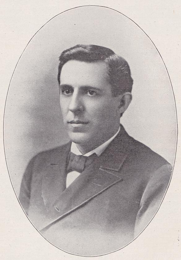
      J. FRANK SNYDER - The author of the written part of this history, was born in Clearfield, June 23d, 1855, graduated from the Leonard Graded School in 1876, admitted to the bar in 1878 ; was a member of the law firm of Orvis & Snyder, and is now a Corporation and Title lawyer in New York City.


3


quehanna) and were making canoes and would come down as soon as they were made and desired me to believe this for truth, to be upon my guard, and to fight as long as I had one man alive. I gave them for answer that I was very much obliged to them for this peace of Intelligence, that I was ready to Receive the enemy and that they might Depent I would follow their advice."

     McGinniss, in a foot note in his "History of the West Branch Valley" at page 214 says : "That the French seriously contemplated an invasion of the West Branch Valley in force, for the purpose of seizing this portion of the Province, there is no doubt, but there is no evidence on record that a large expedition was ever started for that purpose. But that scouting parties were despatched for the purpose of reconnoitering the country and reporting its condition and the strength of the English to the French Commandant, there is no doubt. It was a party of this kind that was reported to Col. Burd. The party doubtless concentrated at Chinklecamoose and there made preparations to descend the river on rafts, or floats, but it is extremely doubtful that it numbered 800 men."

     The report, true or untrue, put Col. Burd on his guard, and on Thursday, April 7th, 1757, Capt. Patterson set off from Fort Augusta (Shamokin) with a party of ten men in quest of intelligence under orders from Col Burd, "To proceed up the West Branch of the River (Susquehanna) as far as SHINGLACLAMUSH, keeping a good lookout all the way and marching as close to the River as he could, in order to Discover if any body of the Enemy was upon the River : and if he should make a Discovery, to be very particular in endeavoring to observe the Numbers, and what they were employed about, and to bring a prisoner, if he found it any ways practicable; but not to Discover himself or any of his party, if he could avoid it; to observe whither the Enemy was cheefly composed of French or Indians. If he should discover a Body of the Enemy to post himself and party on the tope of the most convenient adjacent hill, to be free from discovery, and have at the same time a good prospect of the enemy, and there to lay one day, making particular observations of their motions ; and in case he should discover any particular place that they frequented, to march to that place in the night, and lay in ambush until morning and try all he could to bring of a prisoner, which he might find santering out by himself ; and in this Case to Return to this Fort with all convenient speed ; Recommending to come by water if he could find canoes.

     "But in case he could make no discovery between & SHINGLACLAMUSH, not at that place, to proceed up the South branch of the River from the Fork at SHINGLACLAMUSH & examine that branch; and follow the above orders to go to the head of that branch; and if he found the enemy was not there to return to SHINGLACLAMUSH and to go up the North branch from that place." (Col. Burd's Journal.)

     In a letter to the Proprietors, under date of 9th April, 1757, Governour Denny wrote :- xx "I ordered a strong Detachment under Col. Clapham towards the Ohio to act offensively, and, if possible, destroy an Indian Town ; but intelligence arriving before these orders could be carried into execution that a large body of French and Indians was coming to beseige the Fort, they were obliged to lay the expedition aside. This account proving false, Col. Clapham xxxx sent out a Captain's command to attack an Indian town called


4


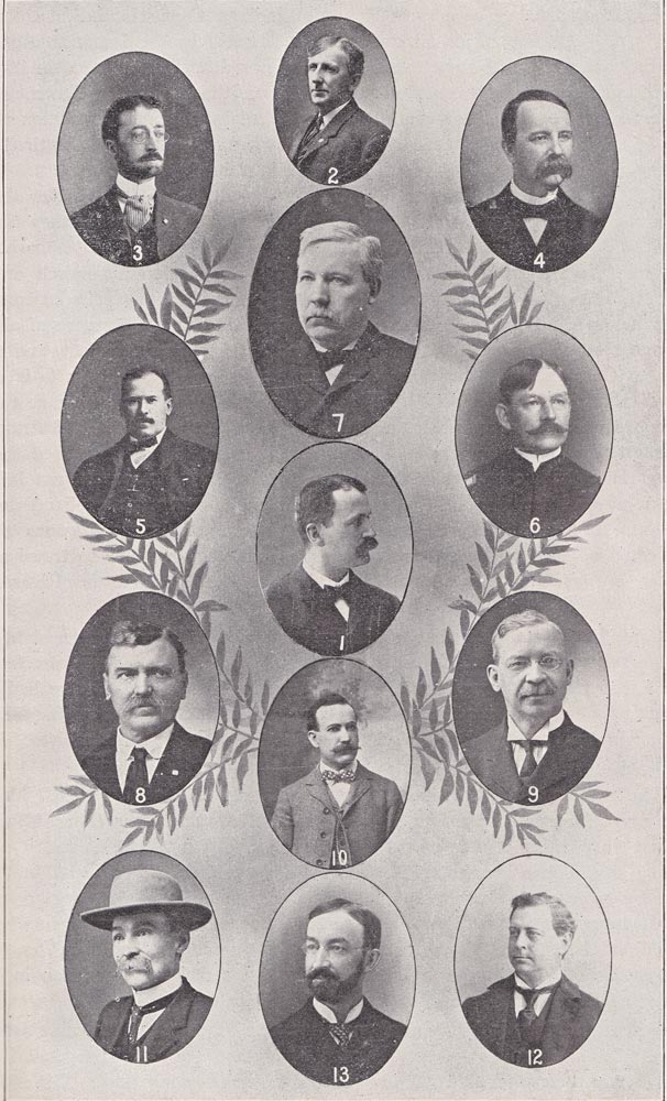
EXECUTIVE COMMITTEE

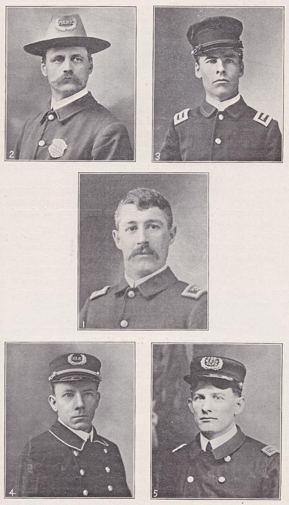
Hon. Allison 0. Smith. 2. J. H. Crissman. 3. E. E. Lindemuth. 4. Hon. M. L. McQuown. 5. Hon. A. E. Patton. 6. Capt. J. E. Harder. 7. Prof. E. C. Shields. 8. John C. Barclay. 9. Smith V. Wilson. 10. Samuel R. Hamilton. 11. Geo. I. Thompson. 12. Matthew Savage. 13. Benj. P. Chase.


5
 

Shingleclamouse, situate near the Head of the West Branch of Susquehanna, where was supposed to be a great Resort of Indians, Capt. Hambright entered the Town, found the cabins all standing but deserted by the Indians. Agreeably to his orders he did not touch anything, nor destroy the Town, in hopes the Indians would come and settle again. This was the only Indian Town could be attacked :" and, the letter continues "We found by a second expedition that they (the Indians) had returned, set their Town on Fire and were retired to Venango, situate where the River au Boef runs into the Ohio."

      Col. Burd's Journal, under date Monday, 25th April, 1757, states that : "This day at noon Capt'n Patterson arrived with his party all well : they came down the River upon Rafts ; Capt'n Patterson reports, x x x. That he marched to Shinglacamuch, saw no Indians nor French either upon his march or at the Town ; the road that leads from Buchaloons passes along by Shinglaclamuch and forks on the South side of the Susquehanna River at the distance of abo't 40 from that Town ; one road from that fork leads to Fort Augusta, and the other to Cumberland County : that both are very much frequented ; & it appeared to him the enemy used them constantly when they came to make their incursions upon this Province : that the cheaff part of the houses at SHINGLACLAMUCH were burnt down, and he imagined that no Indians had lived there a long time : that he was obliged to return from SHINGLACLAMUCH, not being able to proceed for want of Provisions, he and his party having lived upon Walnutts for three days : the country was so excessively mountainous that they could not find any game to kill, and the men were not able to travel any further in this situation, which obliged him to return down the River on Rafts."

     Capt. Levi Trump in charge of garrison at Fort Augusta under date of July ye 1st, 1758, wrote to Governor Denny as follows : x x "I received a letter from Lieut. Colonell James Burd, dated ulto,, informing me that he had an account of a body of French that are erecting a Fort at Shinglaclamuch (Clearfield), and 'tis thought they design to attack this place." Pa. Archives, Vol. III, p. 430.

     The location of this fort is not known to the residents of Clearfield. Many years ago subterranean passages or caves were discovered on the farm of Jacob Guelich, just within a mile and a half North West of Clearfield, and it was reported that a horn such as used by the Indians was found in this cave, but the place has never been thoroughly explored to determine its real character—nor does it appear that there is any substantial proof of a fort ever having been erected at this point. Frederick Post, the distinguished Moravian, reached Shinglimuce (Clearfield) on 2nd August, 1758, but makes no mention in his journal of there being a French fort at this place.

     FREDERICK POST in his journal 2nd August, 1758, says : "We came across several places where two Poles, Painted Red, were stuck in the ground, in order to tye their Prisoners; we arrived this night at Shinglimuce [Clearfield] where was the above marks : tis a disagreeable and melancholy sight to see the means they make use of, according to their critical way, to punish Flesh & Blood."

     Mr. Post says, under date 14th Sept., 1758, "We came to Susquehanna &


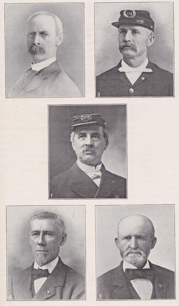
     SOLDIER'S COMMITTEE;--1. Capt. Geo. D. Runk. 2. Capt. P. A Gaulin. 3. Capt. W. P. Harpster. 4. Col. E. A. Irvin. 5. W. B. Beamer. Capt. G. Woodring, a member of this committee was unable to furnish photograph in time.


7
 

crost 6 times & came to Calamaweshink (Chinklecamoose) where had been an old Indian Town; in the Evening there came 3 Indians and said they saw two Indian tracts where we slept turn Back, so that we were sure that they followed us."

     These records establish the fact that there existed an Indian town of great importance on the West Branch of the Susquehanna. Whether referred to as Jenkiklamuhs, Shingleclamush, Shingleclamouse, Shinglecamuch, Shinglecamuce, Calamaweshink, Chinglelamouk, Chingleolamoak, Chingleolamuk or "Chingleclamouche old Town" as designated in the Records of the Land Office —or Chinkleclamoose, as now most commonly used, we are told is corrupted from "Achtschingi-Clamme" which according to Reichel, Translation of the Moravian Historical Society, signifies "it almost joins" or it may, according to another authority (Bureau of Ethnology U. S. Smithsonian Institution) be derived from Achtochingi Cammui, meaning "at the calm or quiet hill," or "lying still at the hill," which bear practically the same meaning and involve also the definition given by Boyd as, "it almost meets to-gether" or "Nearly joins" in allusion to the narrows. Bishop Ettwein ( Journal 16th July 1772) tells us the name signifies "No one tarries here willingly."

     Chingleclamouche, the famous chief, lived in Wayne Township, Clinton County, in an Indian town located on the Montgomery farm, near Wayne station, called Patterson, over which a chief by that name, of the Shawnee tribe, ruled. (Hist. W. Br. Valley.—McGinness, 79.) From Patterson the great chief came to the spot on which Clearfield Borough is located and builded unto himself a town which was known as "Chingleclamouche old Town." How long he ruled, or the number of his children, has not been recorded. Neither are we informed by Capt. Hambright, or Capt. Patterson, if, in April, 1757, the old chief set fire to his town and "retired to Venango," or whether he had long previous gone to the Happy Hunting Grounds. This much can be stated with reasonable certainty, "Chingleclamouche Old Town" was a matter of history as early as April, 1757, and surely so on August 2nd, 1758, when Frederick Post sojourned at the place "where had been an old Indian town."
It should also be observed that the stream now known as Clearfield Creek was designated, in the military orders, as the "South" branch of the River.
 

EARLY MAPS.
 

     Upon a "Map of the Improved parts of the Province of Pennsylvania" by Nicholas Scull, January 1, 1759, "Chingleclamouche" is located.

     Chinglelamouk, Mushannon Creek, Clearfield Creek, Chest Creek and Canoe Place all are located on the W. Scull map published April 4th, 177o. This map also locates an Indian path from Bald Eagle Creek to Chingleclamouk, and another leading from Frankstown (Blair Co.), crossing the head waters of Clearfield Creek, Chest Creek and the West Branch at Canoe Place, to Venango Fort.

     The Evans map of 1775, a map of the Colonies, 1765, and a "Map of the Frontier of the Northern Colonies with Boundary line established Between them and the Indians at the Treaty held by S. Will Johnson at Ft. Stanwix, in Nov., 1768," do not give any of the data given on the W. Scull map.

     "The map of Pennsylvania exhibiting not only the Improved parts of that


8


FIREMEN'S COMMITTEE


I. Harry G. Ogden. 2. James McBlain. 3. Ward Logan. 4. V. L. Robins. 5. H. C. McIlvain.


9


Province but also its extensive Frontiers, laid down from actual surveys, etc." Pub. by Robert Sayer & J. Bennett, London, June loth, 1775, locates Chingleomuk, and Clearfield Creek, and the Indian path from Bald Eagle Creek where Beach Creek enters that stream to Chingleolamuk is shown.

     "A new map of the Western Parts of Virginia, Pennsylvania, Maryland, &c.," by Thos. Hutchins, Captain of the 60th Regiment of Foot, London, Nov. 7th, 1778, gives Chingleolamuk, Clearfield Creek and the Indian Path from Bald Eagle Creek to Chingleolamuk.

     The Reading Howell map, 1791, shows Clearfield Creek as a branch of the West Br. of the Susquehanna, and in Huntingdon County.

     It will be recalled that as part of the orders given Captain Patterson on April 7th, 1757, "in case he could make no discovery between & Shinglaclamush not at that place, to proceed up the South Branch of the River from the Fork at Shinglaclamush & examine that branch." The South Branch was none other than Clearfield Creek, but not until 1770 does this last name attach to that stream—and why, we may ask, was it so named?

     Bishop Ettwein, in his journal under date of July 14th, 1772, answers our question, "Reached Clearfield Creek where the Buffaloes formerly cleared large tracts of undergrowth, so as to give them the appearance of cleared fields ; HENCE, the Indians call the creek CLEARFIELD."

     An inspection of several of the maps would indicate that Chingleclamouche was located at the mouth of Clearfield Creek, such also appears from the orders to Captain Patterson, but this question in geography is also settled by a reference to Bishop Ettwein's journal, July 16th, 1772, "After representing the state of our case to the malcontents, I felt reassured, and journeyed on with a few brethren two miles in a pelting rain to the site of Chinklacamoose," which locates the old town within the present limits of Clearfield borough.
 

TREATIES.
 

     The Indian troubles in Pennsylvania for the proprietary period ended with the treaty of Fort Stanwix (now Rome, N. Y.), on Nov. 5th, 1768, with the Six Nations, which conveyed to the proprietors all the land within a boundary extending from the New York State line on the Susquehanna, past Towanda and Pine Creek, up the West Branch to its source, over to Kittaning, and thence down the Ohio to the extreme Southwestern portion of the Province. This was called the New Purchase; and within its boundaries is included that portion of Clearfield County lying South and East of the West Branch of the Susquehanna.

     From 1768 until 1784 the Northwestern boundary line of the Indian purchases remained unchanged. During that period THE DECLARATION OF INDEPENDENCE was adopted, Pennsylvania became a State and made a constitution. After peace was concluded, the State, under the treaty of Fort Stanwix, dated October 23rd, 1784, purchased all the remaining. land within its charted limits. This purchase was confirmed at Fort McIntosh in January, 1785, and is known as the "Last" purchase. That part of Clearfield County lying North and West of the West Branch of the Susquehanna, is included within the limits of this purchase.

     Day, in his Historical Collection, of Pennsylvania, says, "This vast territory,


Turn to Pages 10 - 19


Return to Top of Page


Return To Clearfield County Main Index Page


Ellis Michaels, Clearfield County PAGenWeb Archives File Manager


Copyright 2009, USGenWeb Archives