

Union Parish Louisiana |
|---|
![]()
1930 Union Parish Louisiana Census Images
To see a list of the contributors who helped make the Union Parish censuses available, visit our
Census Acknowledgements Page
- Subdivisions used in the 1930 Census
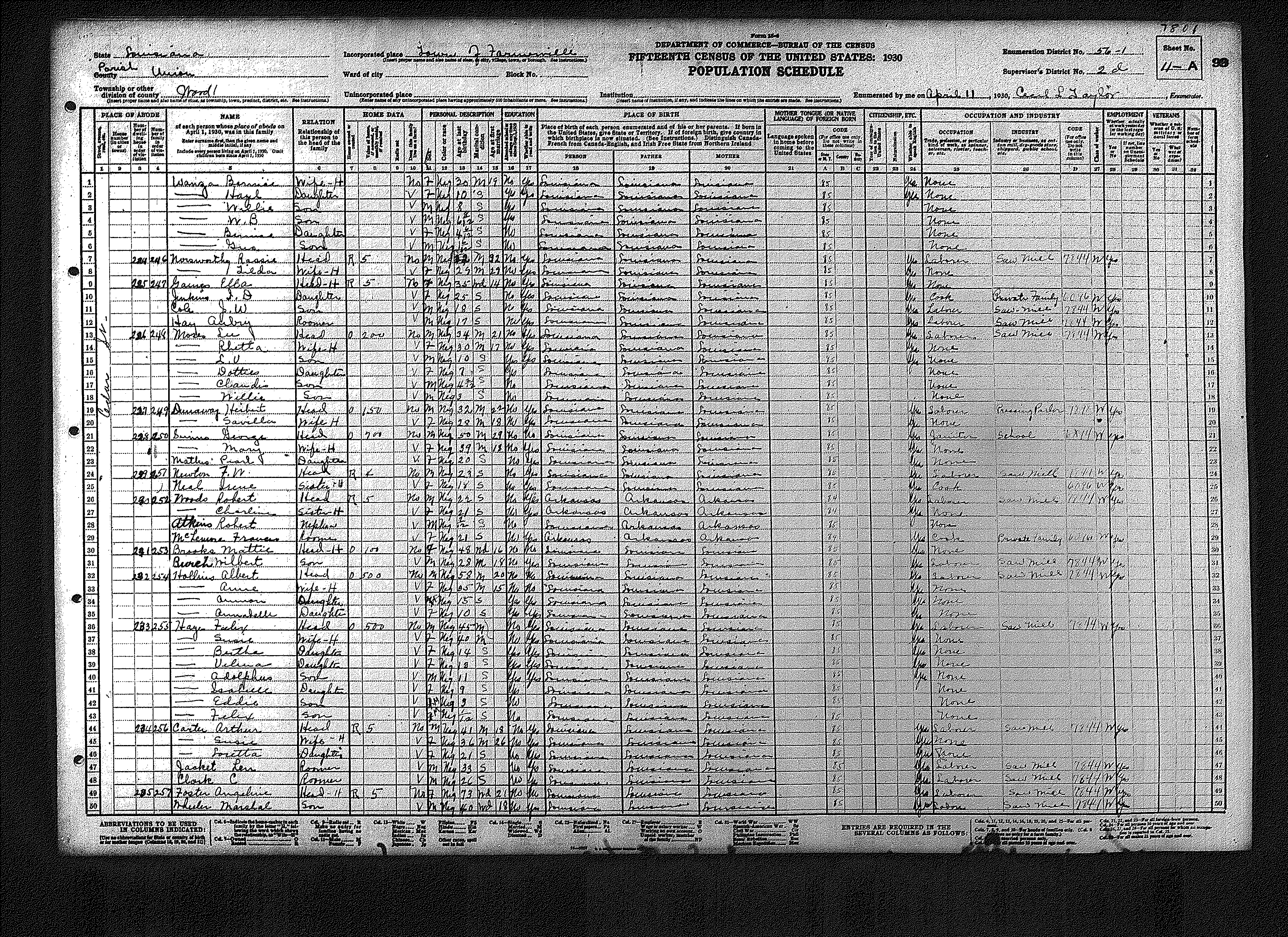
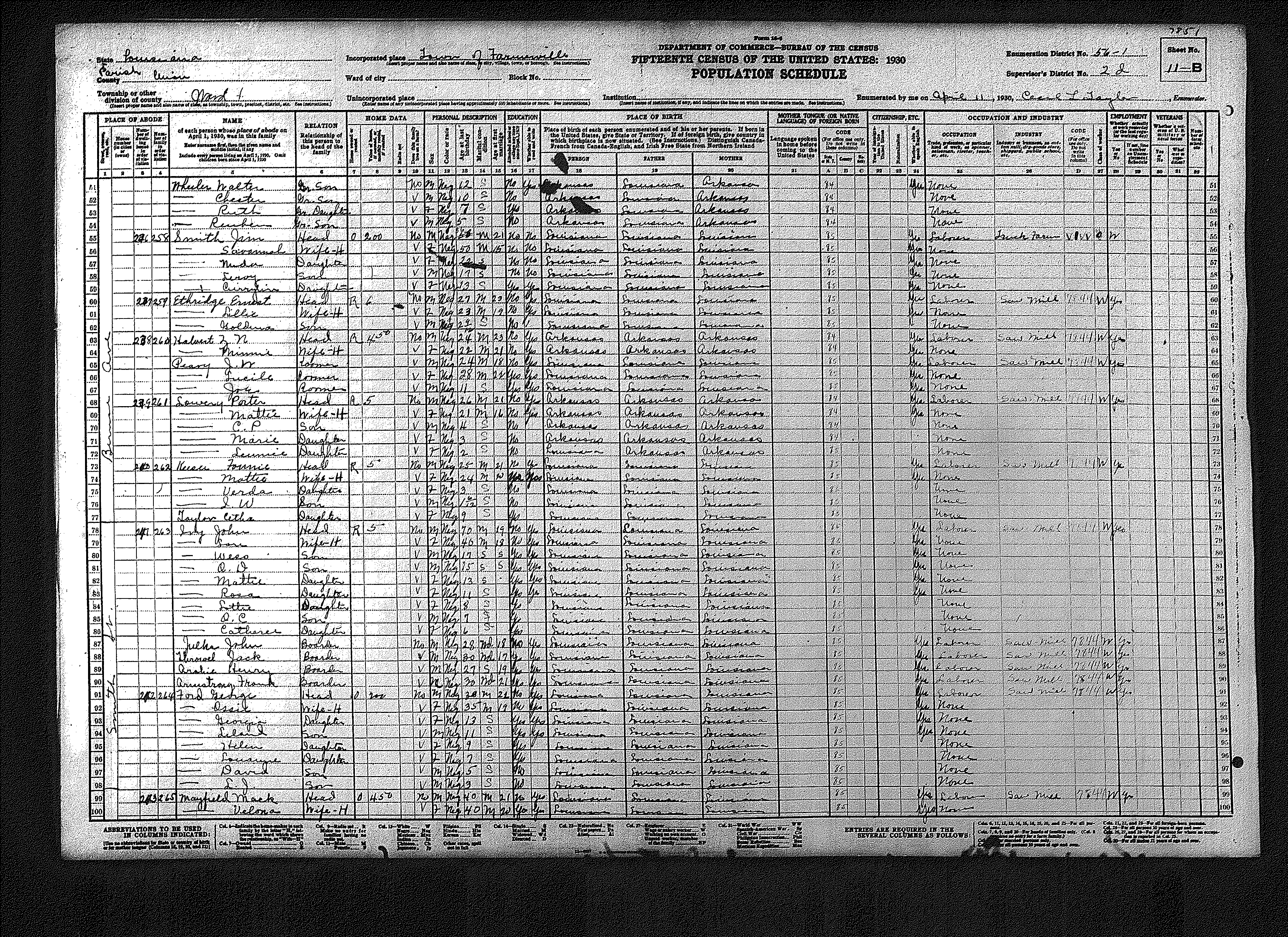
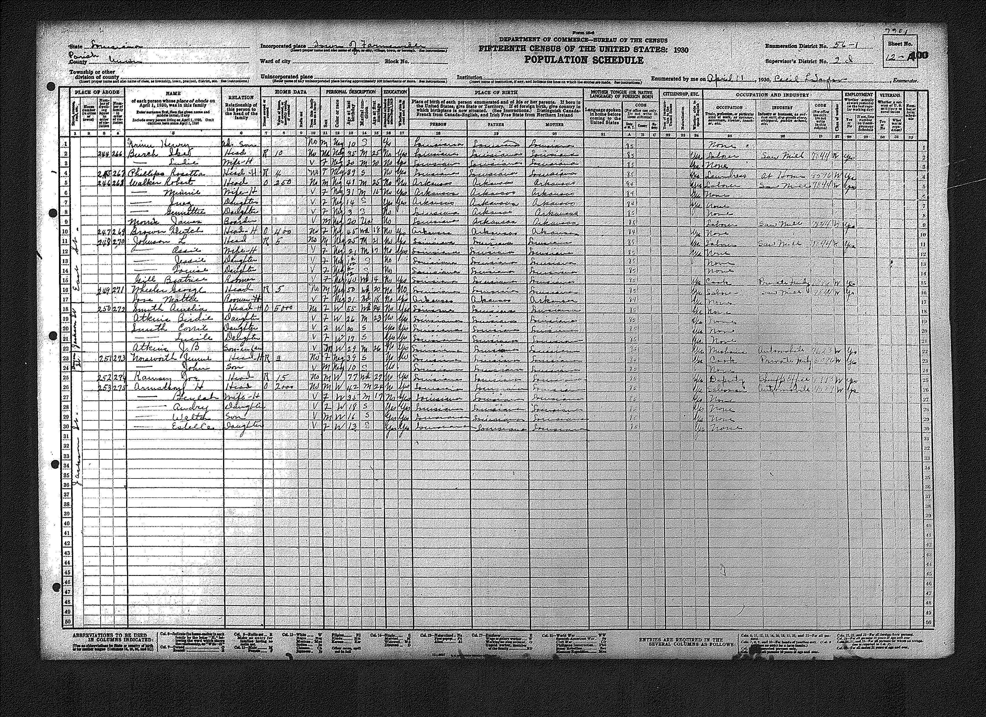
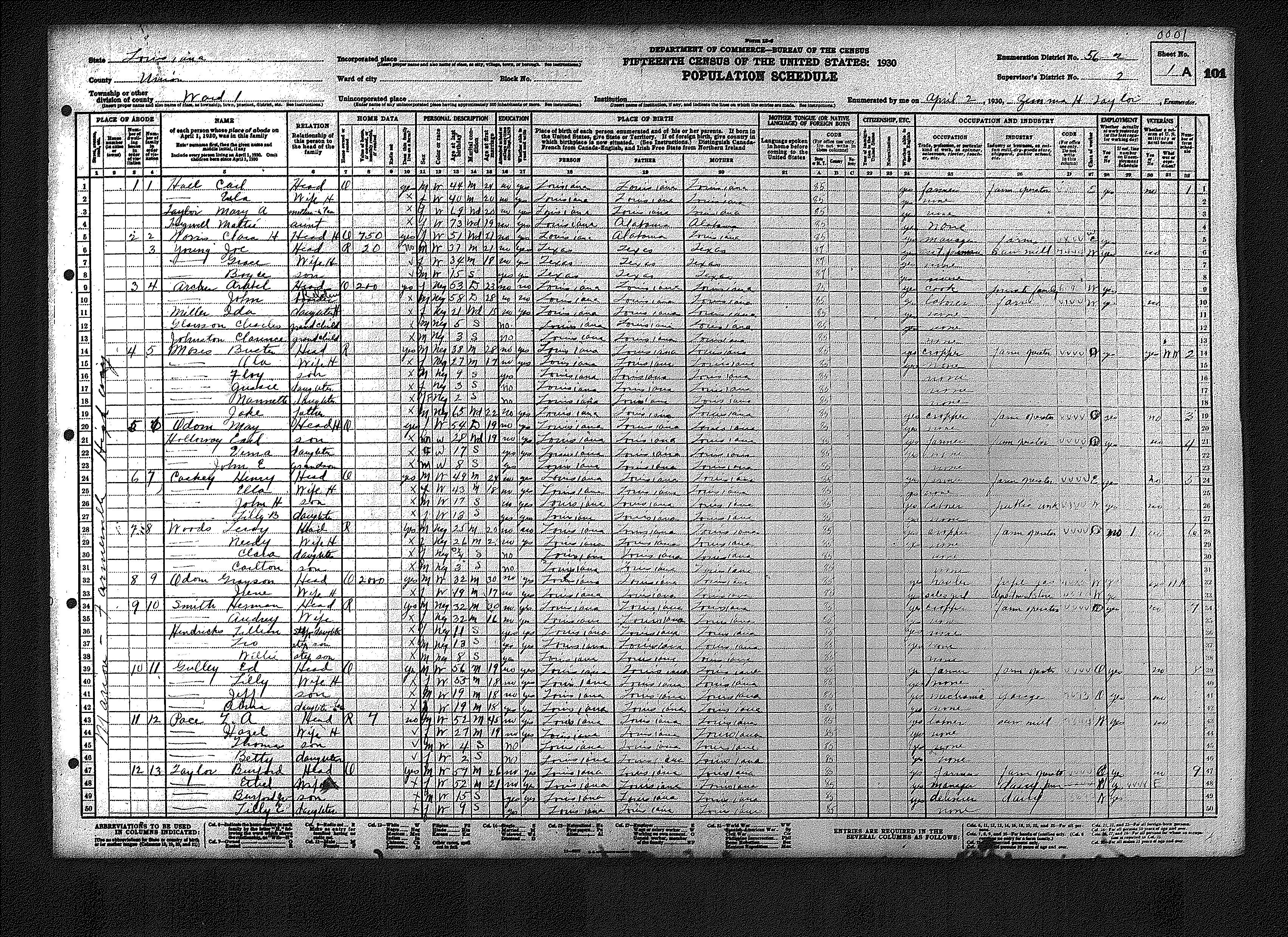
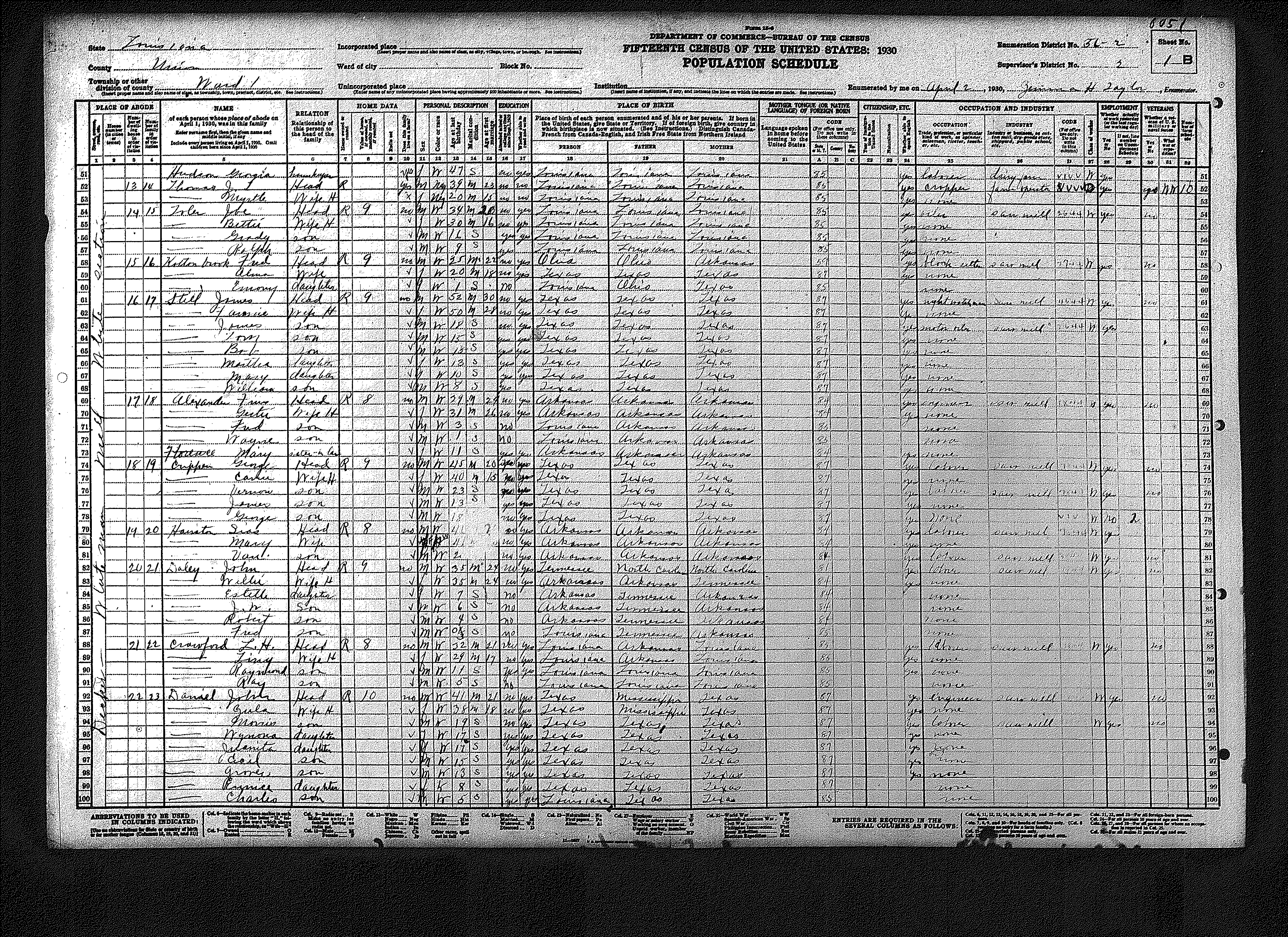
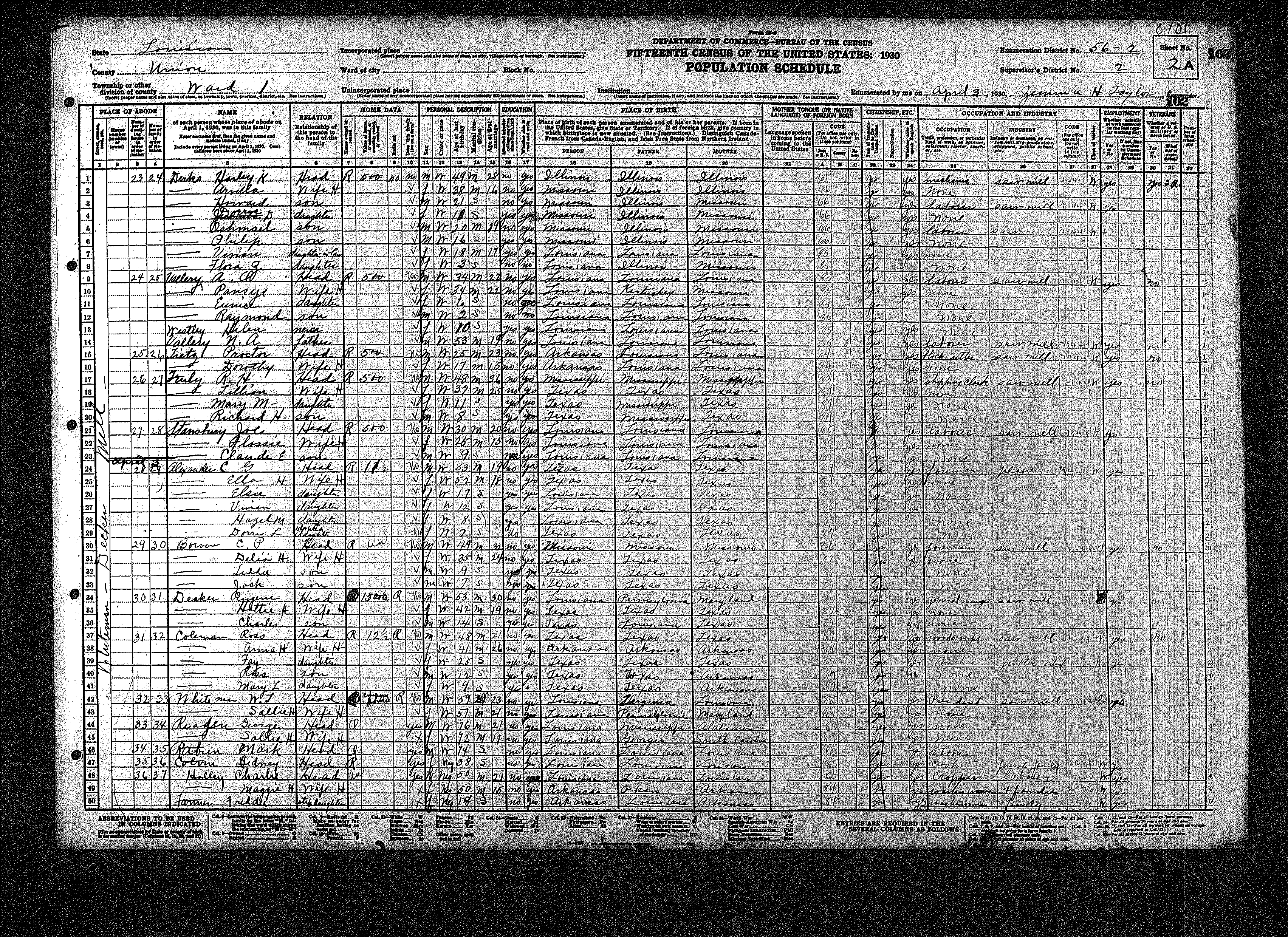
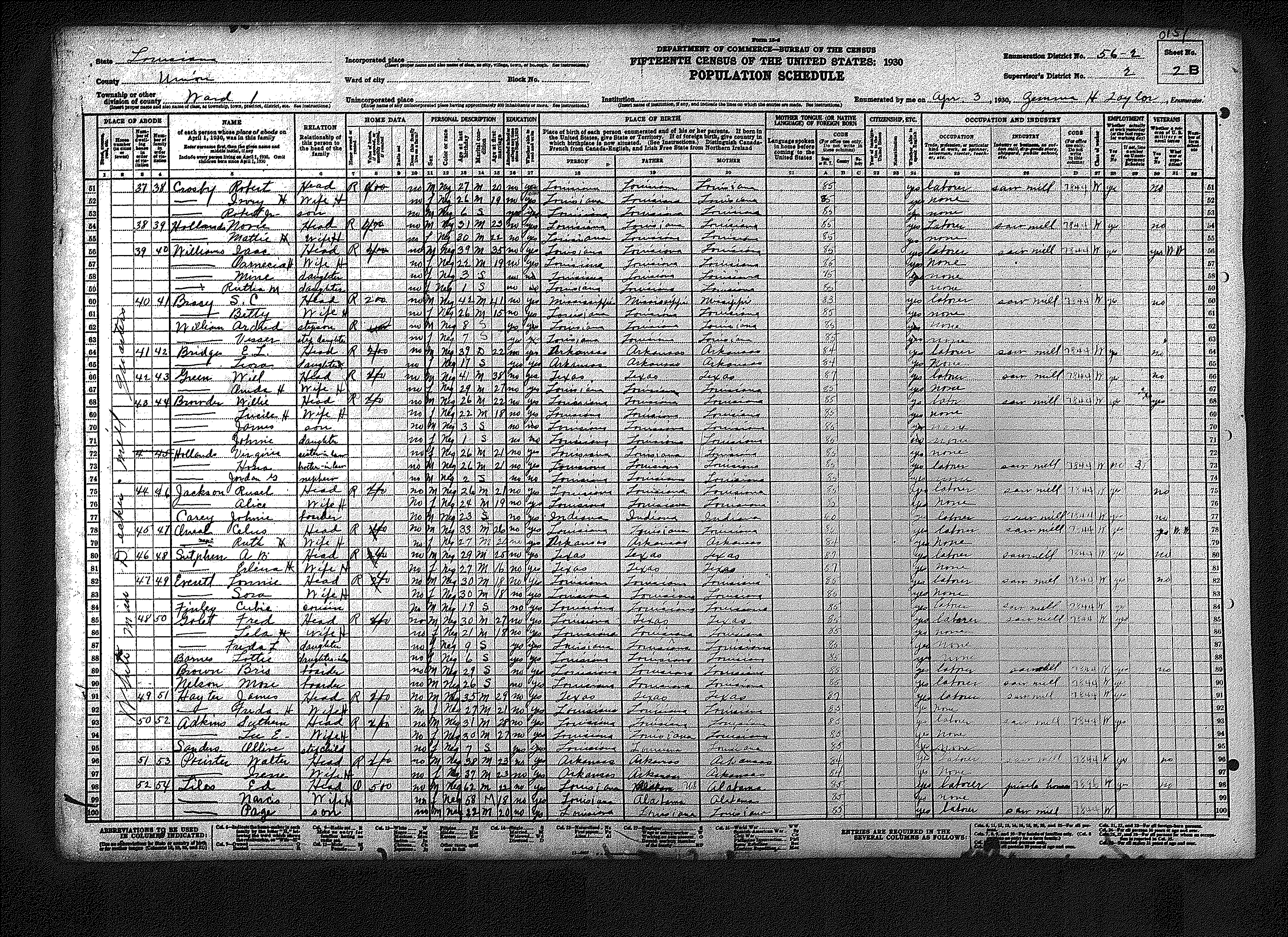
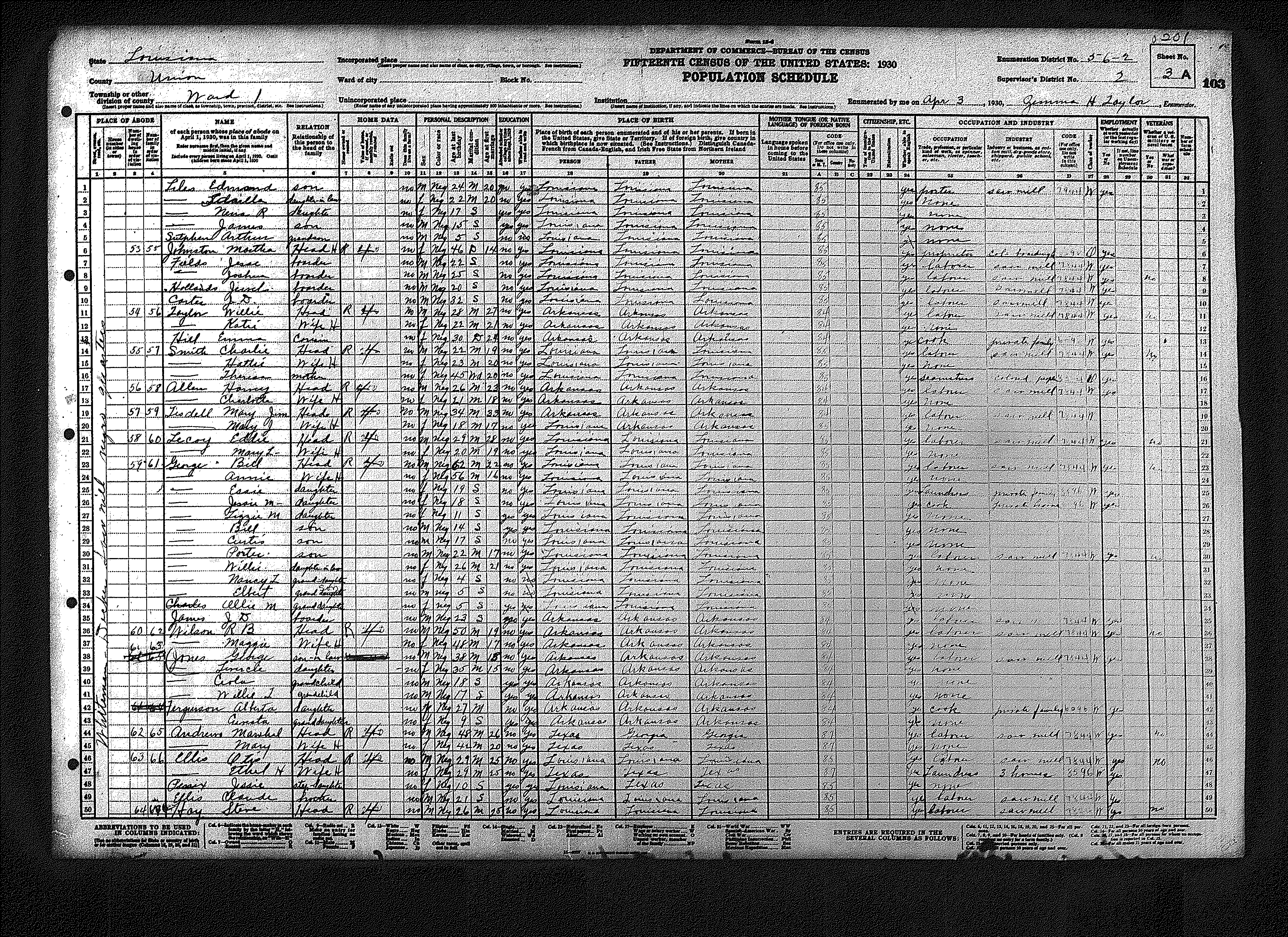
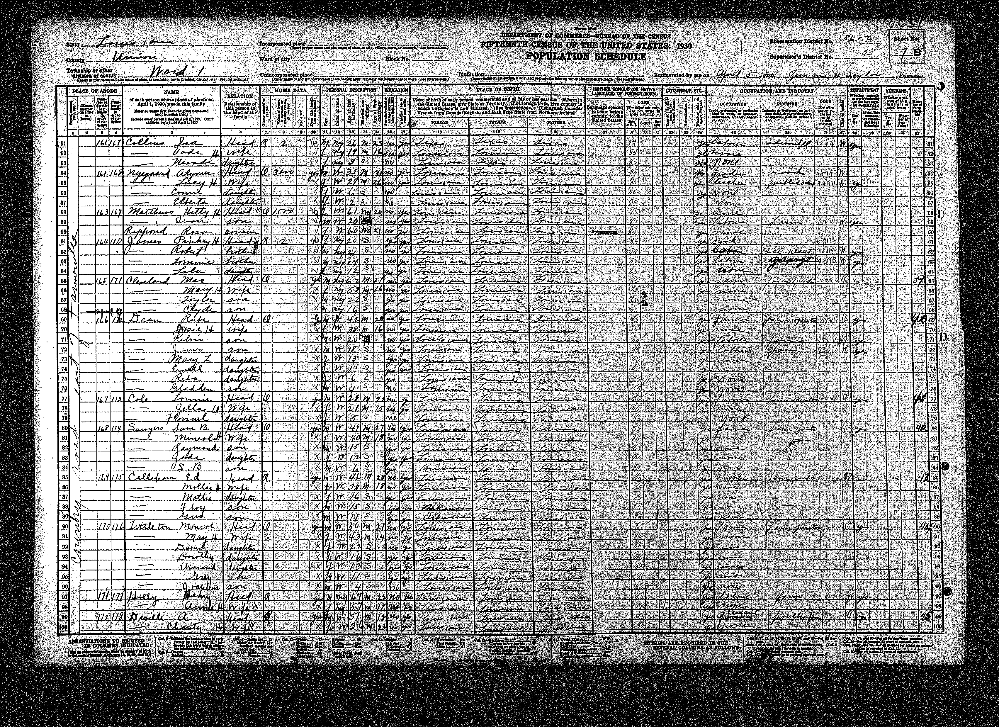
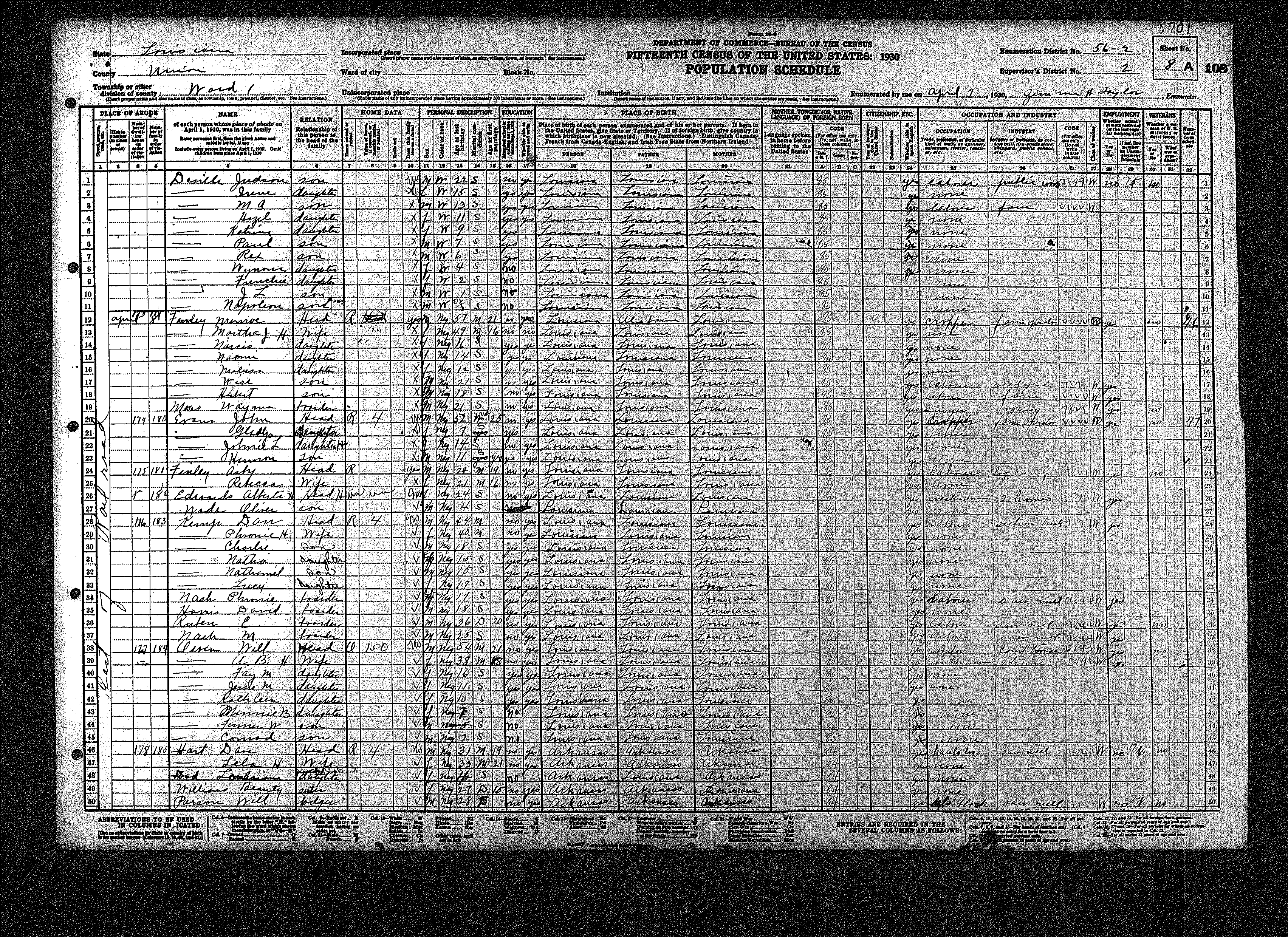
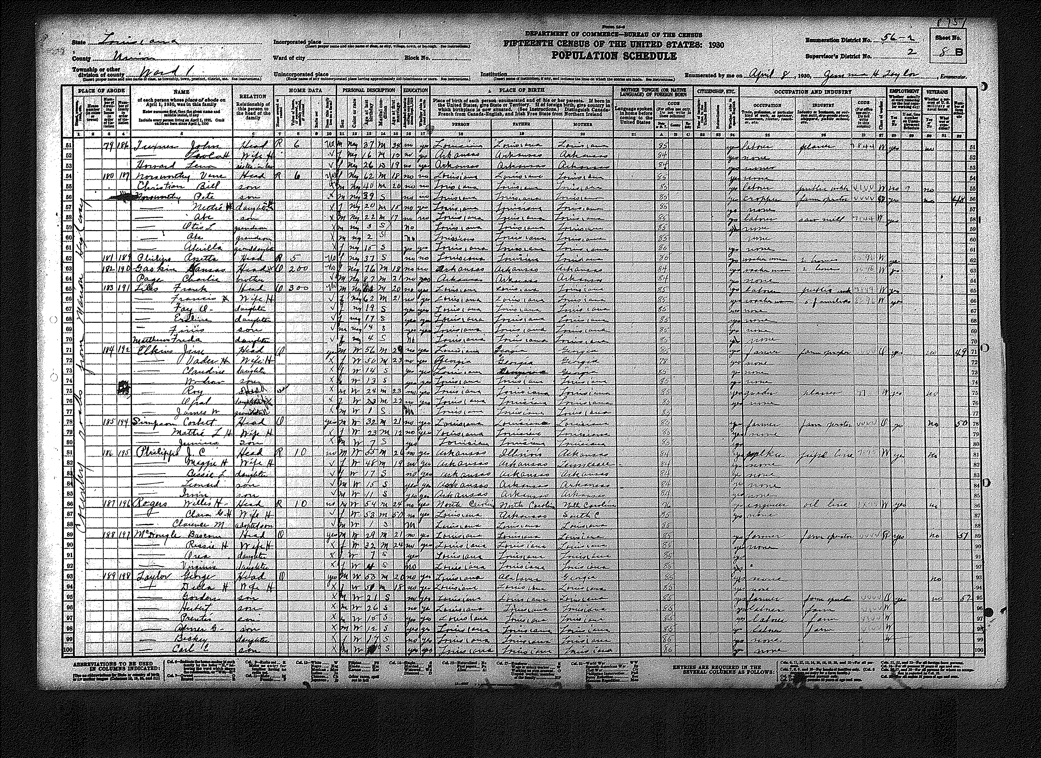
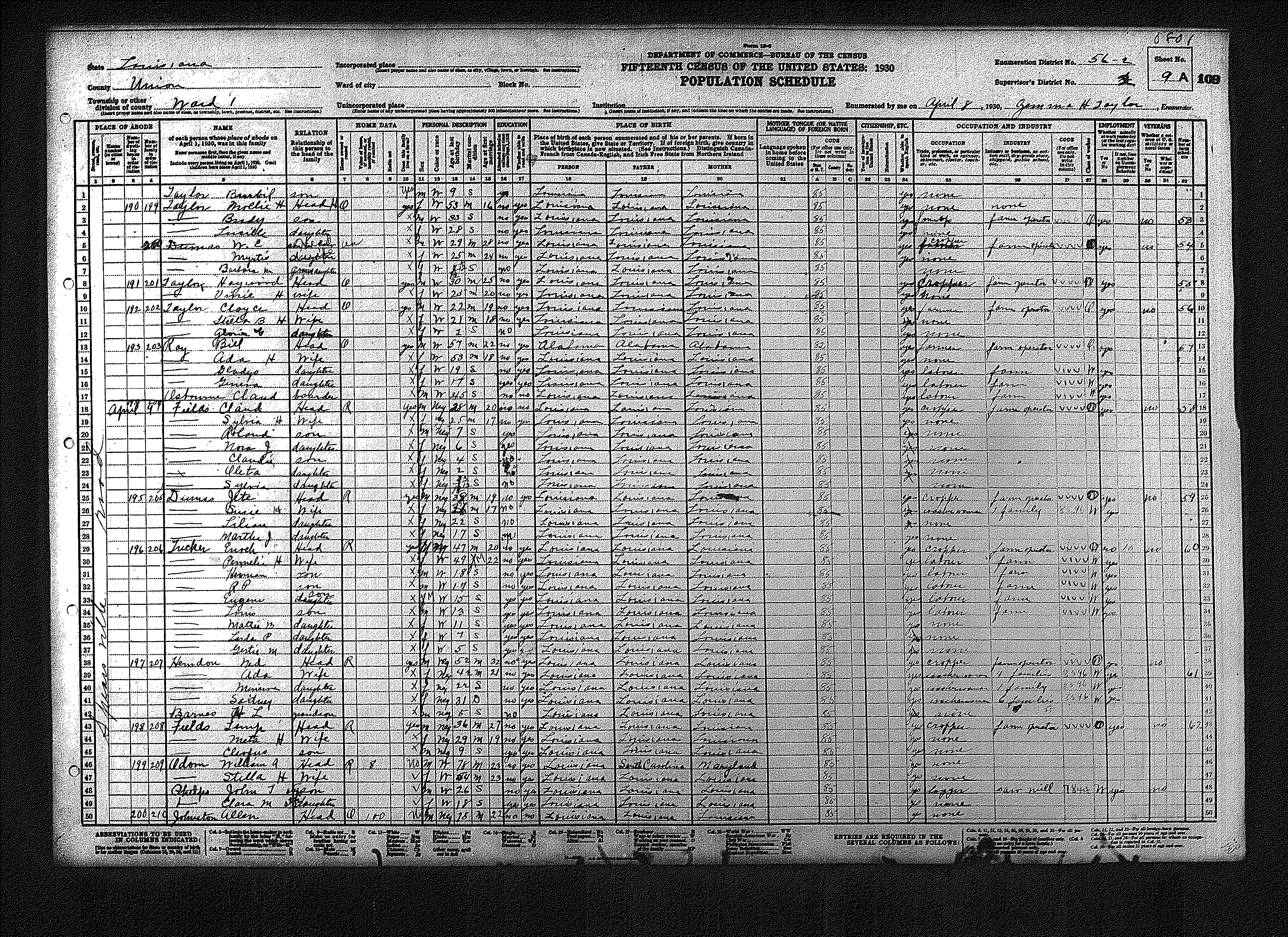
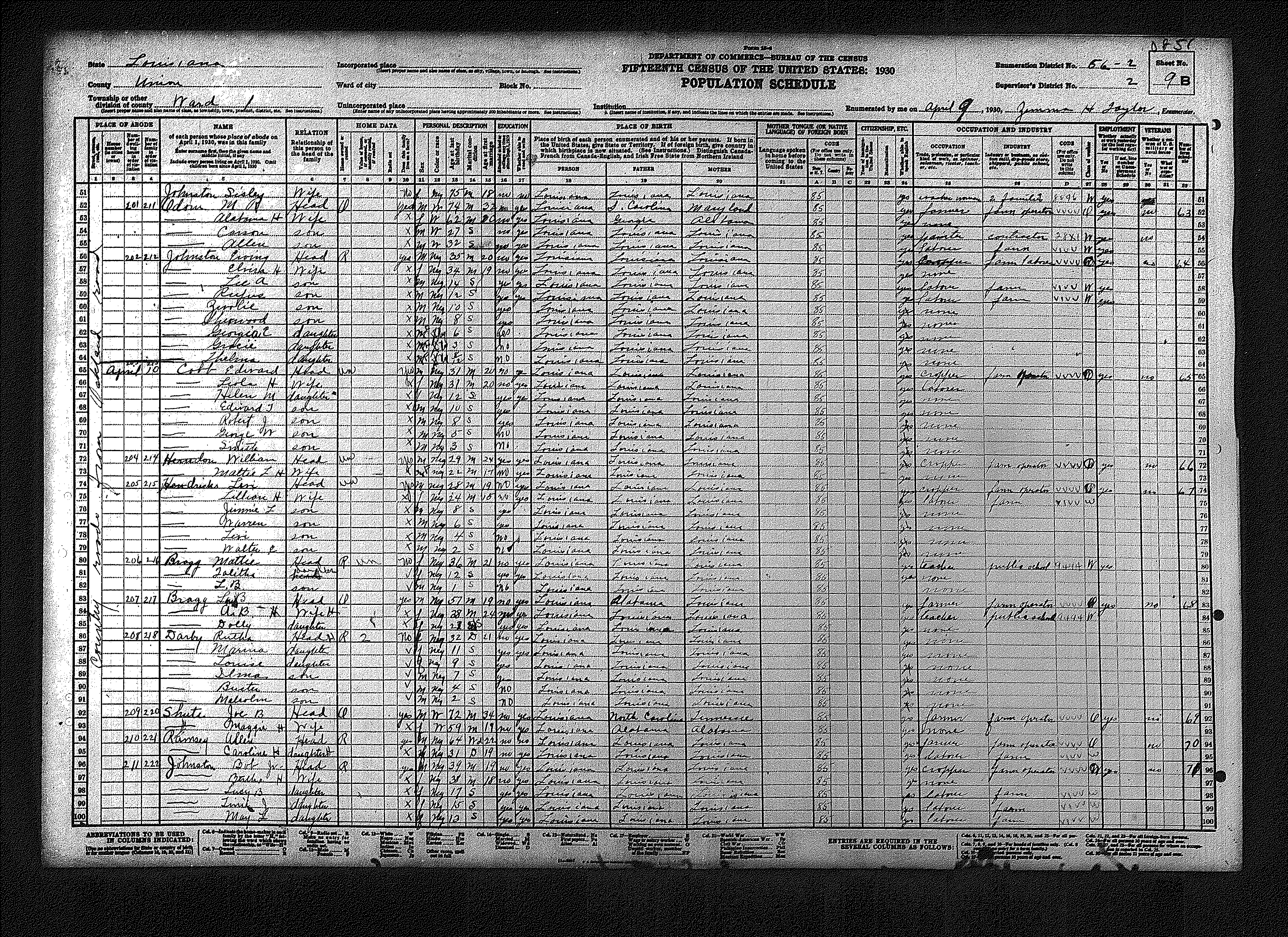
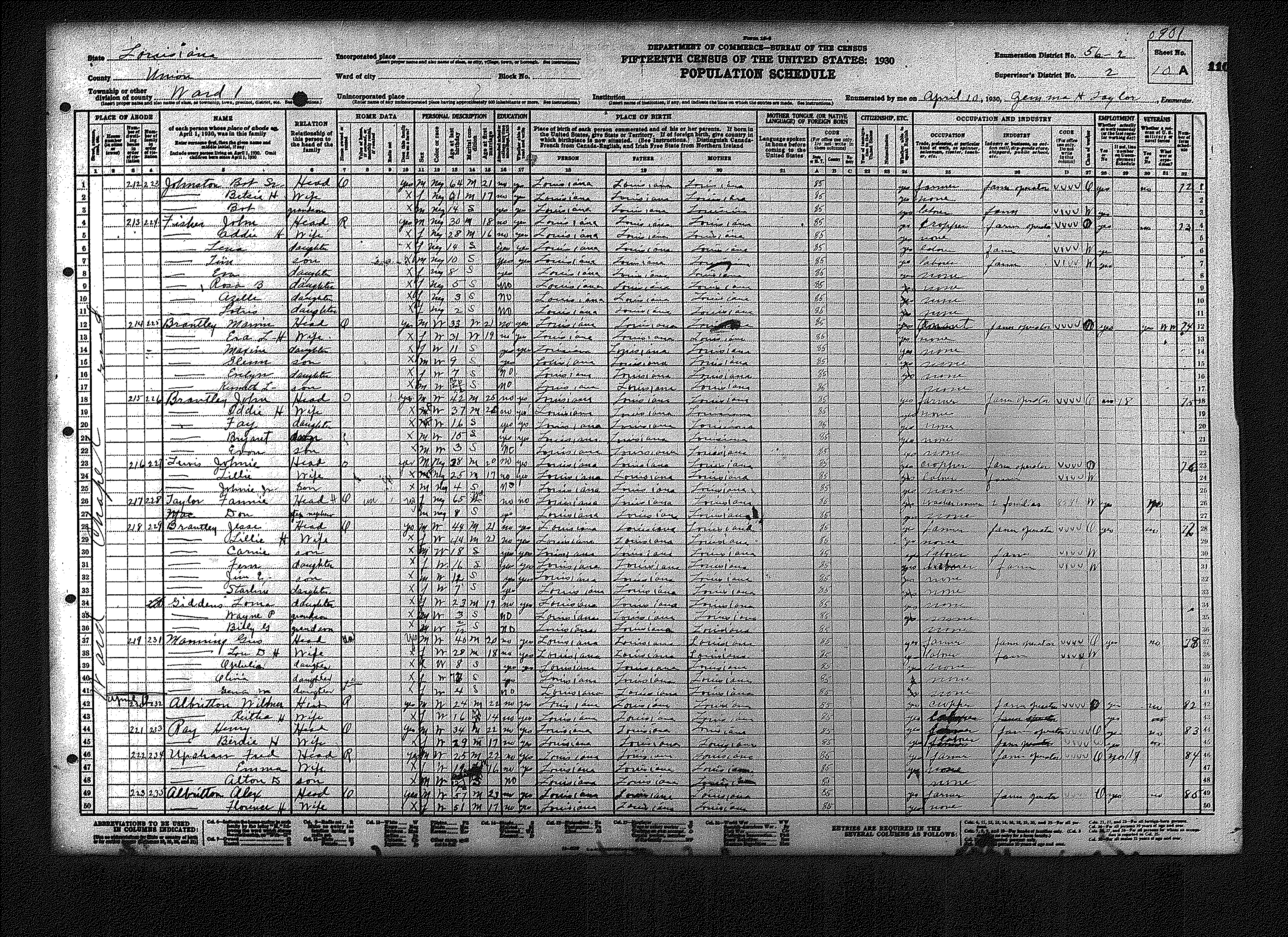
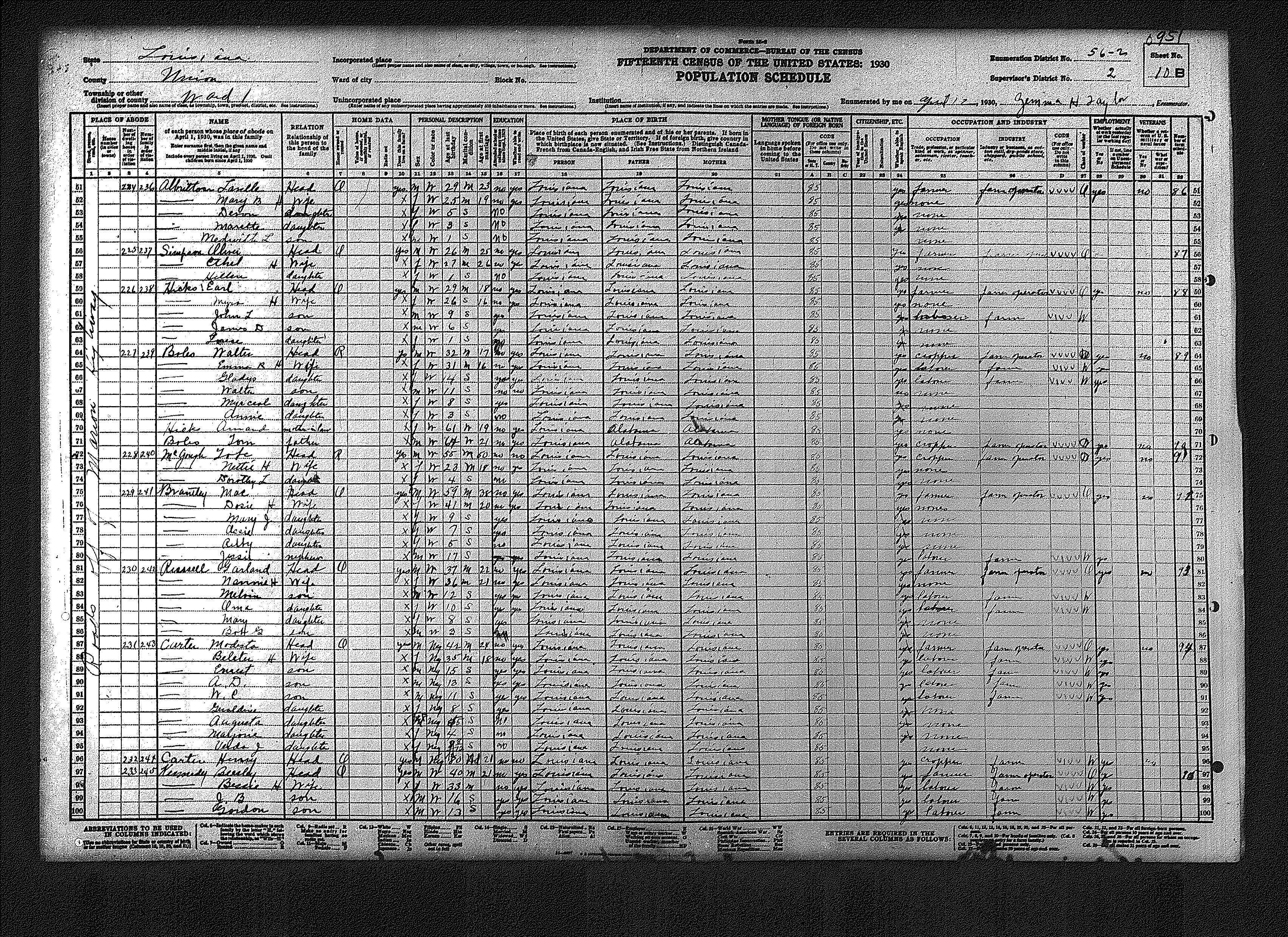
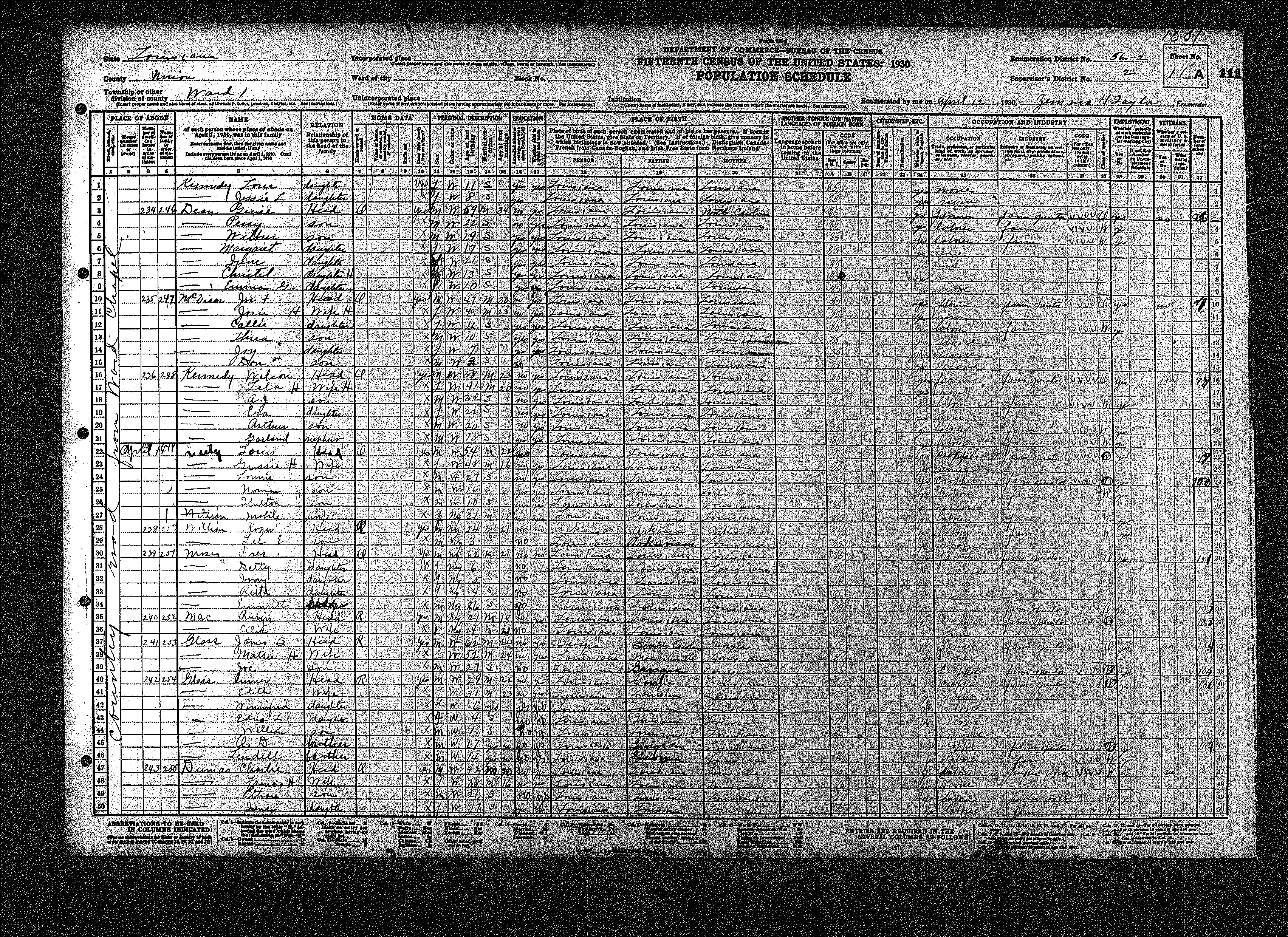
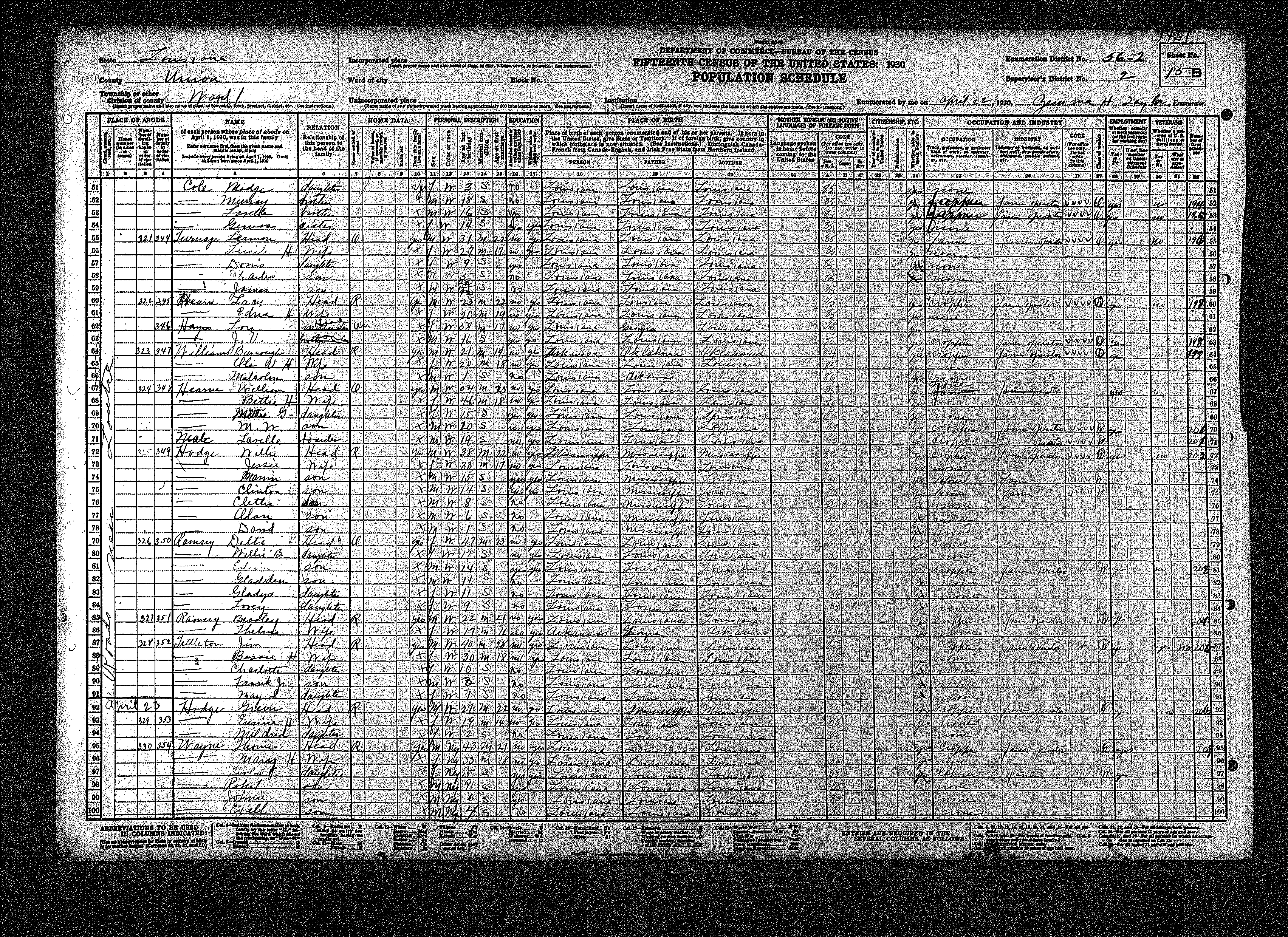
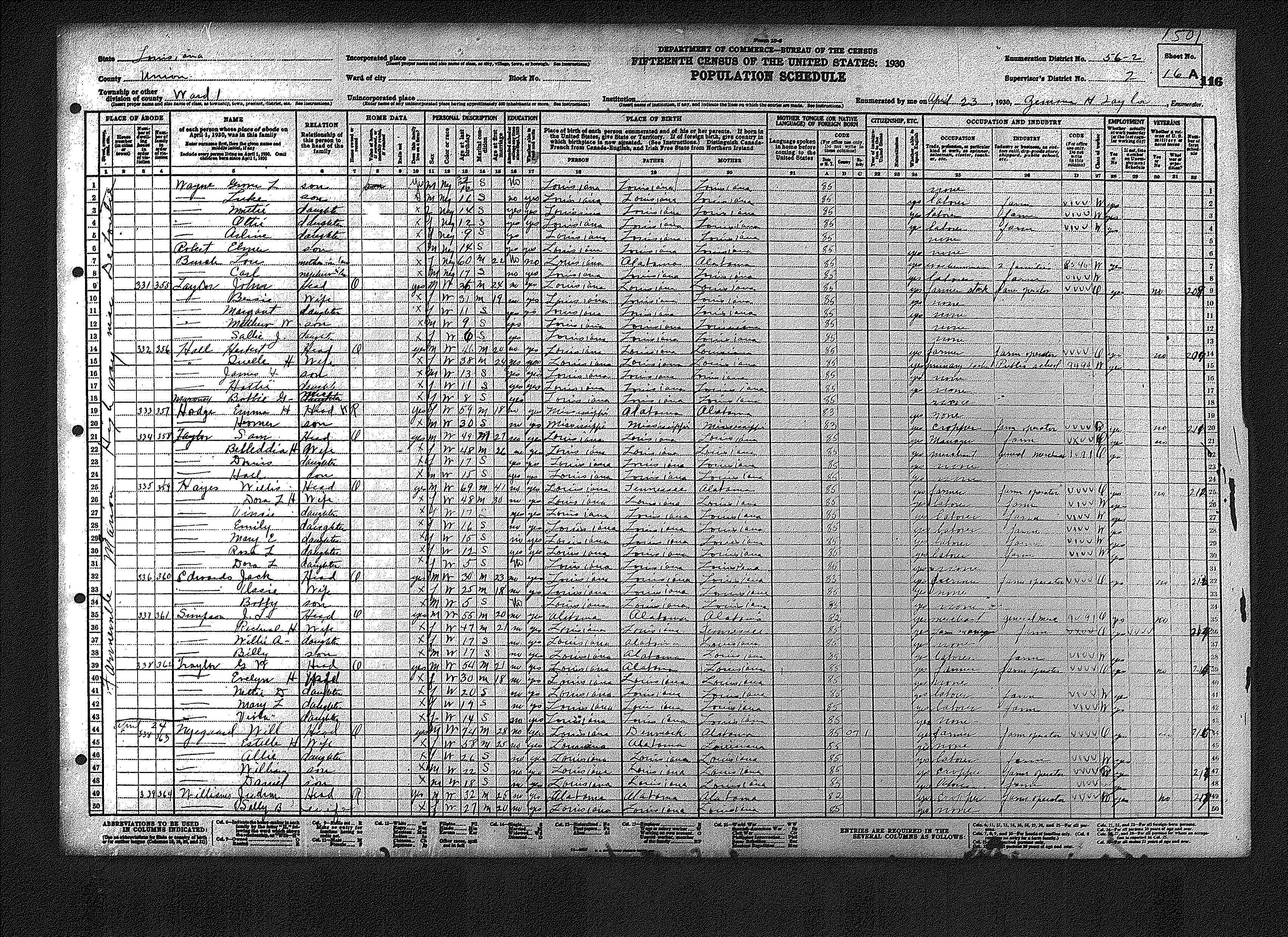
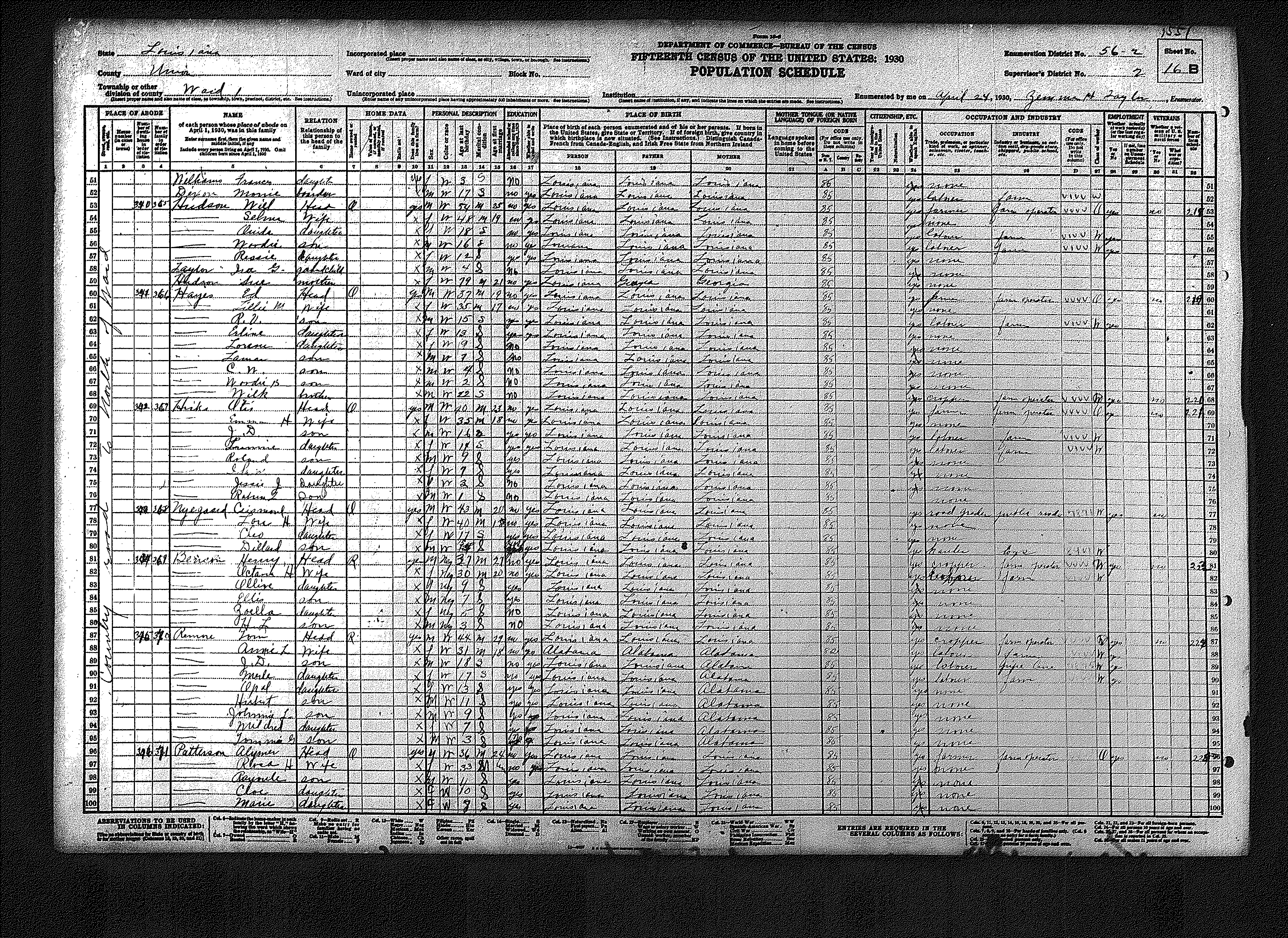
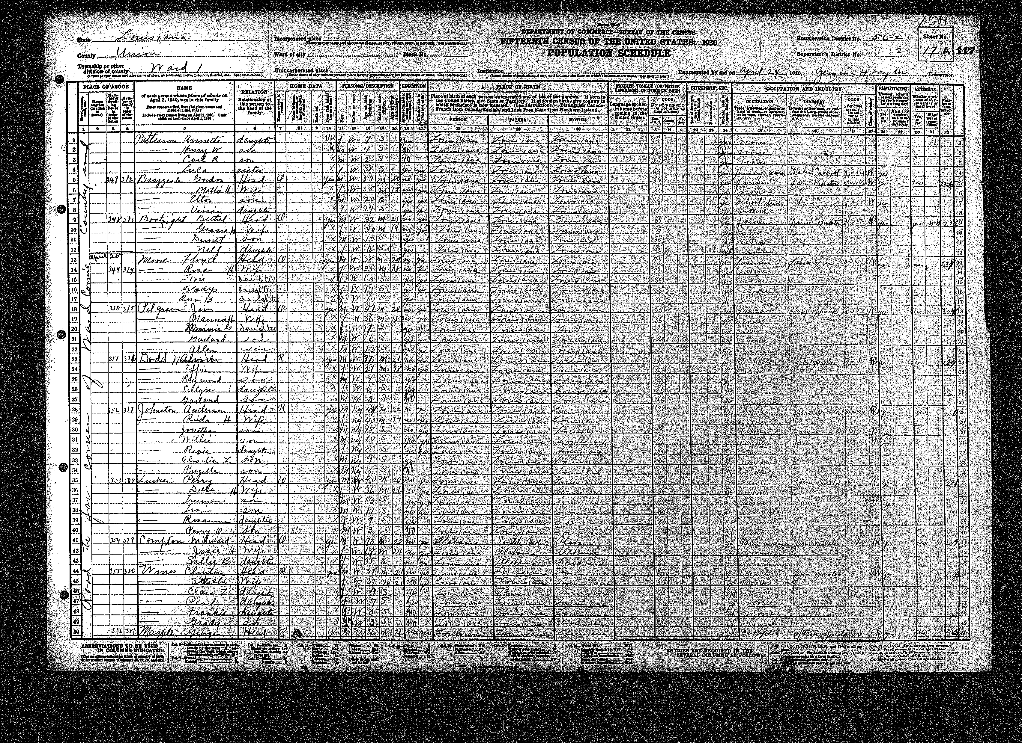
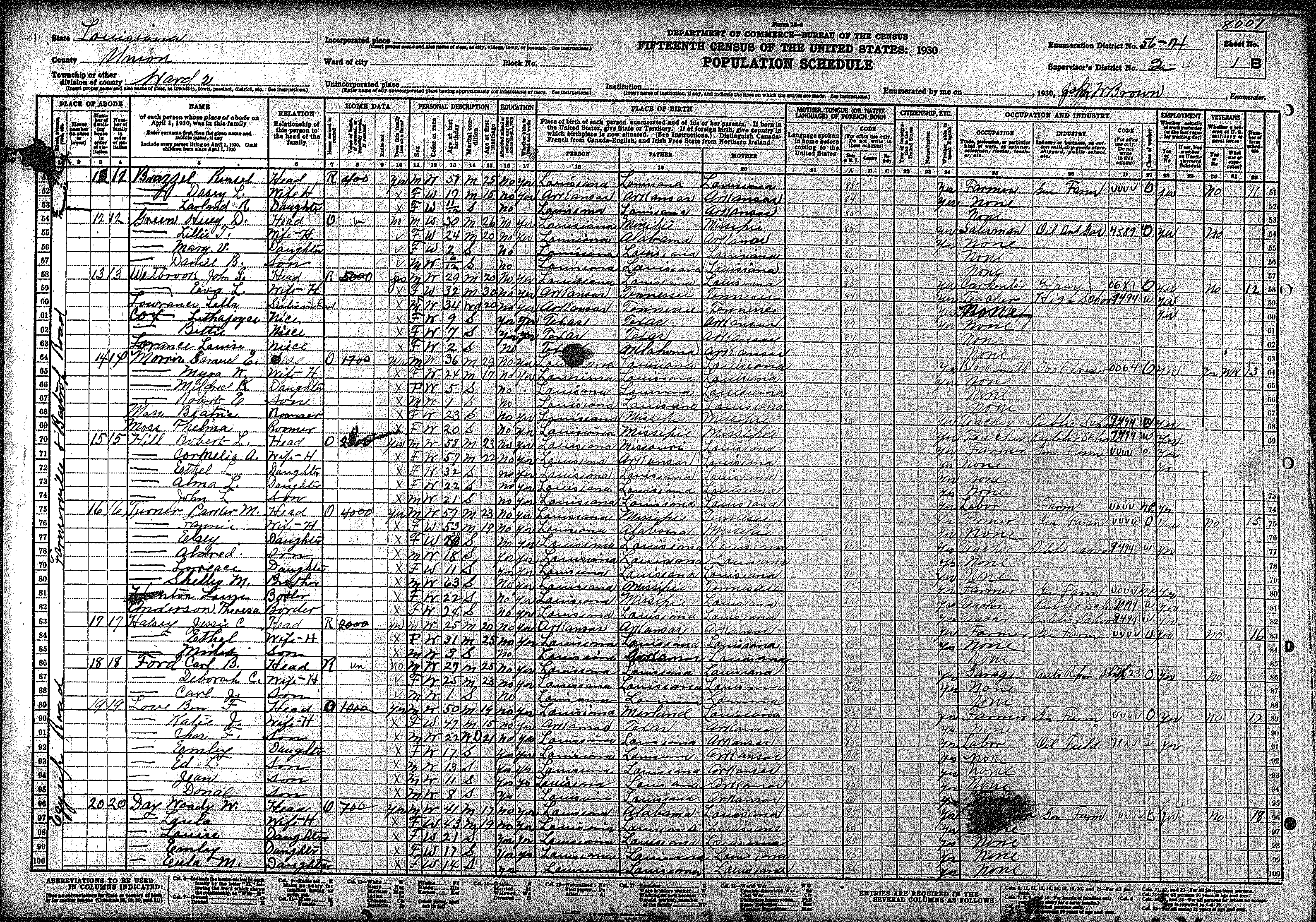
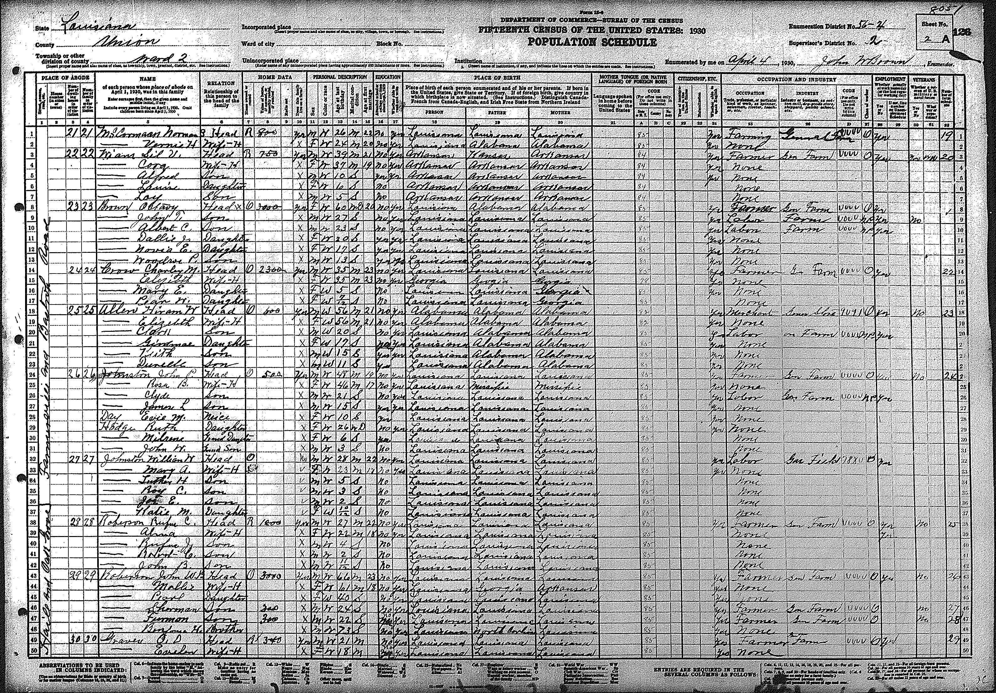
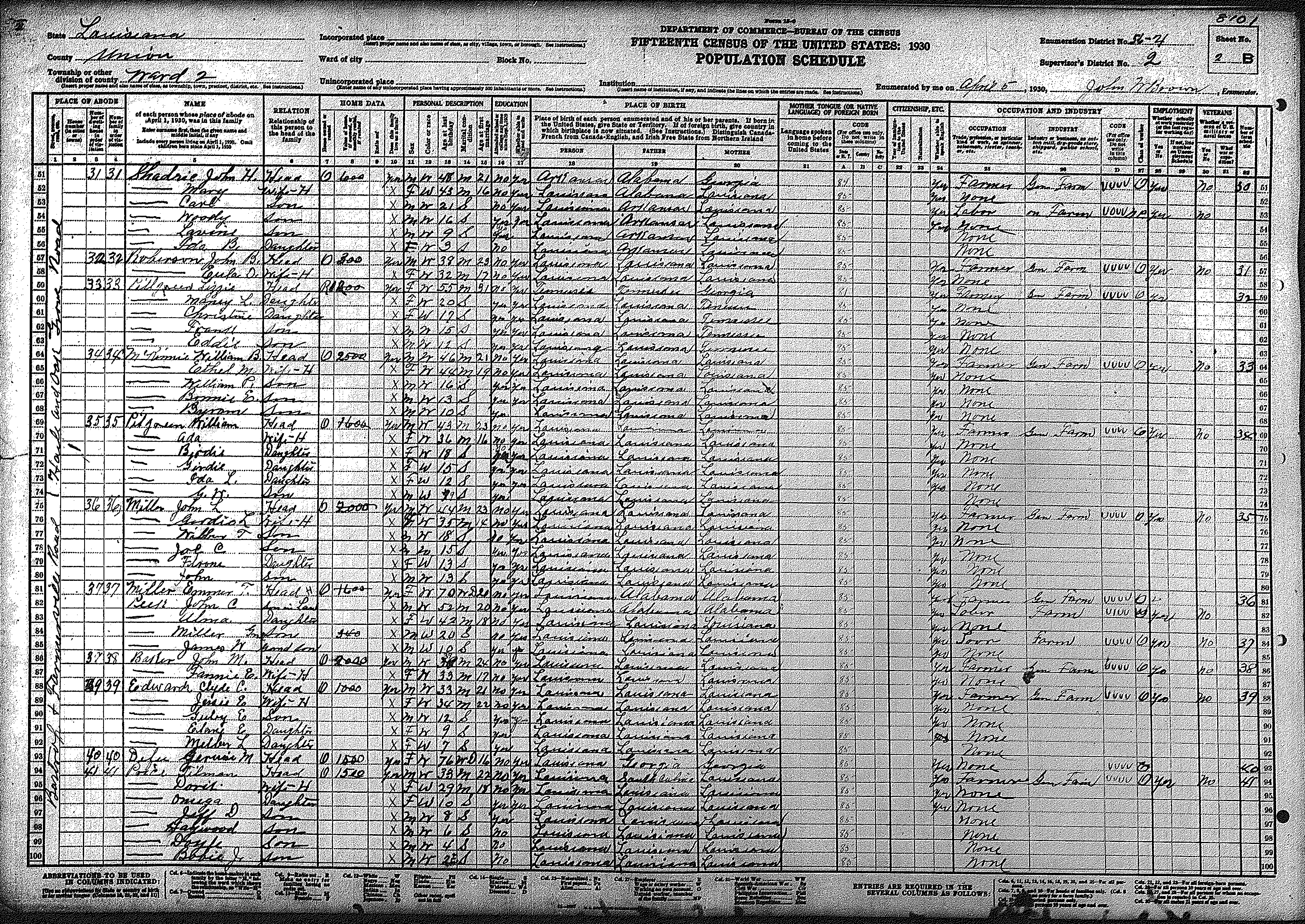
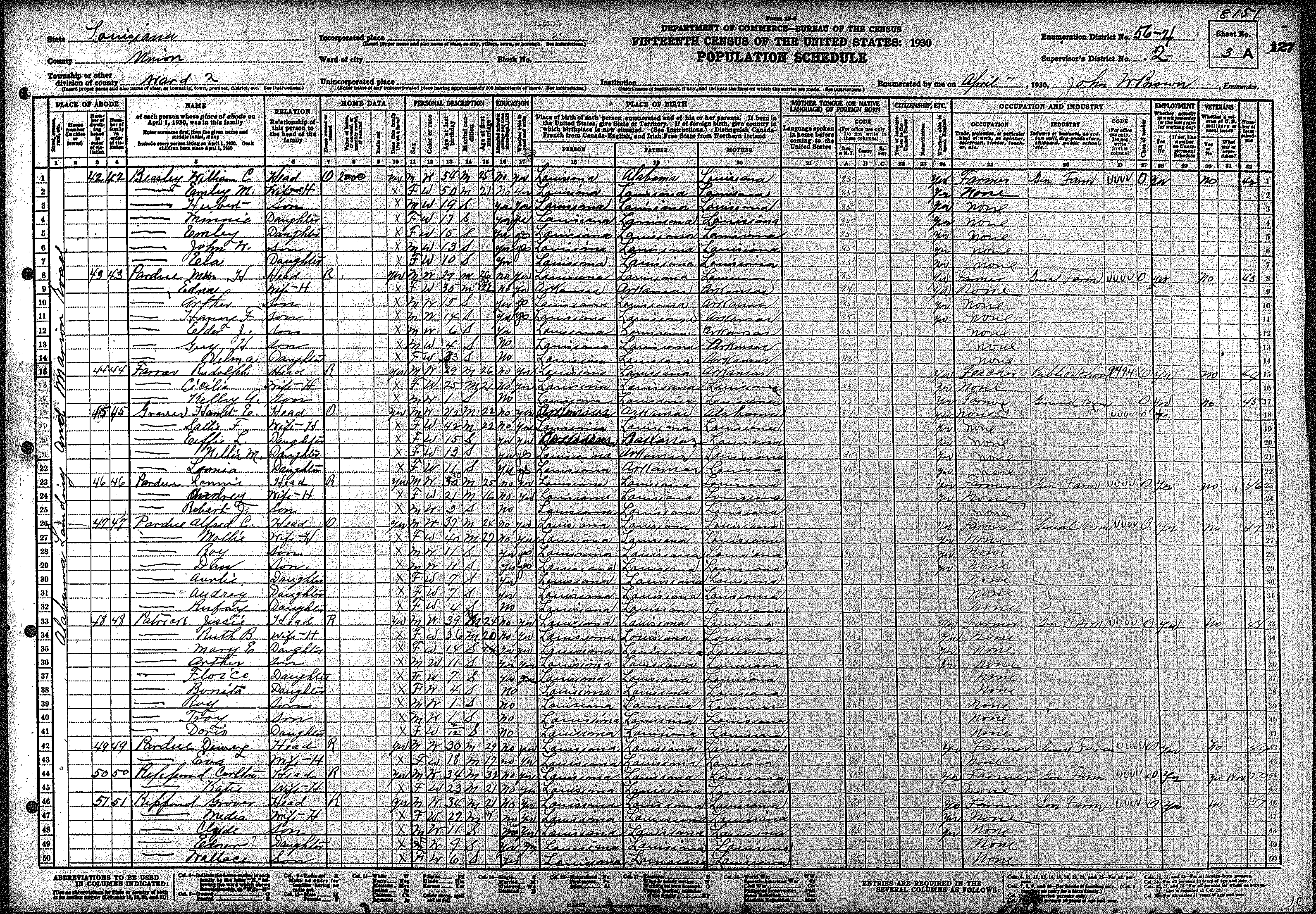
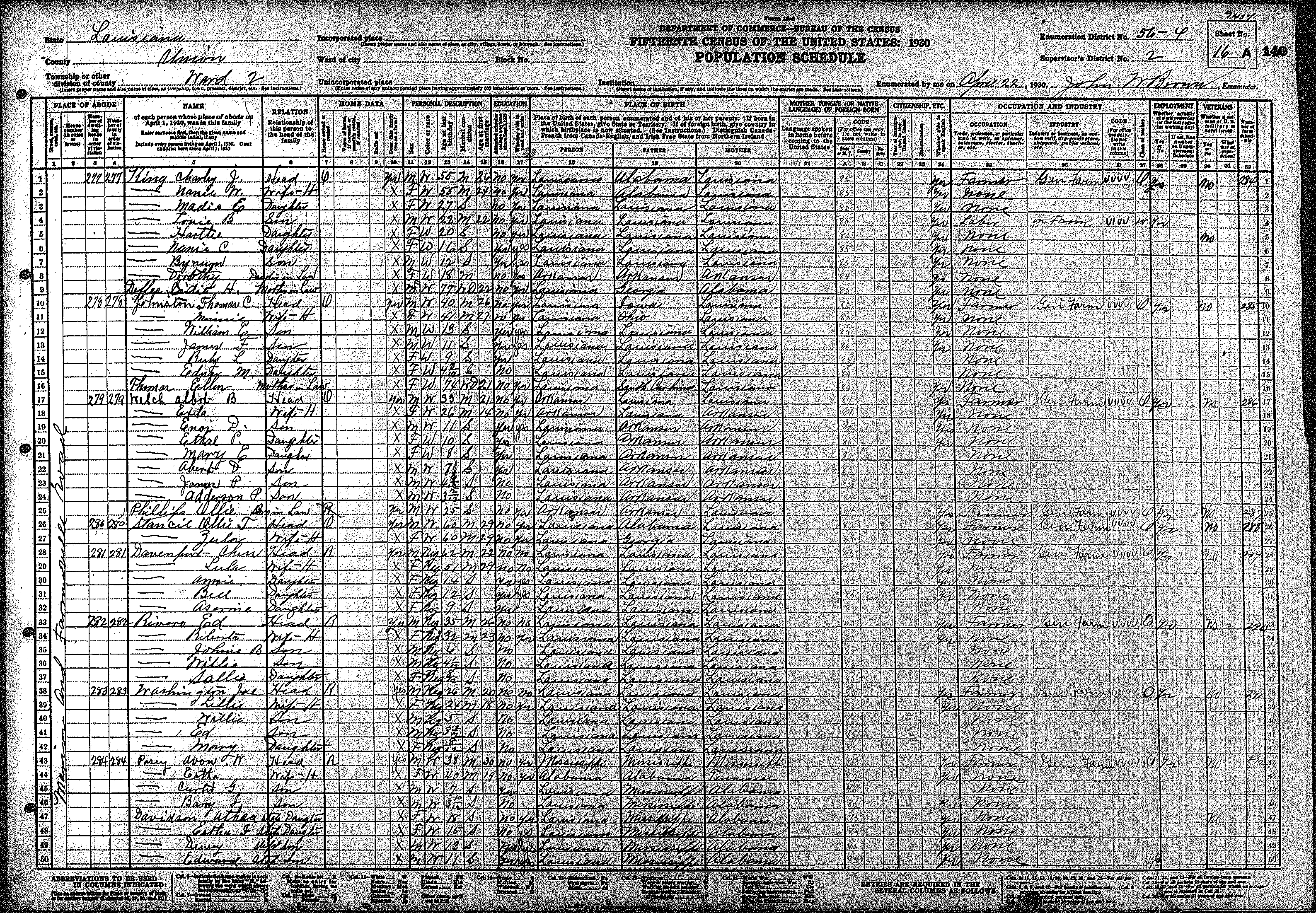
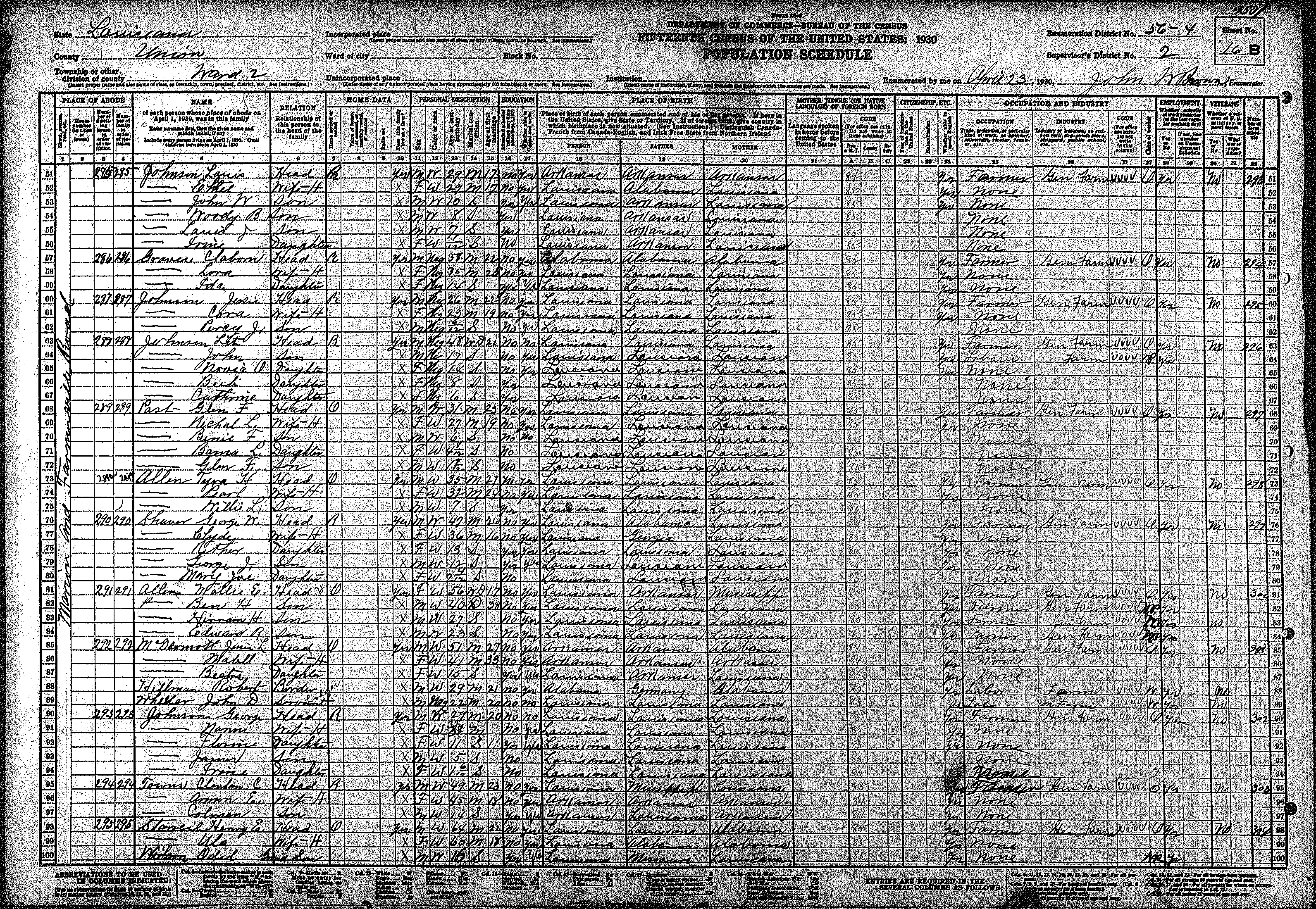
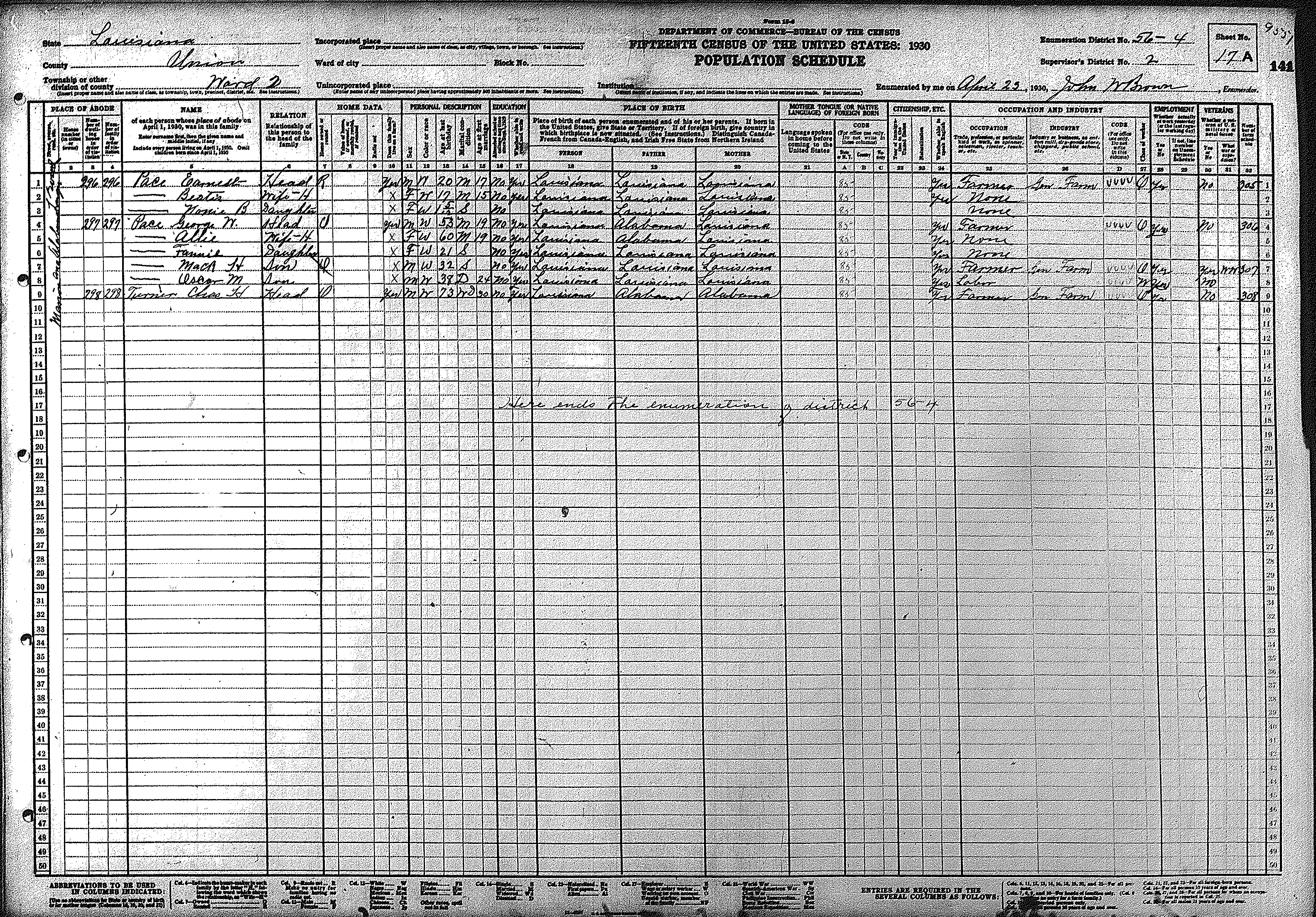
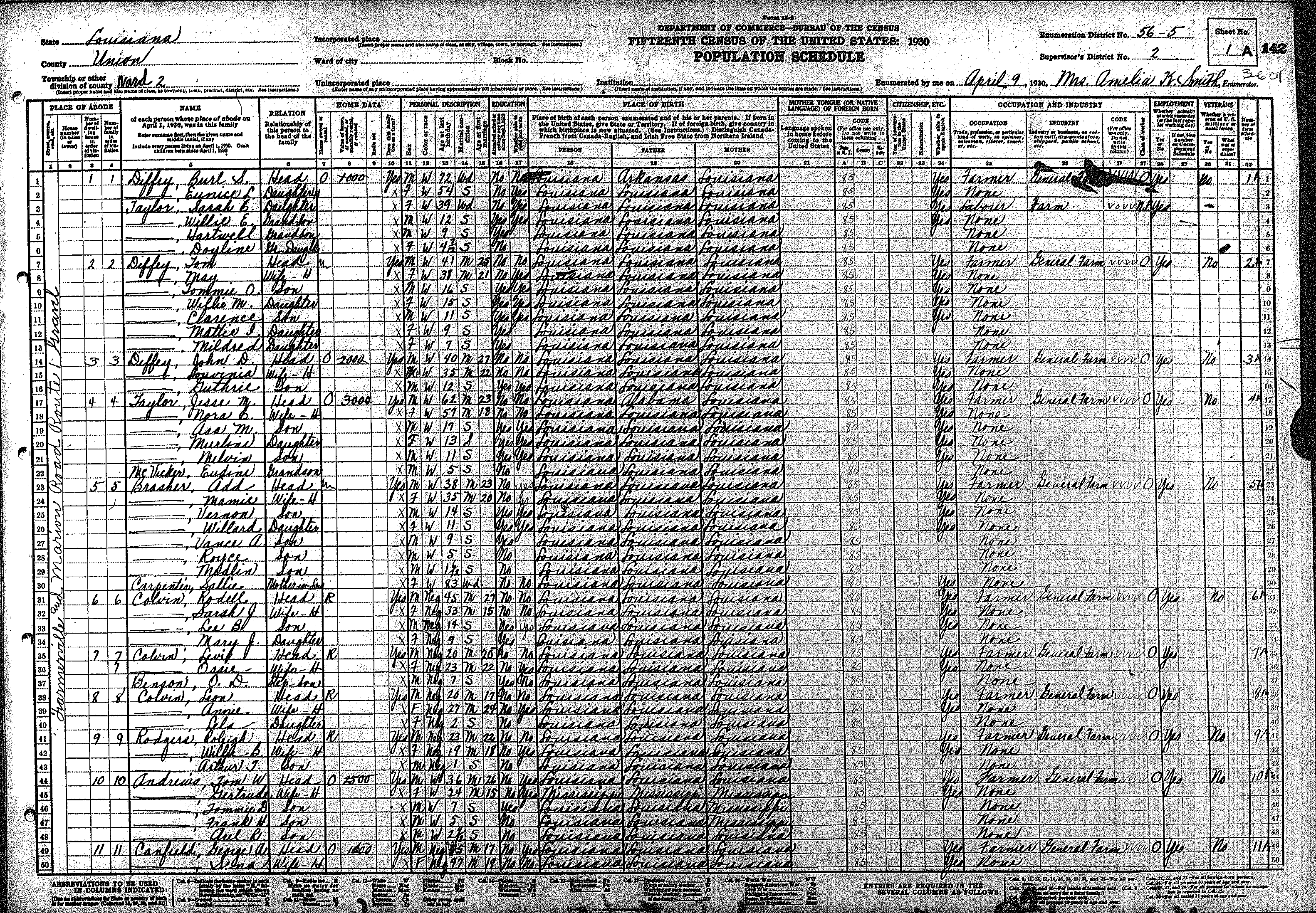
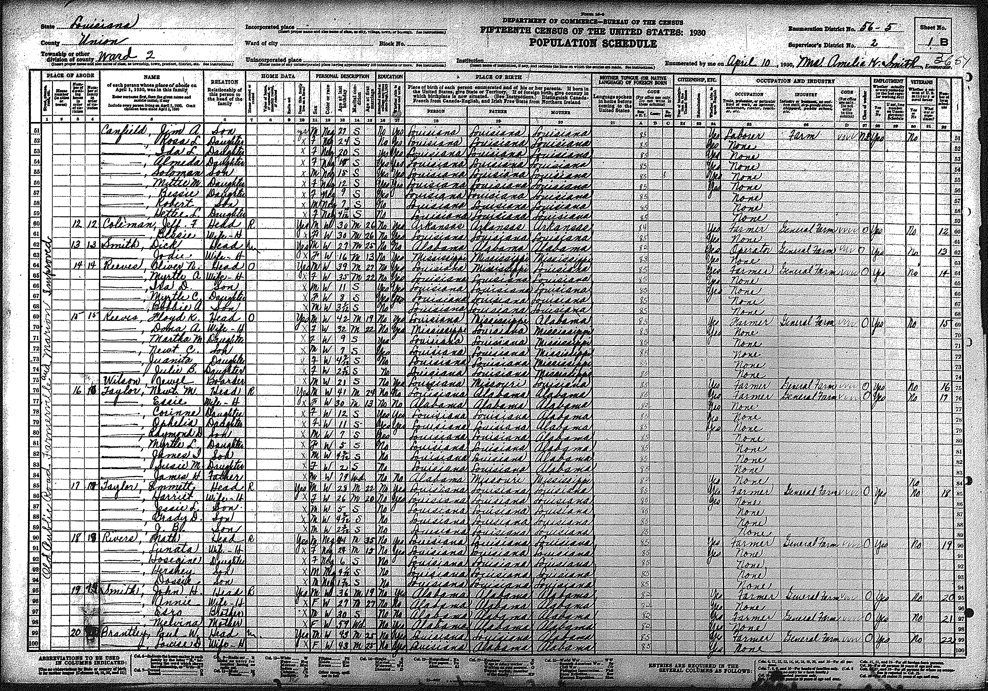
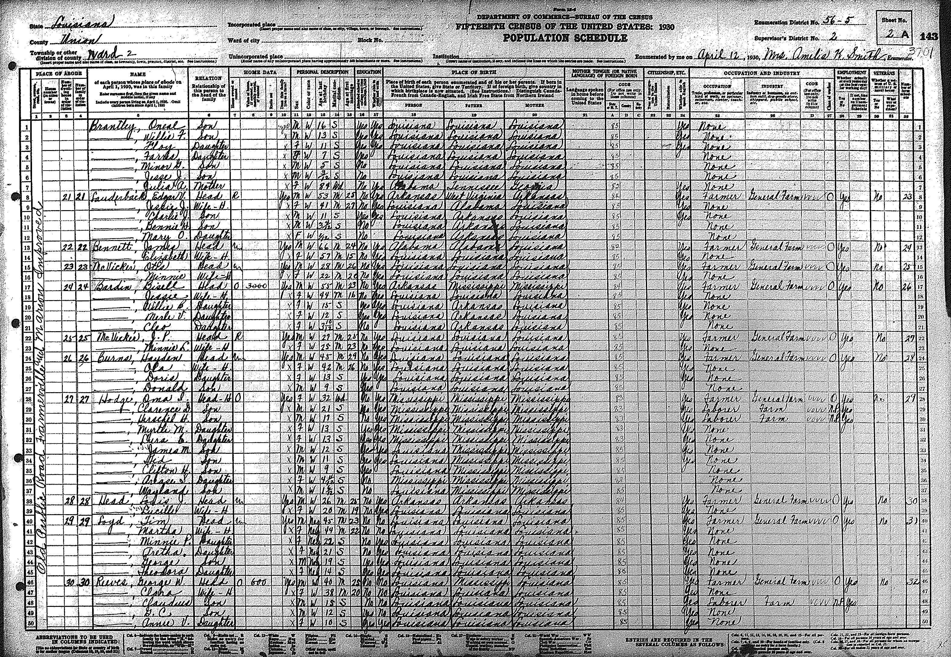
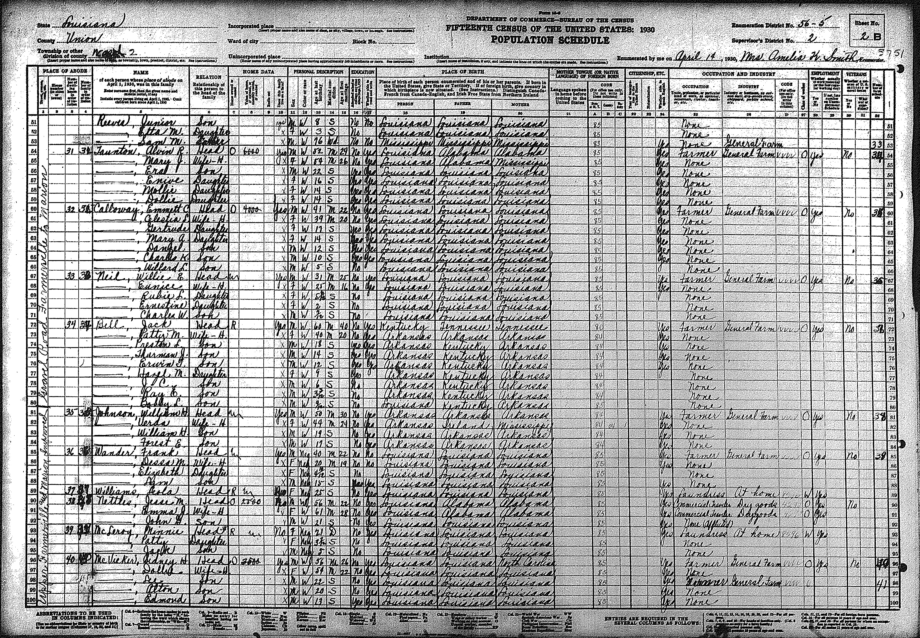
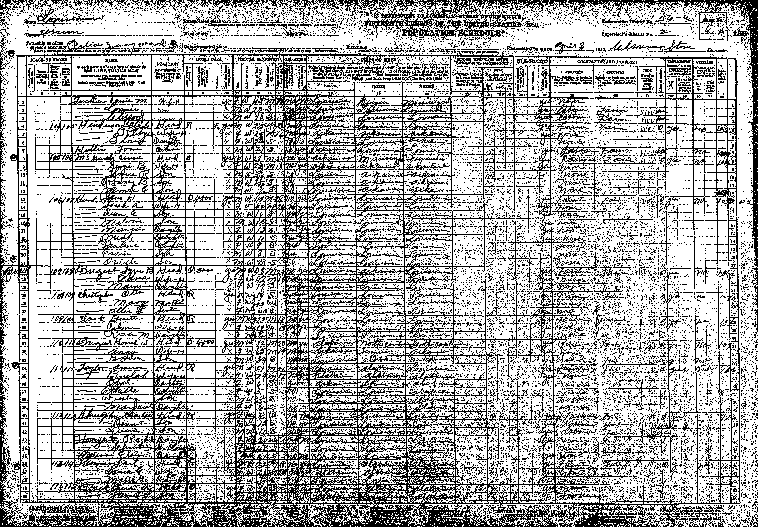
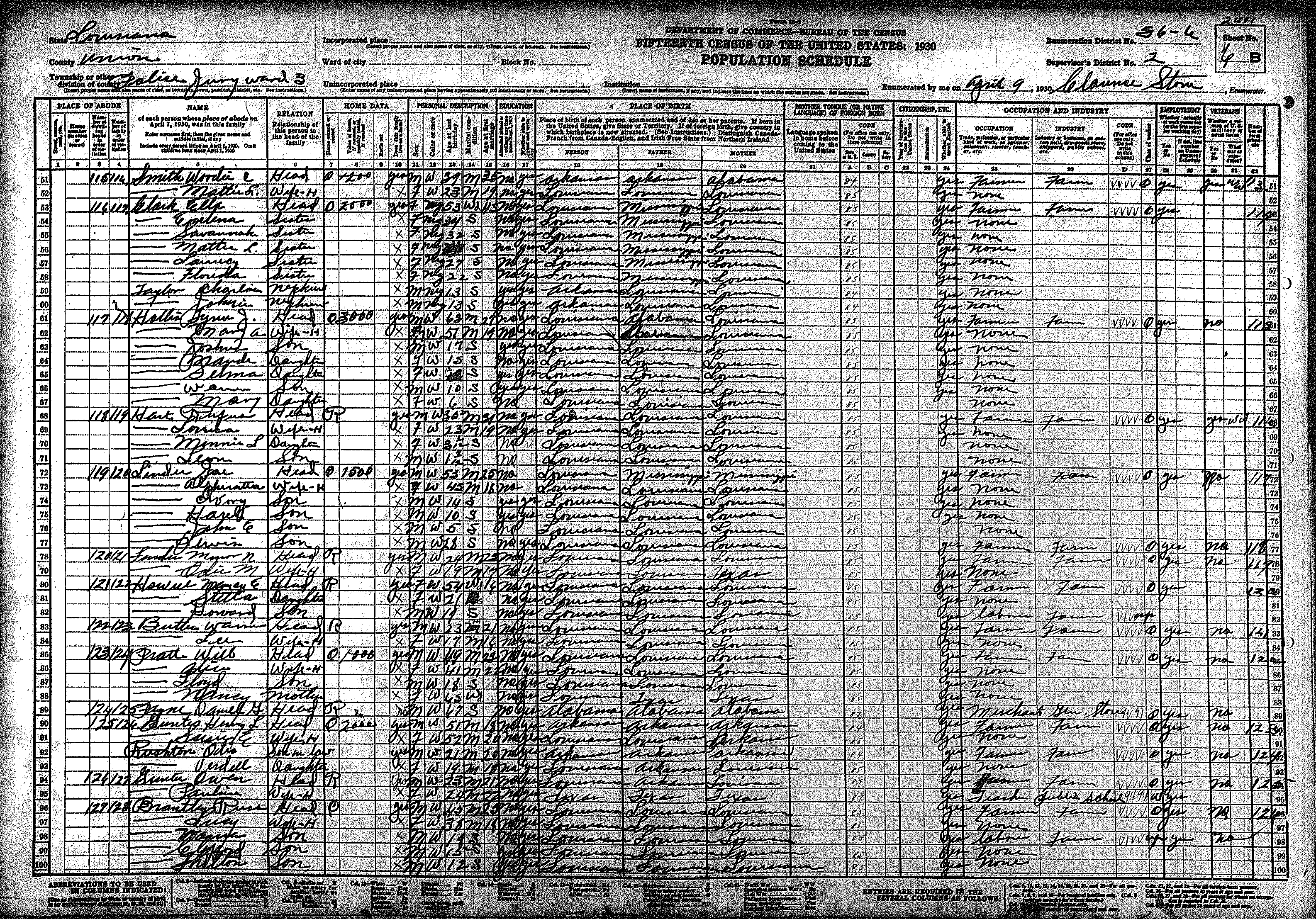
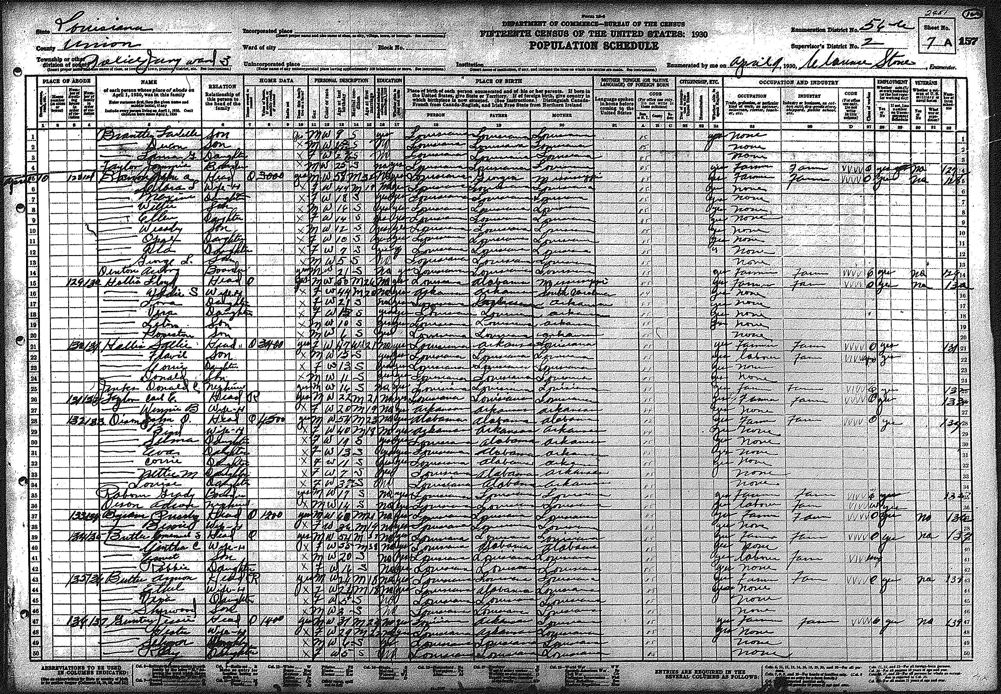
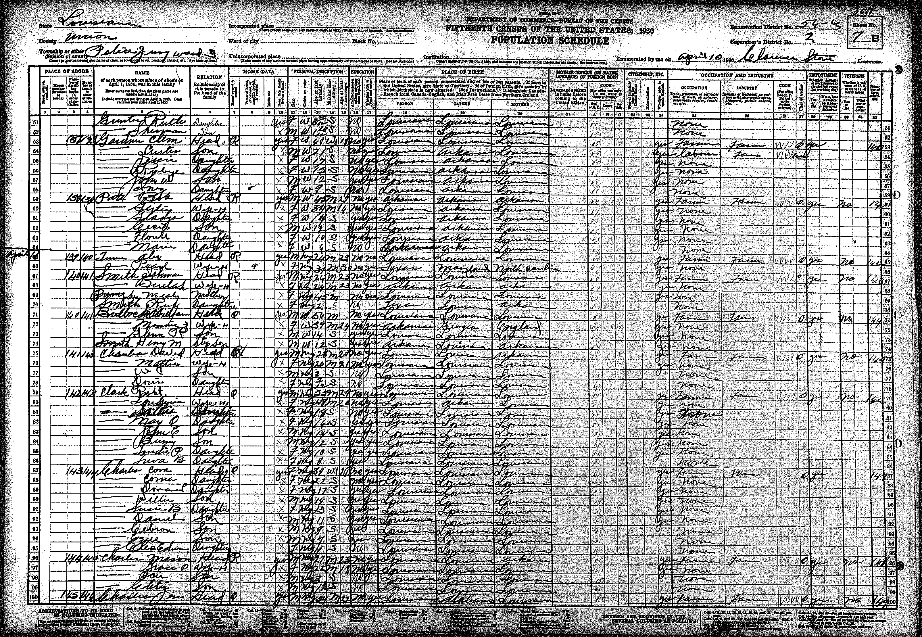
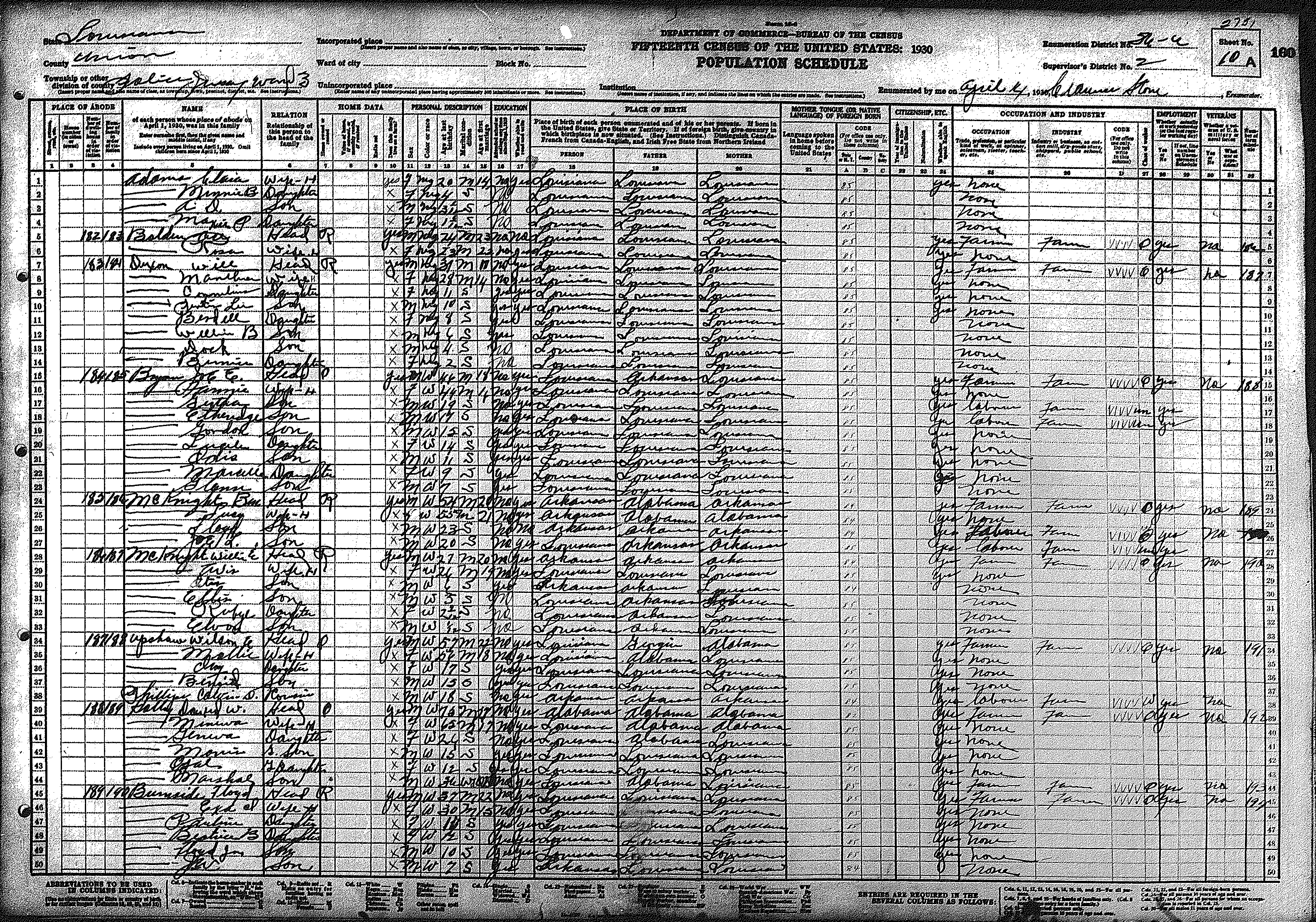
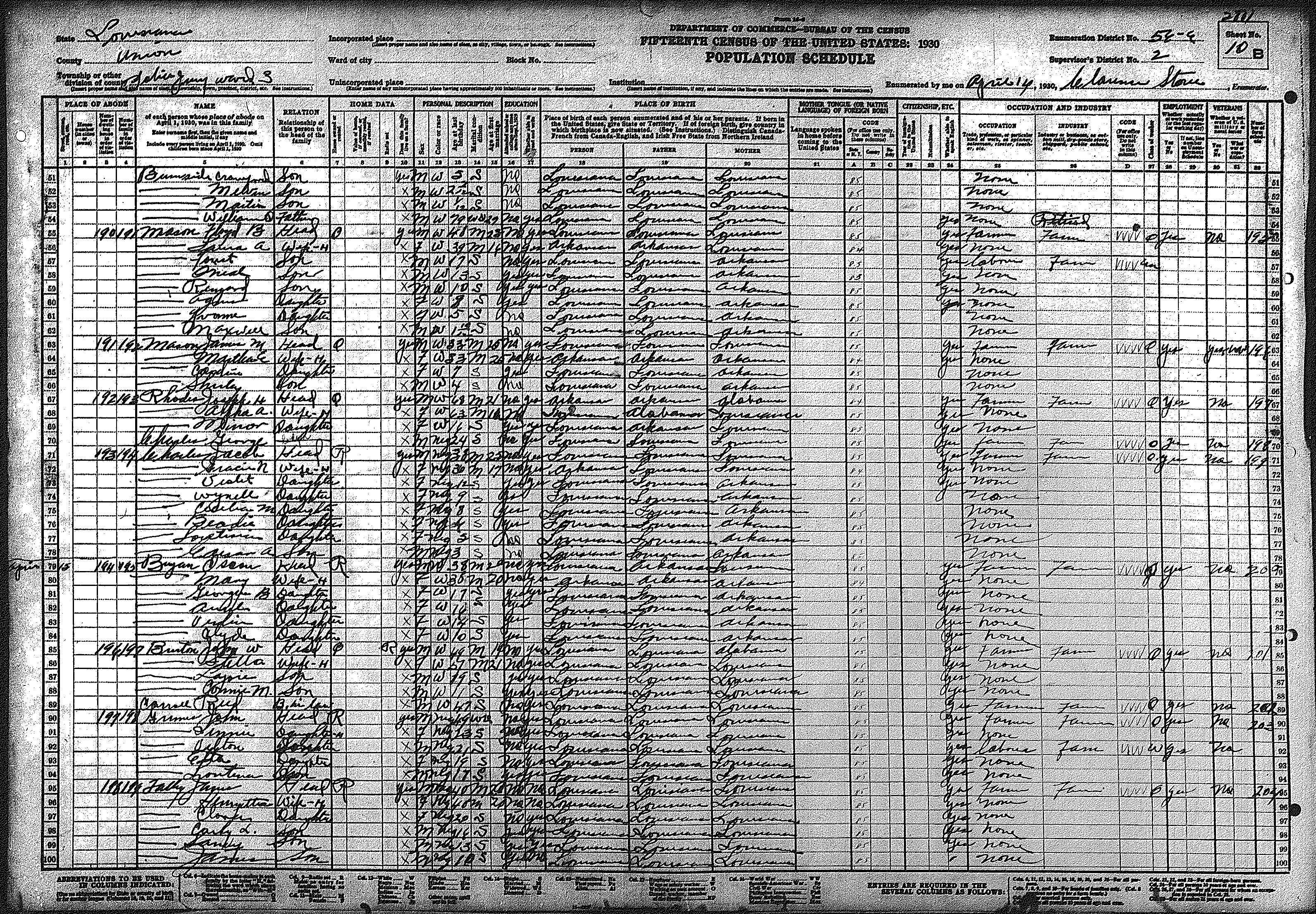
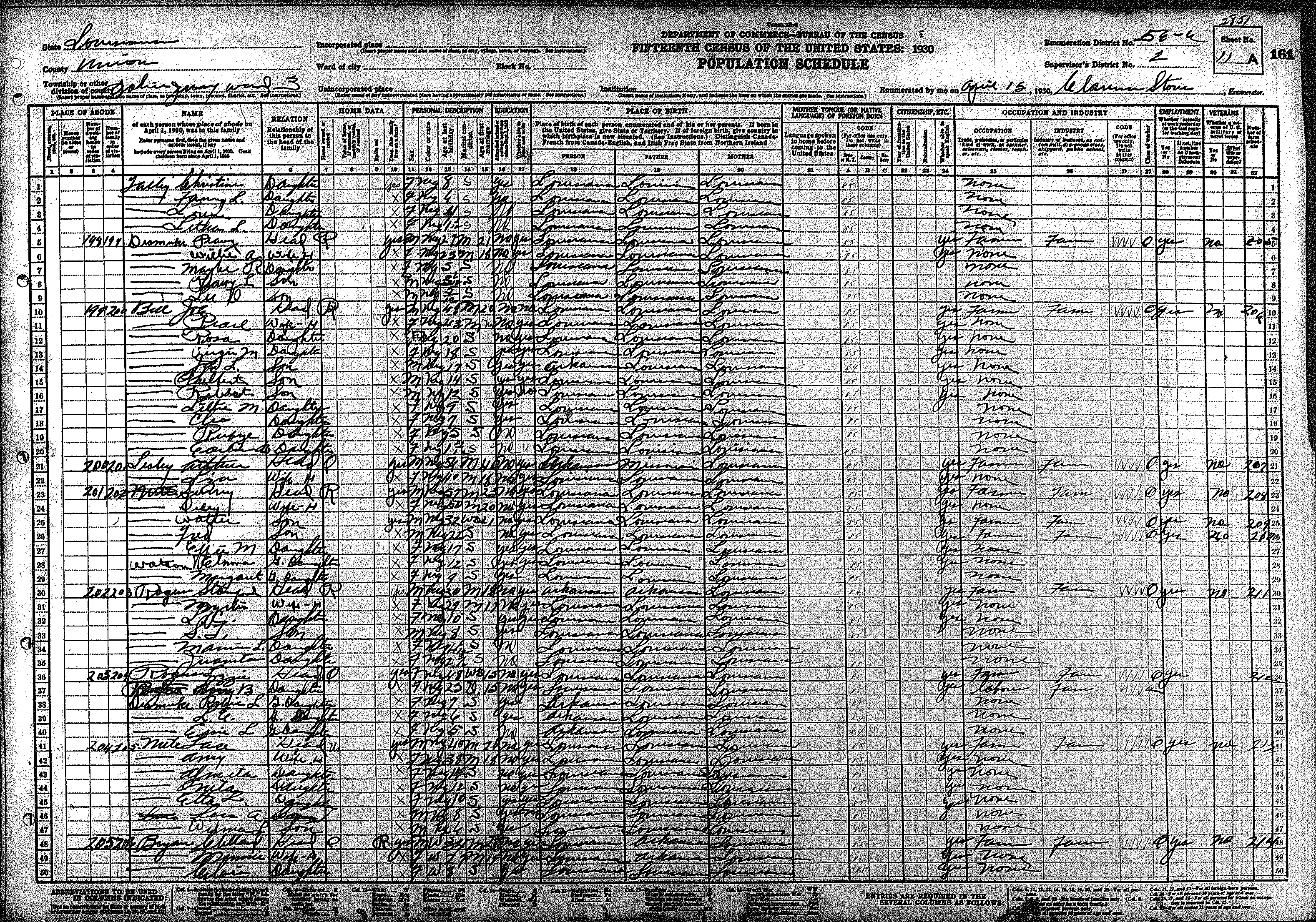
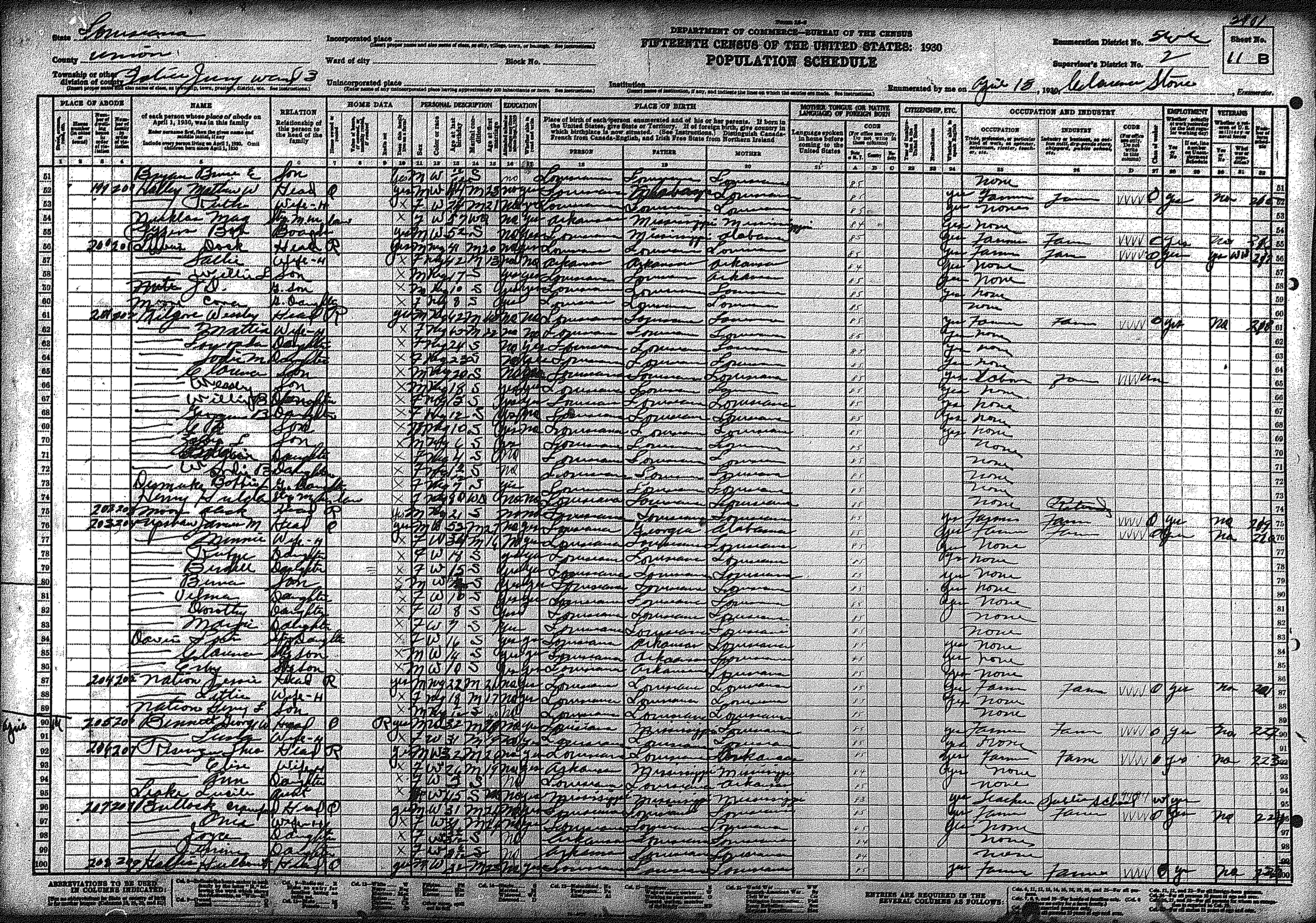
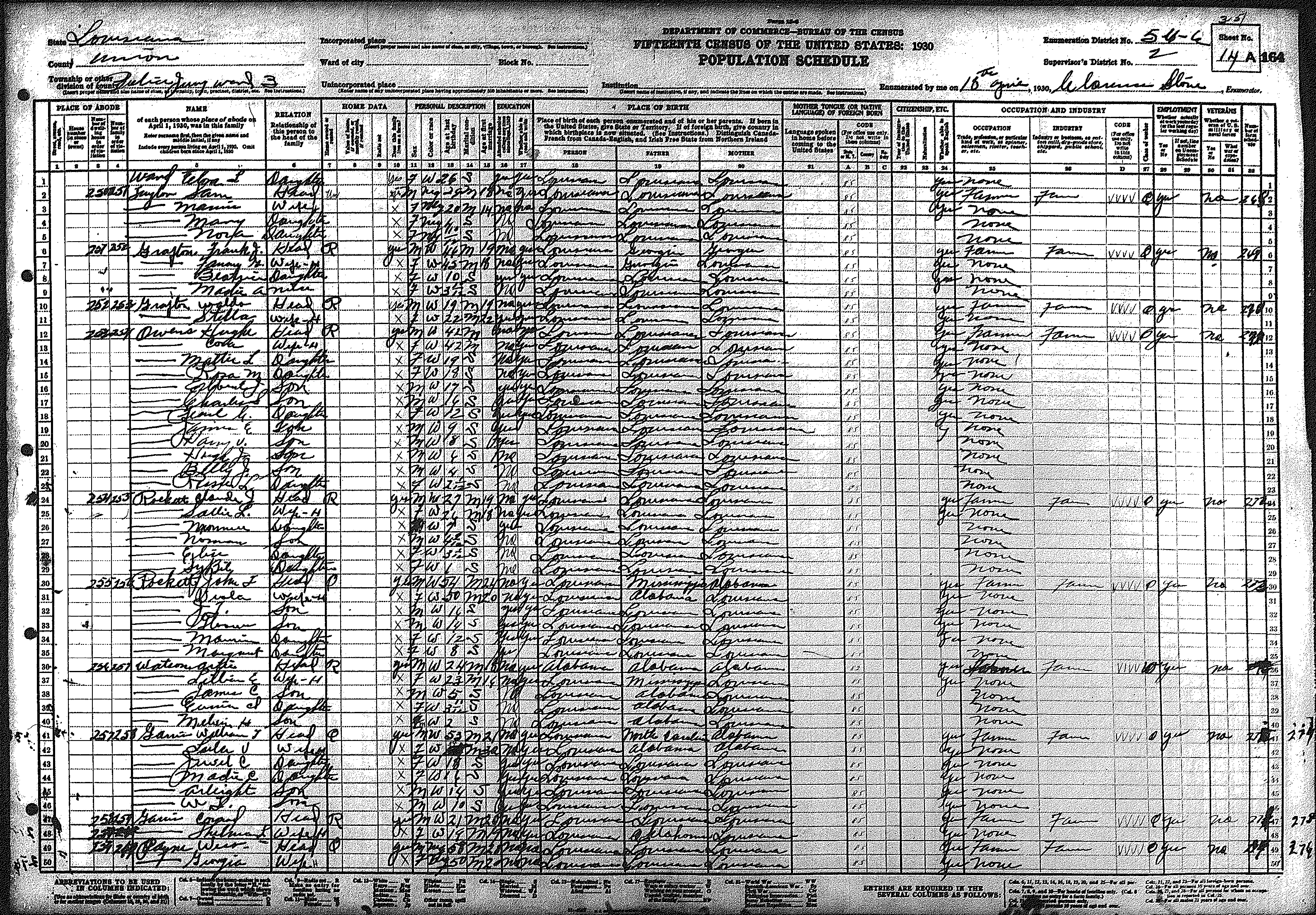
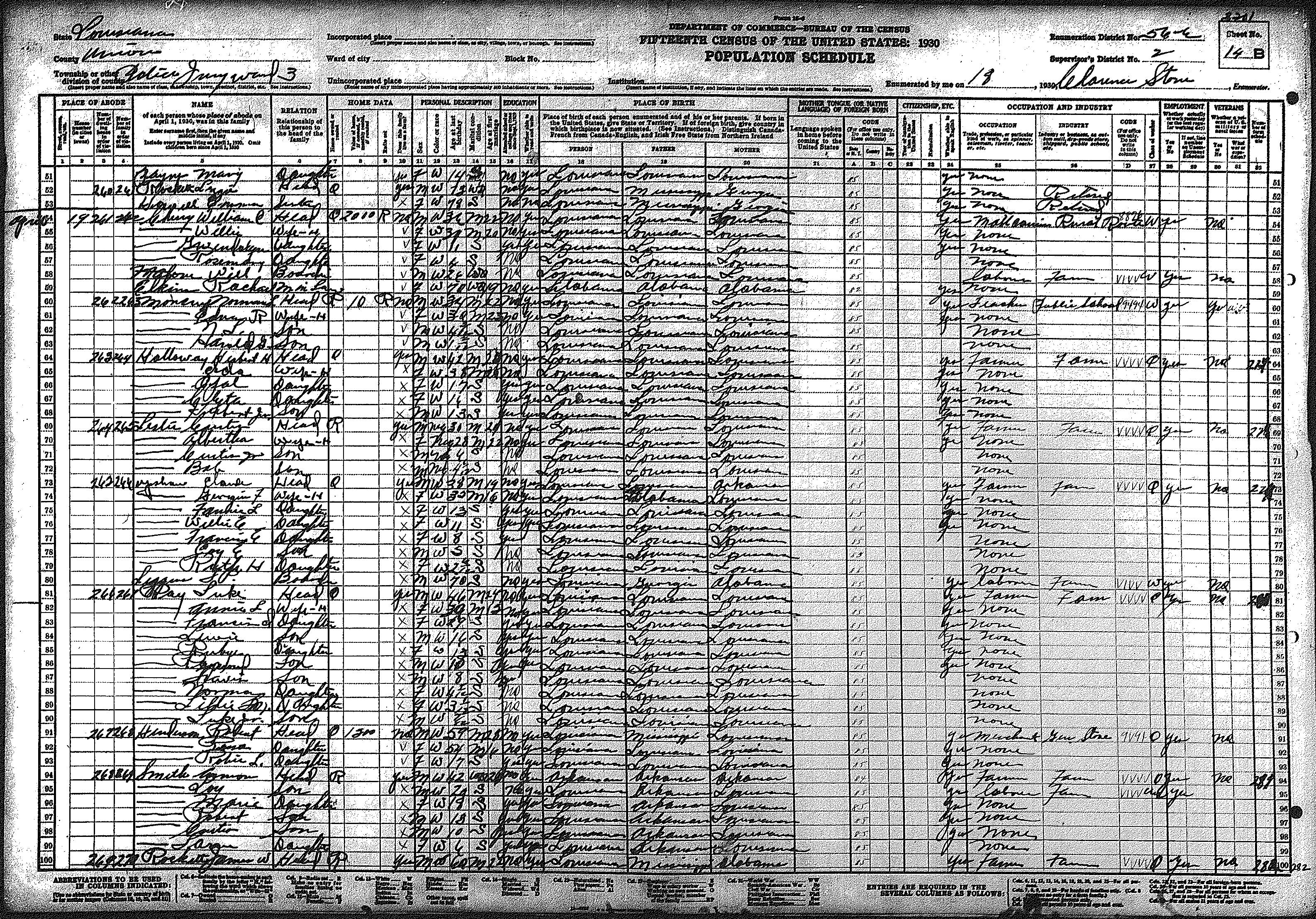
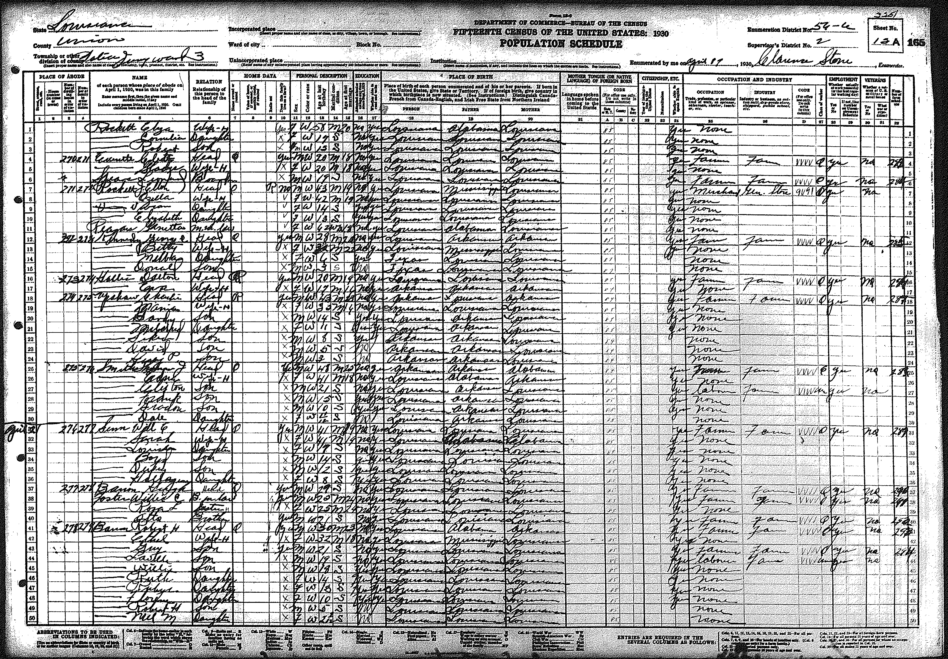
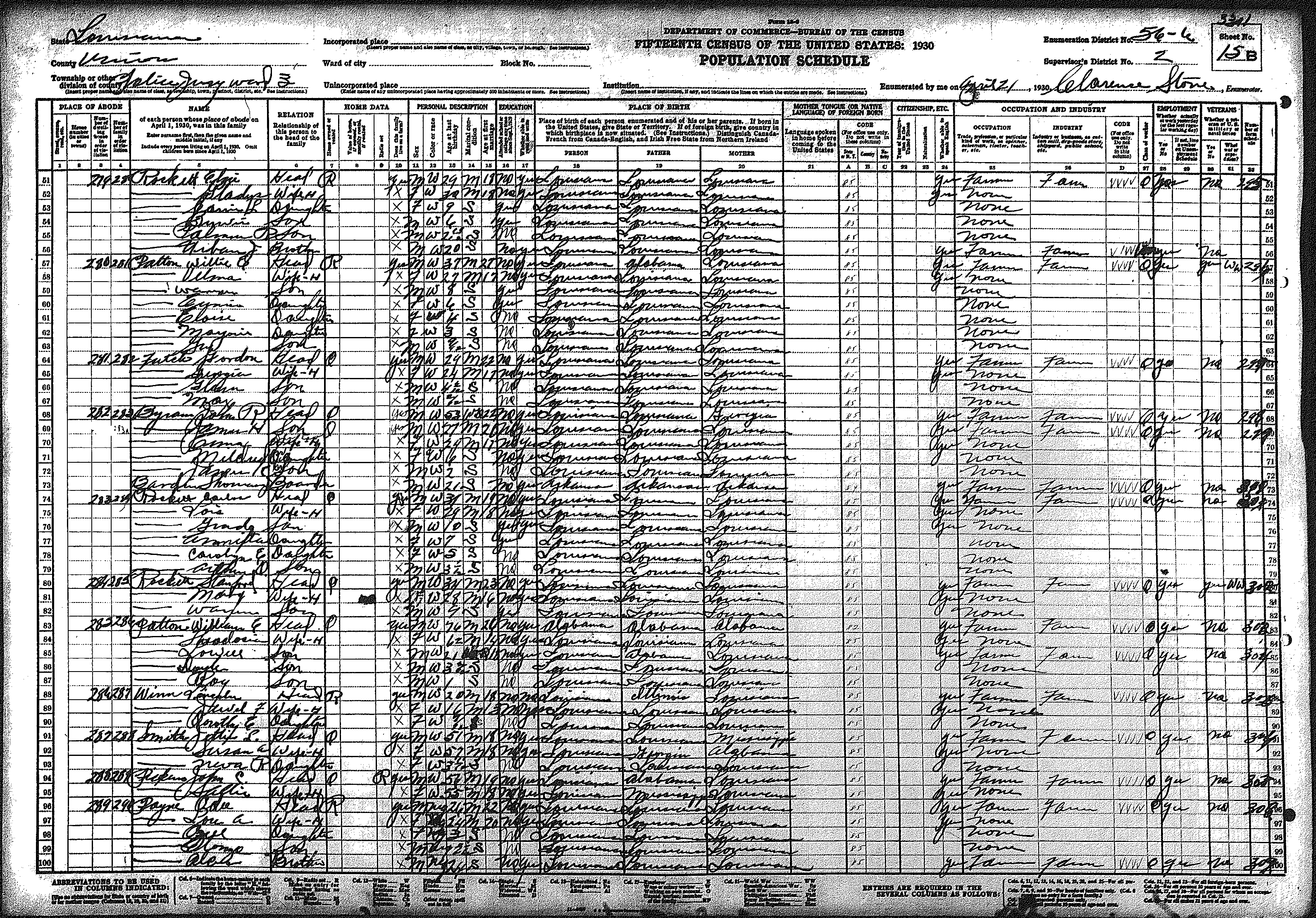
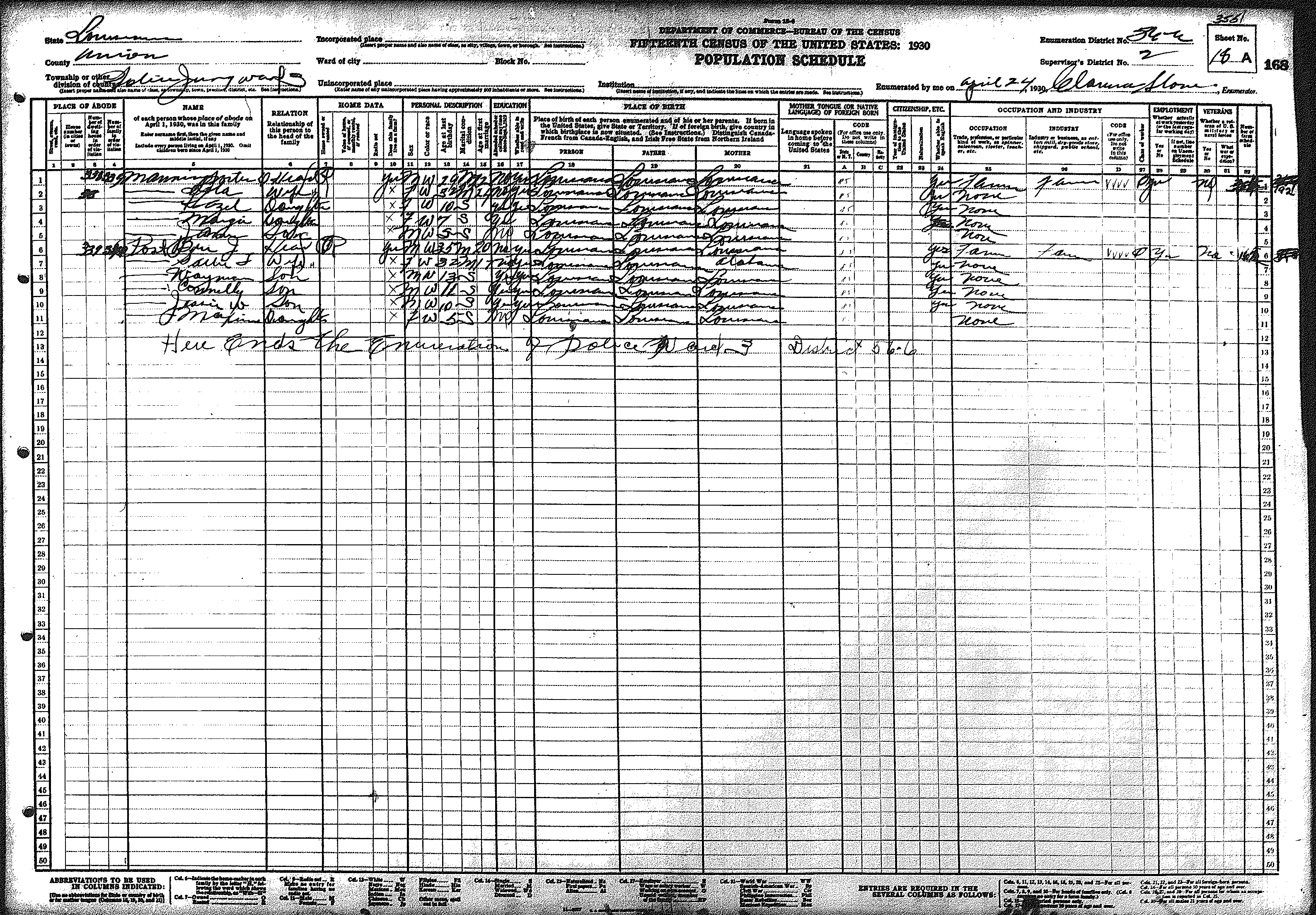
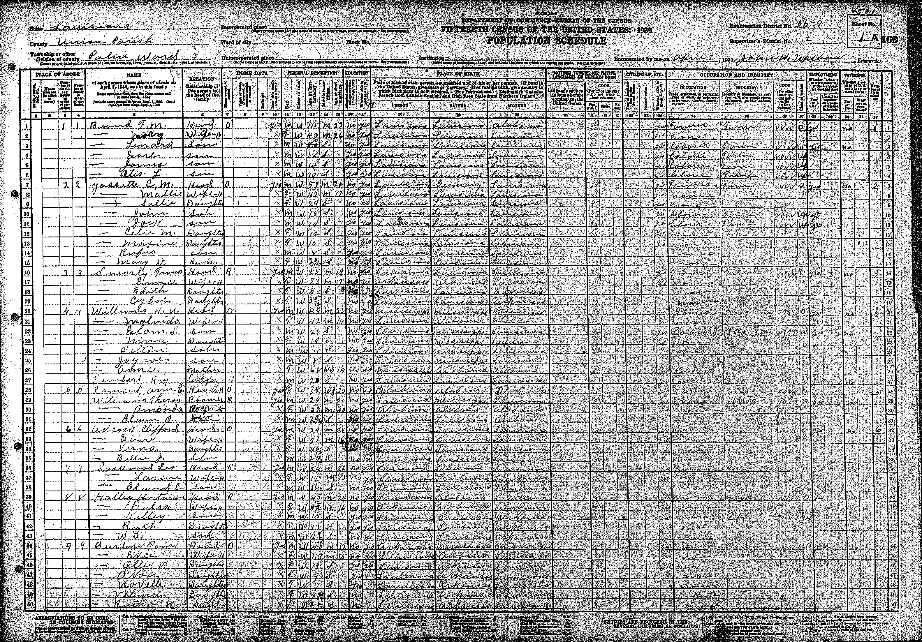
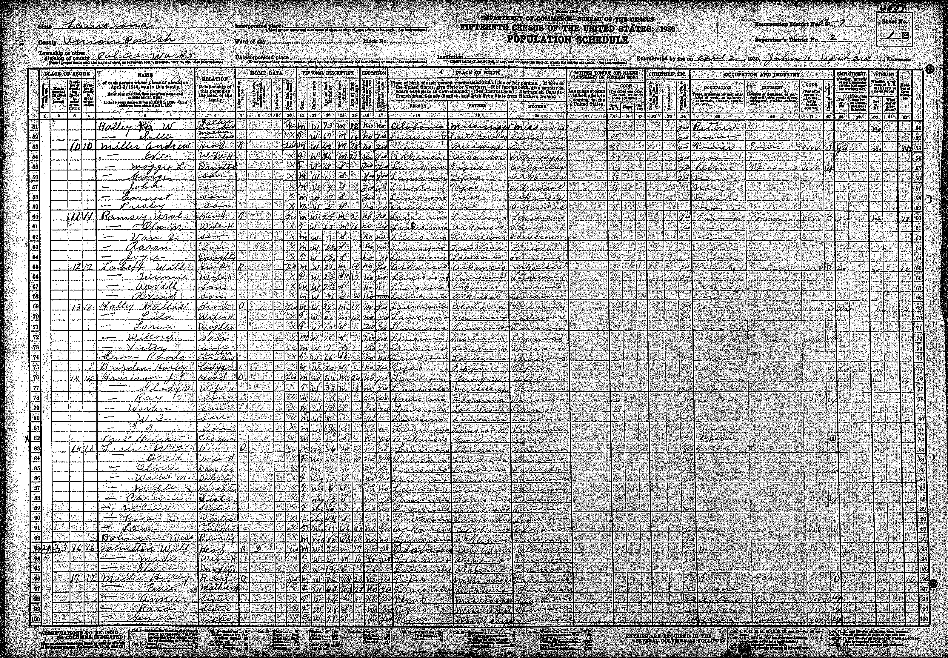
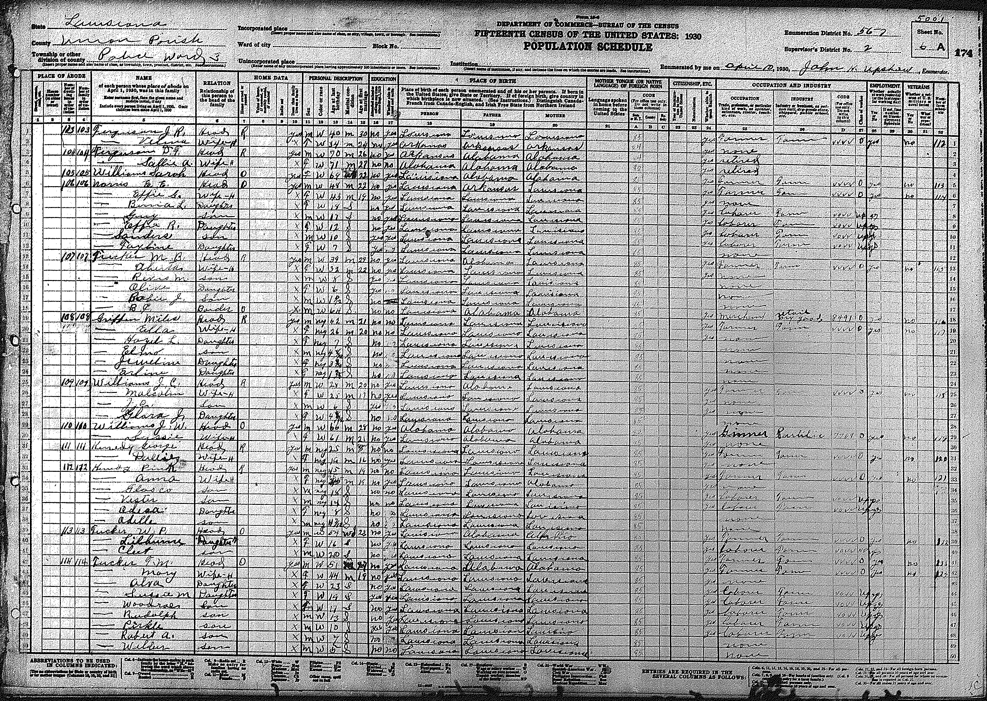
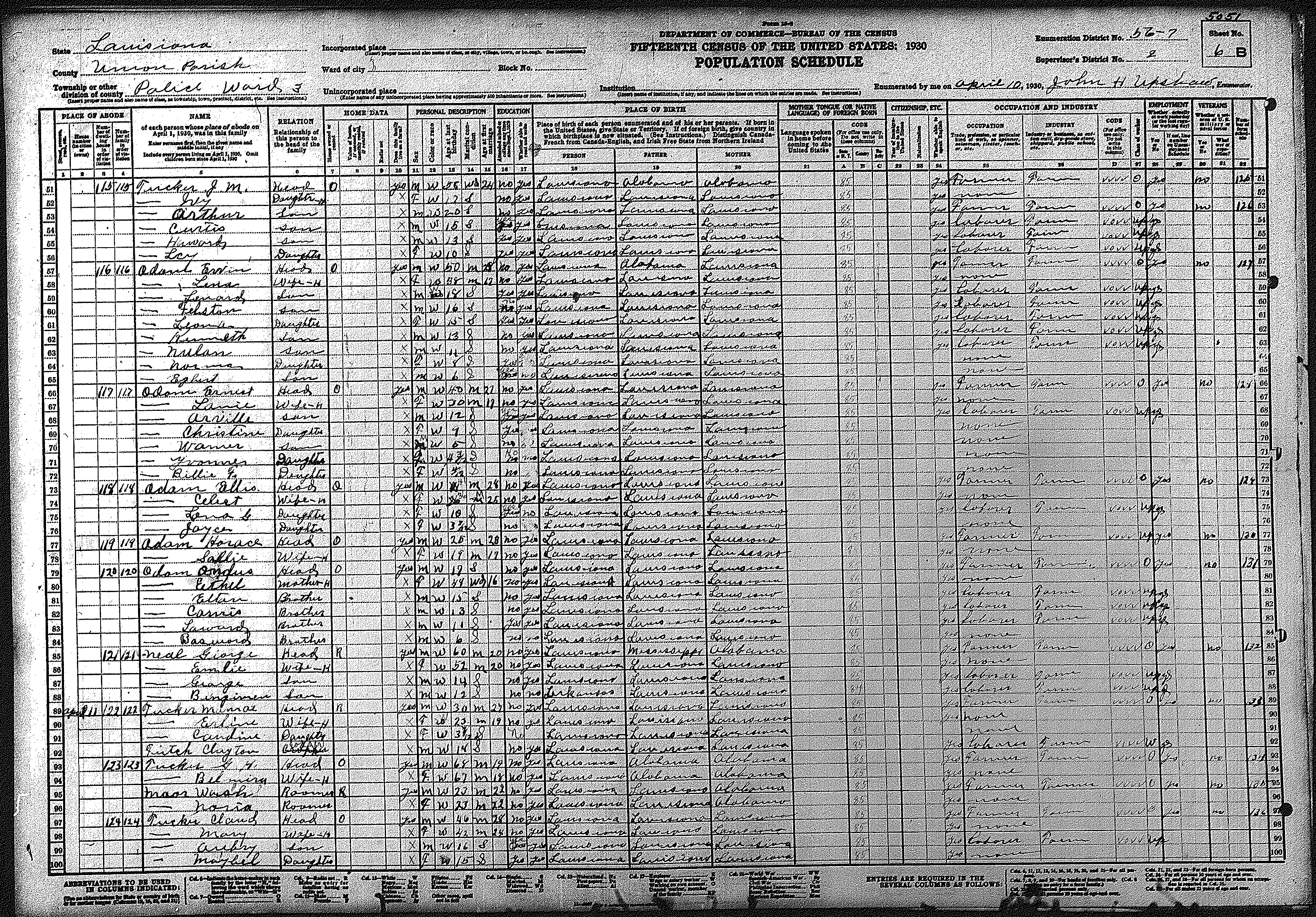
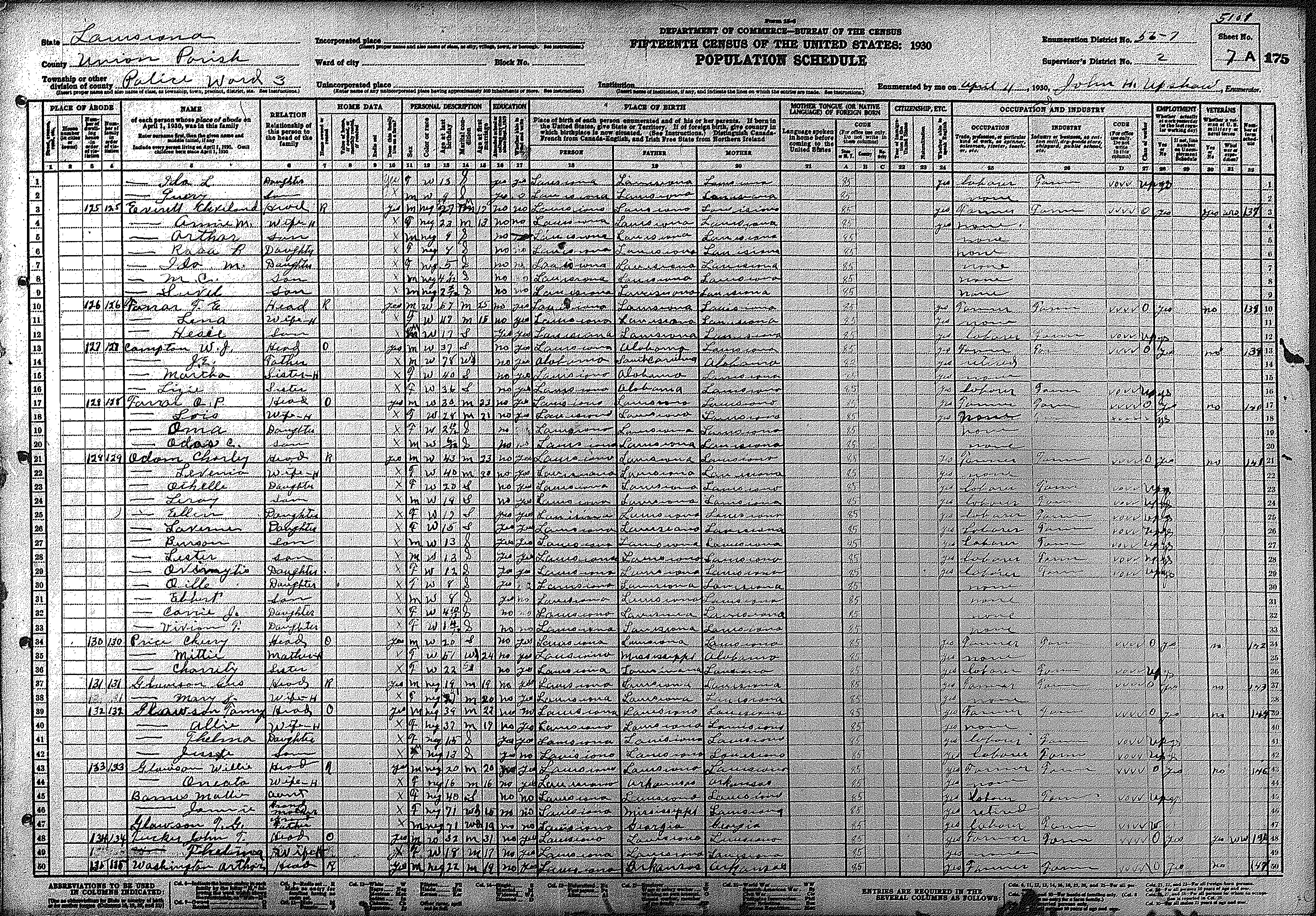
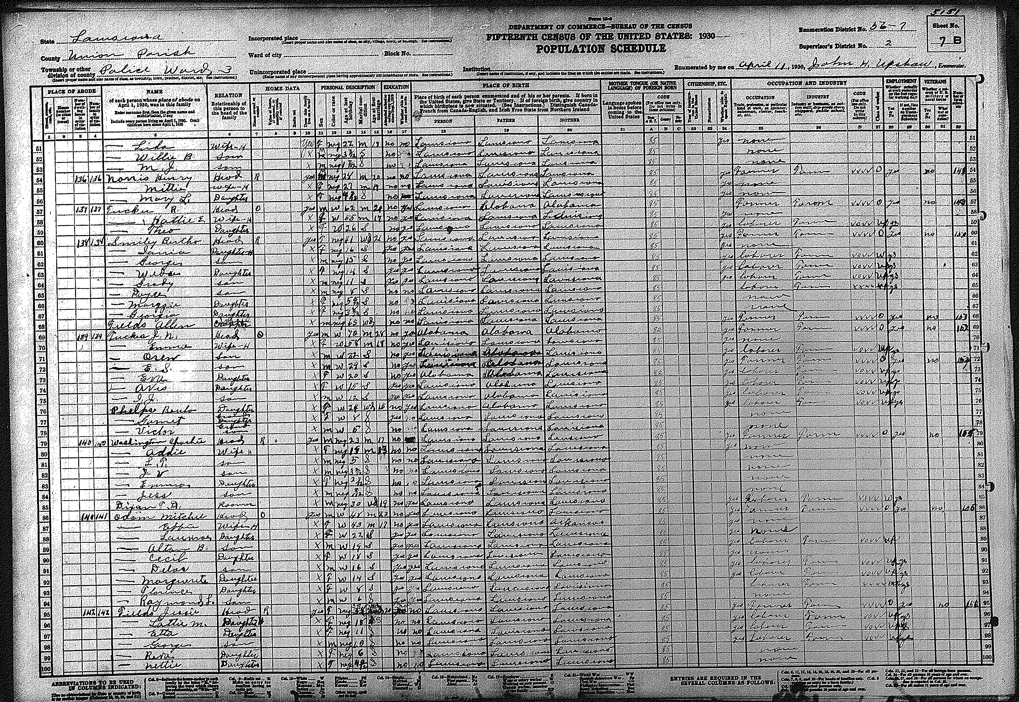
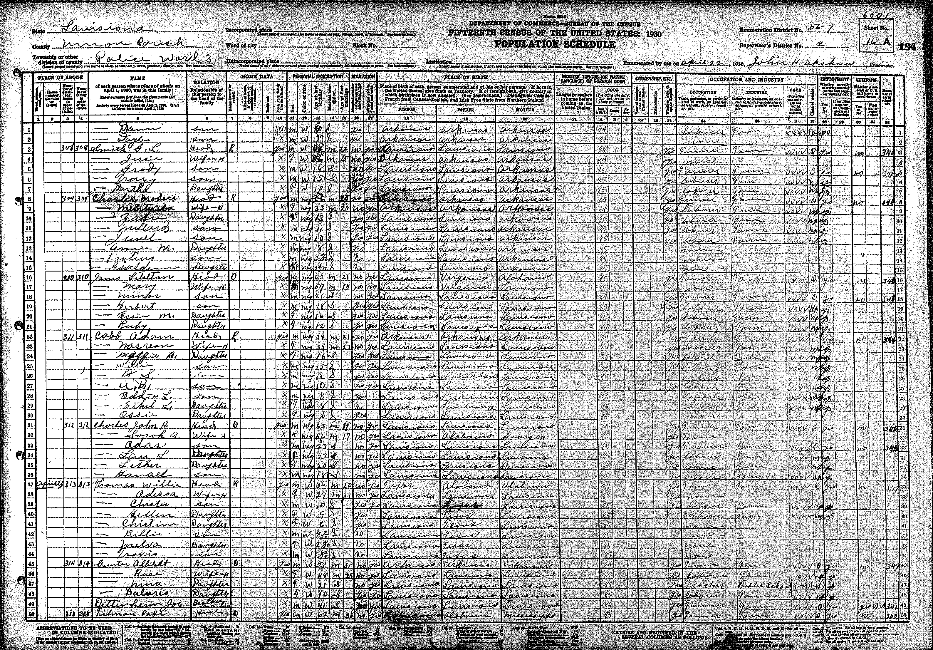
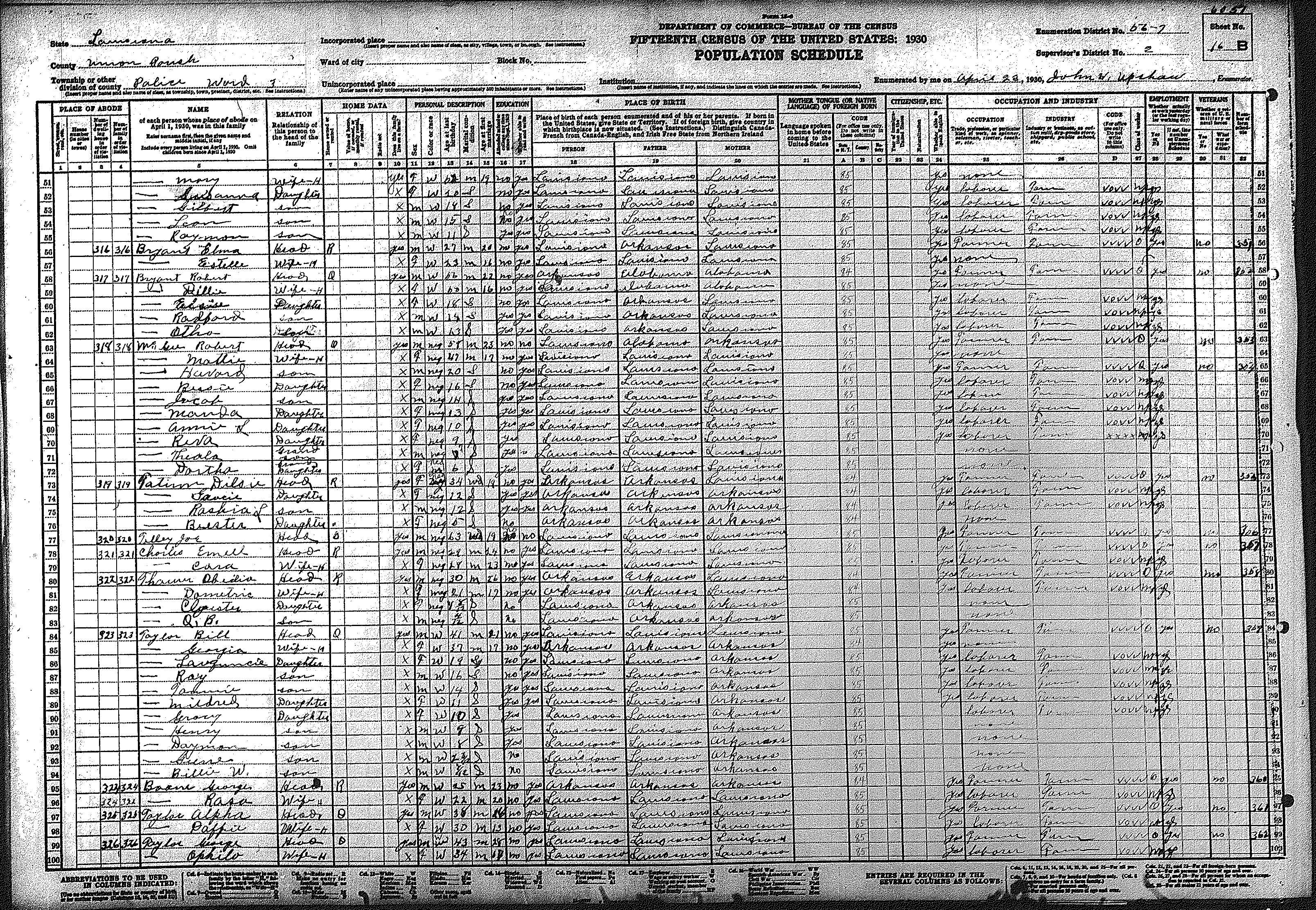
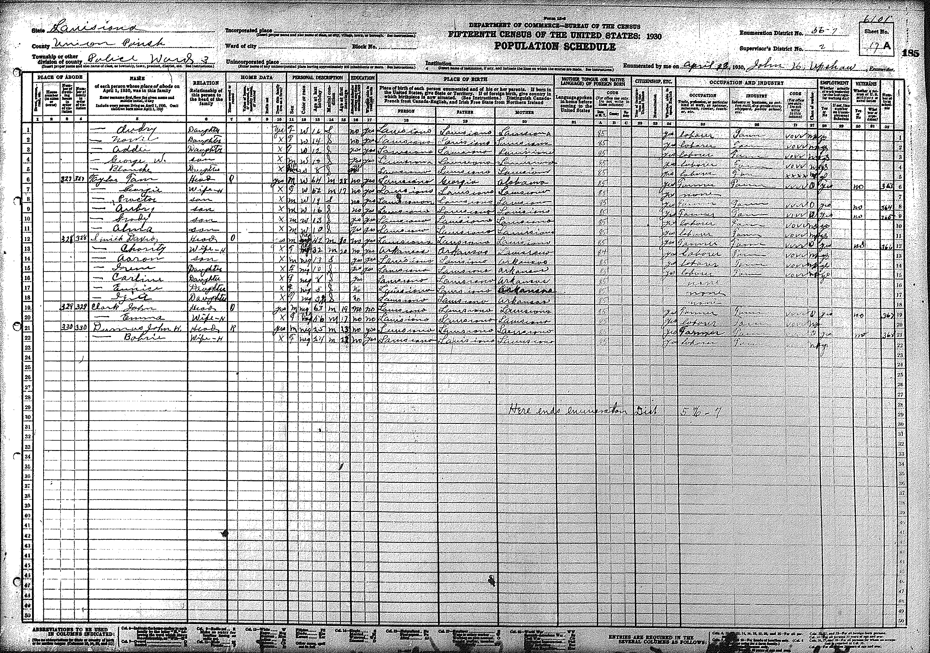
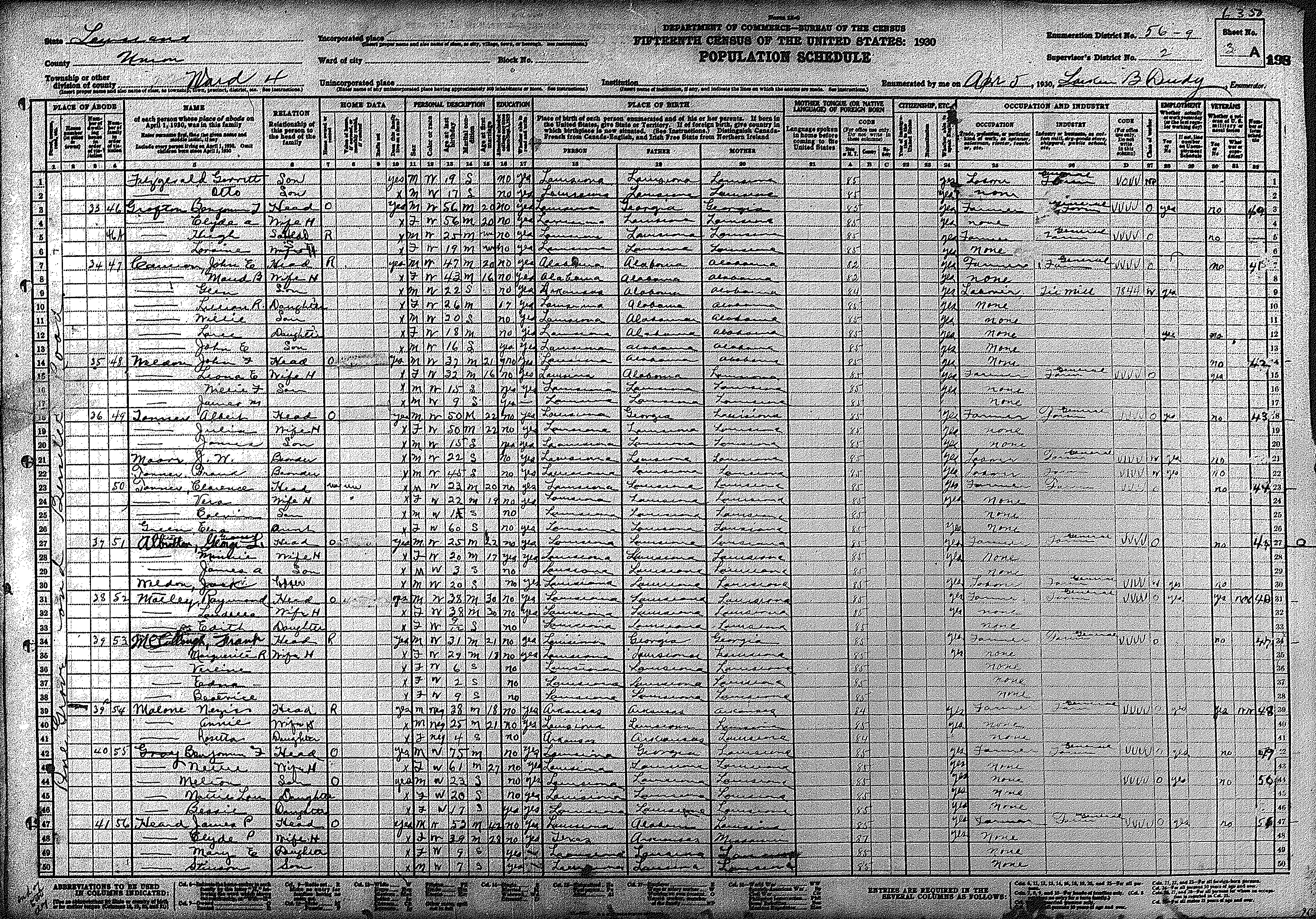
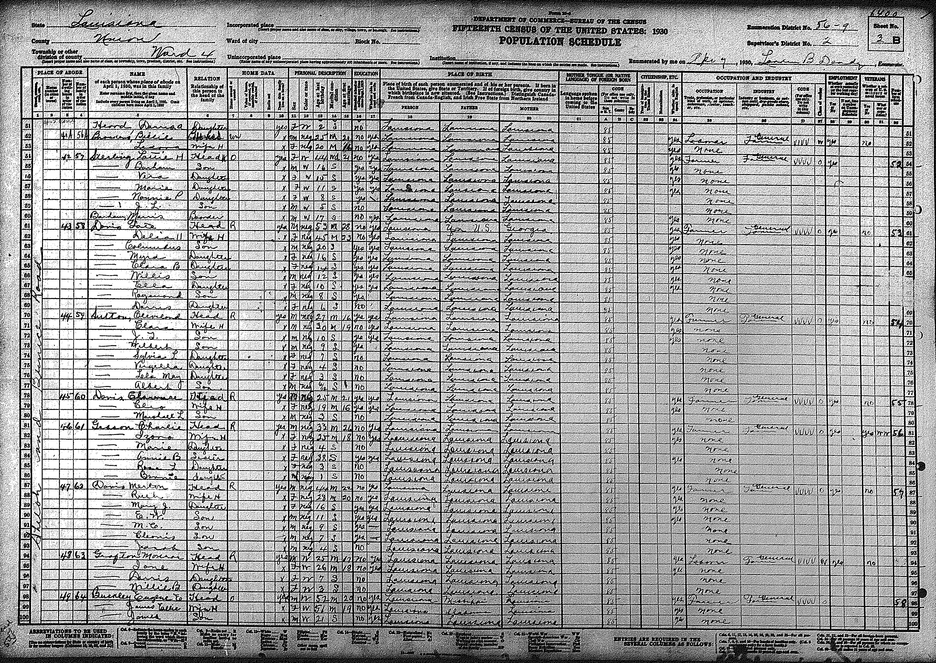
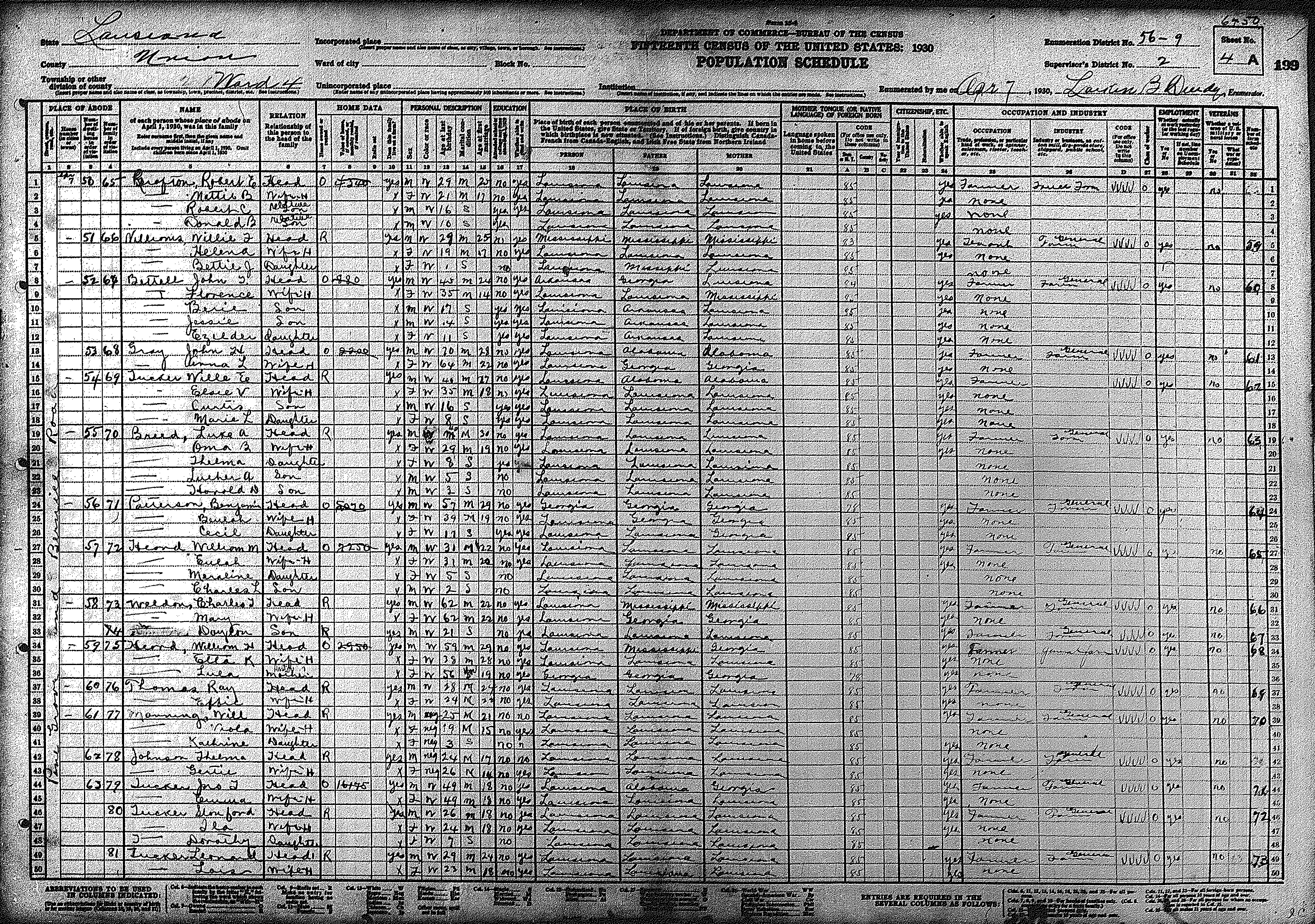
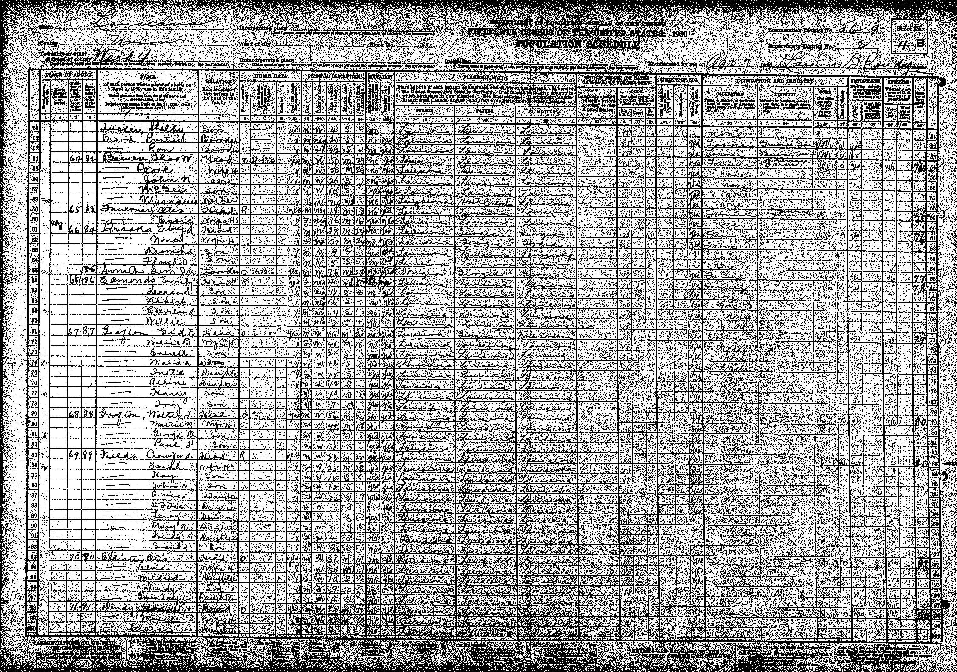
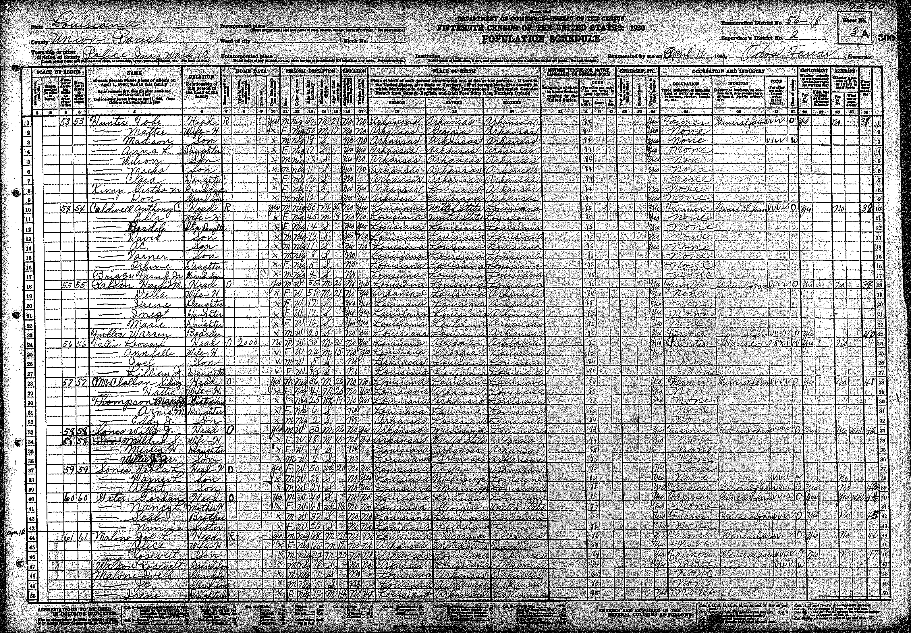
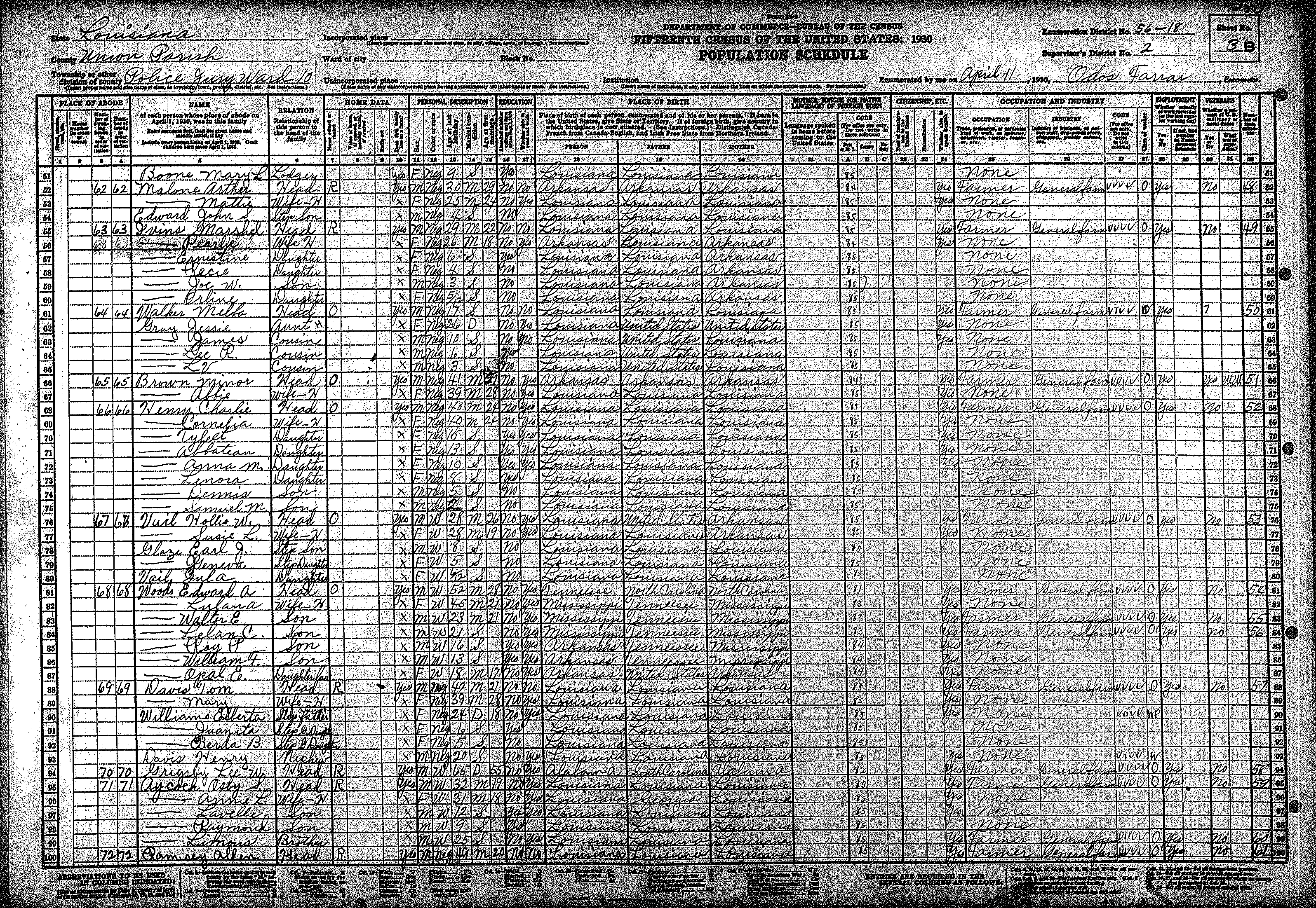
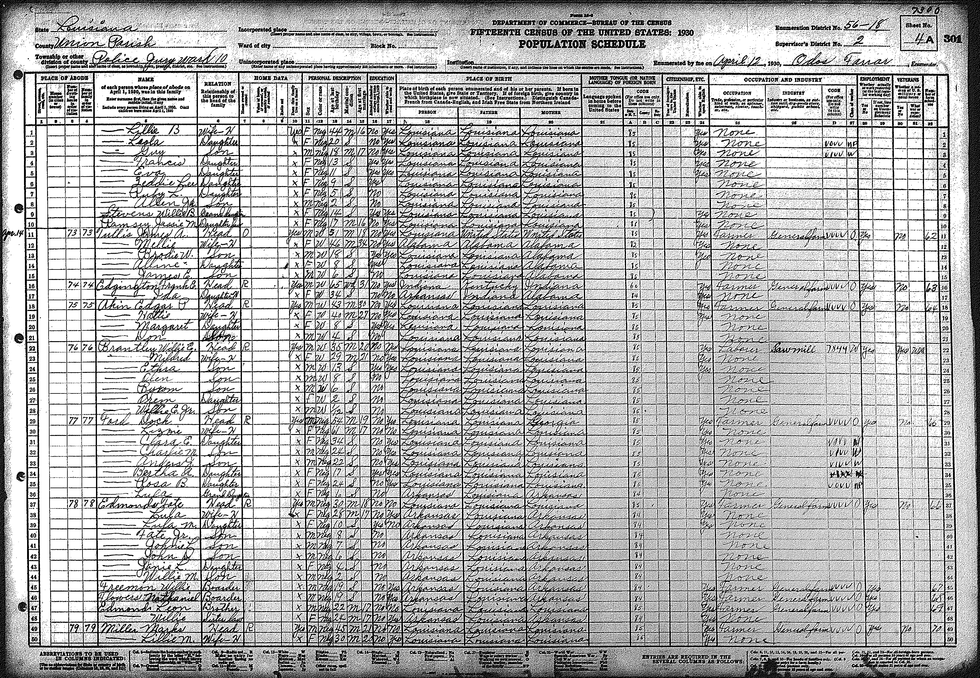
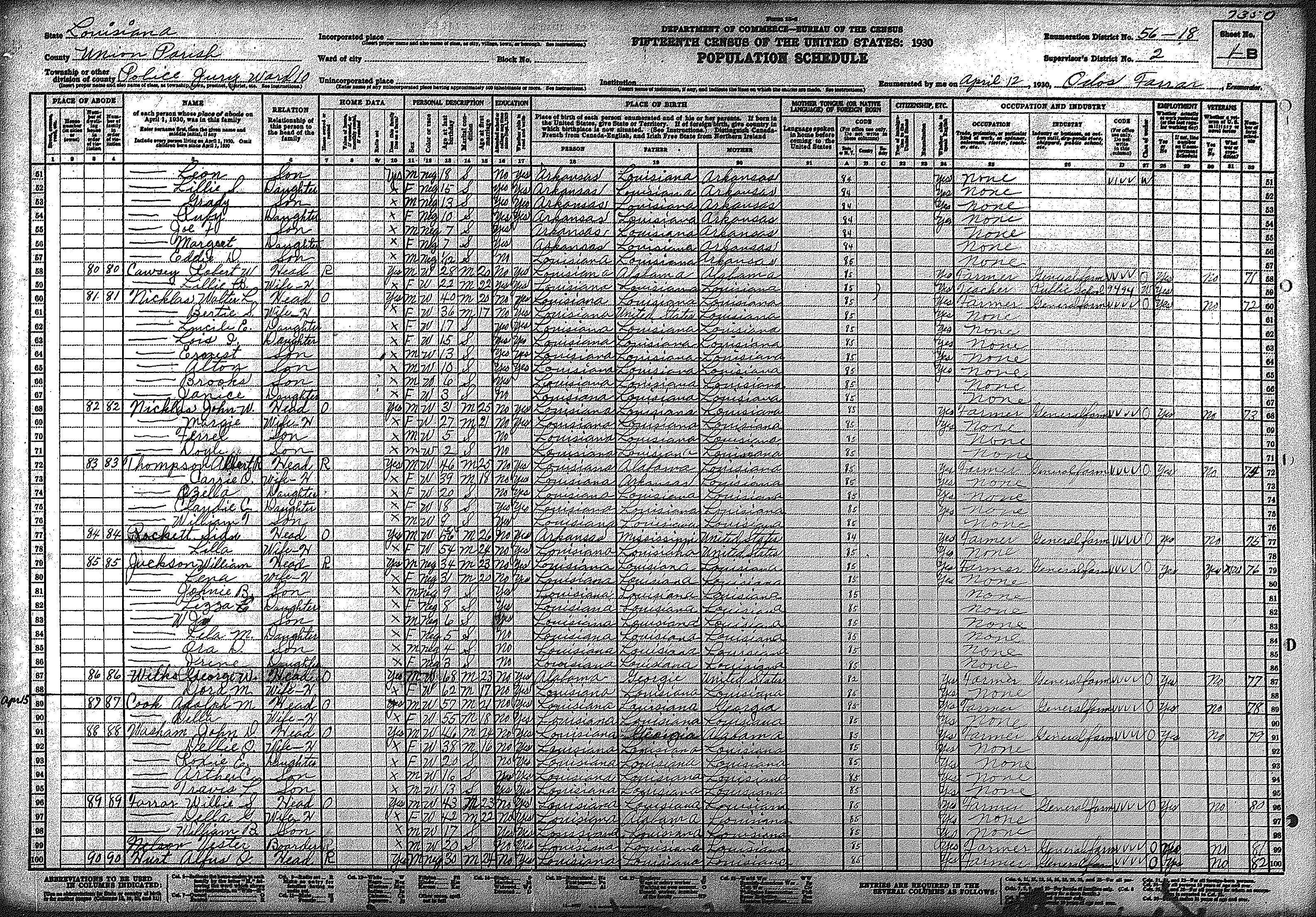
- All 1870 – 1930 Union Parish censuses are subdivided according to the ward numbers. The 1930 census enumeration is divided into ten wards. For a detailed explanation of the ward boundaries, see our Ward Designations Page. The Census Bureau also used their official Enumeration Districts (ED) to subdivide each portion of the parish. The more populous wards had several EDs within their limits, whereas others only included one.
| 1930 Union Parish Louisiana Census Indices | ||||
|---|---|---|---|---|
| Ward 1 | Ward 2 | Ward 3 | Ward 4 | Ward 5 |
| Ward 6 | Ward 7 | Ward 8 | Ward 9 | Ward 10 |
visit our Tips for Enlarging Census Images page.
| 1930 Union Parish Louisiana Census Images | |||||||||||||||||||
|---|---|---|---|---|---|---|---|---|---|---|---|---|---|---|---|---|---|---|---|
| Ward # | ED # |
Pages |
|||||||||||||||||
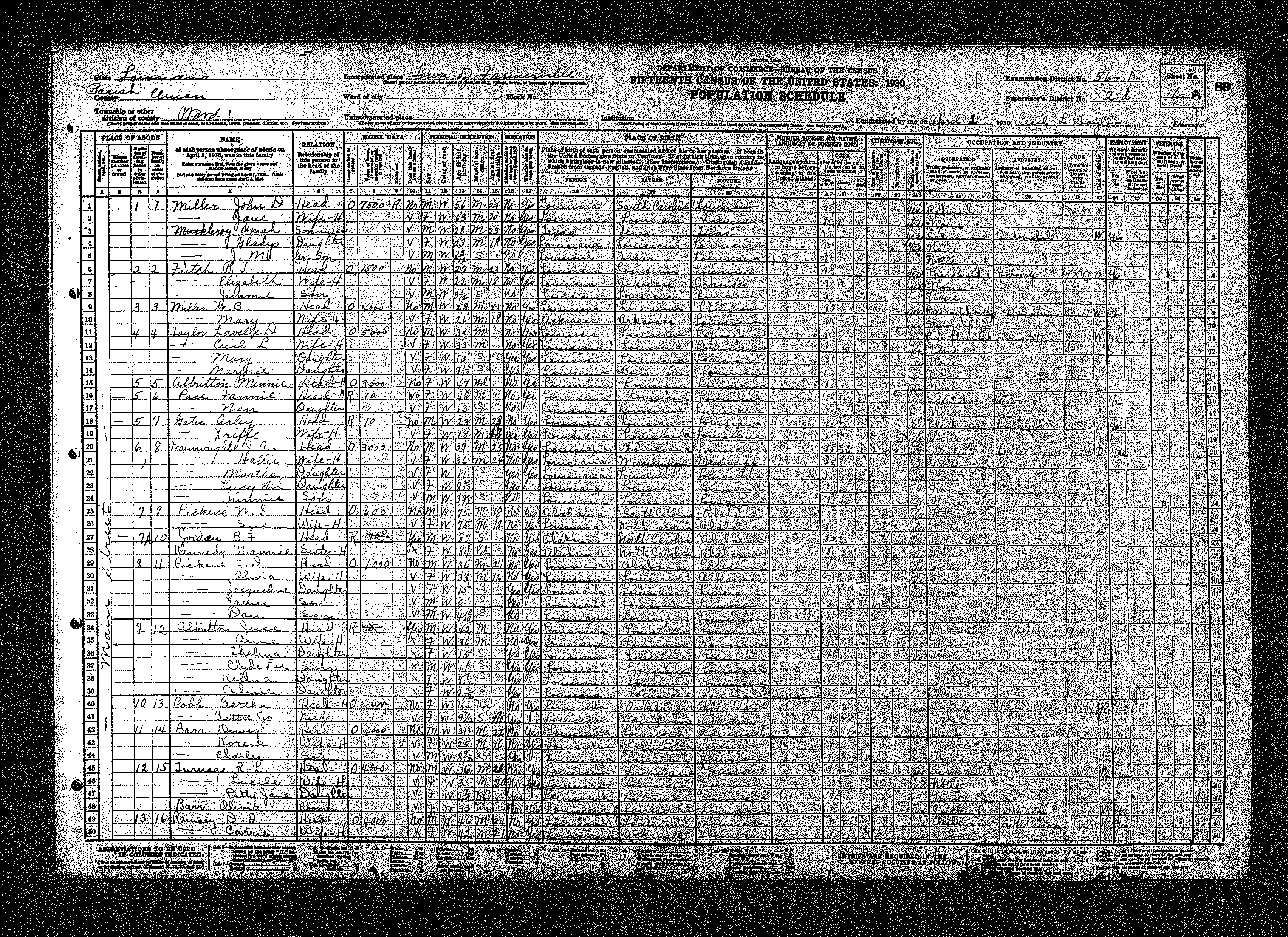
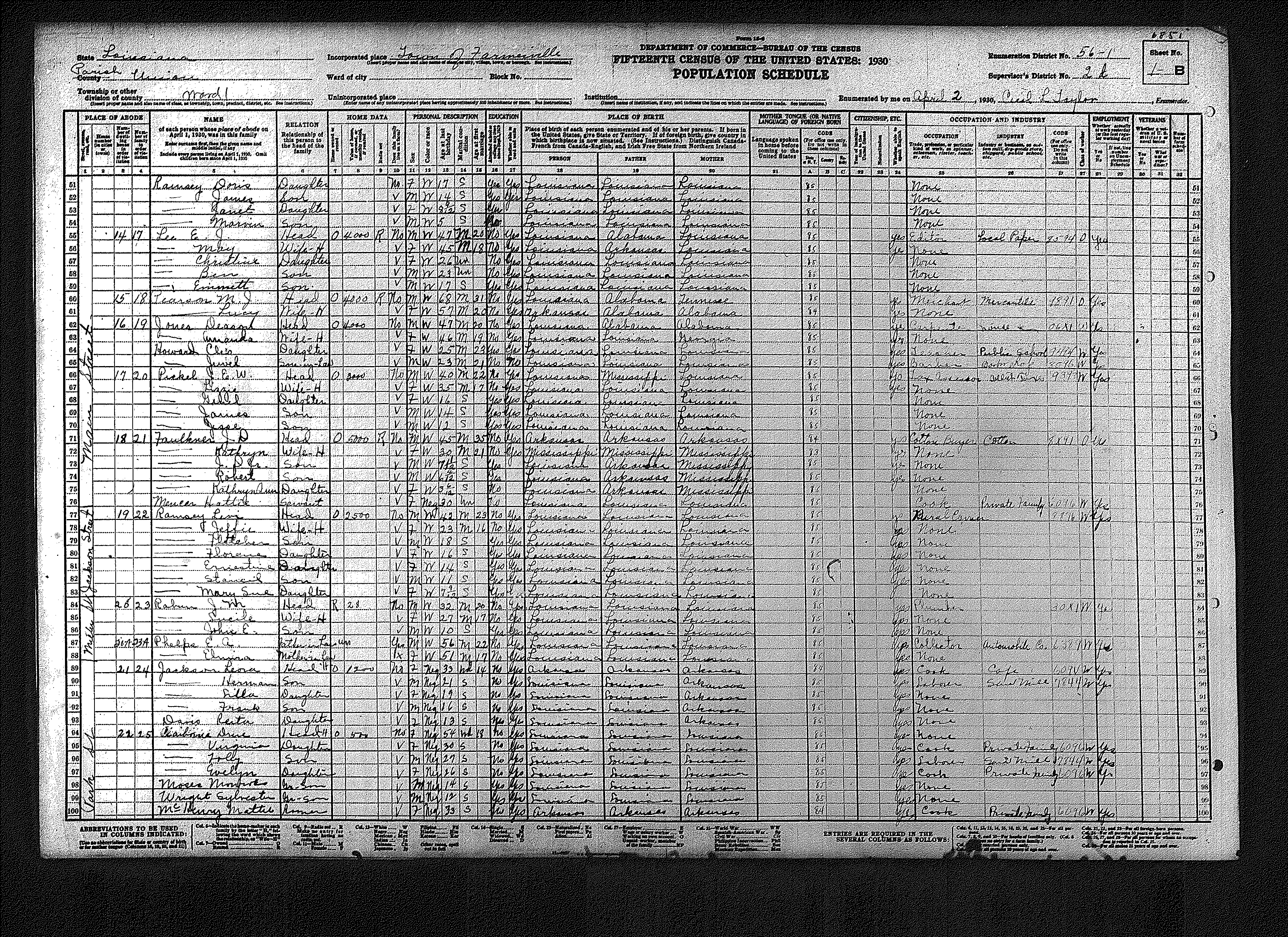
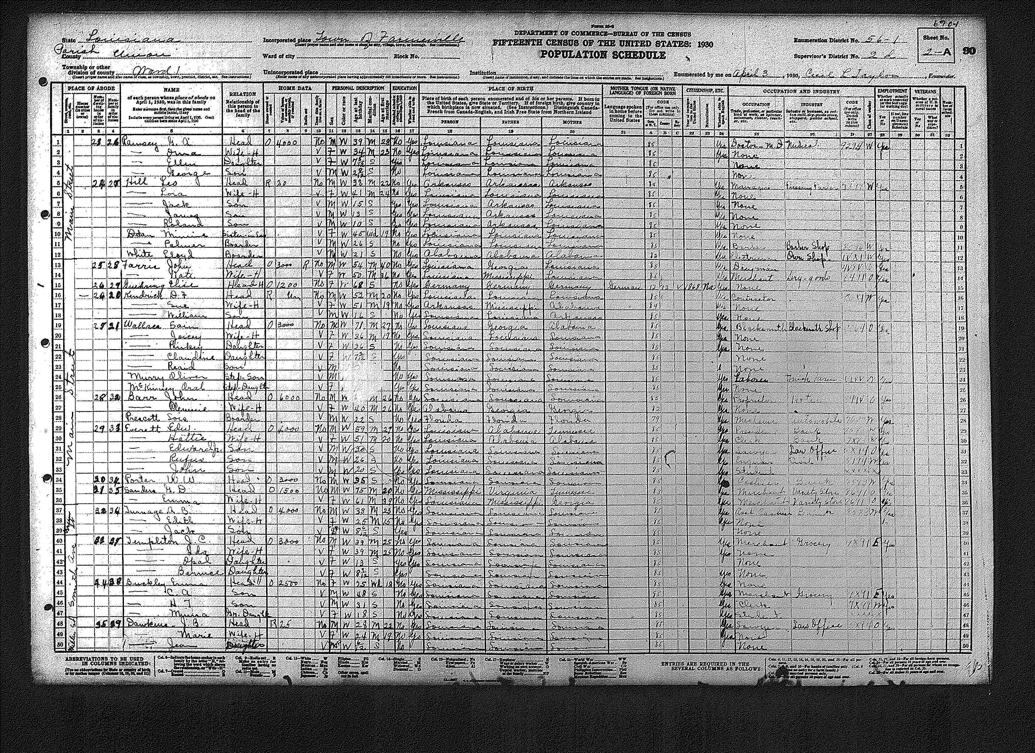
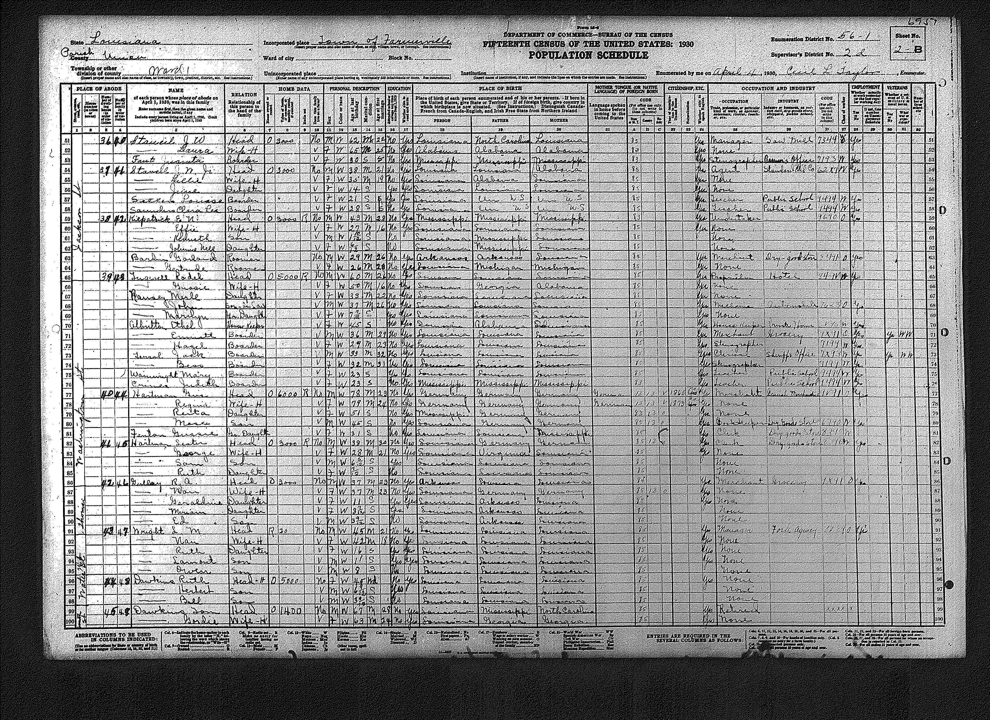
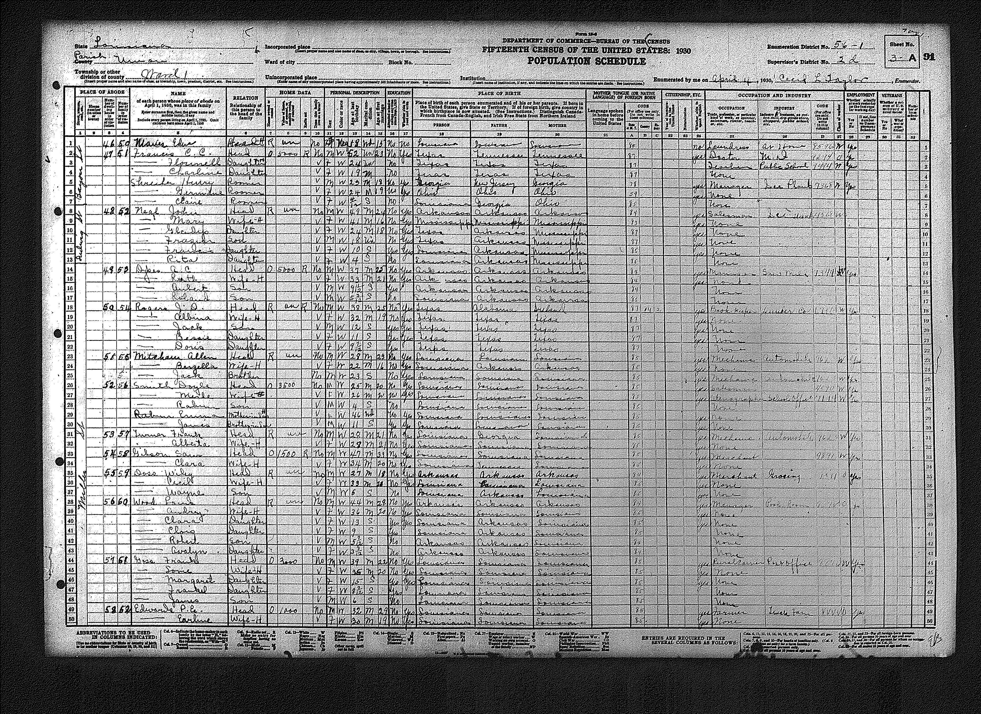
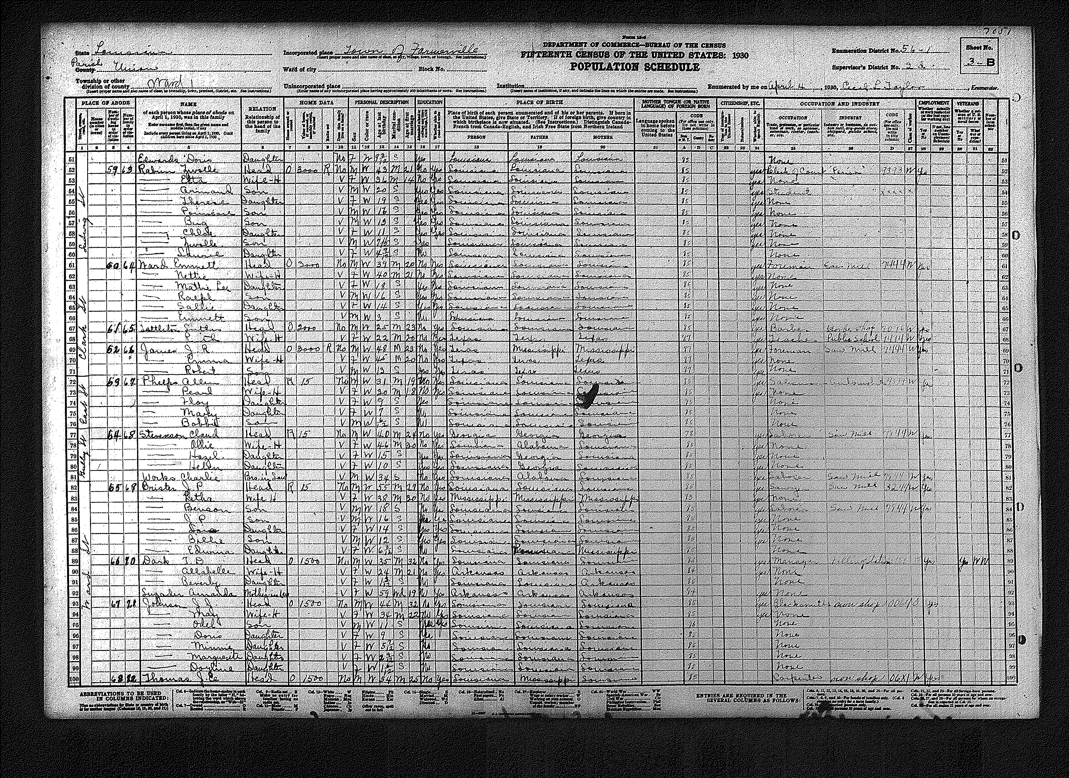
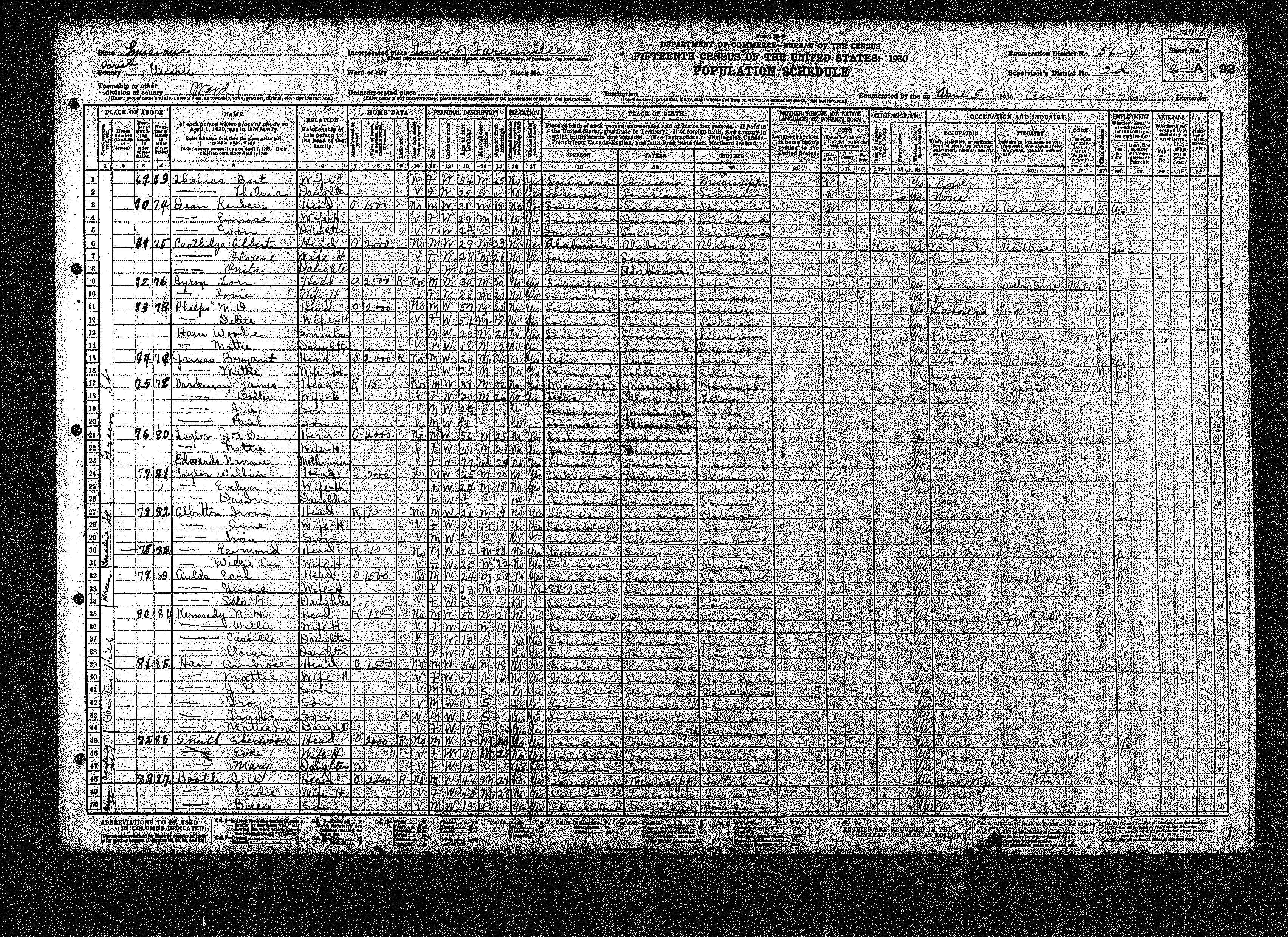
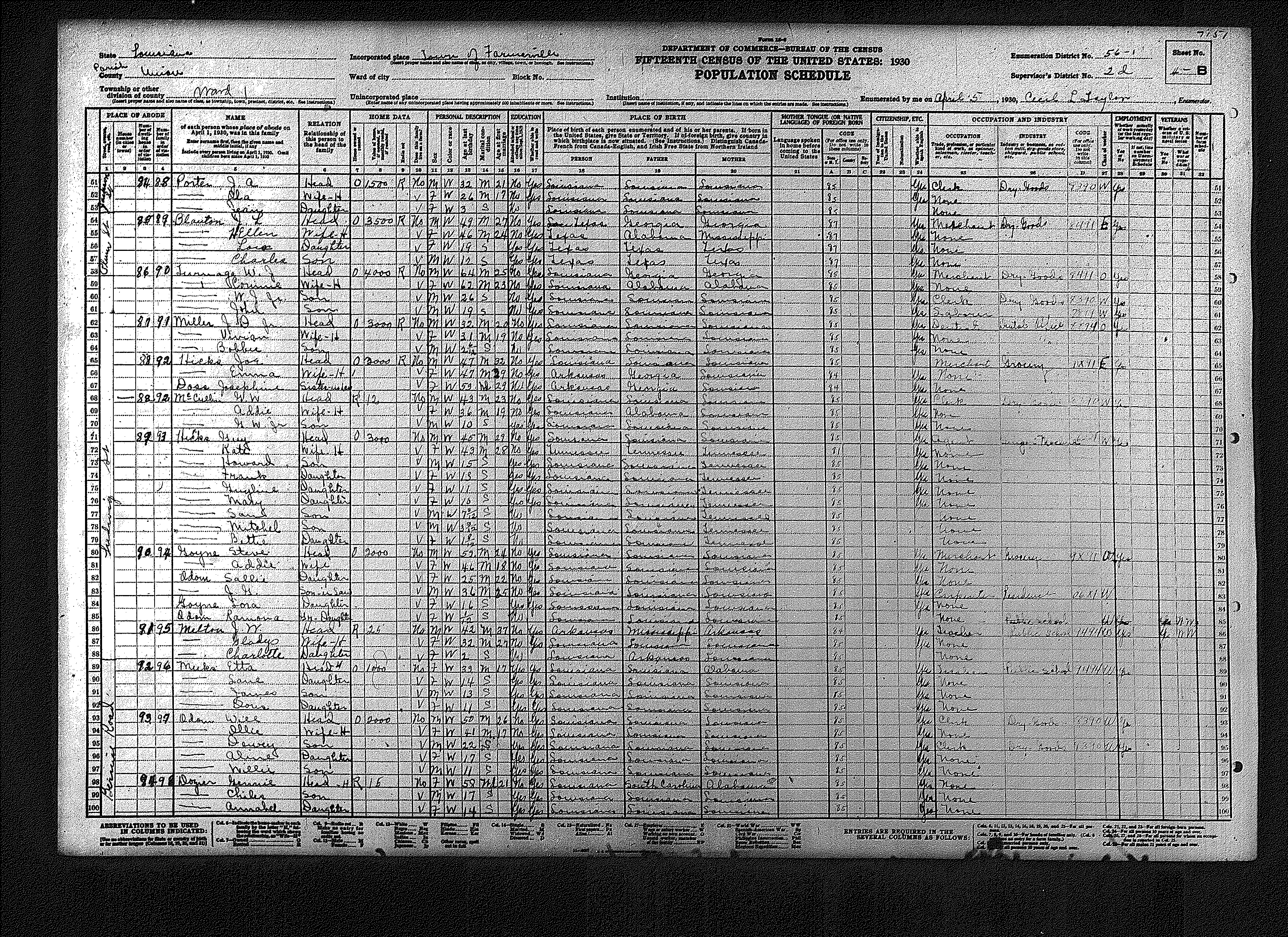
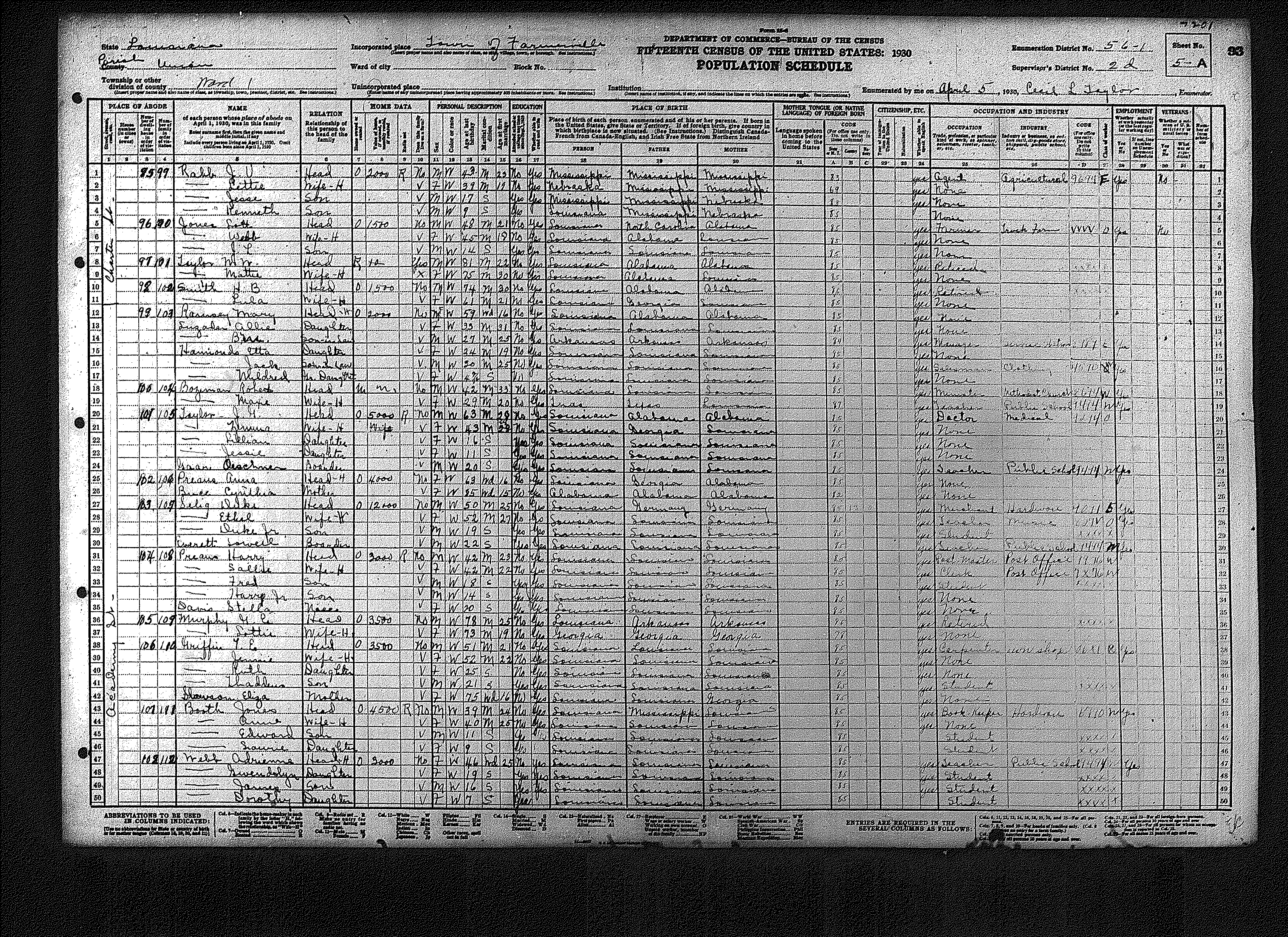
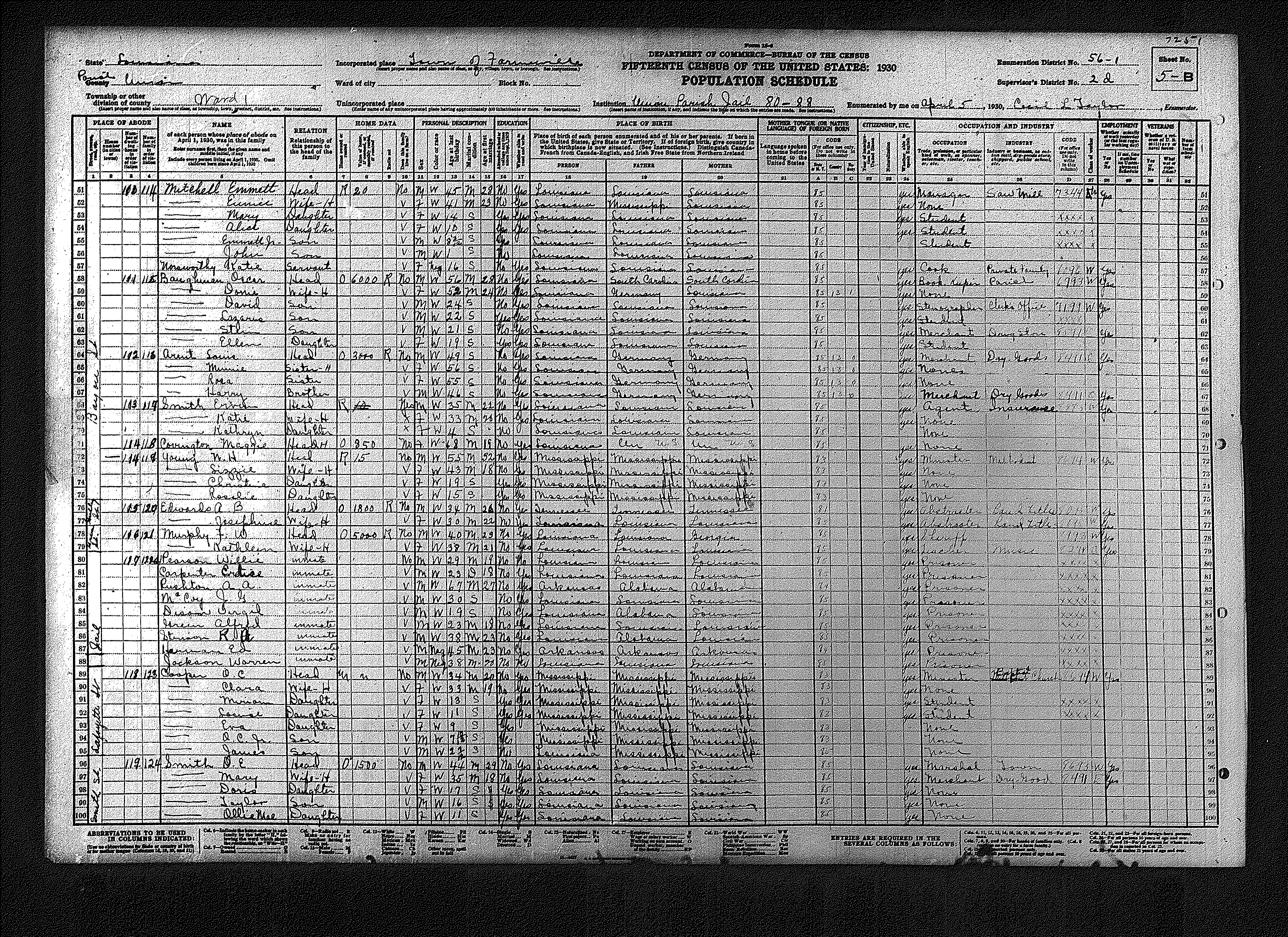
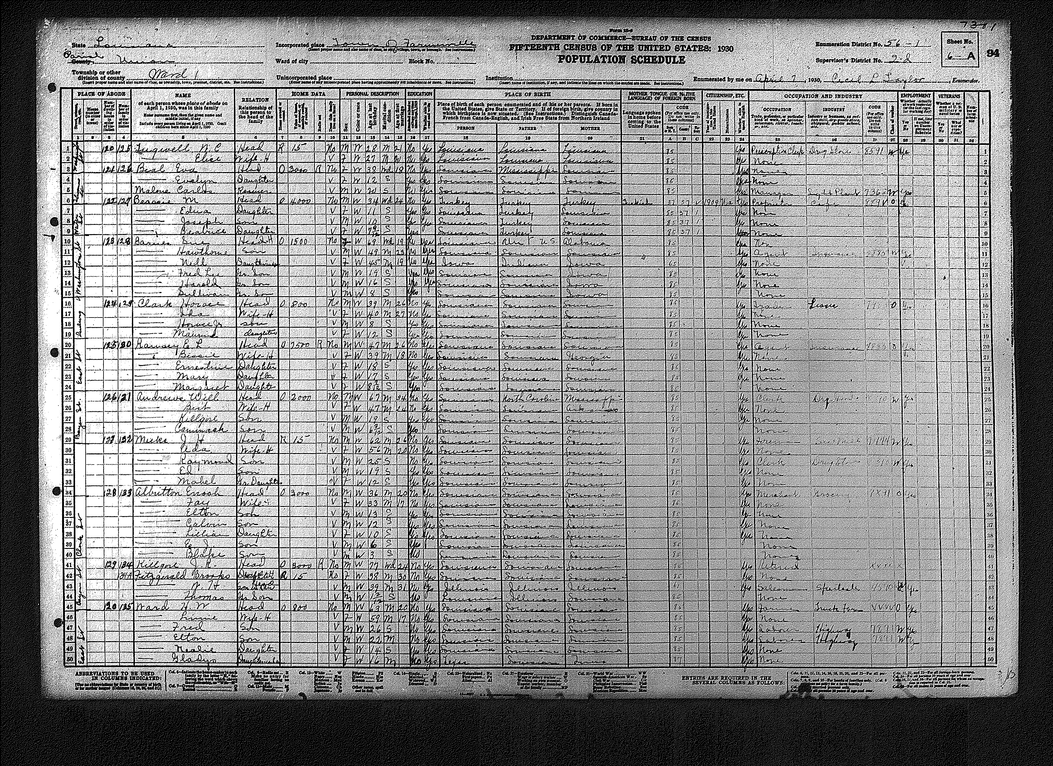
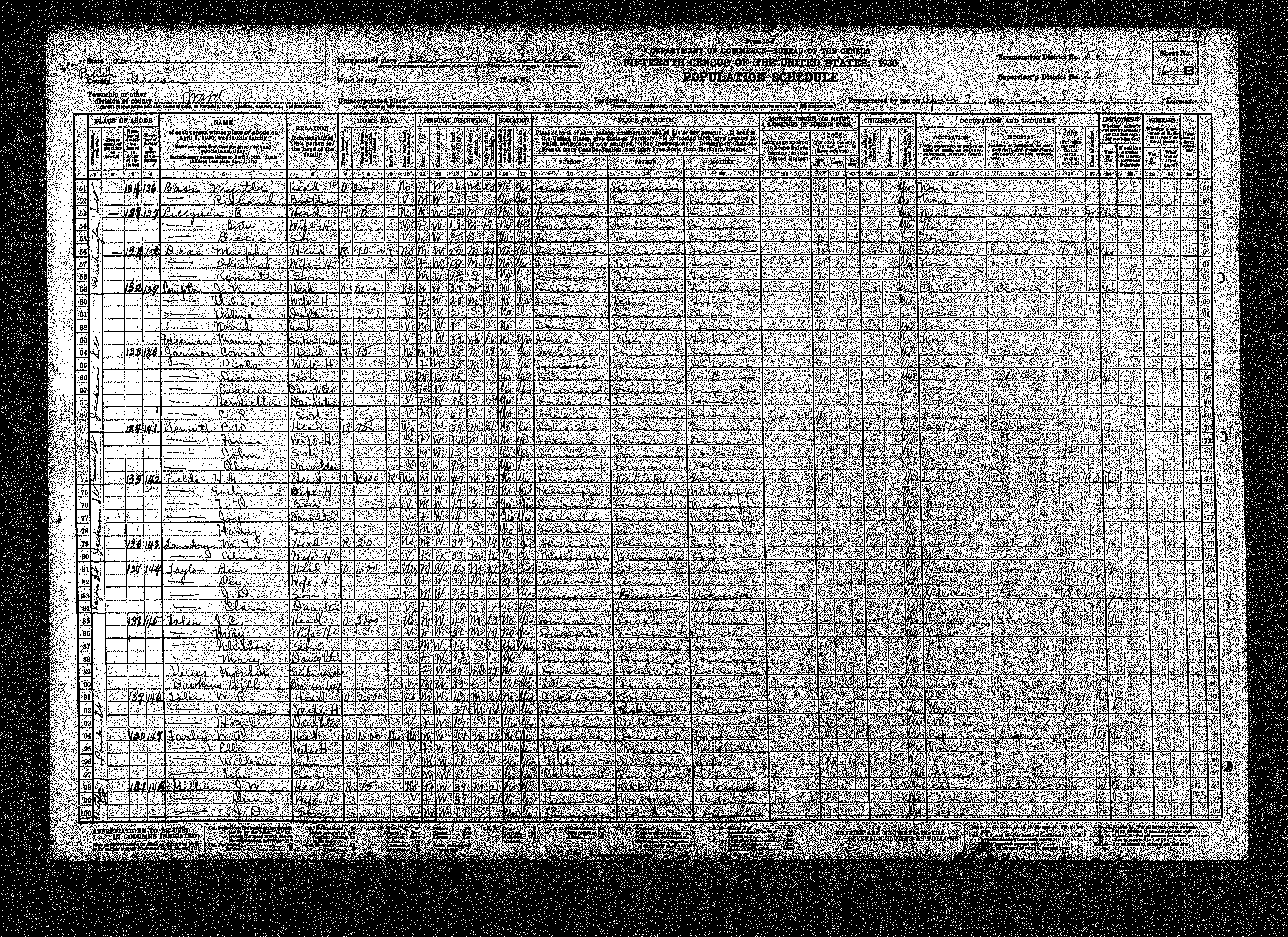
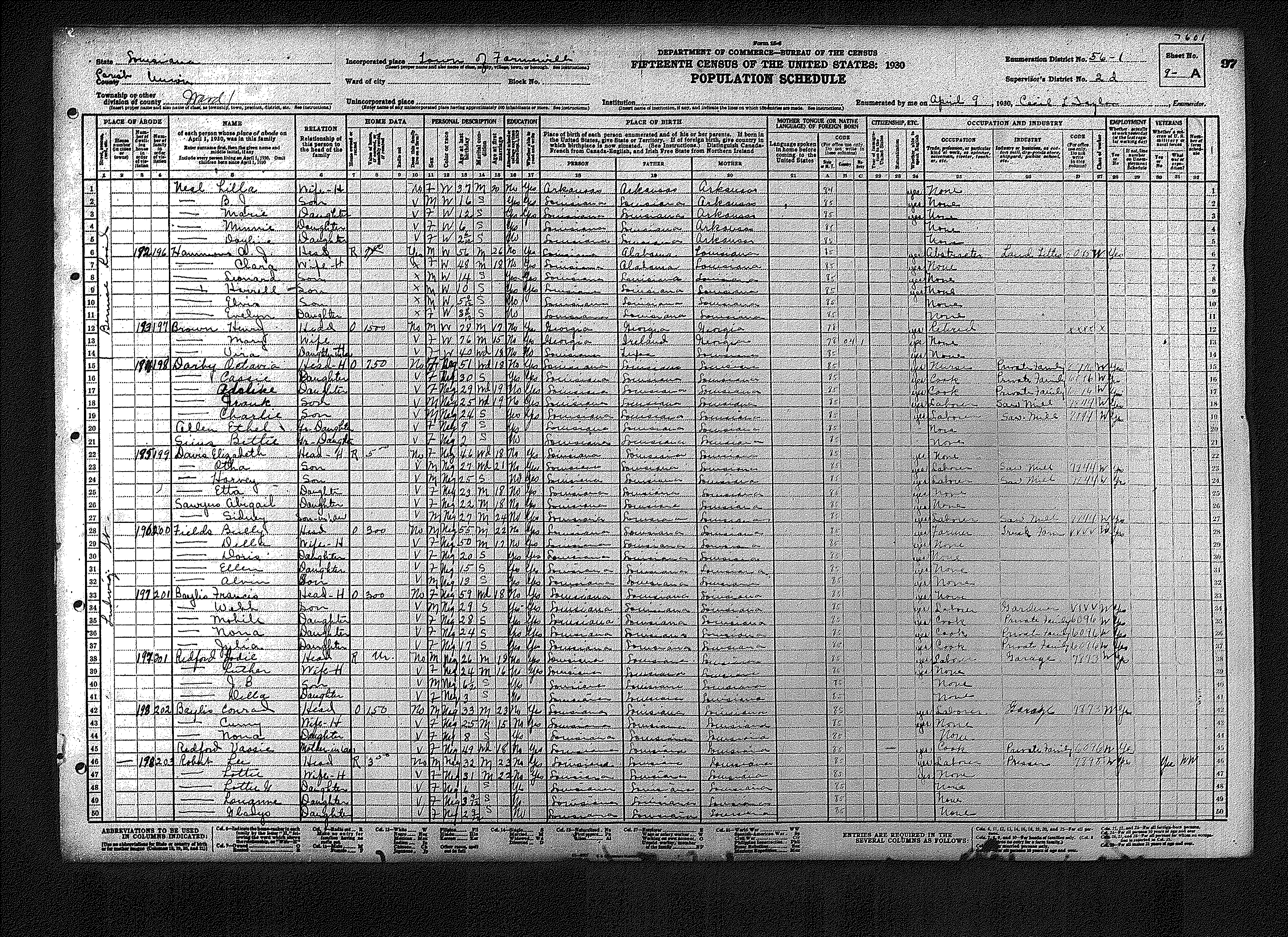
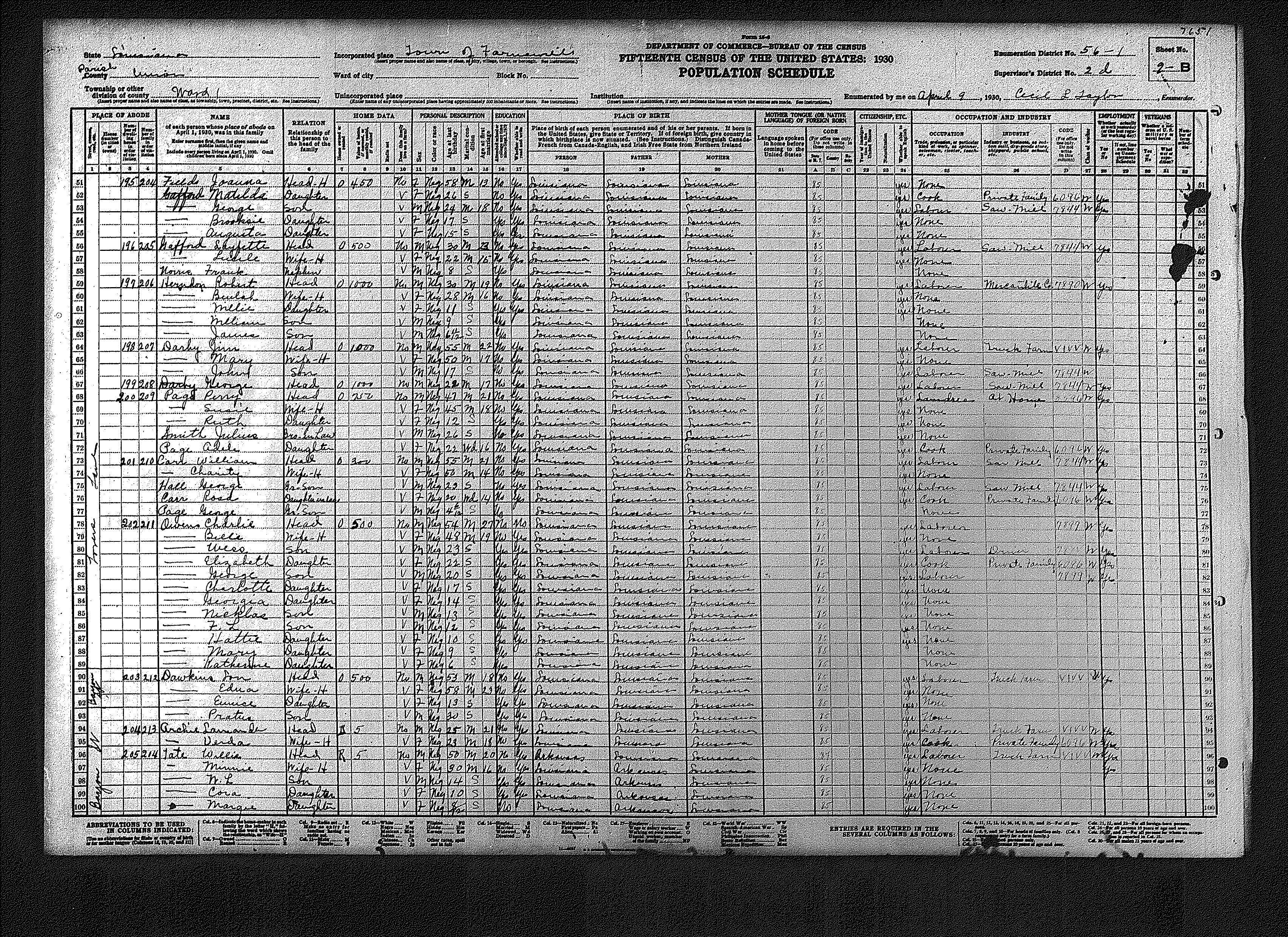
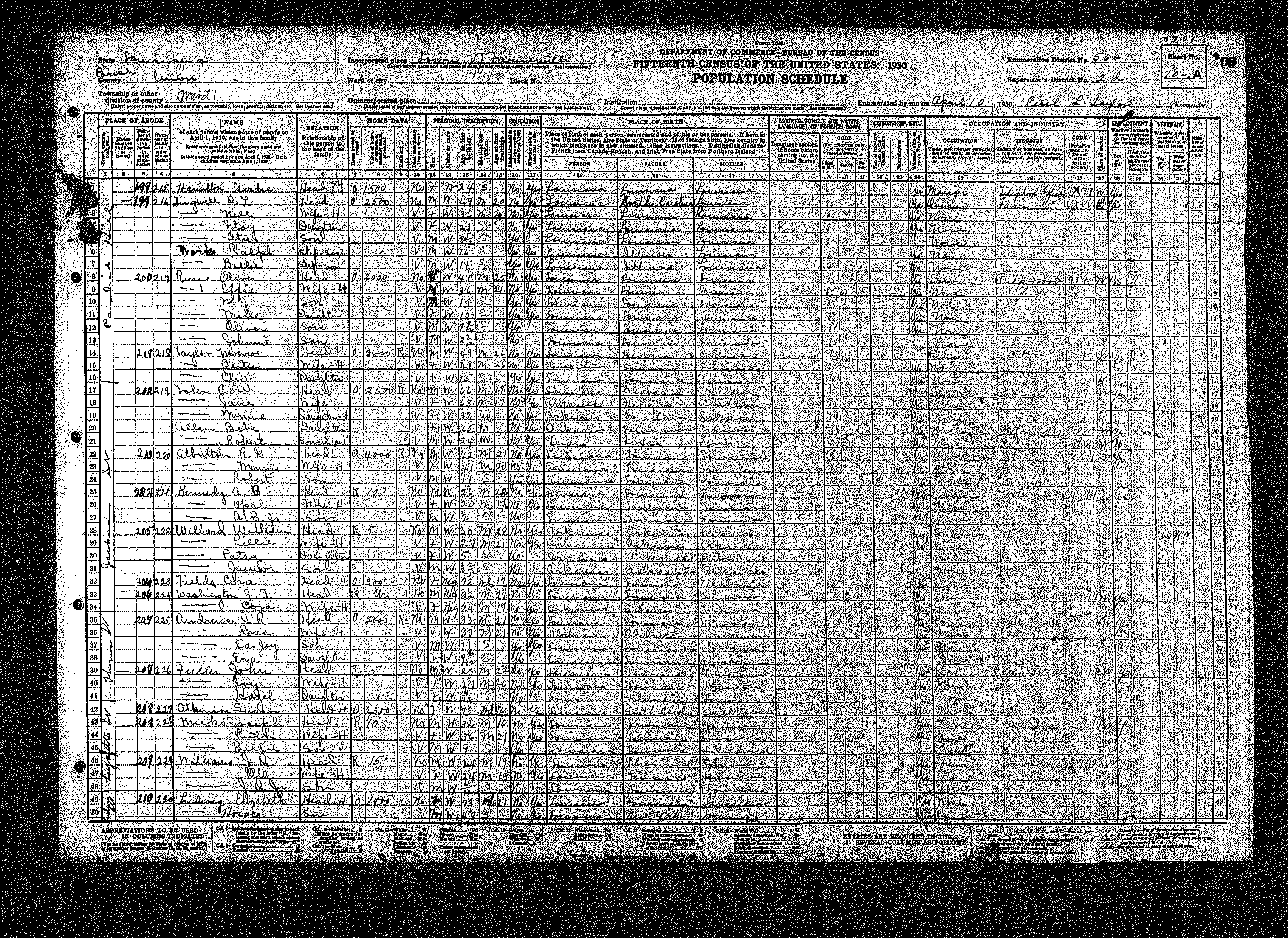
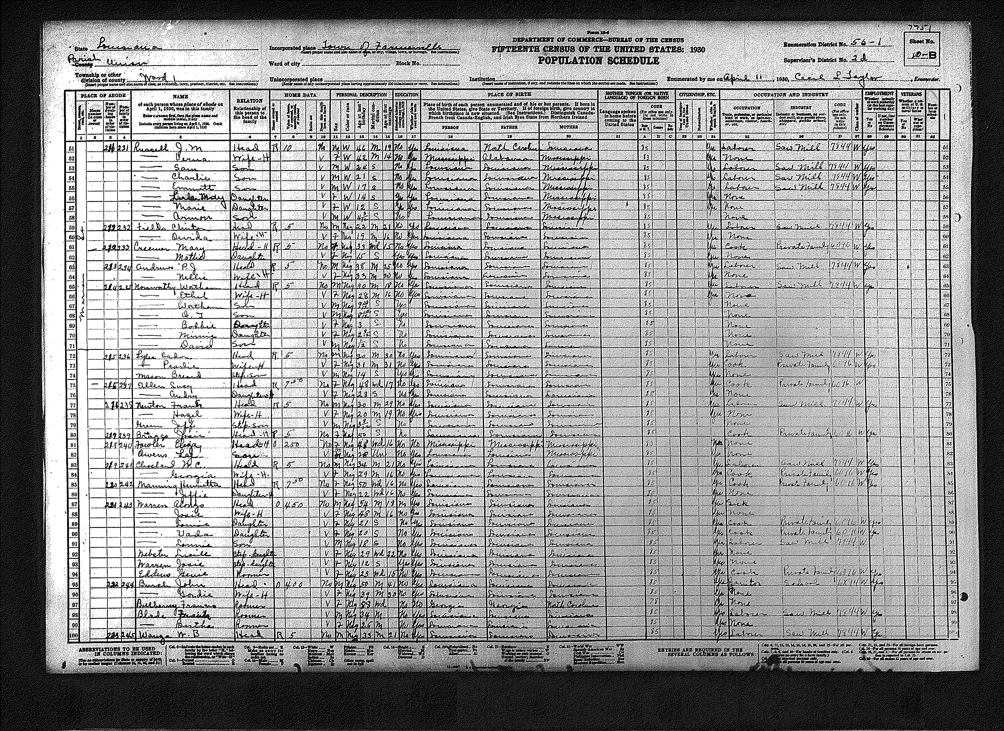
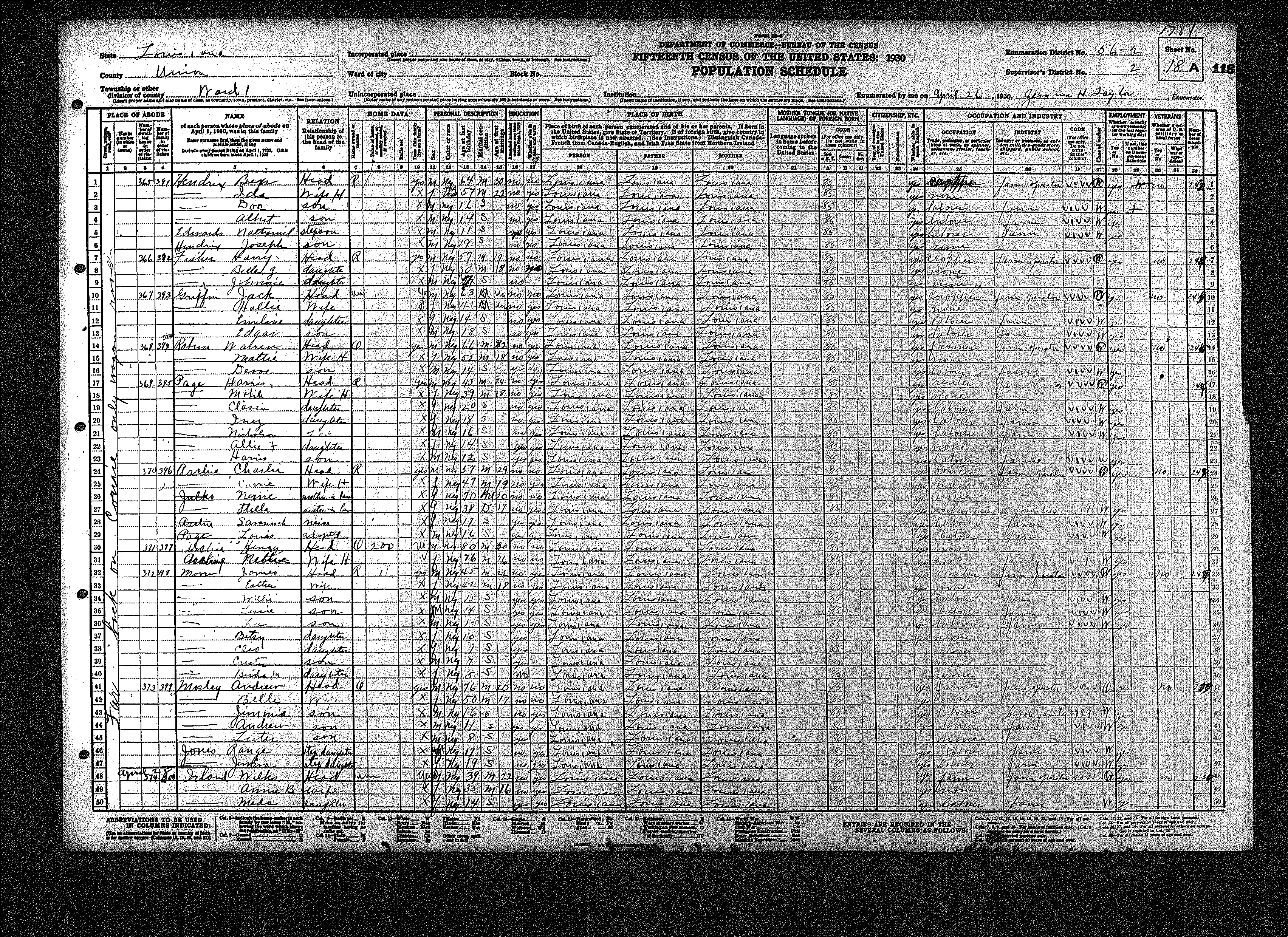
| 1 | 56 – 1 | Town of Farmerville | |||||||||||||||||
| 1 | 2 | 3 | 4 | 5 | 6 | 7 | 8 | 9 | 10 | 11 | 12 | 13 | 14 | 15 | |||||
| 16 | 17 | 18 | 19 | 20 | 21 | 22 | 23 | 24 | |||||||||||
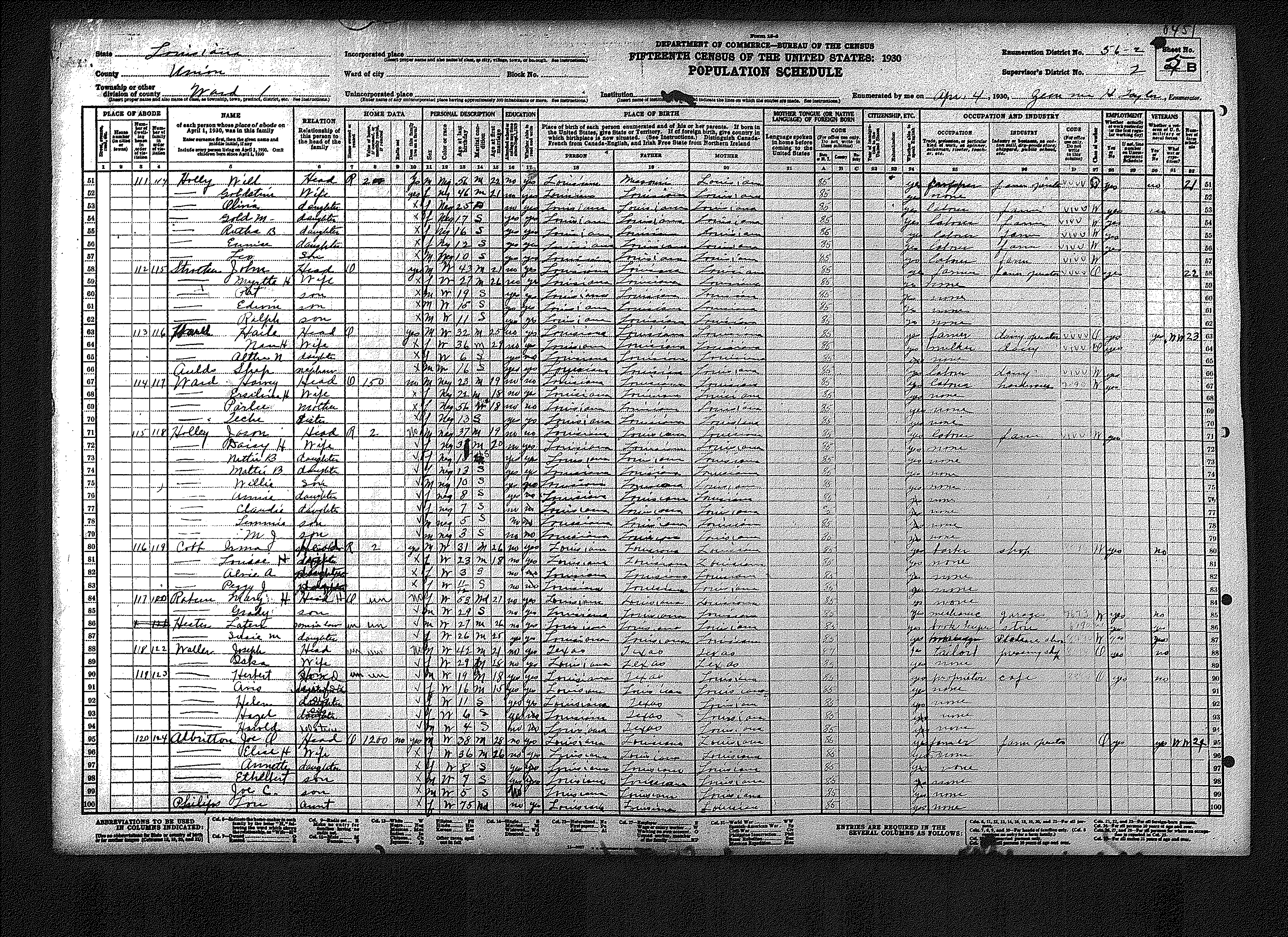
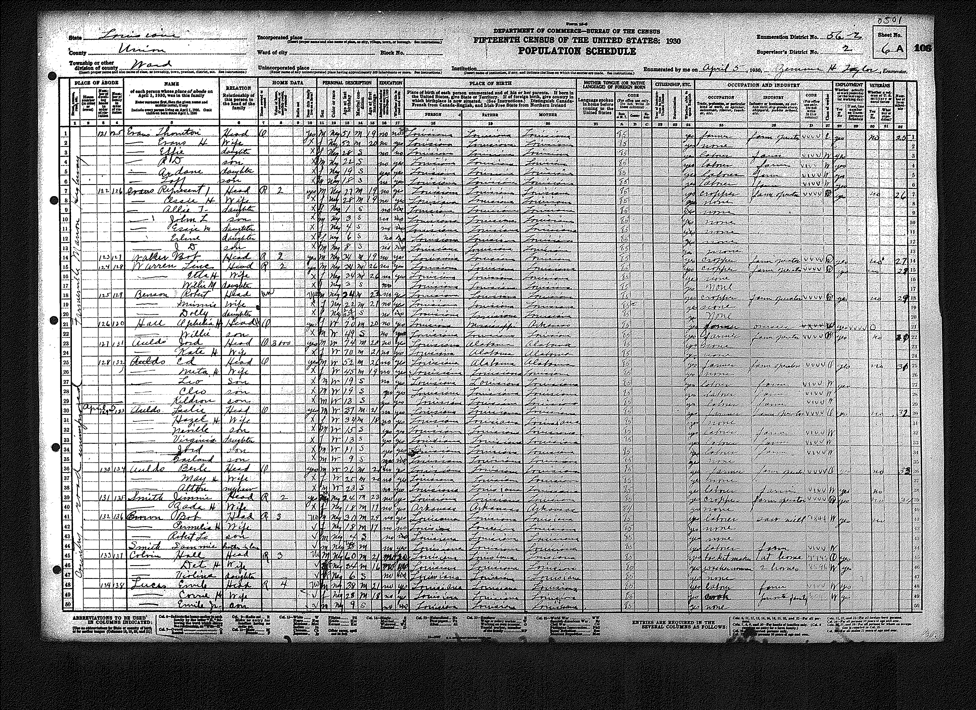
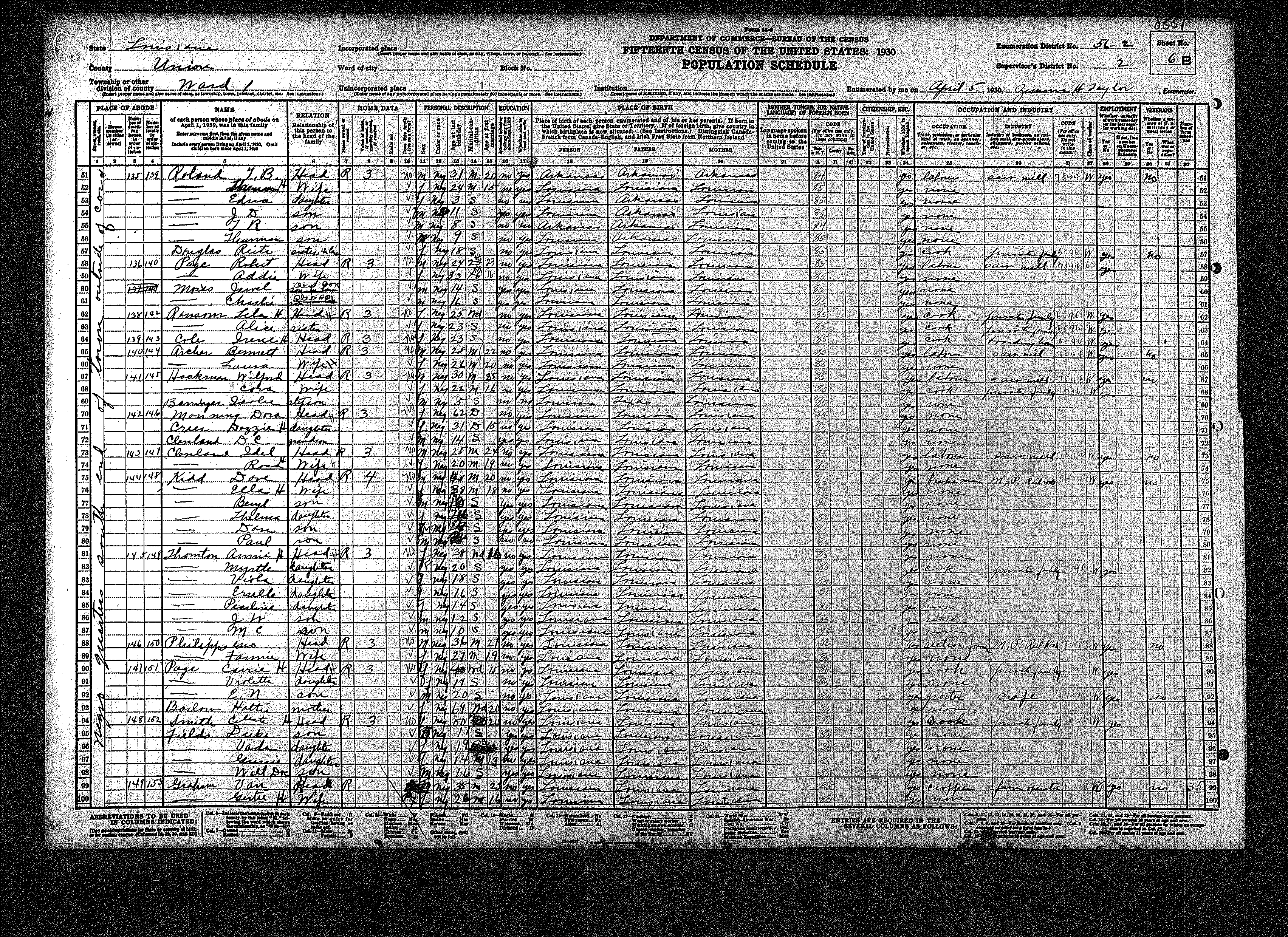
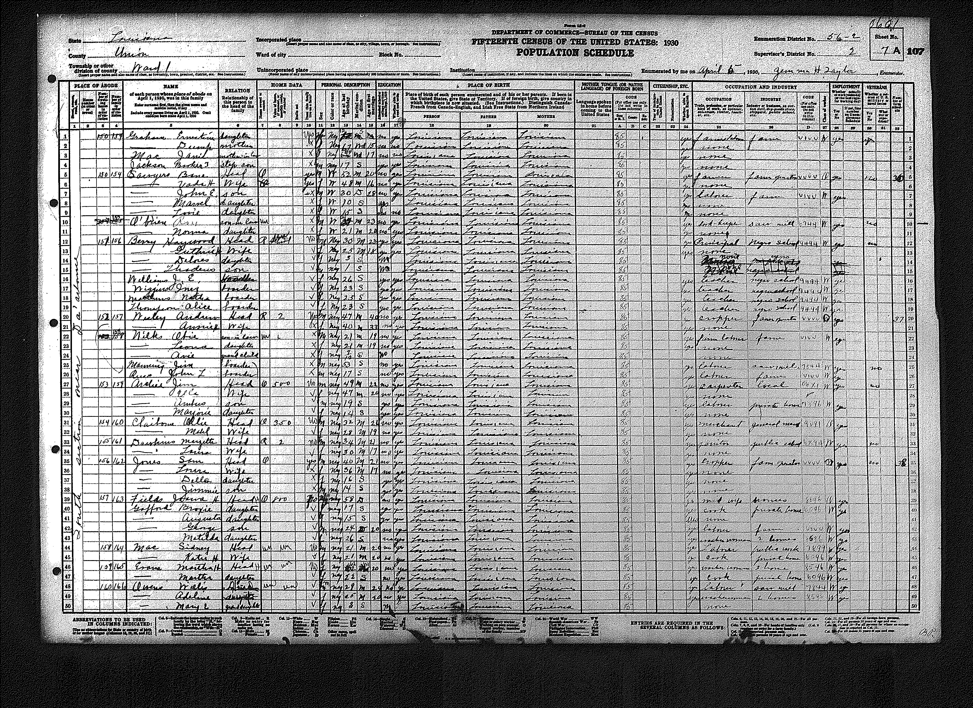
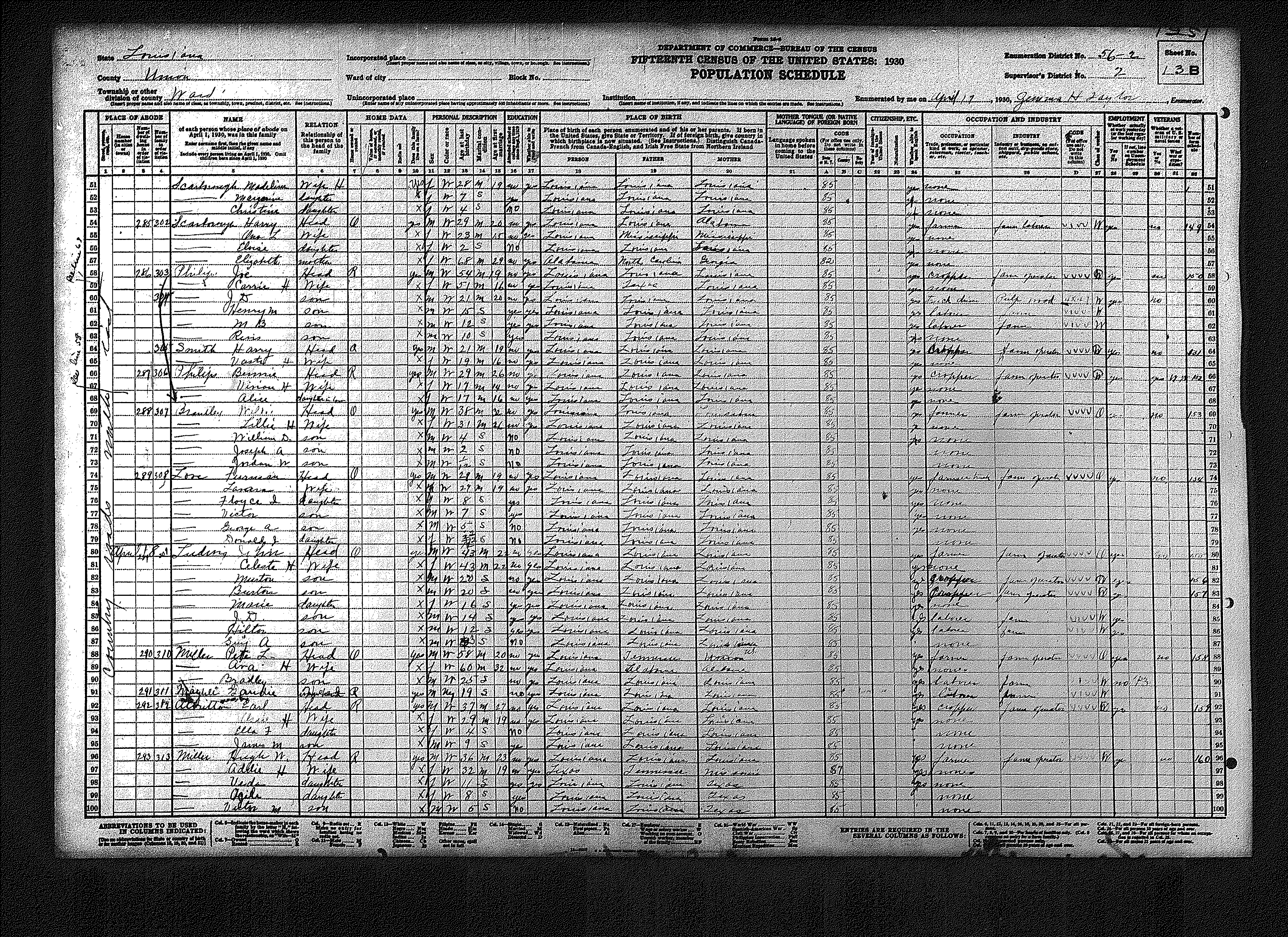
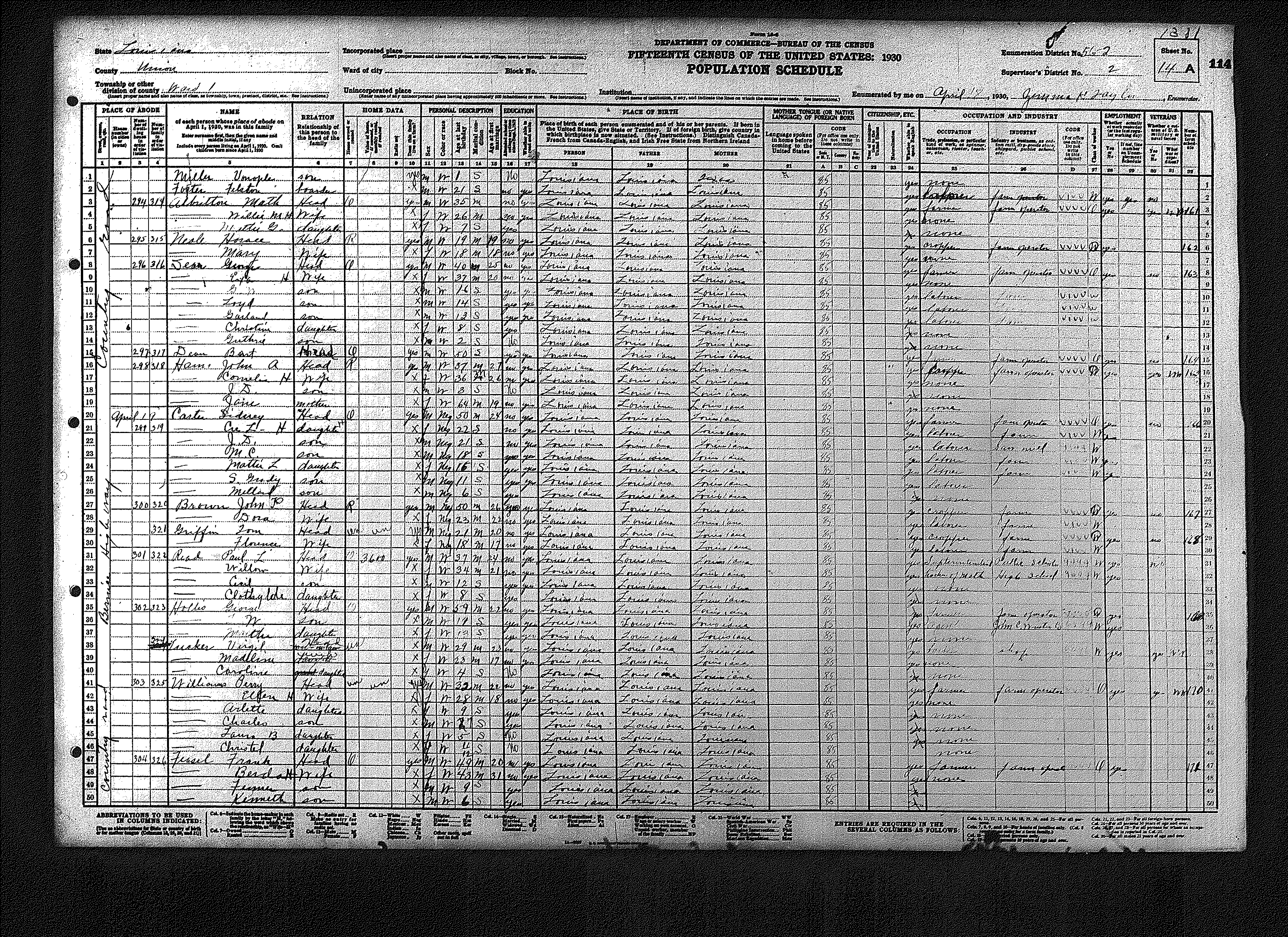
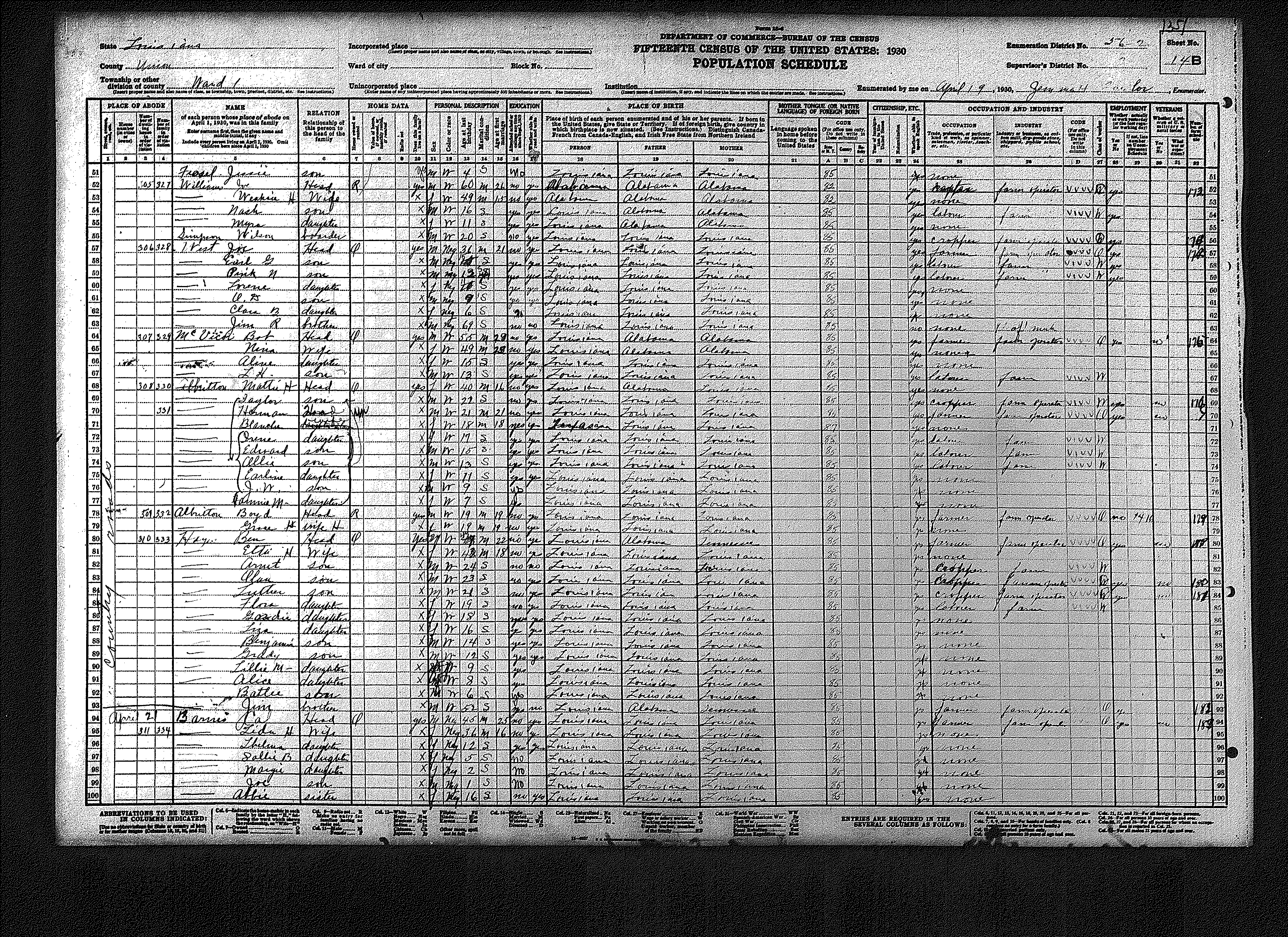
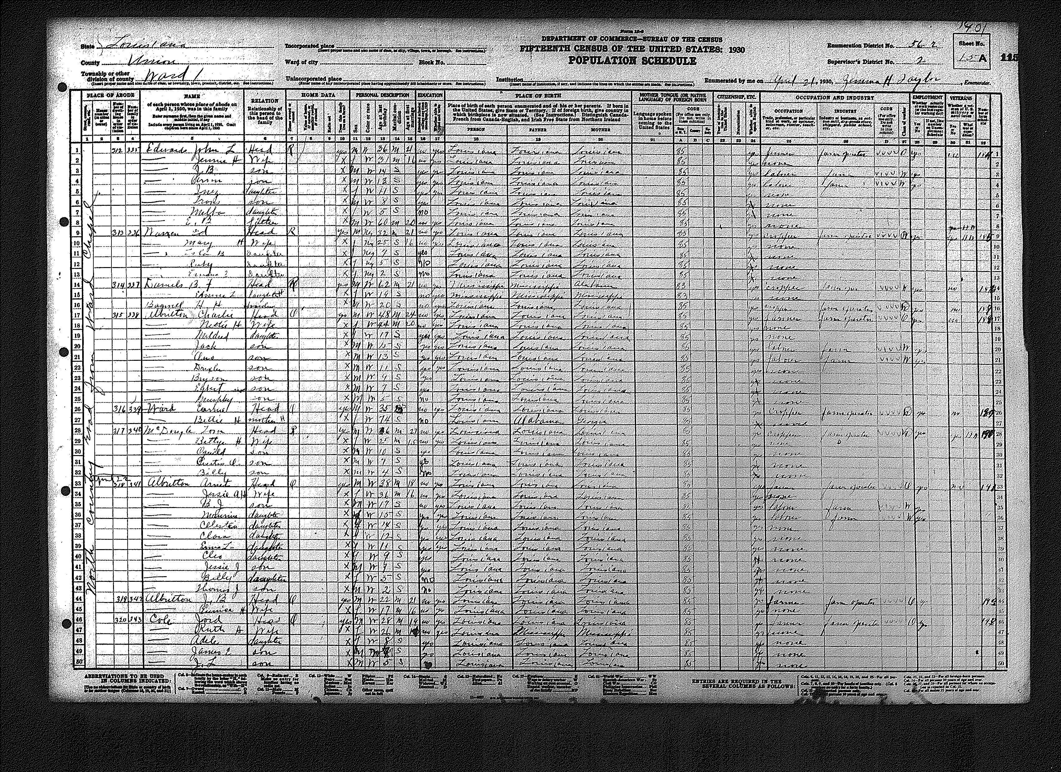
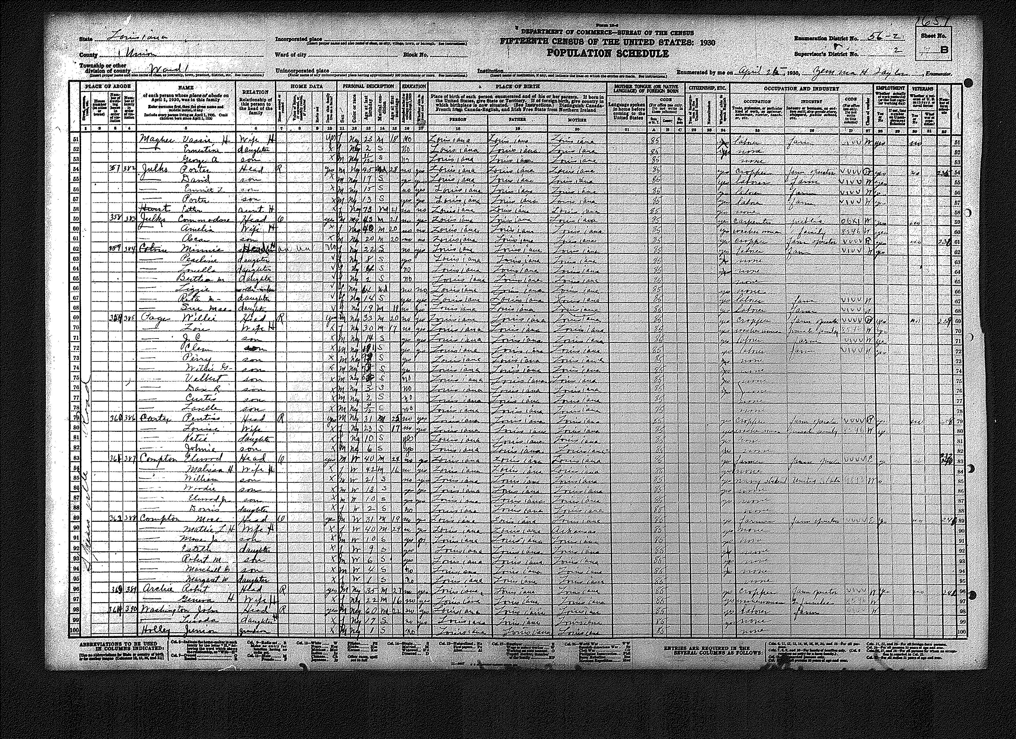
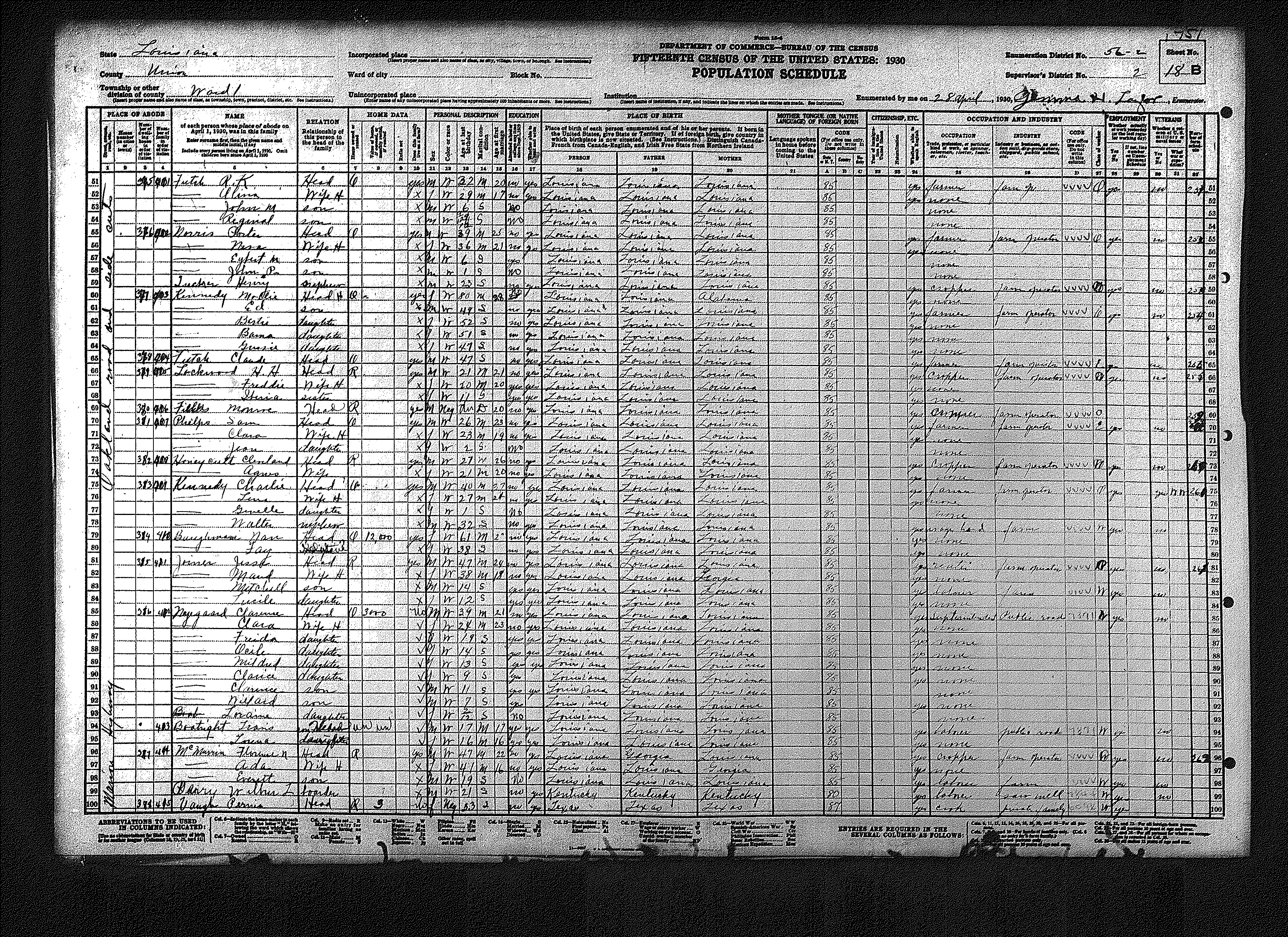
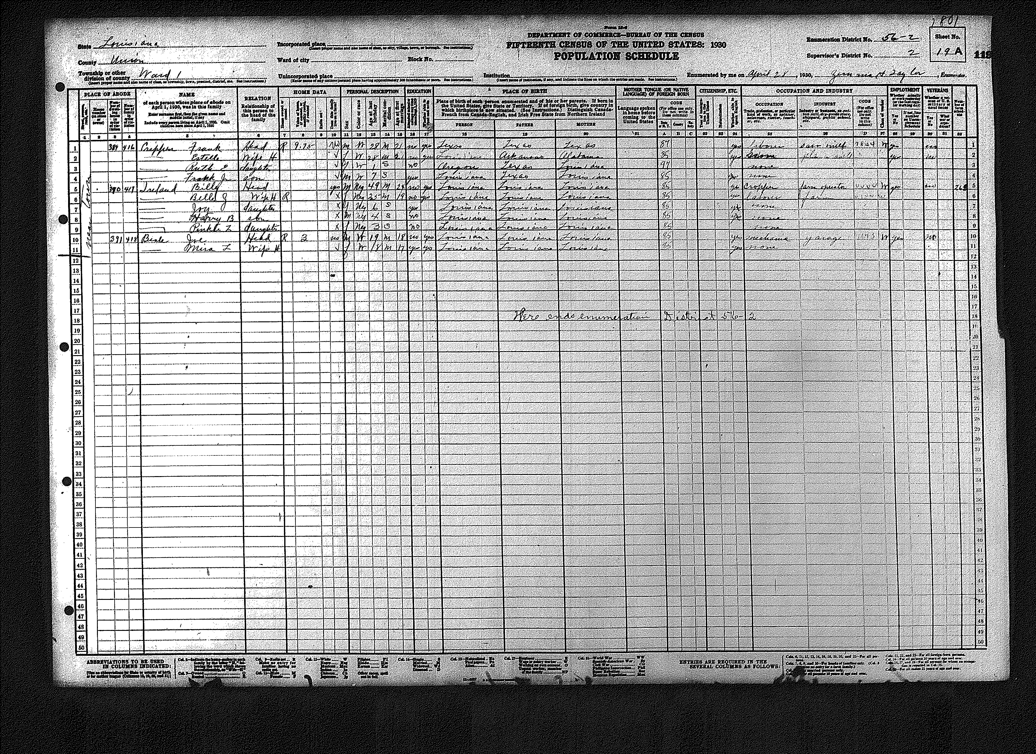
| 56 – 2 | Region surrounding Farmerville | ||||||||||||||||||
| 25 | 26 | 27 | 28 | 29 | 30 | 31 | 32 | 33 | 34 | 35 | 36 | 37 | 38 | 39 | |||||
| 40 | 41 | 42 | 43 | 44 | 45 | 46 | 47 | 48 | 49 | 50 | 51 | 52 | 53 | 54 | |||||
| 55 | 56 | 57 | 58 | 59 | 60 | 61 | 62 | ||||||||||||
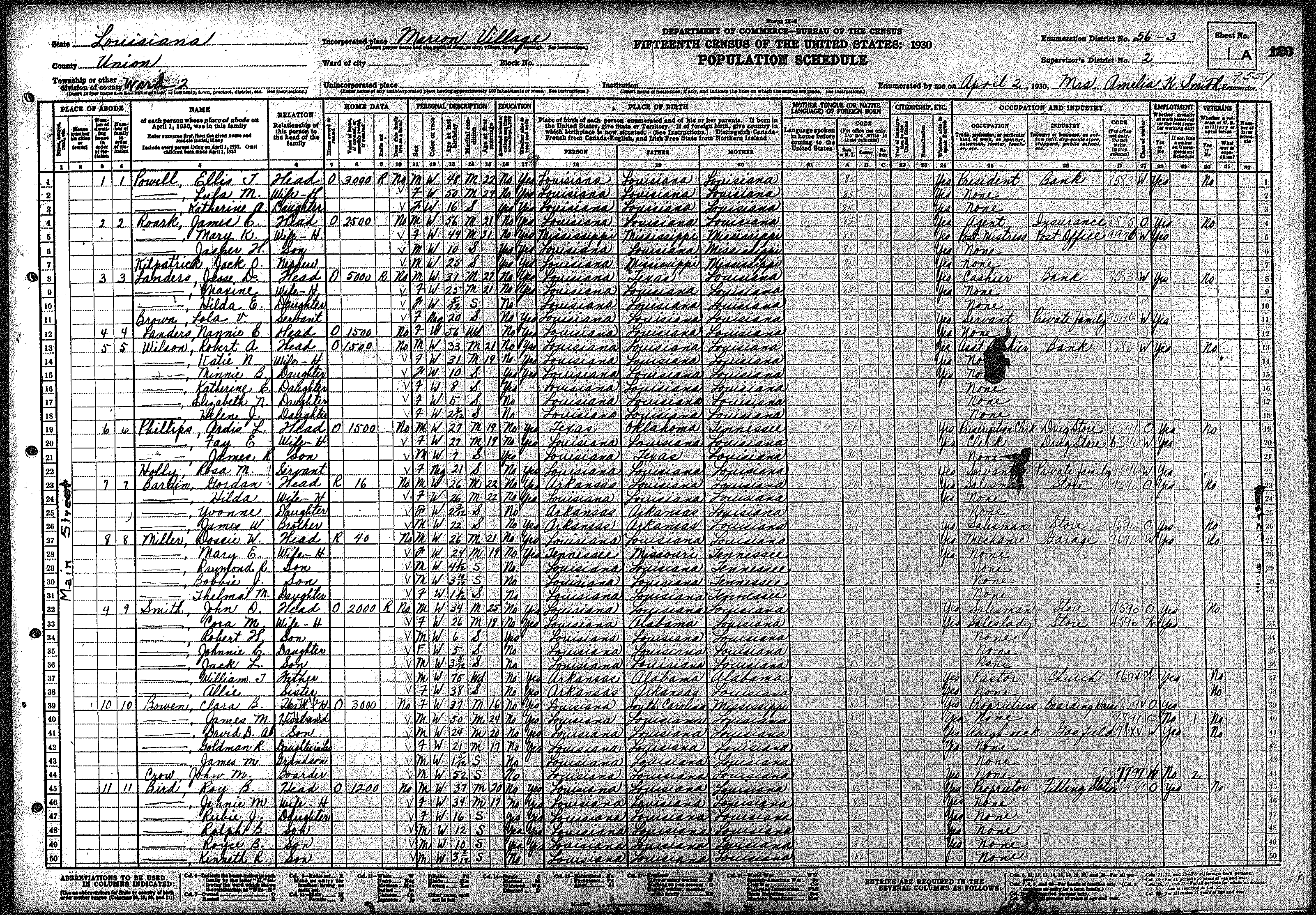
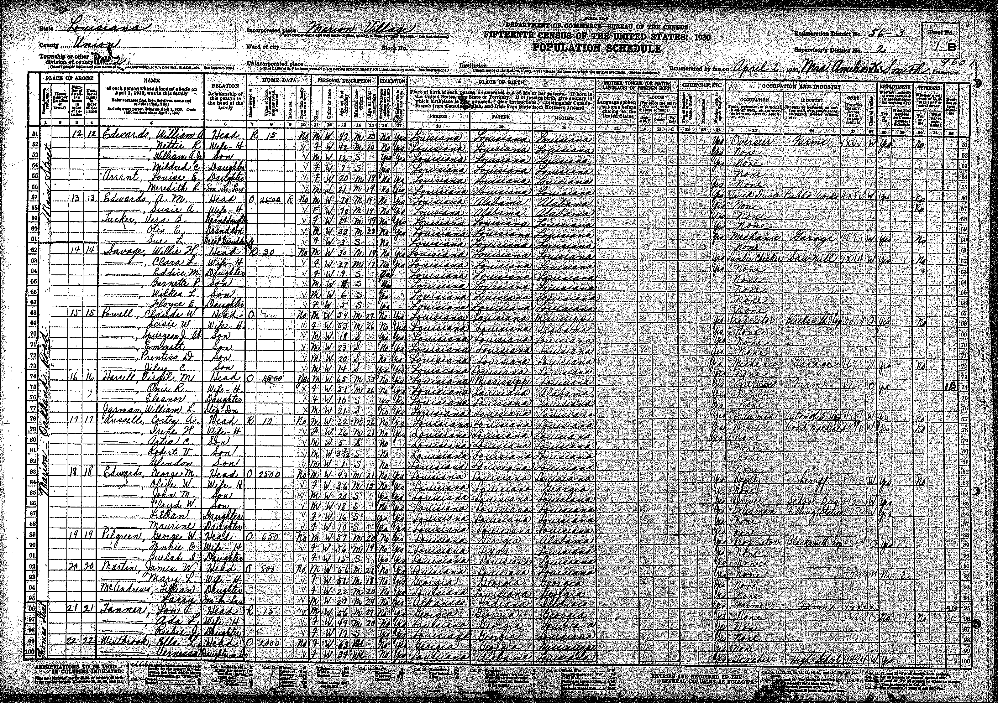
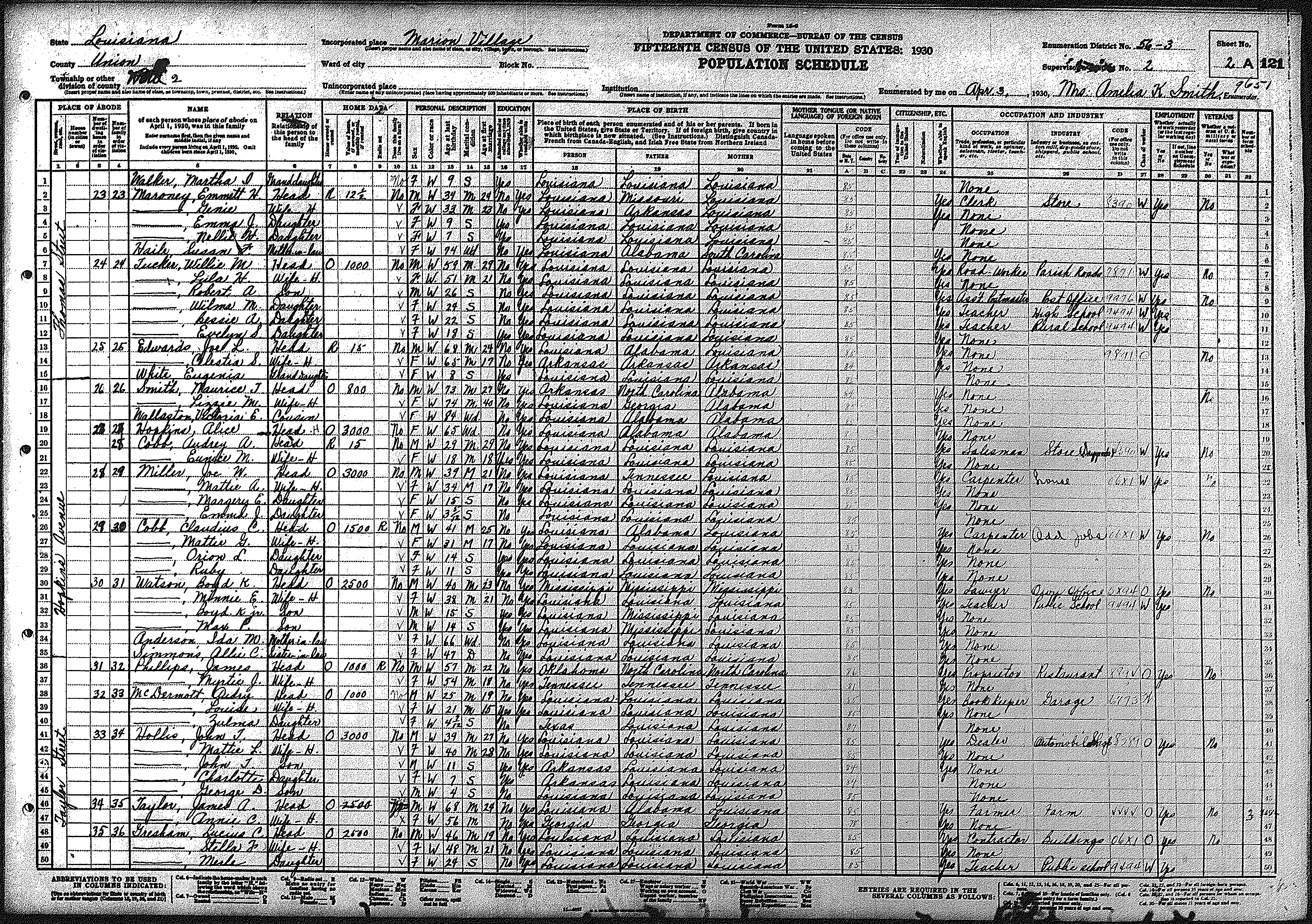
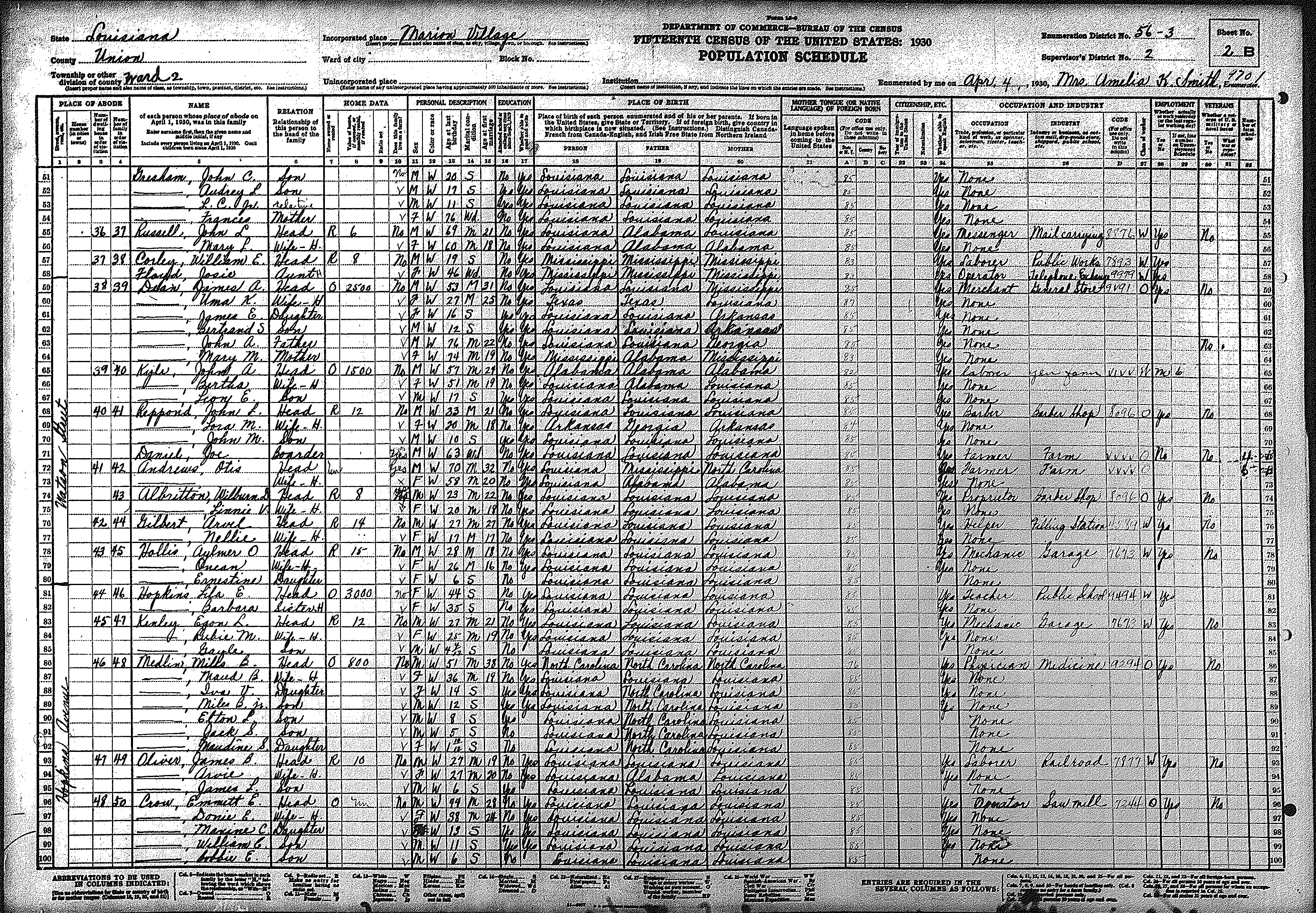
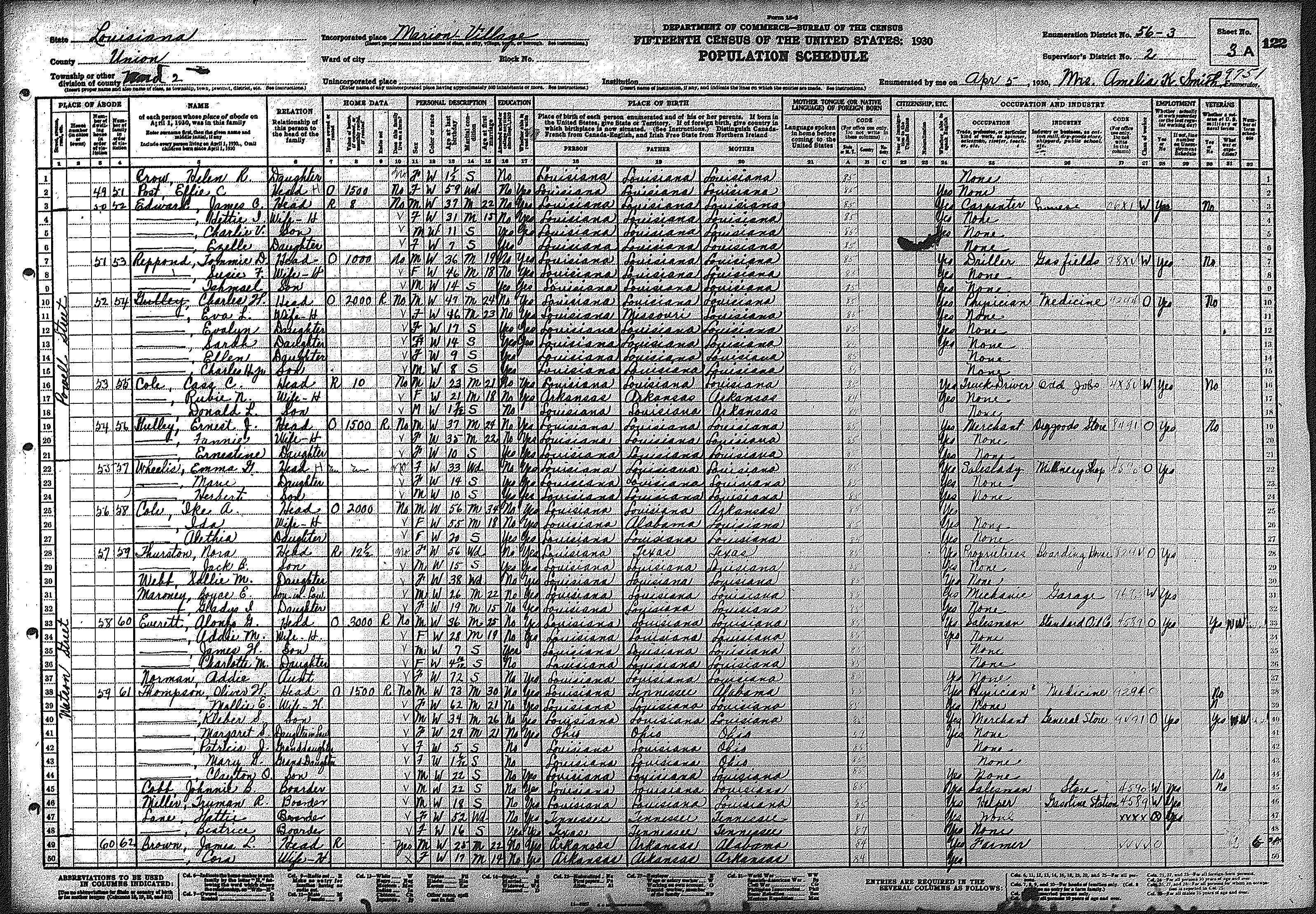
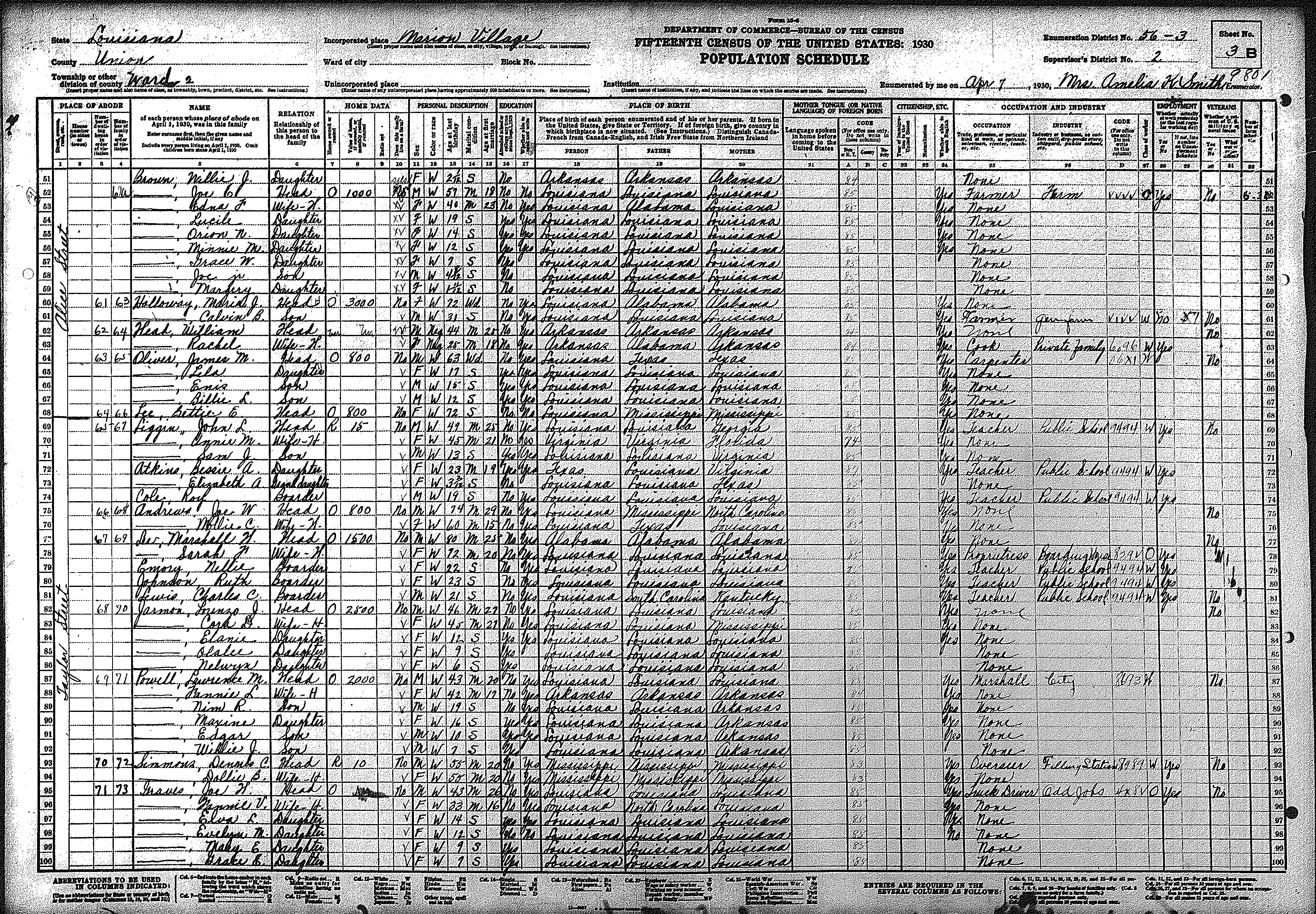
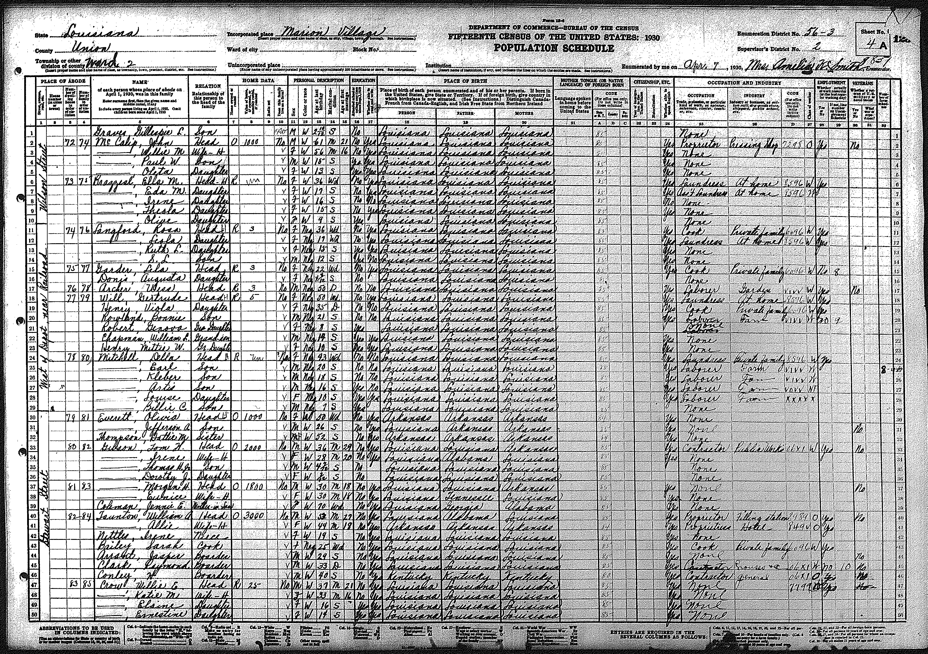
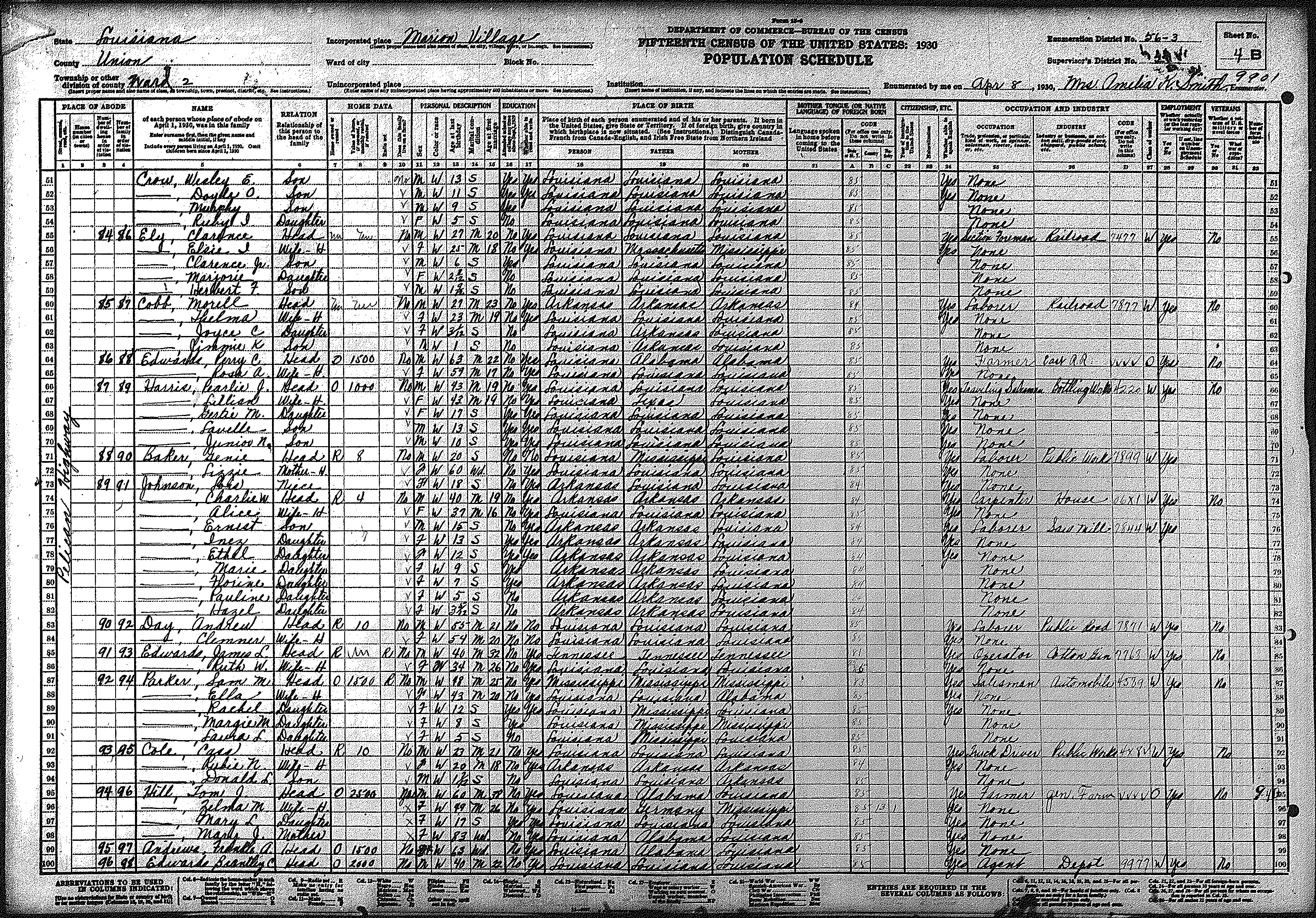
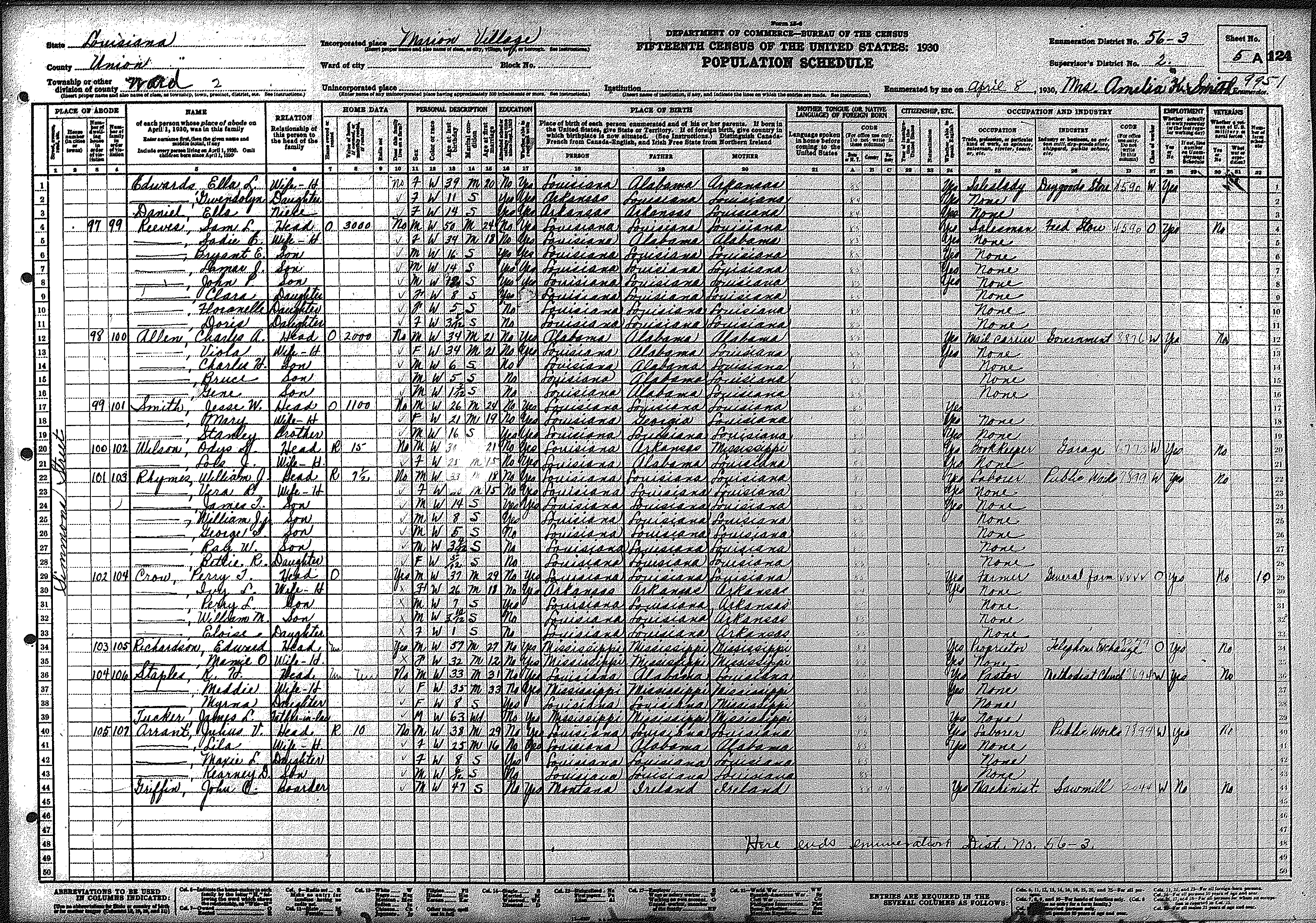
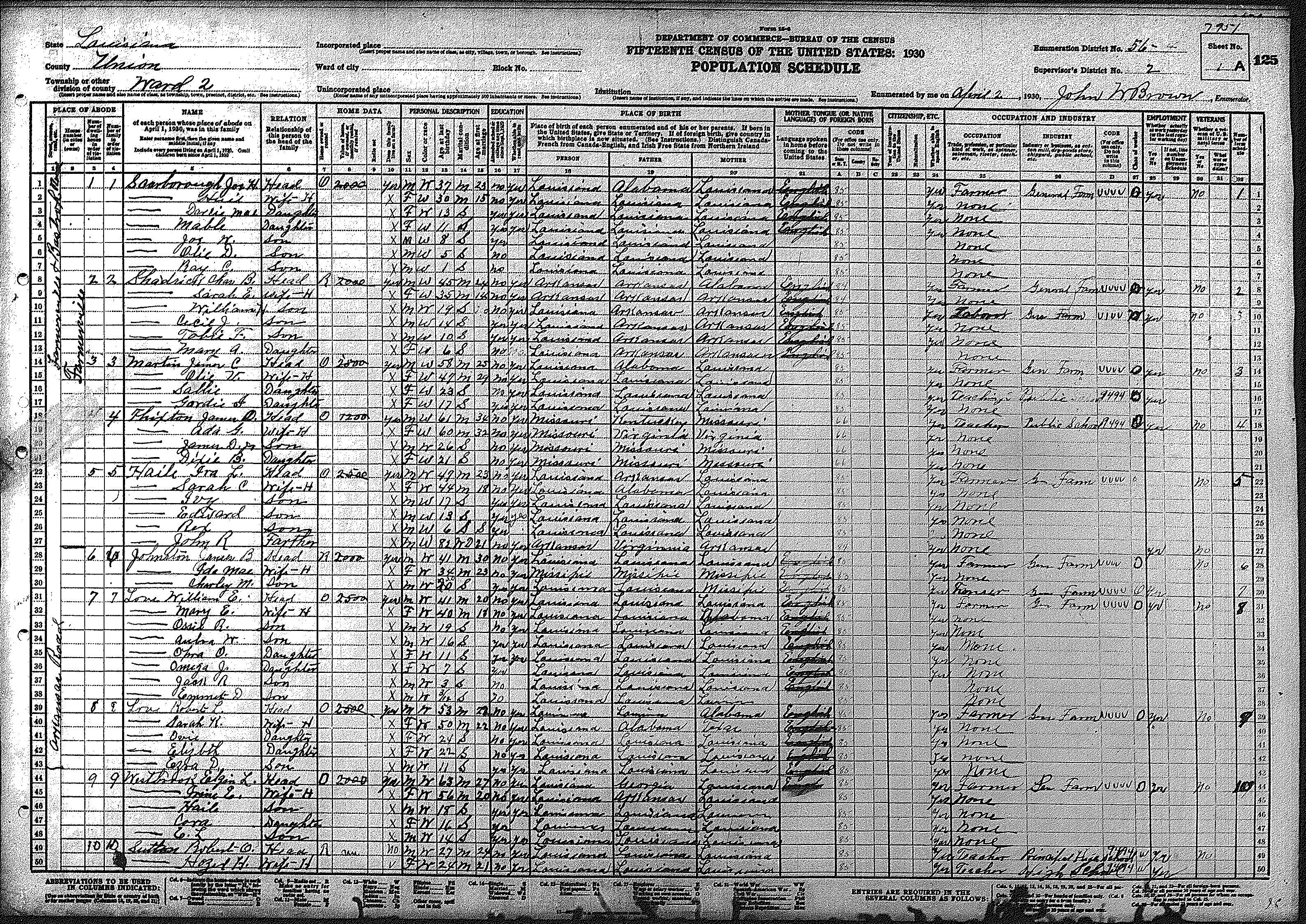
| 2 | 56 – 3 | Village of Marion | |||||||||||||||||
| 64 | 65 | 66 | 67 | 68 | 69 | 70 | 71 | 72 | 73 | ||||||||||
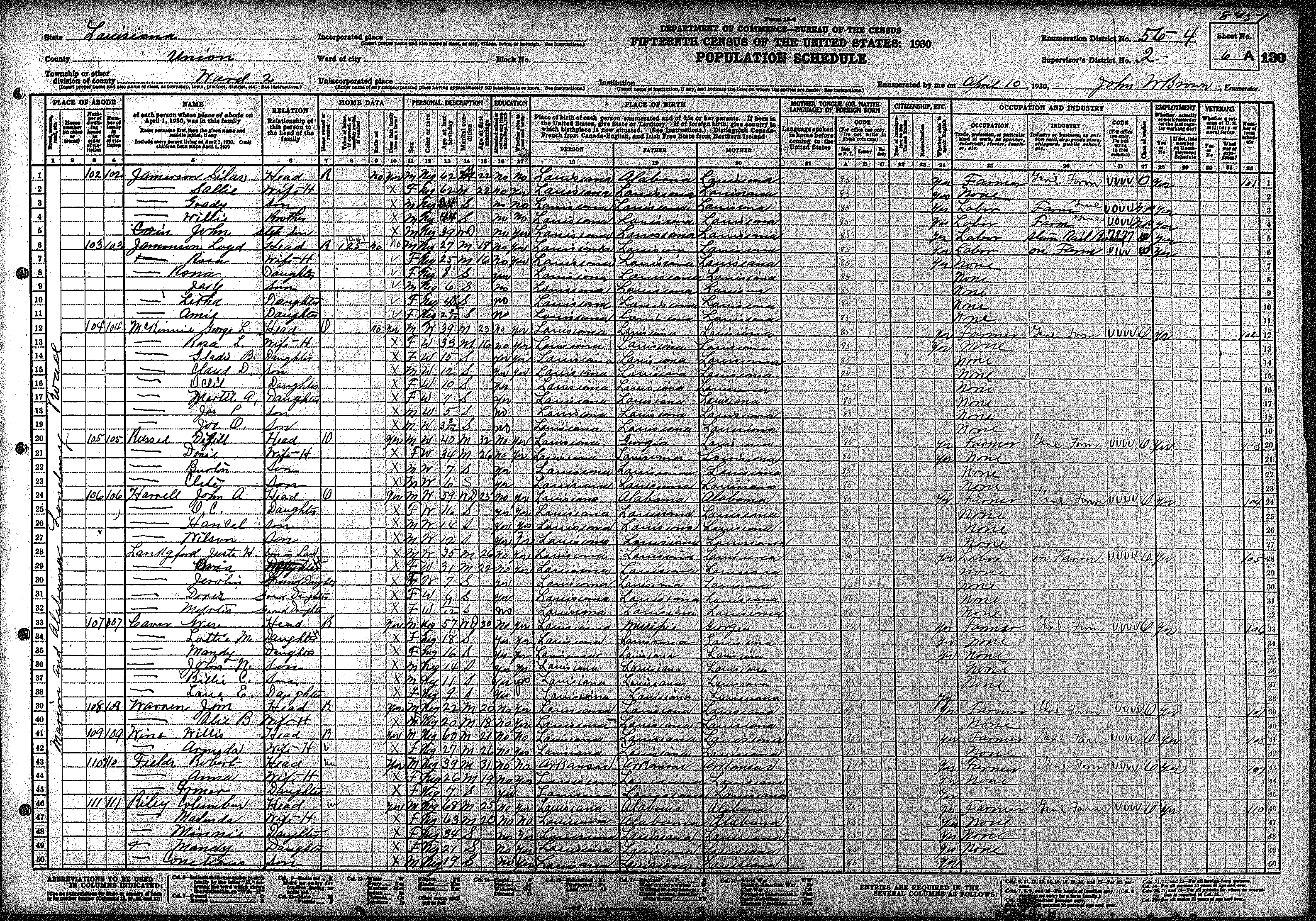
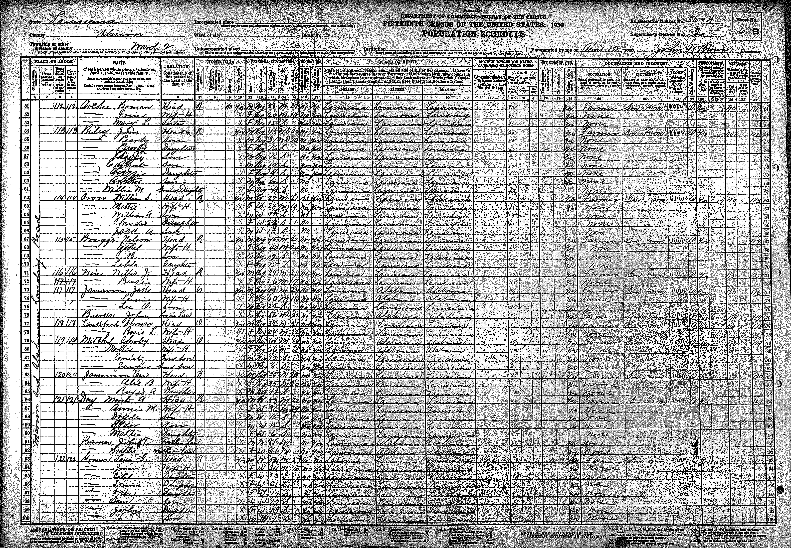
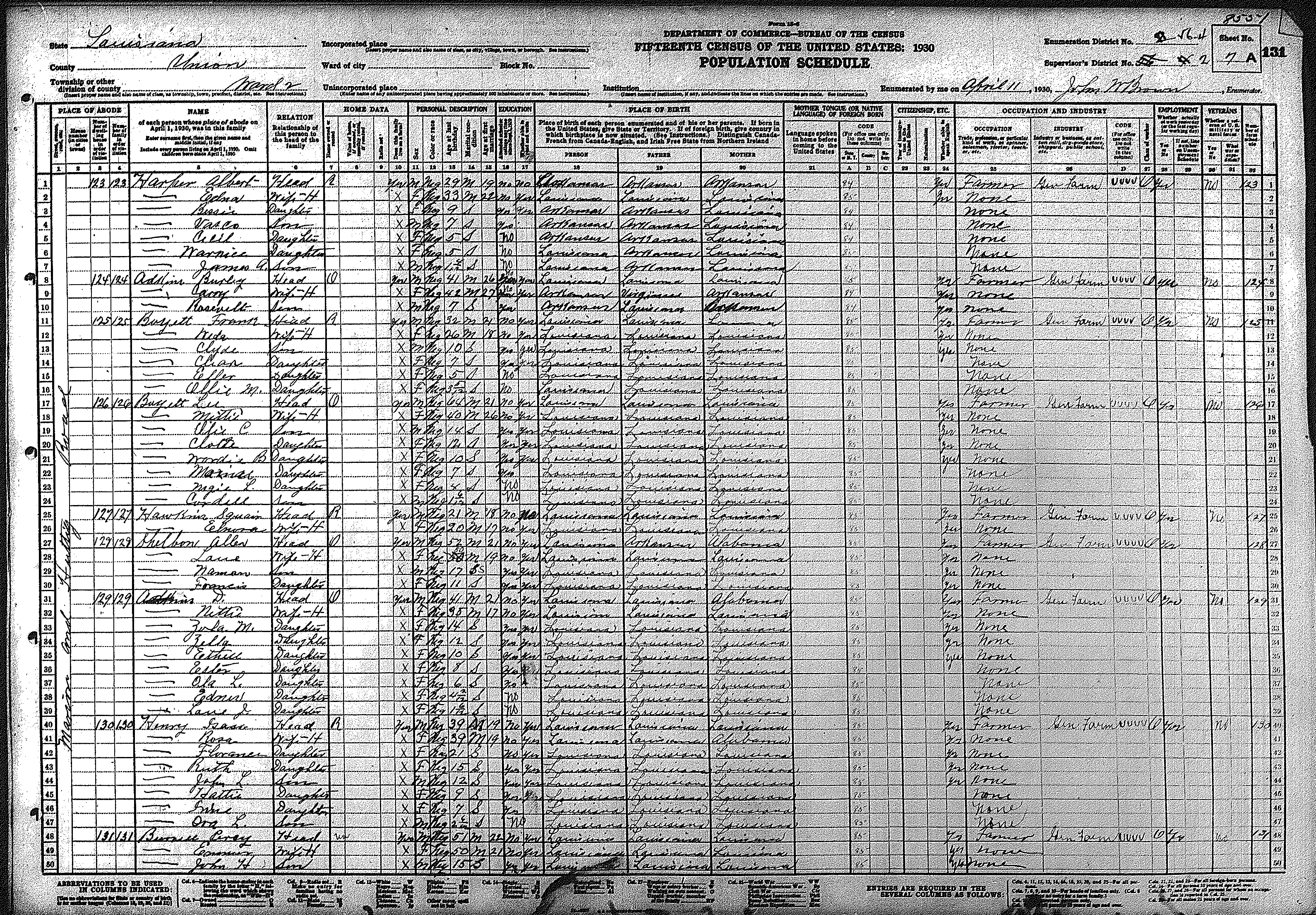
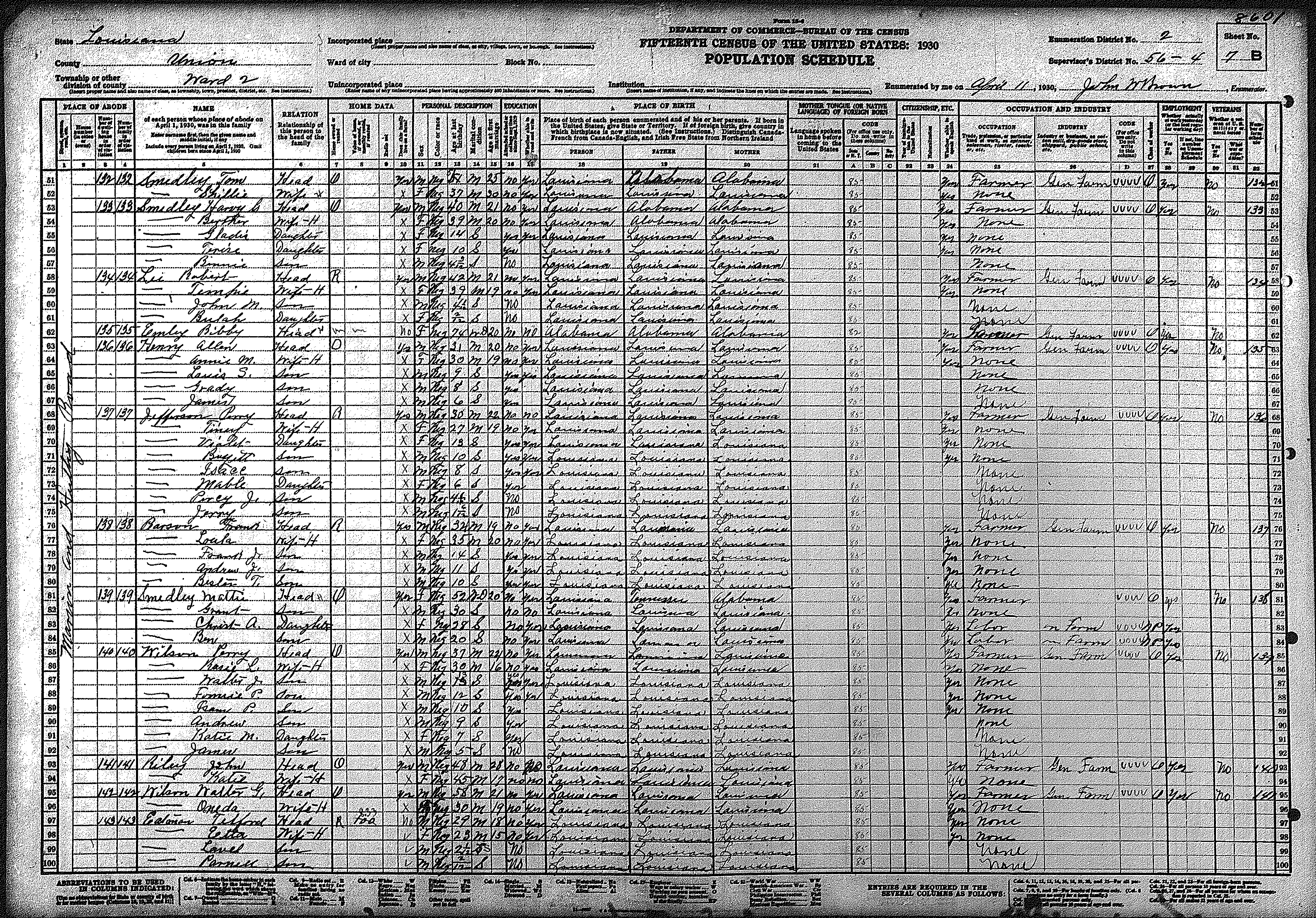
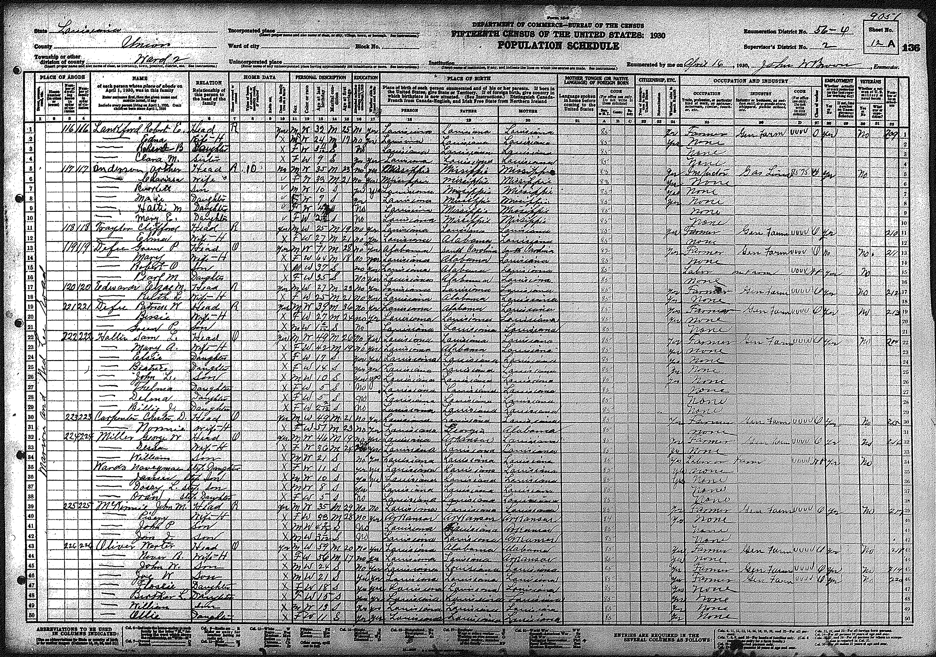
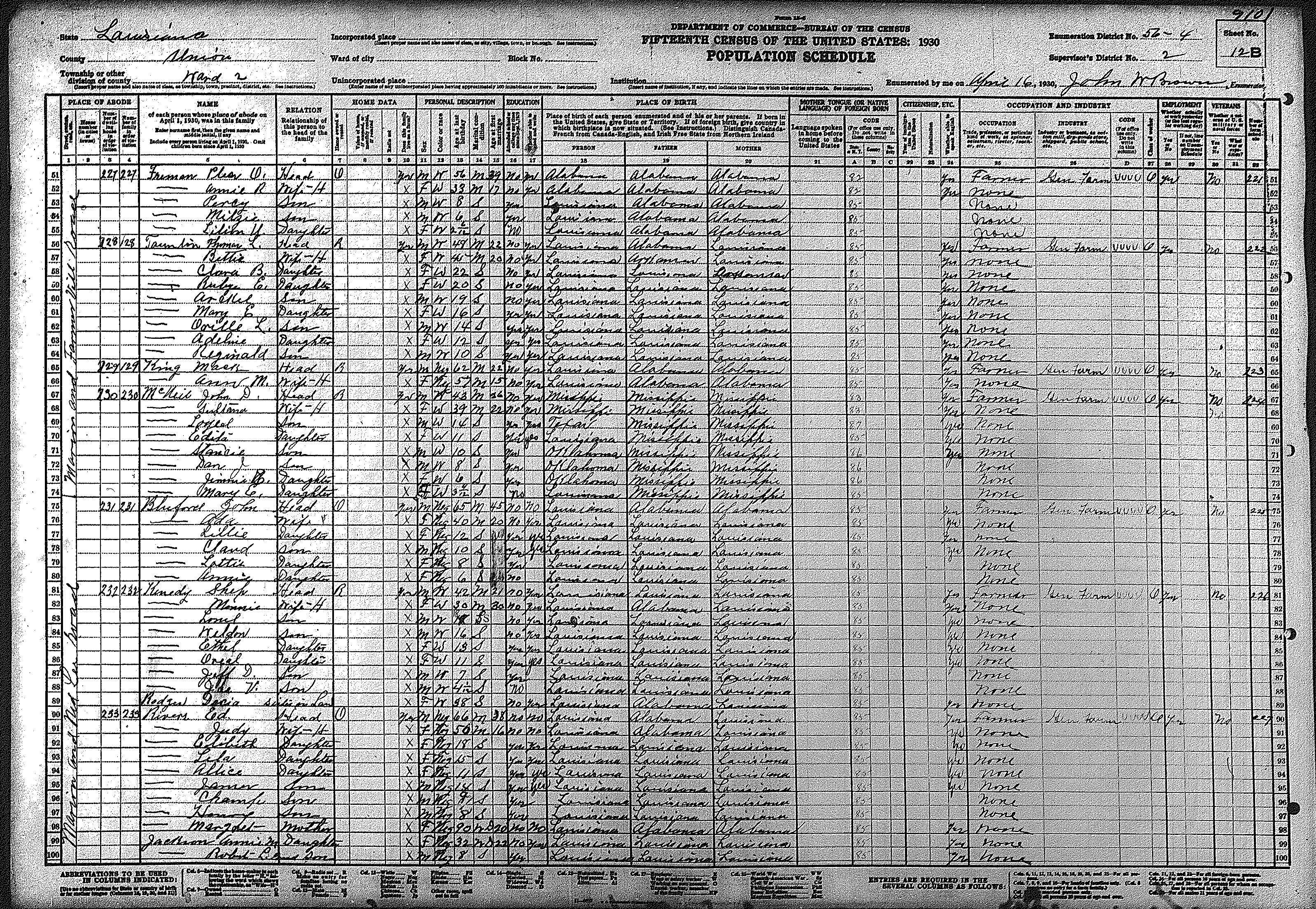
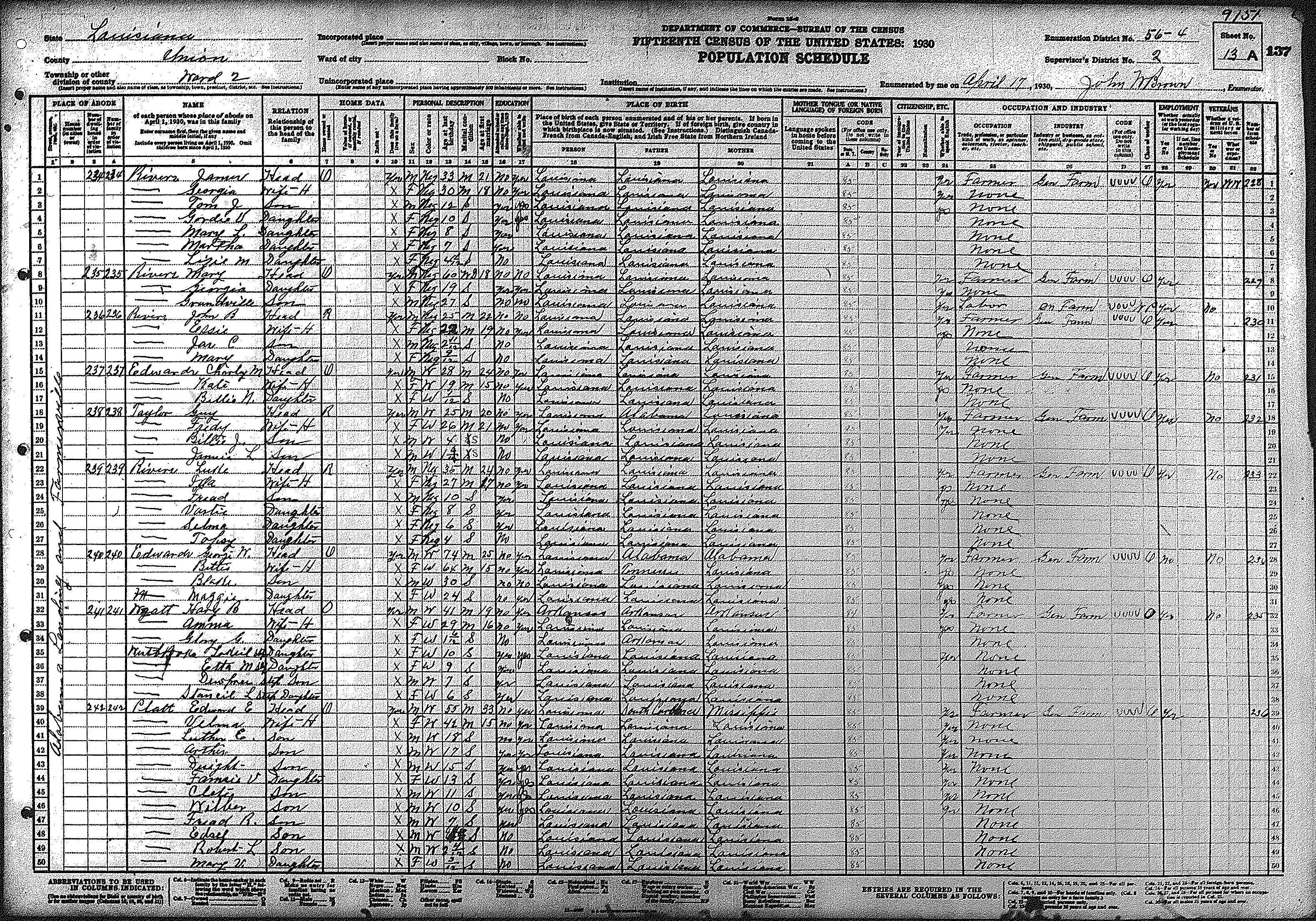
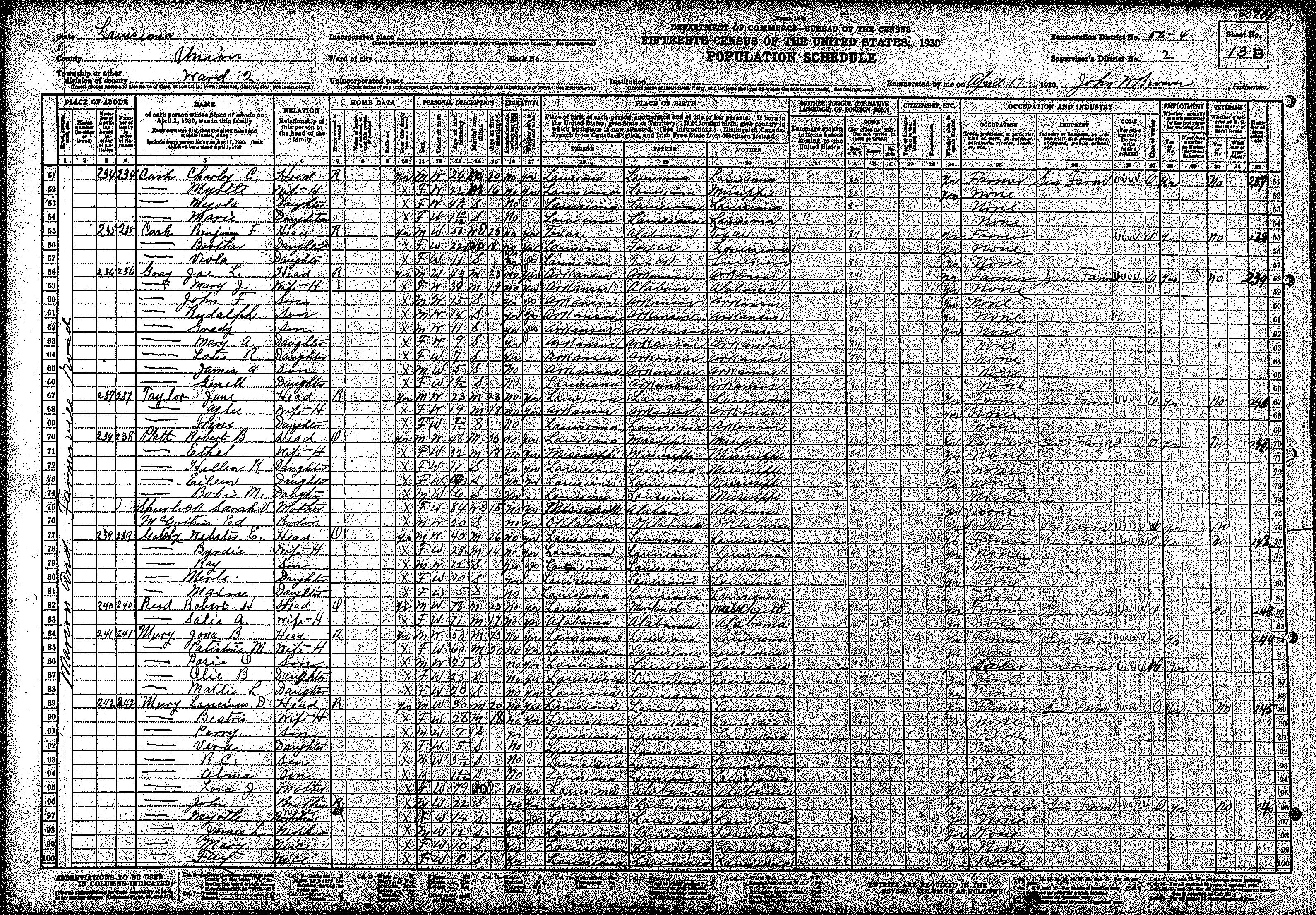
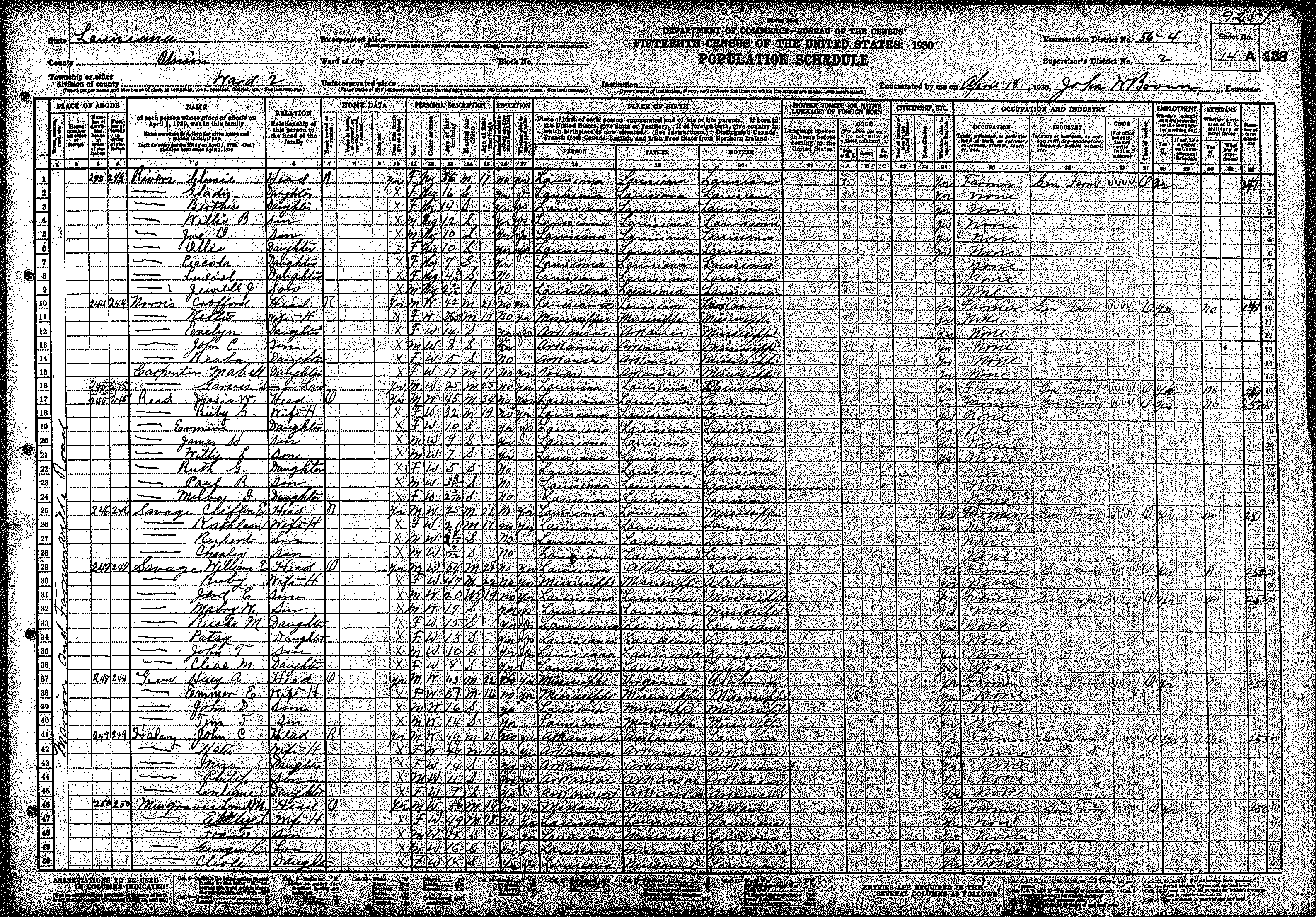
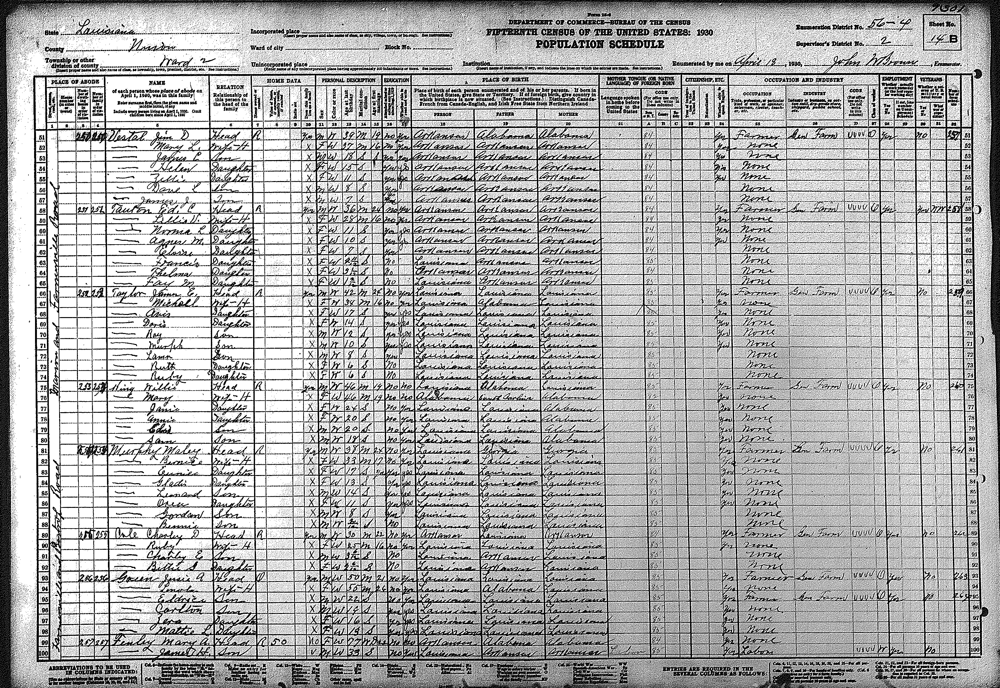
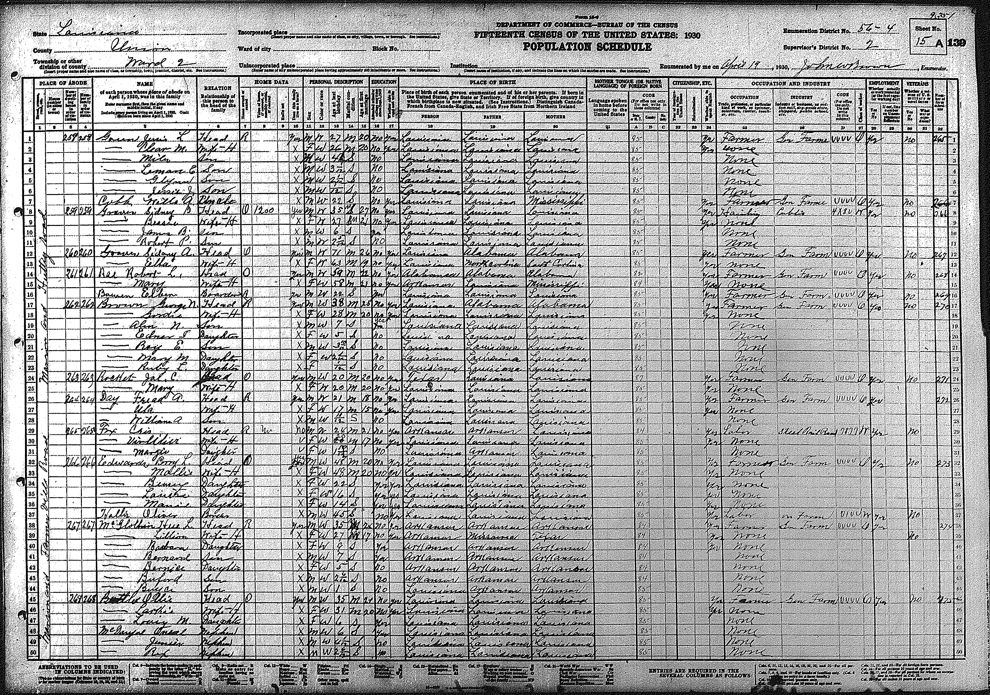
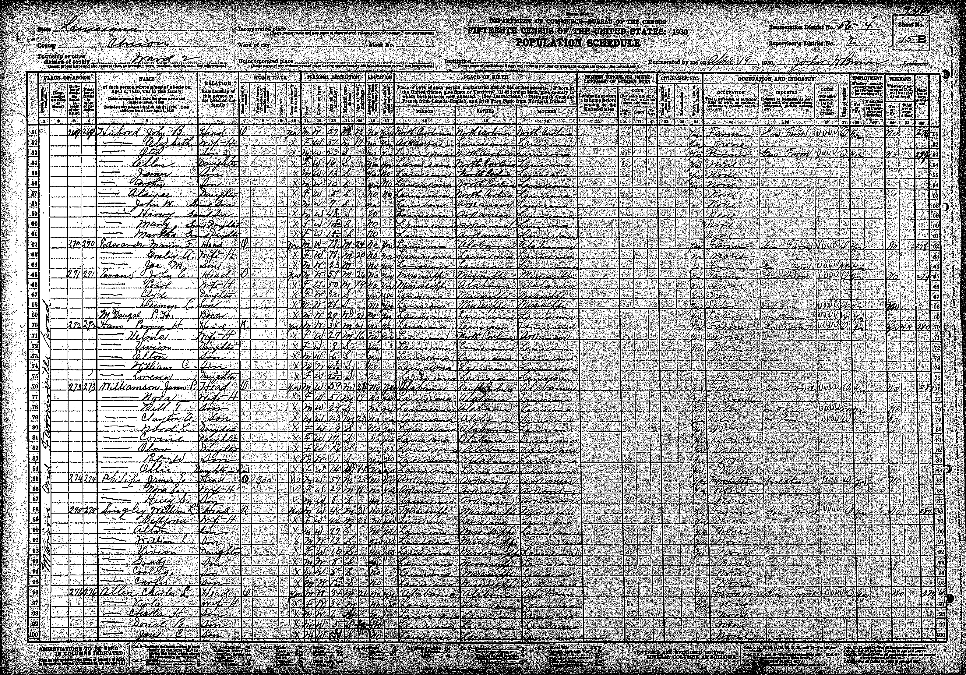
| 56 – 4 | East/central Union Parish surrounding Marion | ||||||||||||||||||
| 74 | 75 | 76 | 77 | 78 | 79 | 80 | 81 | 82 | 83 | 84 | 85 | 86 | 87 | 88 | |||||
| 89 | 90 | 91 | 92 | 93 | 94 | 95 | 96 | 97 | 98 | 99 | 100 | 101 | 102 | 103 | |||||
| 104 | 105 | 106 | 107 | ||||||||||||||||
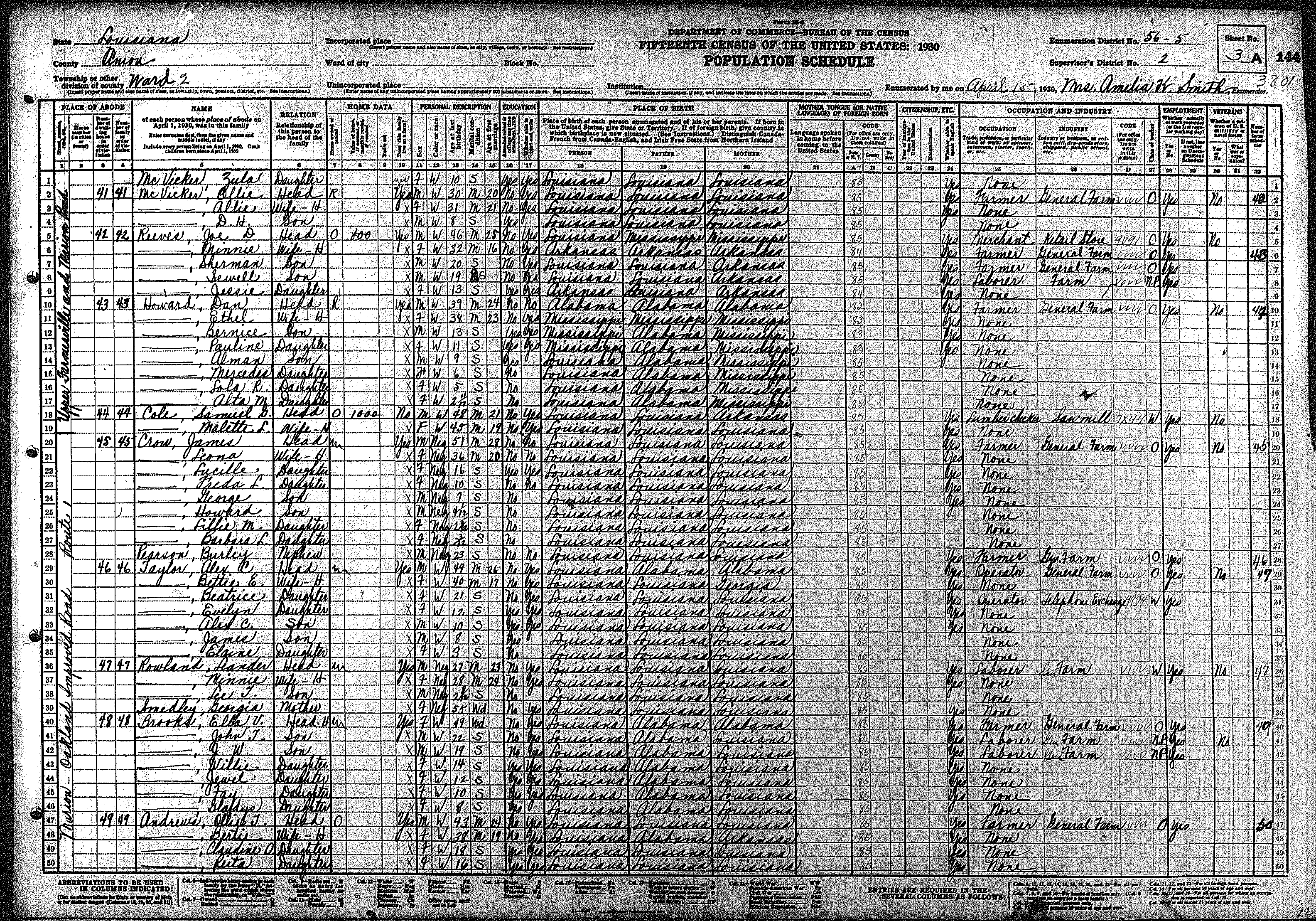
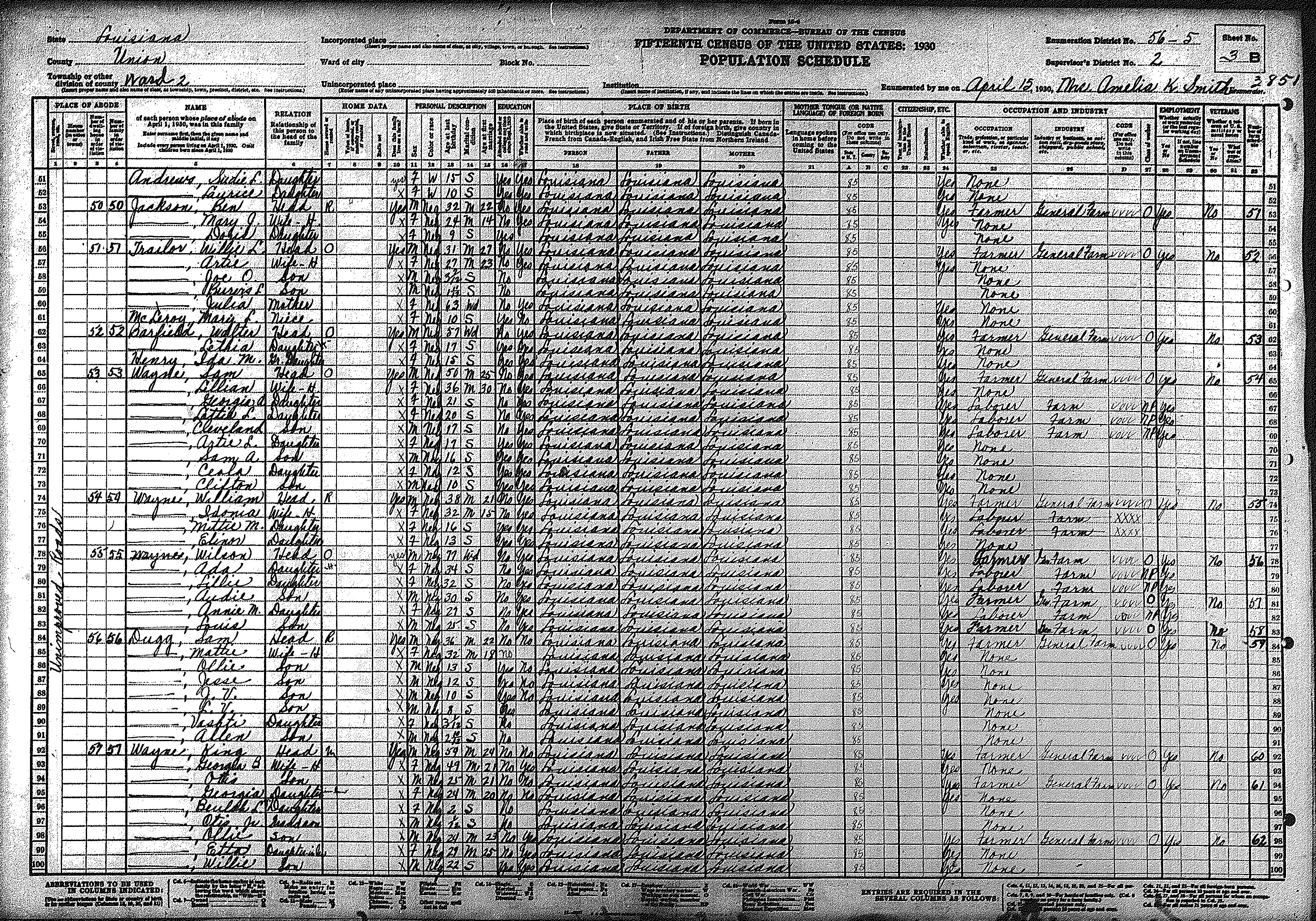
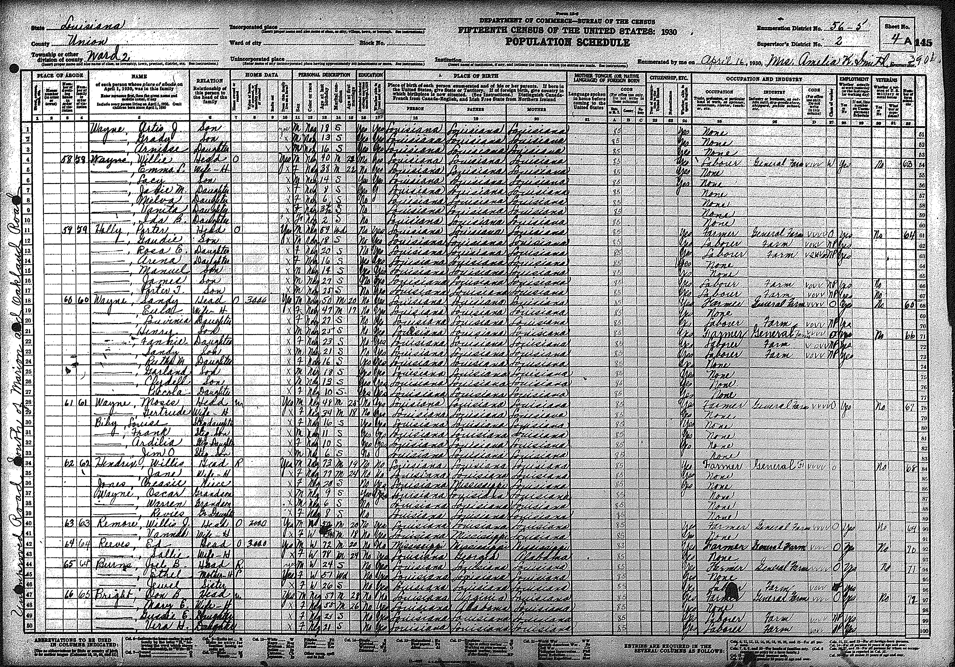
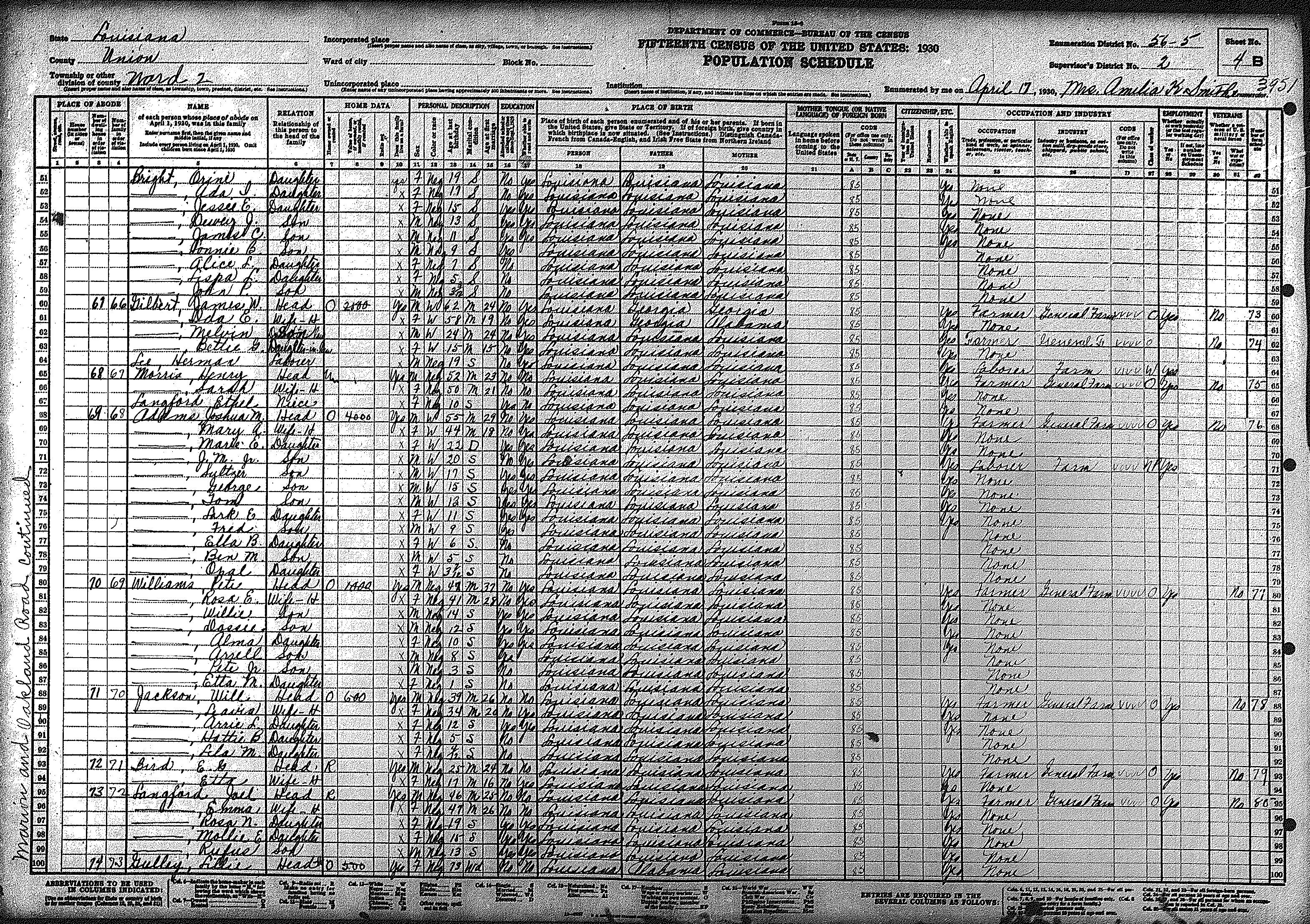
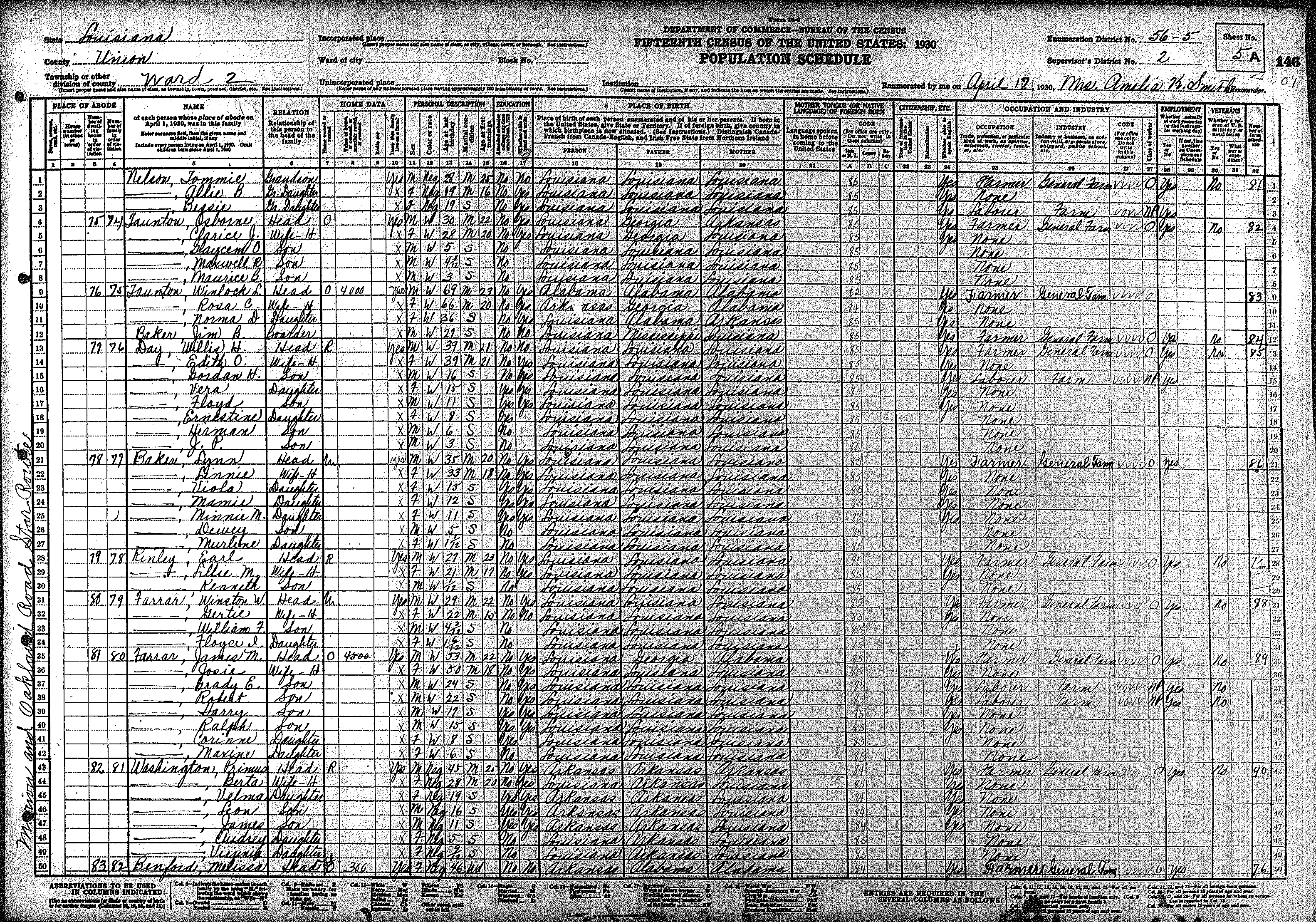
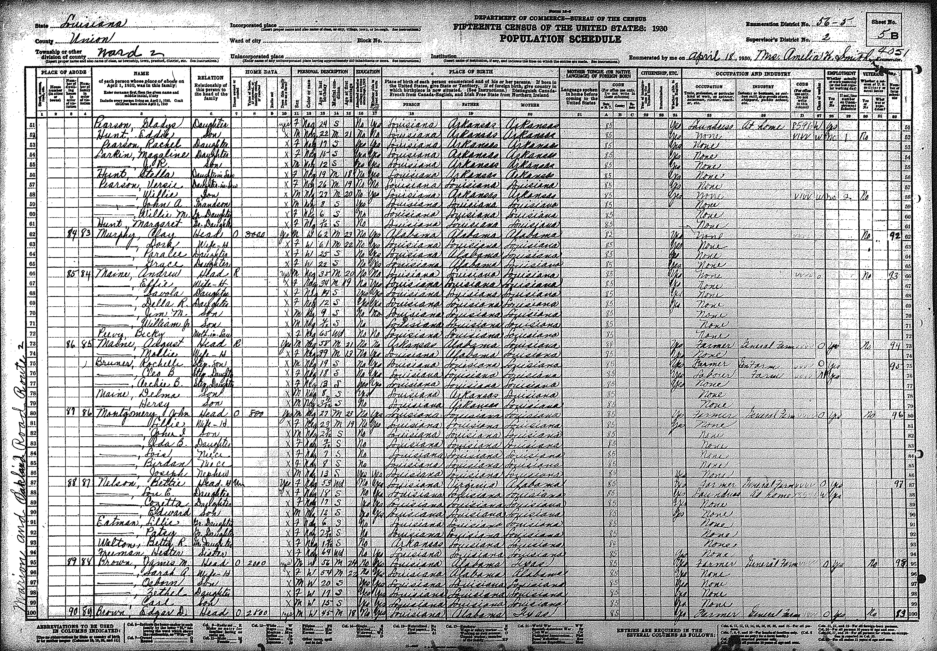
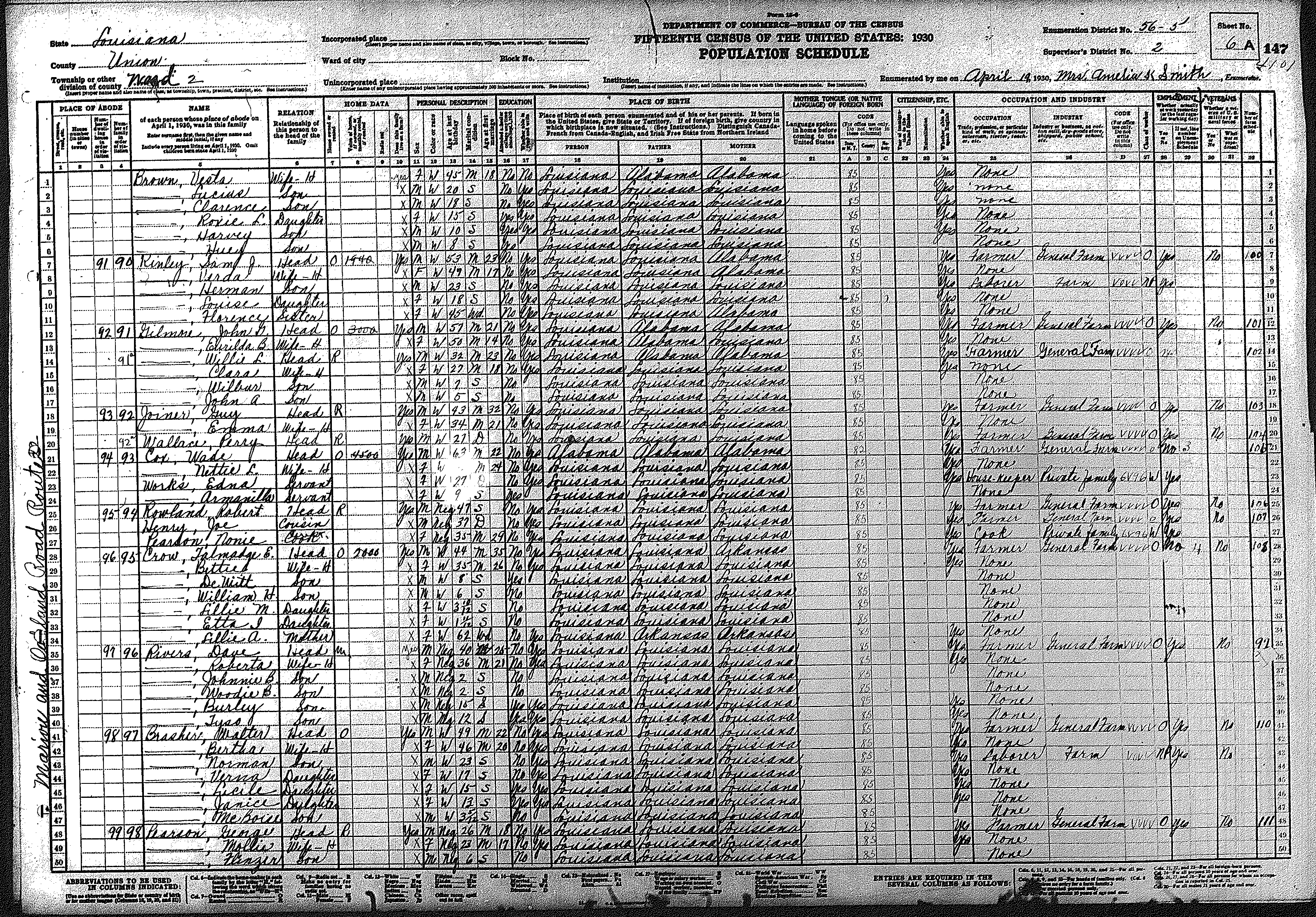
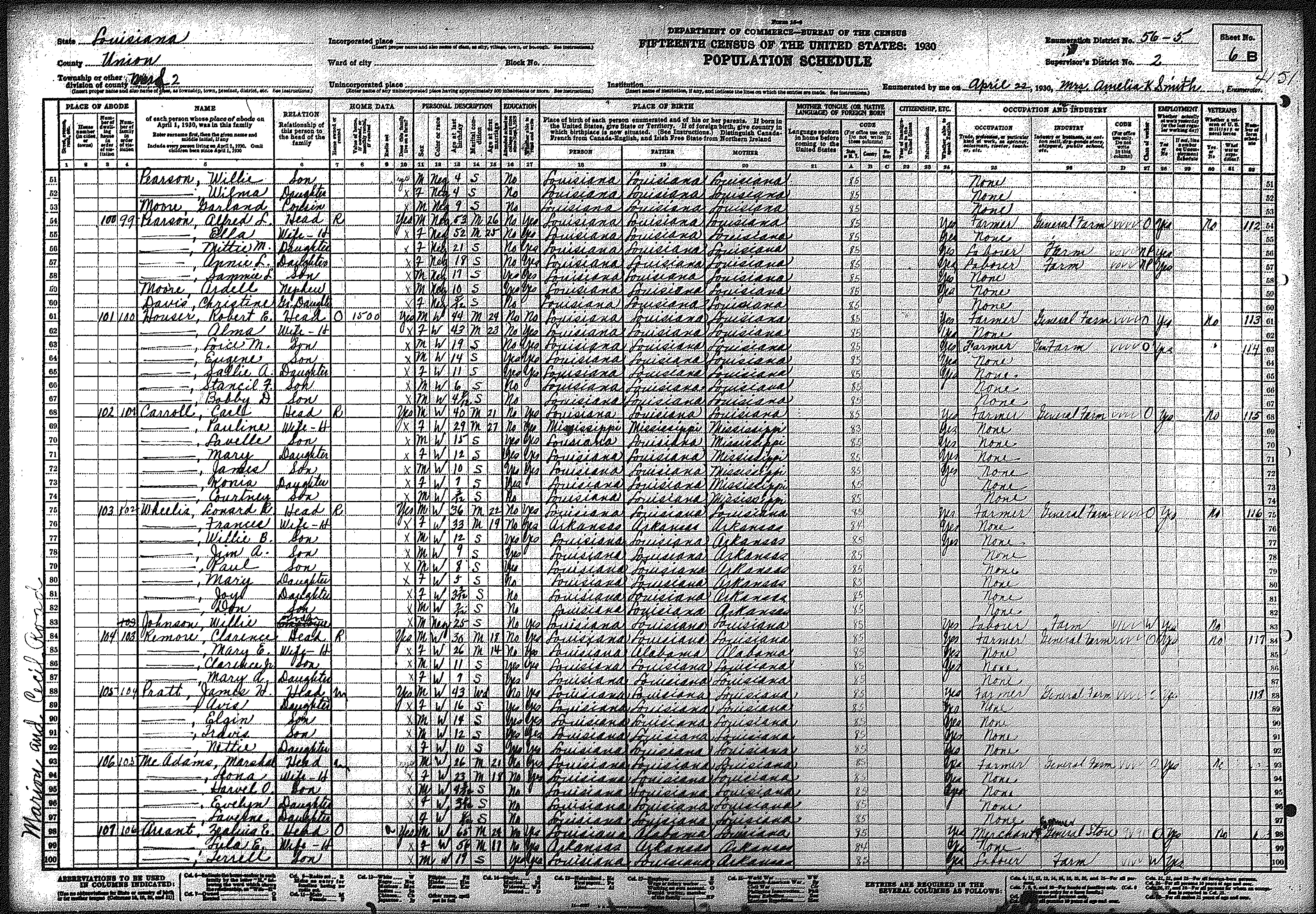
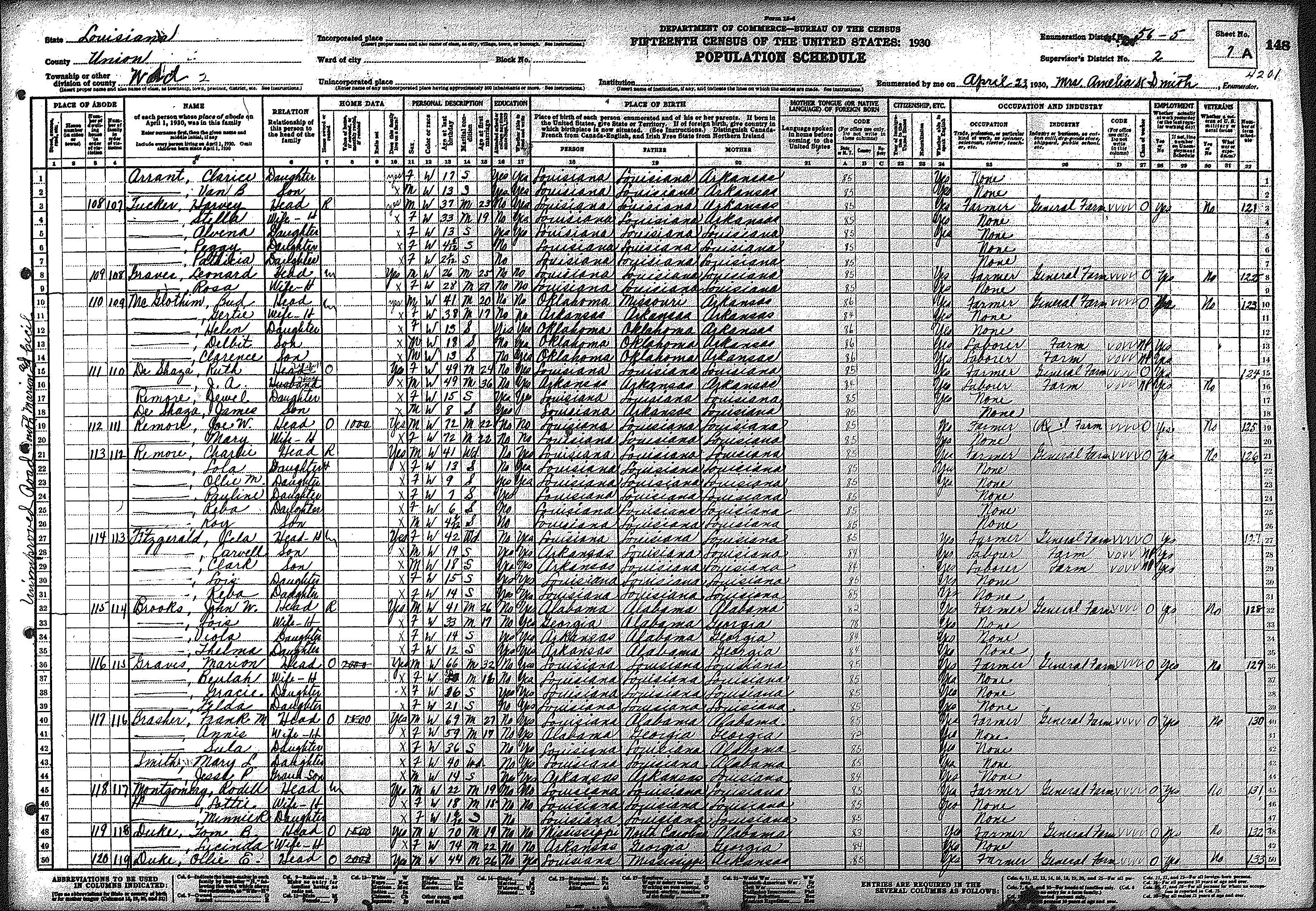
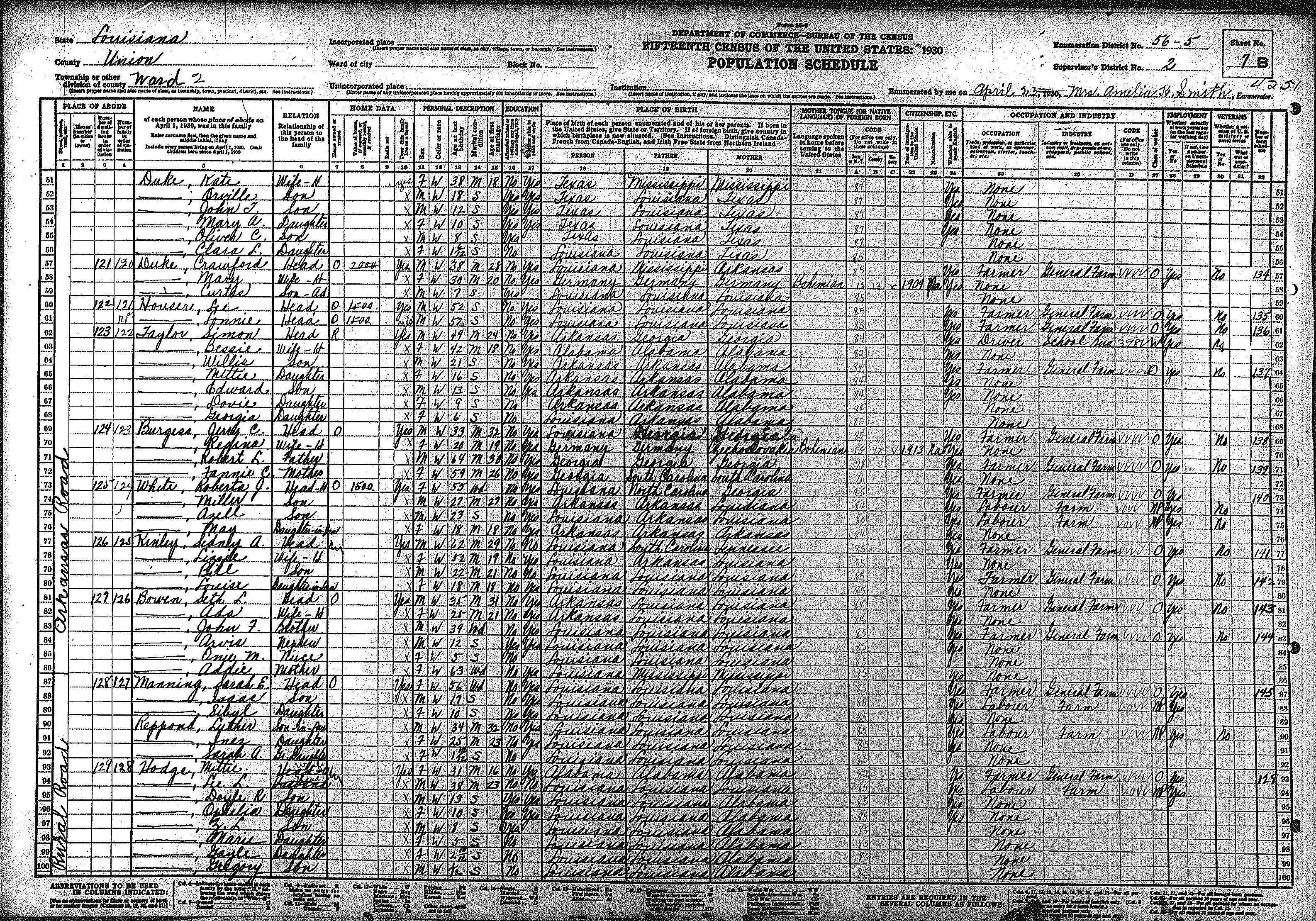
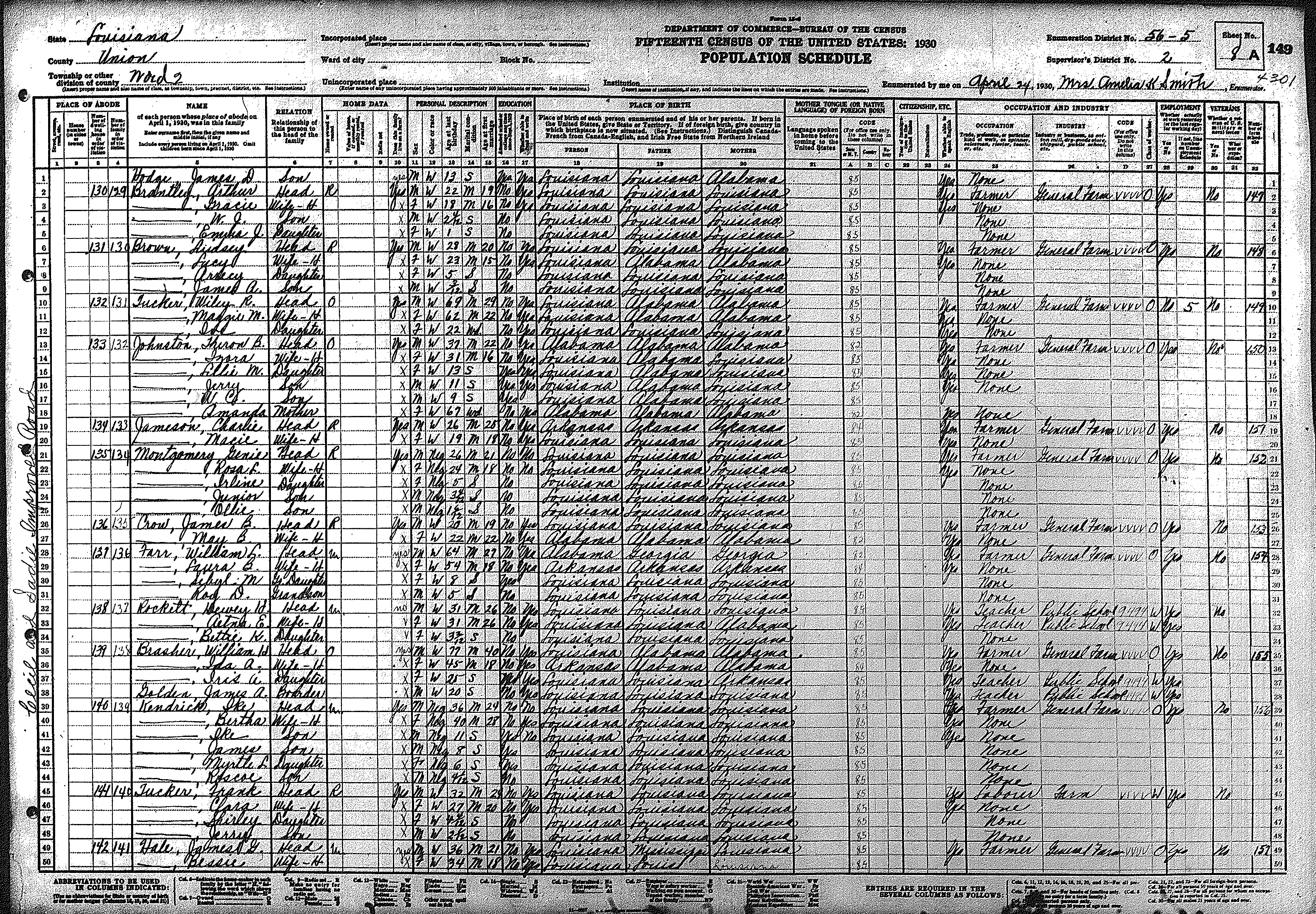
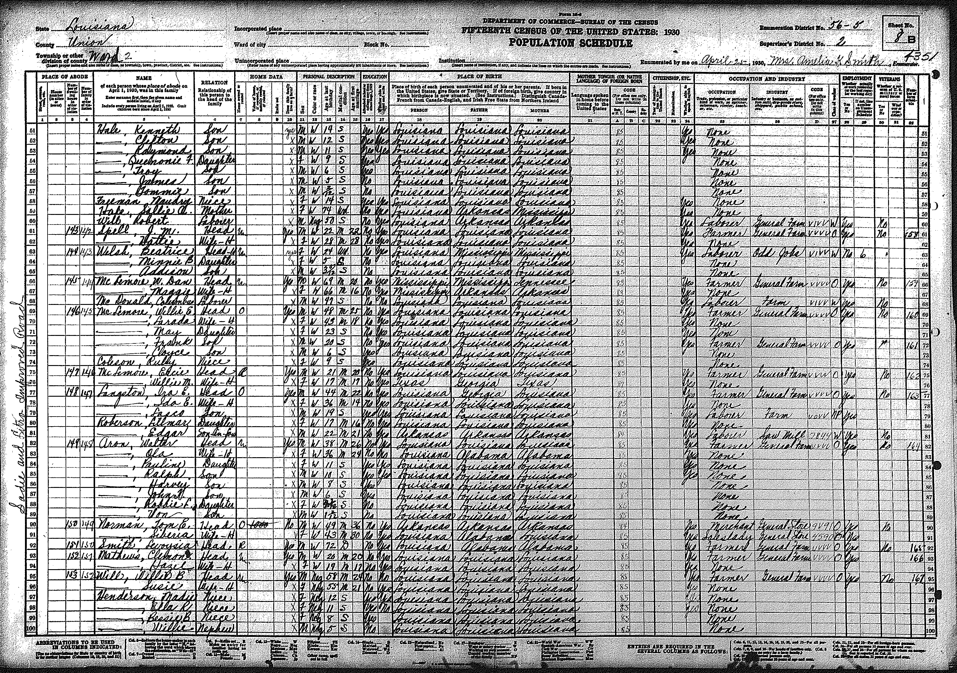
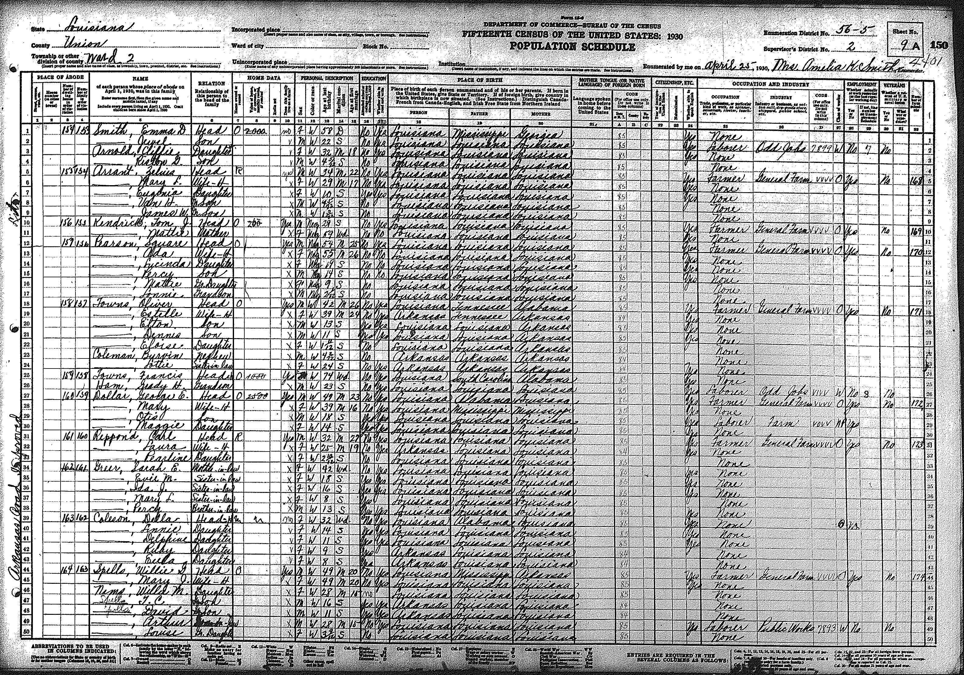
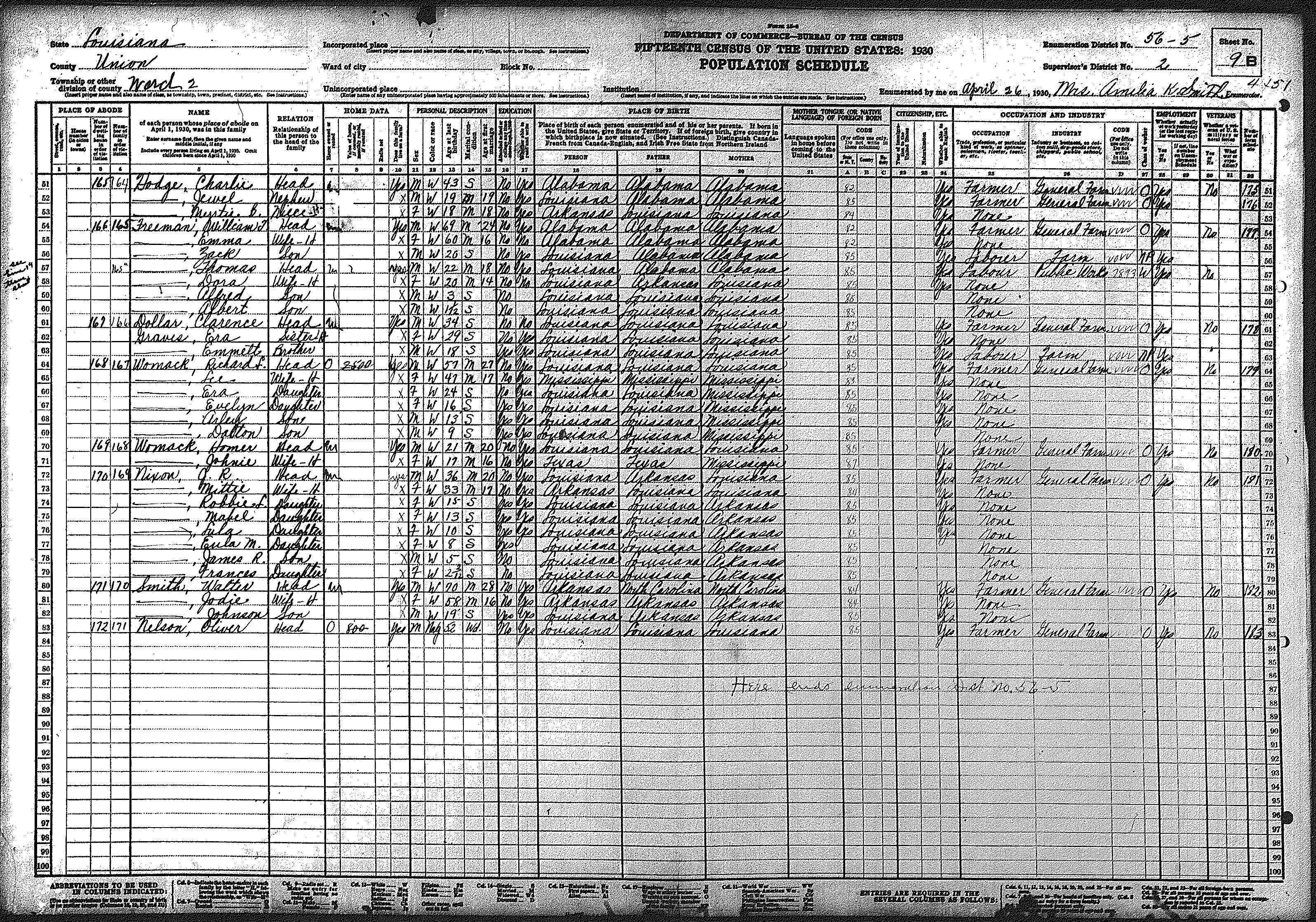
| 56 – 5 | Northeast Union Parish, including Sadie & Litroe communites along Arkansas line | ||||||||||||||||||
| 108 | 109 | 110 | 111 | 112 | 113 | 114 | 115 | 116 | 117 | 118 | 119 | 120 | 121 | 122 | |||||
| 123 | 124 | 125 | |||||||||||||||||
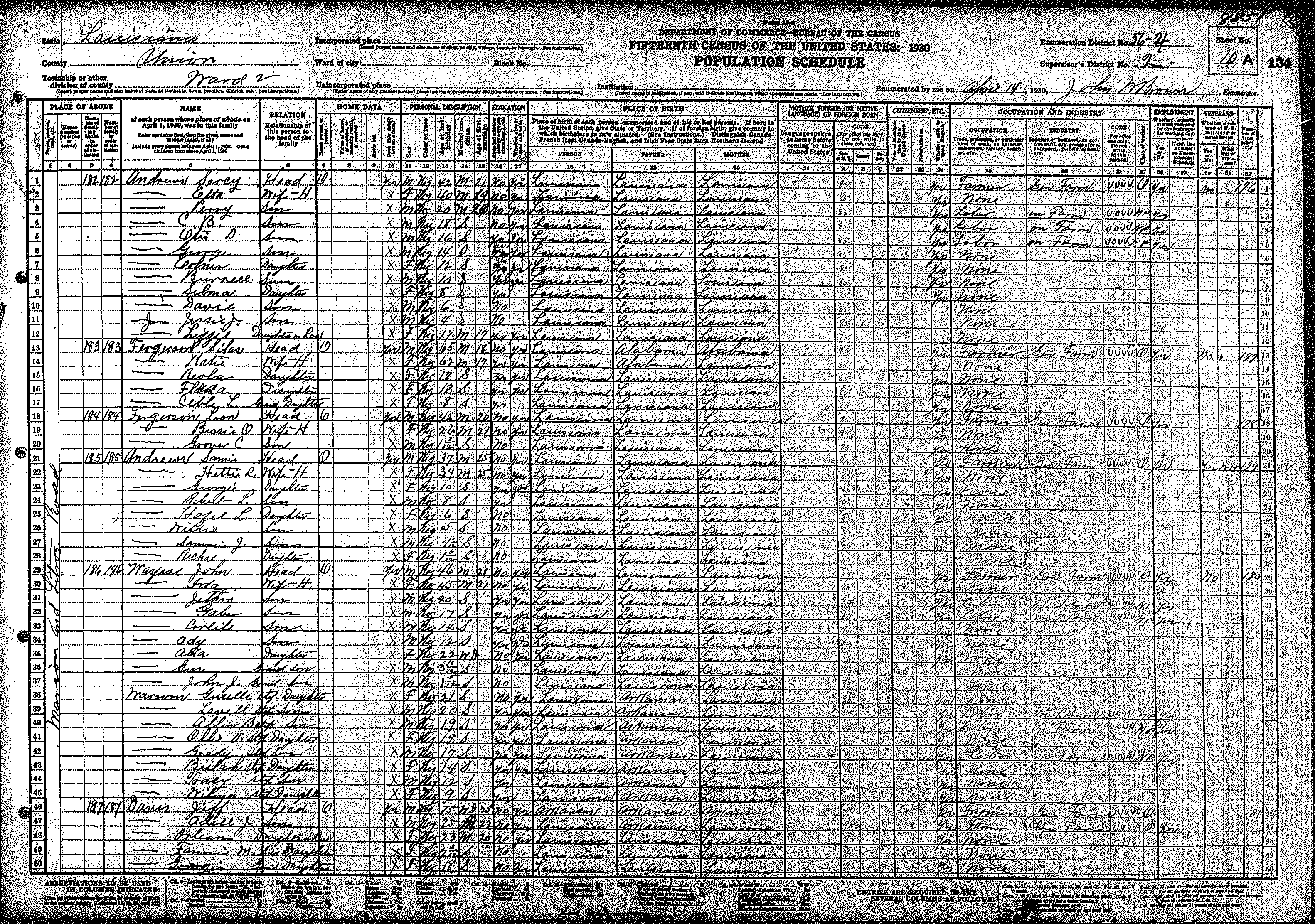
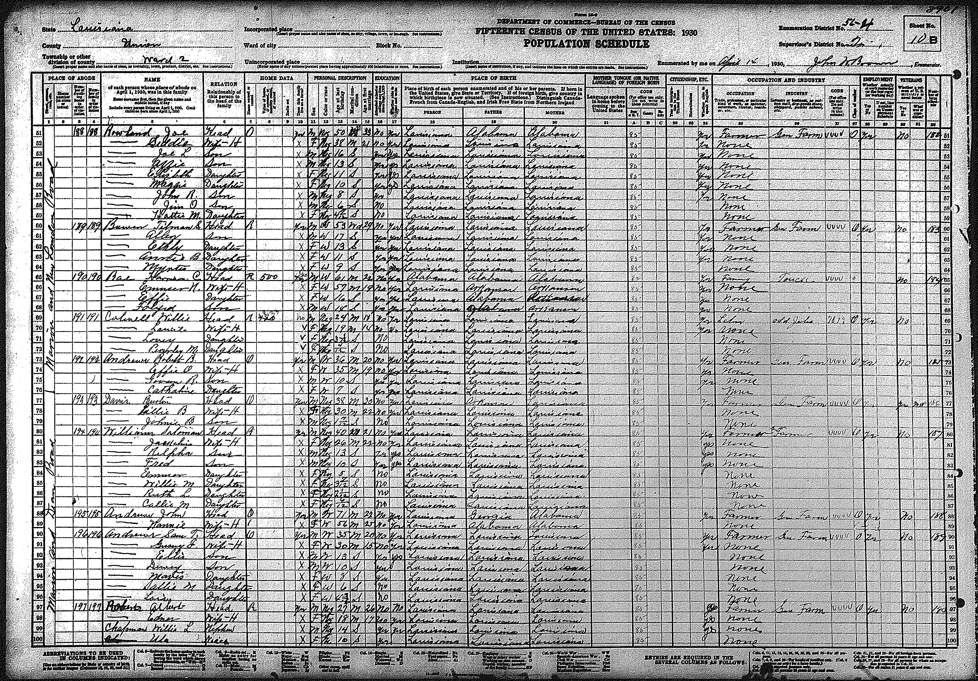
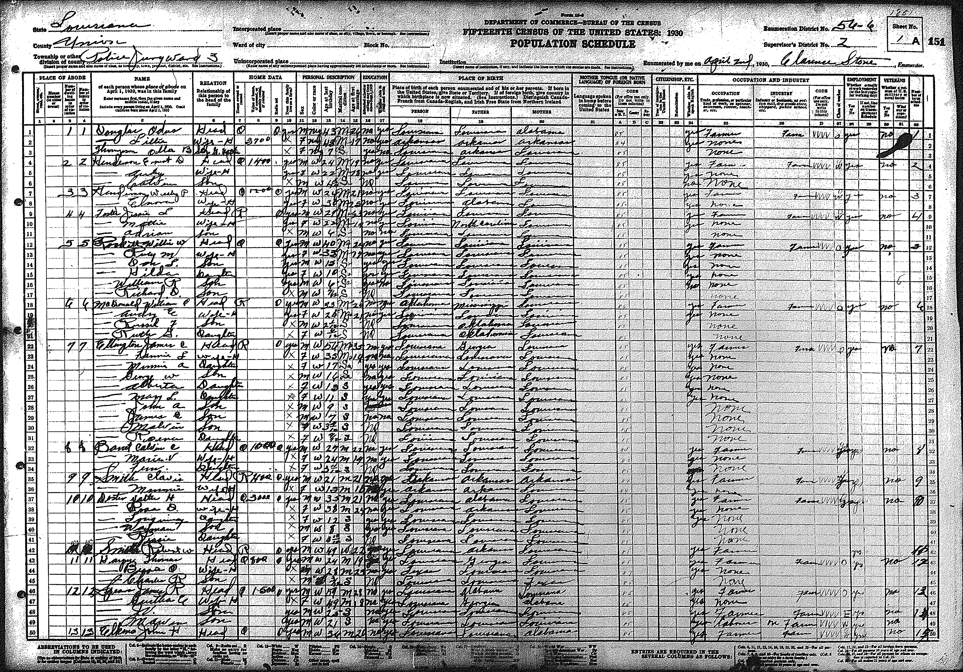
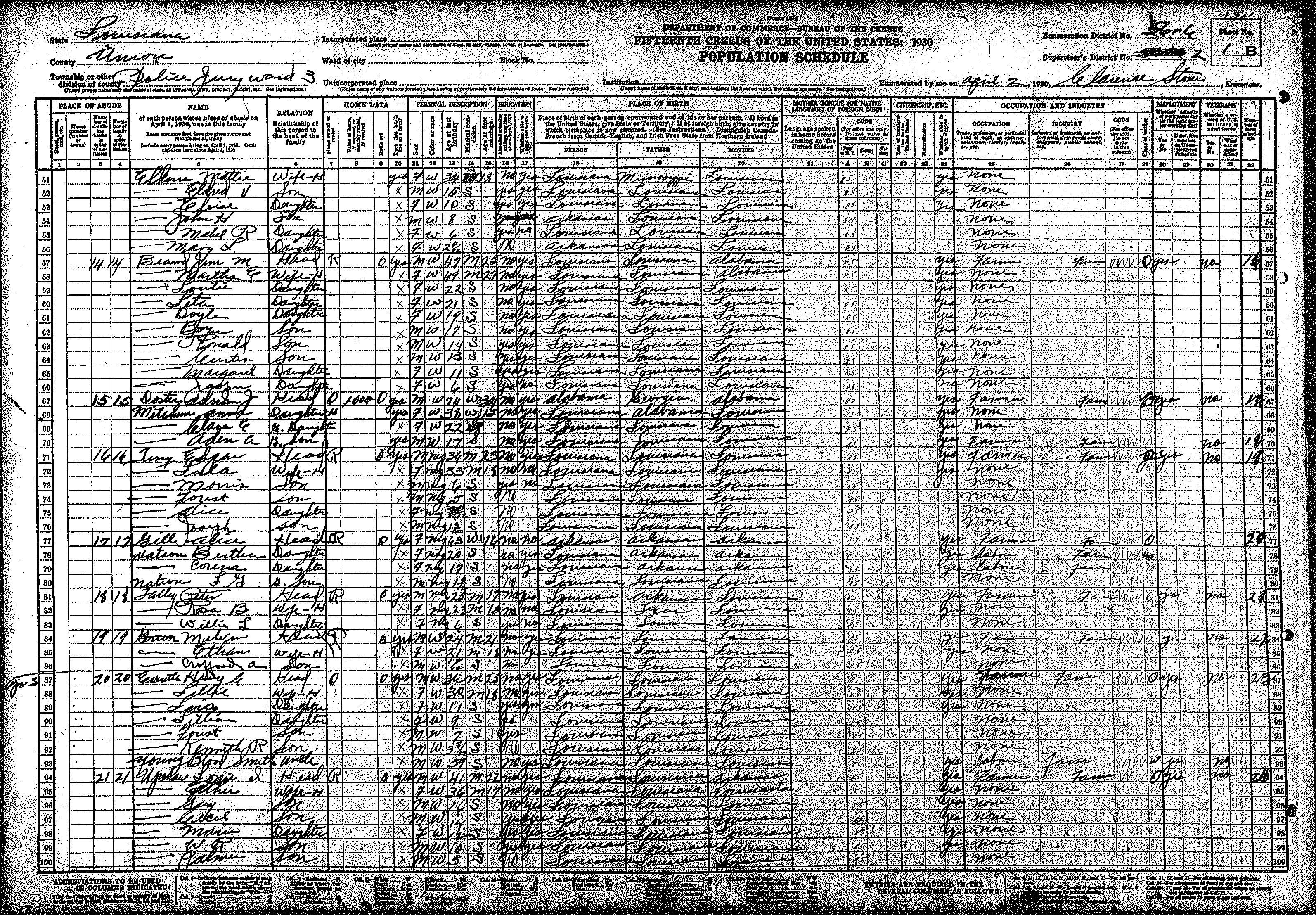
| 3 | Northwest Union Parish surrounding Spearsville, Cherry Ridge, & Camp Creek community | ||||||||||||||||||
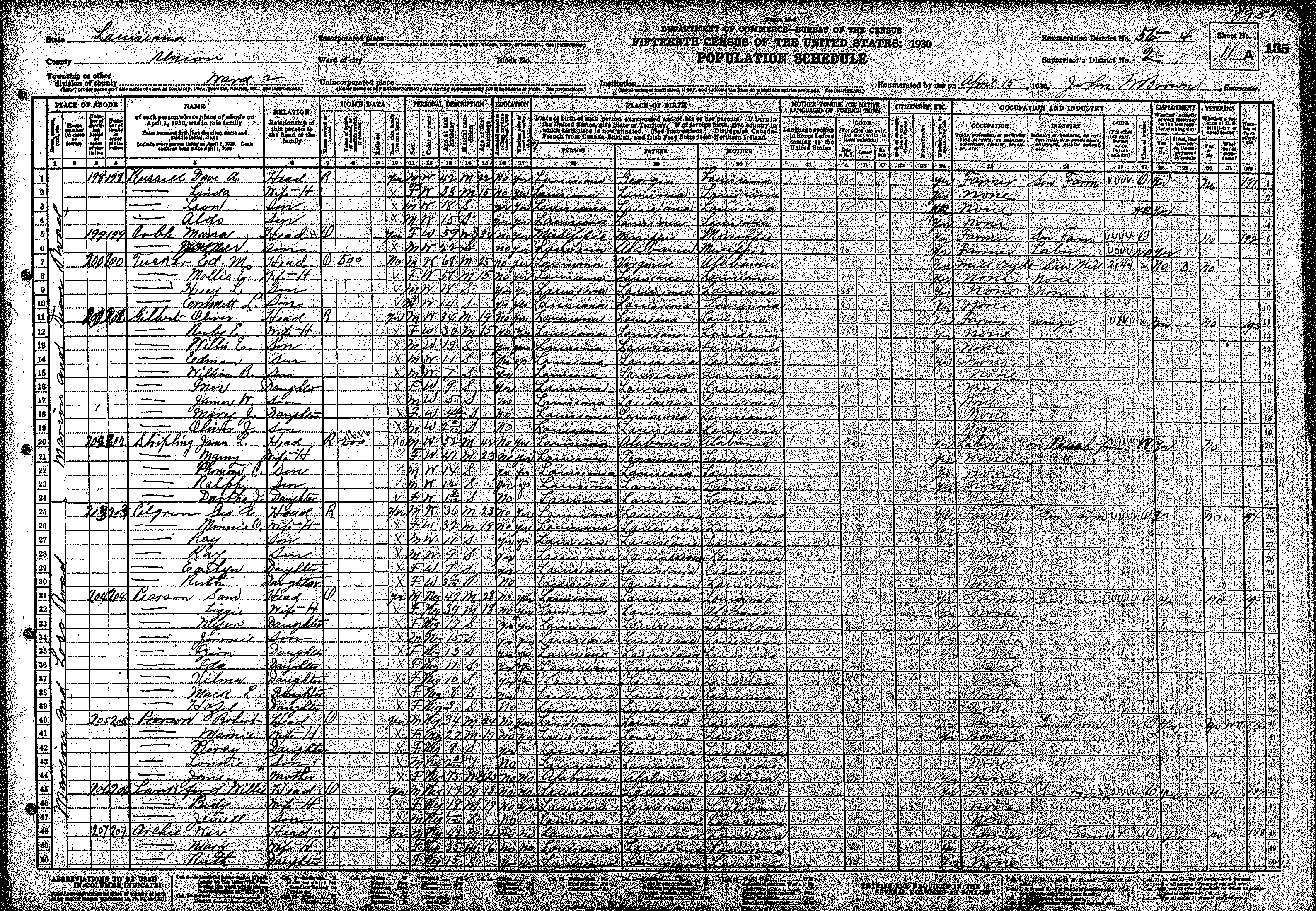
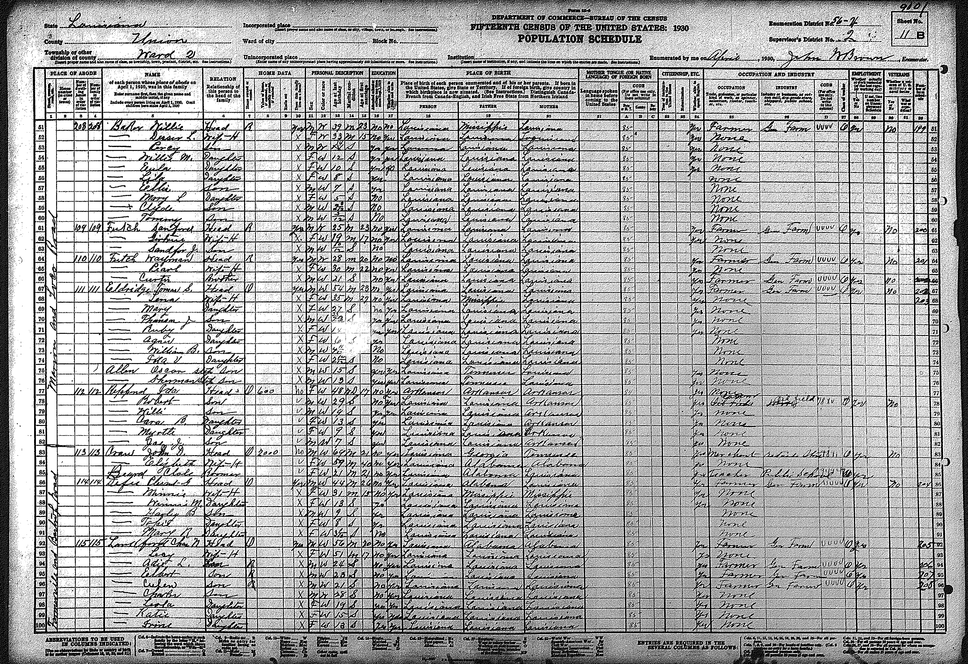
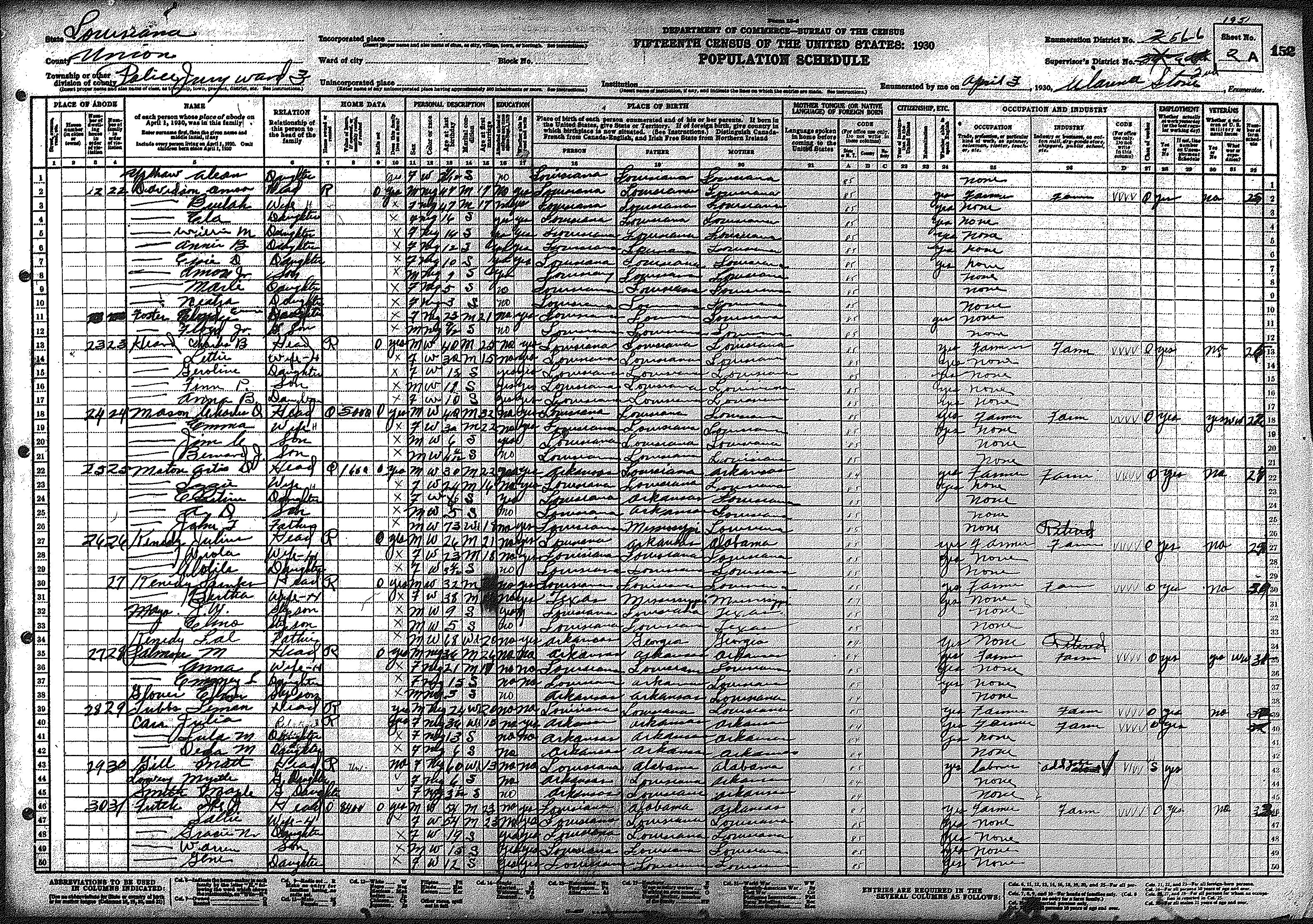
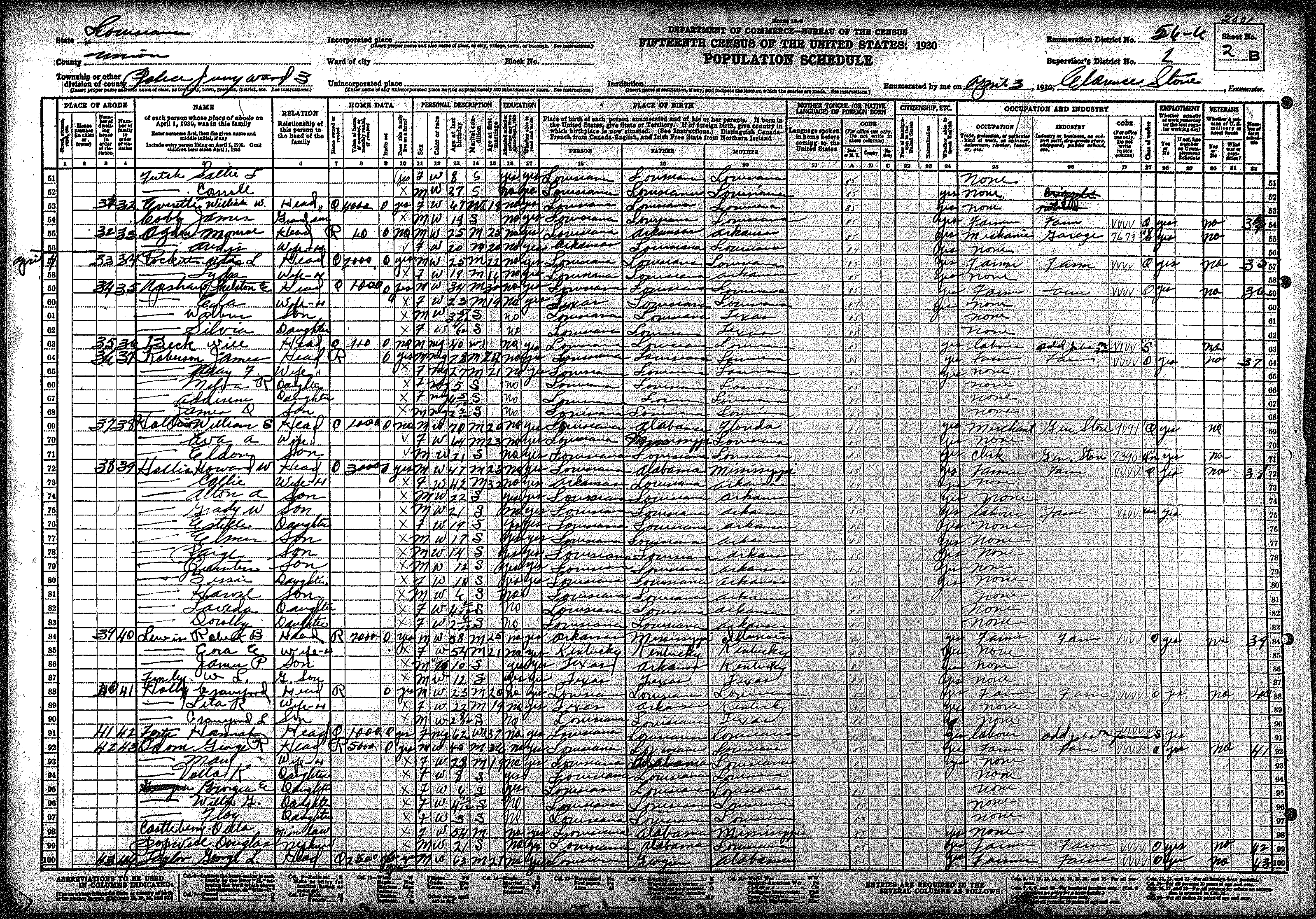
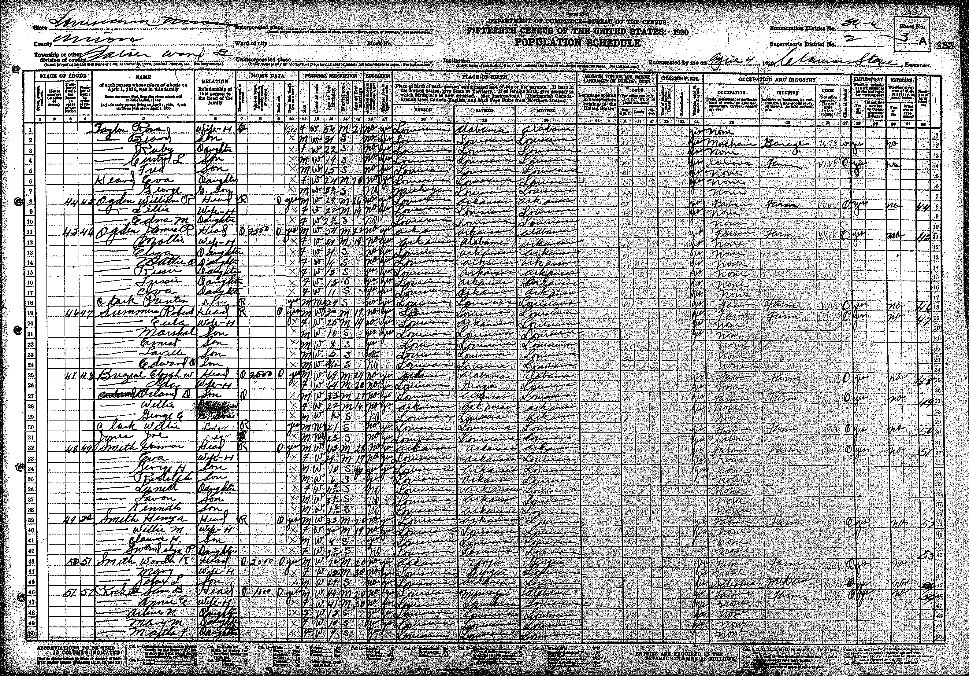
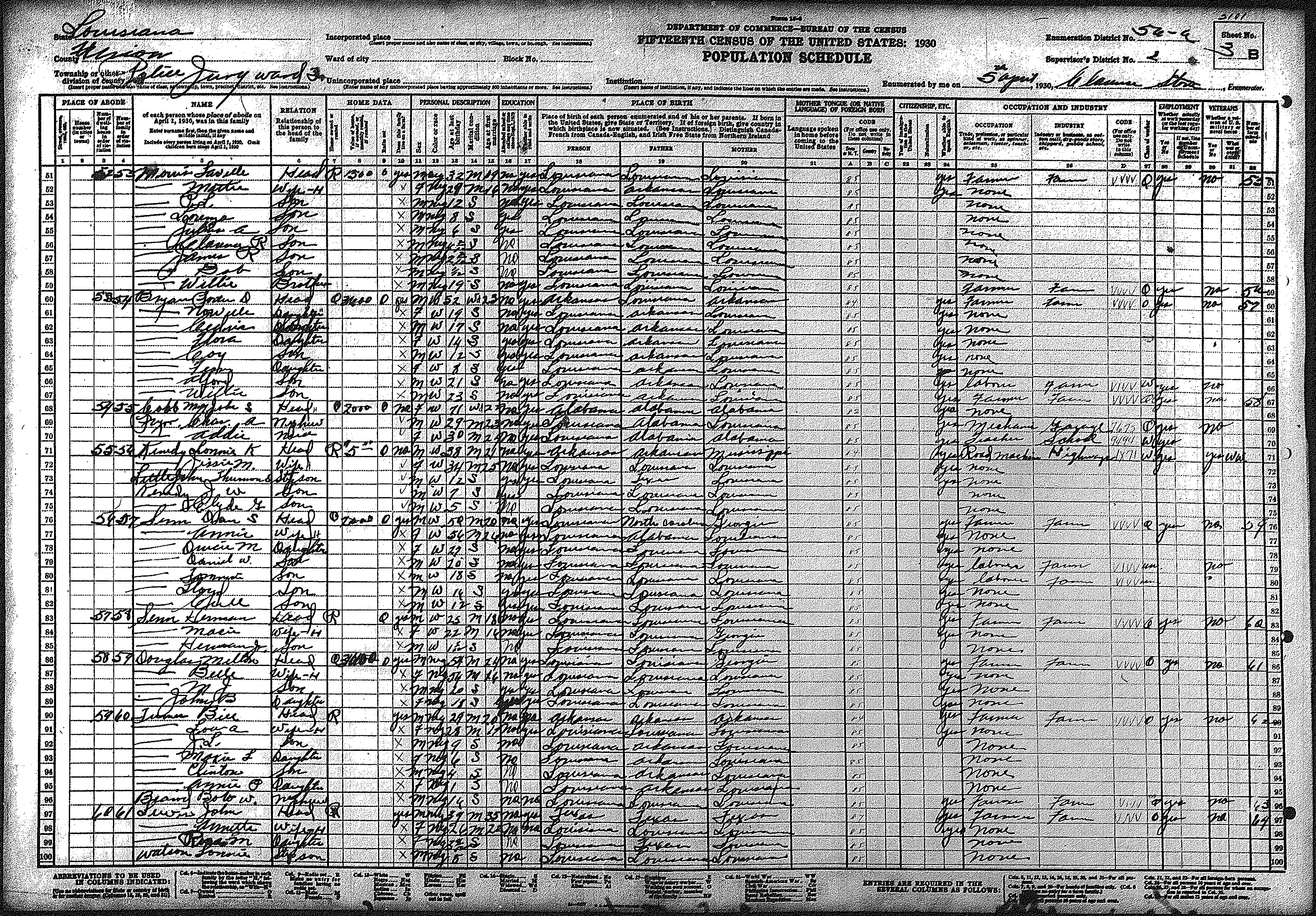
| 56 – 6 | 126 | 127 | 128 | 129 | 130 | 131 | 132 | 133 | 134 | 135 | 136 | 137 | 138 | 139 | 140 | ||||
| 141 | 142 | 143 | 144 | 145 | 146 | 147 | 148 | 149 | 150 | 151 | 152 | 153 | 154 | 155 | |||||
| 156 | 157 | 158 | 159 | 160 | 161 | ||||||||||||||
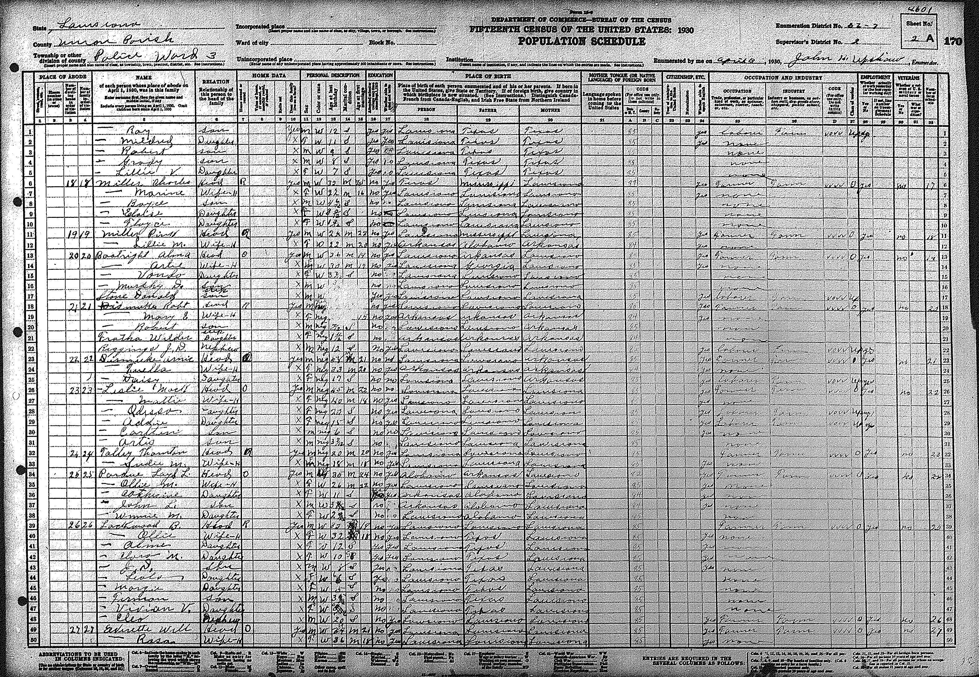
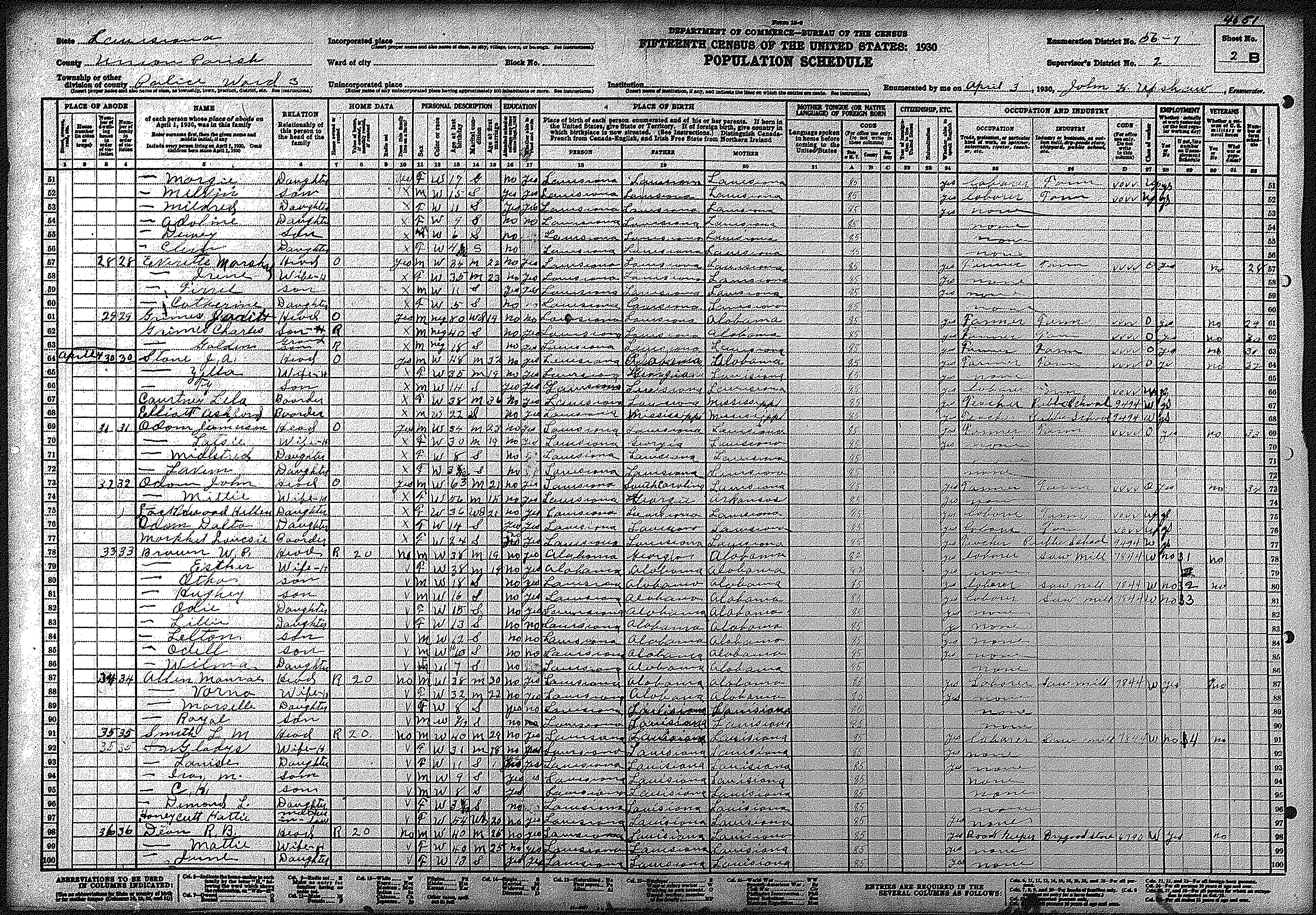
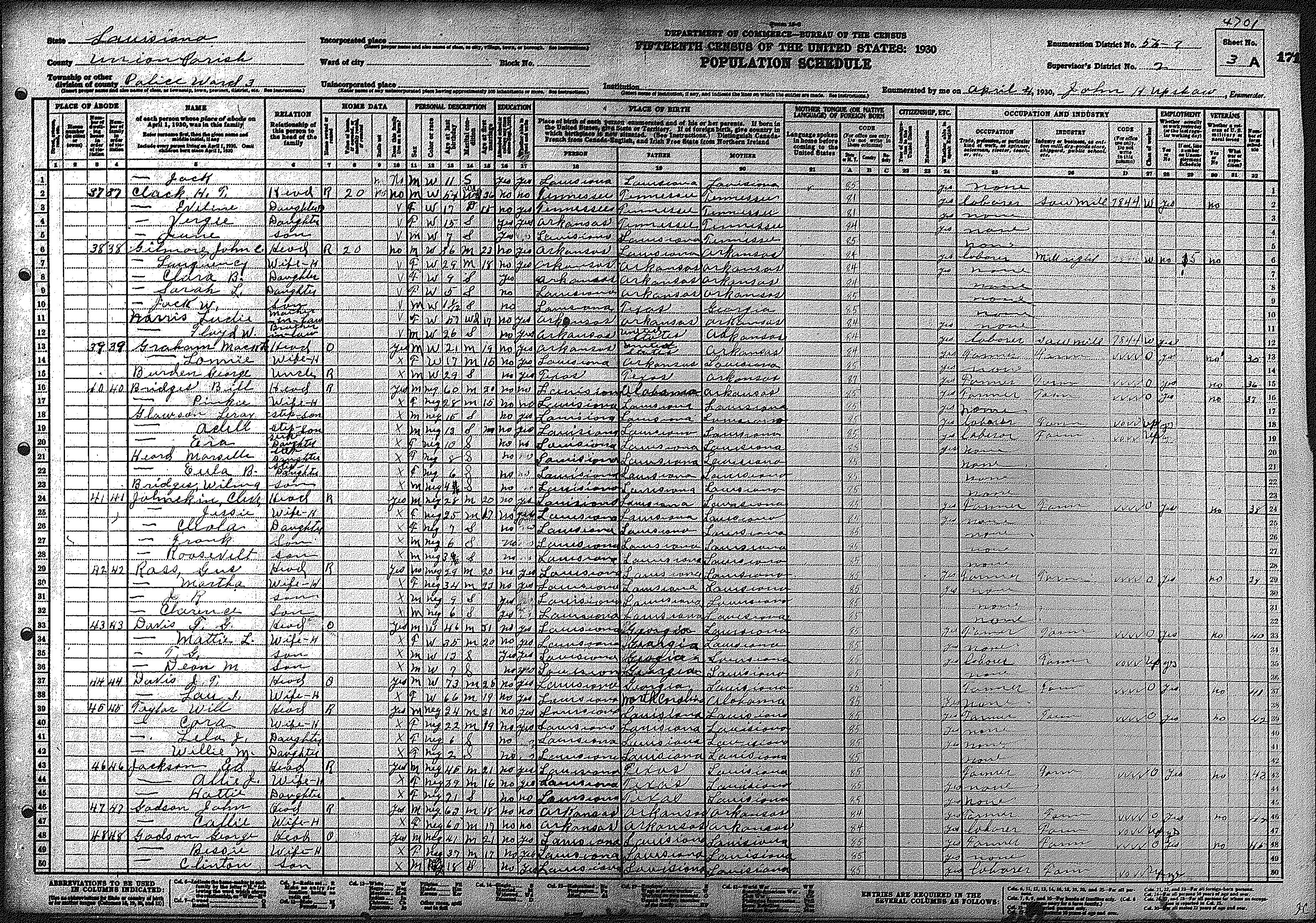
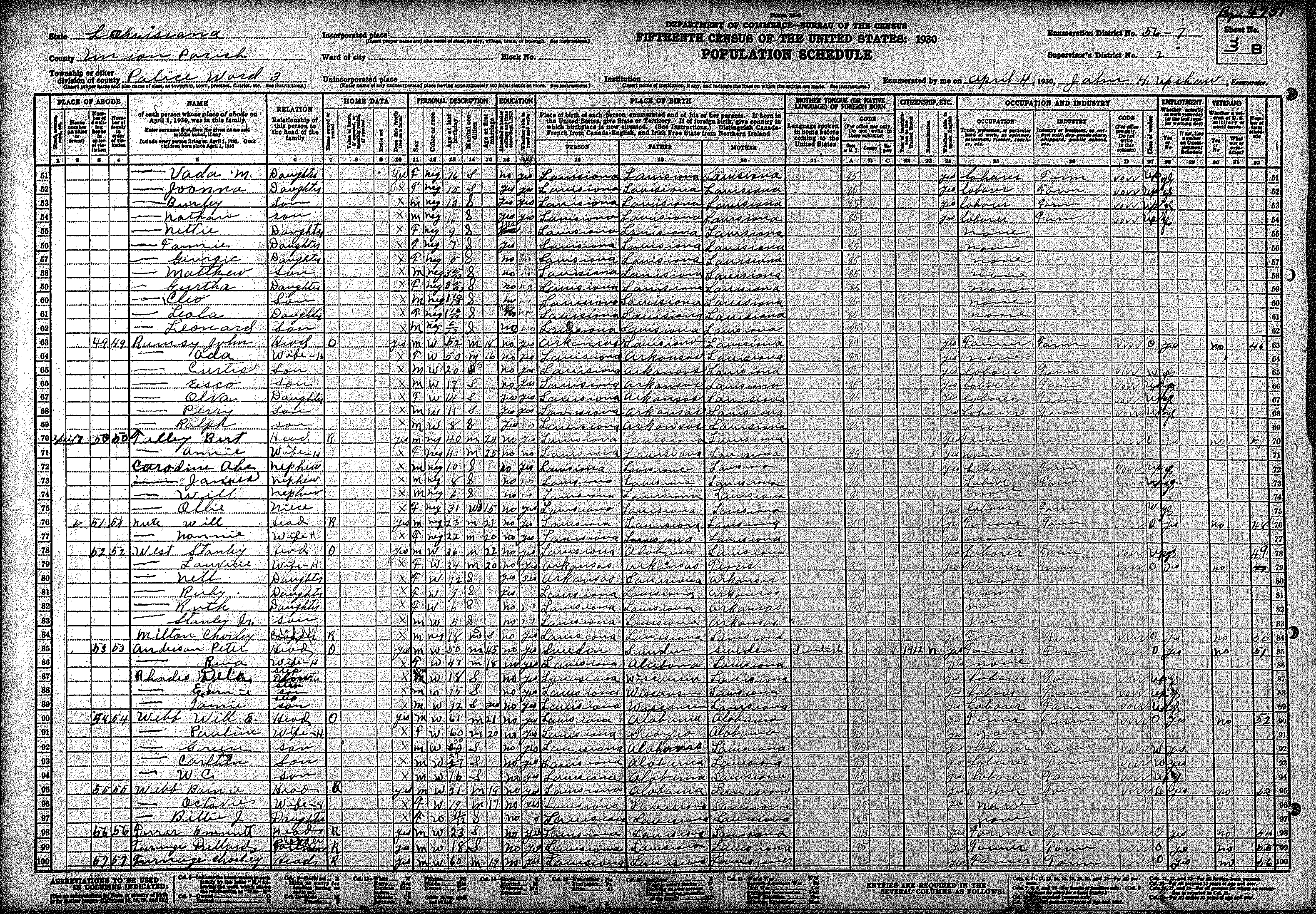
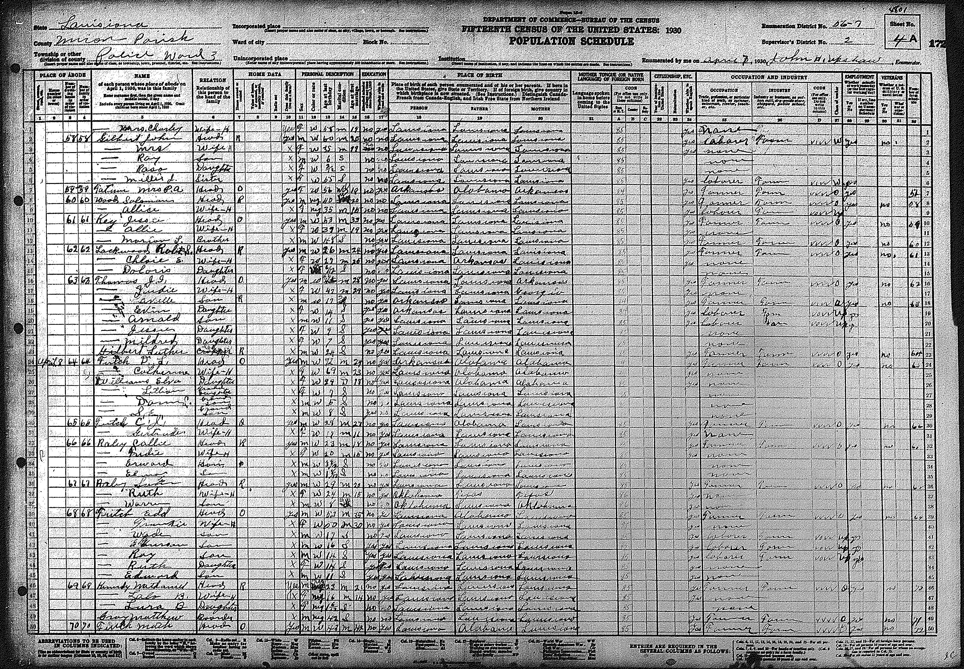
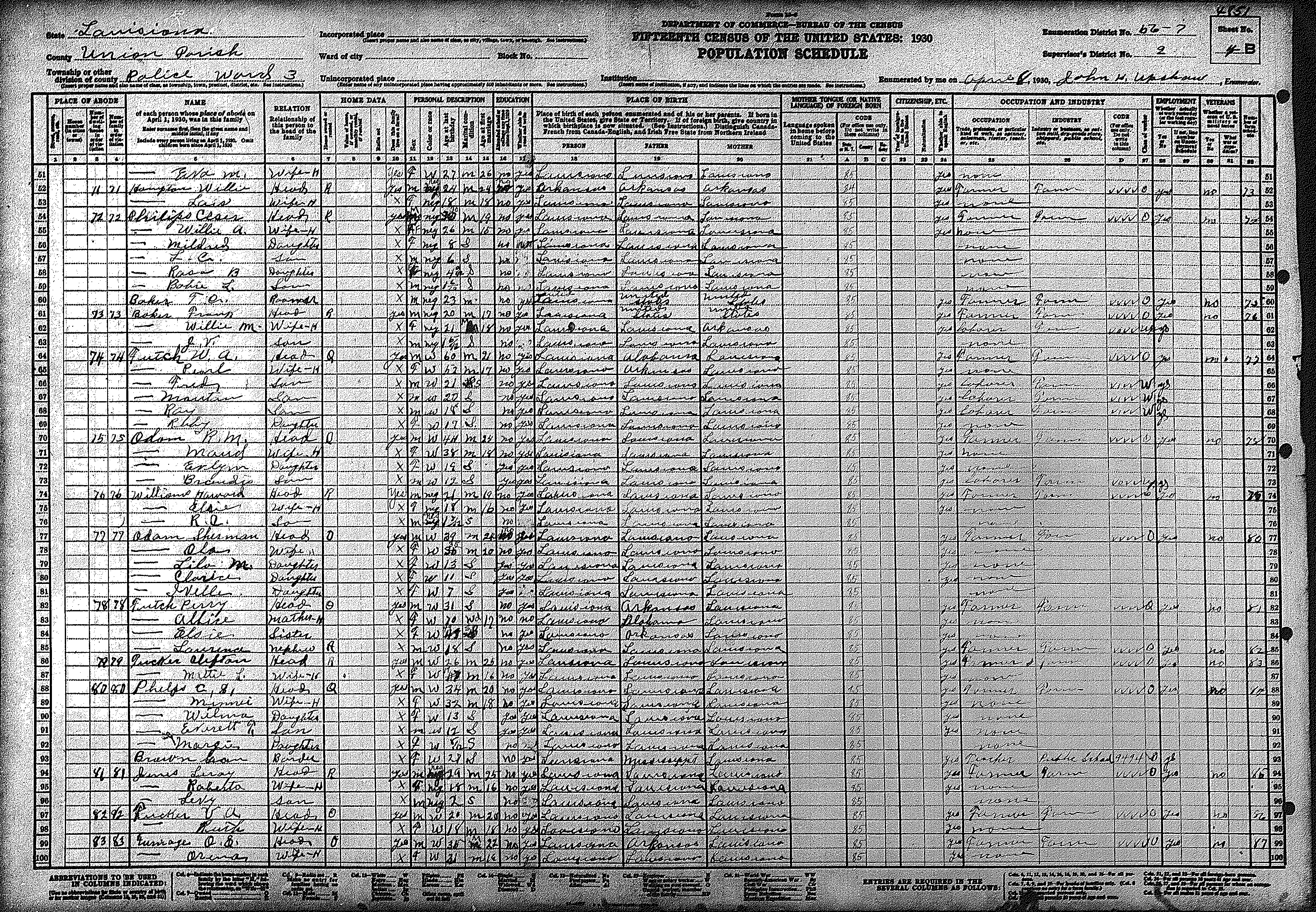
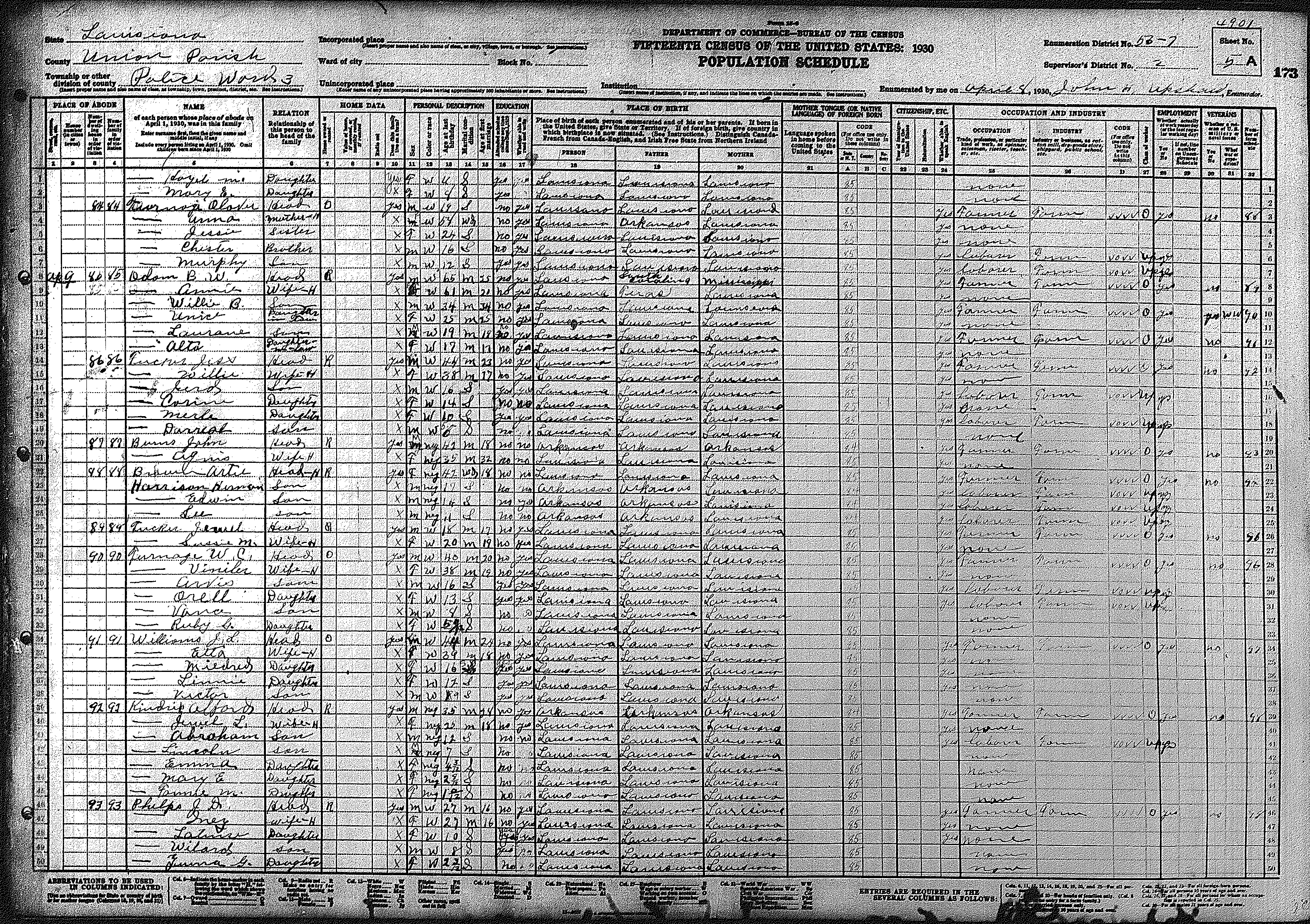
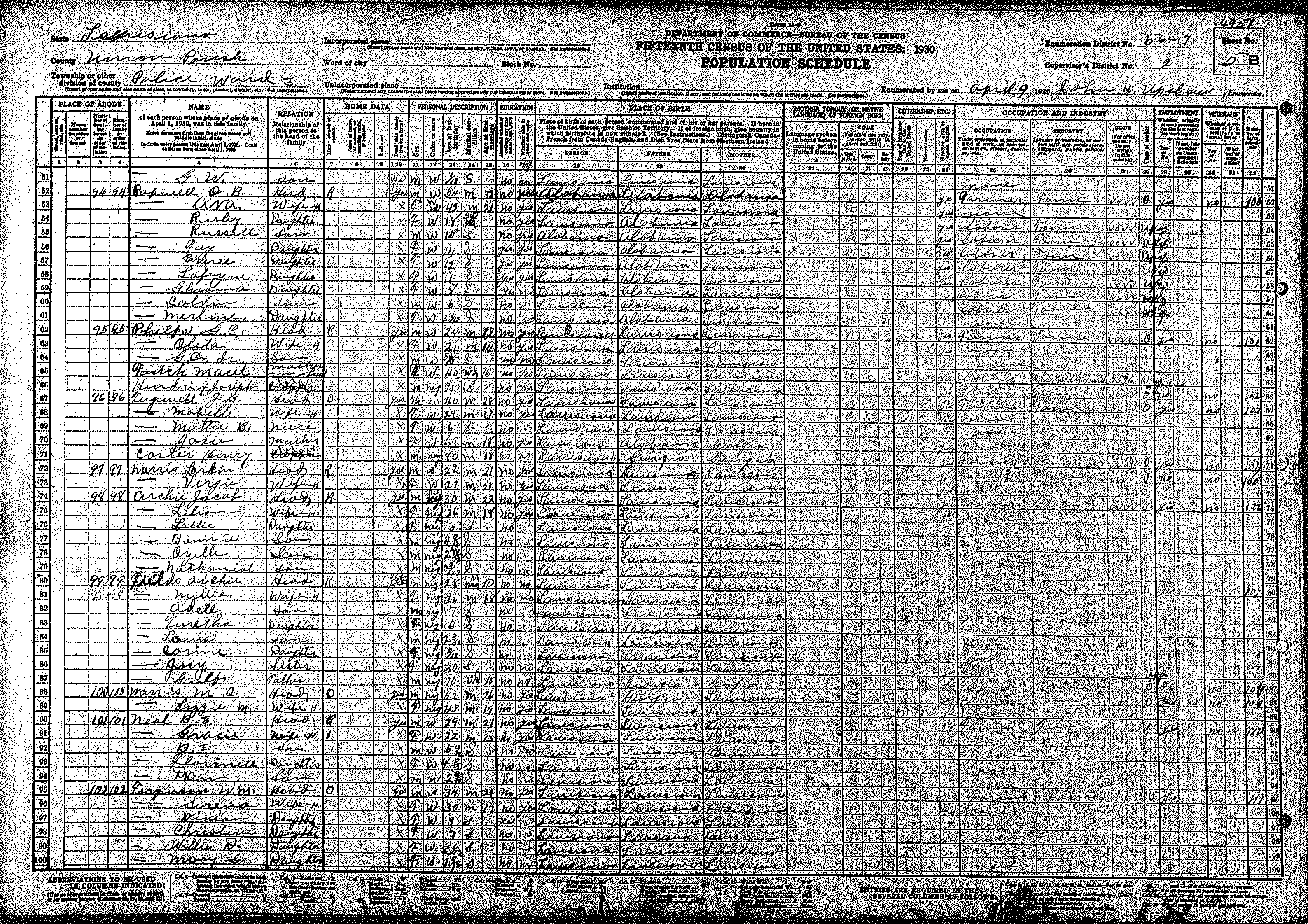
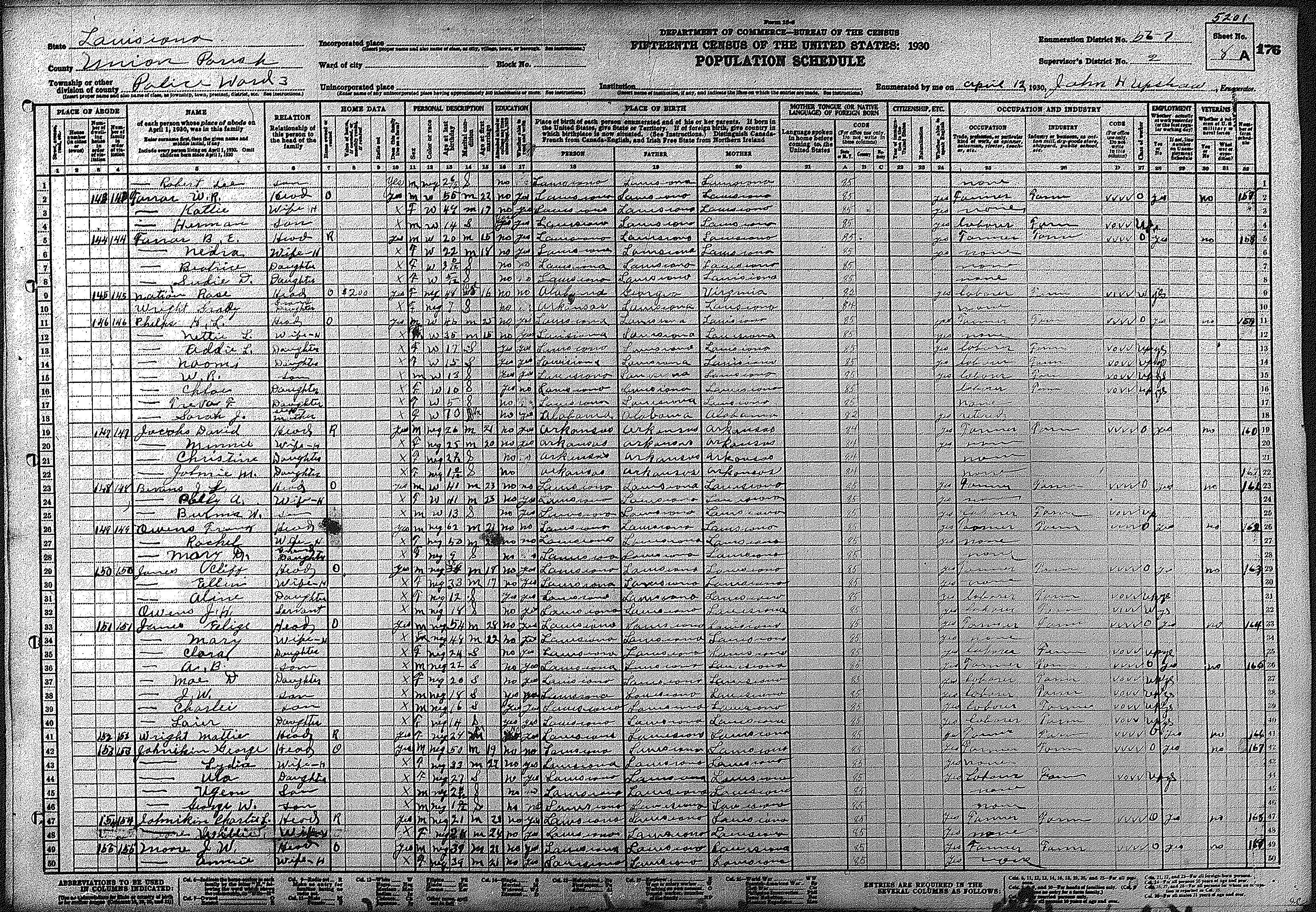
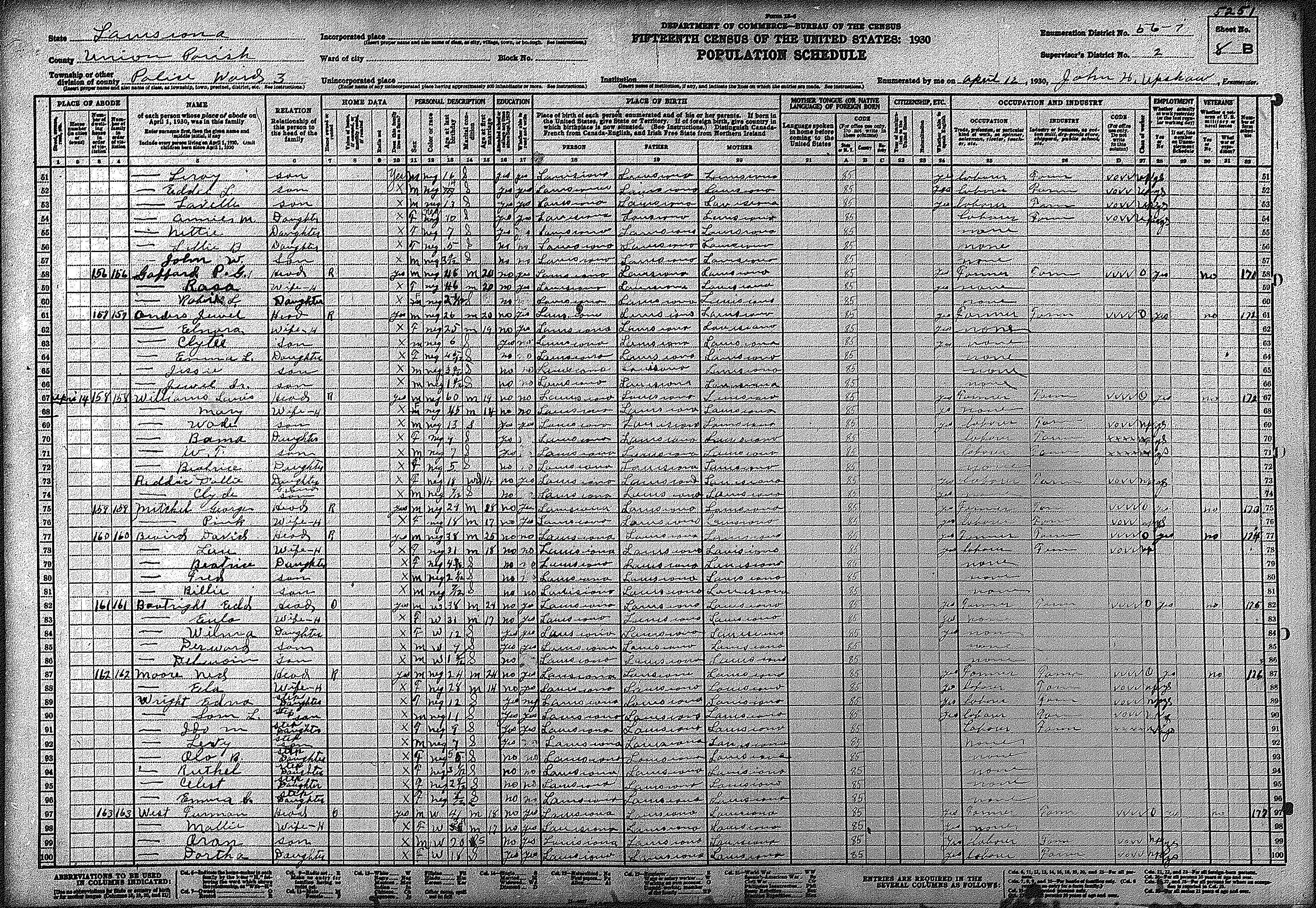
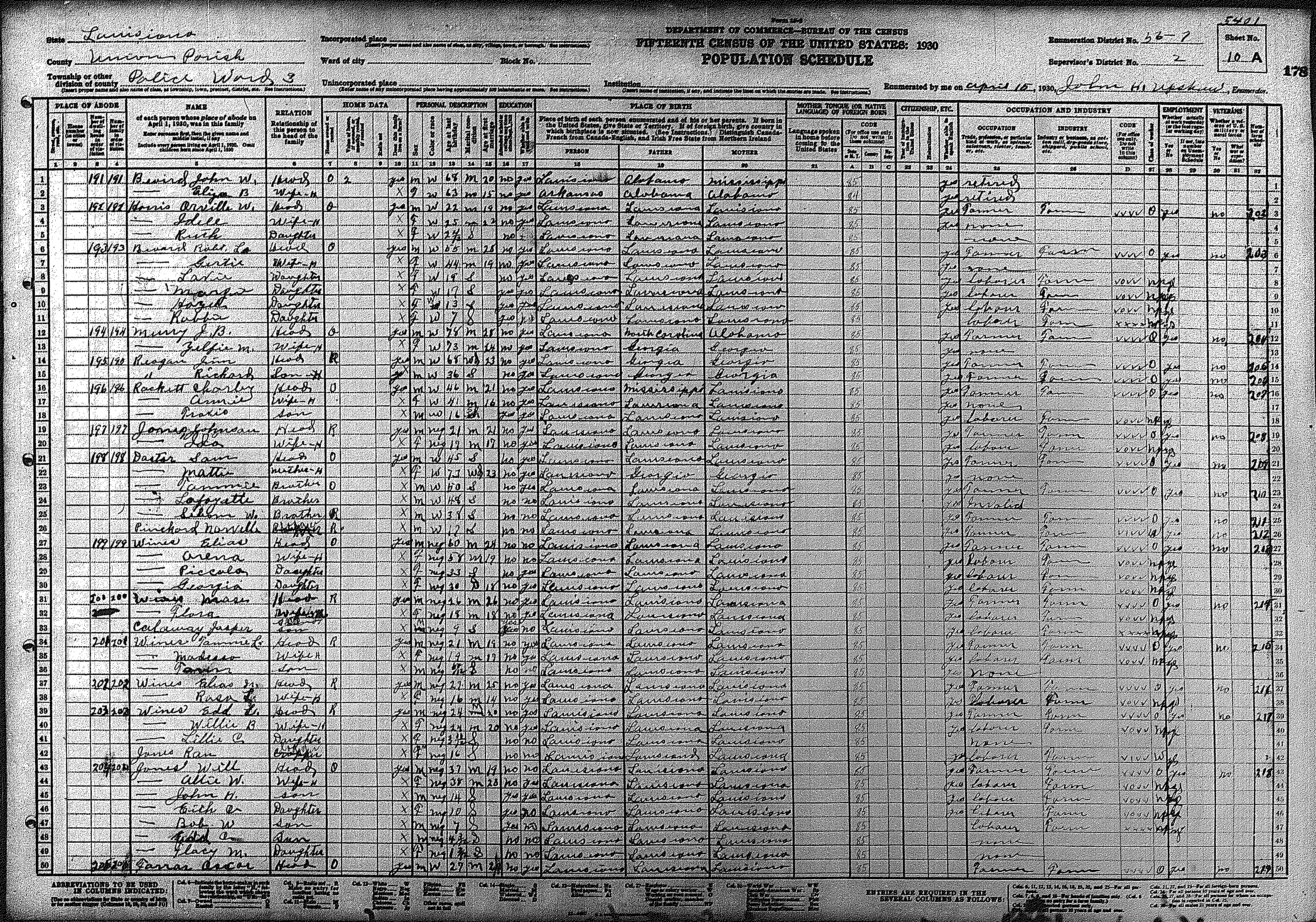
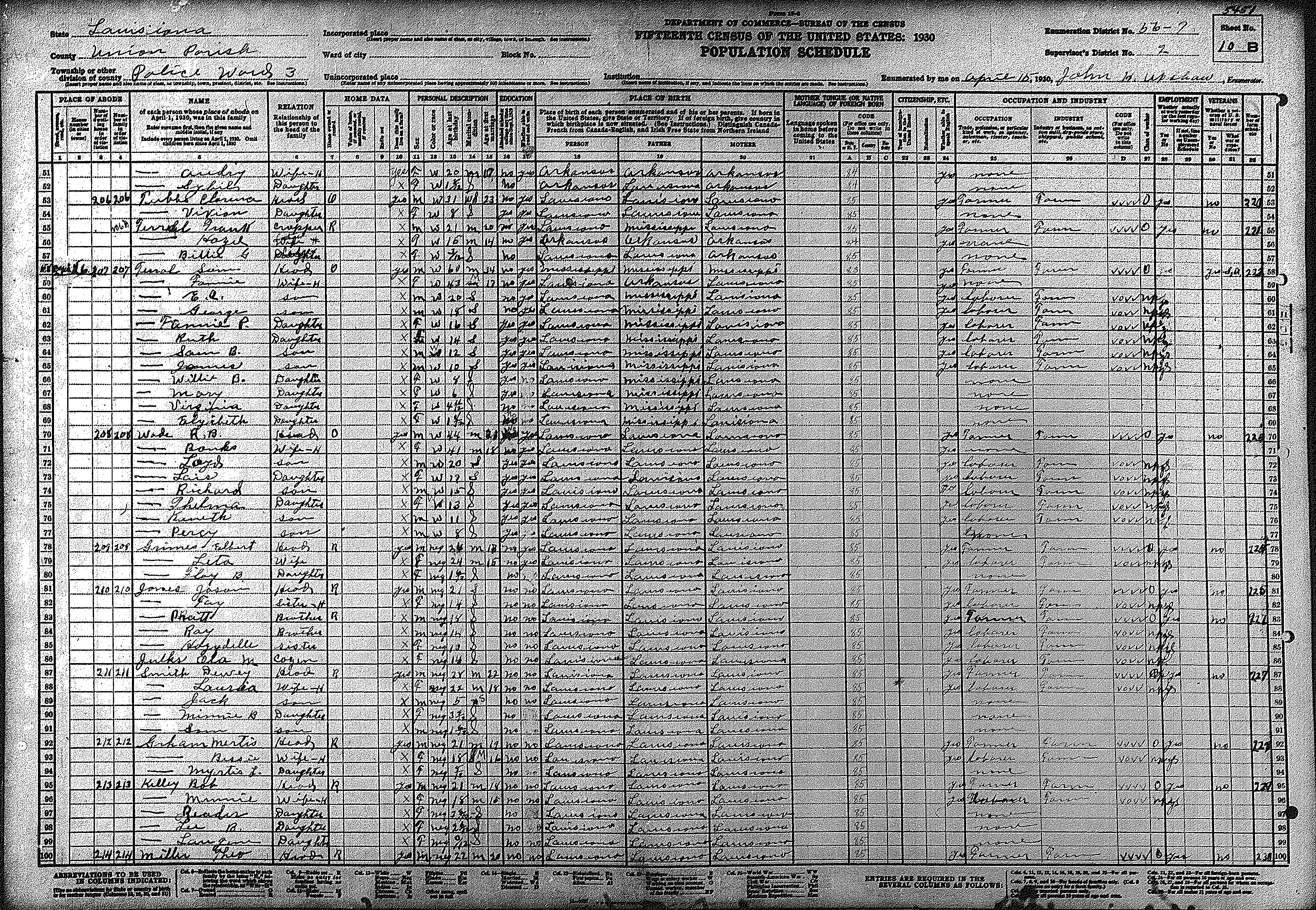
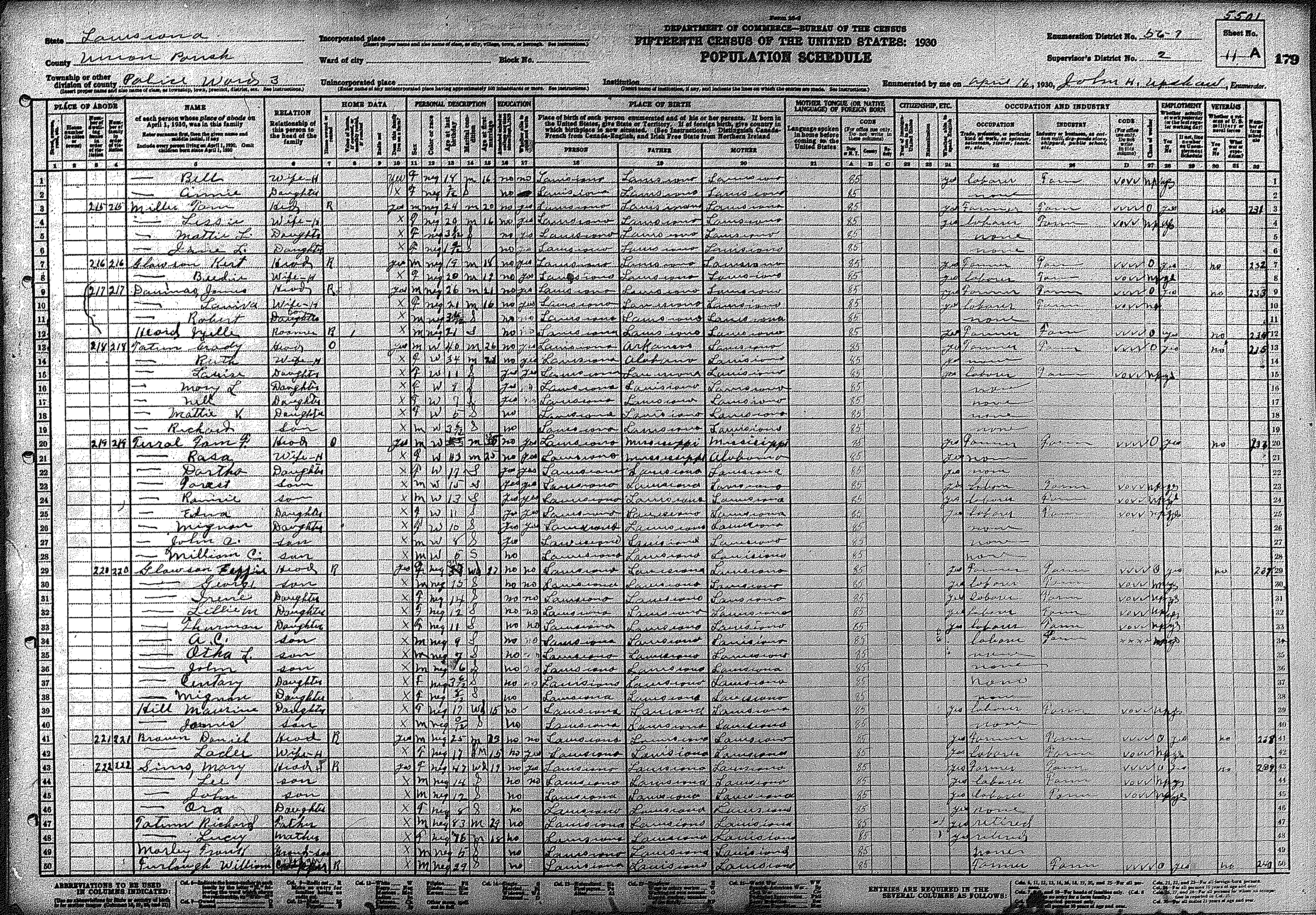
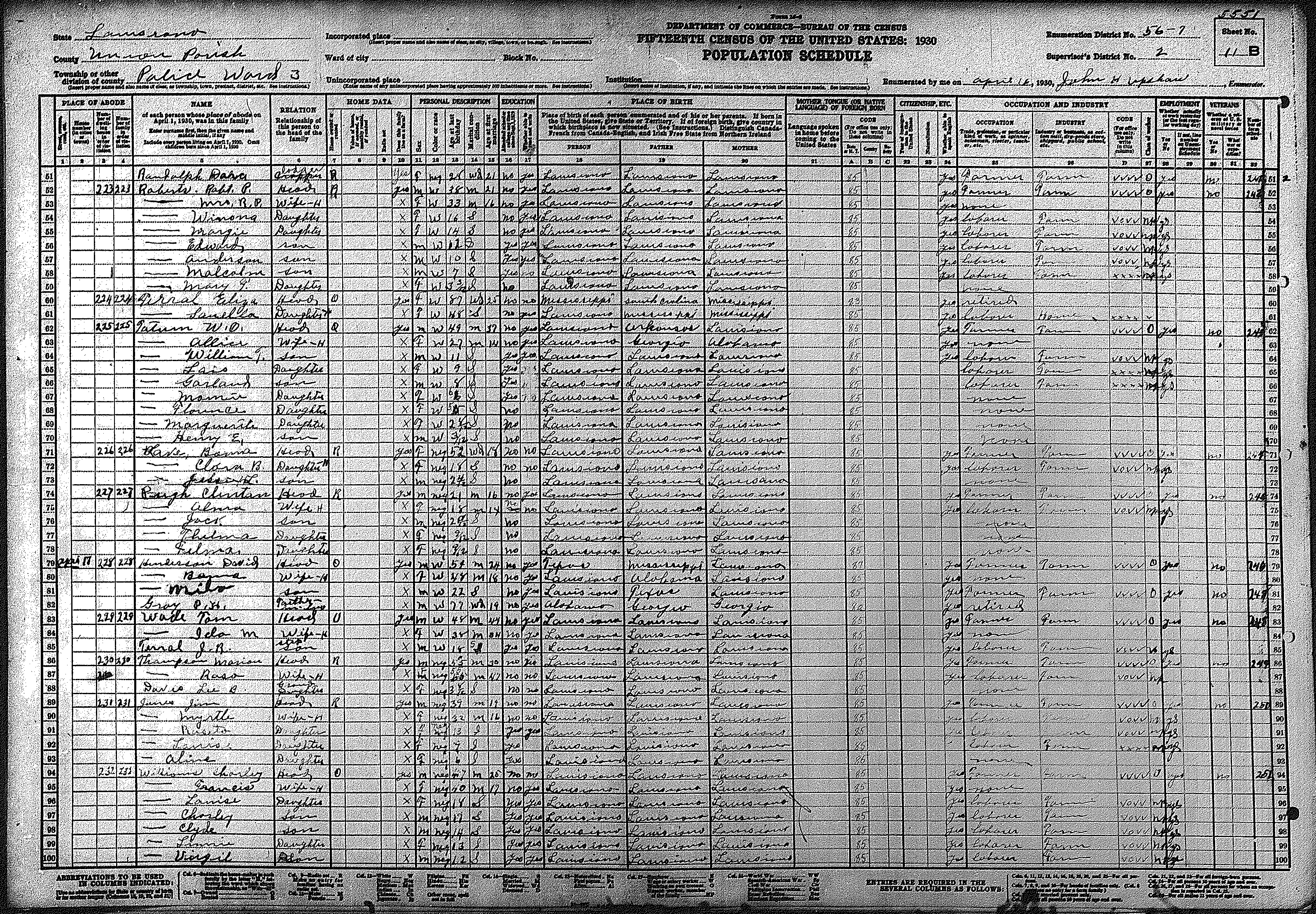
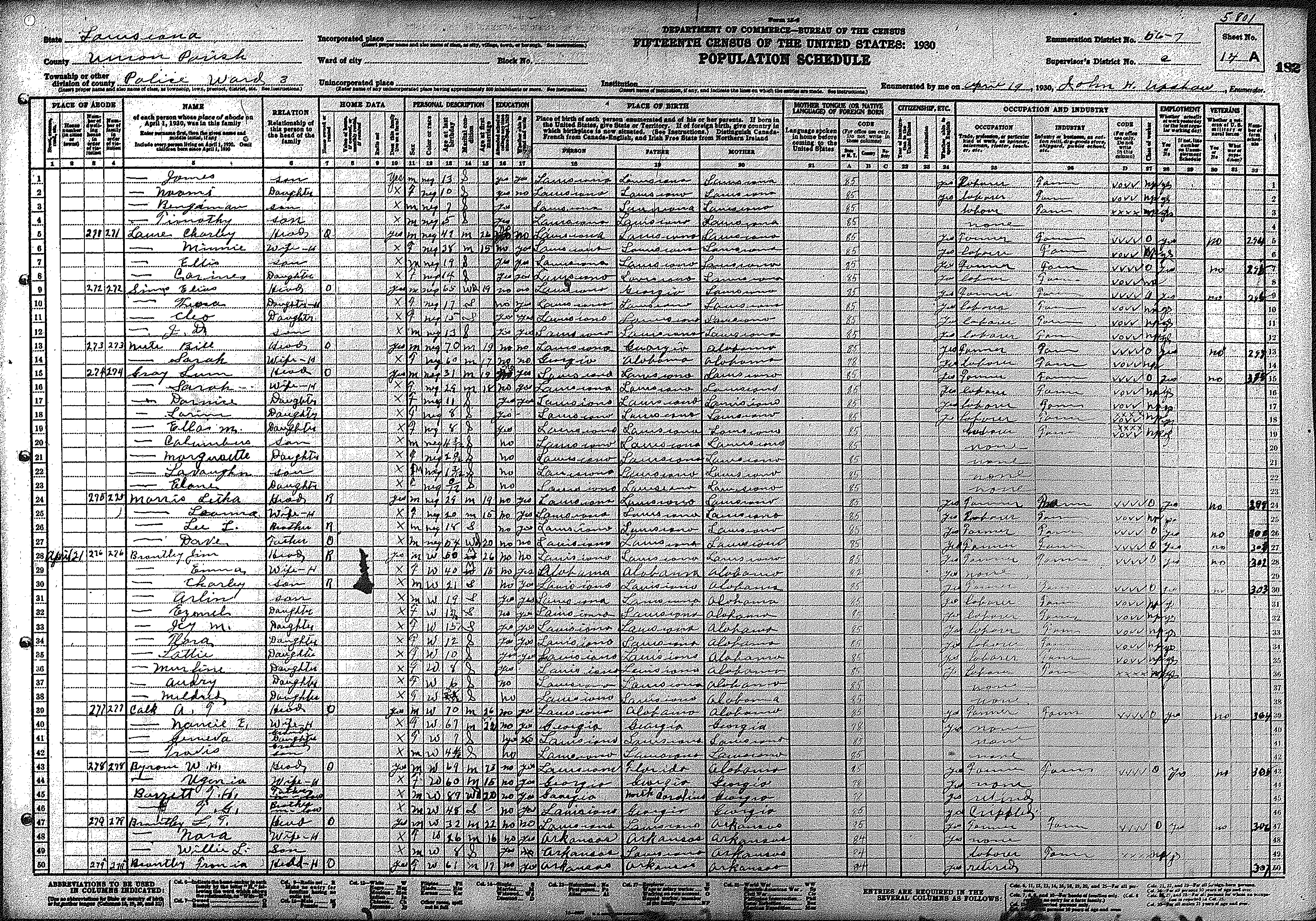
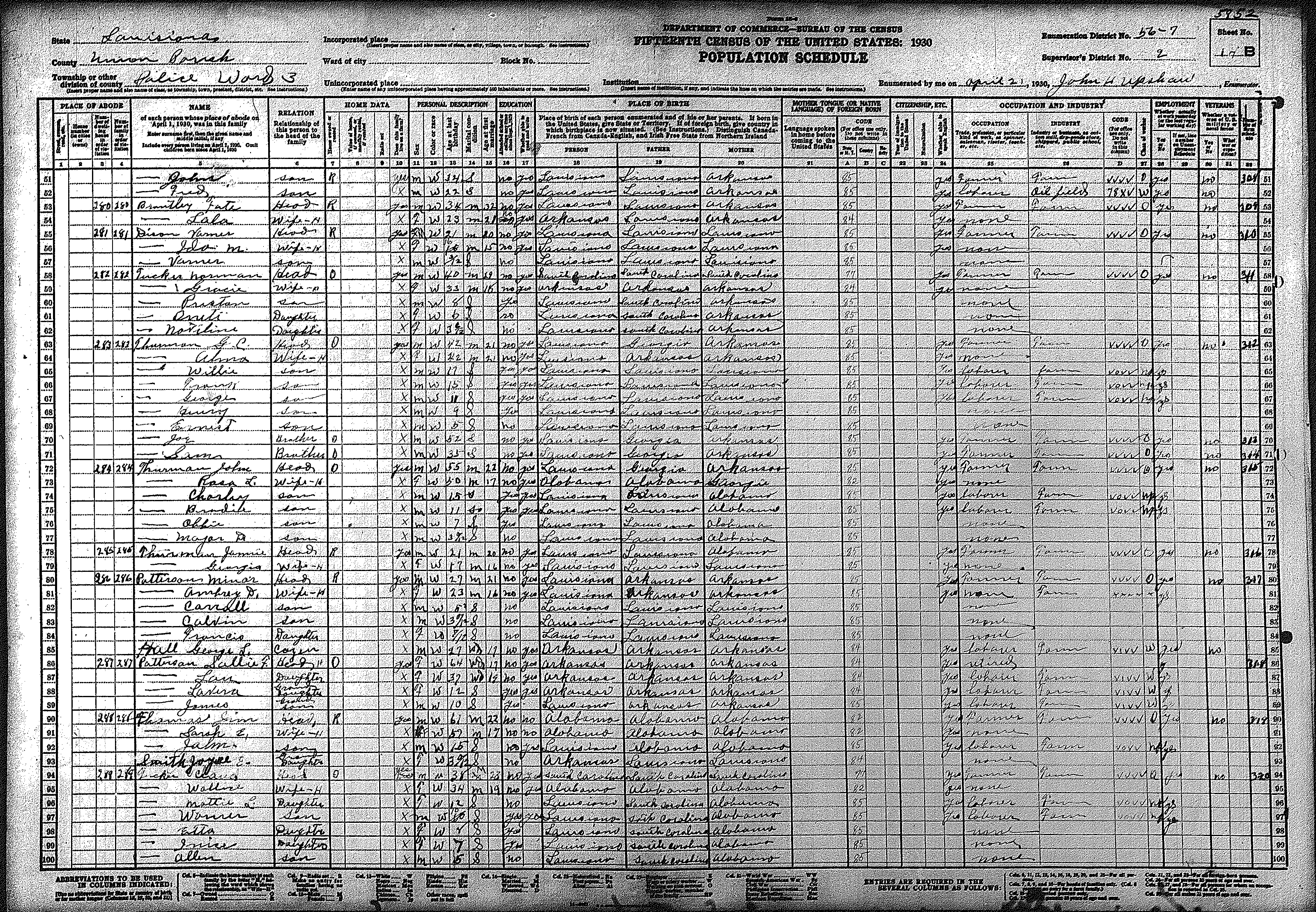
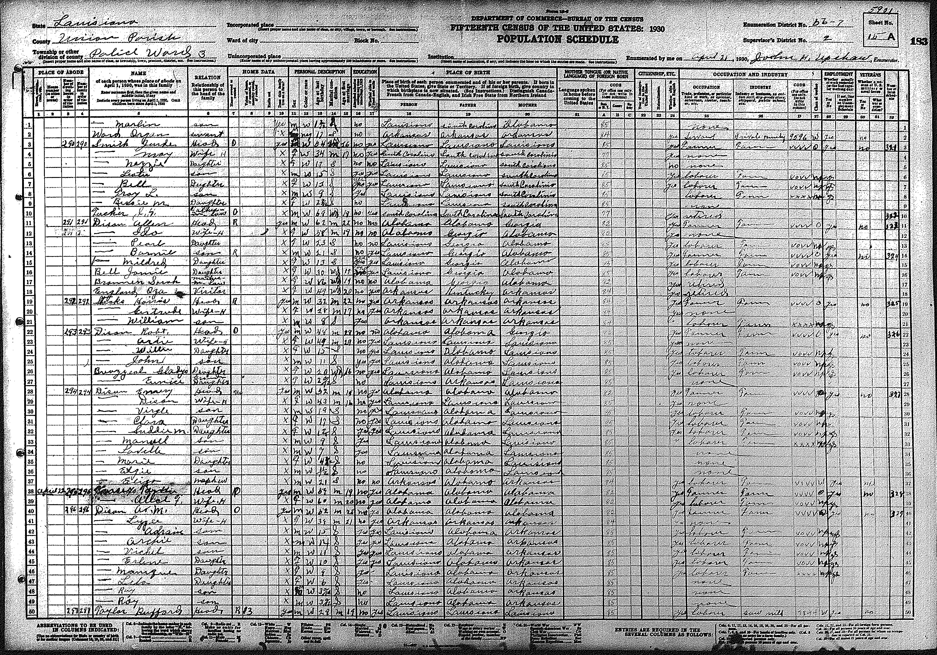
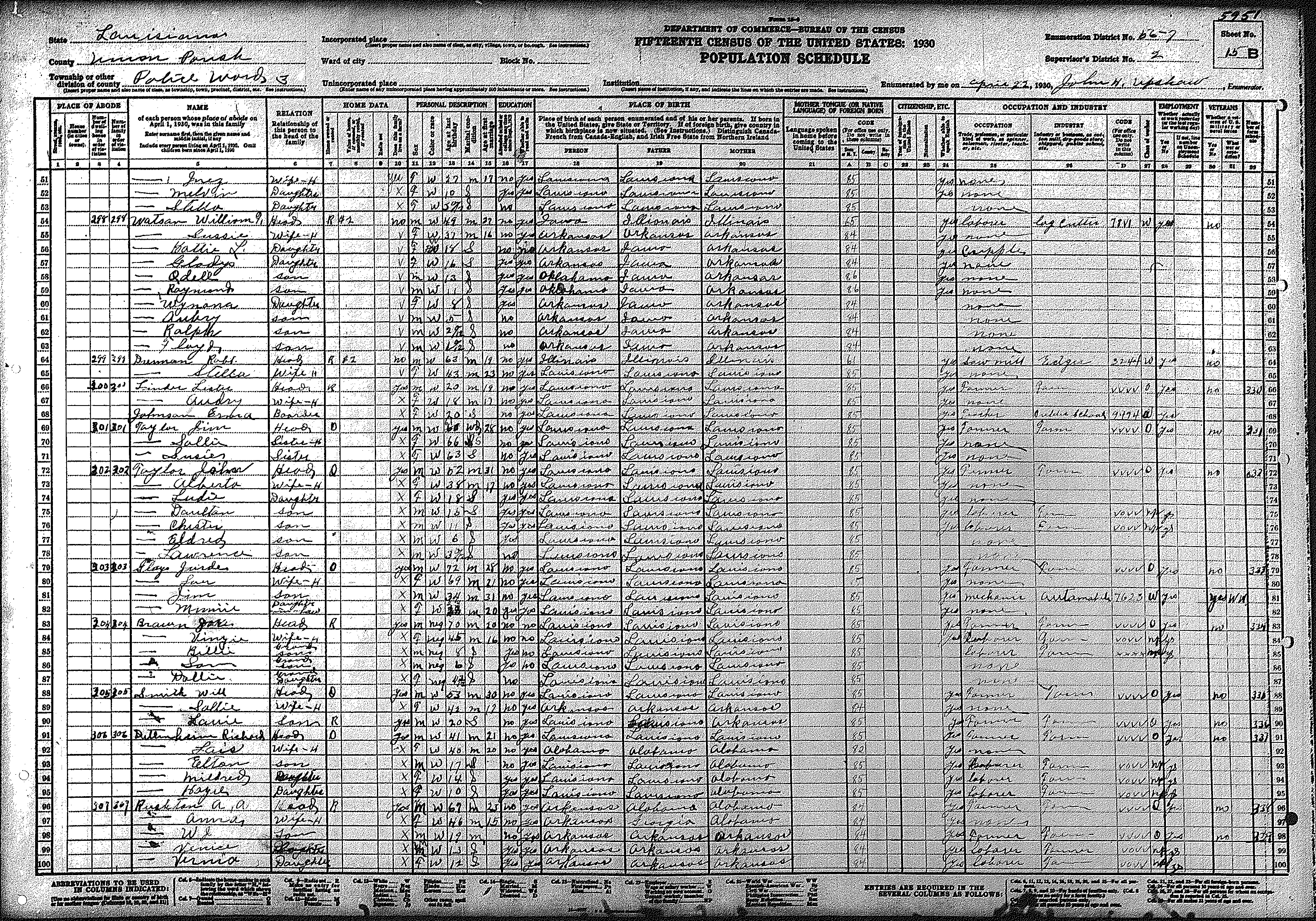
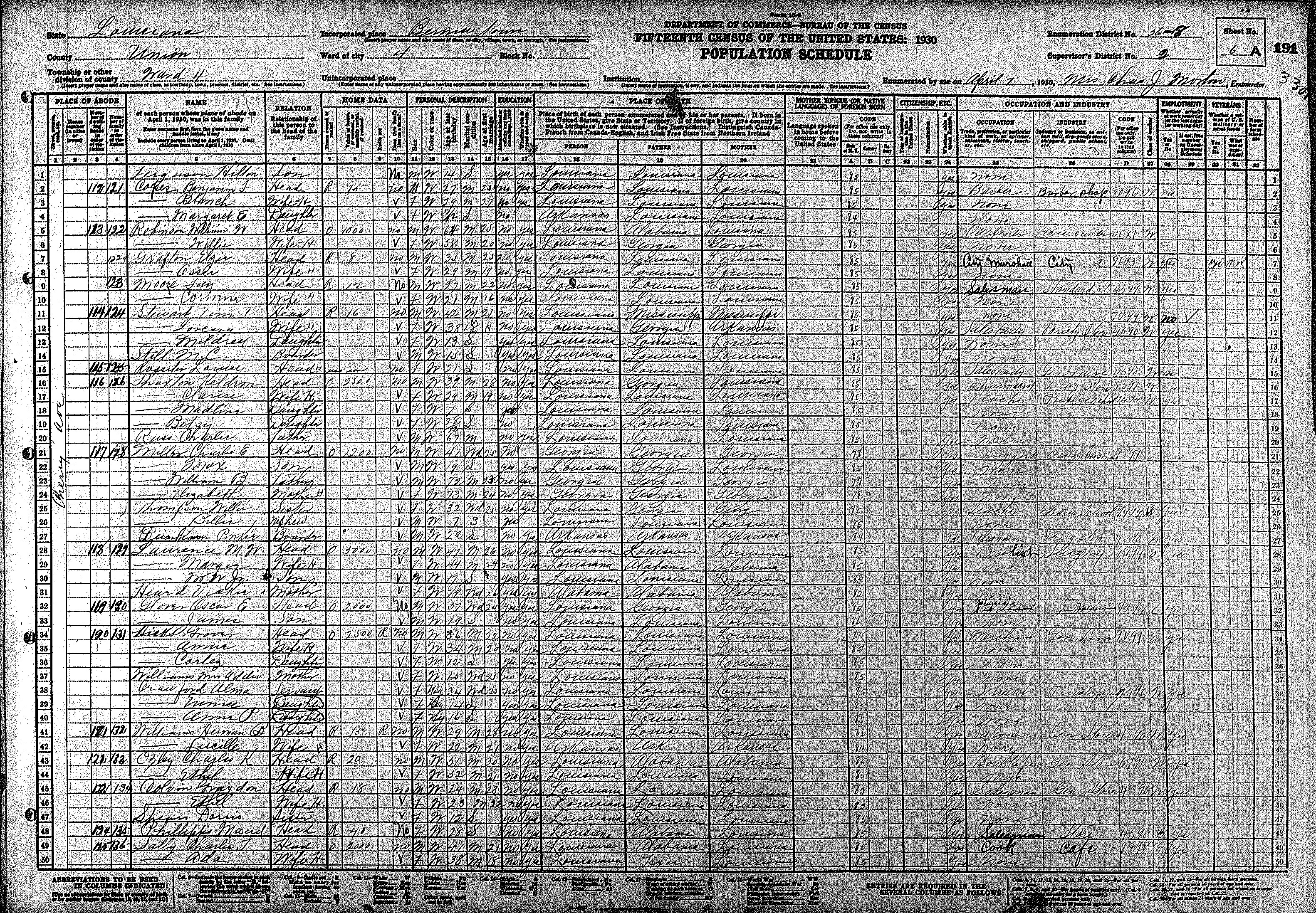
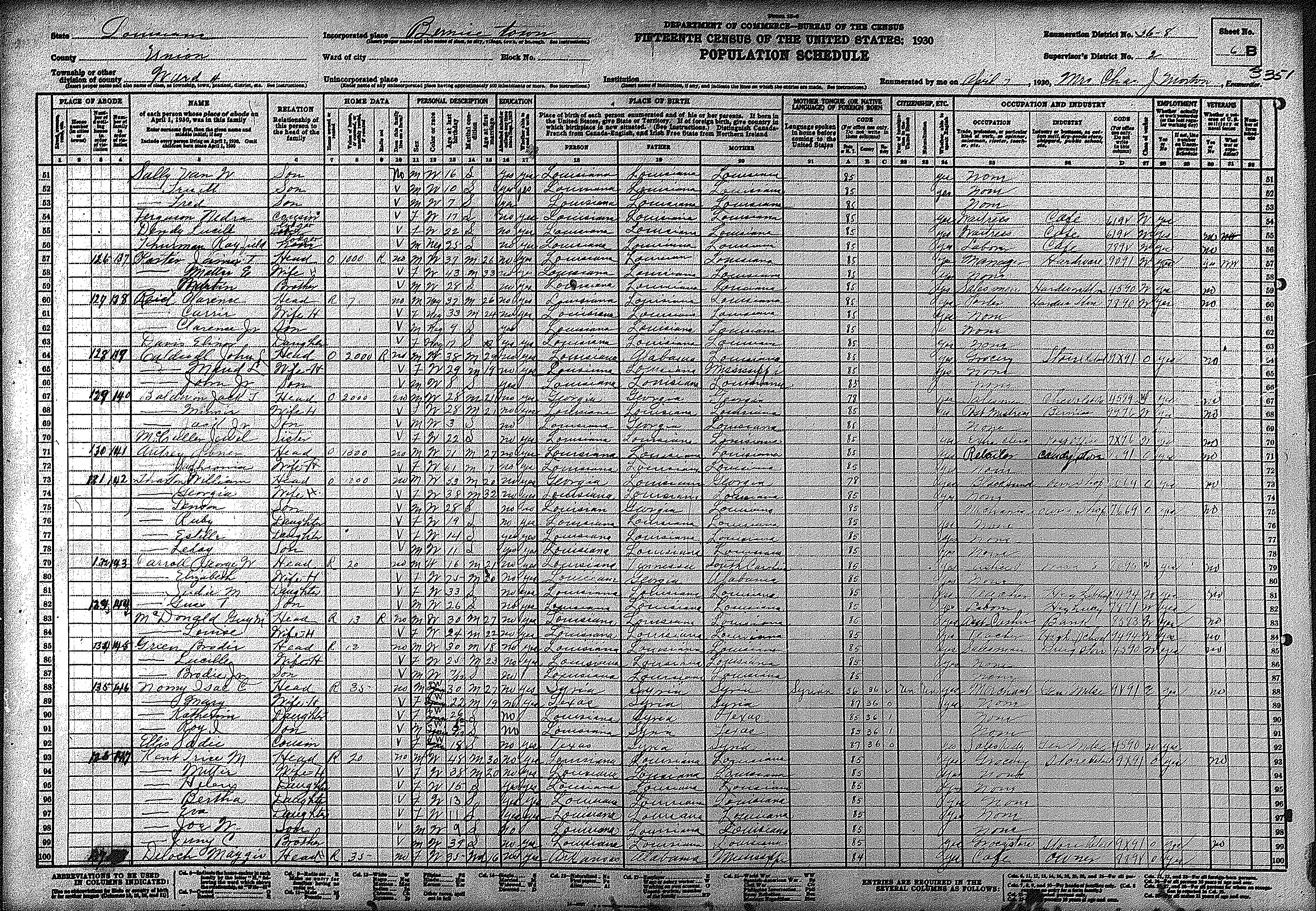
| 56 – 7 | 162 | 163 | 164 | 165 | 166 | 167 | 168 | 169 | 170 | 171 | 172 | 173 | 174 | 175 | 176 | ||||
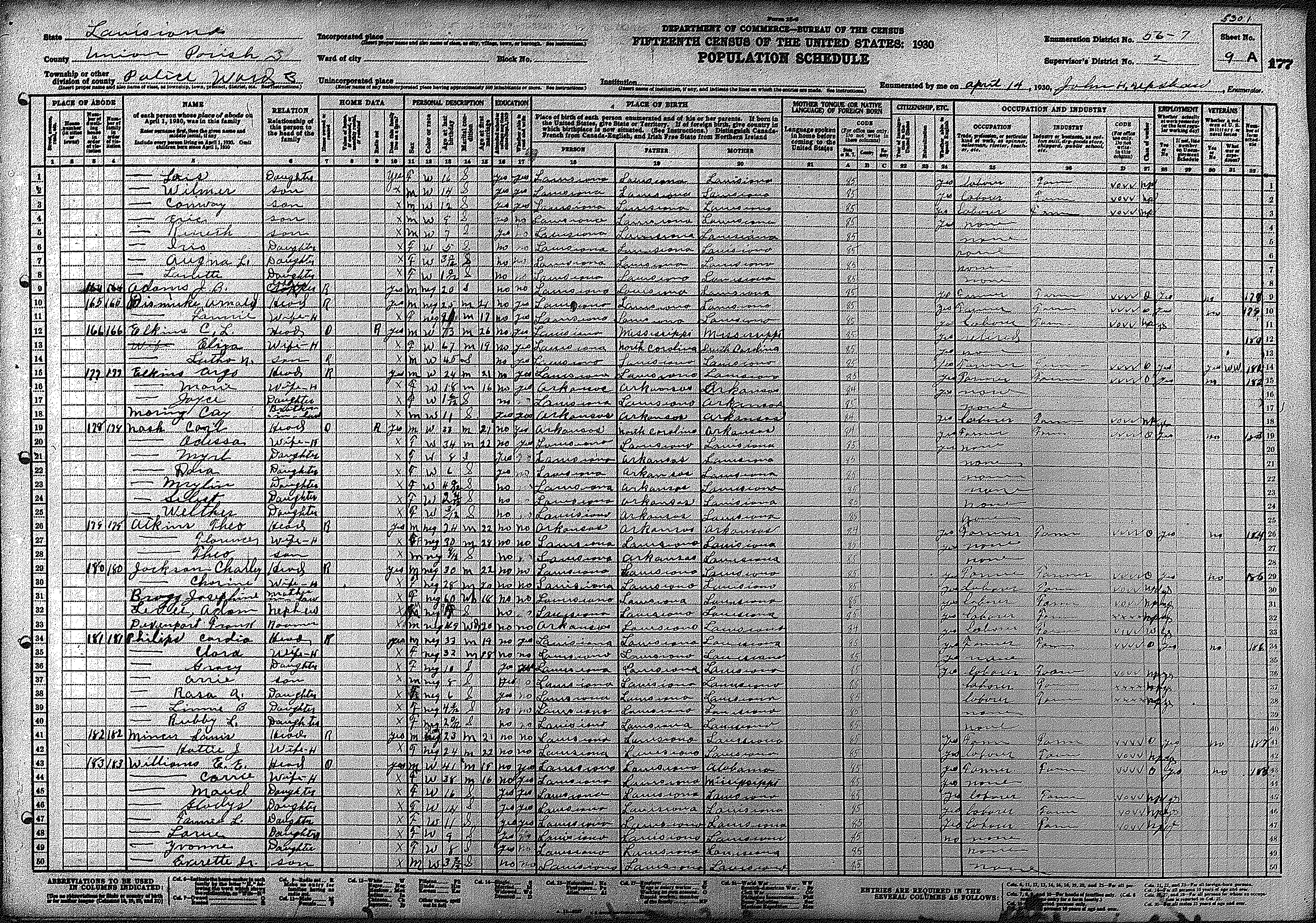
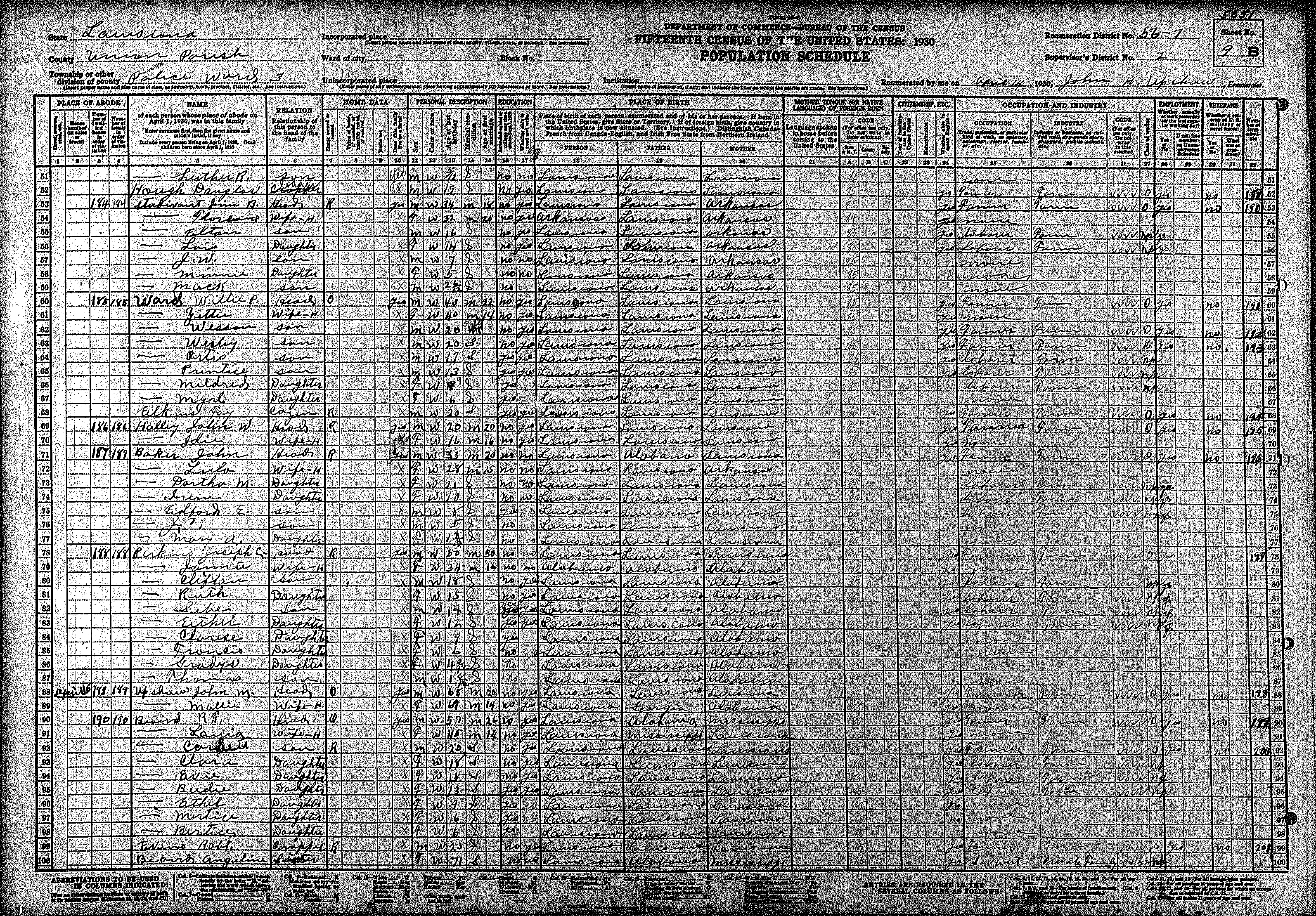
| 177 | 178 | 179 | 180 | 181 | 182 | 183 | 184 | 185 | 186 | 187 | 188 | 189 | 190 | 191 | |||||
| 192 | 193 | 194 | 195 | ||||||||||||||||
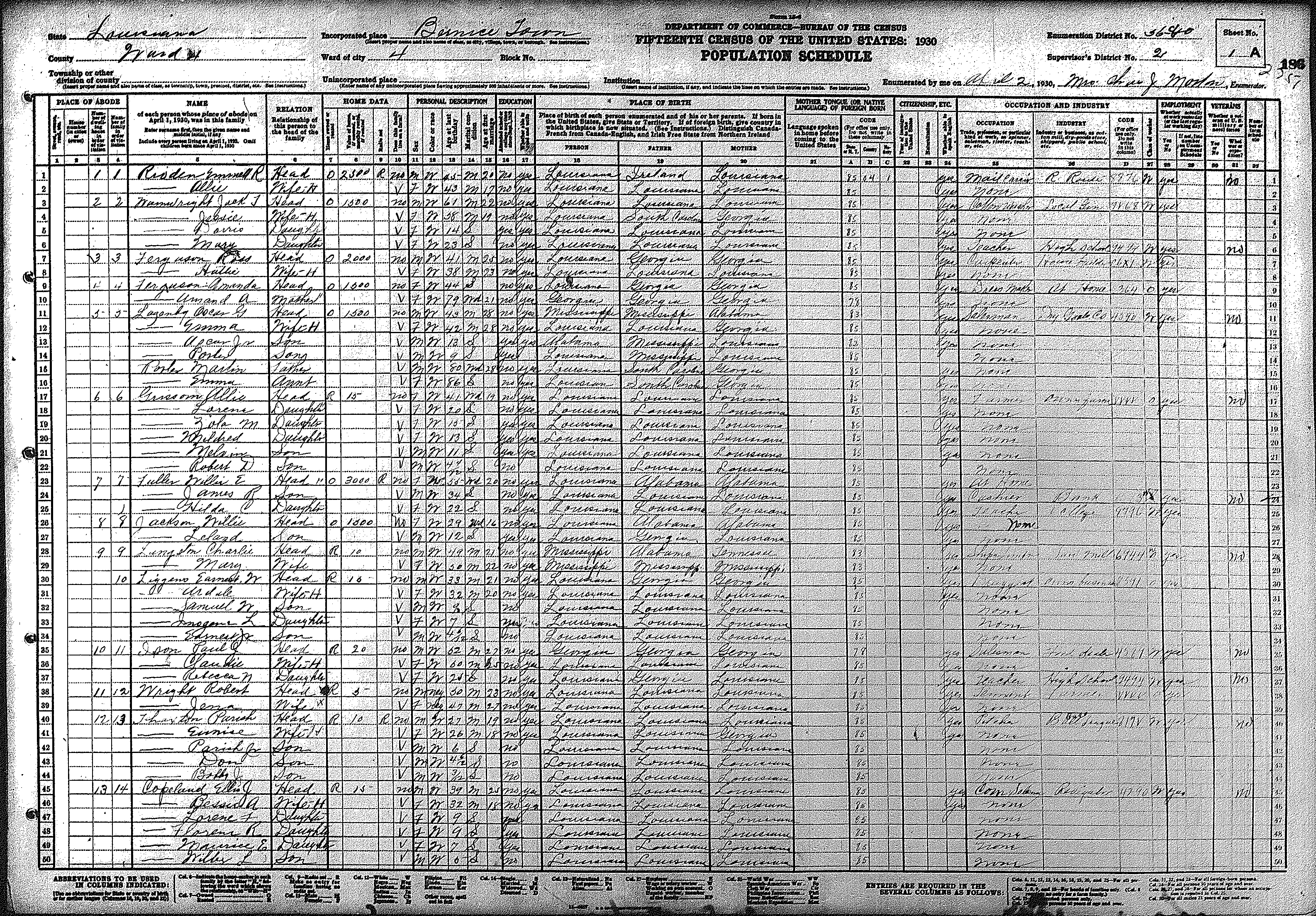
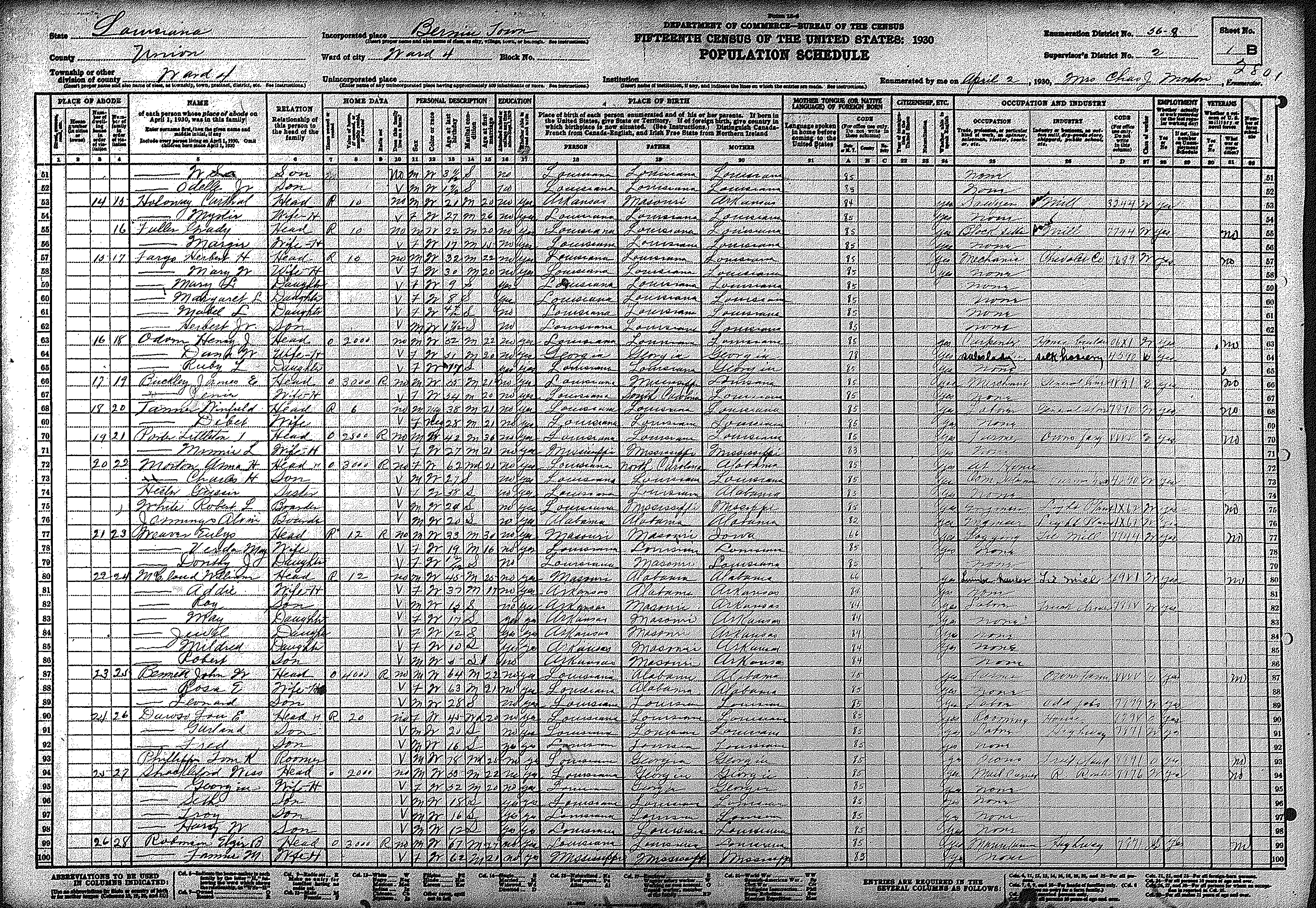
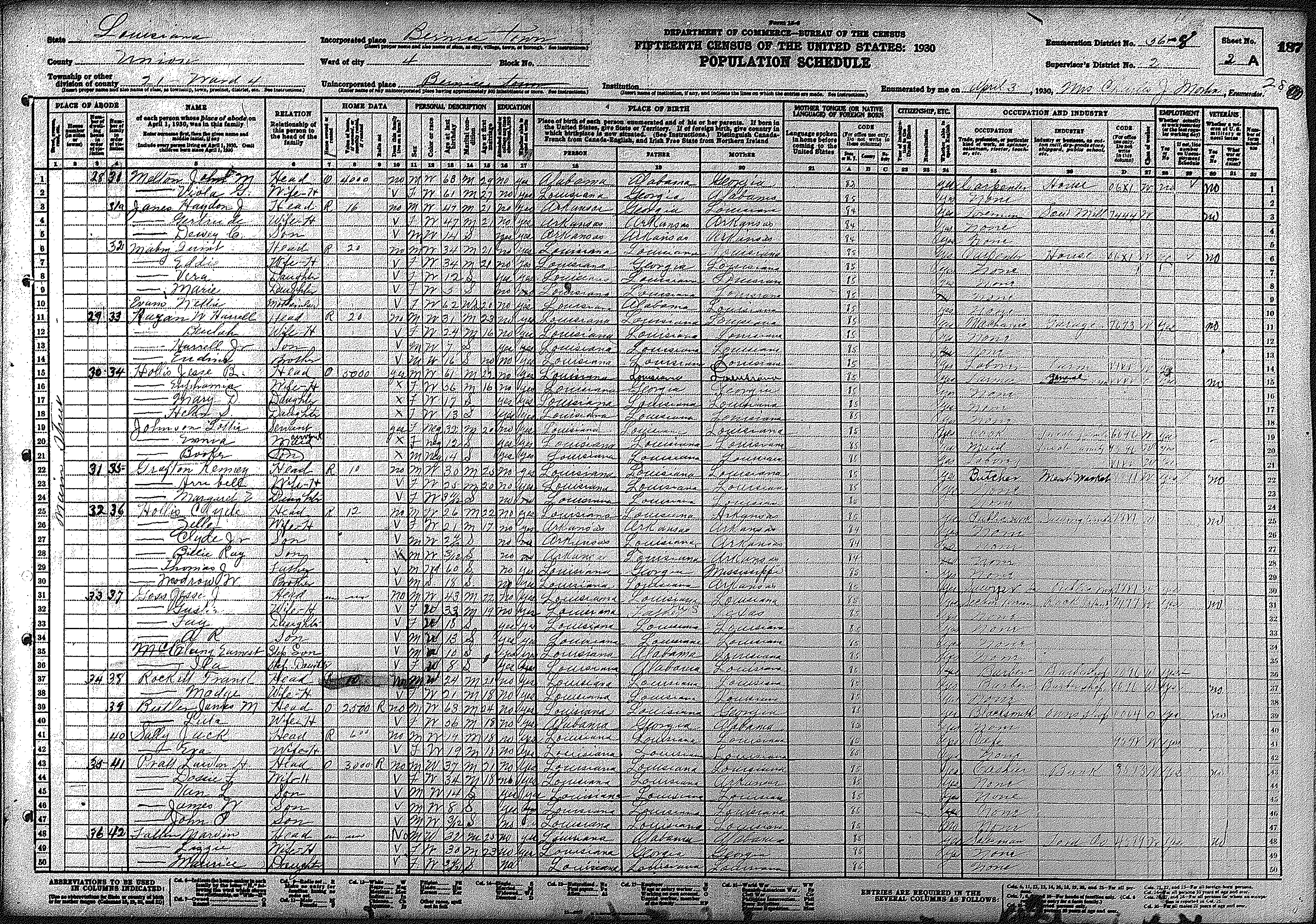
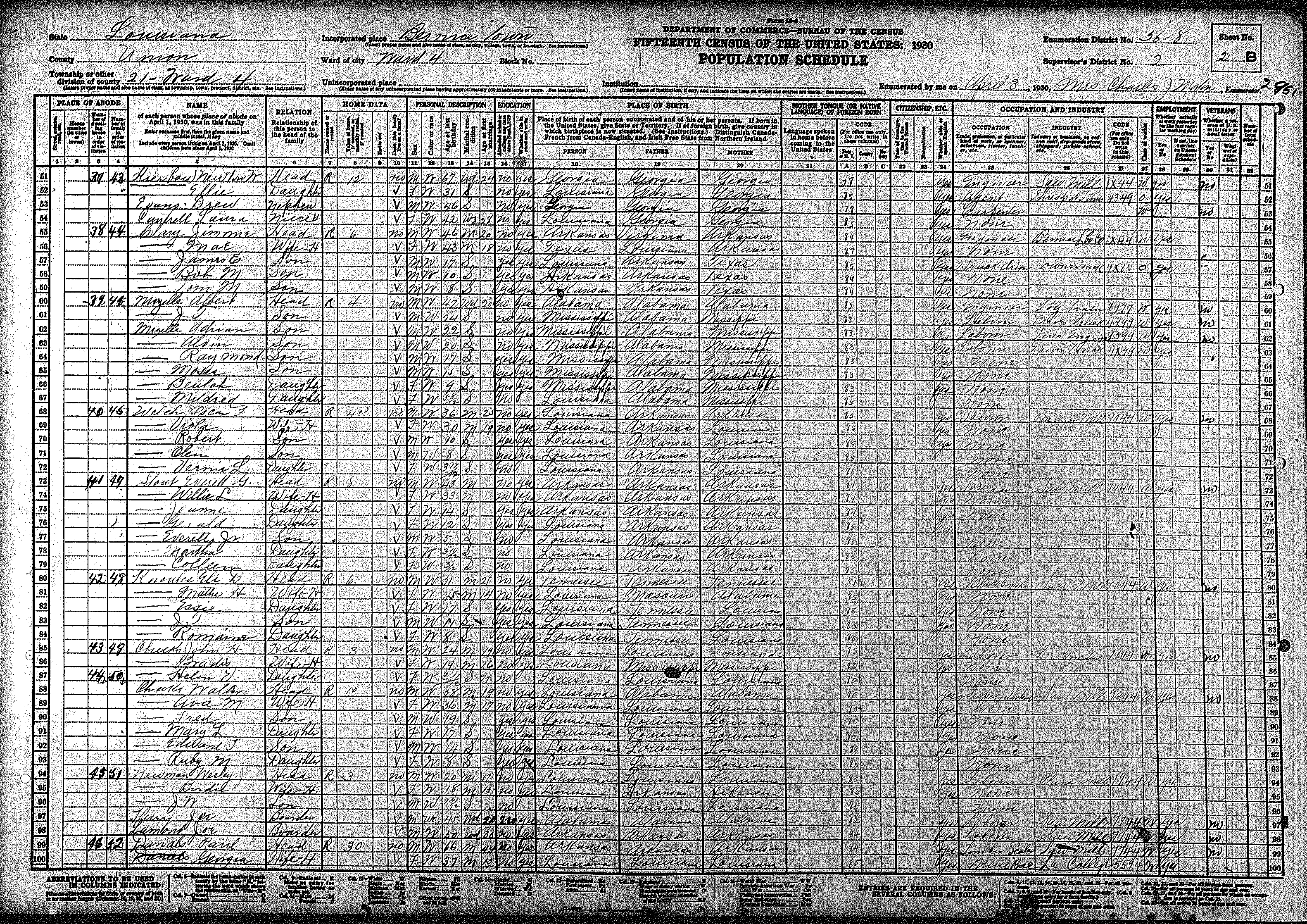
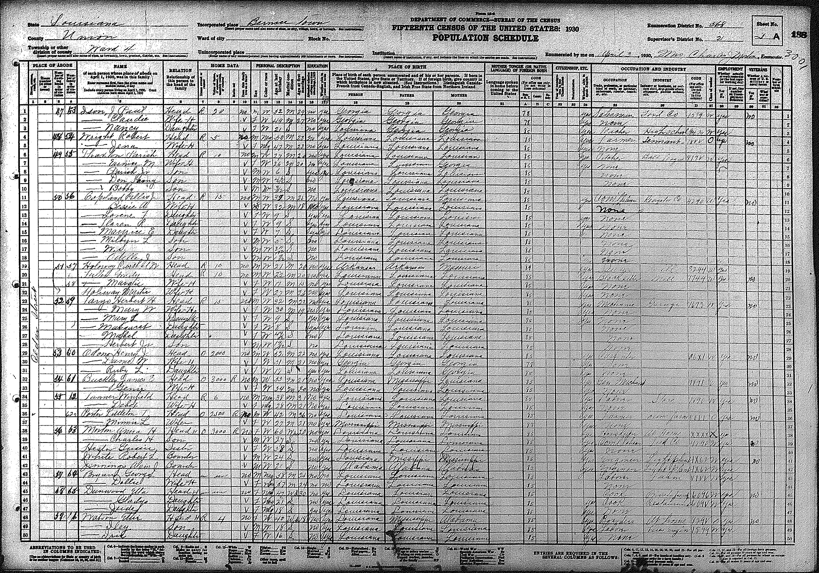
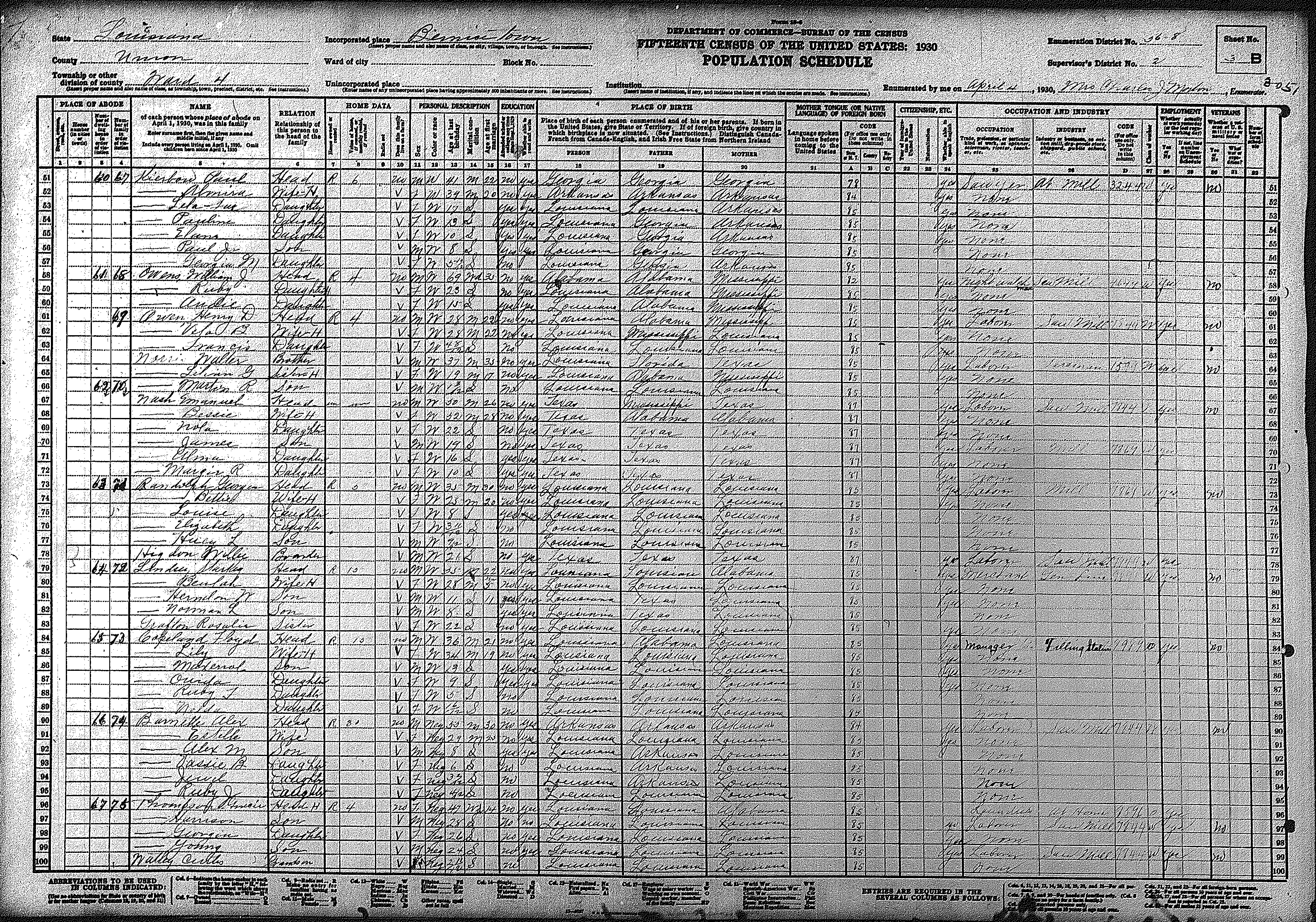
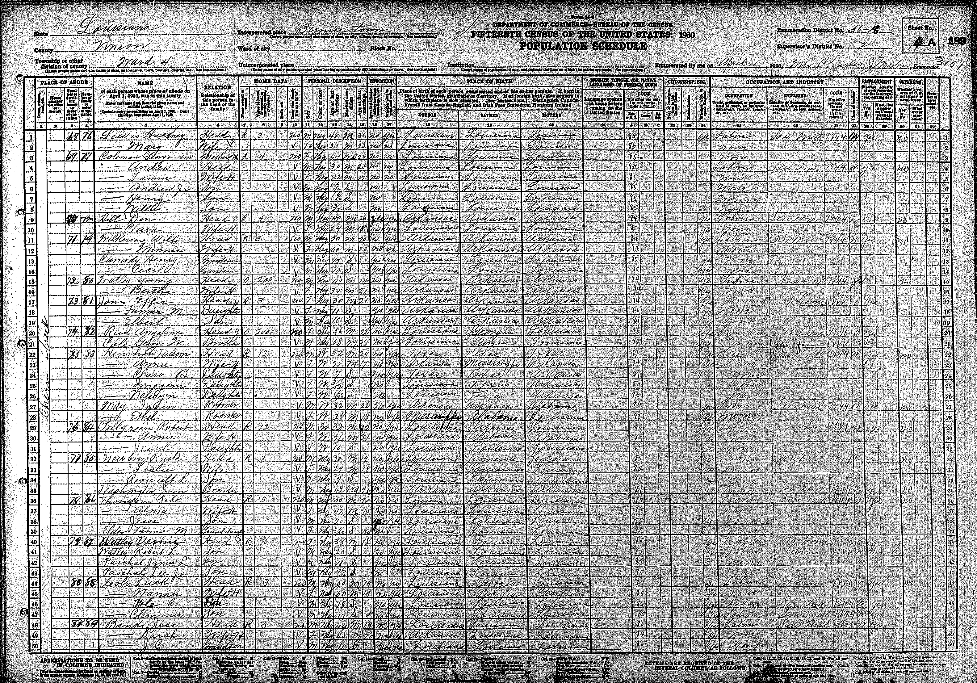
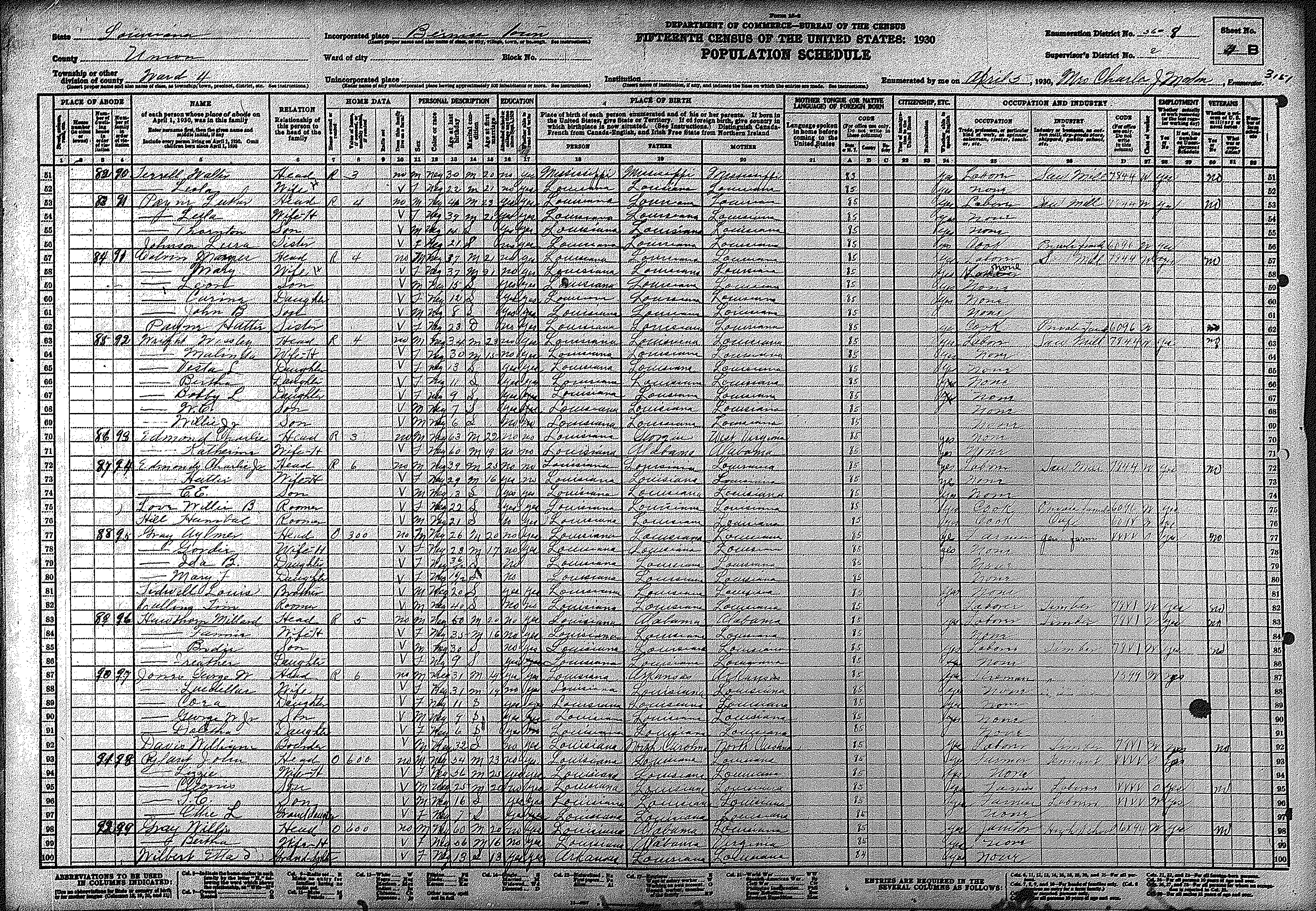
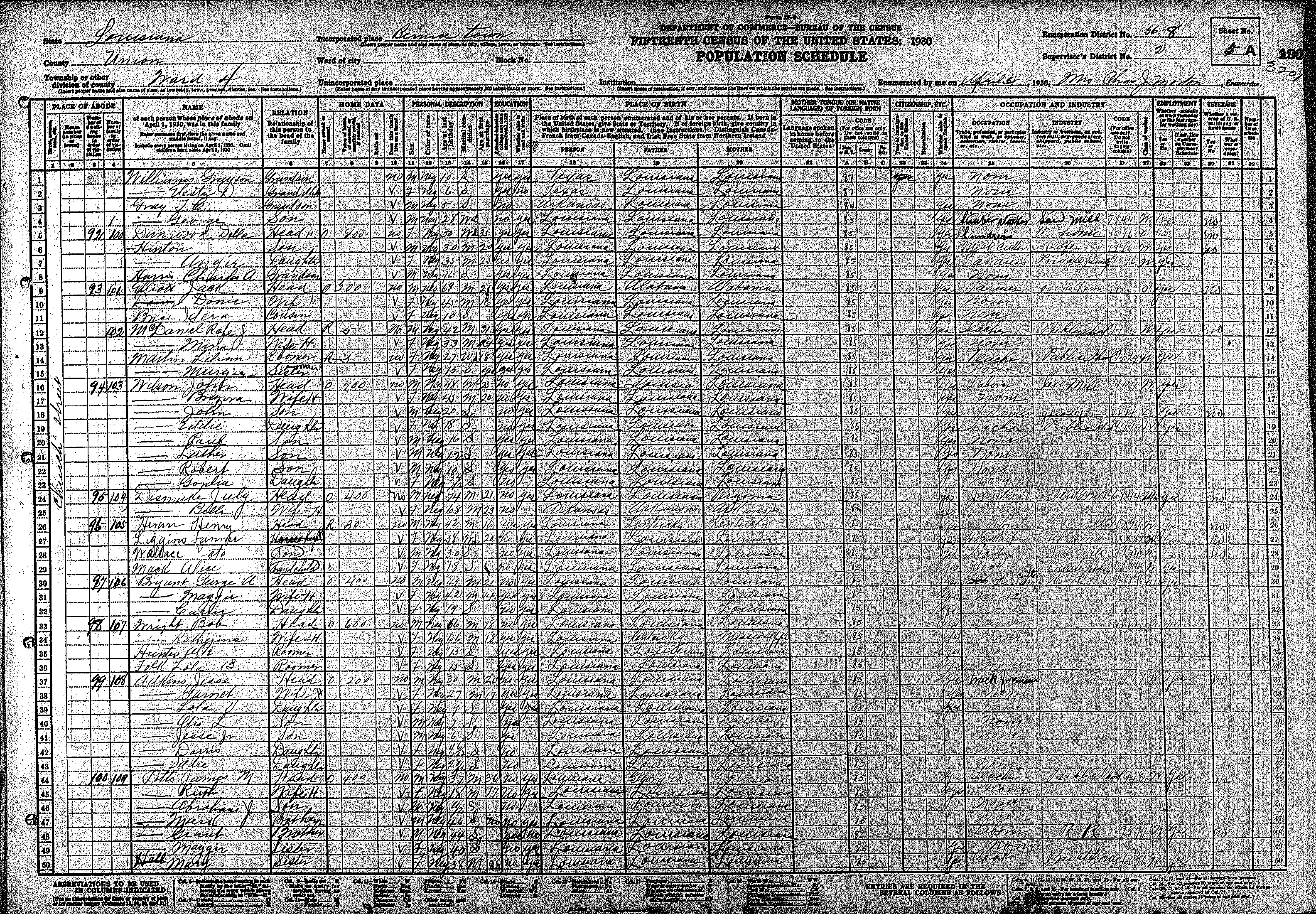
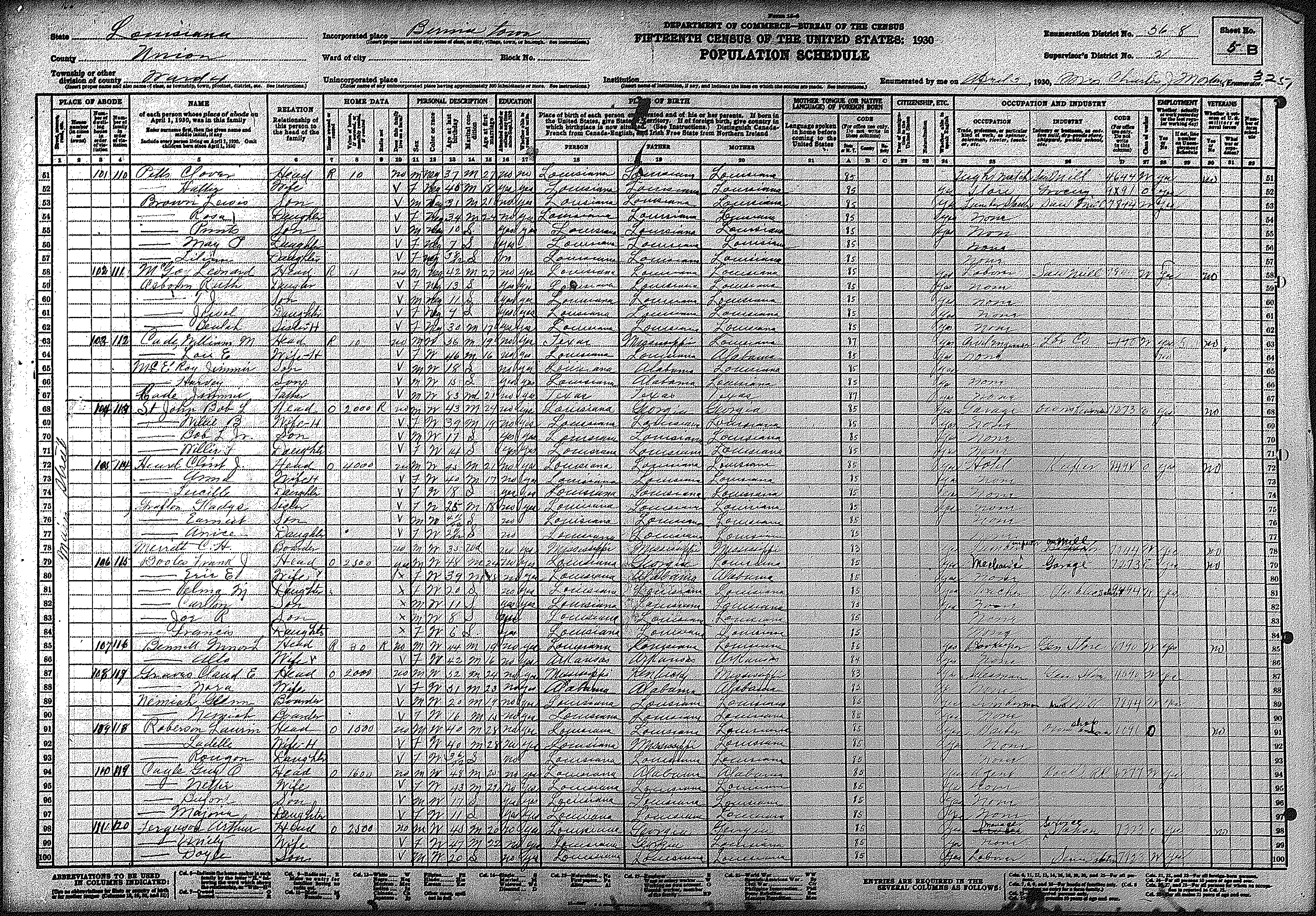
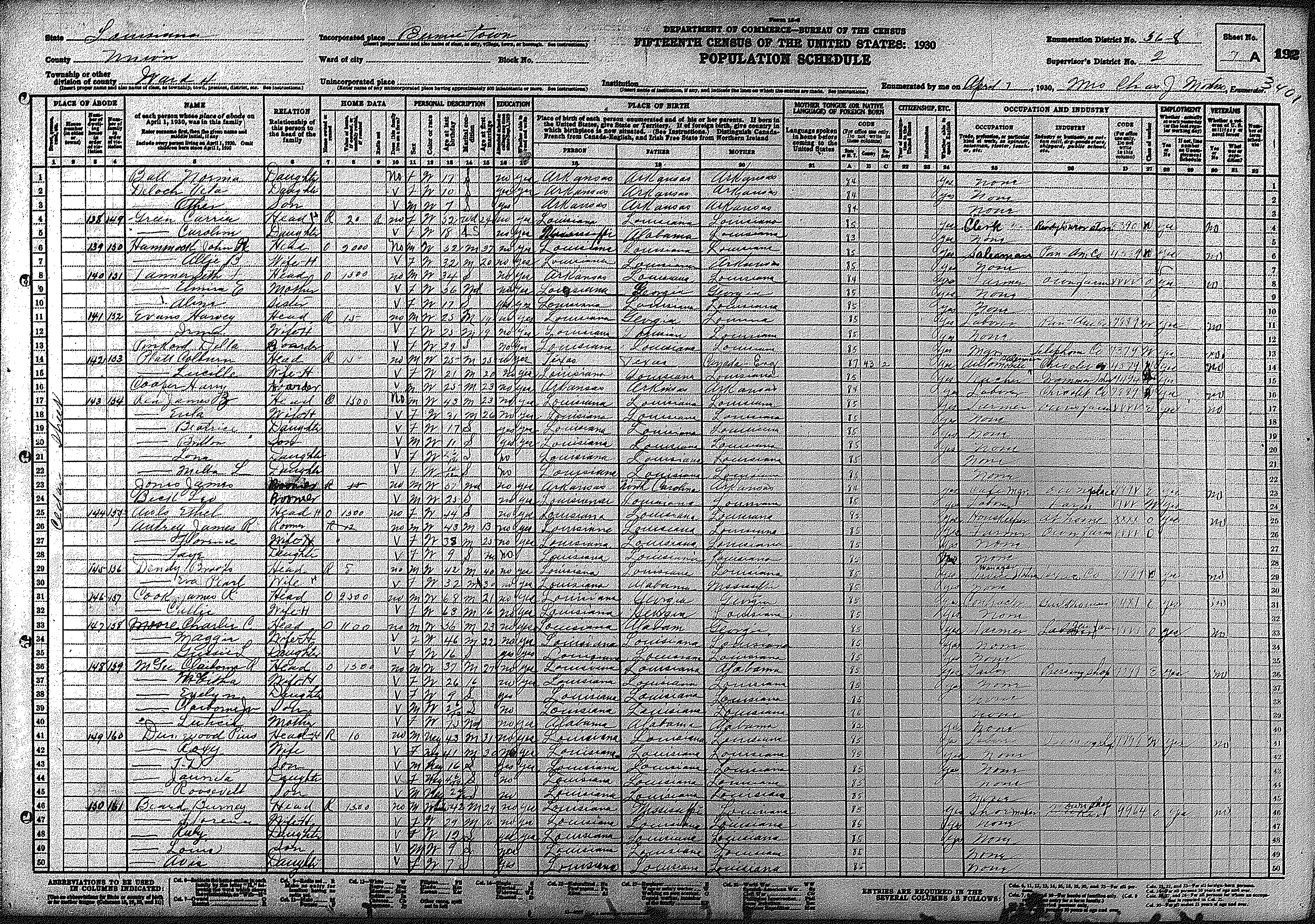
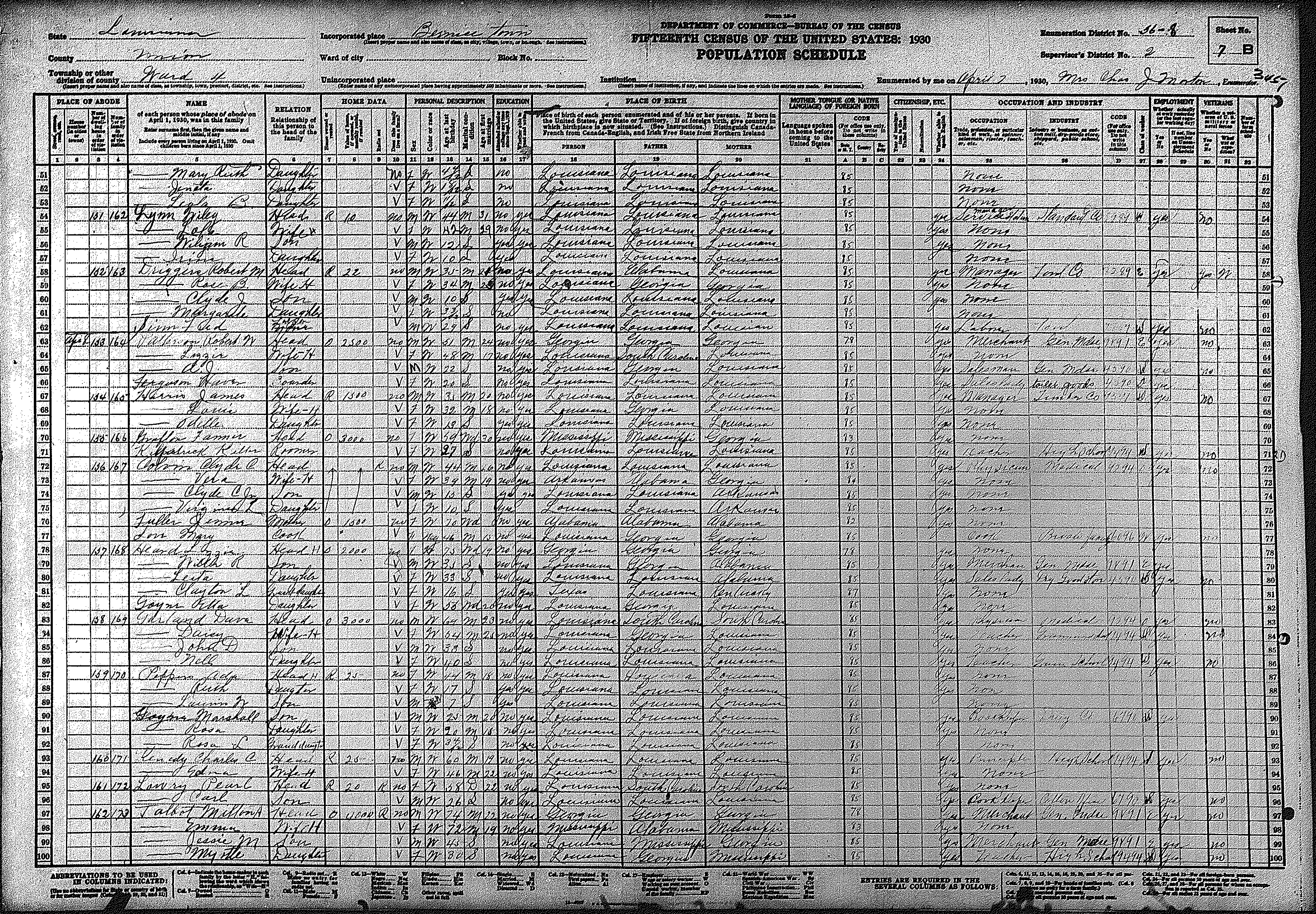
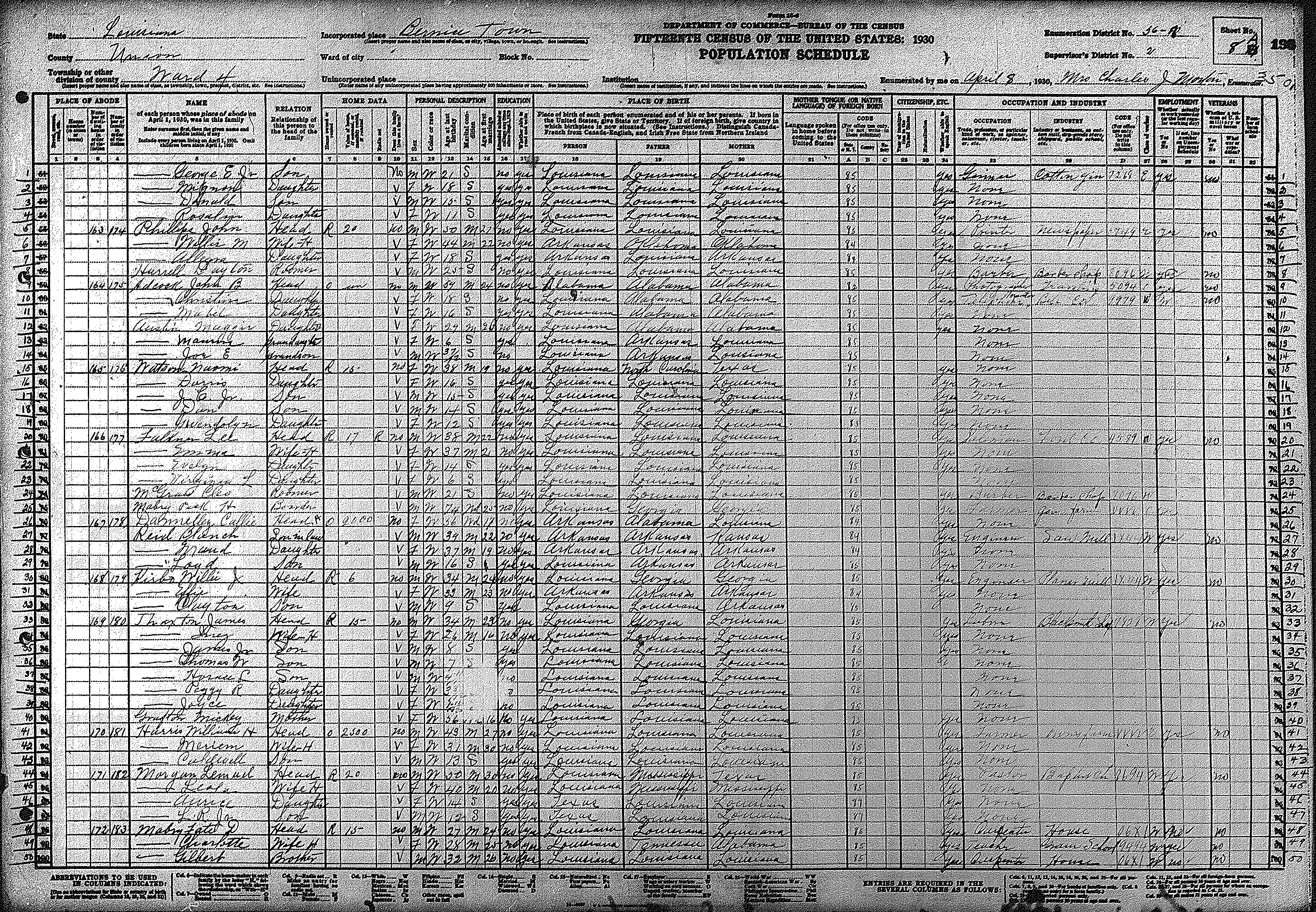
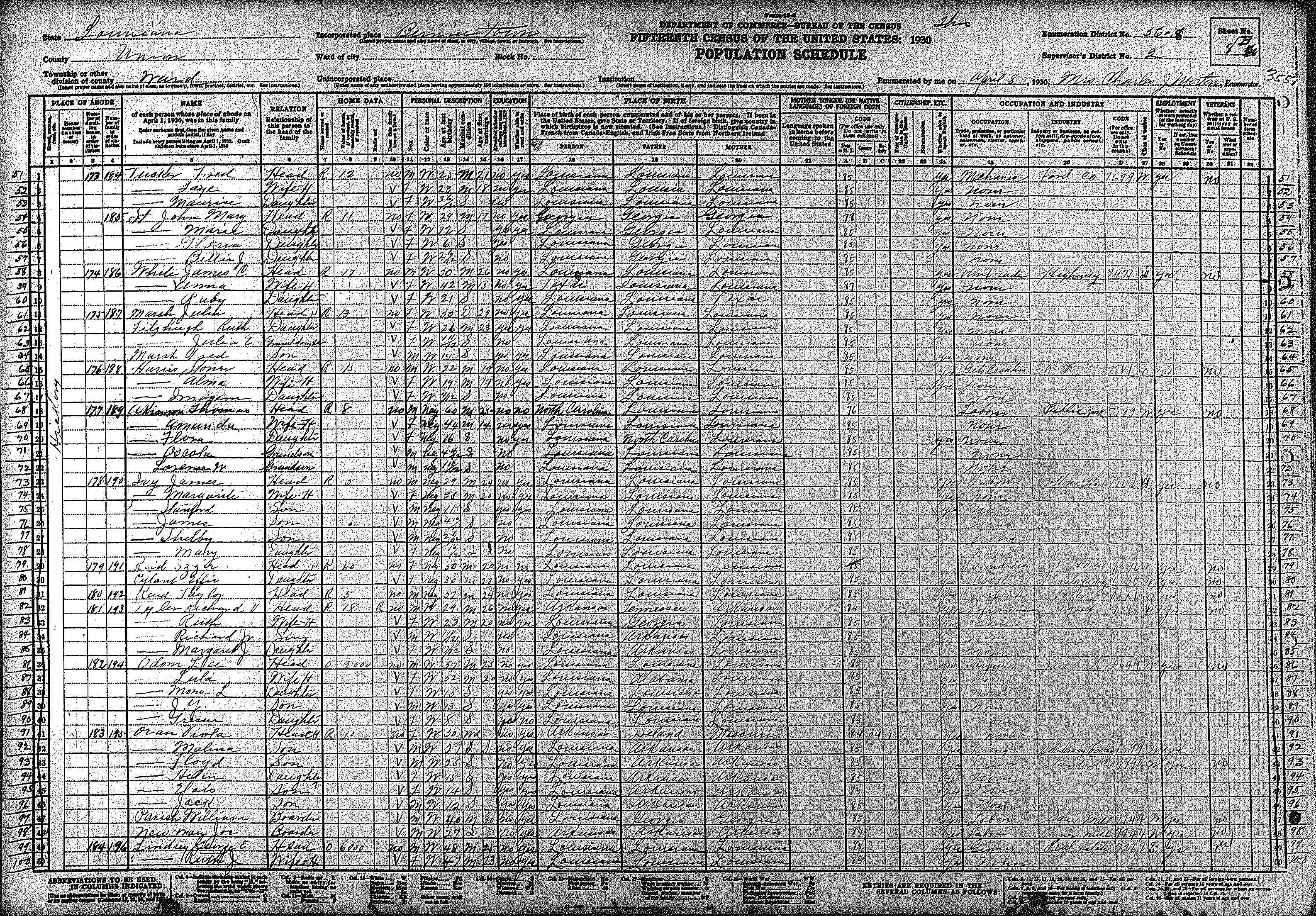
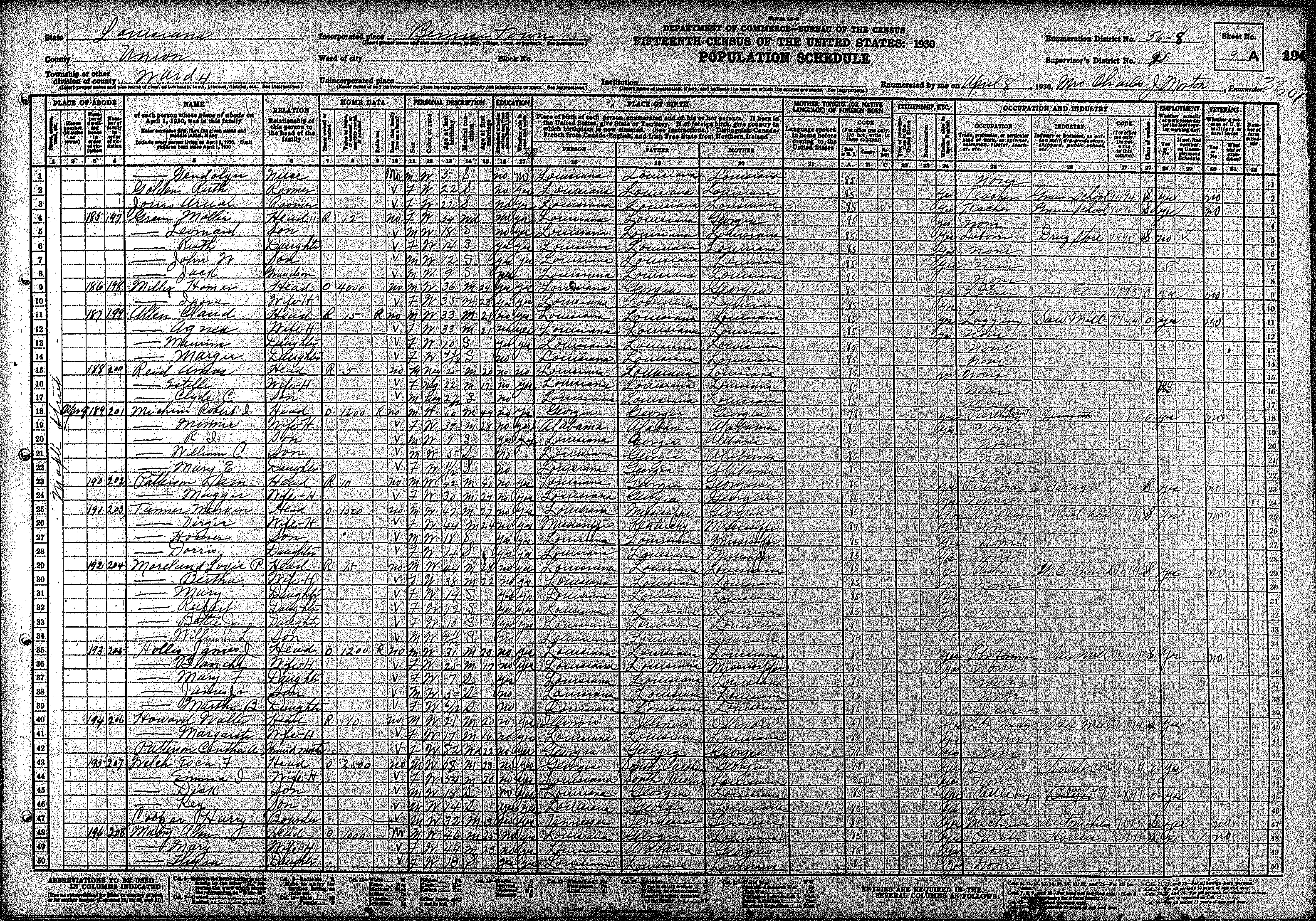
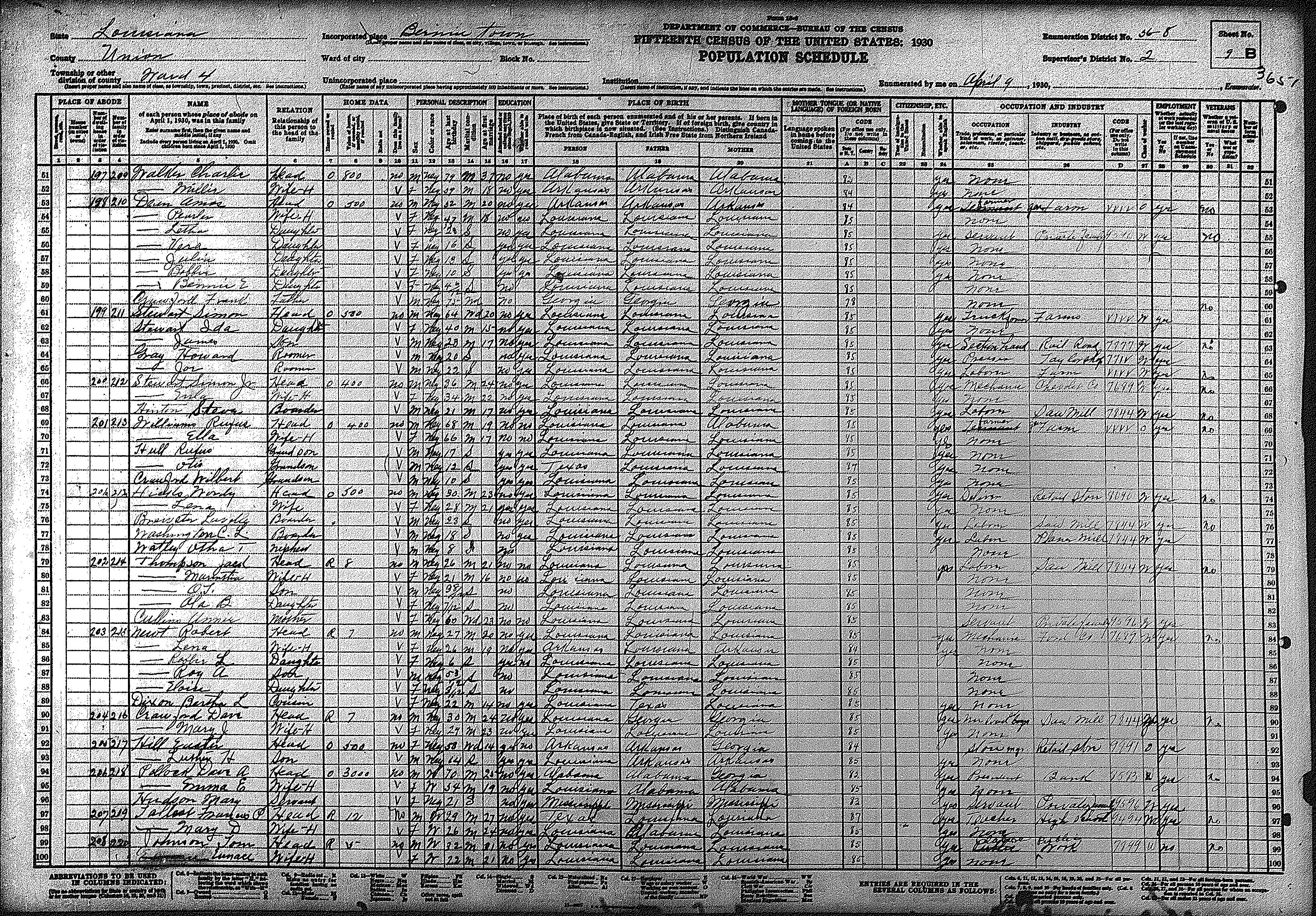
| 4 | 56 – 8 | Town of Bernice | |||||||||||||||||
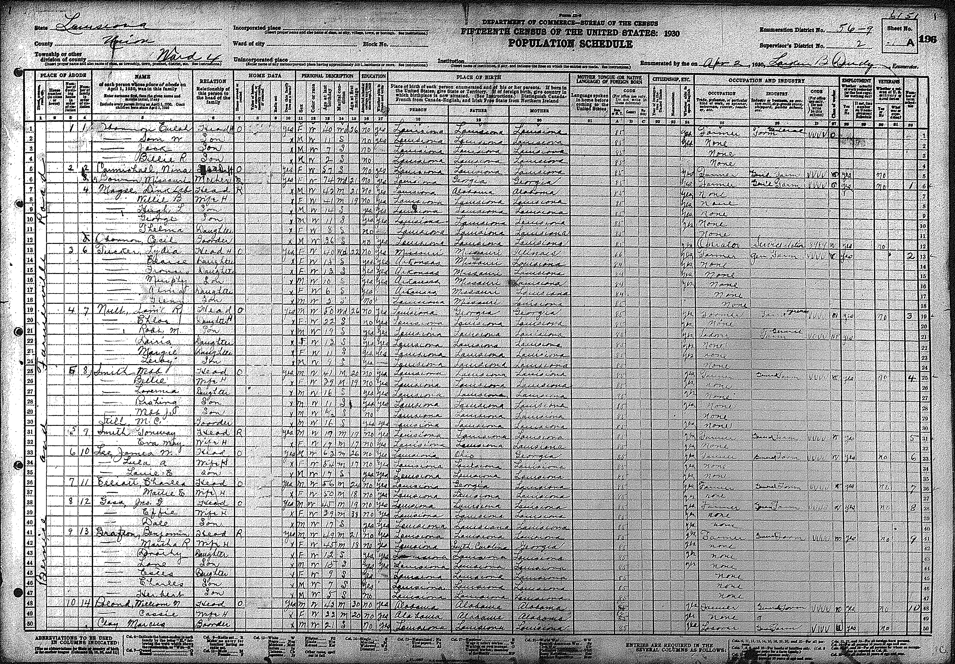
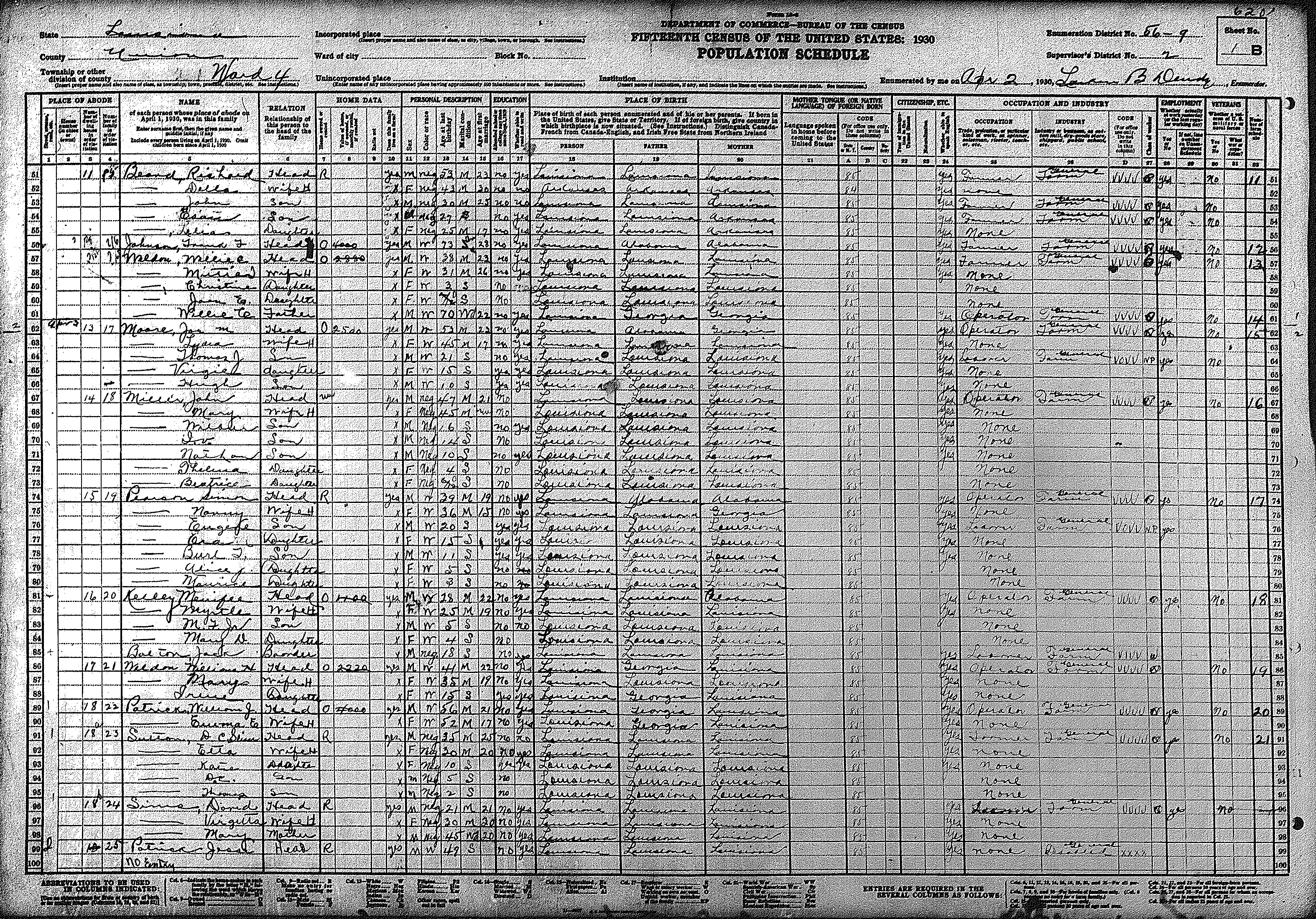
| 196 | 197 | 198 | 199 | 200 | 201 | 202 | 203 | 204 | 205 | 206 | 207 | 208 | 209 | 210 | |||||
| 211 | 212 | 213 | 214 | 215 | |||||||||||||||
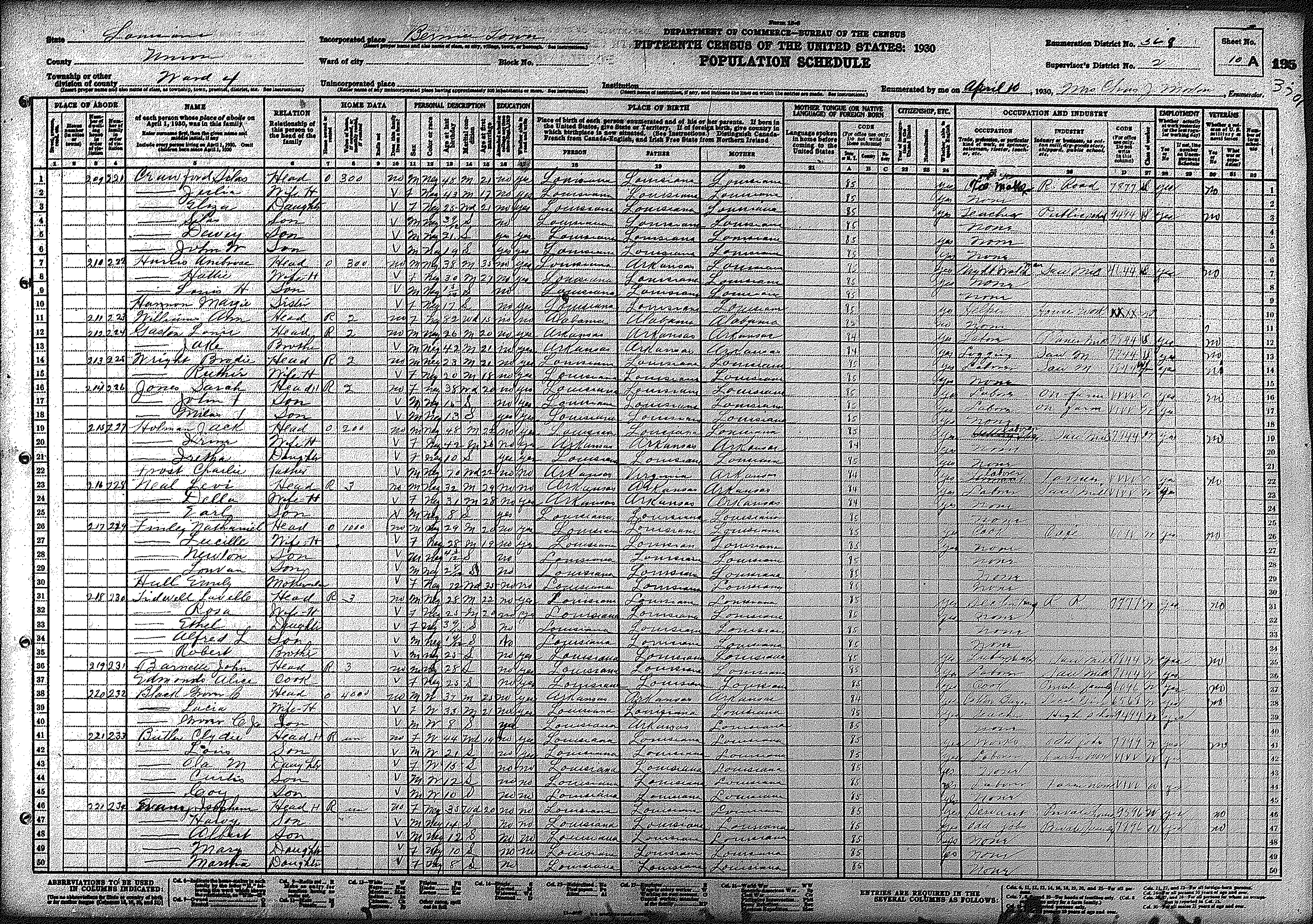
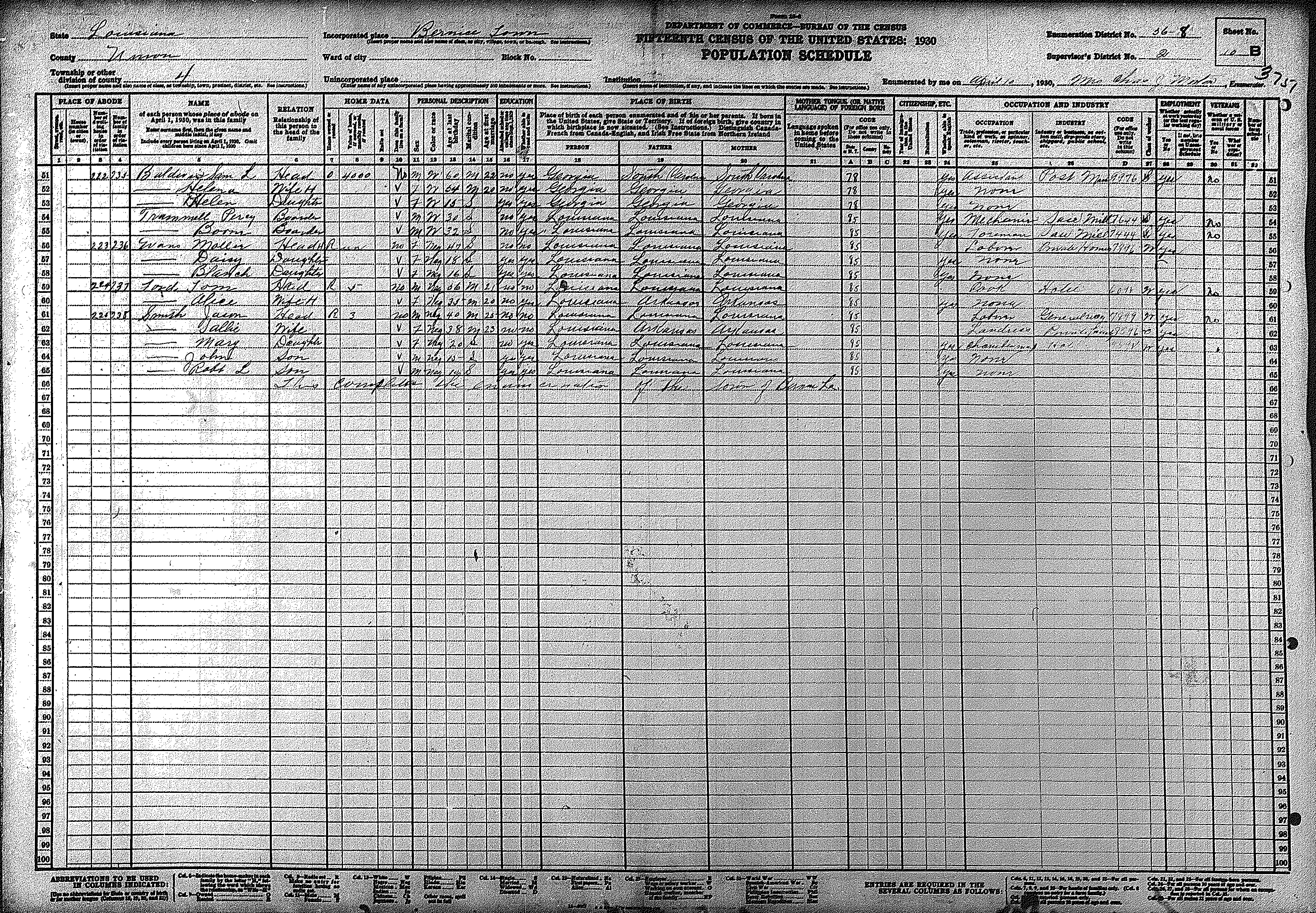
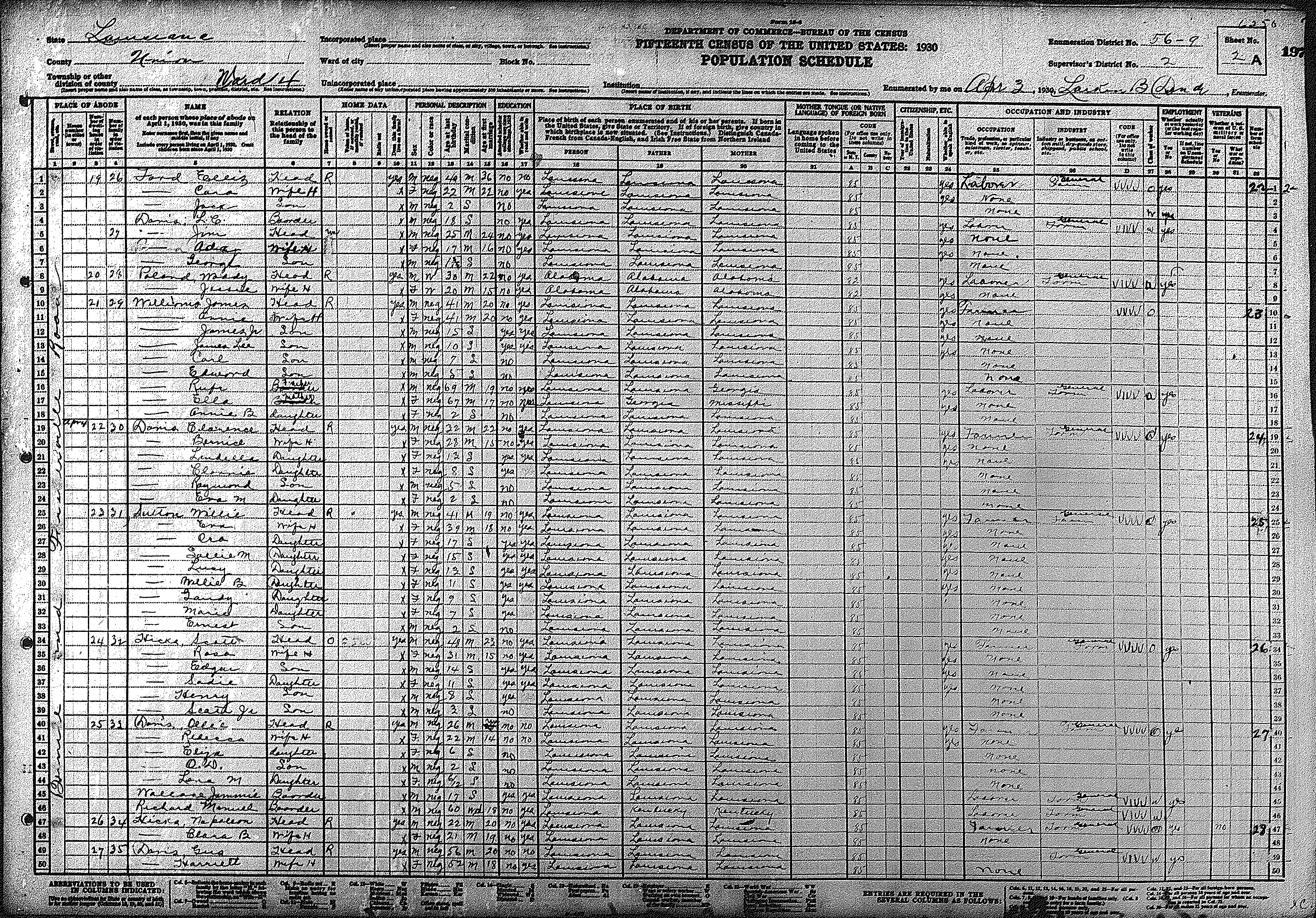
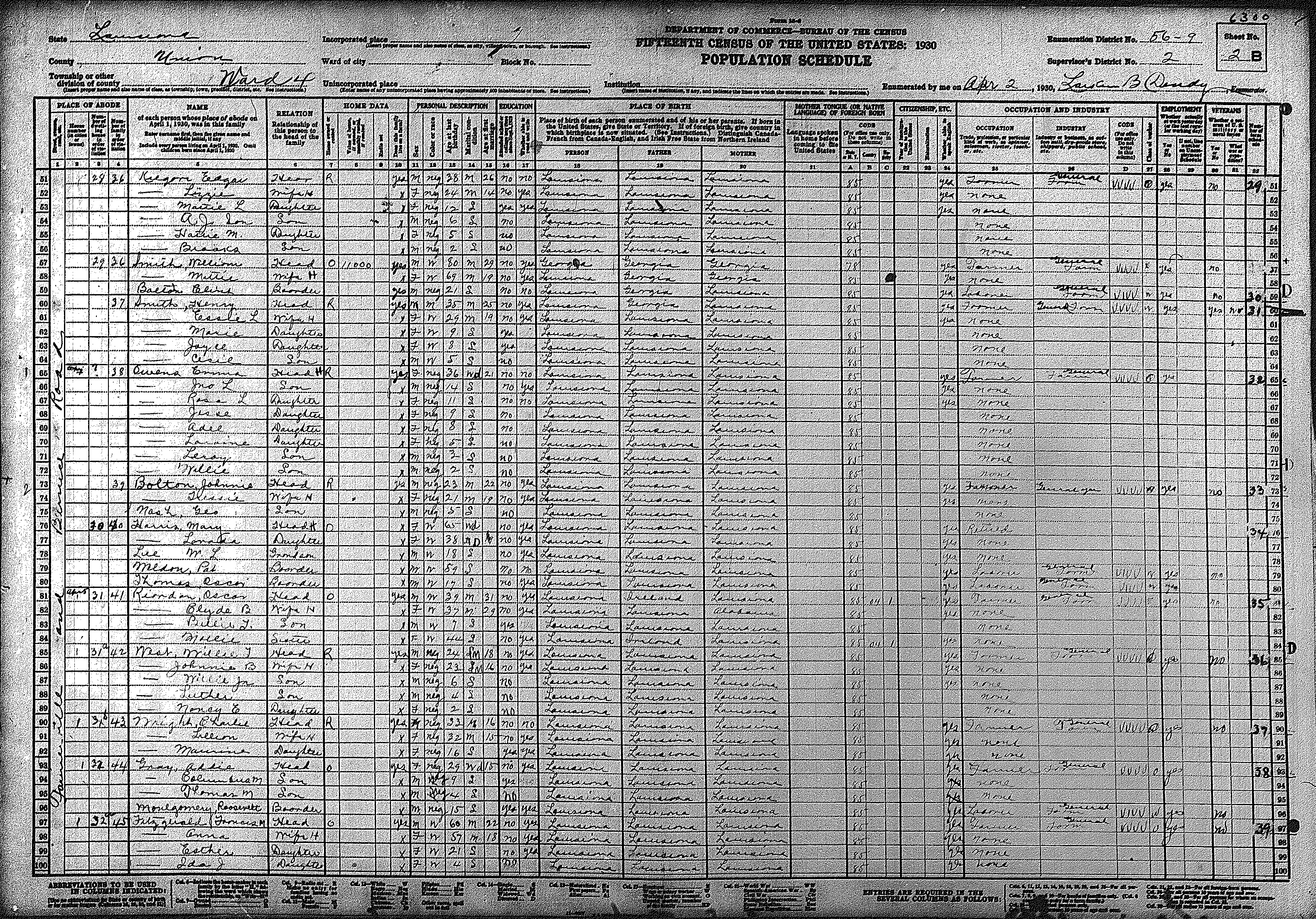
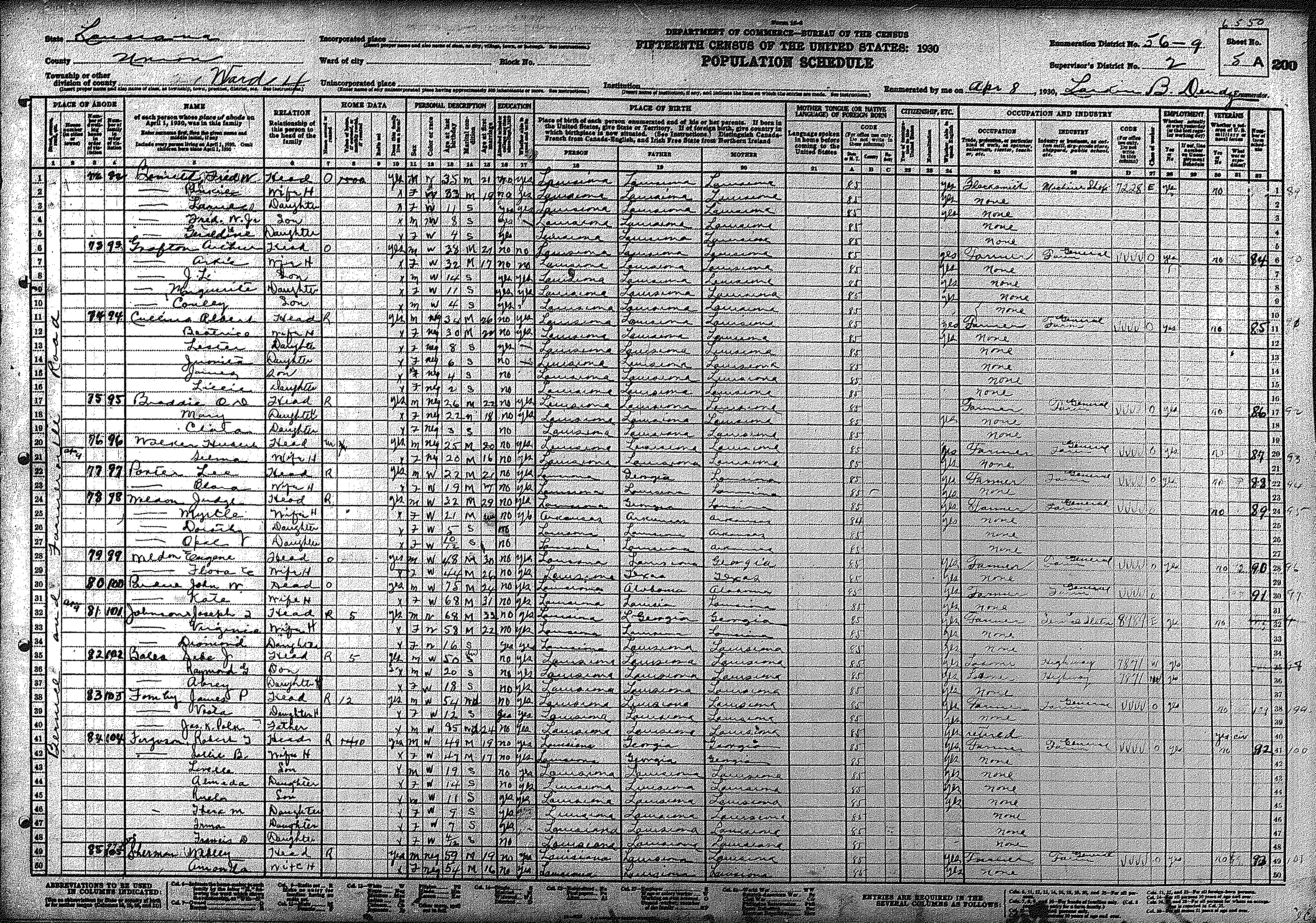
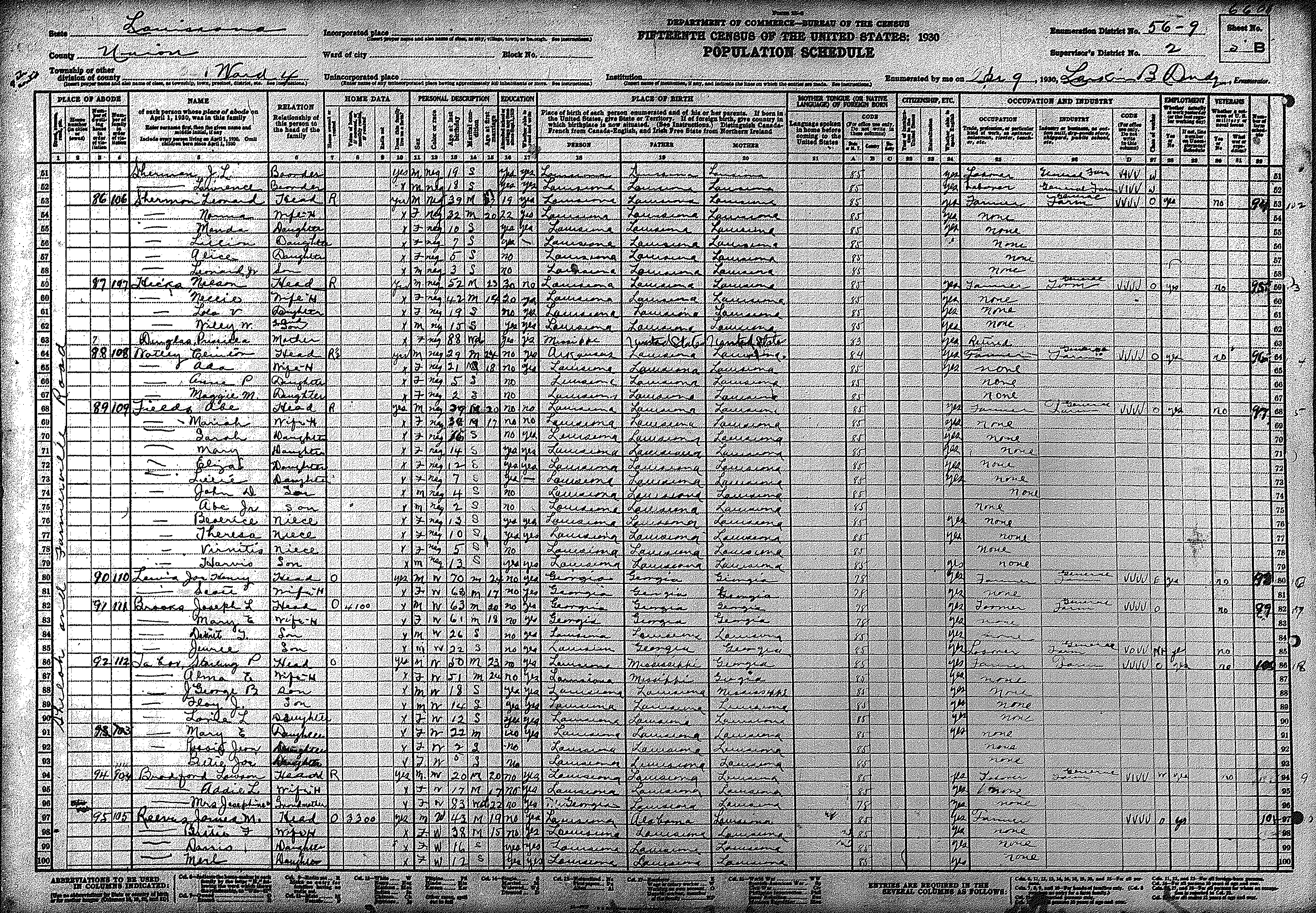
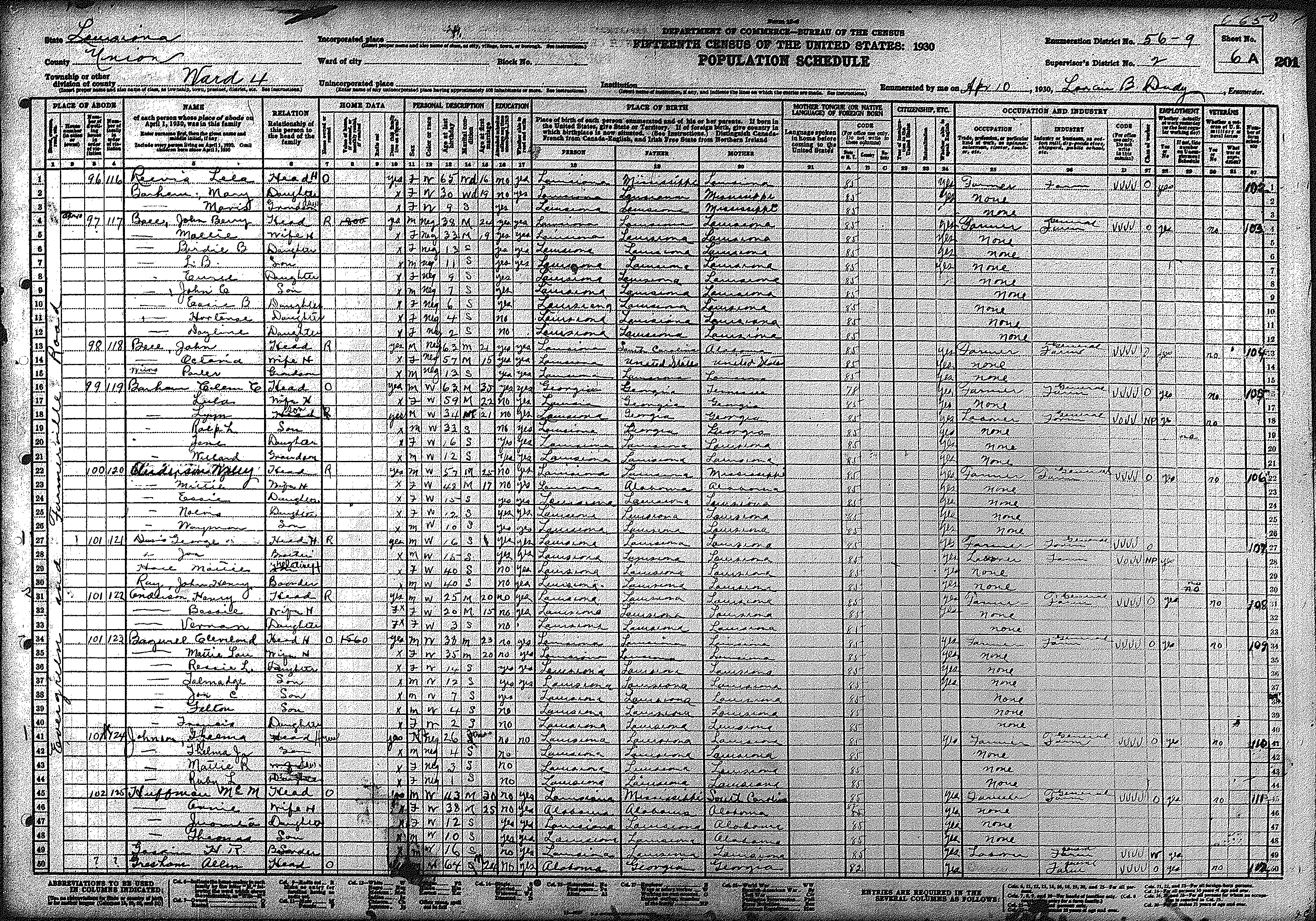
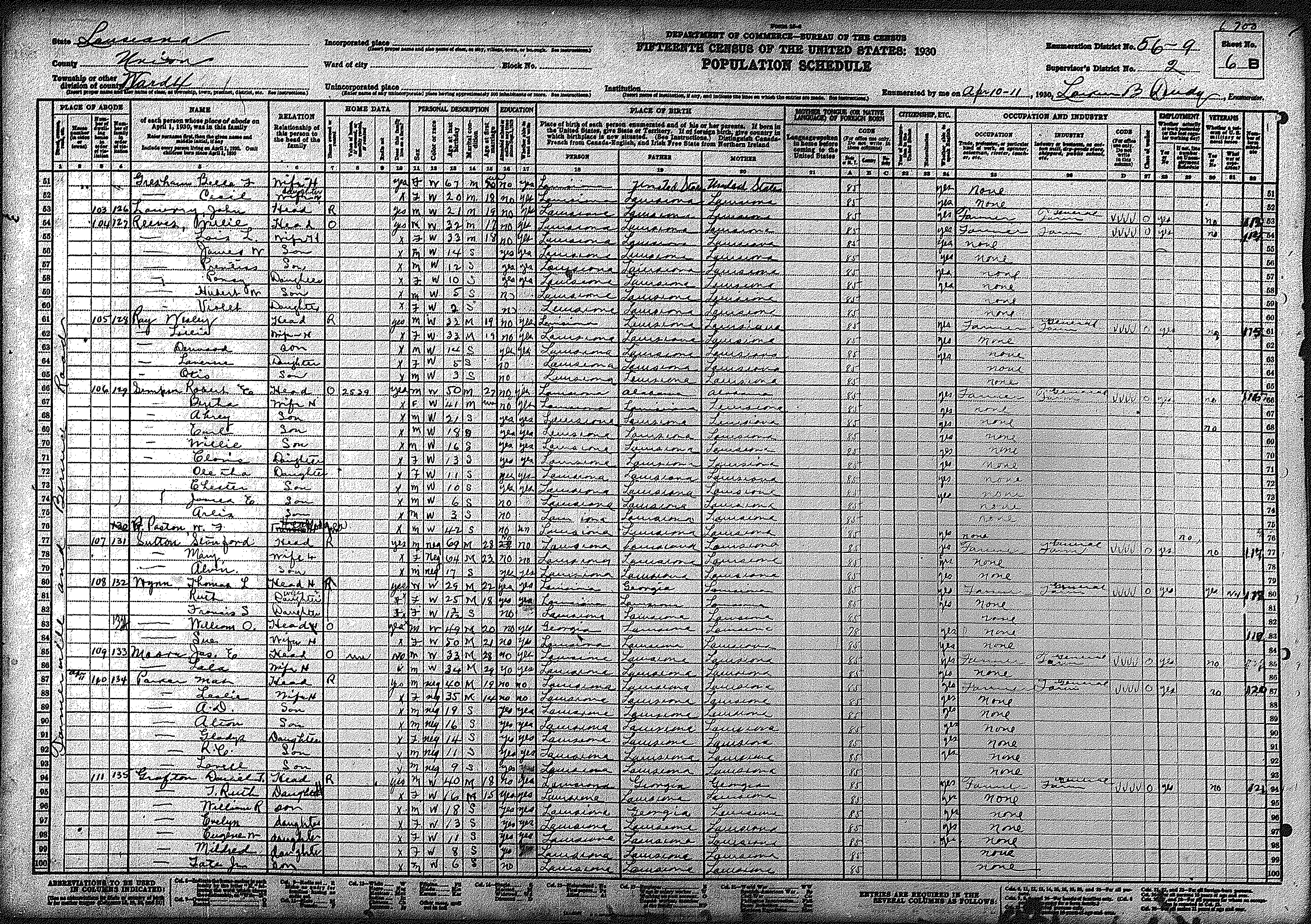
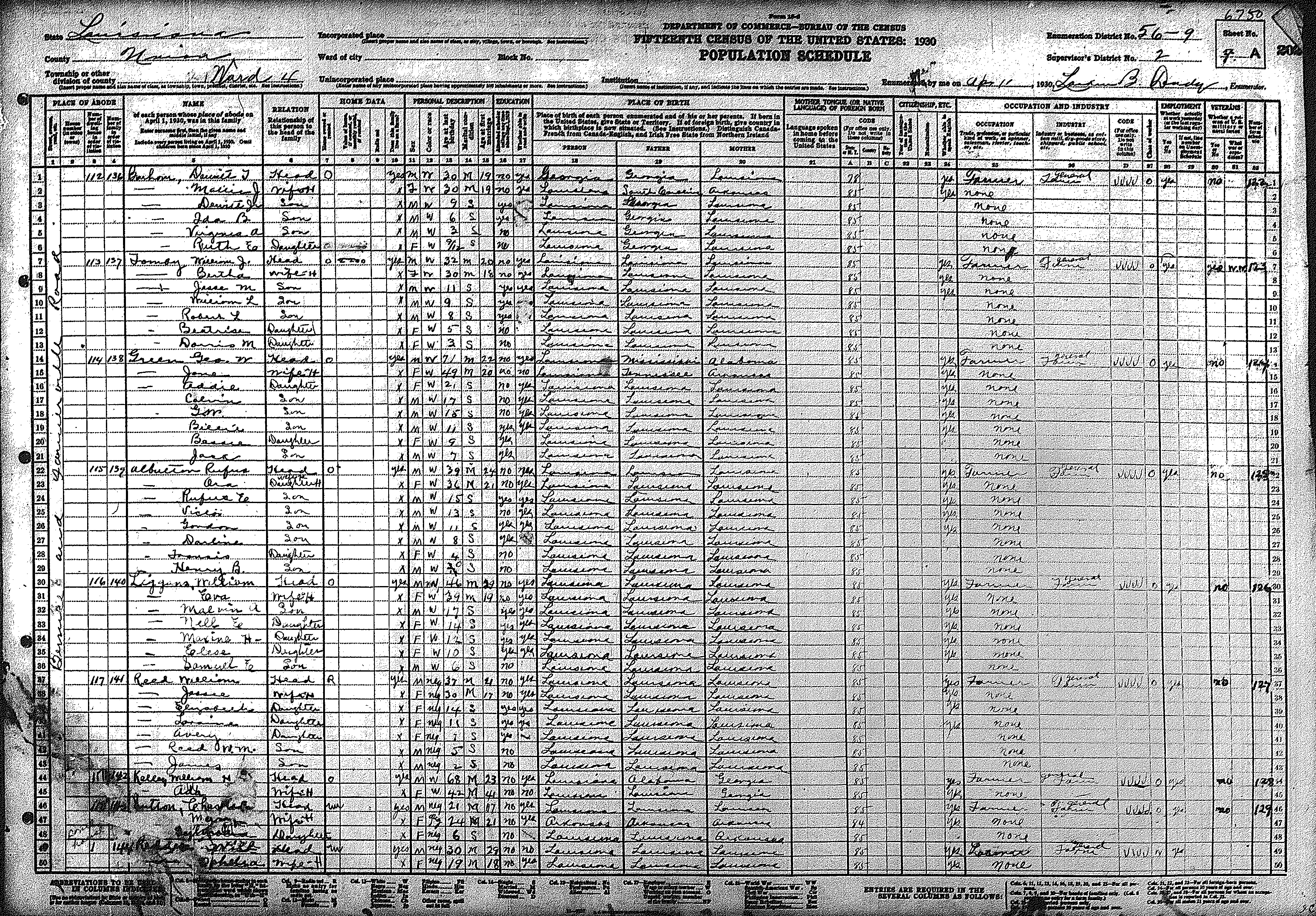
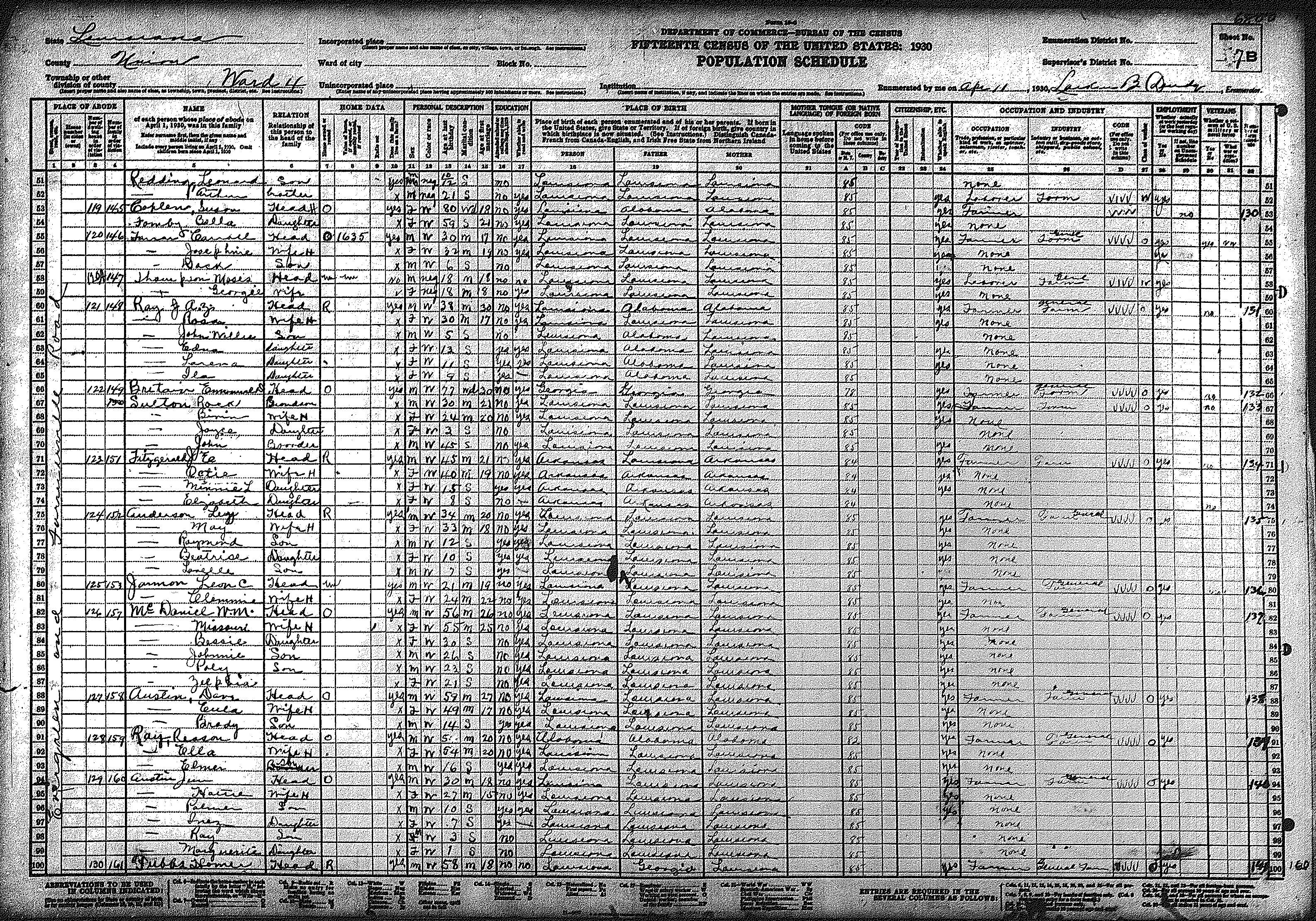
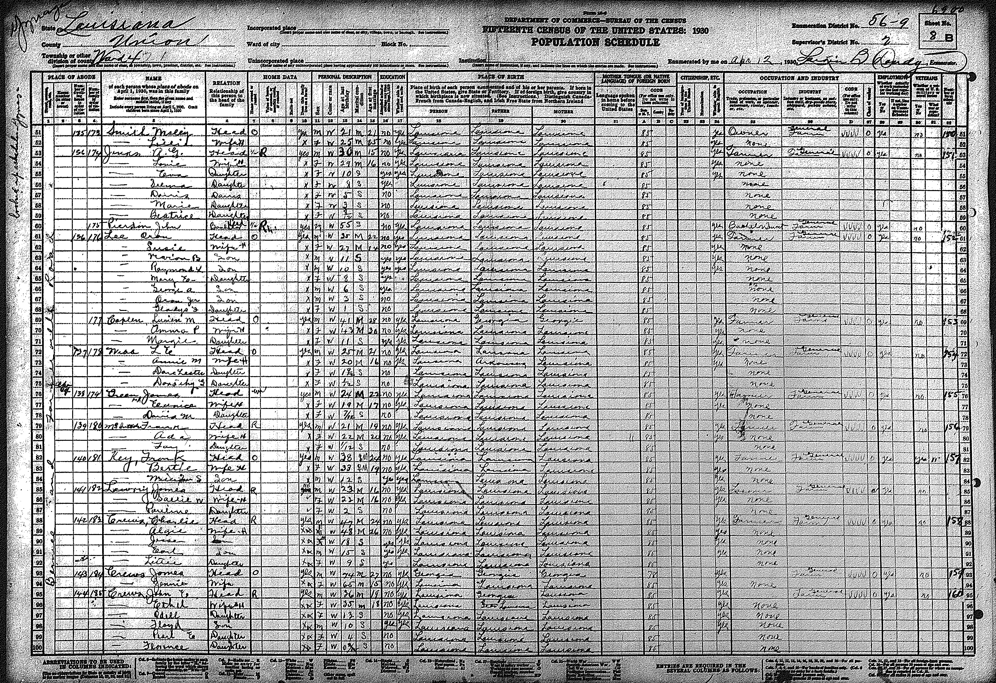
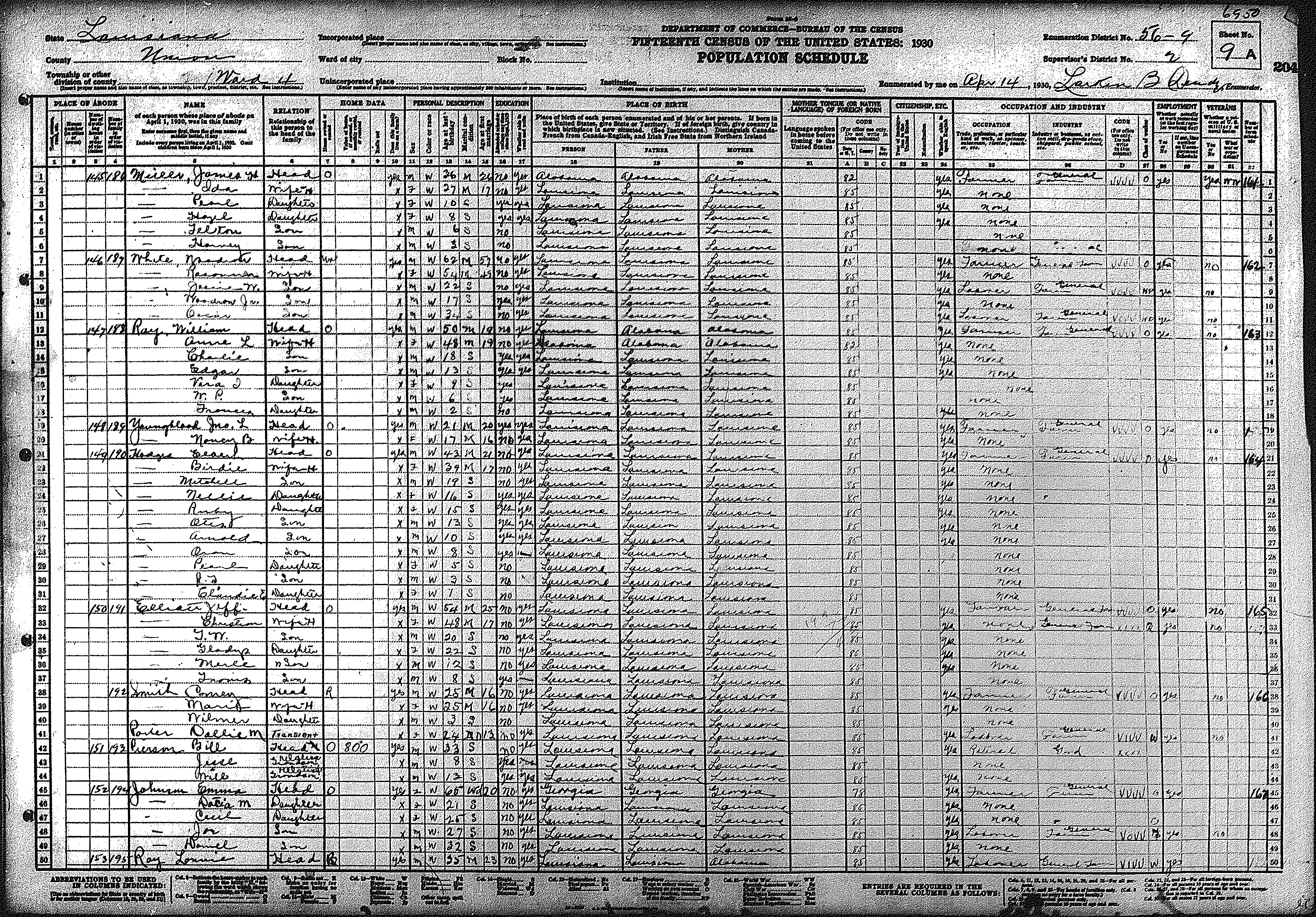
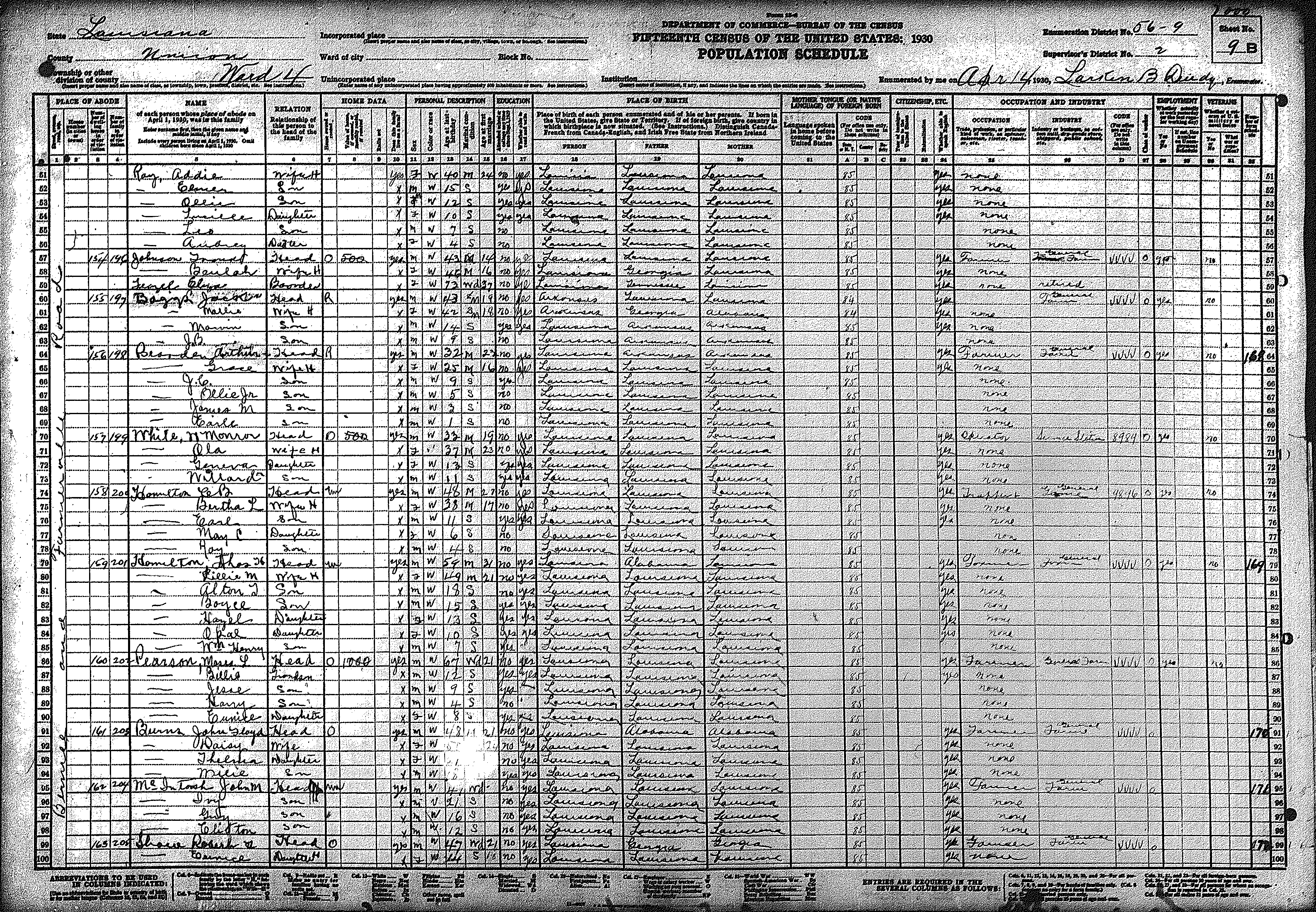
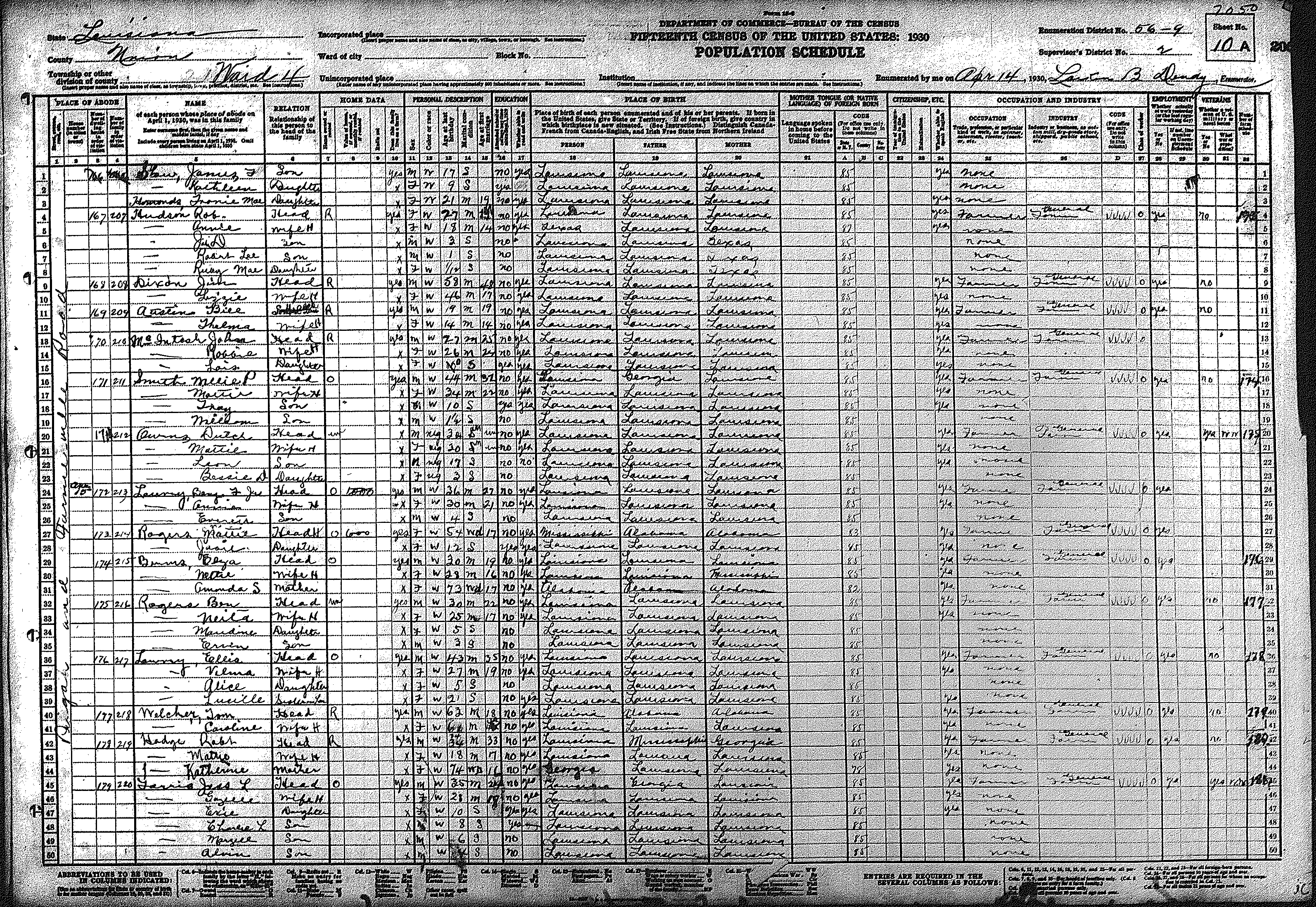
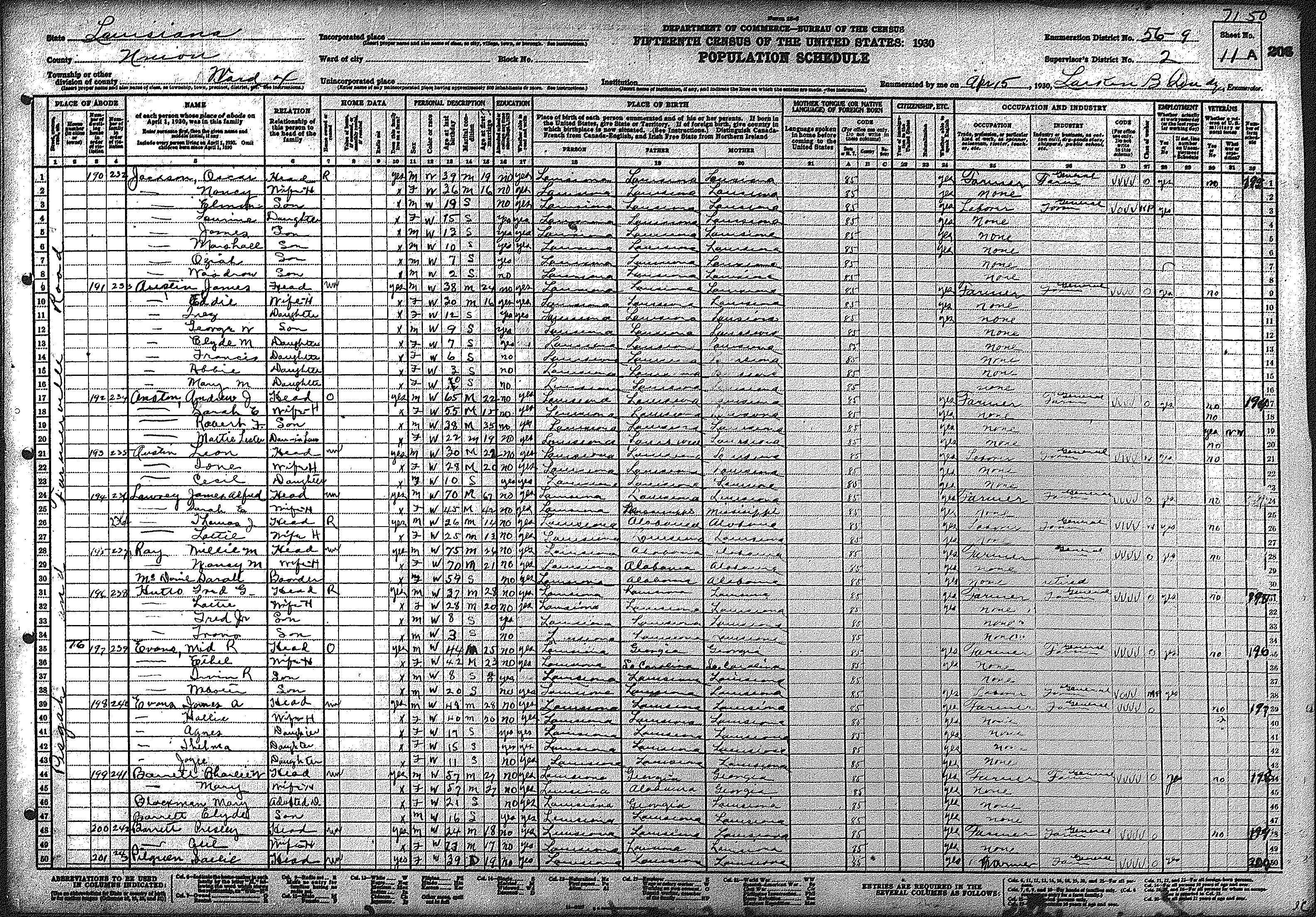
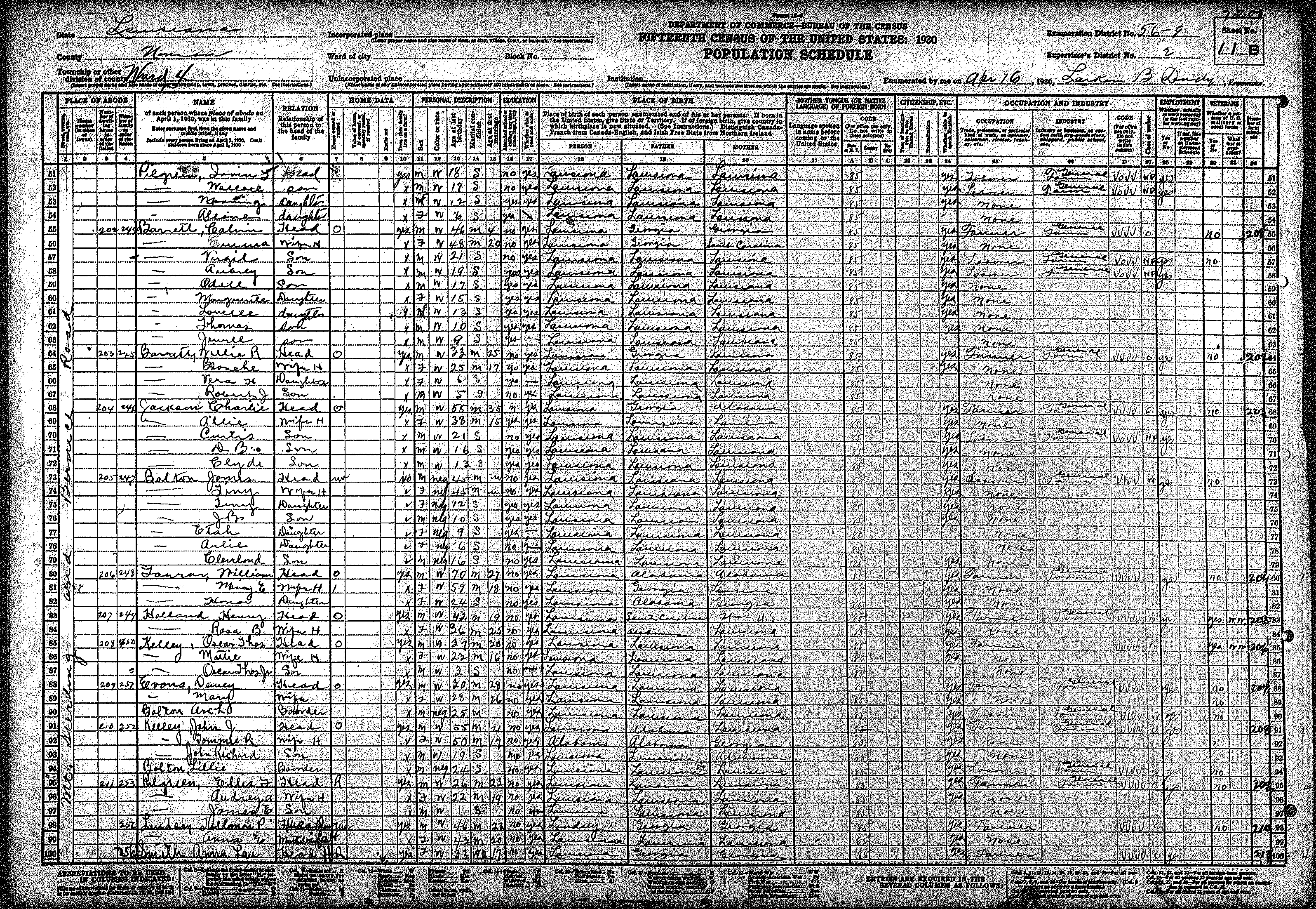
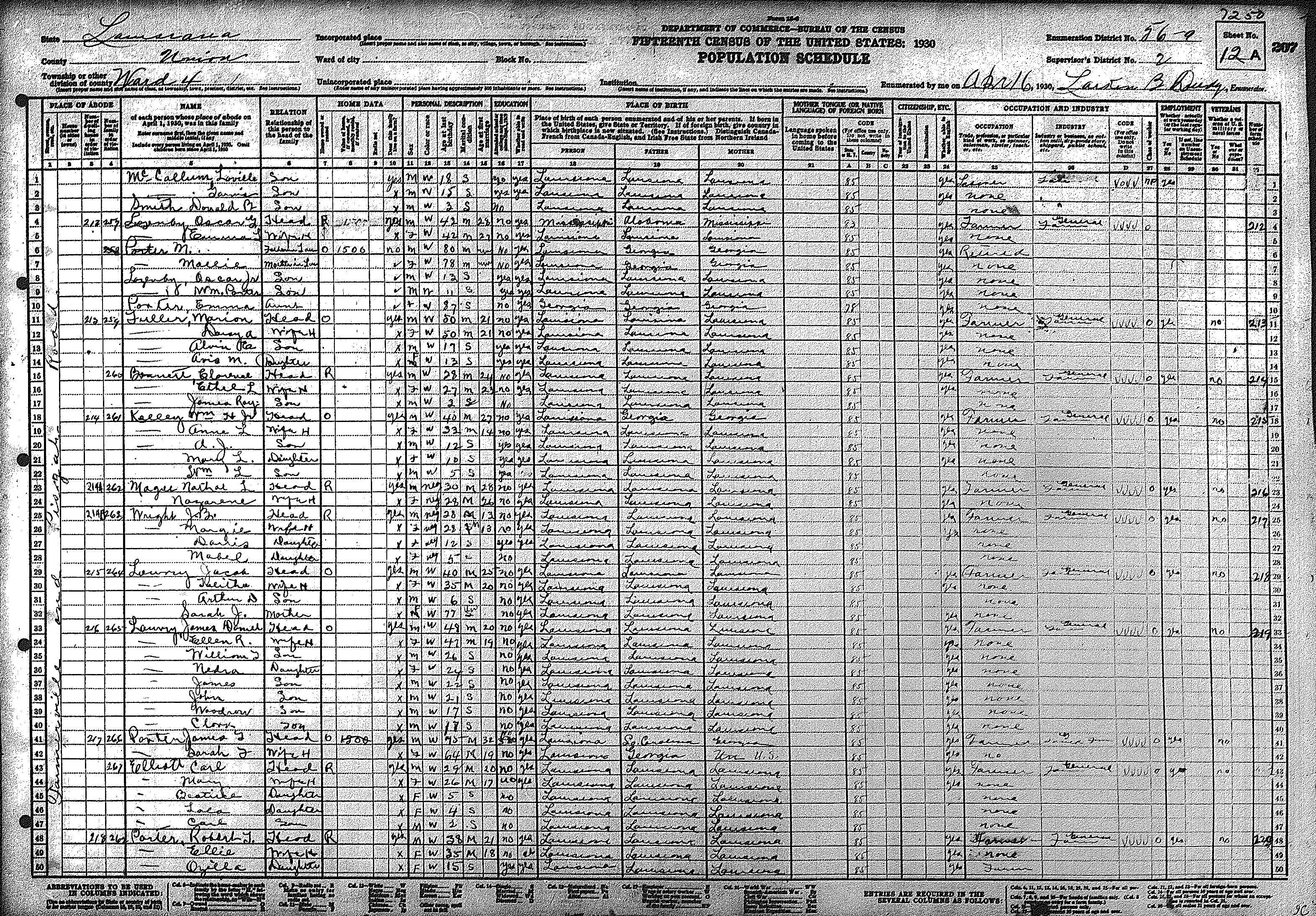
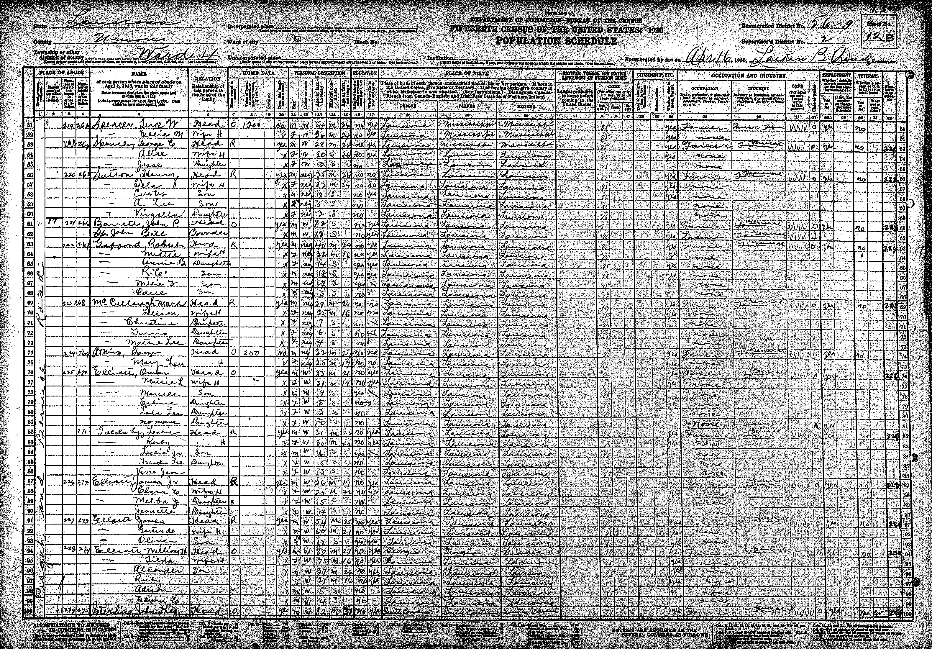
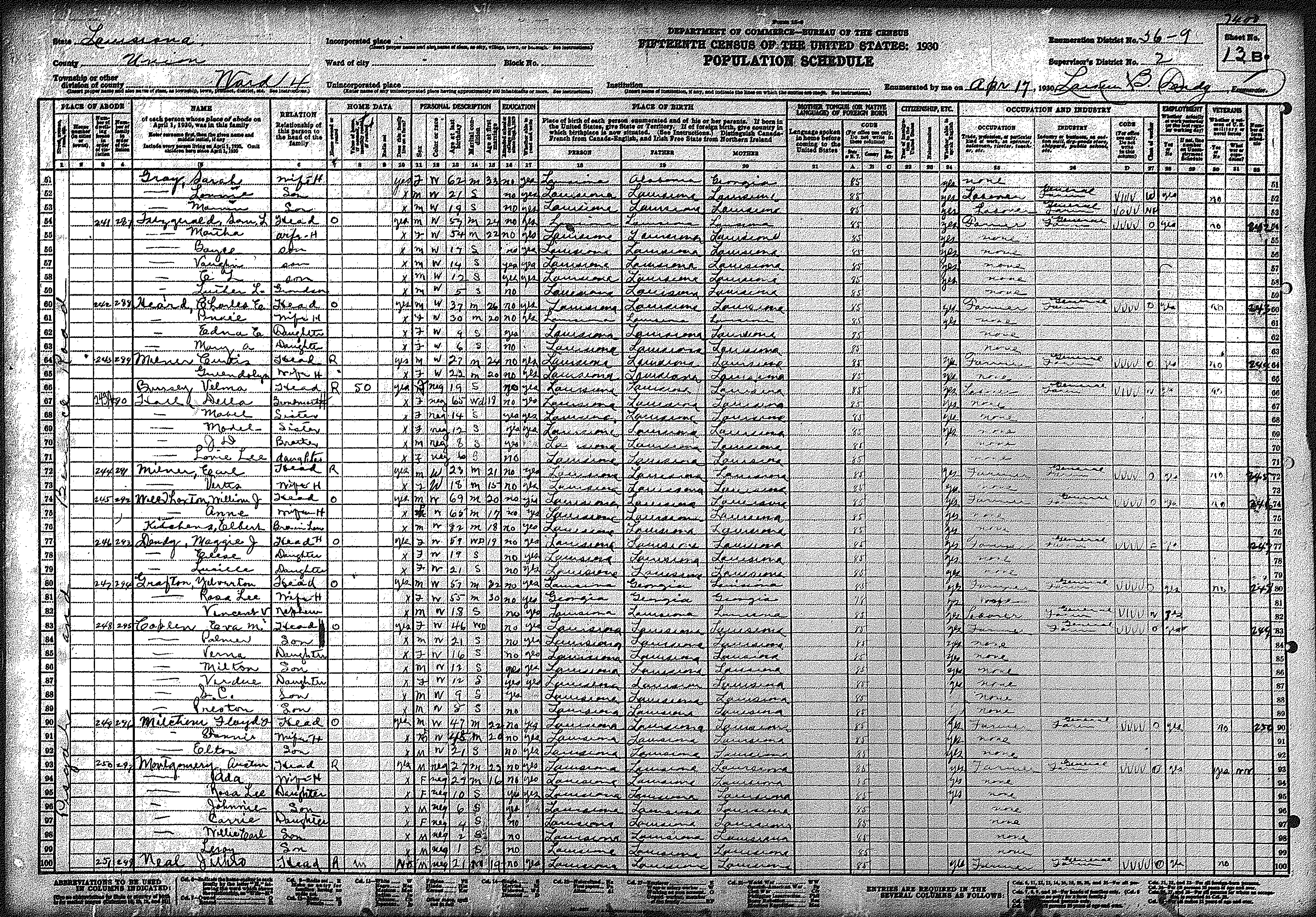
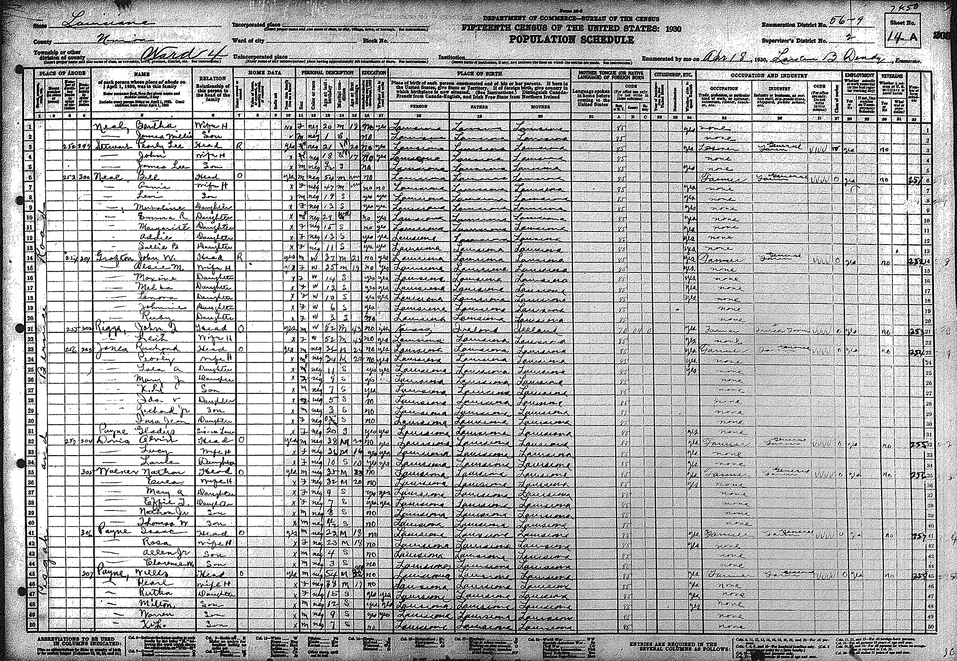
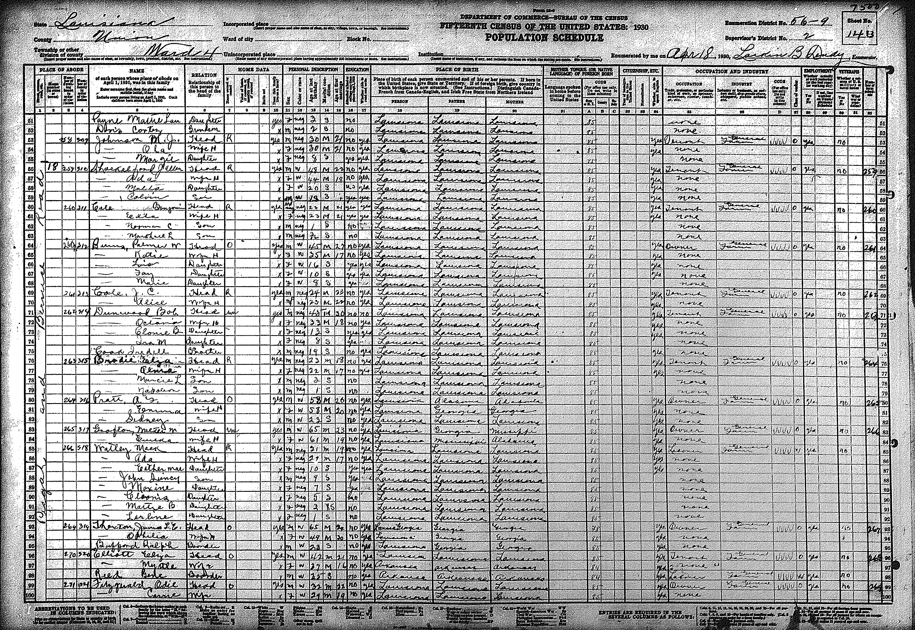
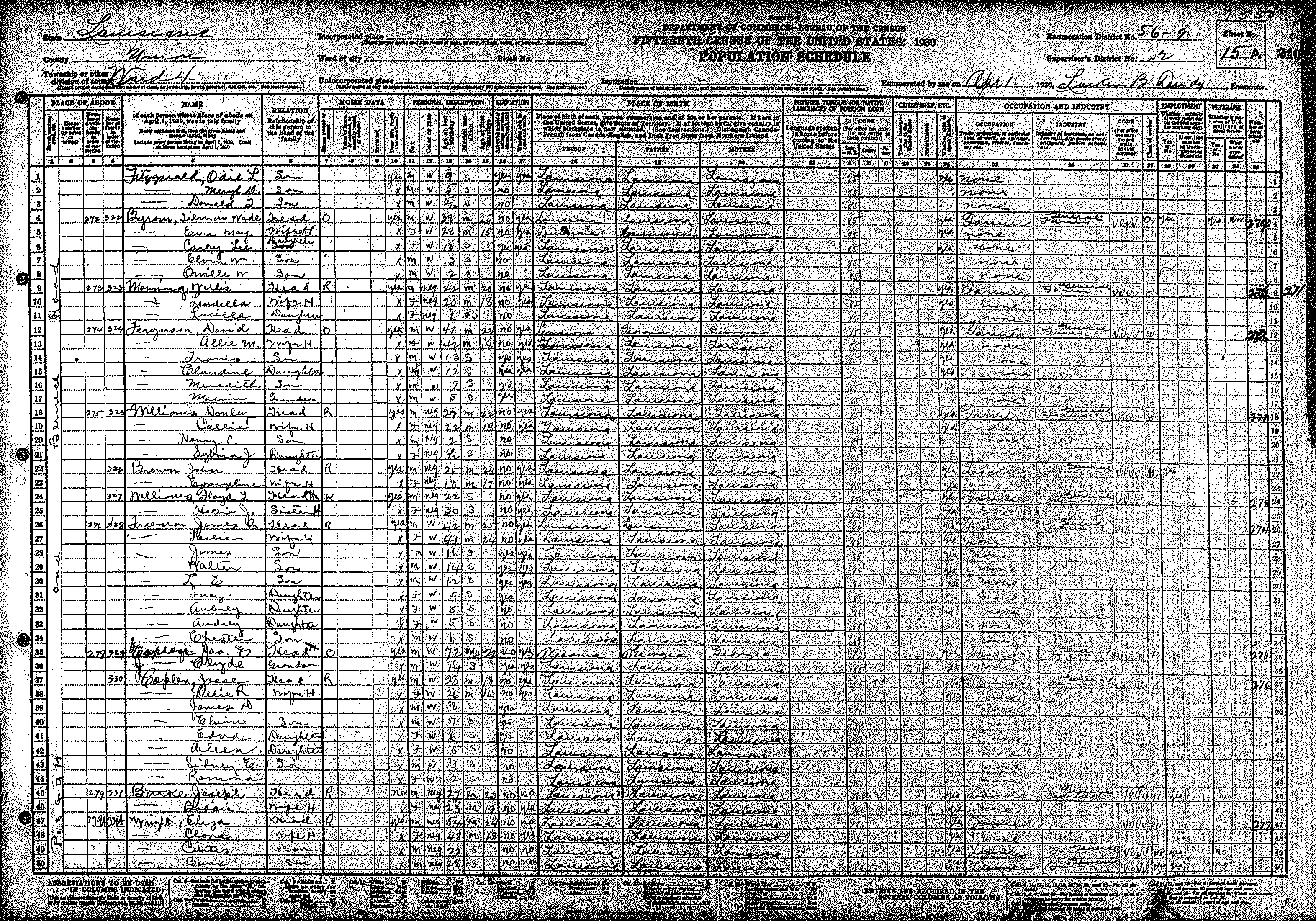
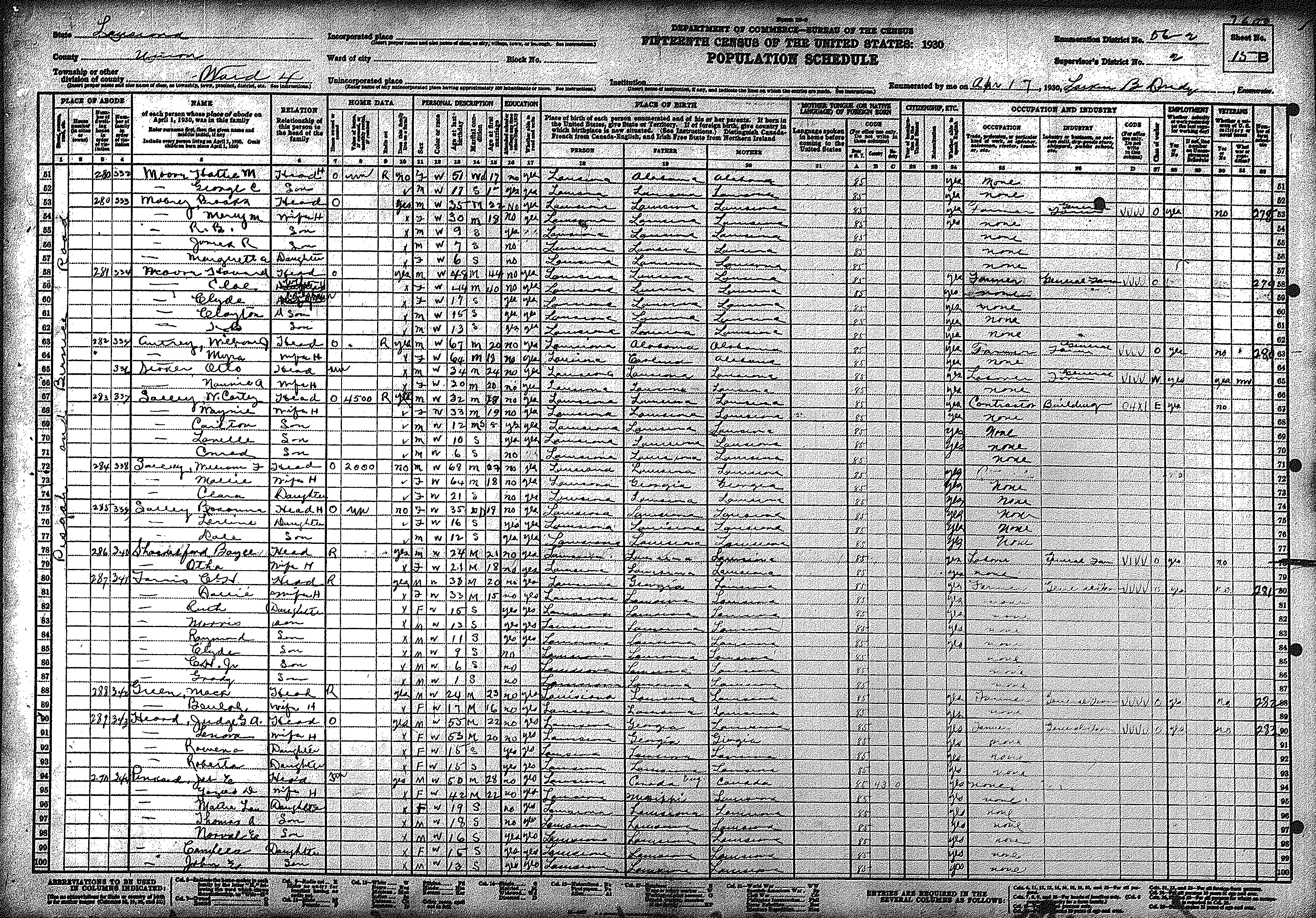
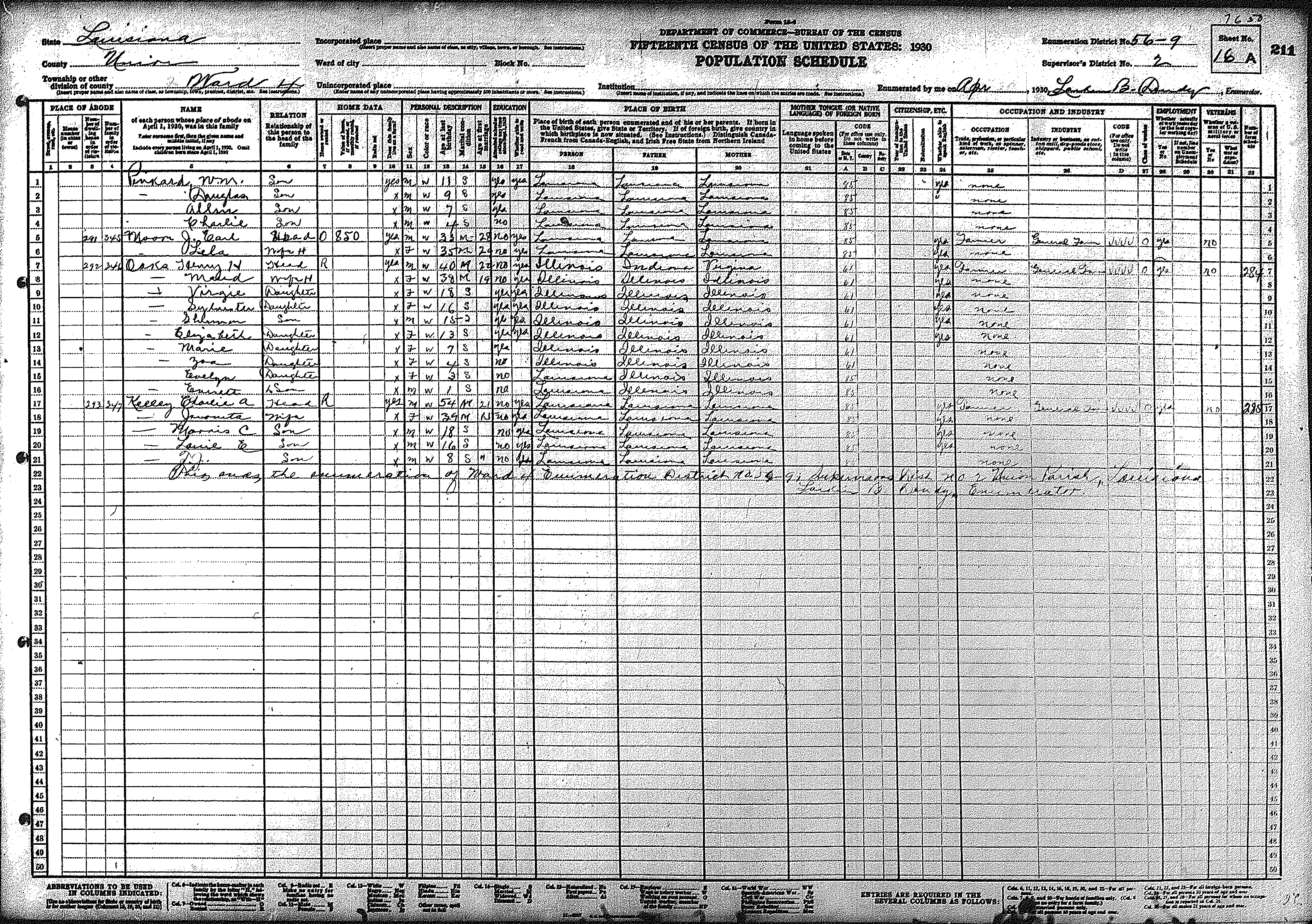
| 56 – 9 | Western Union Parish surrounding Bernice, including Pisgah | ||||||||||||||||||
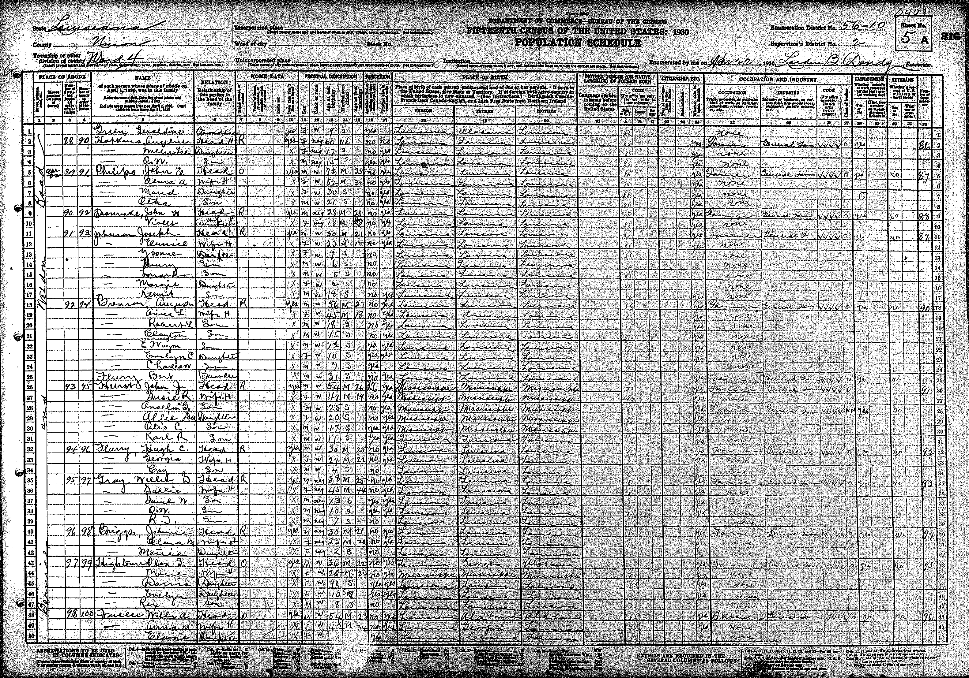
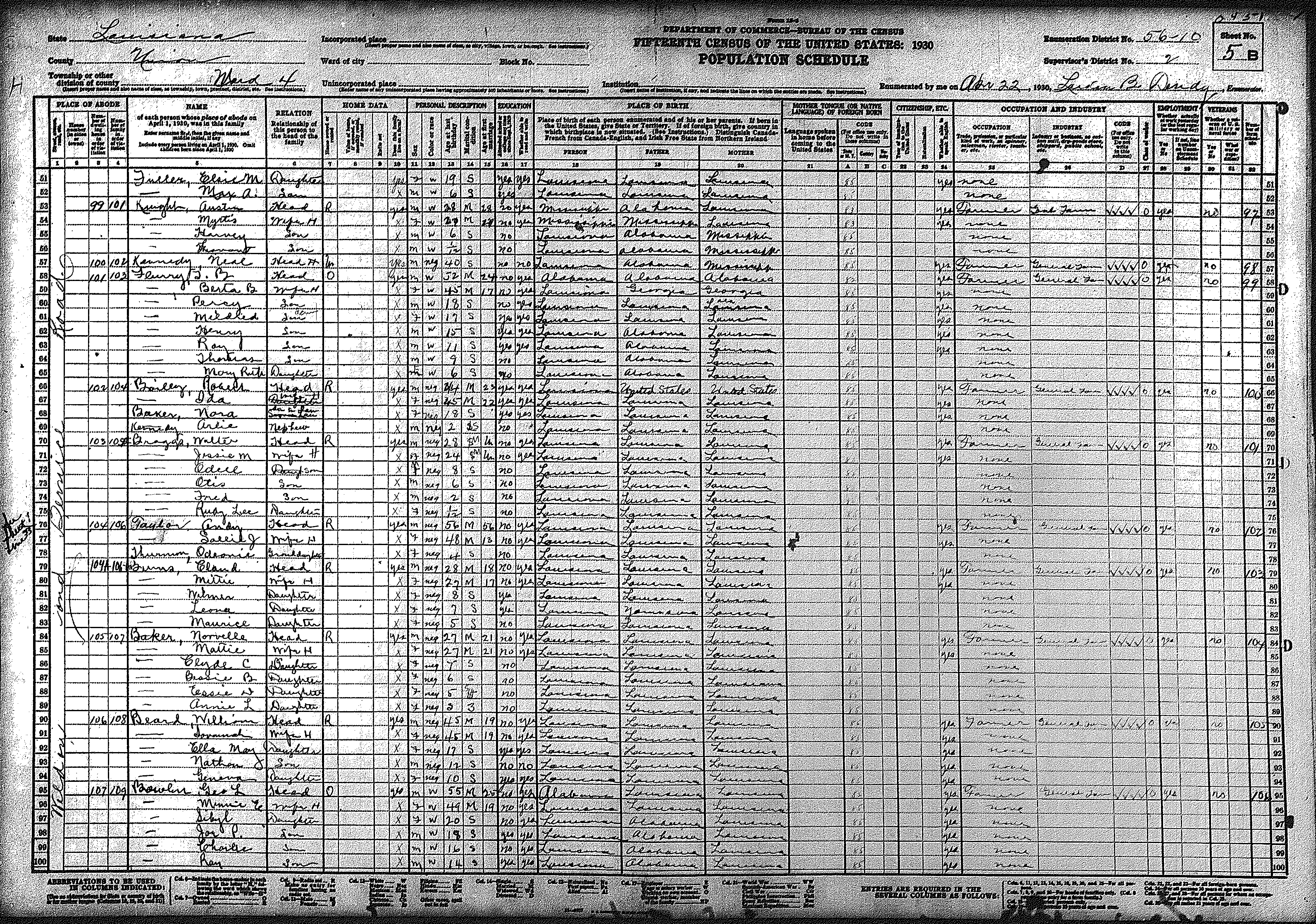
| 216 | 217 | 218 | 219 | 220 | 221 | 222 | 223 | 224 | 225 | 226 | 227 | 228 | 229 | 230 | |||||
| 231 | 232 | 233 | 234 | 235 | 236 | 237 | 238 | 239 | 240 | 241 | 242 | 243 | 244 | 245 | |||||
| 246 | 247 | ||||||||||||||||||
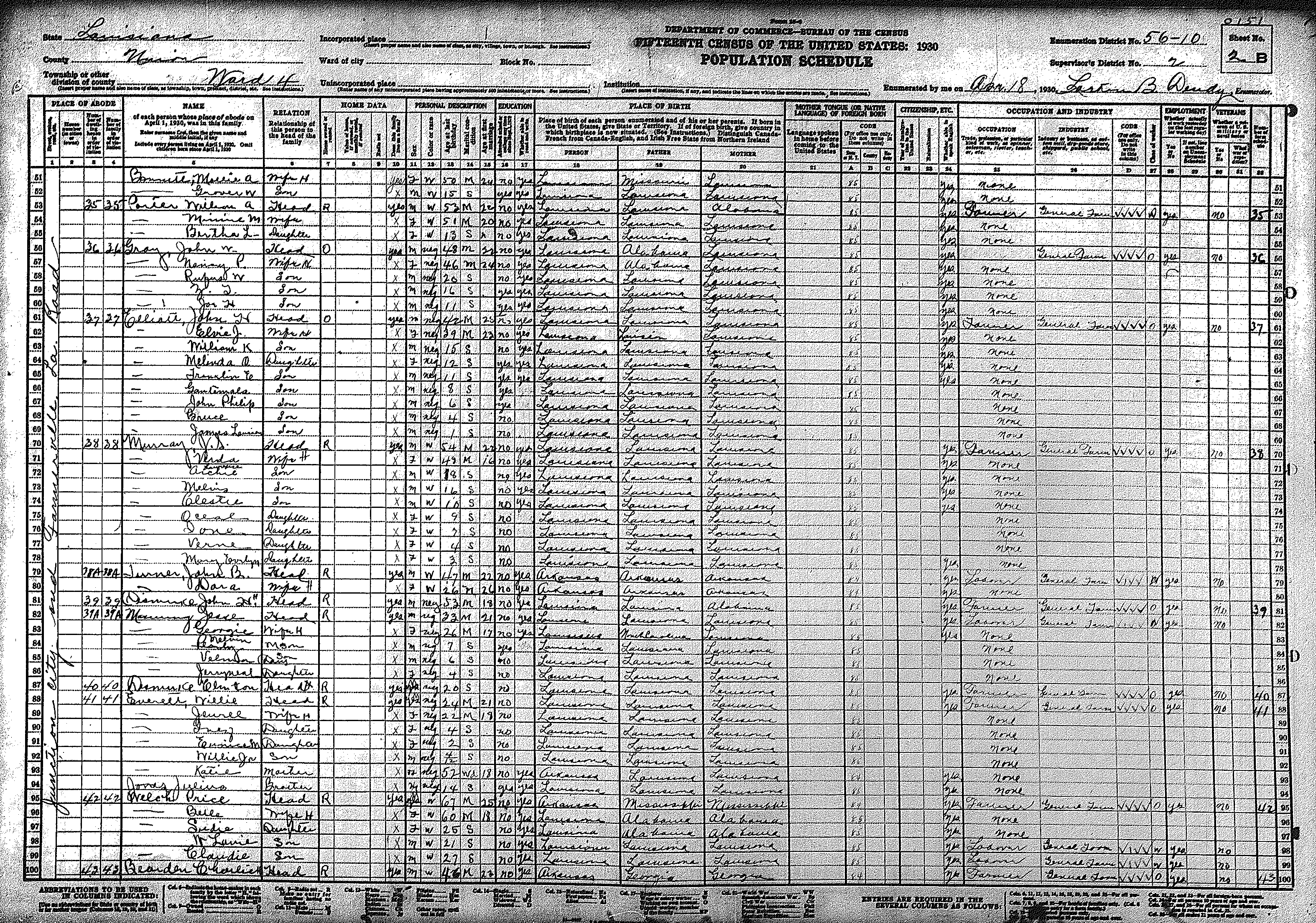
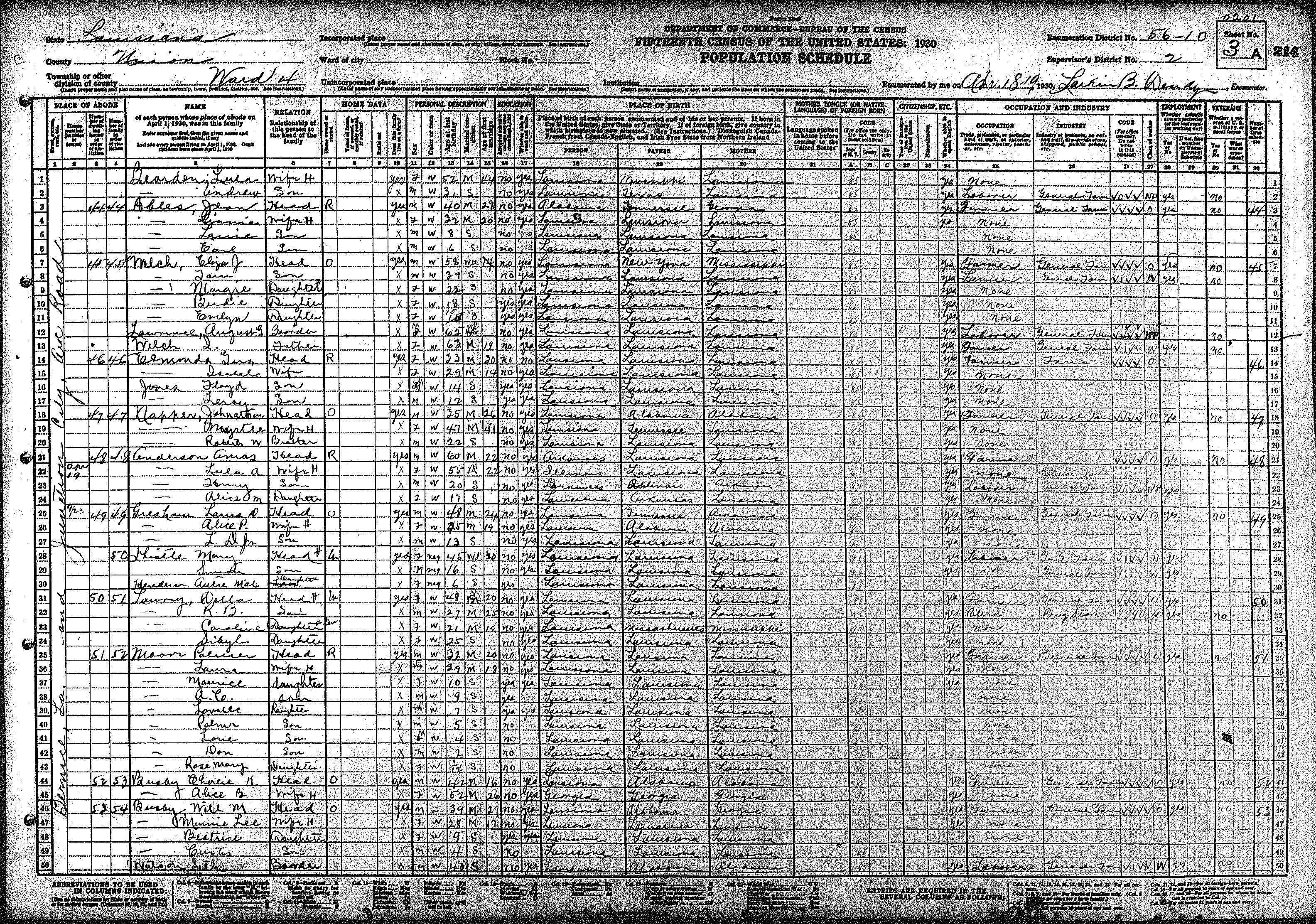
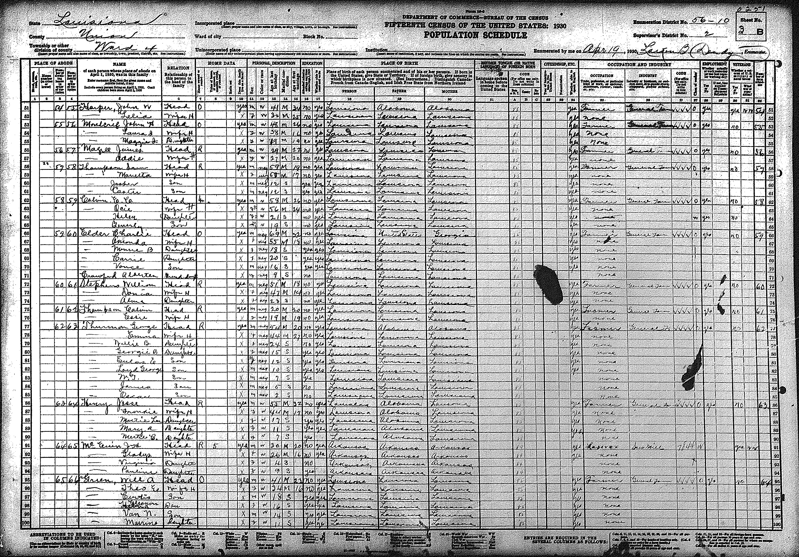
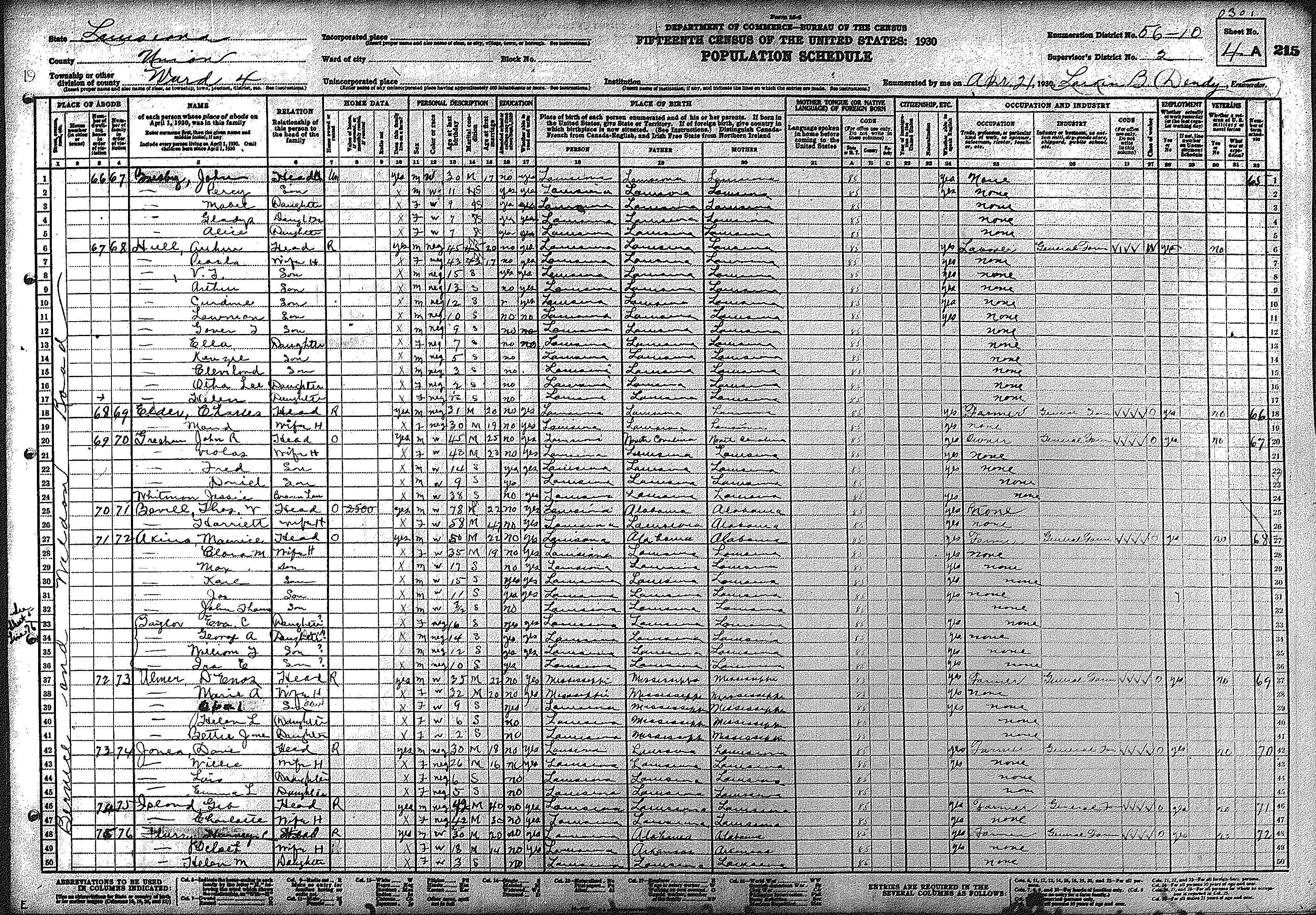
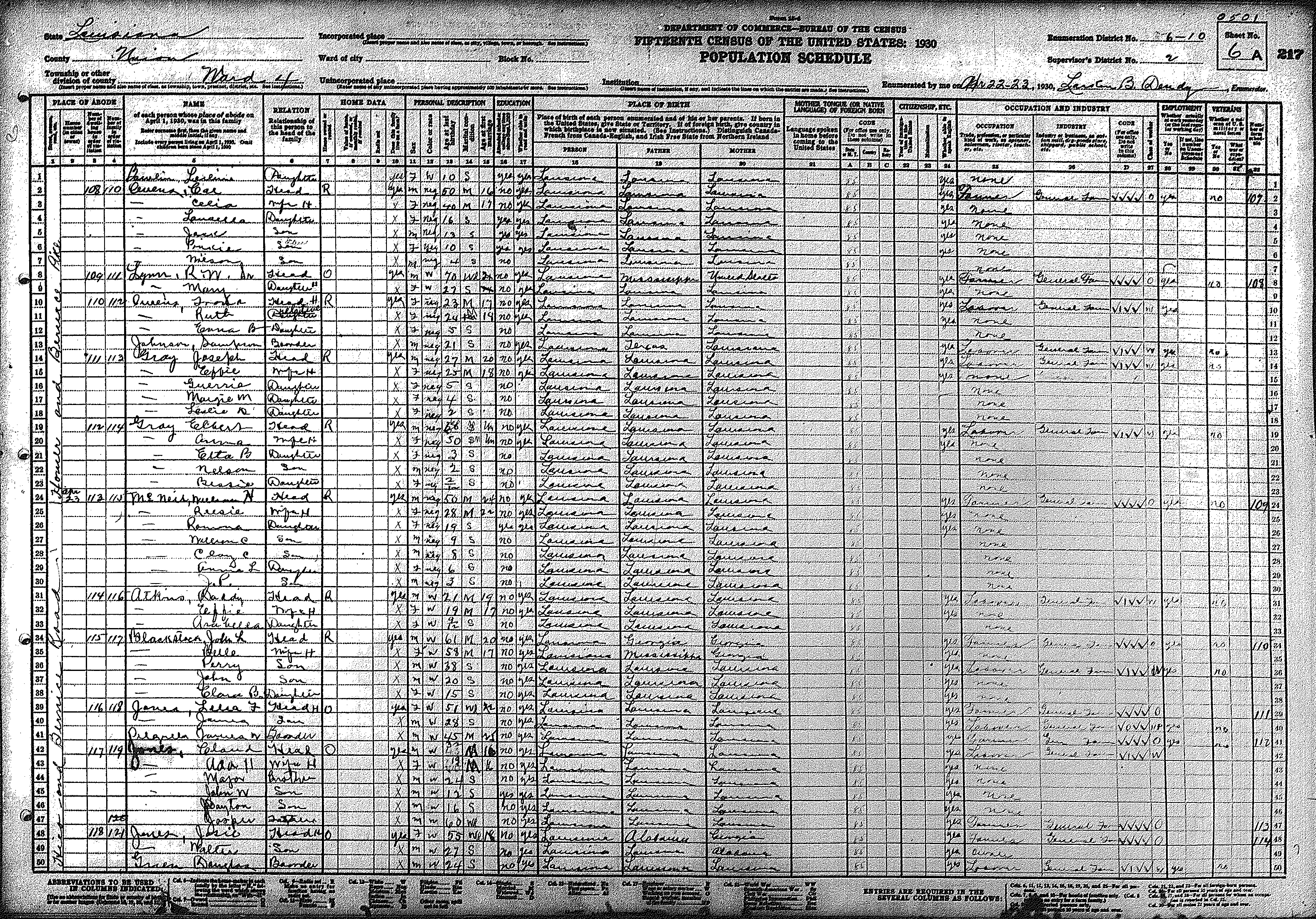
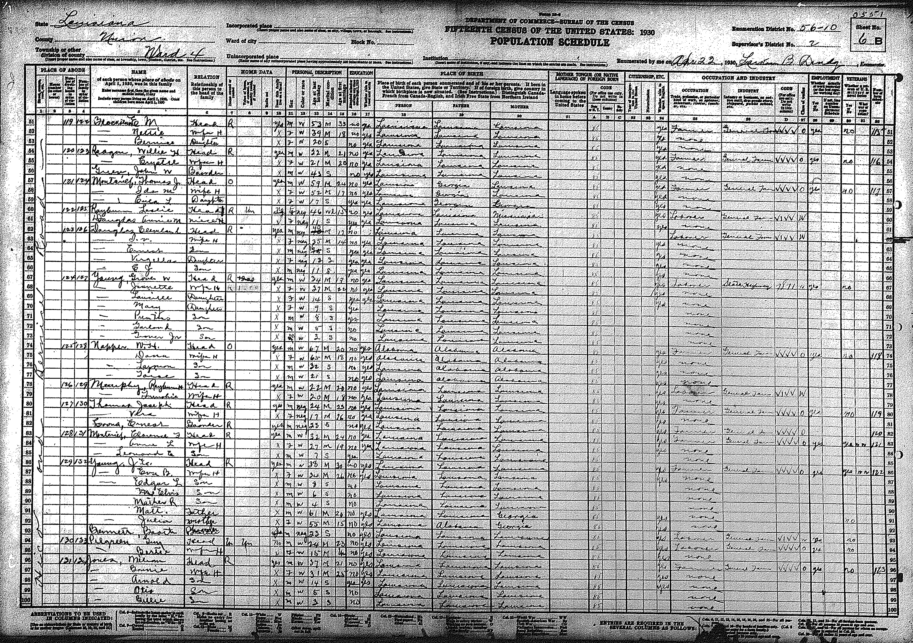
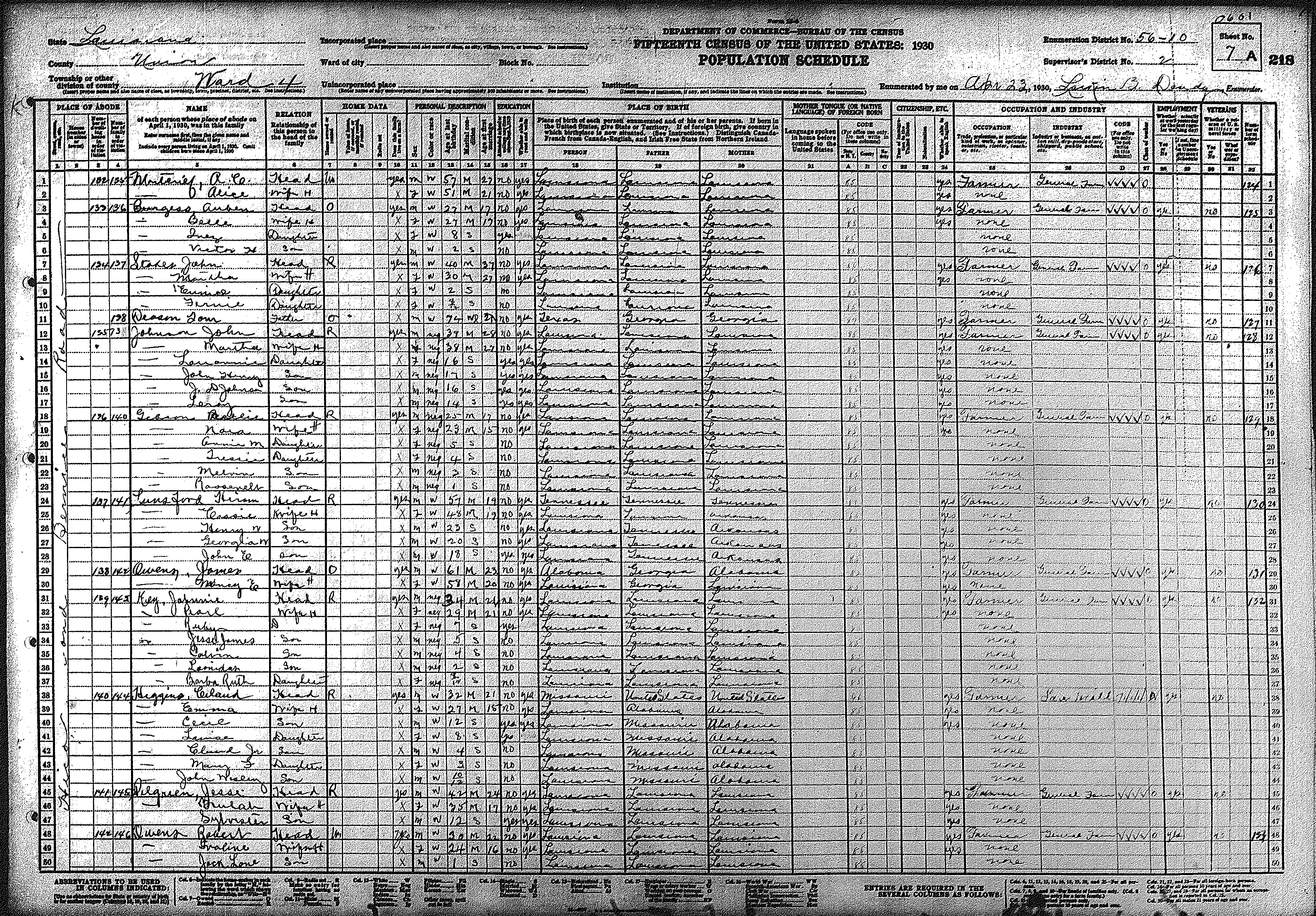
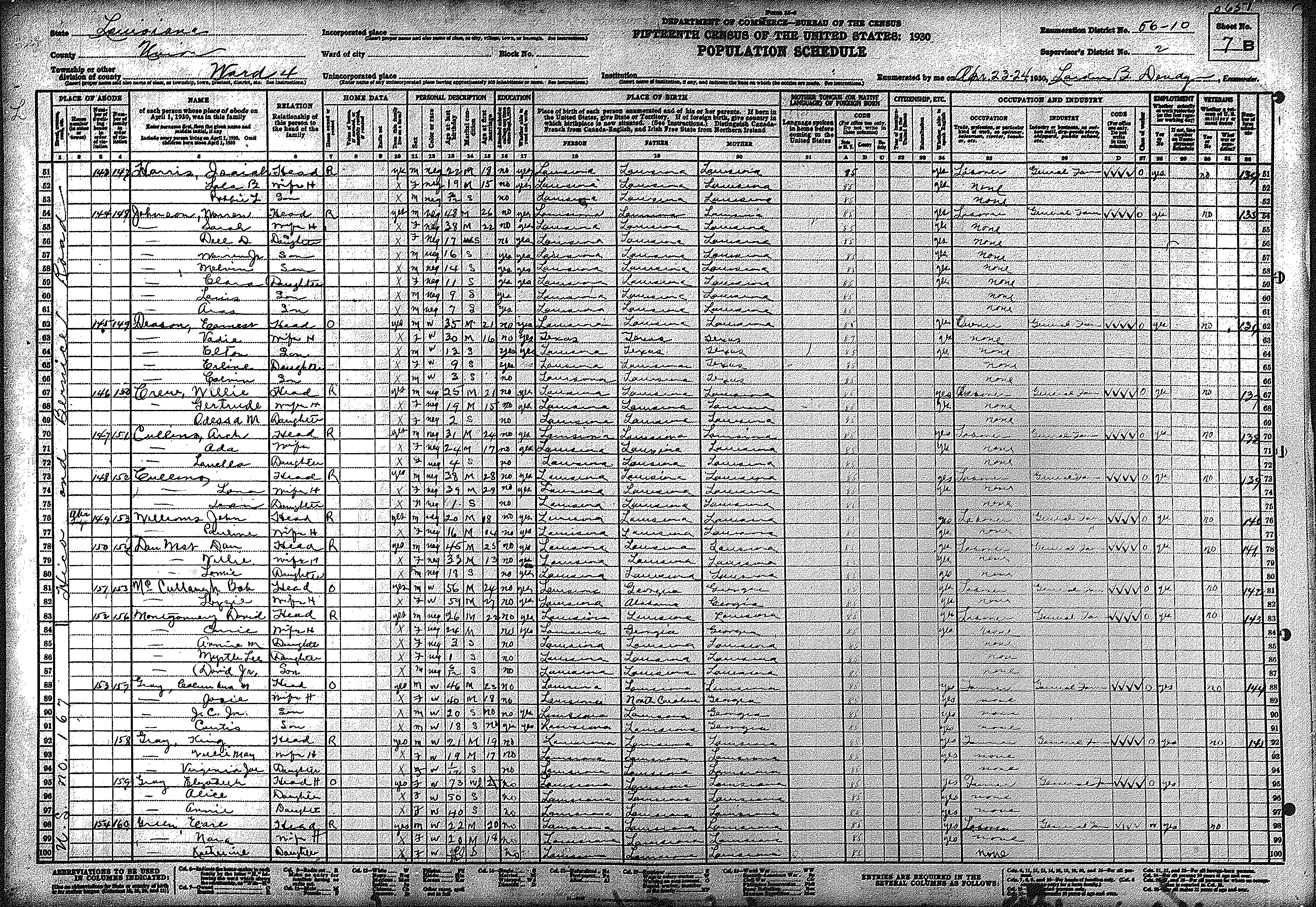
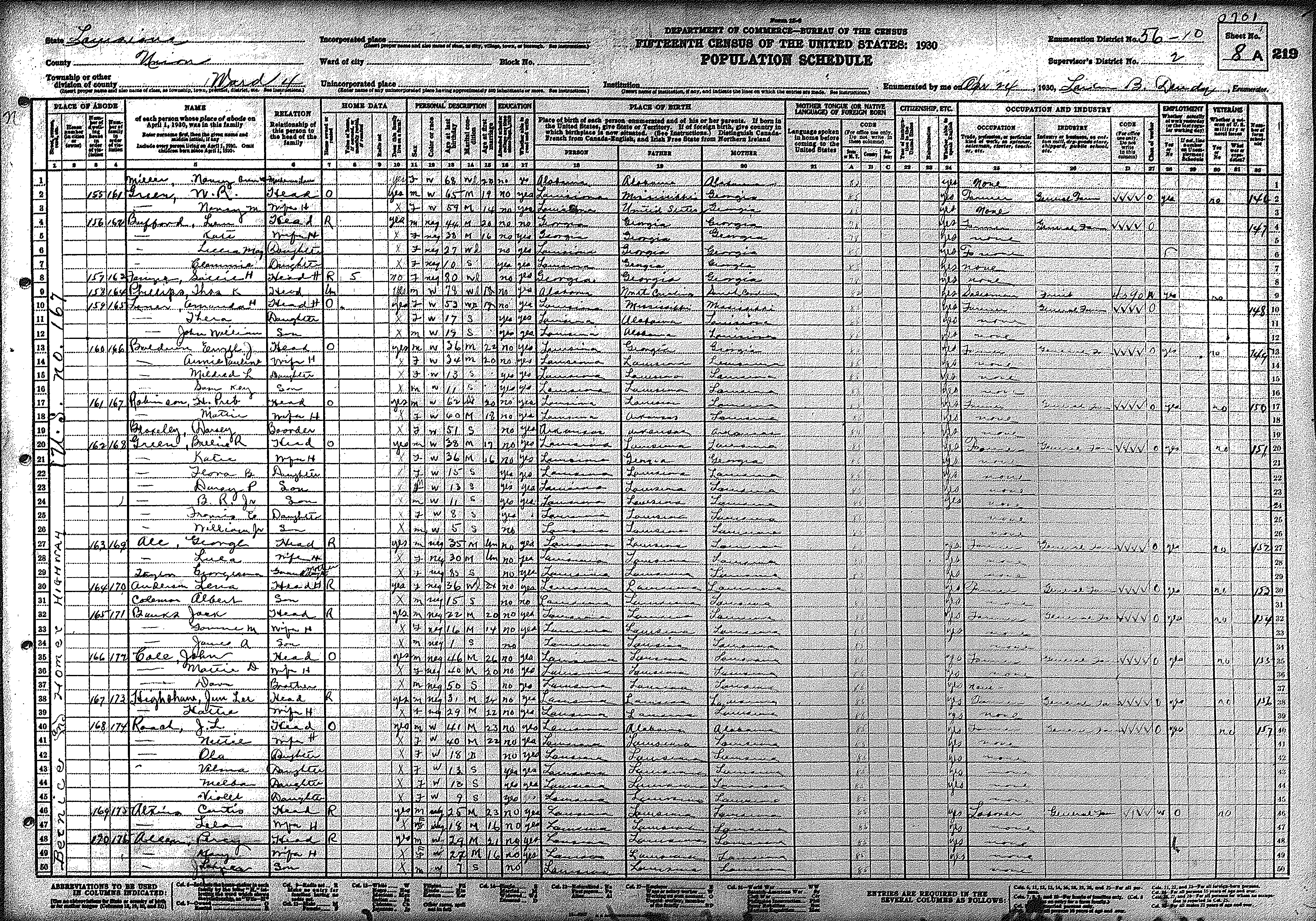
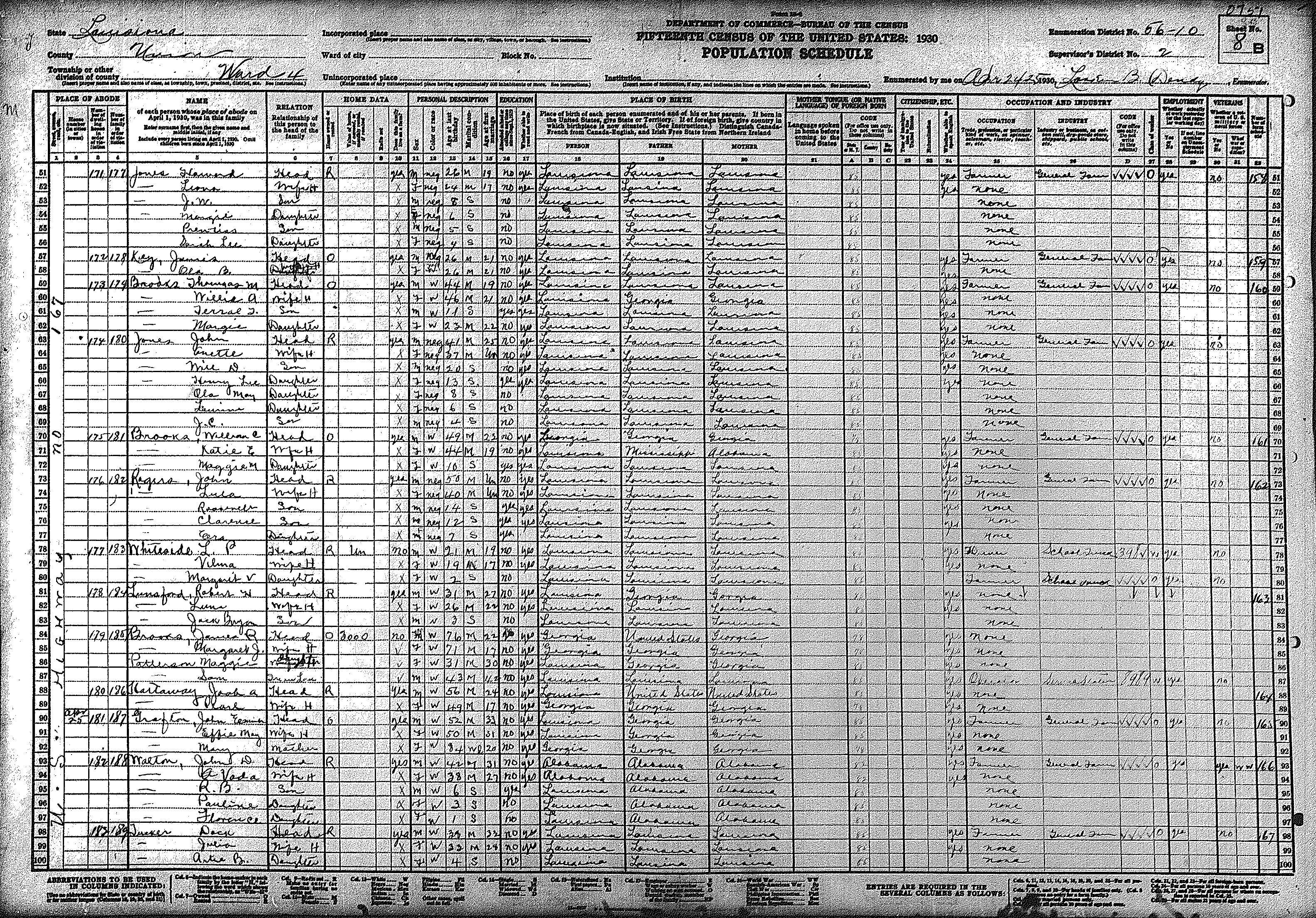
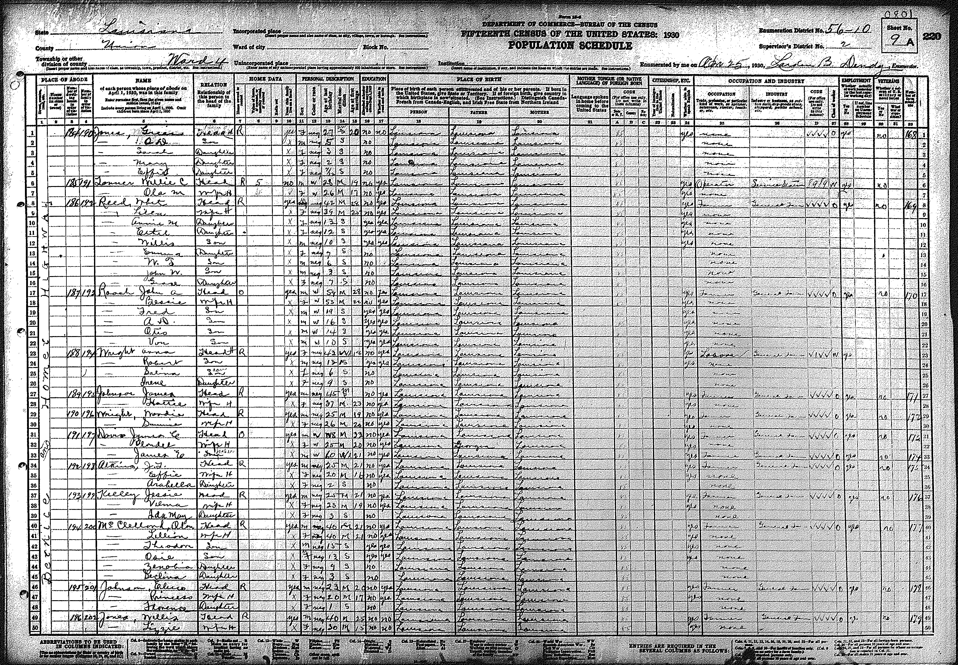
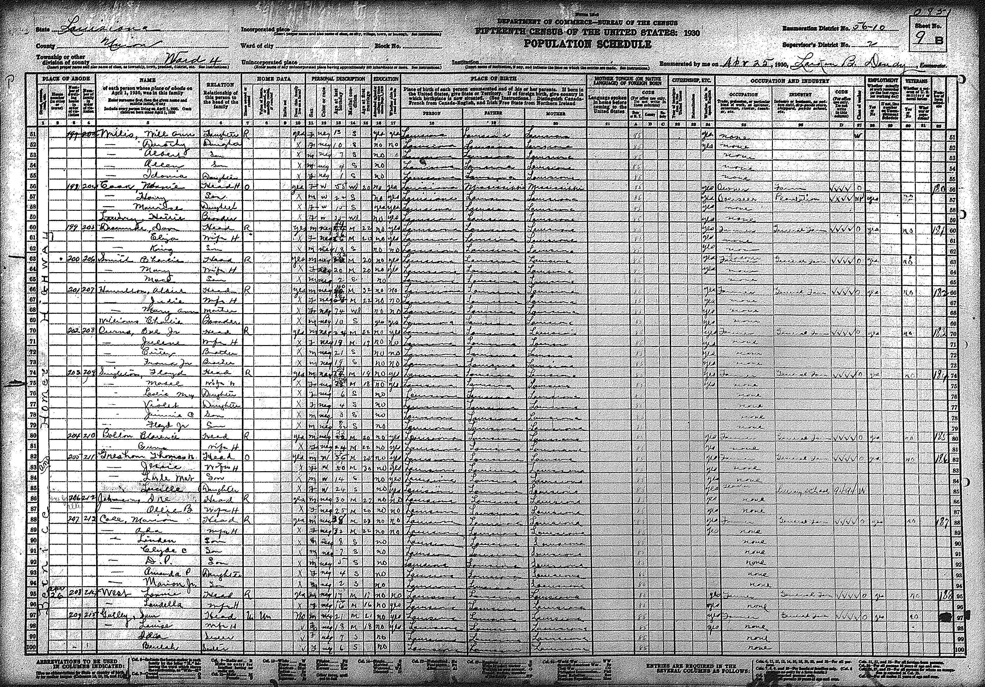
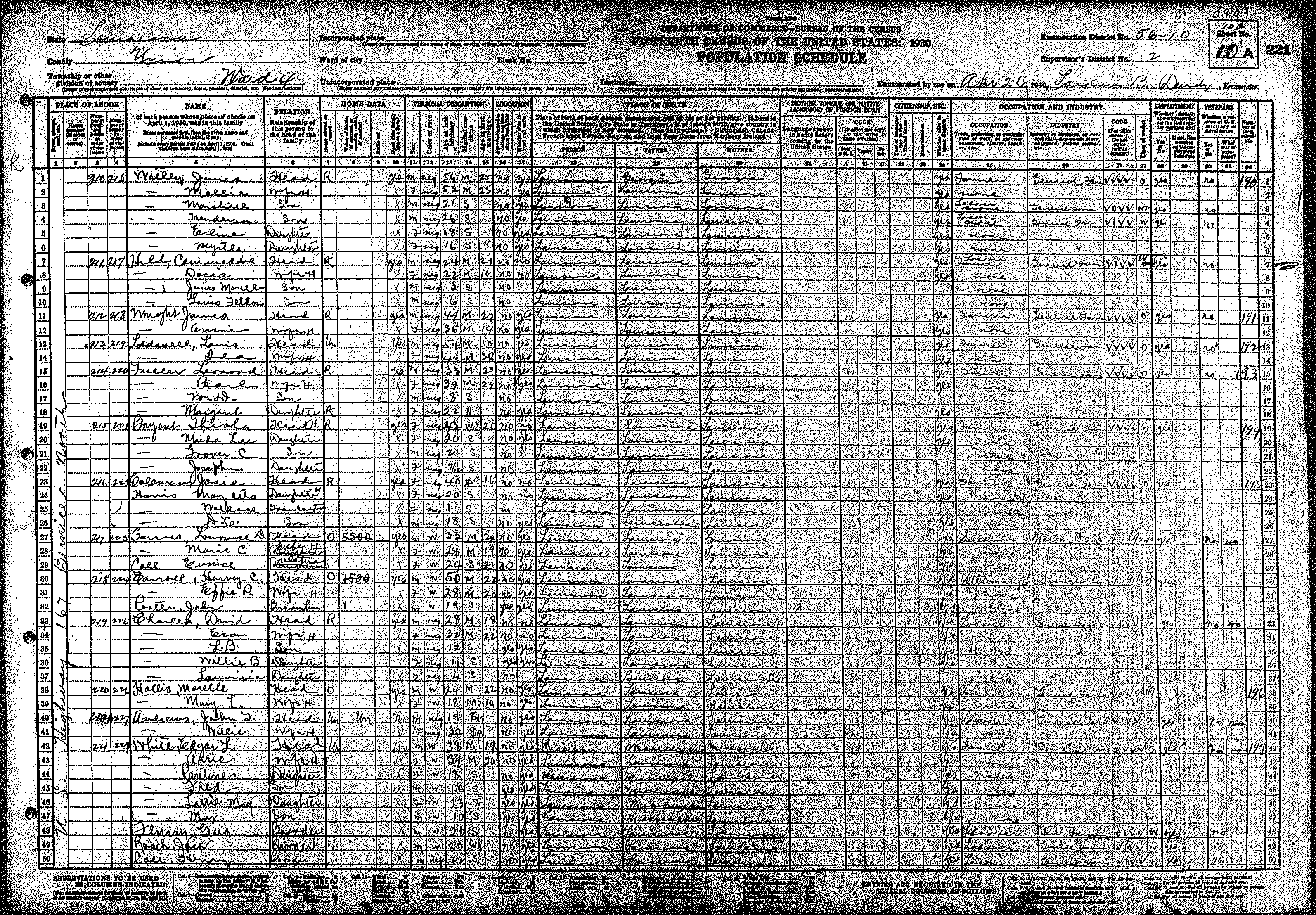
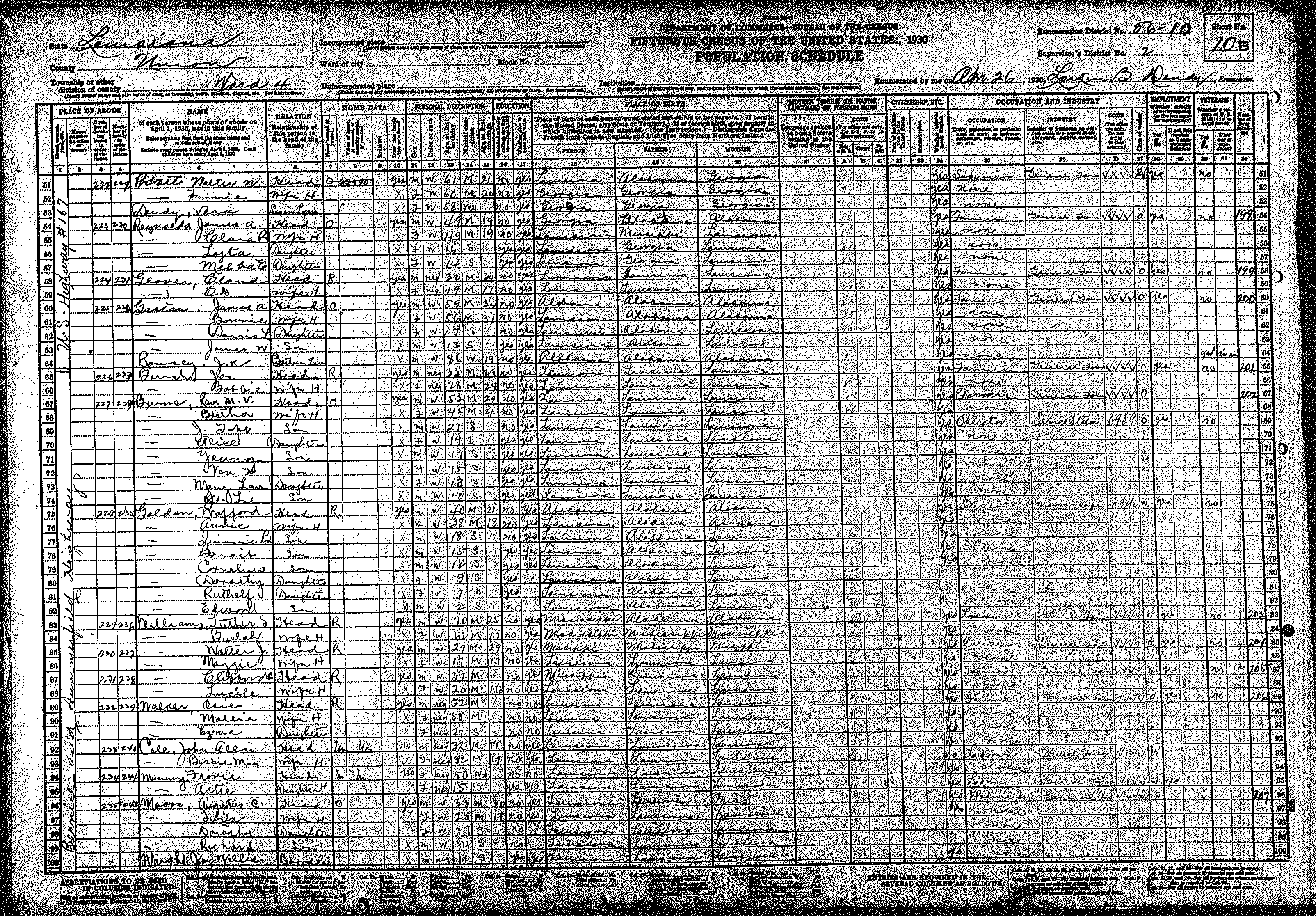
| 56 – 10 | Western Union Parish, including Weldon & Highway 167 towards Junction City | ||||||||||||||||||
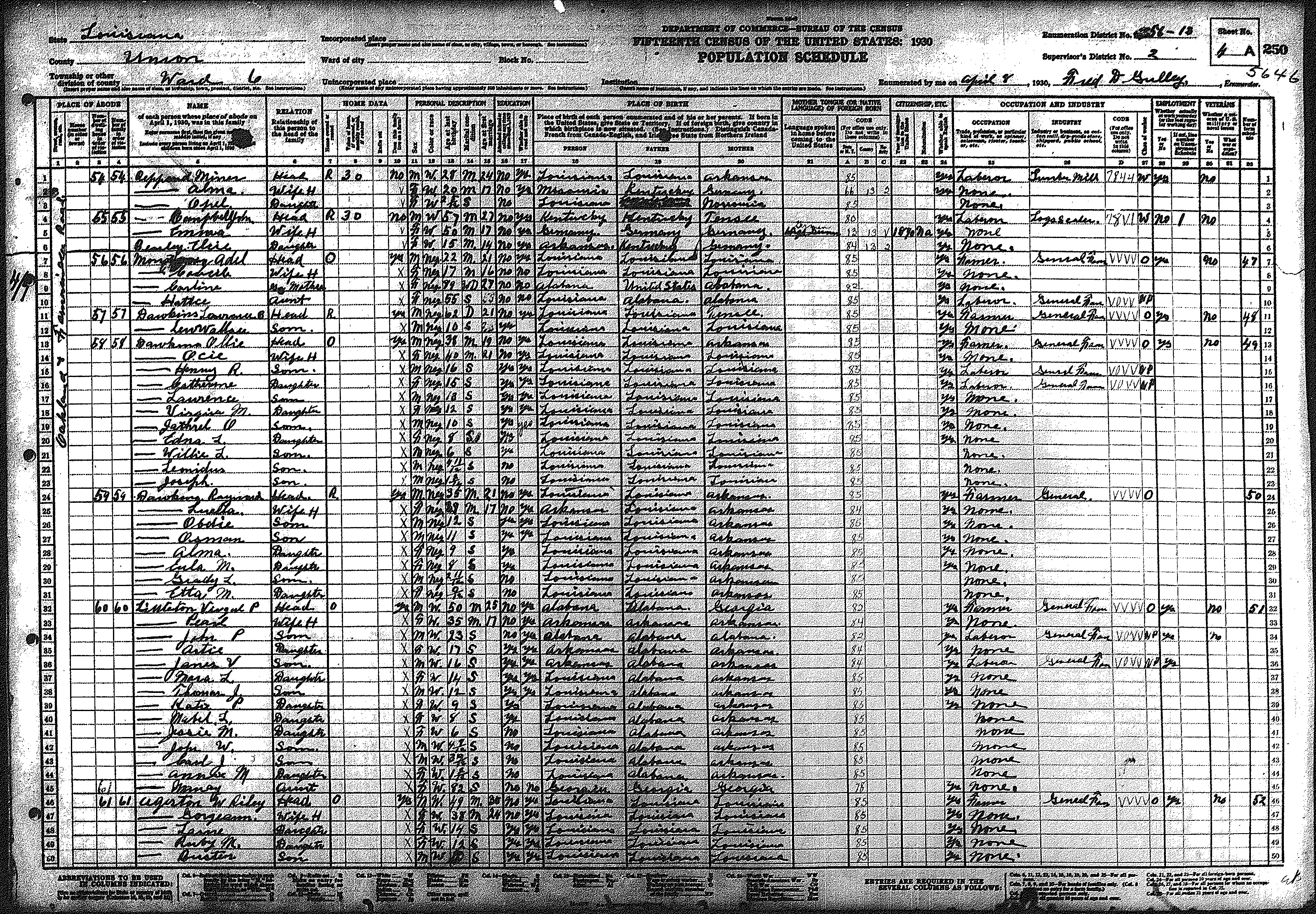
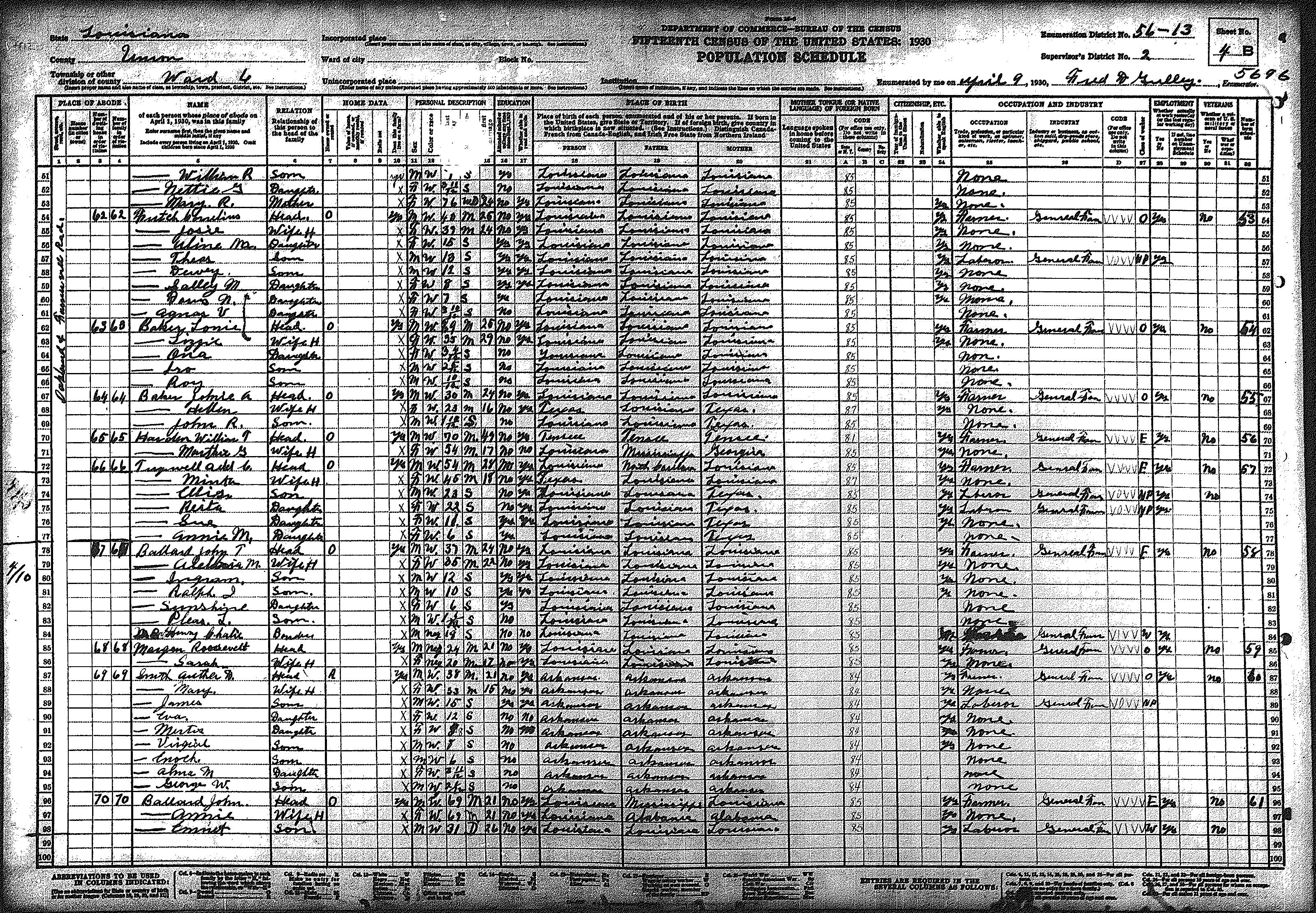
| 249 | 250 | 251 | 252 | 253 | 254 | 255 | 256 | 257 | 258 | 259 | 260 | 261 | 262 | 263 | |||||
| 264 | 265 | 266 | 267 | 268 | 269 | 270 | |||||||||||||
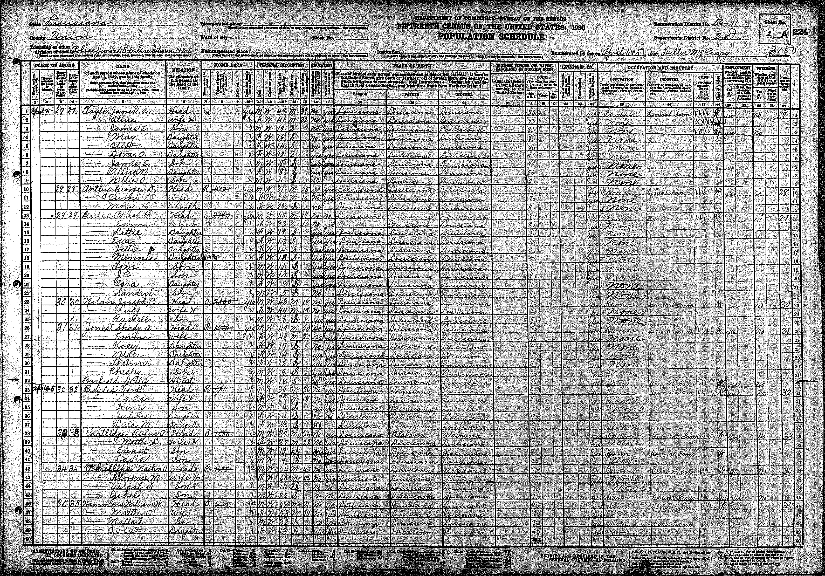
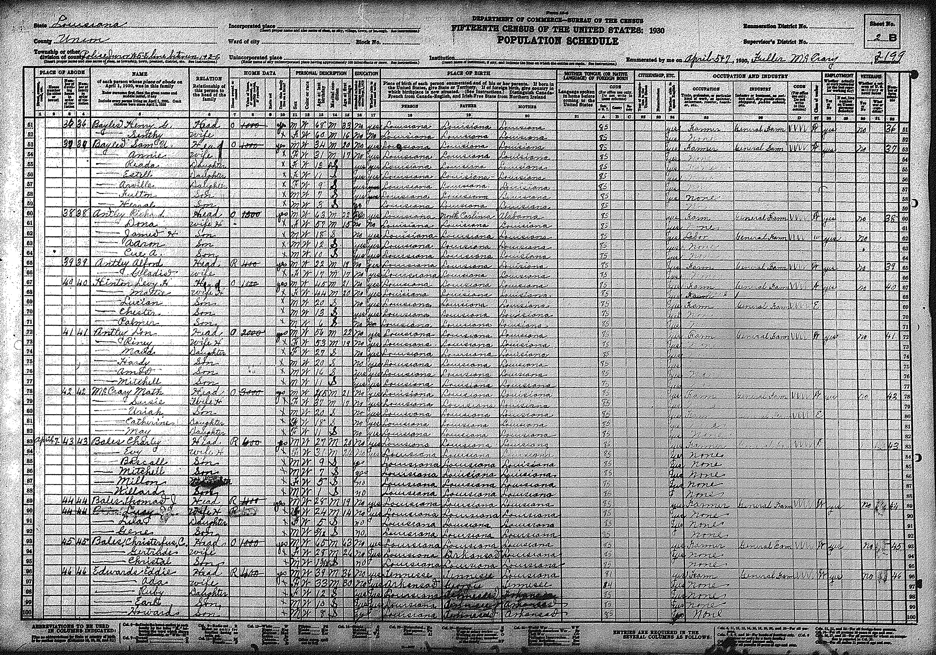
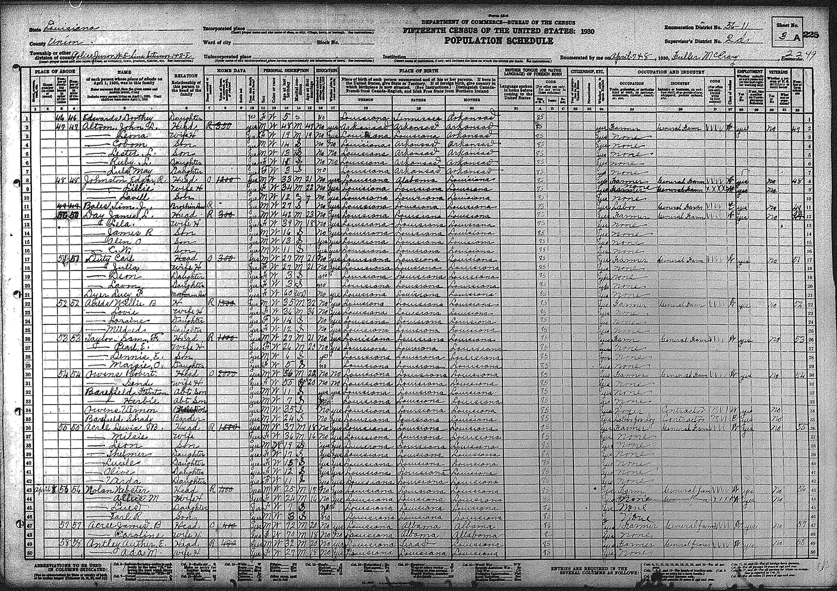
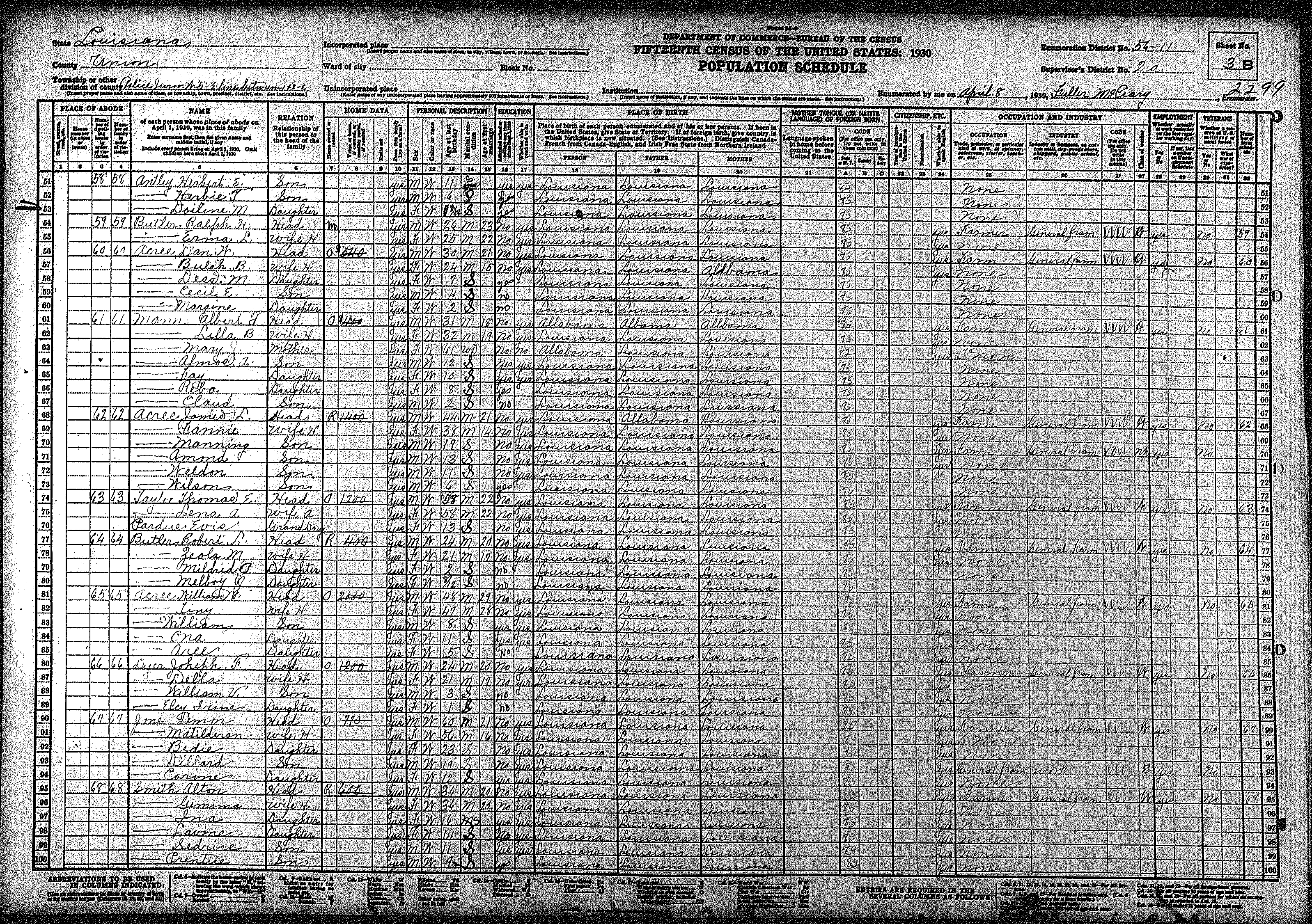
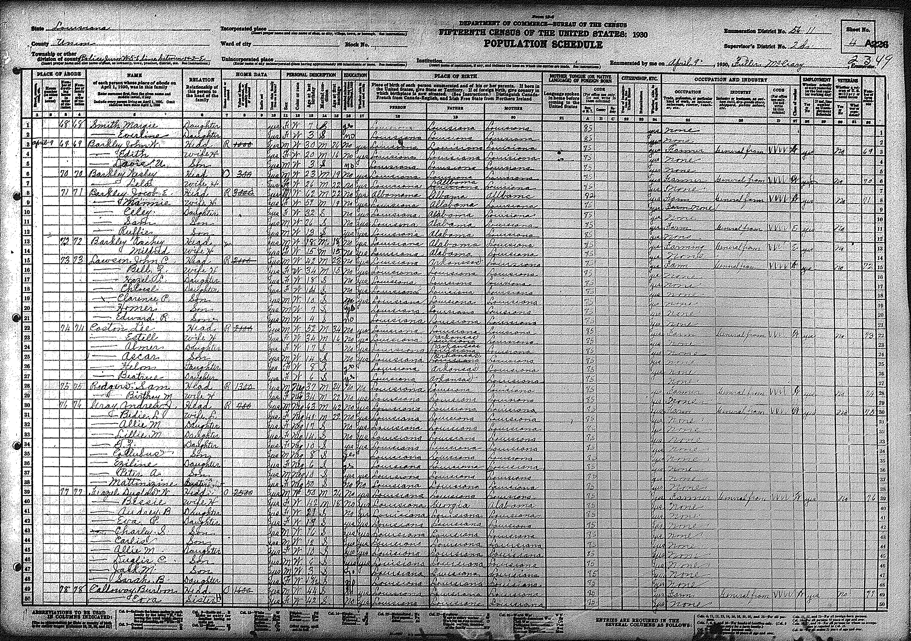
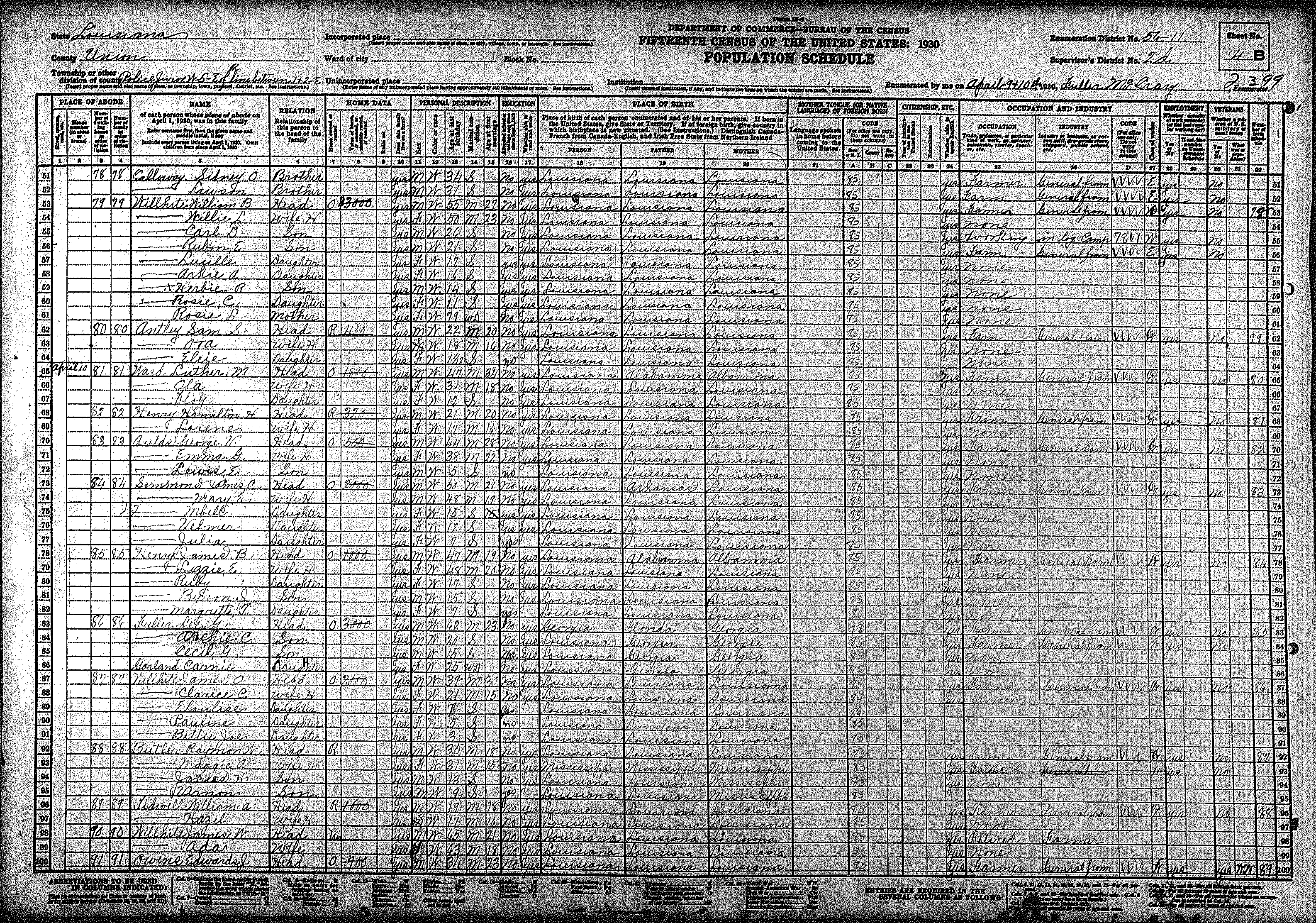
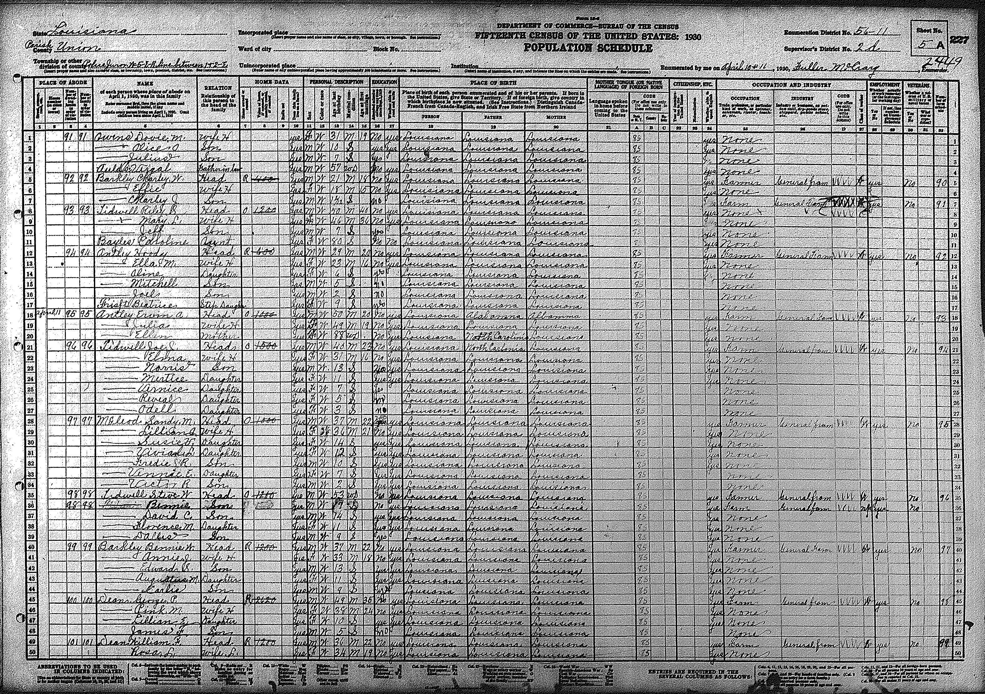
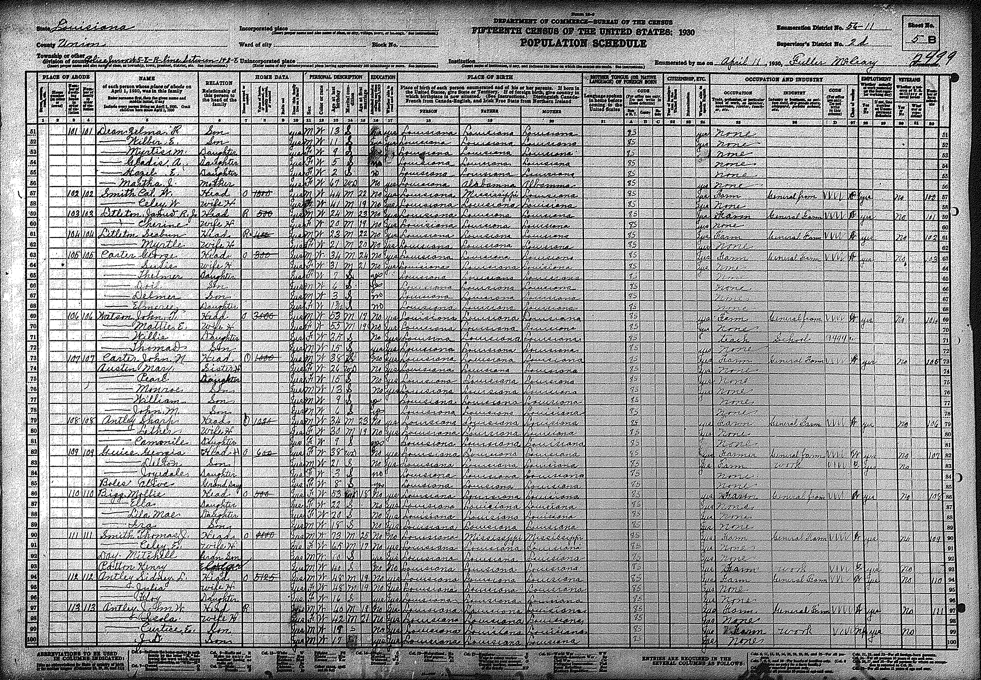
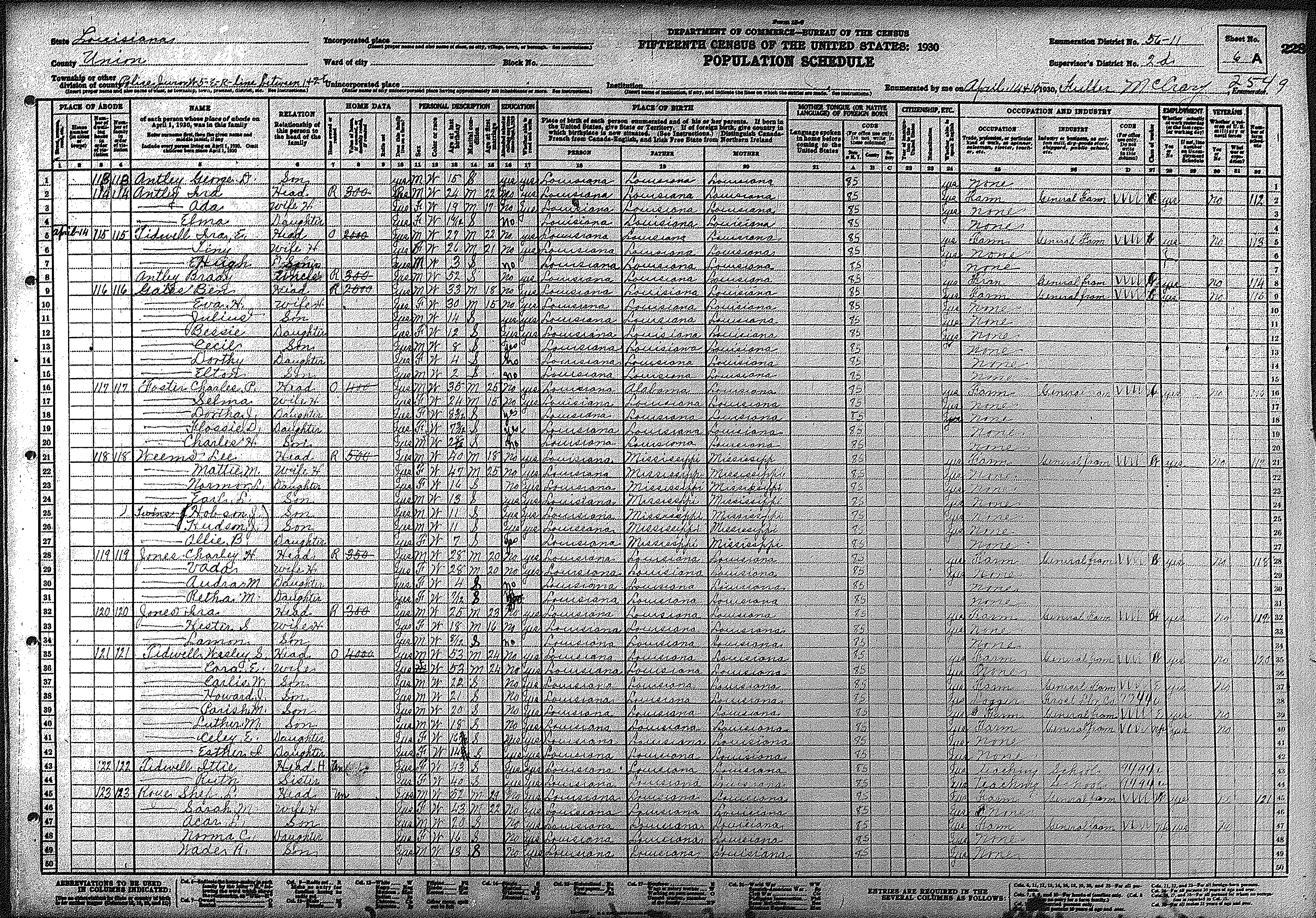
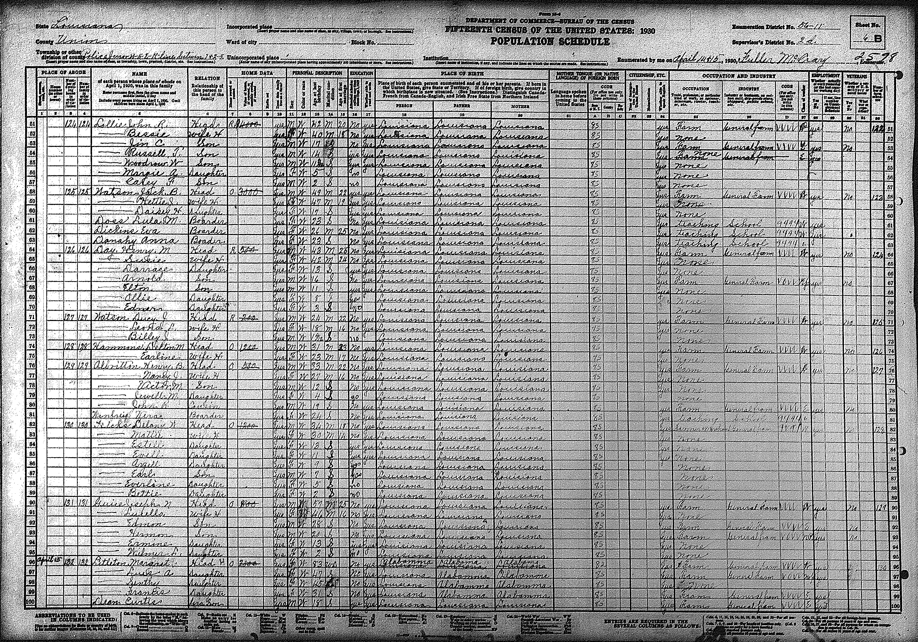
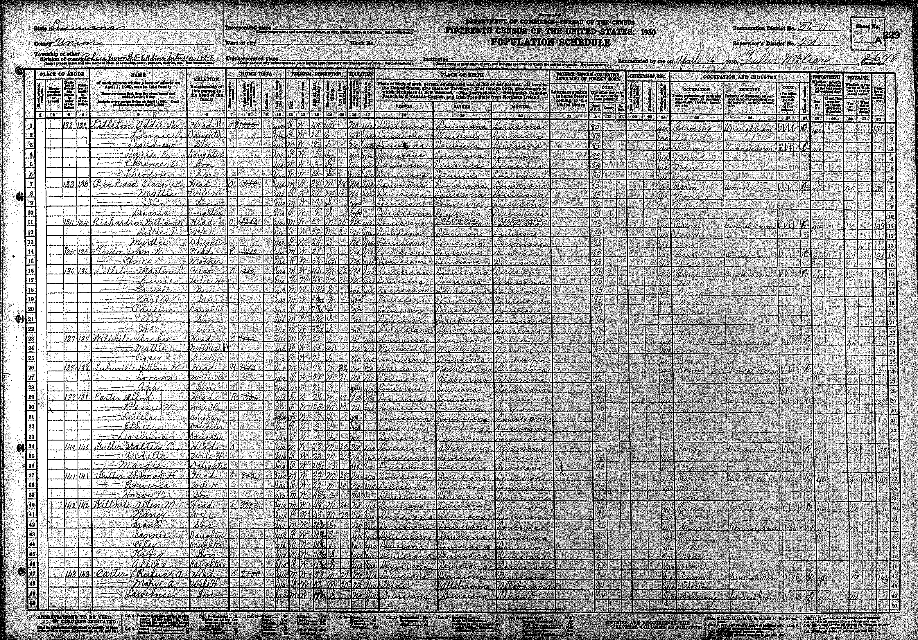
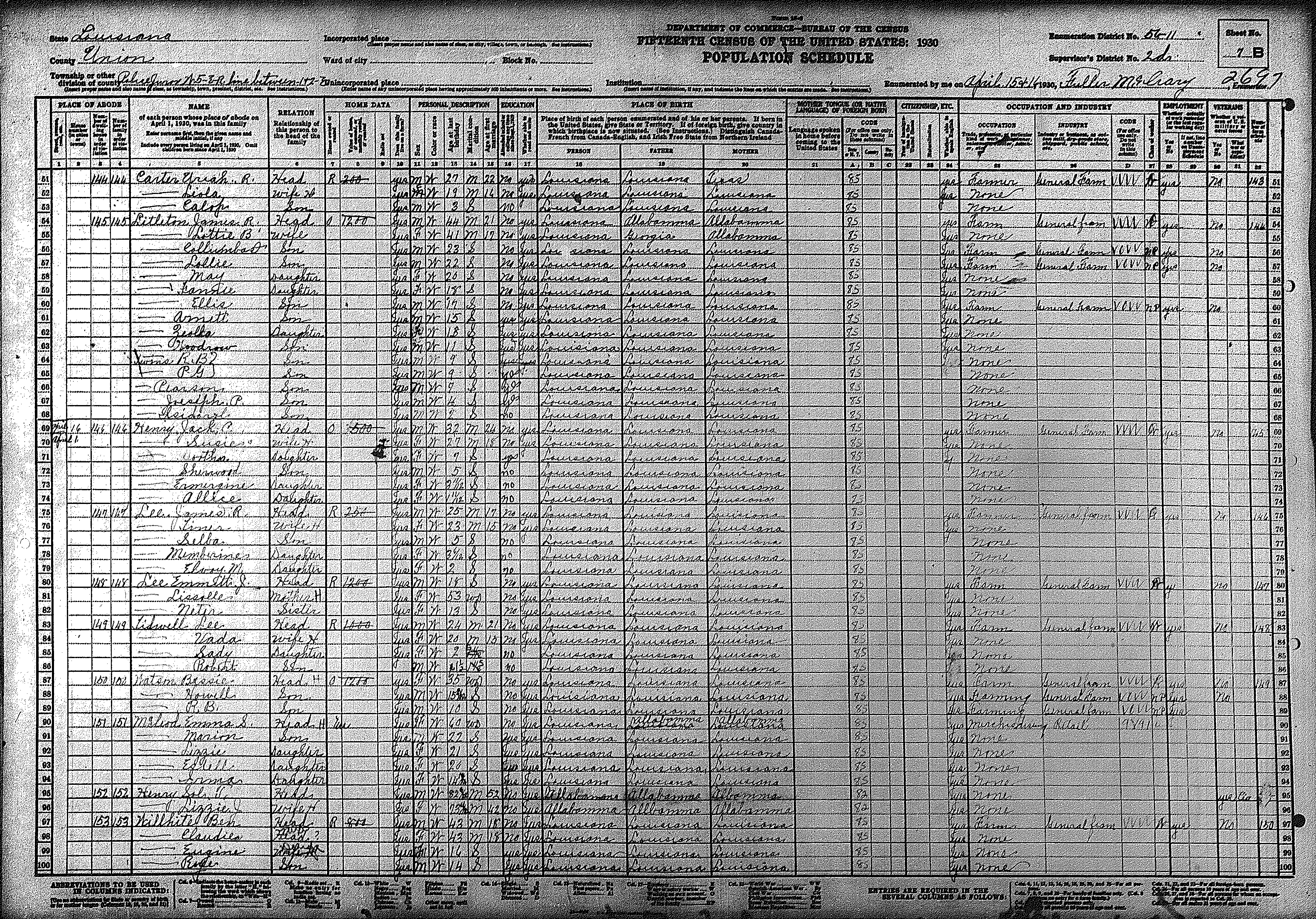
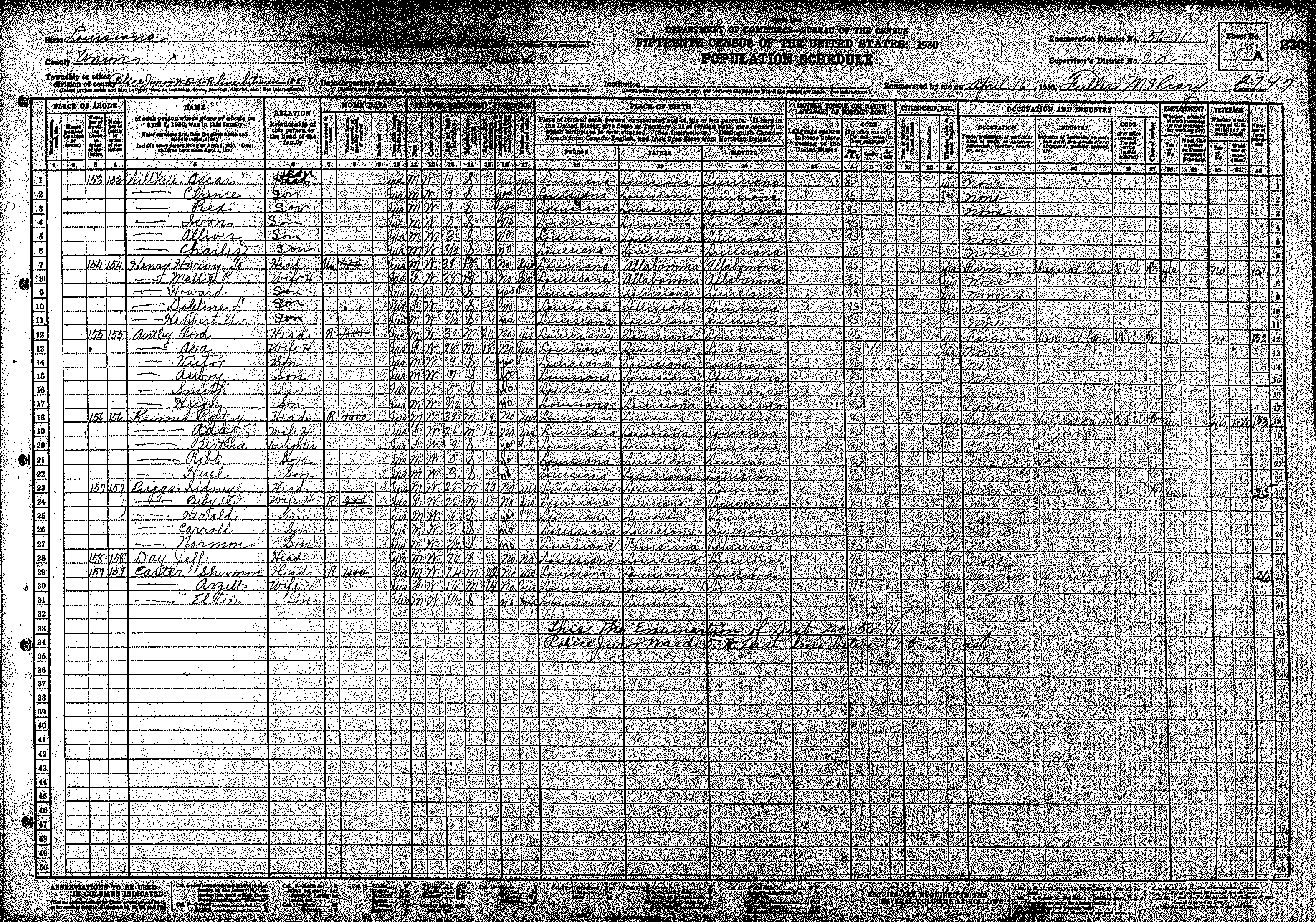
| 5 | 56 – 11 | Southeastern Union Parish including the communities of Point & Willhite | |||||||||||||||||
| 271 | 272 | 273 | 274 | 275 | 276 | 277 | 278 | 279 | 280 | 281 | 282 | 283 | 284 | 285 | |||||
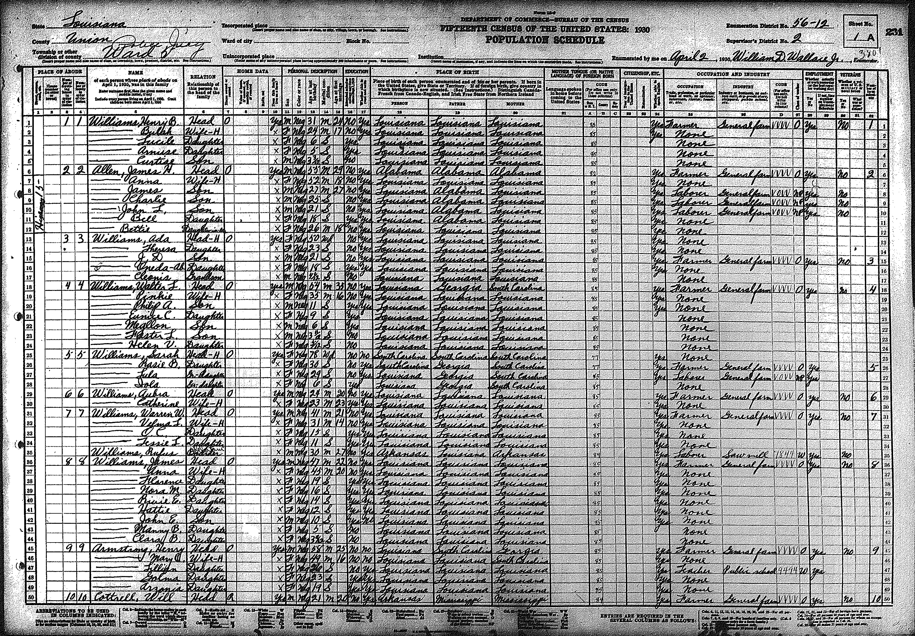
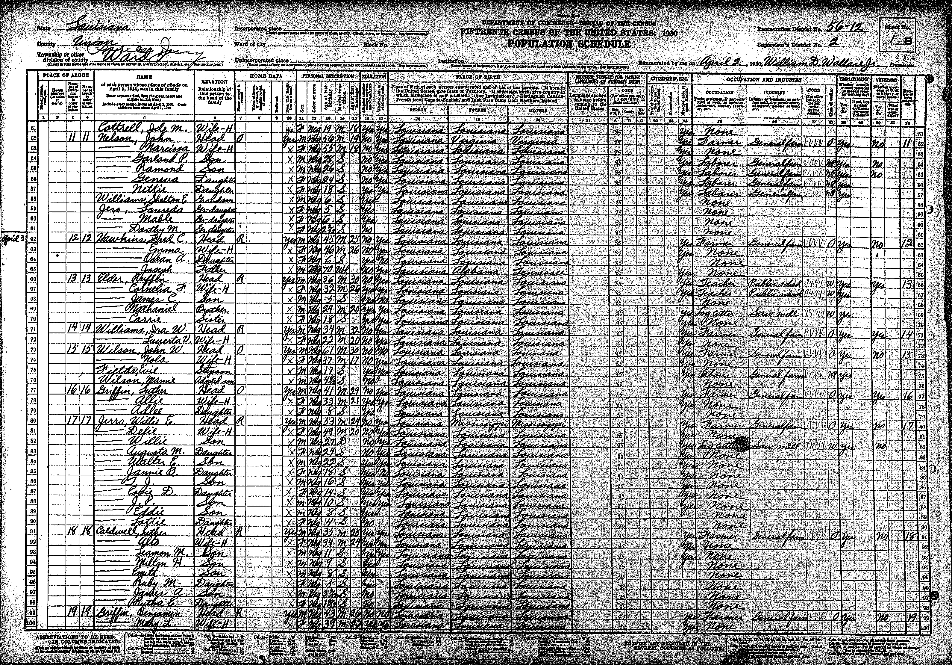
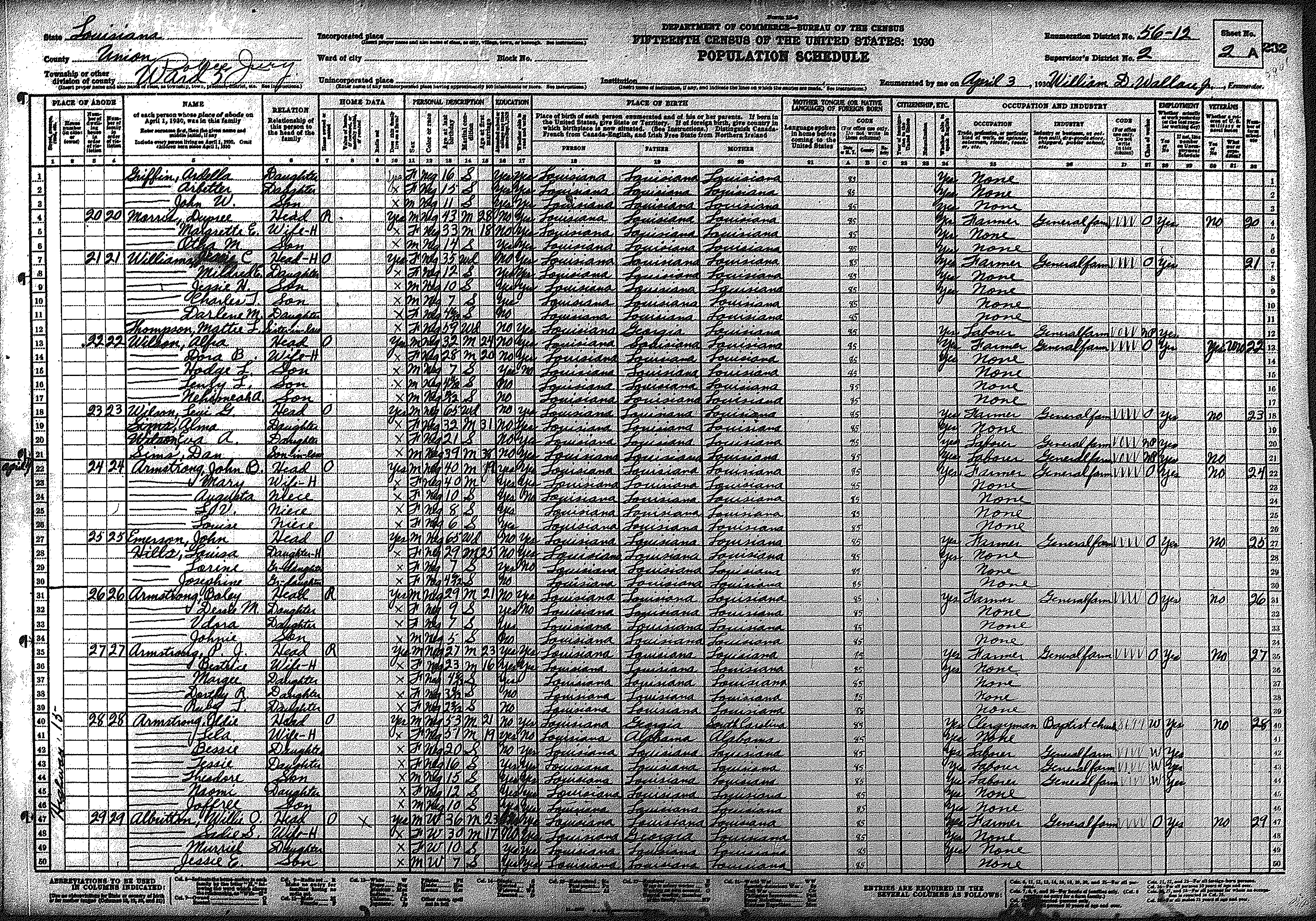
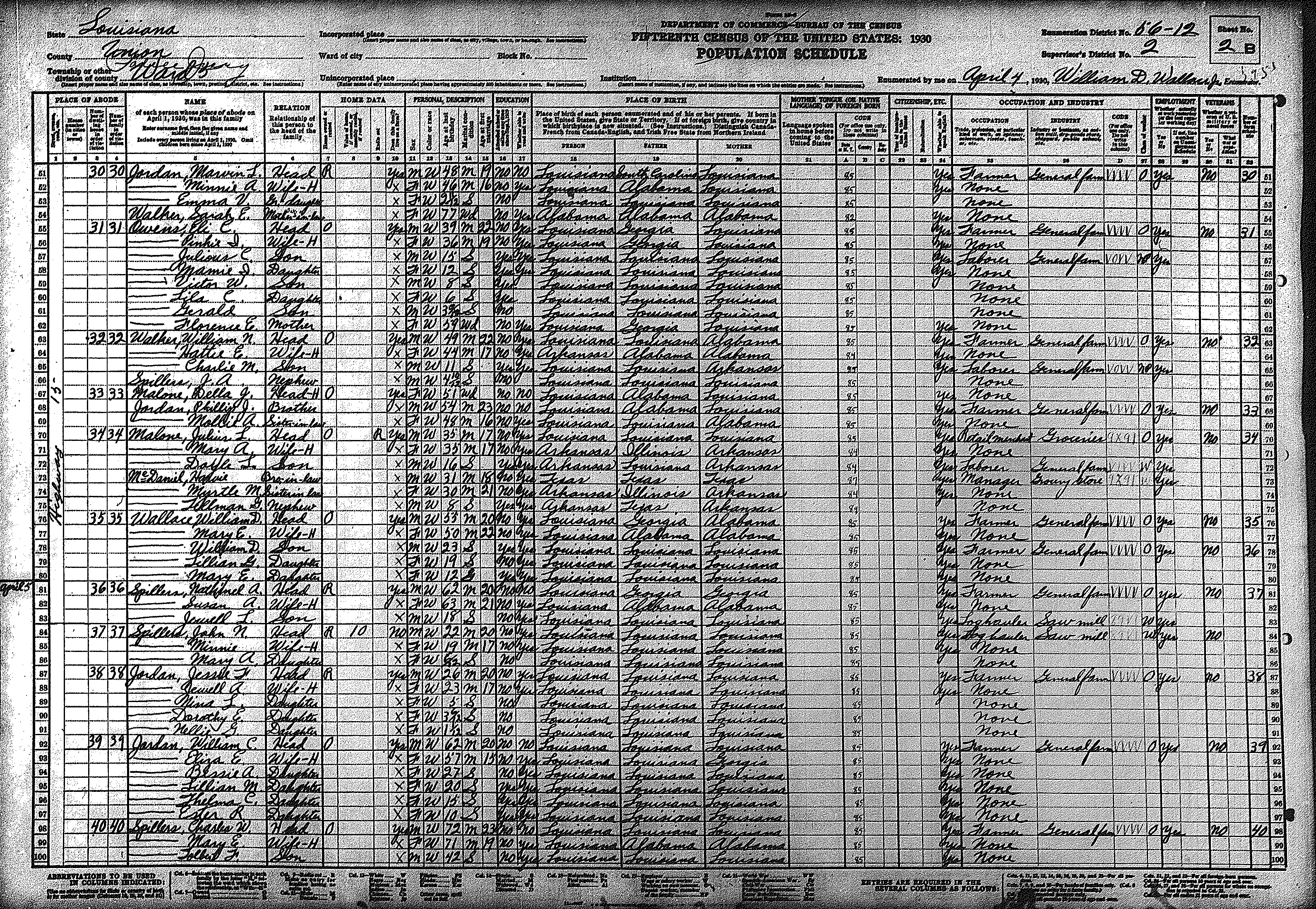
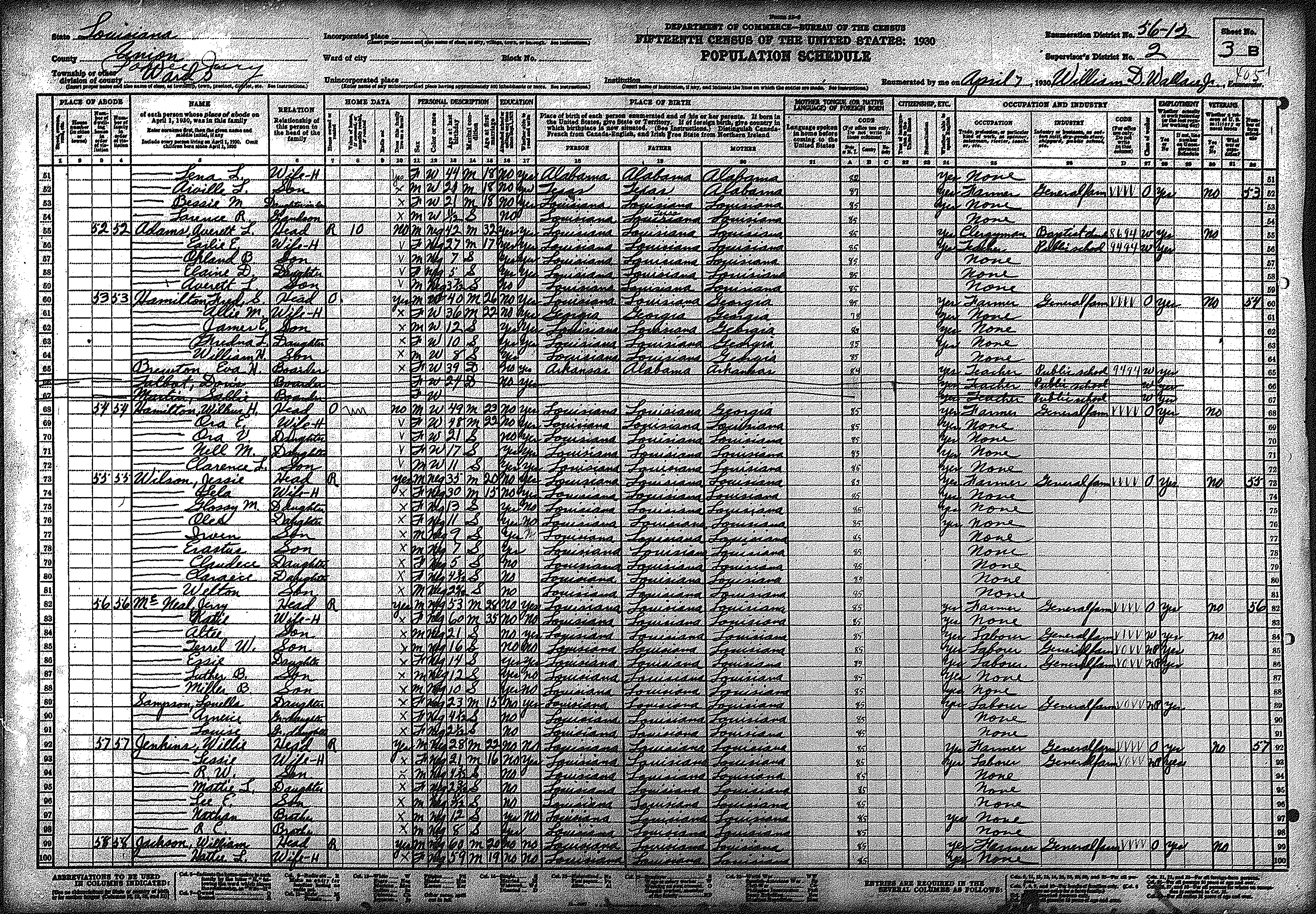
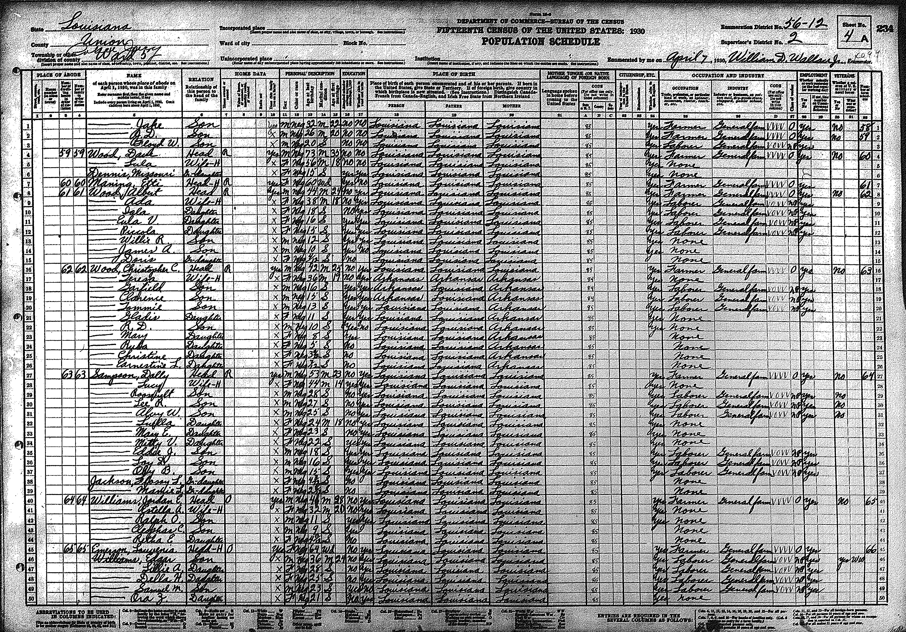
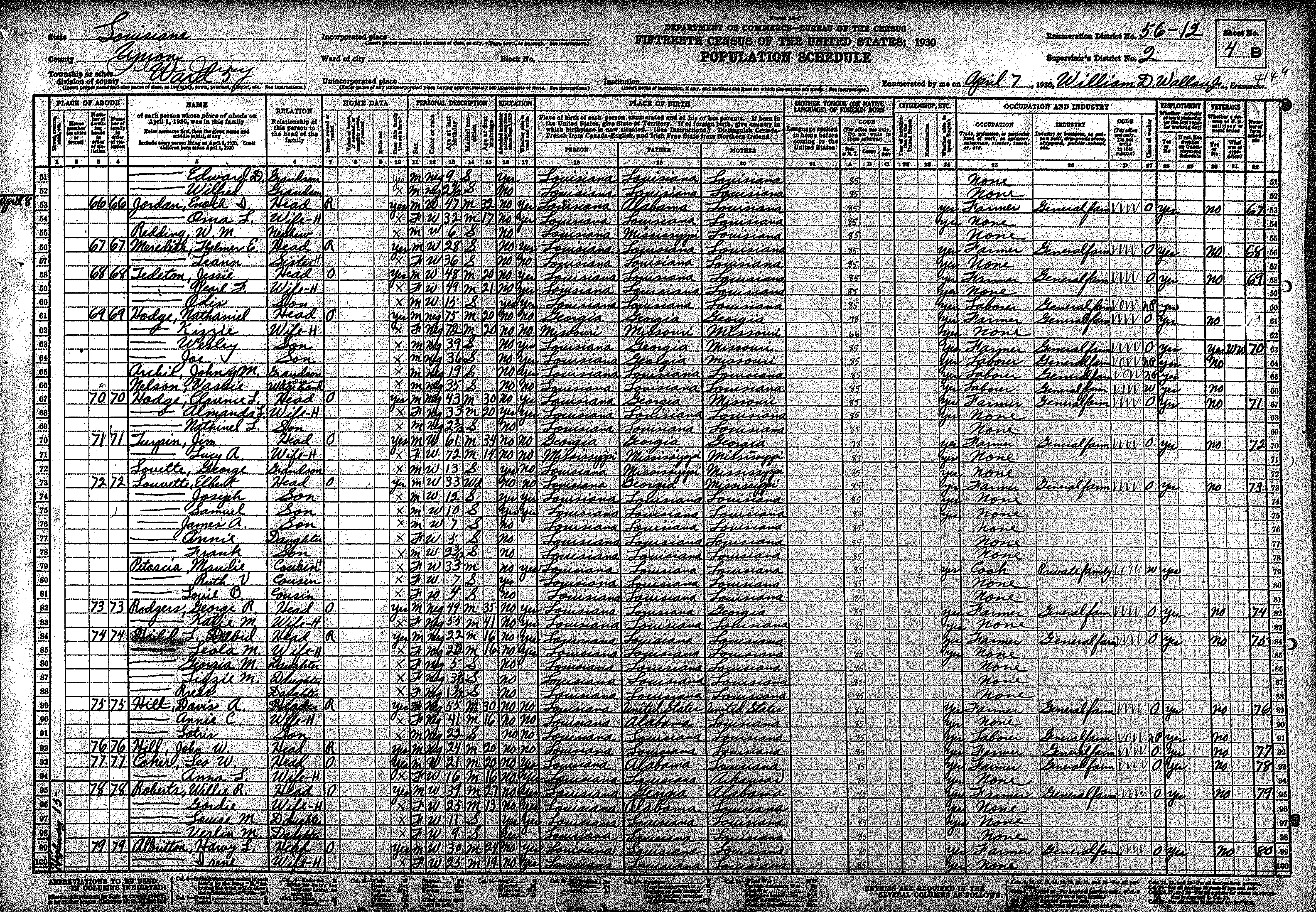
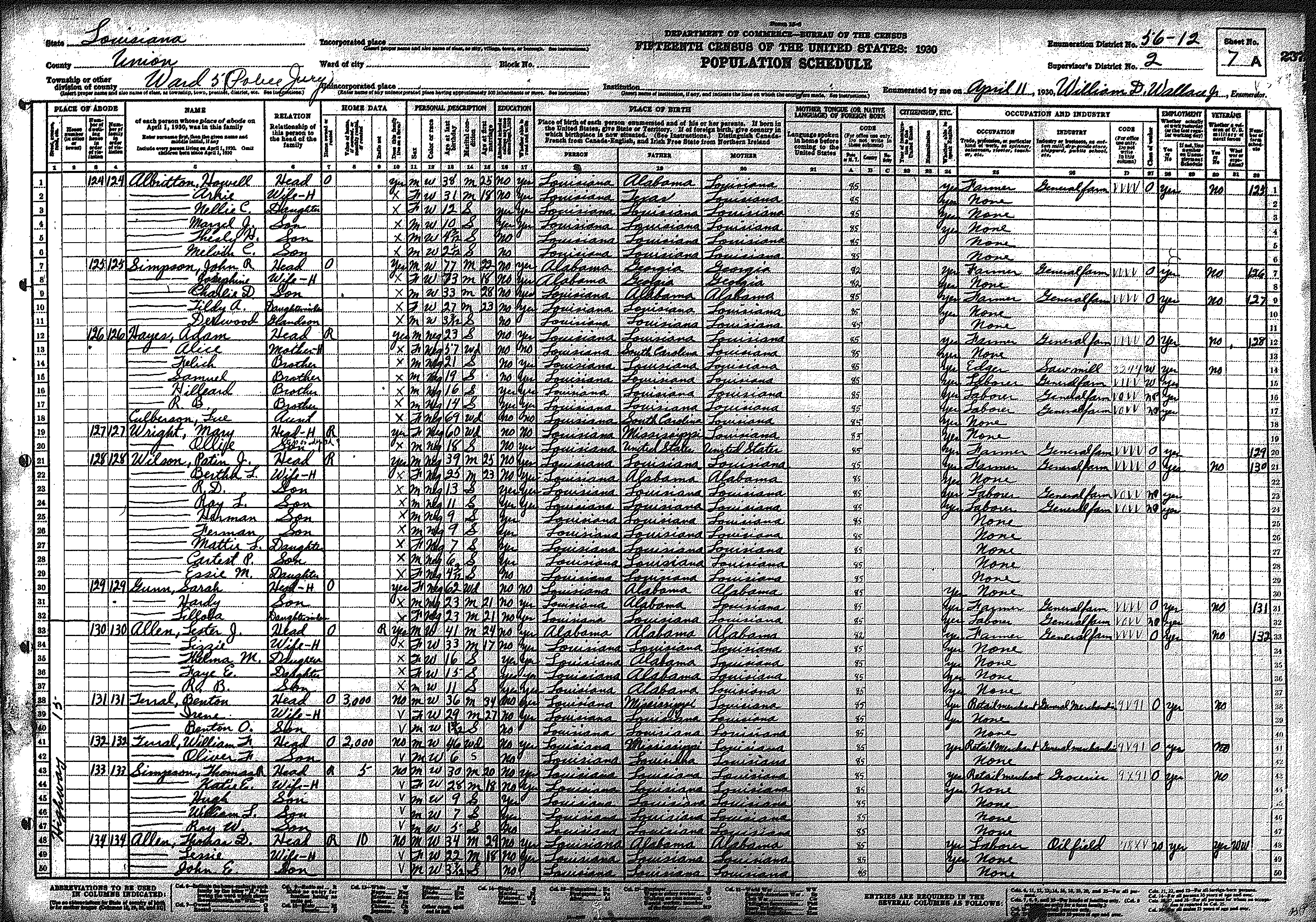
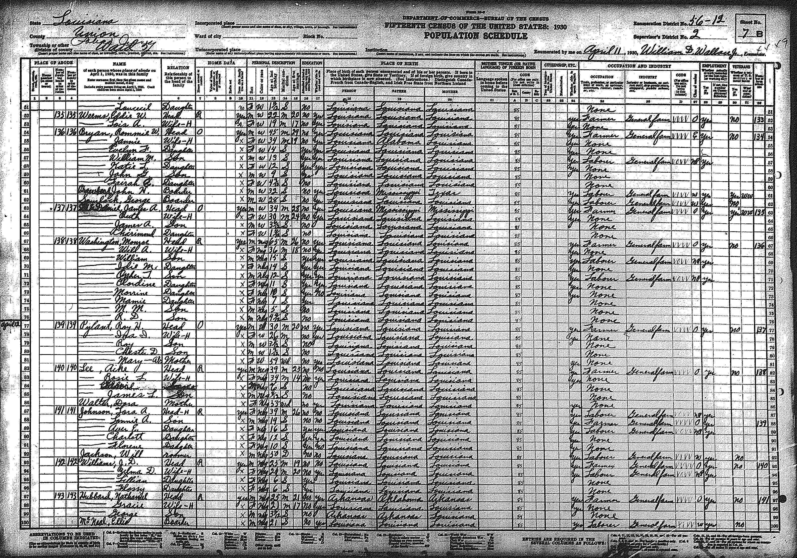
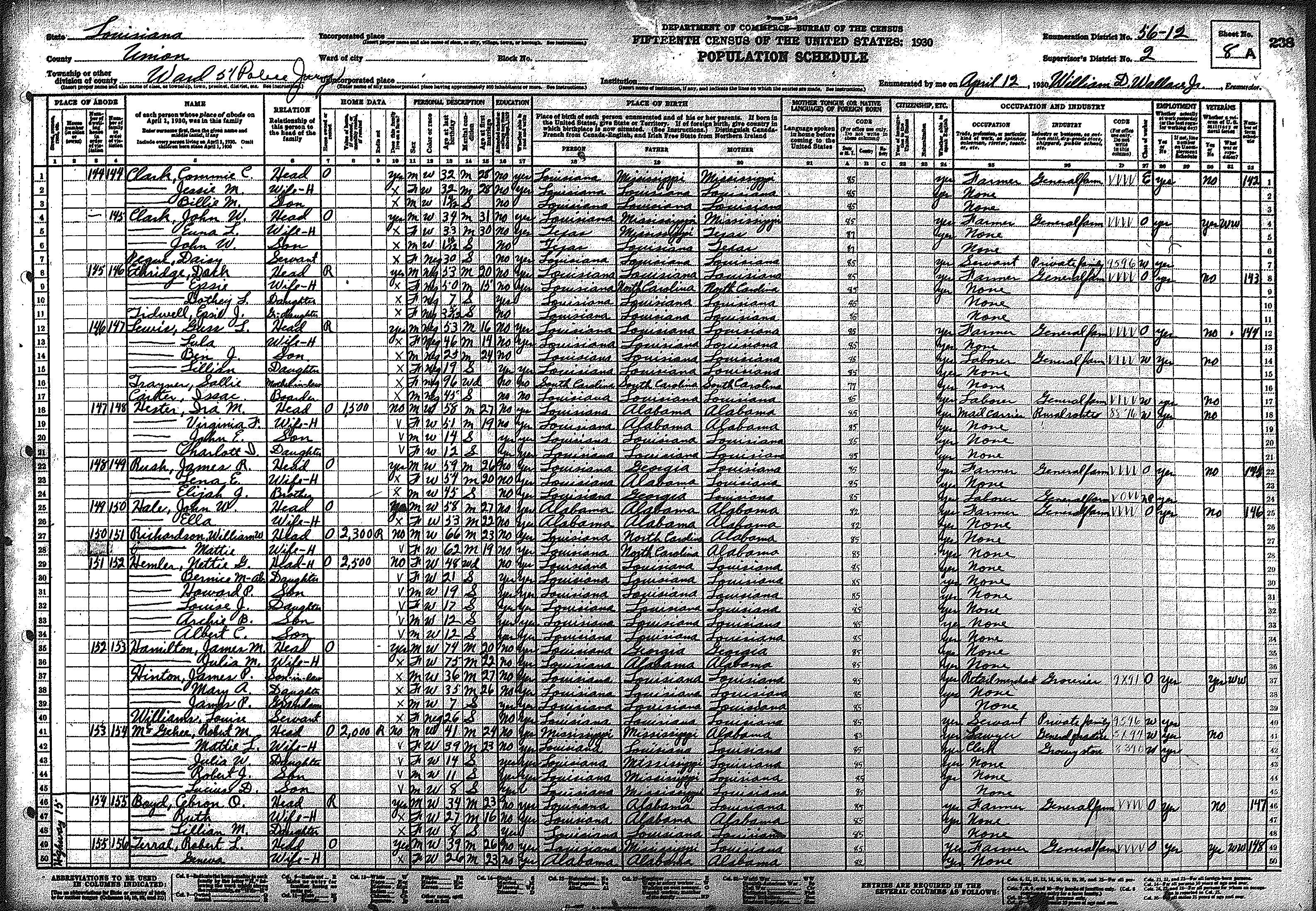
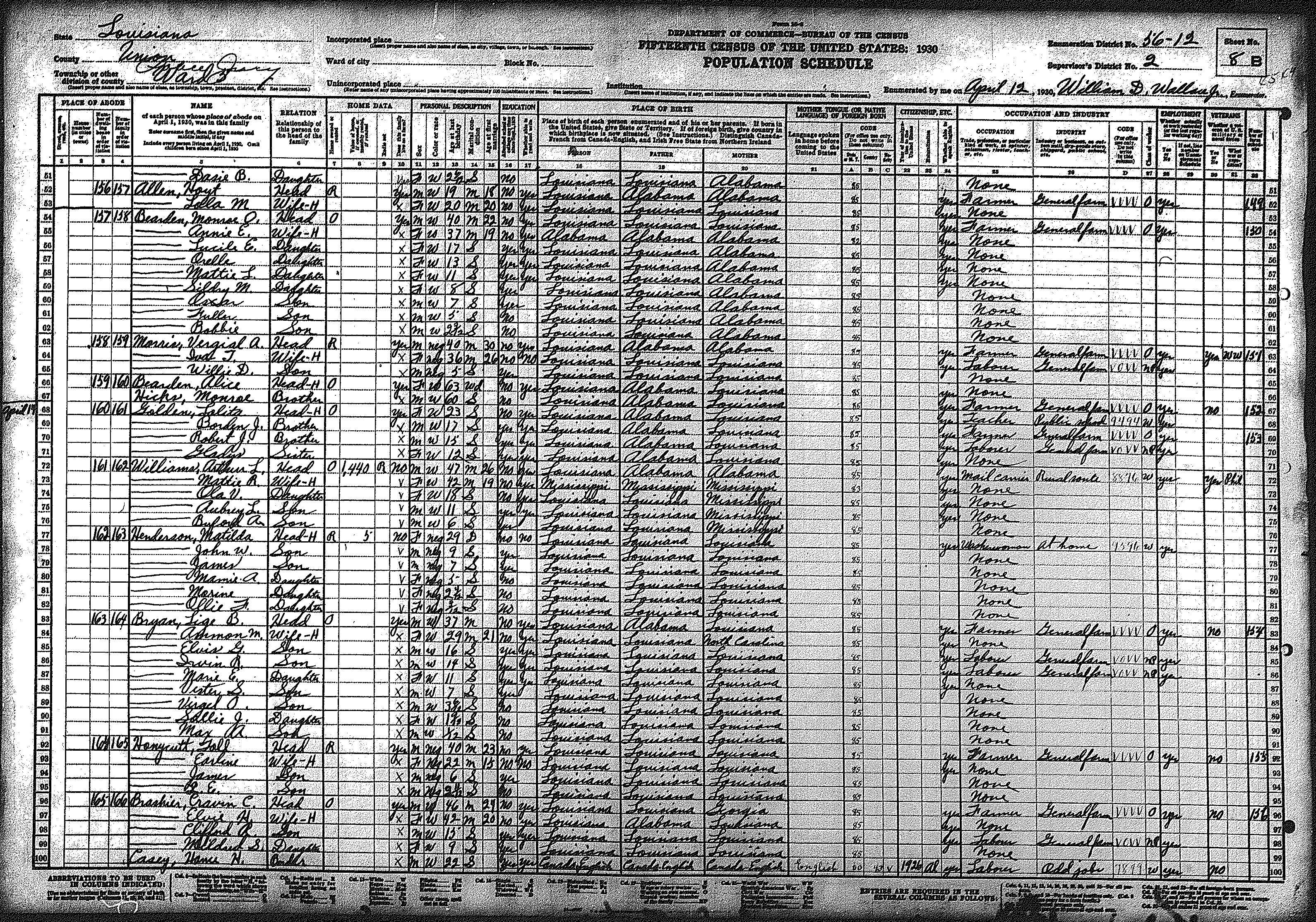
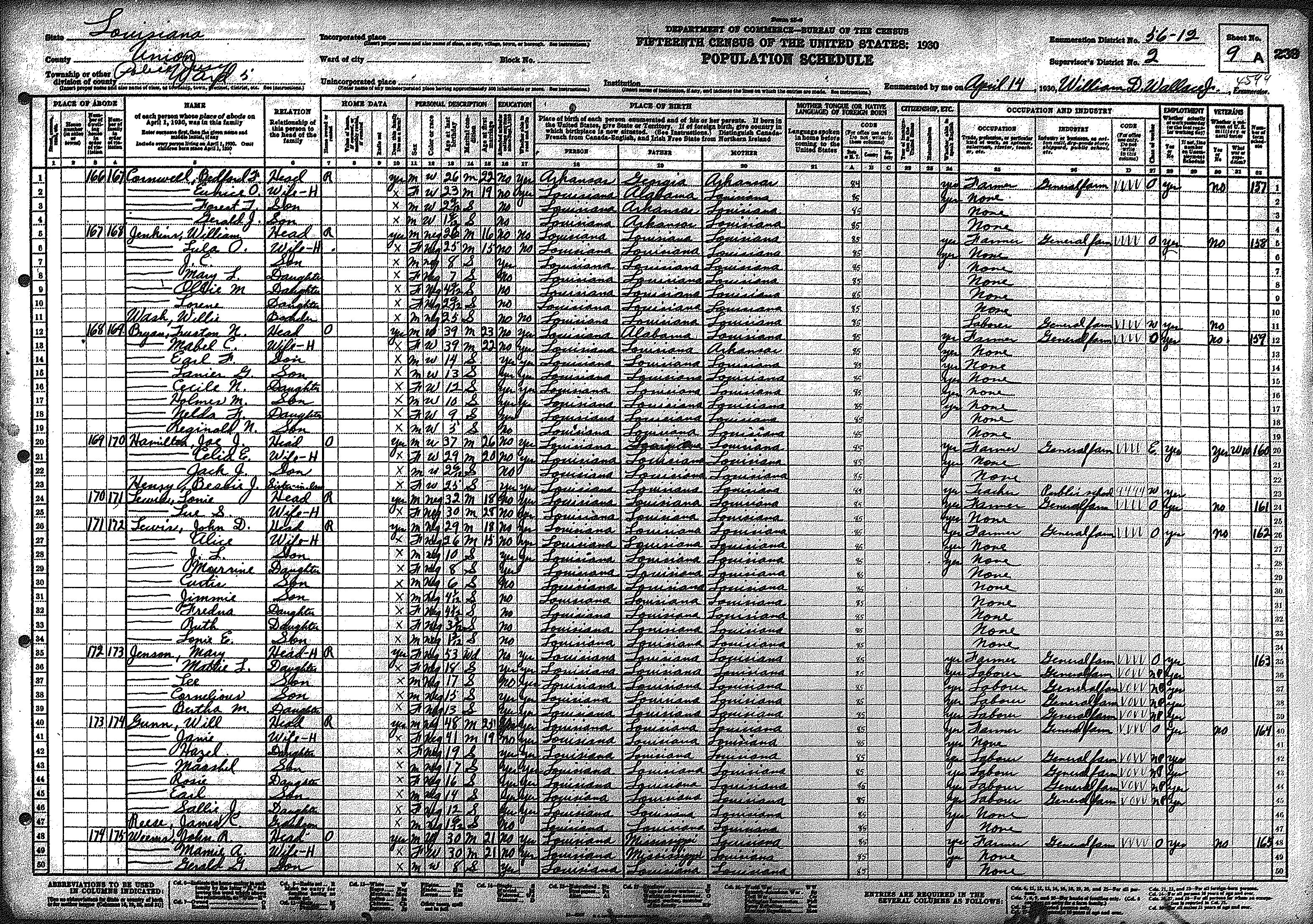
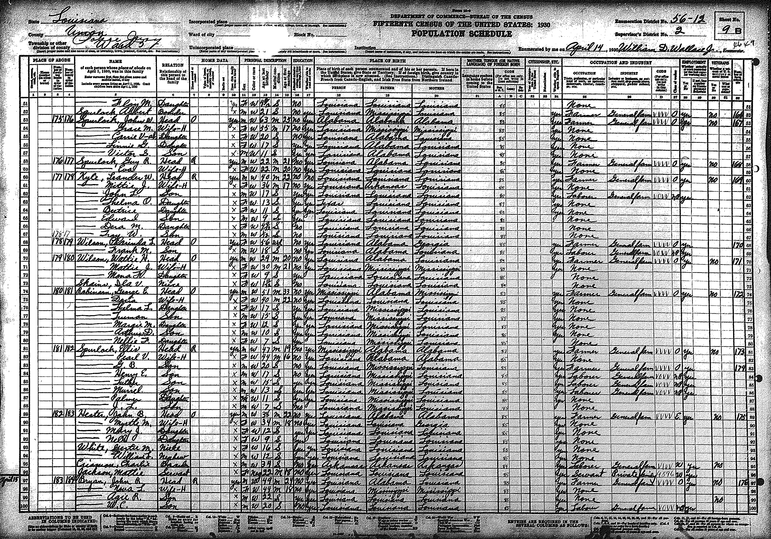
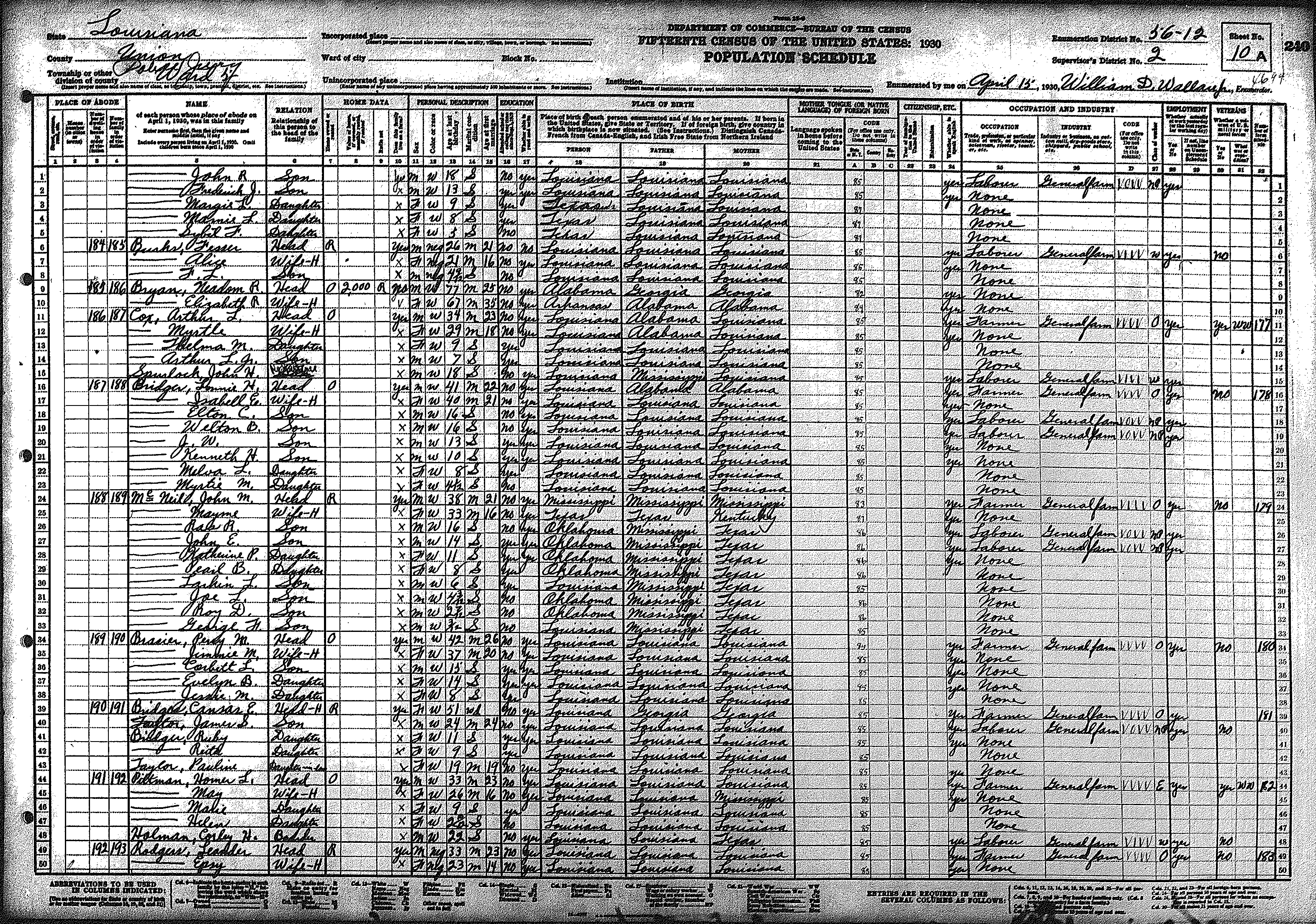
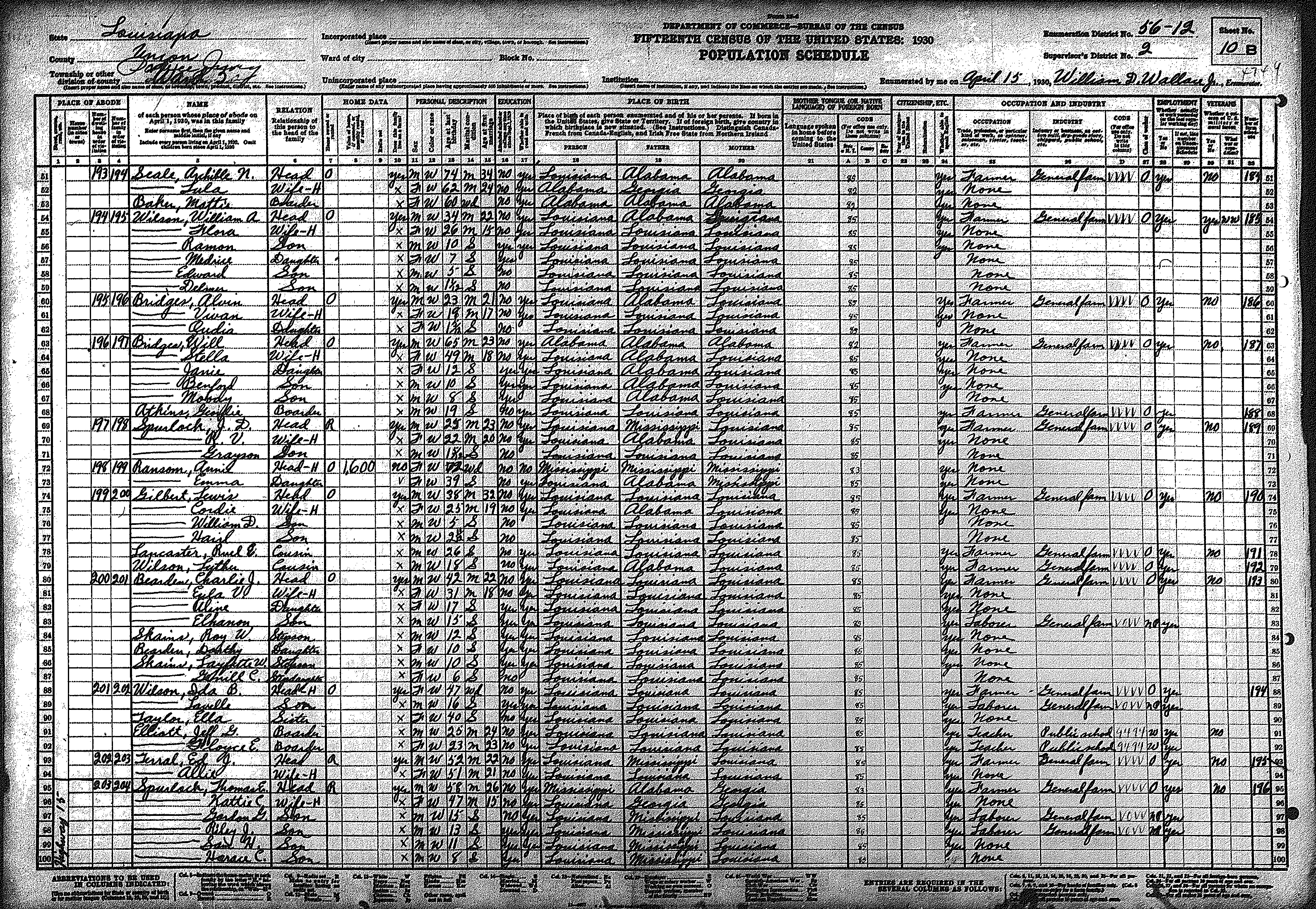
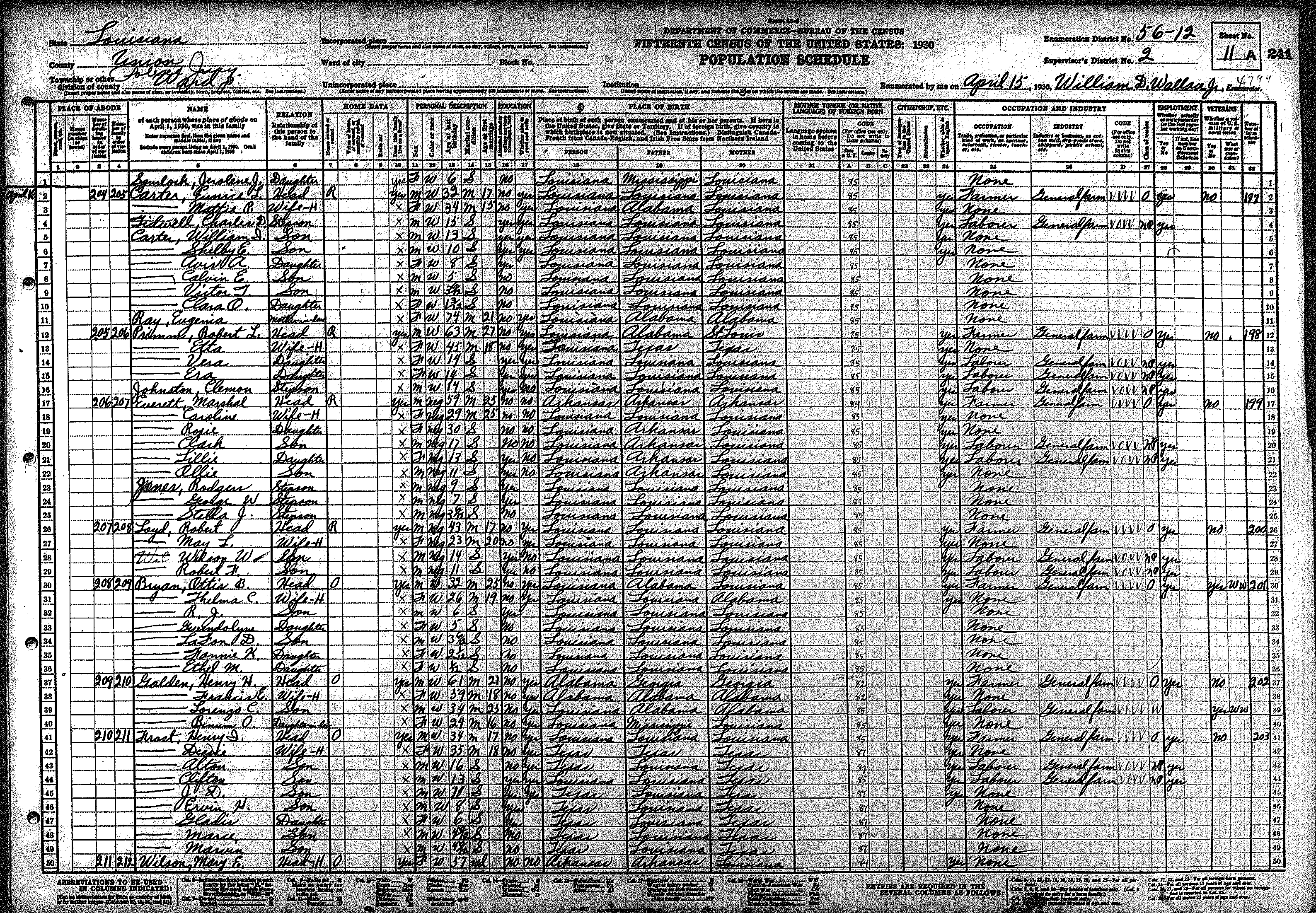
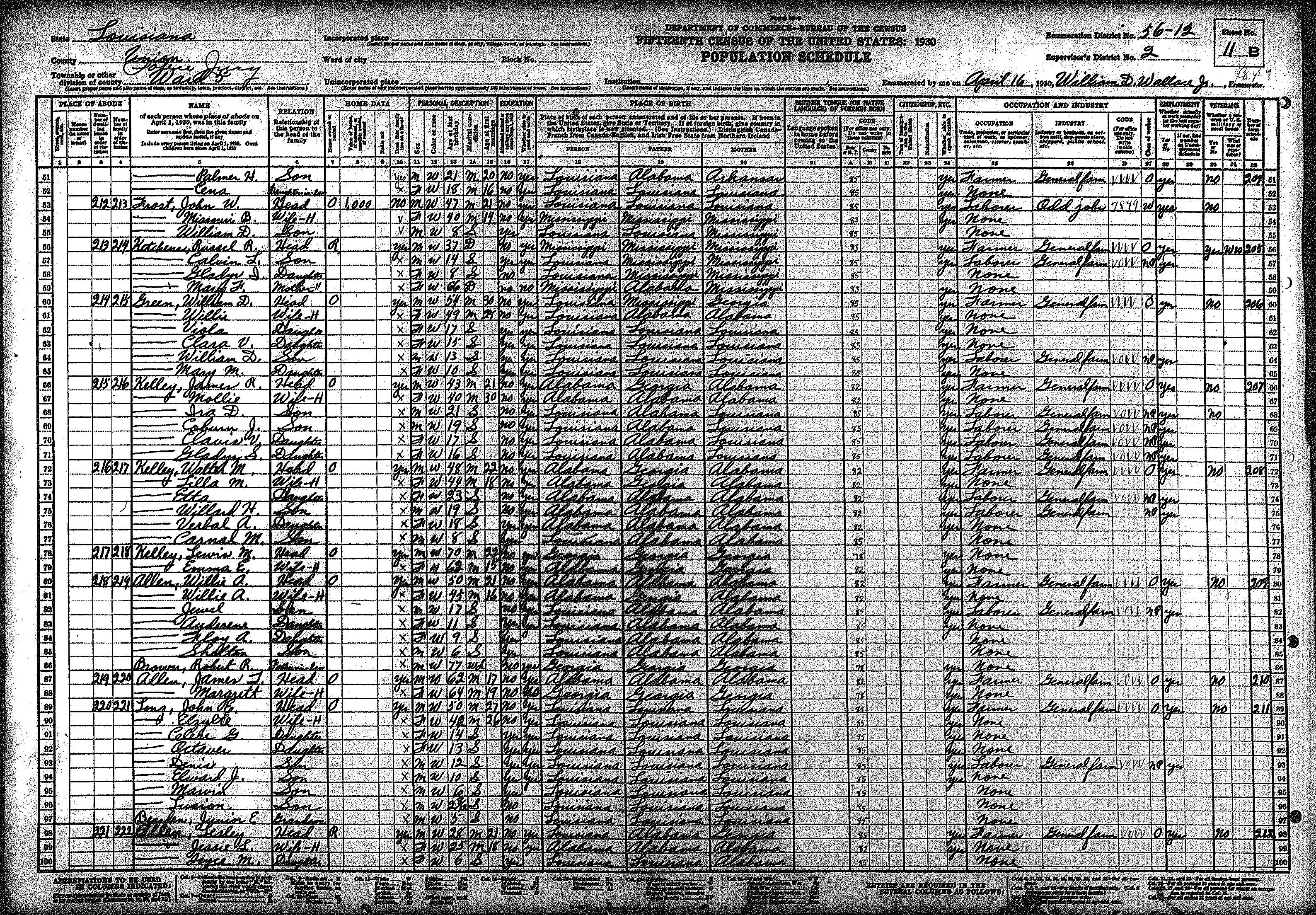
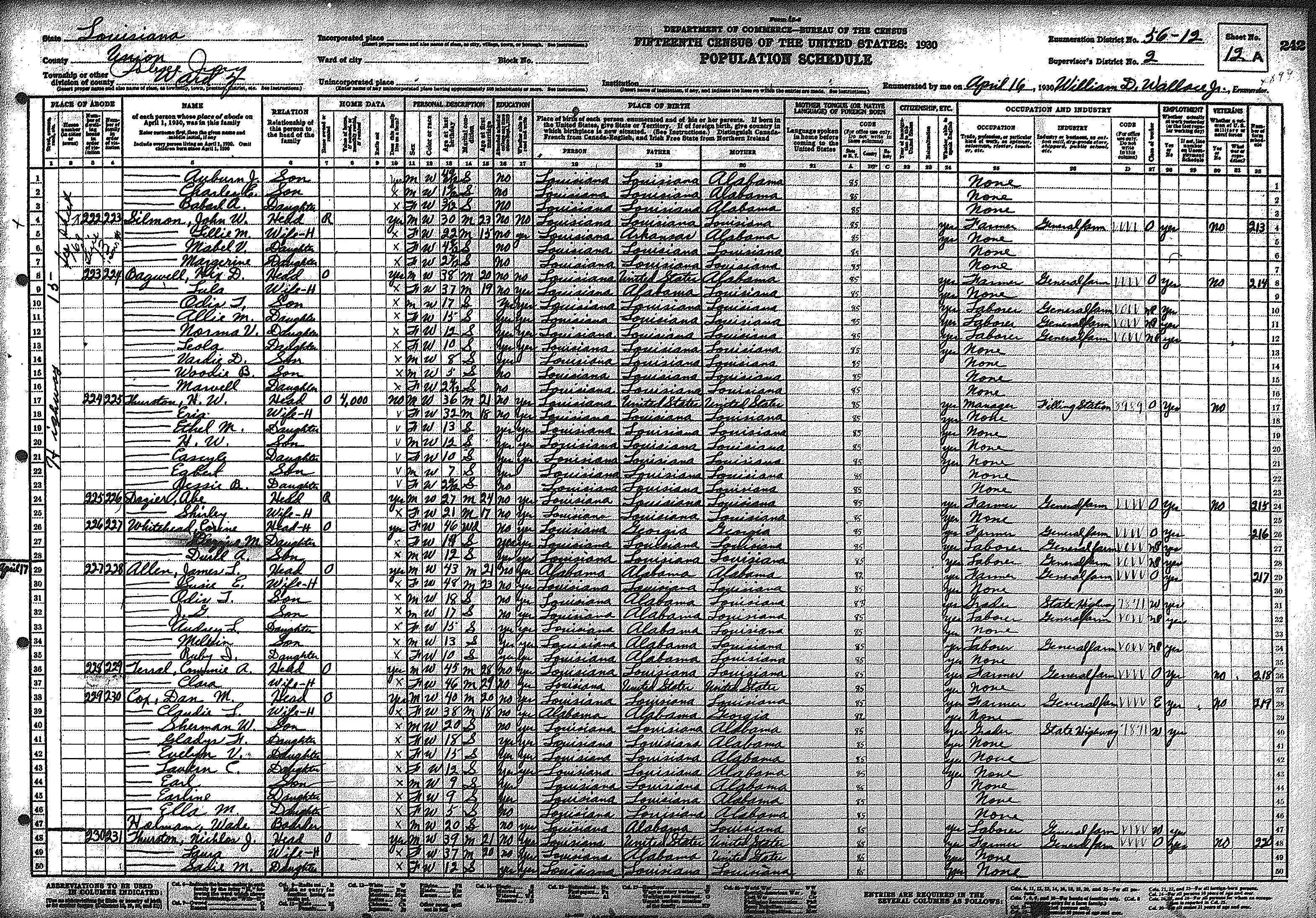
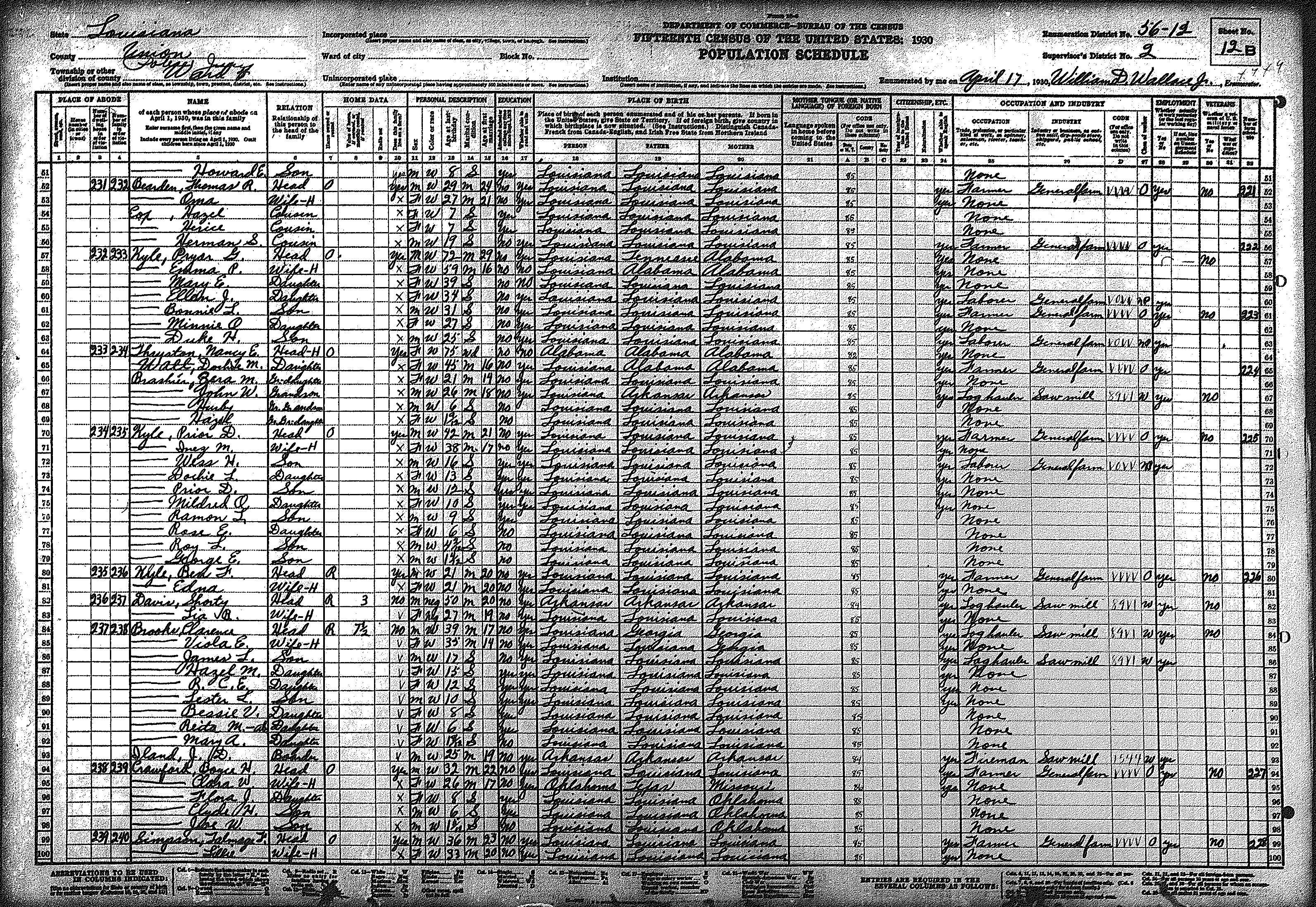
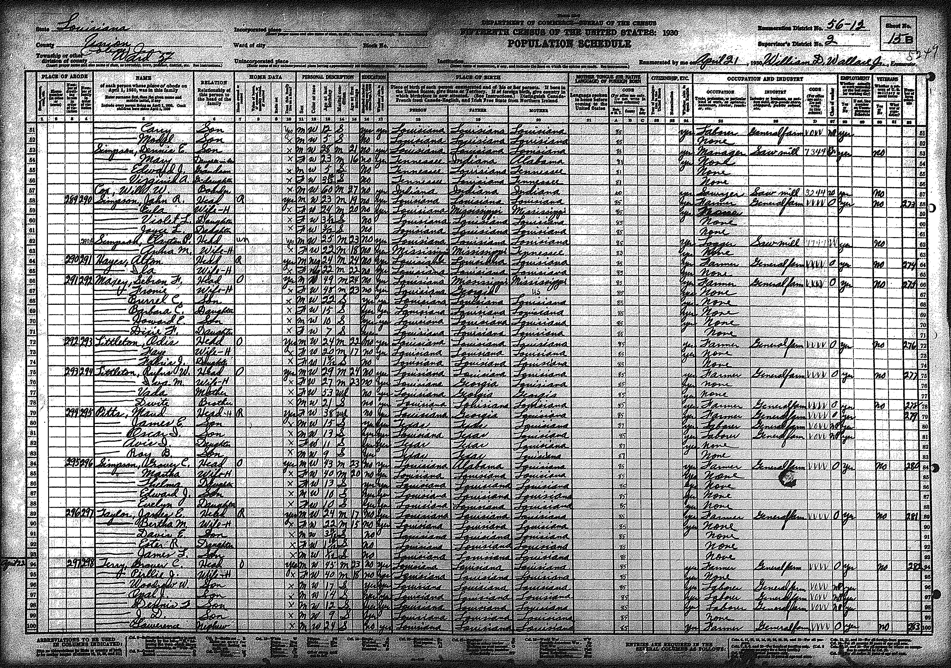
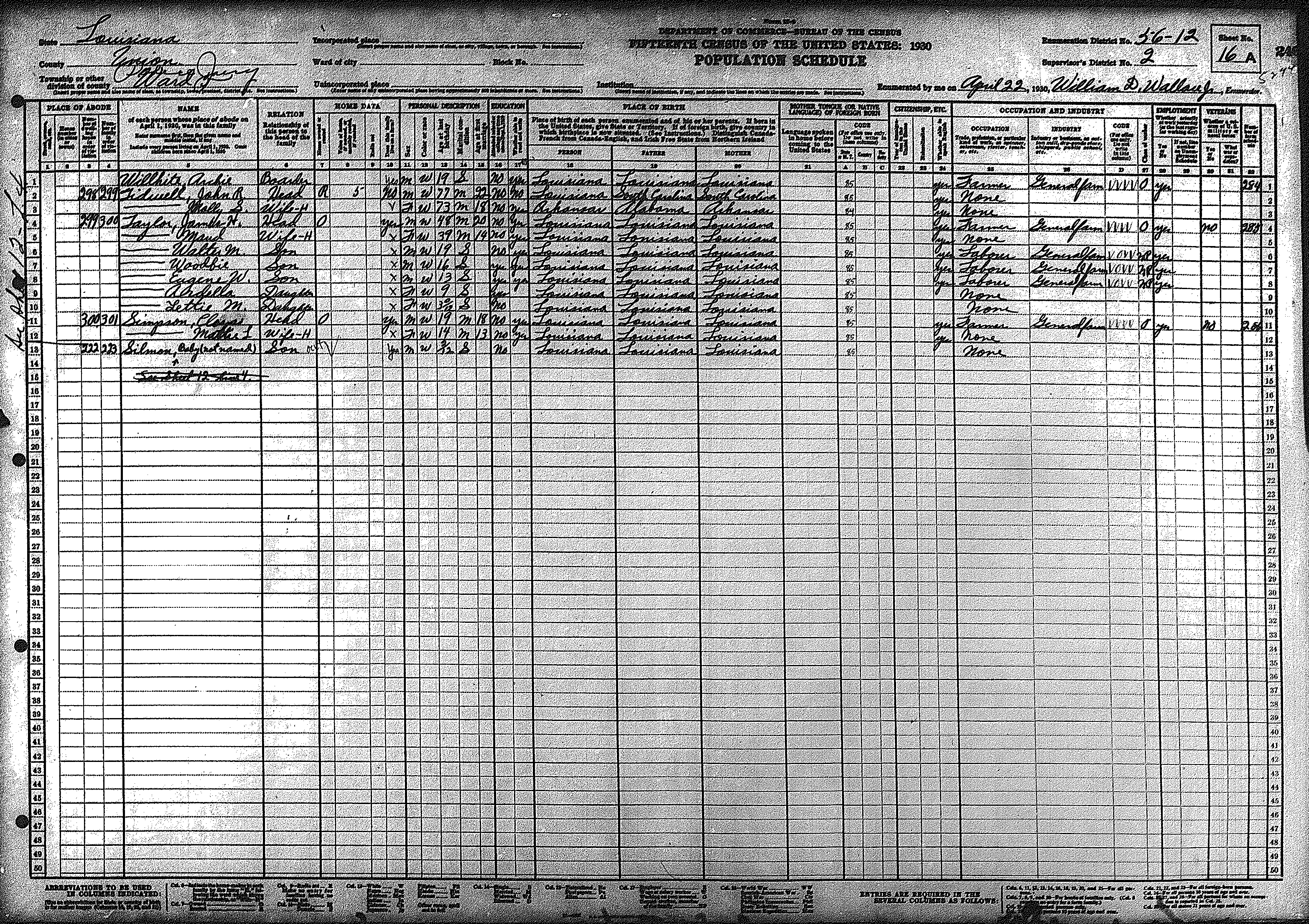
| 56 – 12 | Southeastern Union Parish including Downsville & Highway 15 region | ||||||||||||||||||
| 287 | 288 | 289 | 290 | 291 | 292 | 293 | 294 | 295 | 296 | 297 | 298 | 299 | 300 | 301 | |||||
| 302 | 303 | 304 | 305 | 306 | 307 | 308 | 309 | 310 | 311 | 312 | 313 | 314 | 315 | 316 | |||||
| 317 | 318 | ||||||||||||||||||
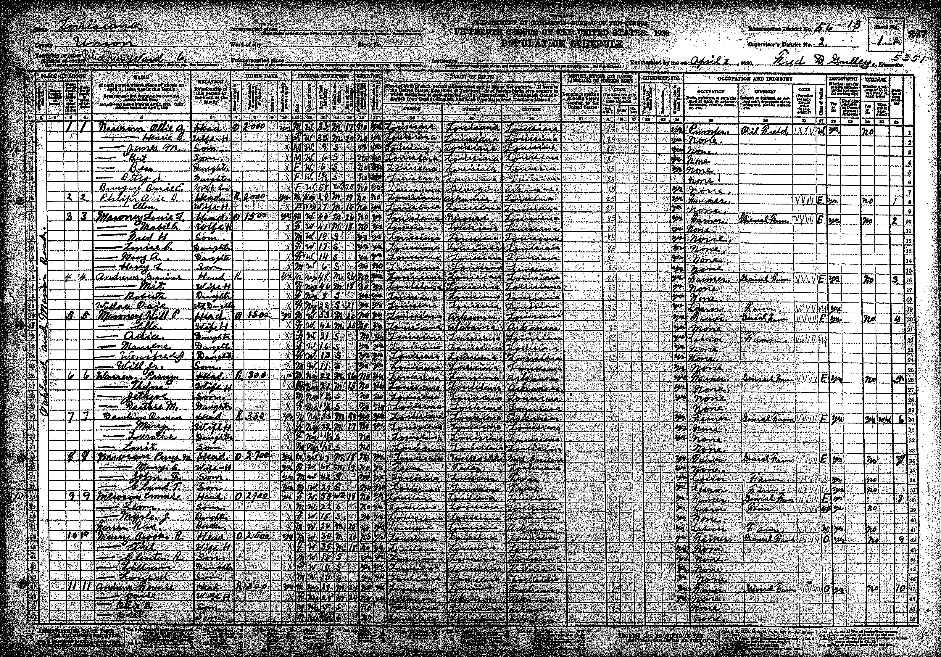
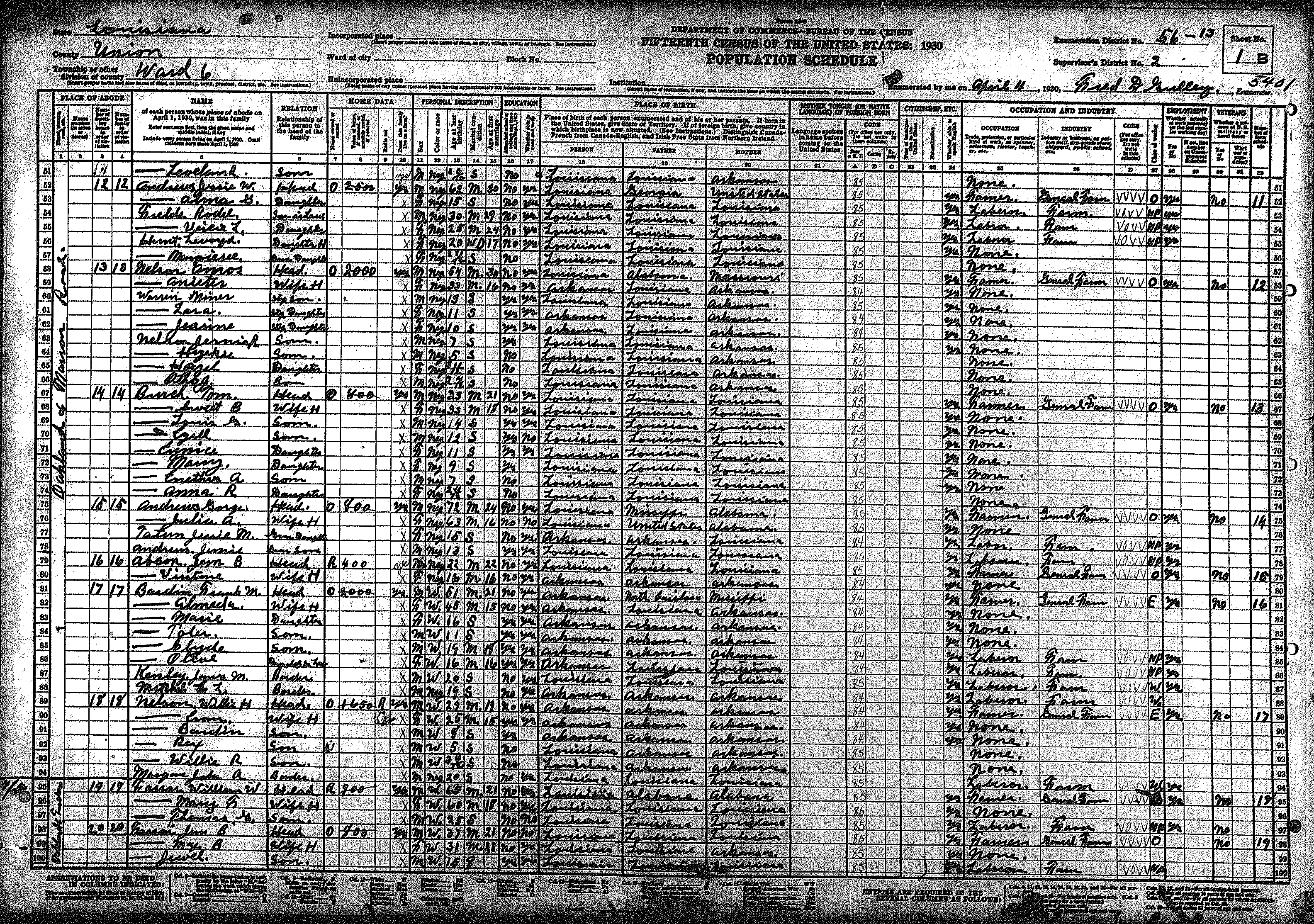
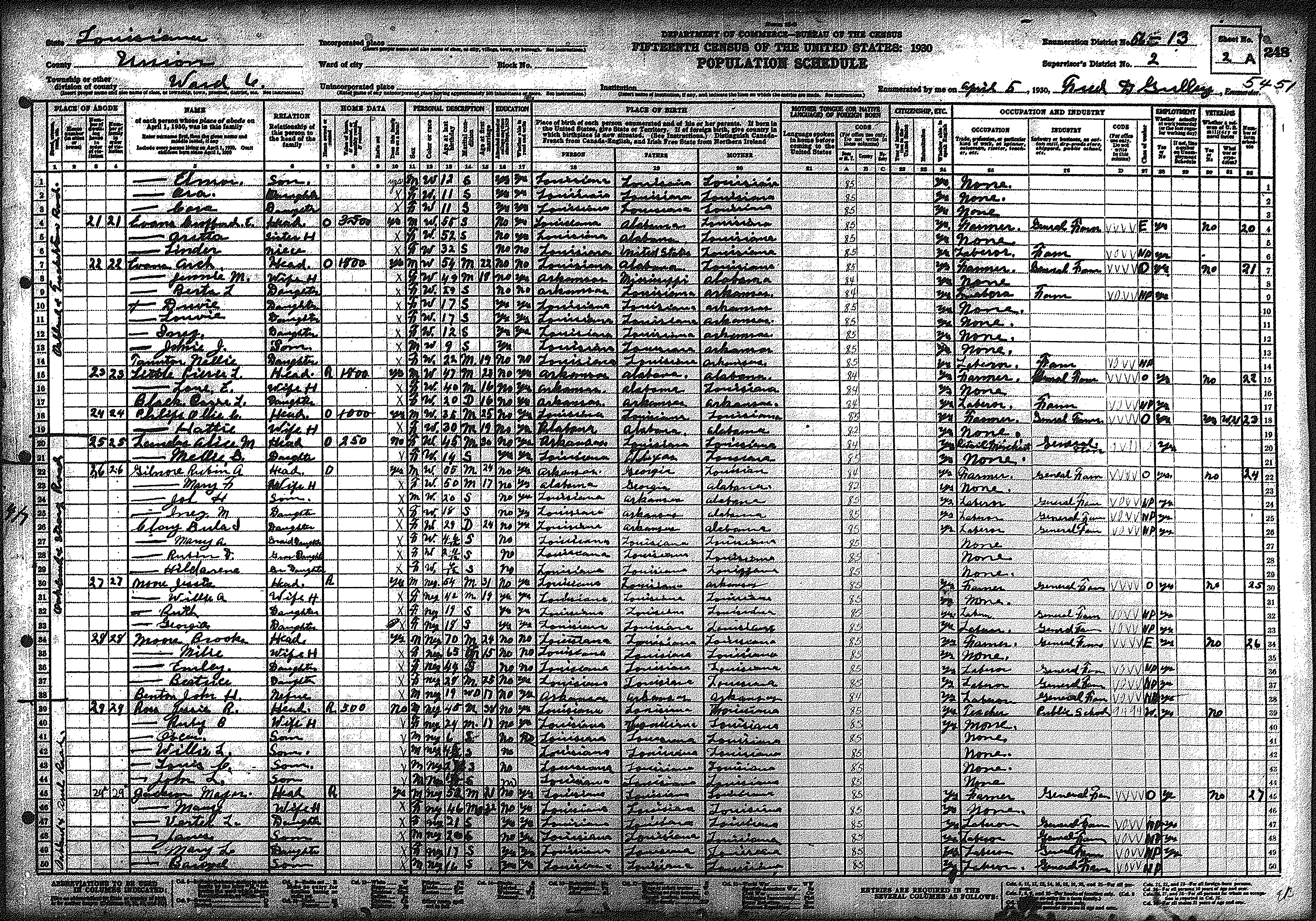
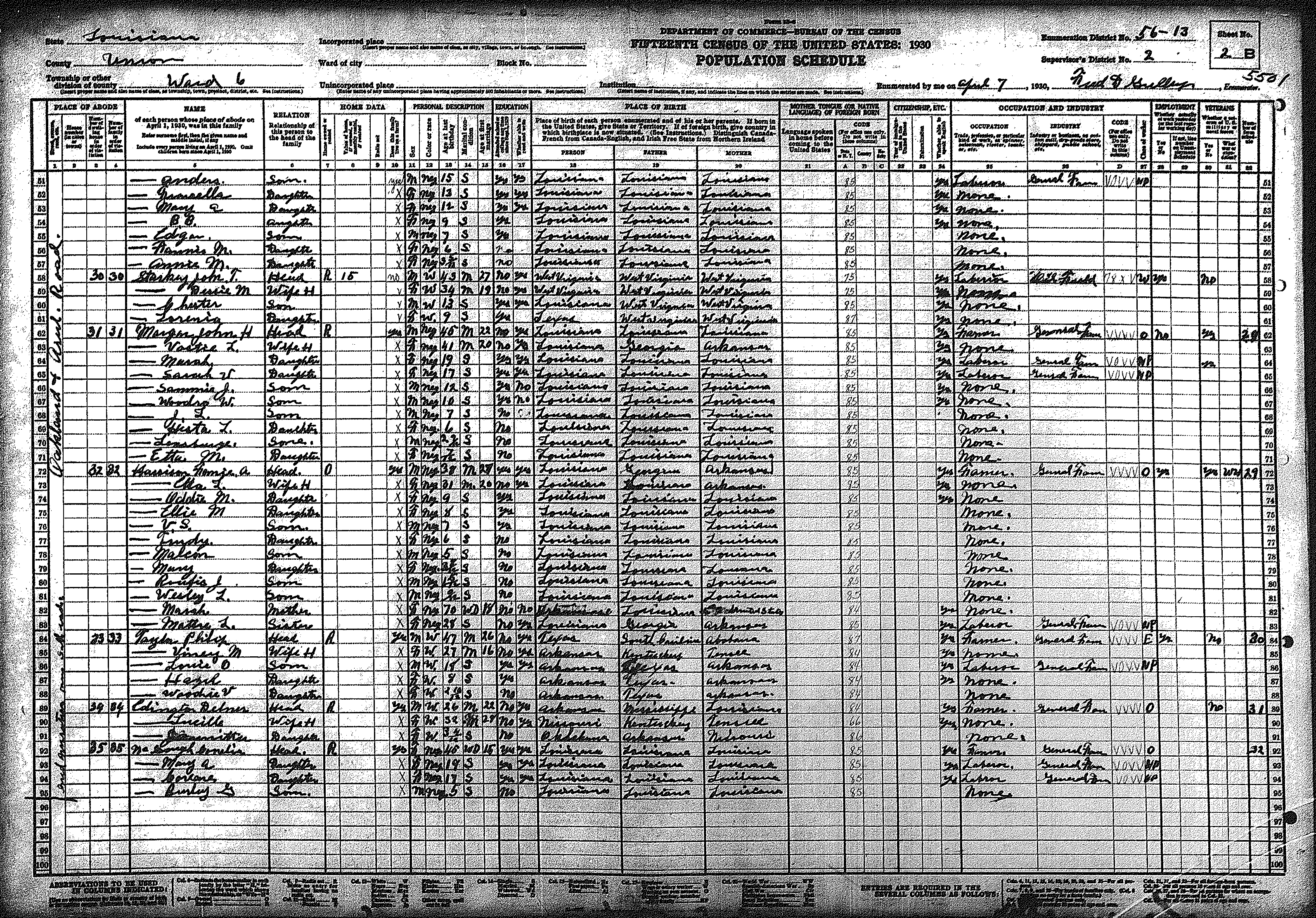
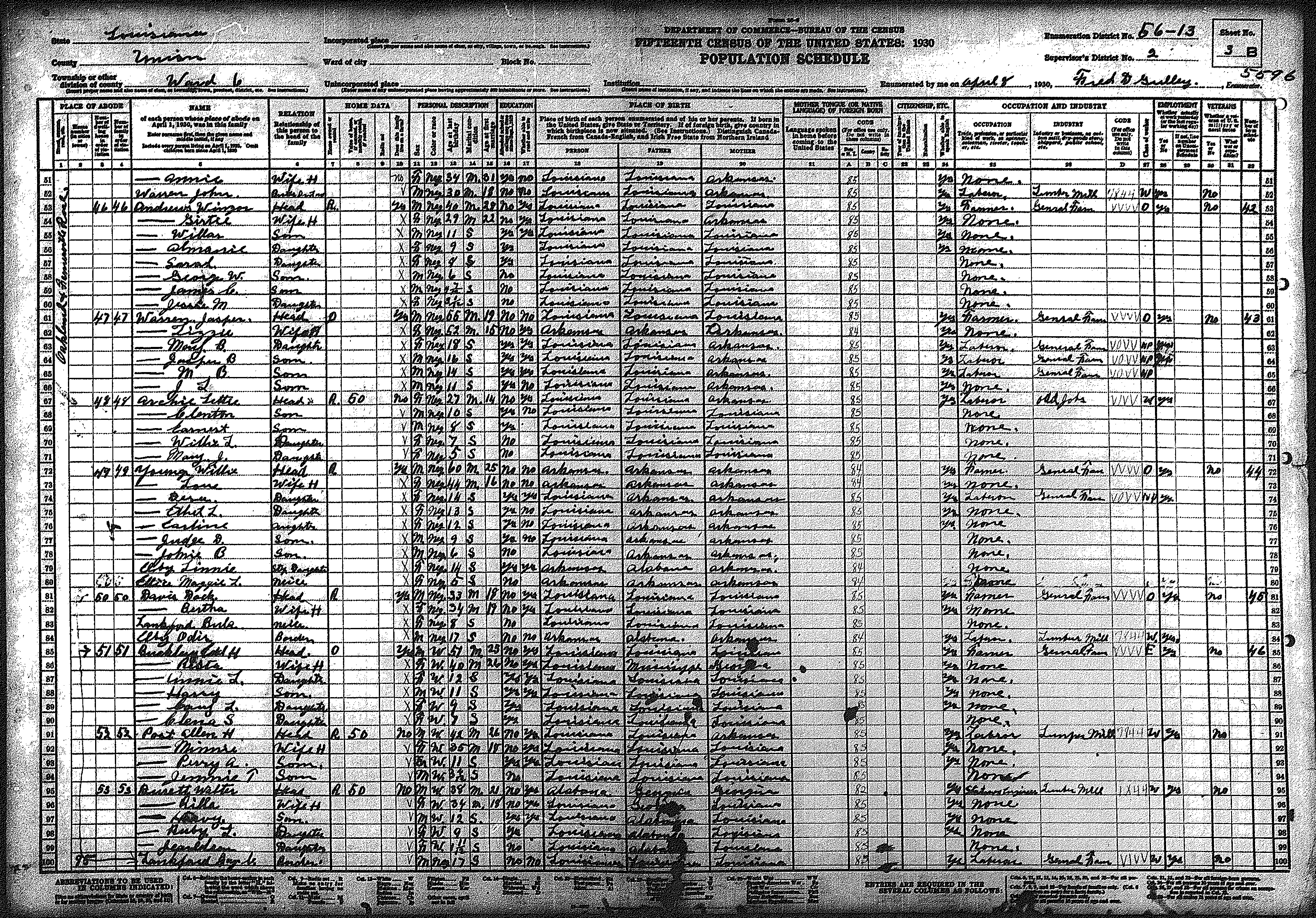
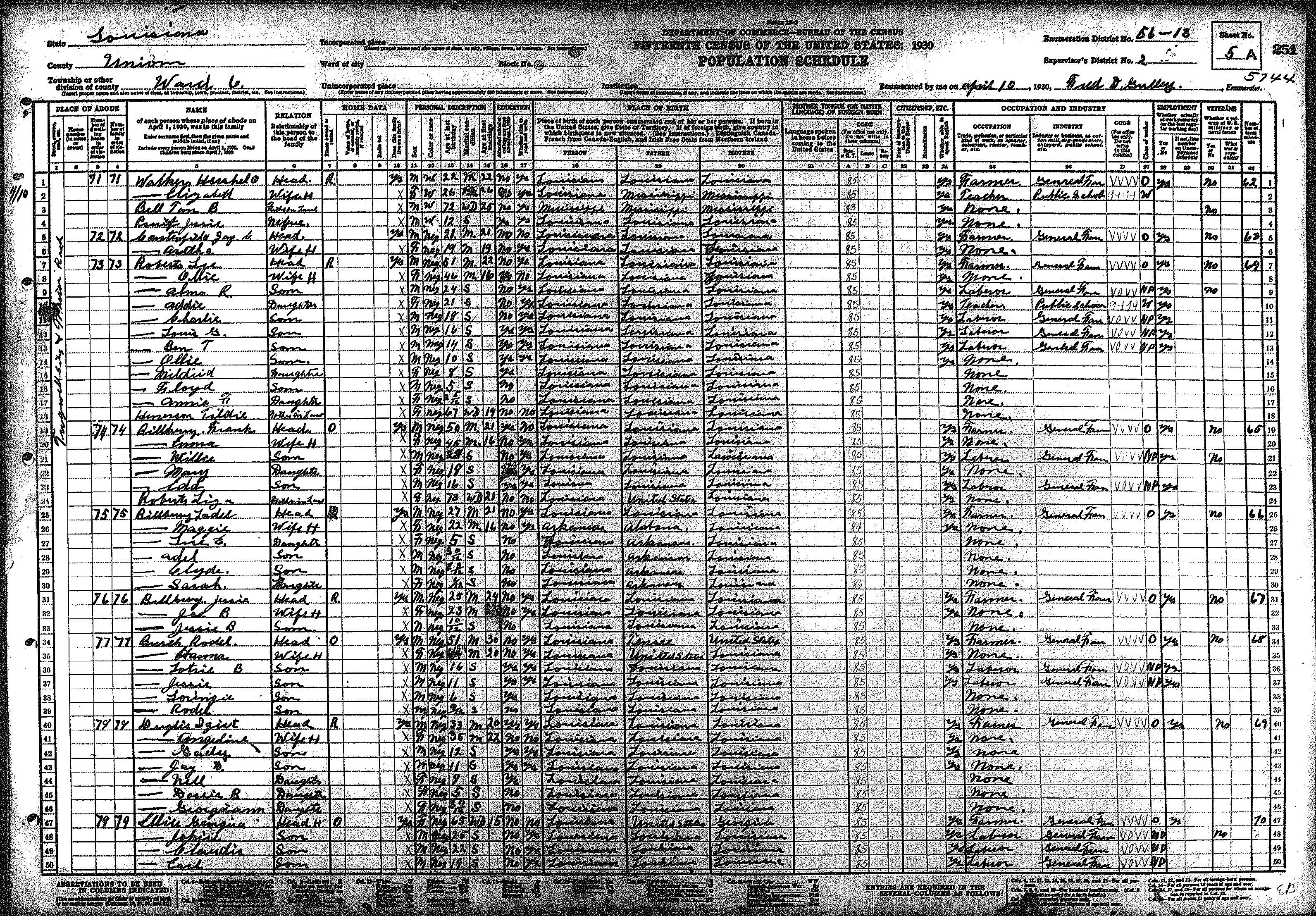
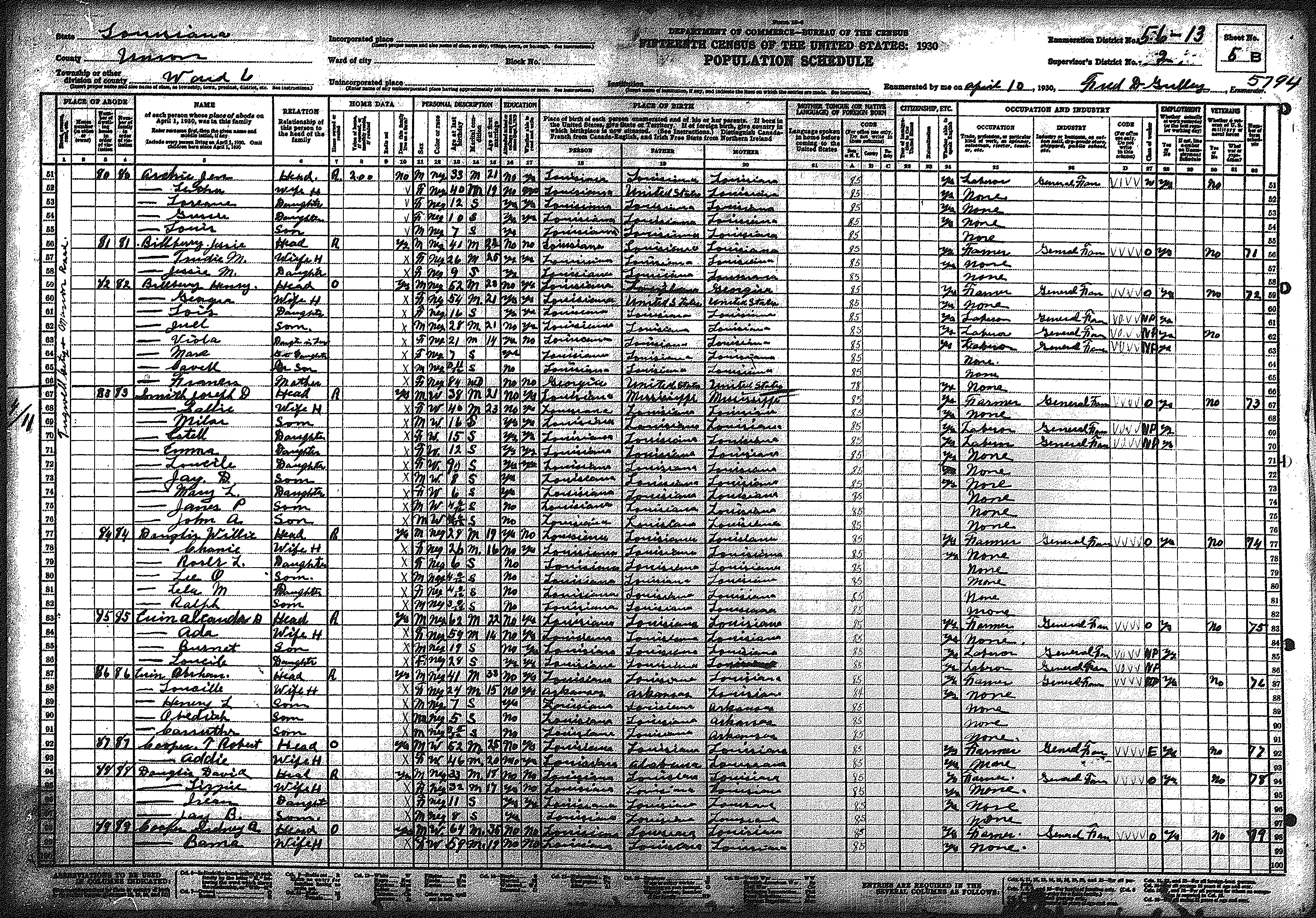
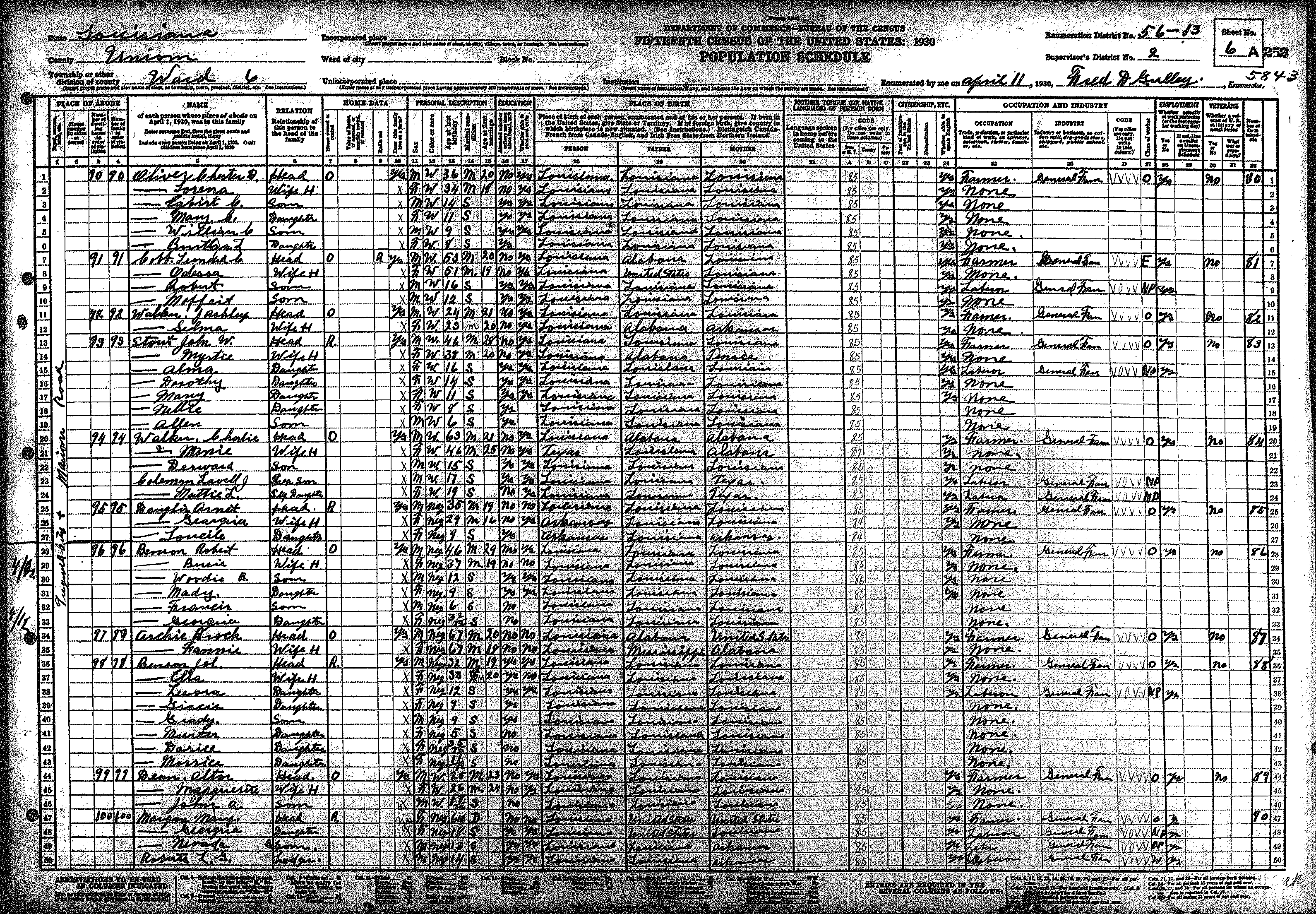
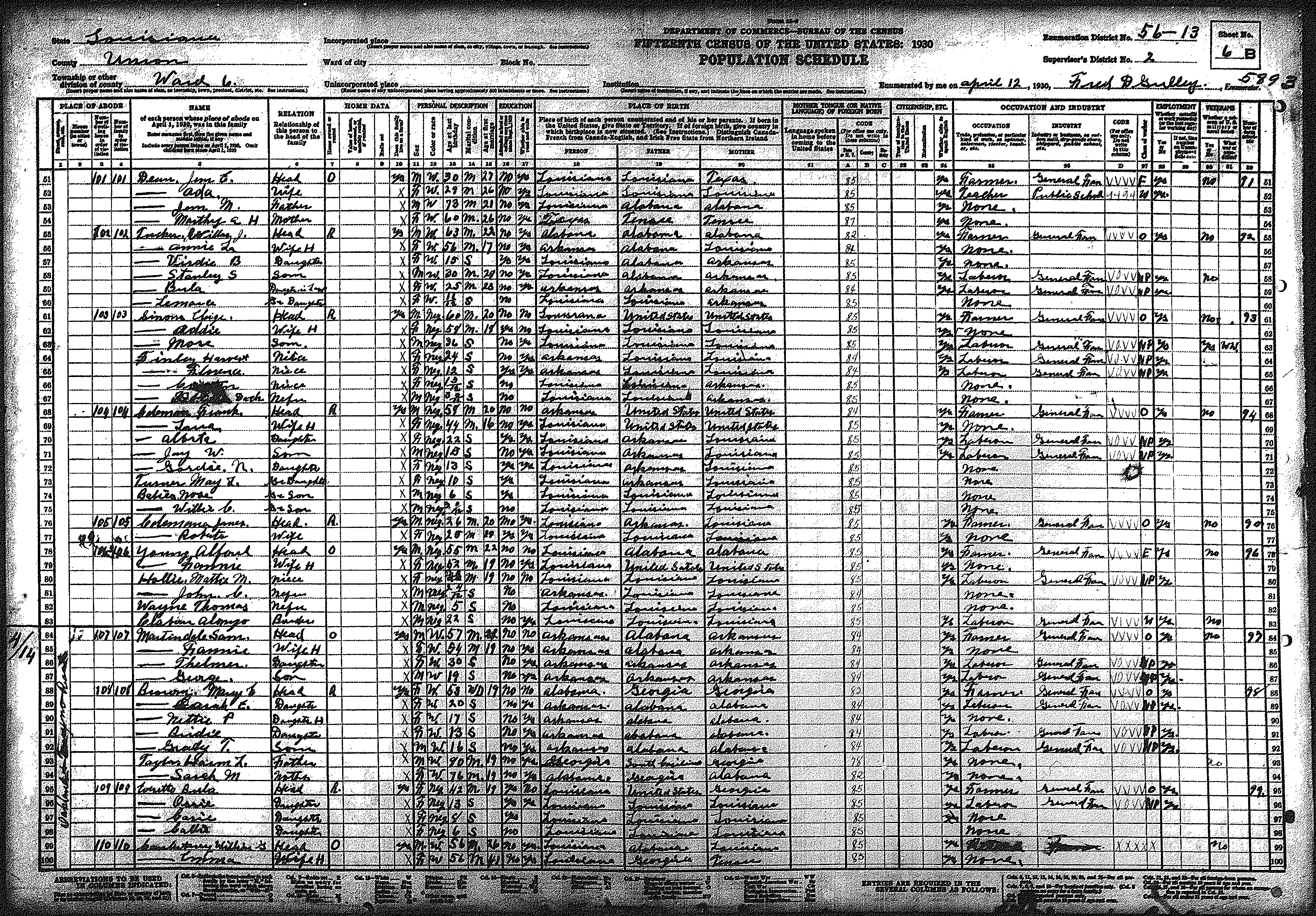
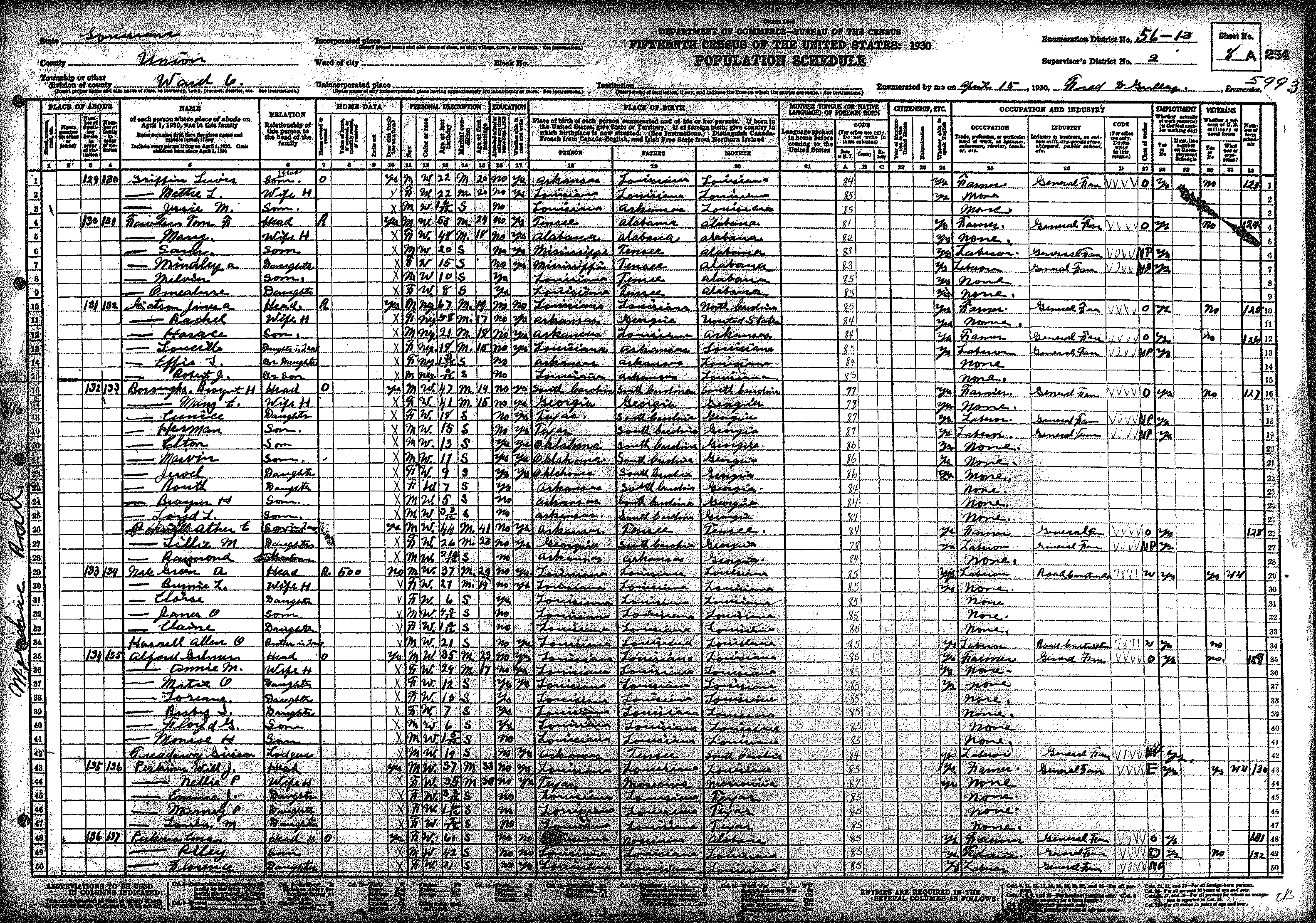
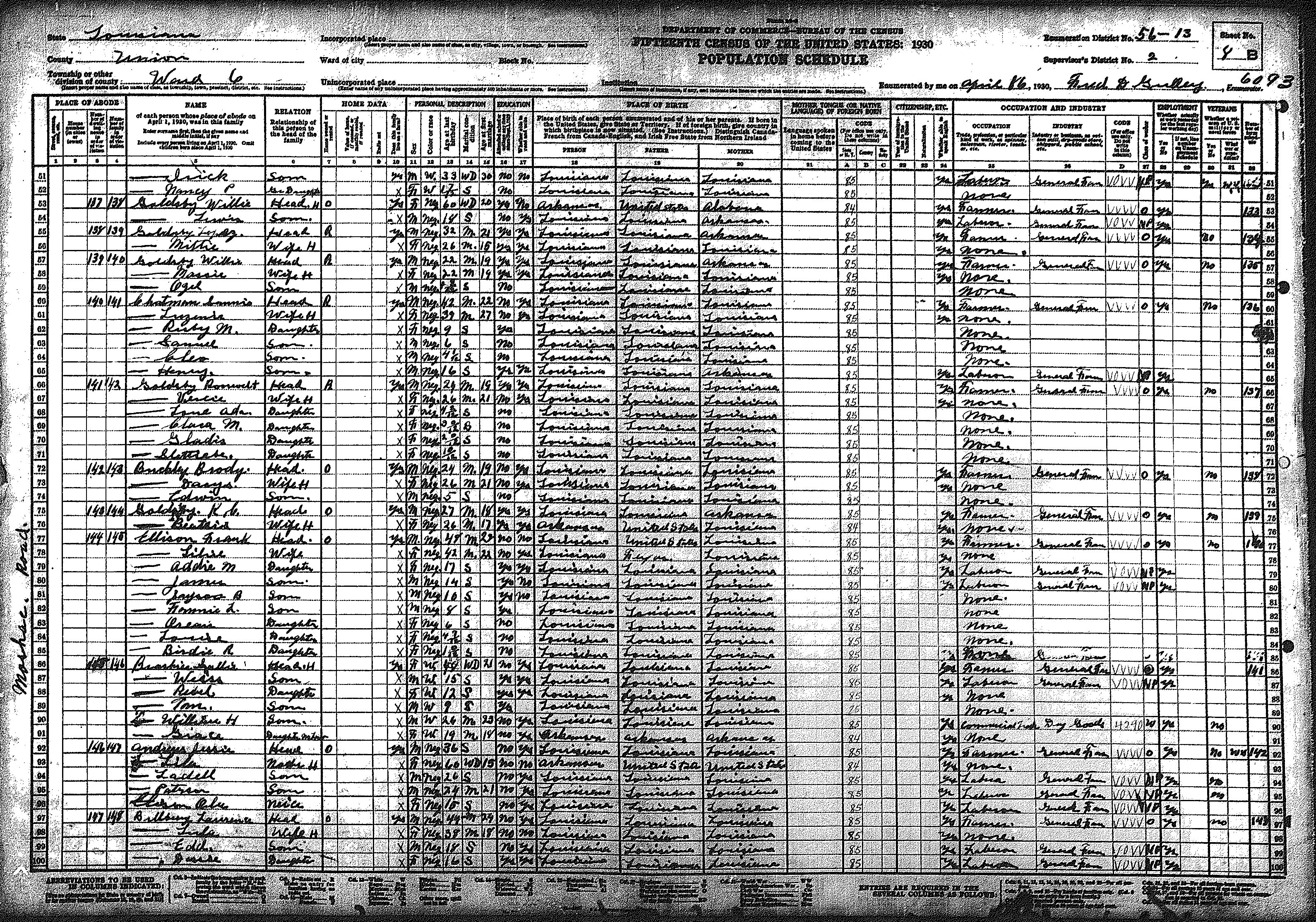
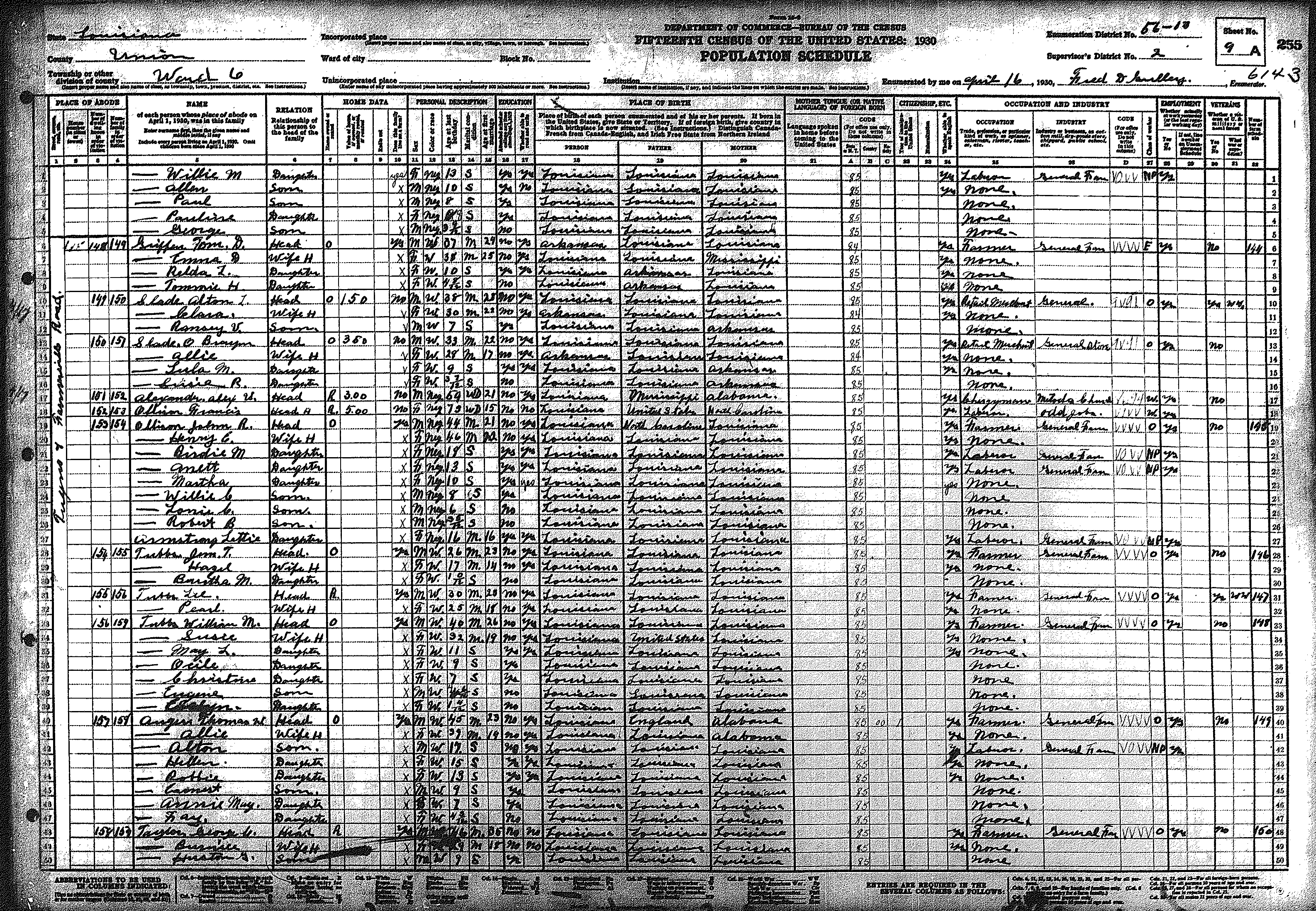
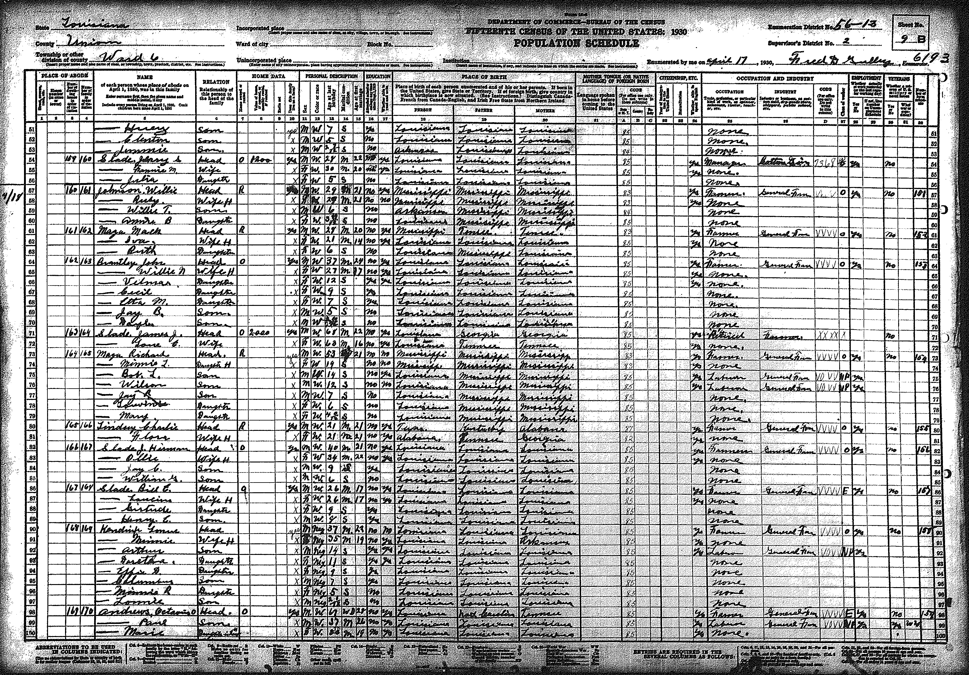
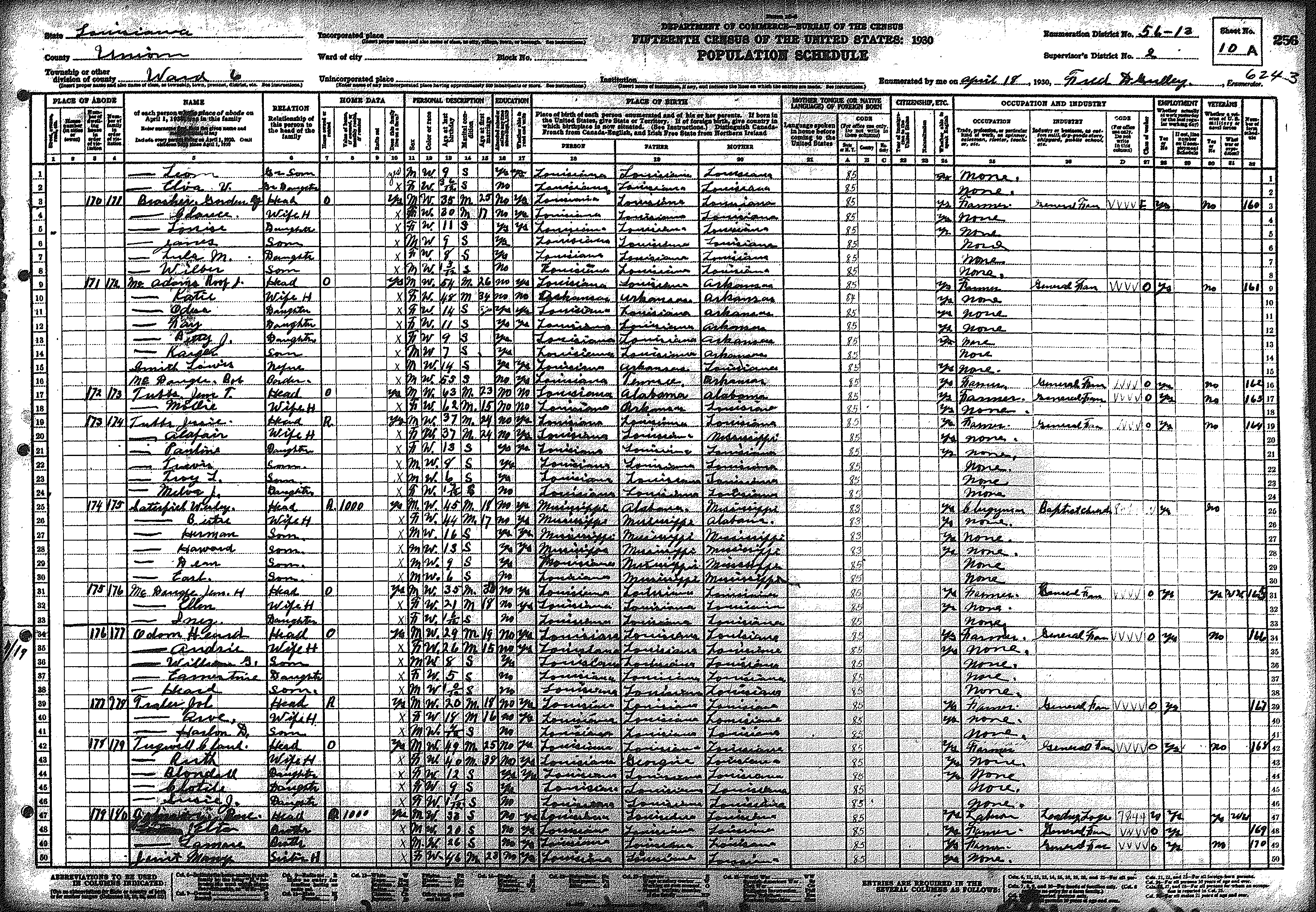
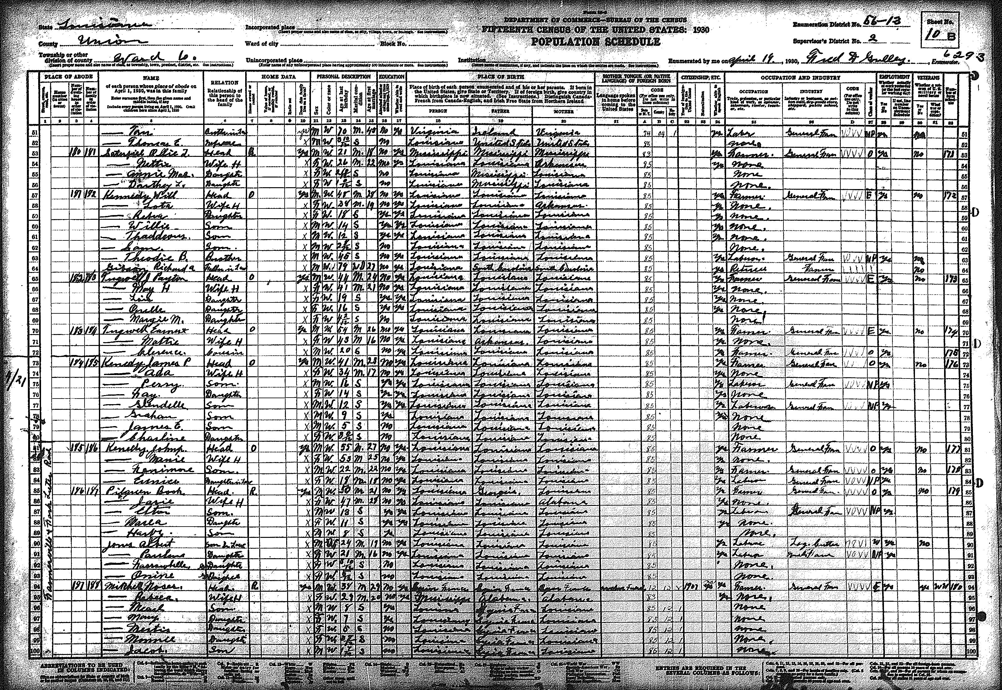
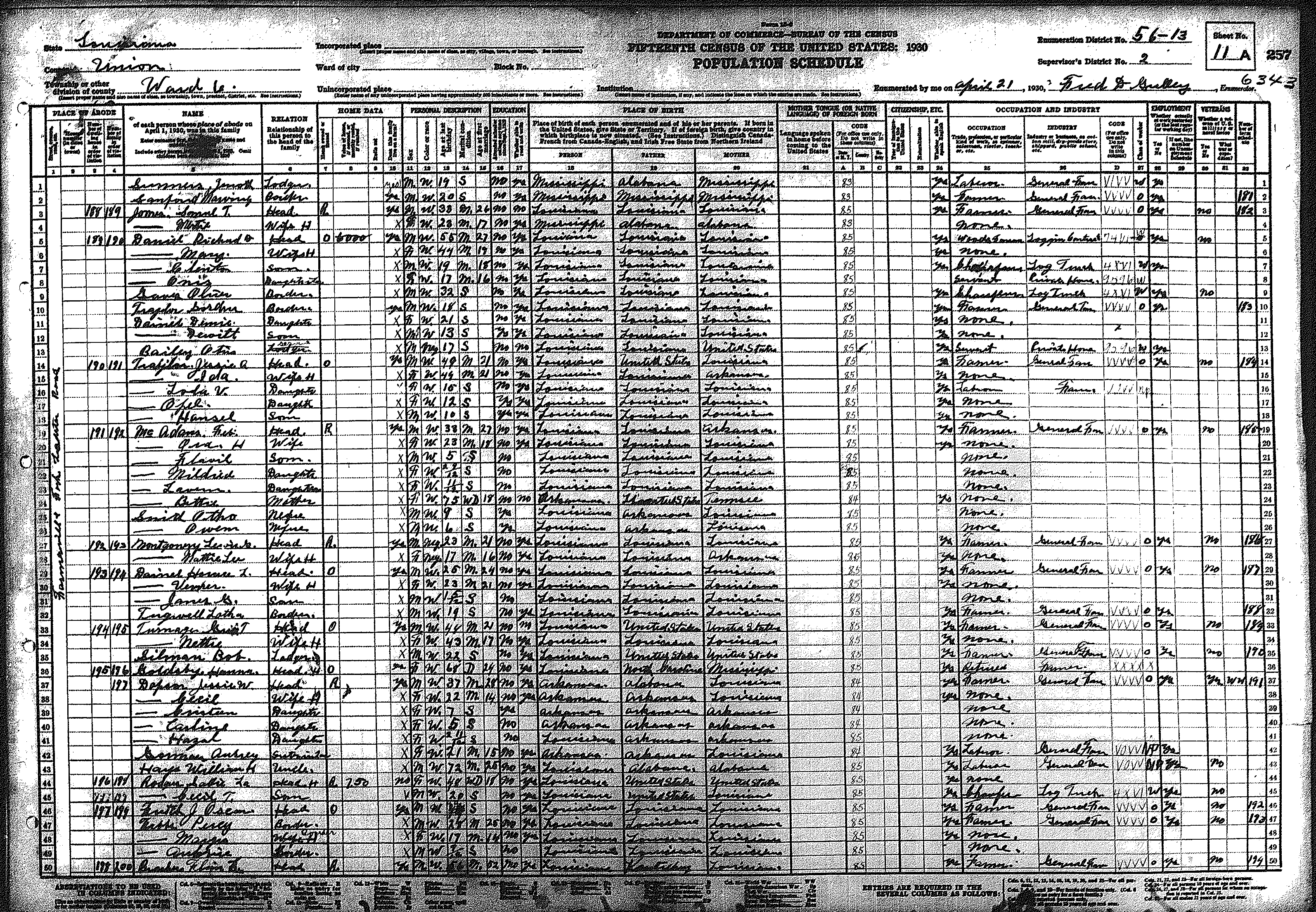
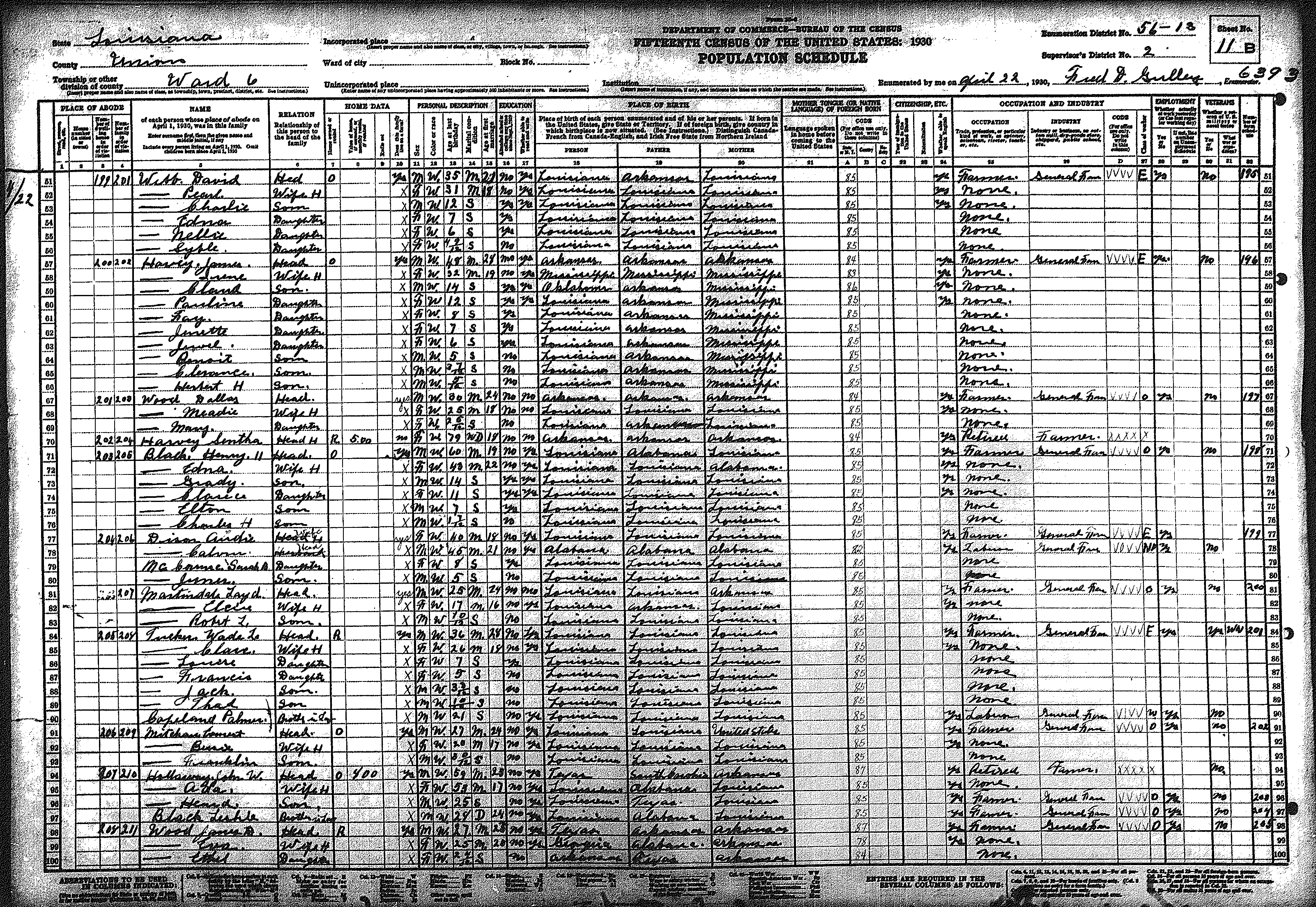
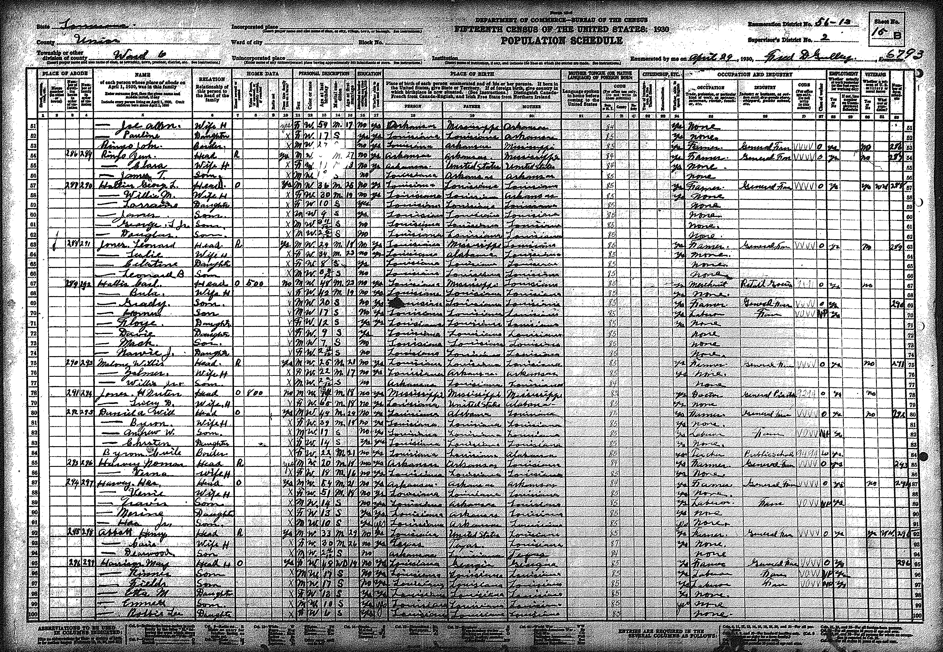
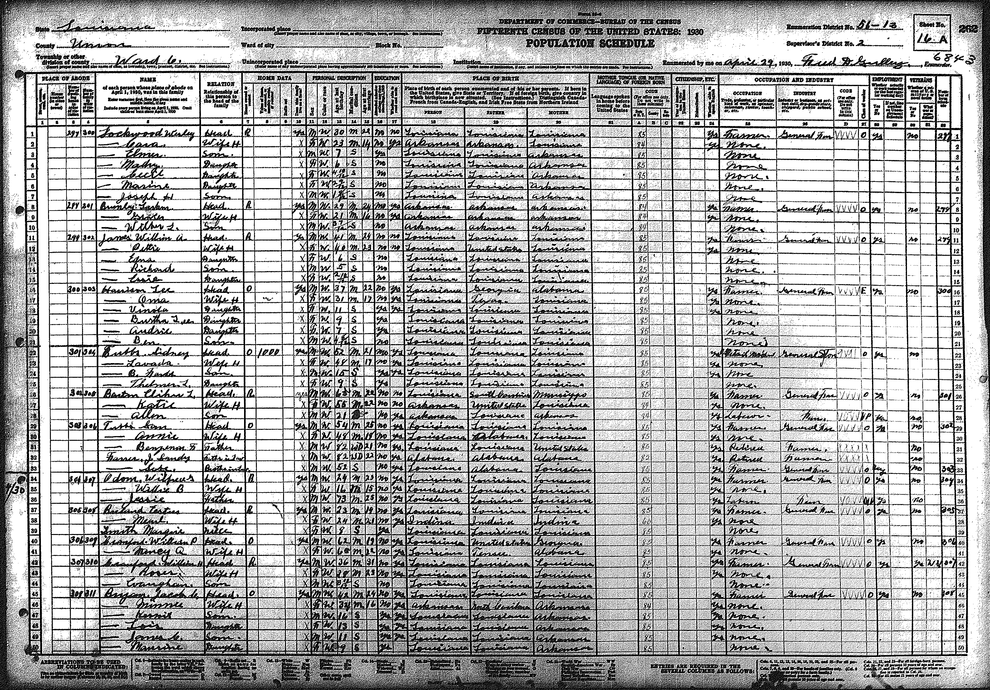
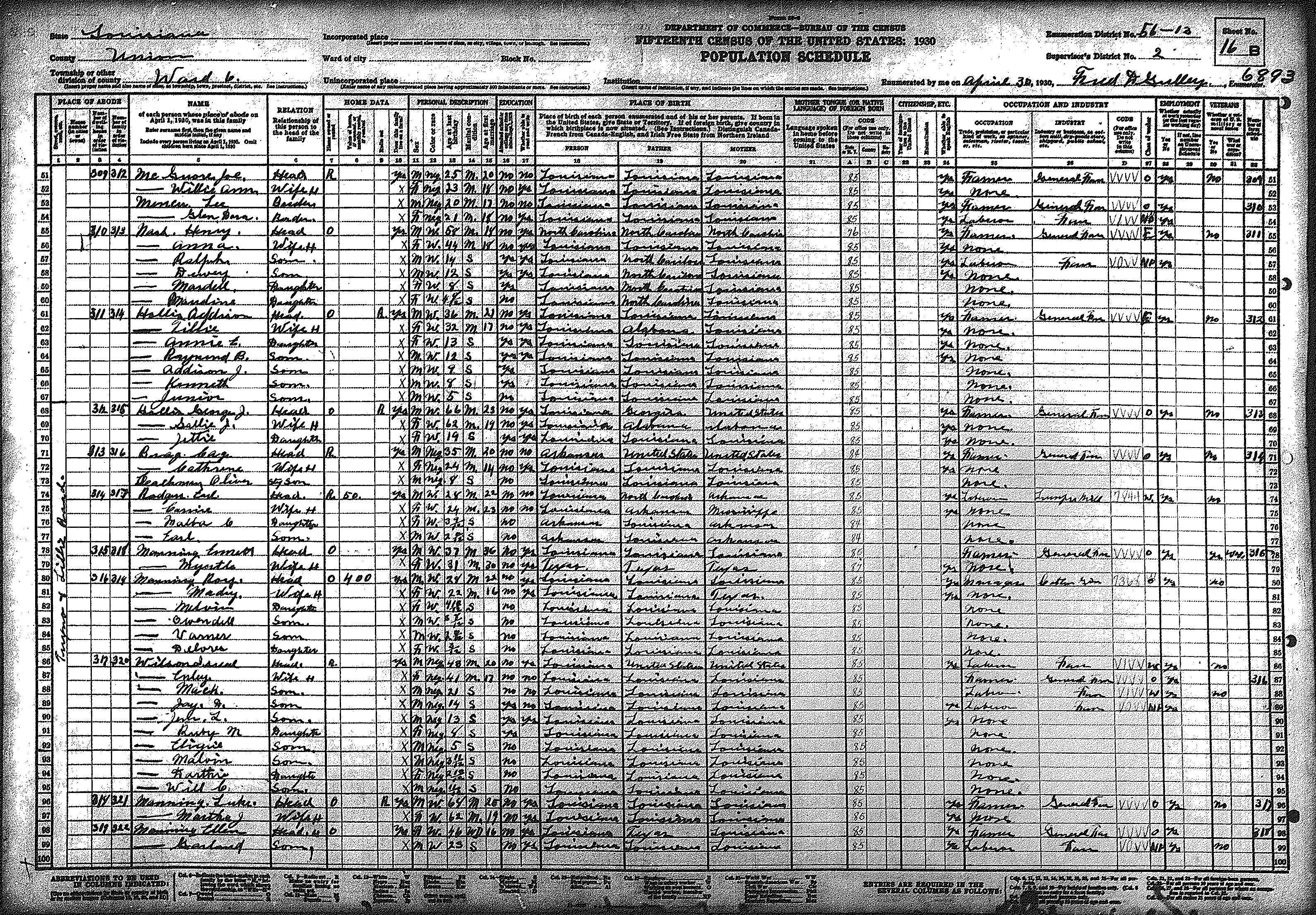
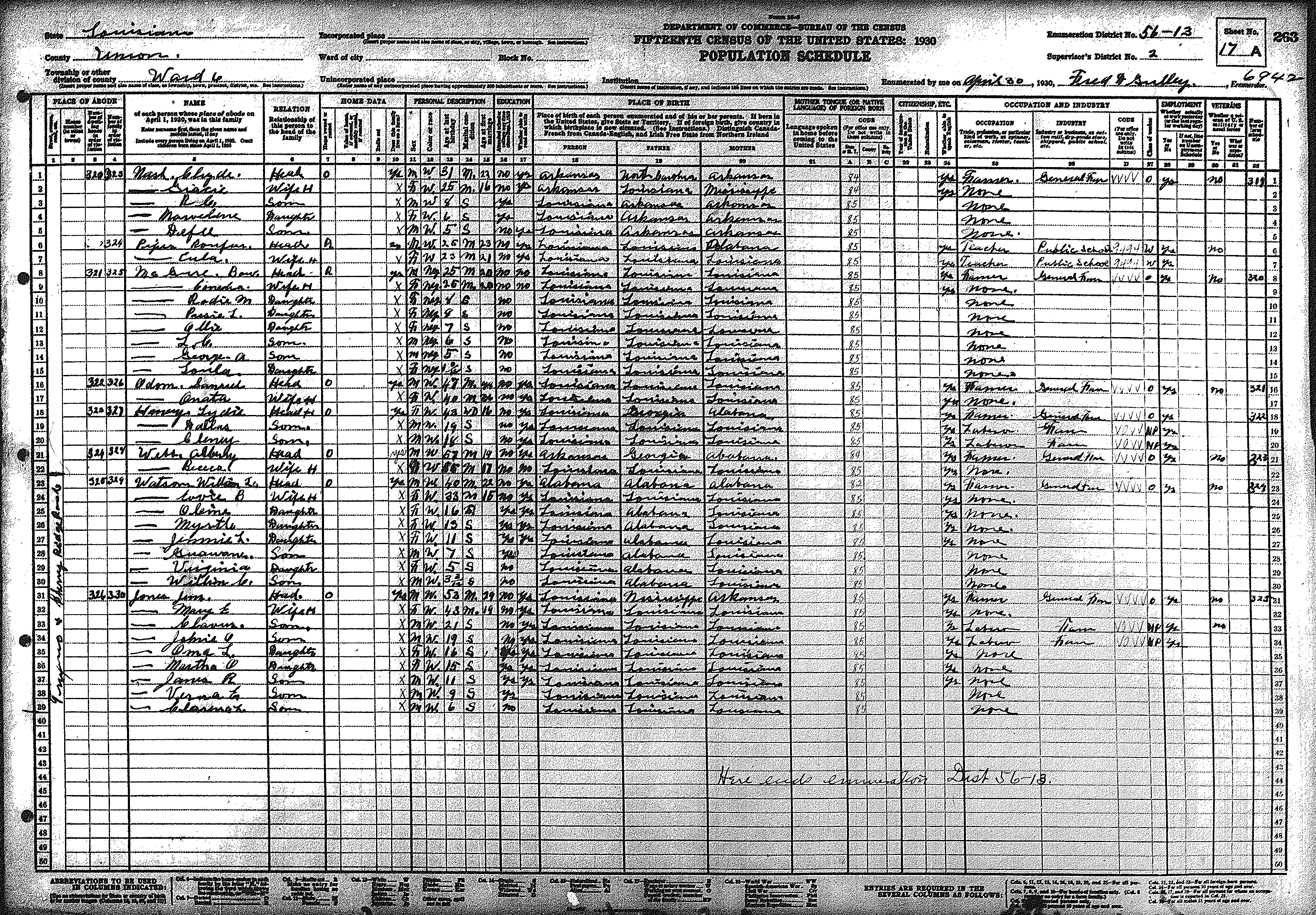
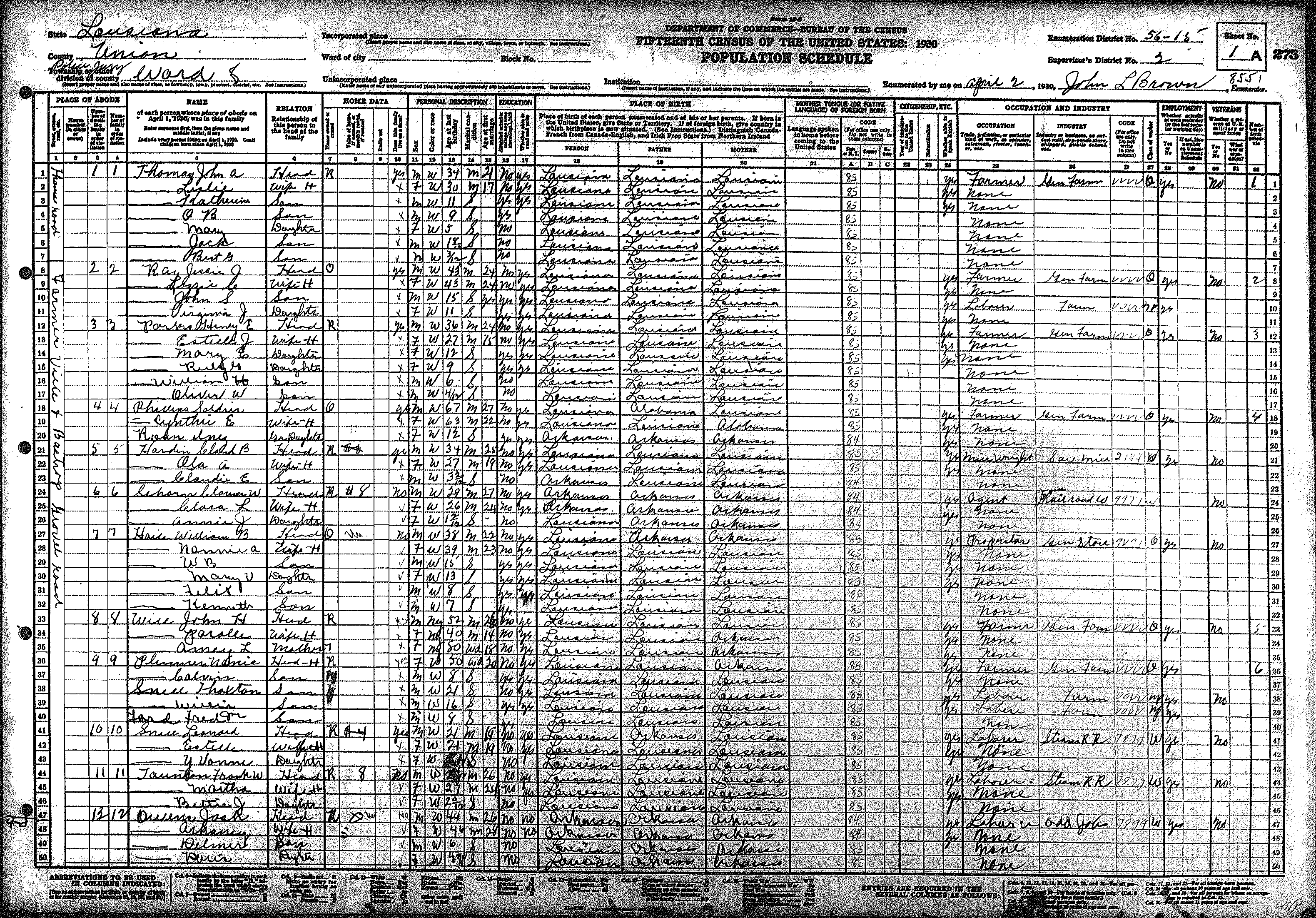
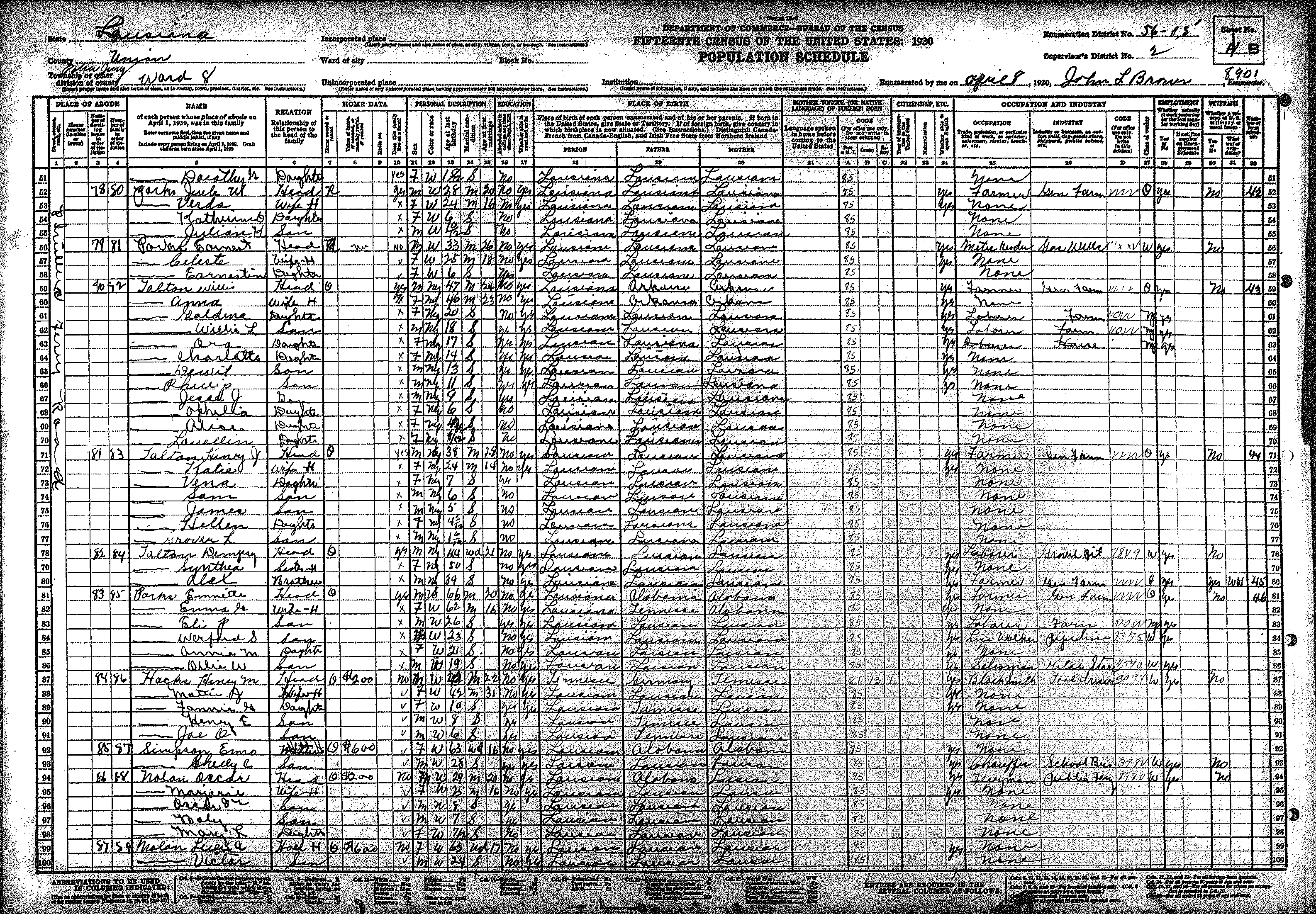
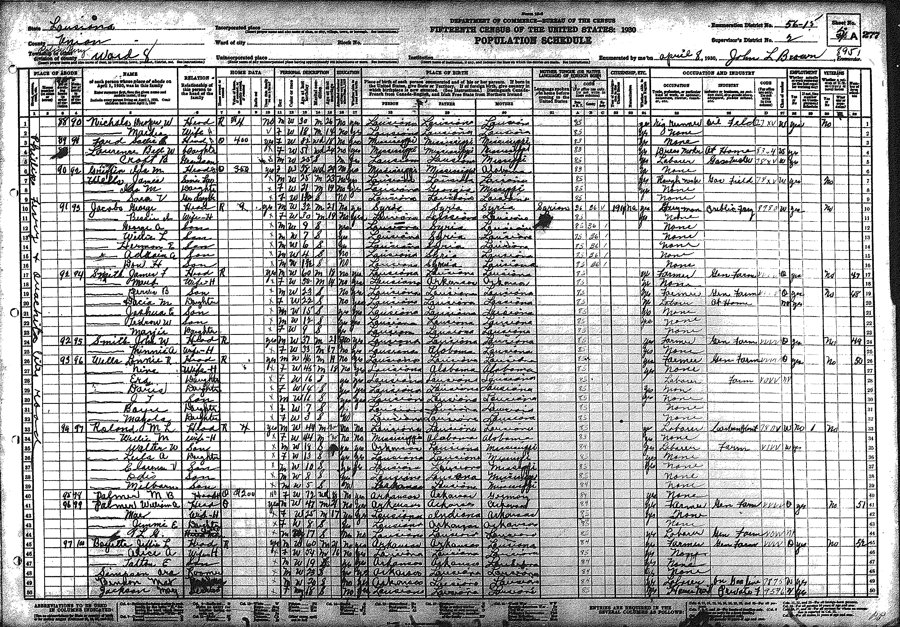
| 6 | 56 – 13 | North/central Union Parish including Oakland, Truxno, Conway communities | |||||||||||||||||
| 320 | 321 | 322 | 323 | 324 | 325 | 326 | 327 | 328 | 329 | 330 | 331 | 332 | 333 | 334 | |||||
| 335 | 336 | 337 | 338 | 339 | 340 | 341 | 342 | 343 | 344 | 345 | 346 | 347 | 348 | 349 | |||||
| 350 | 351 | 352 | 353 | 354 | |||||||||||||||
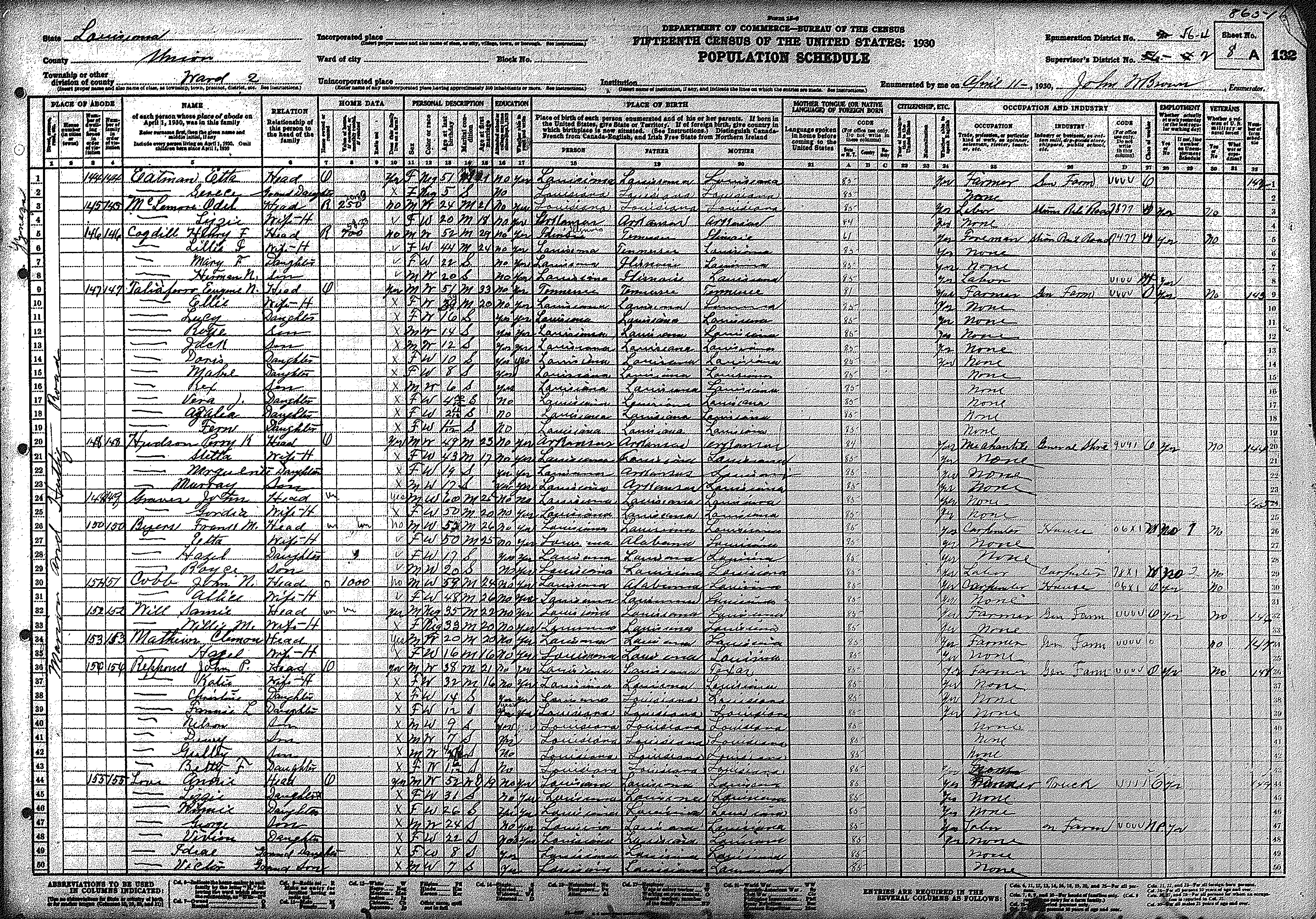
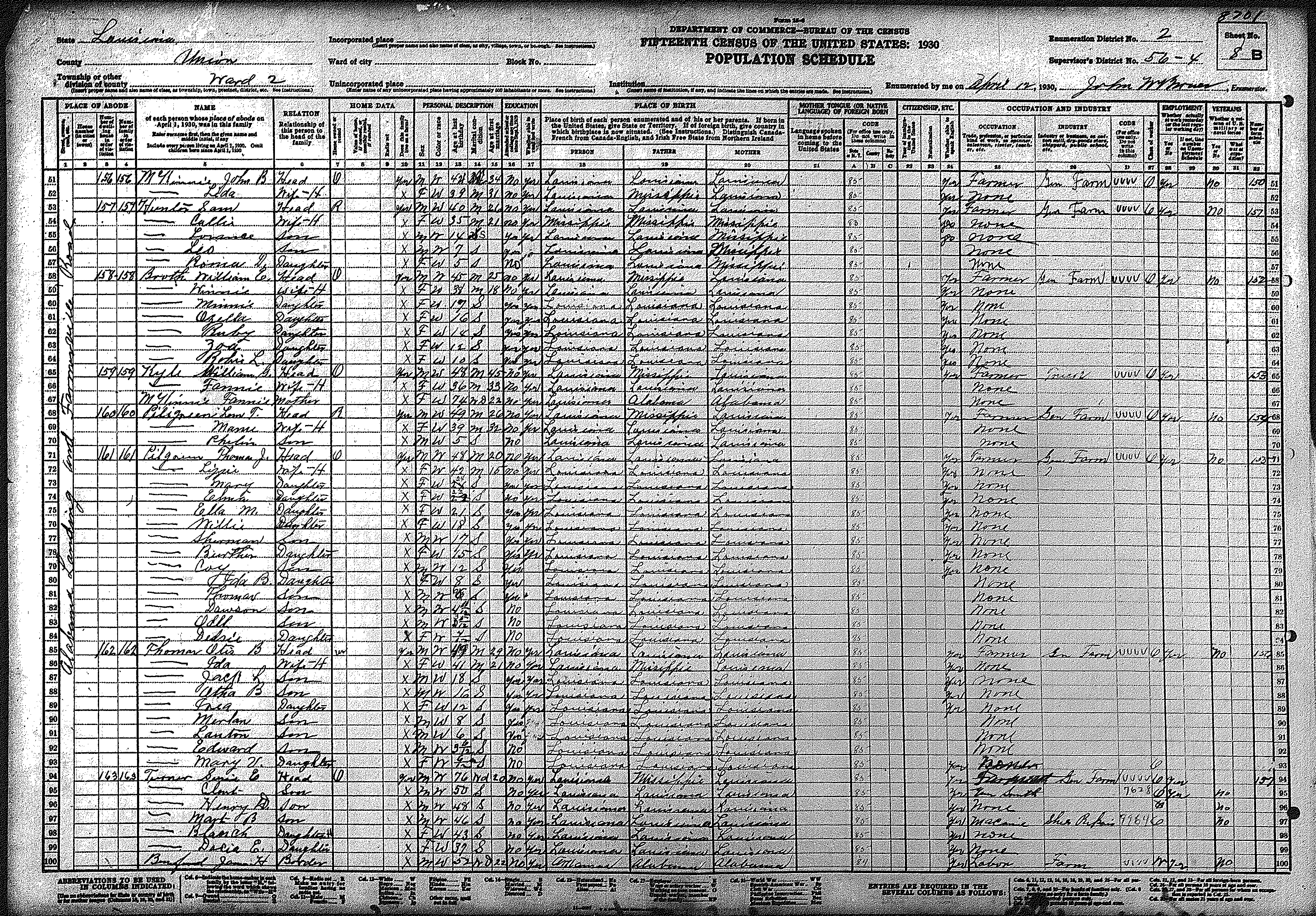
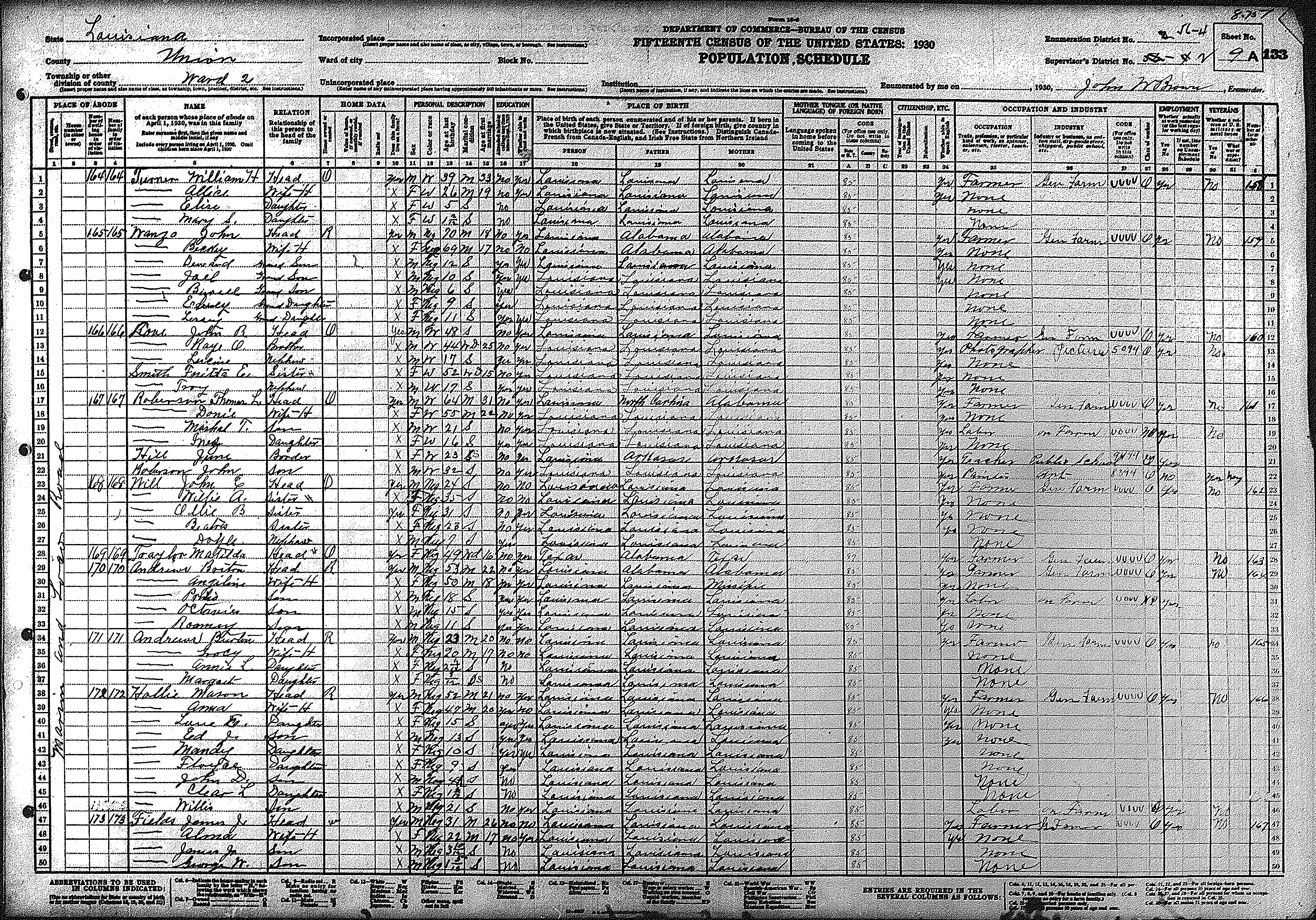
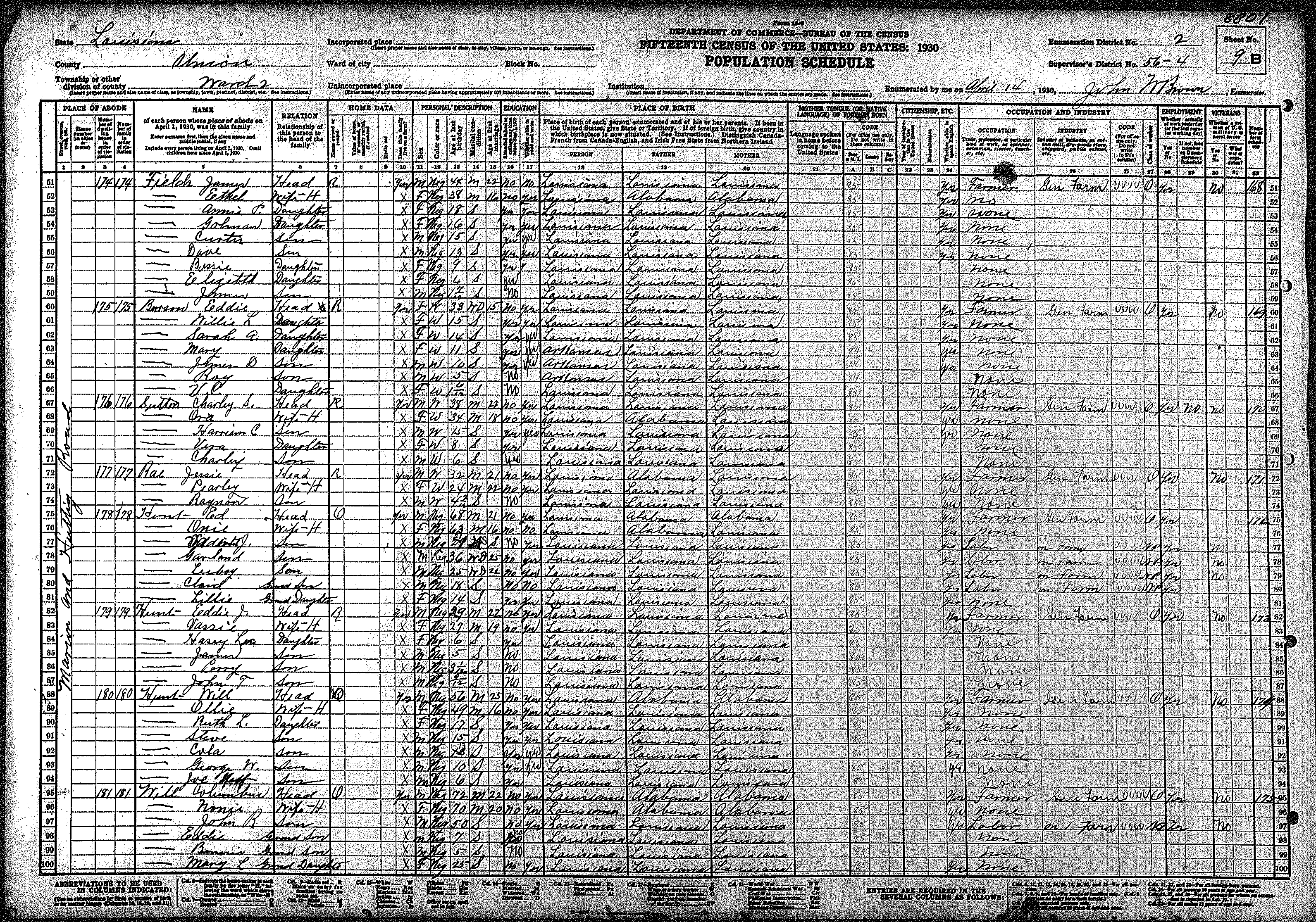
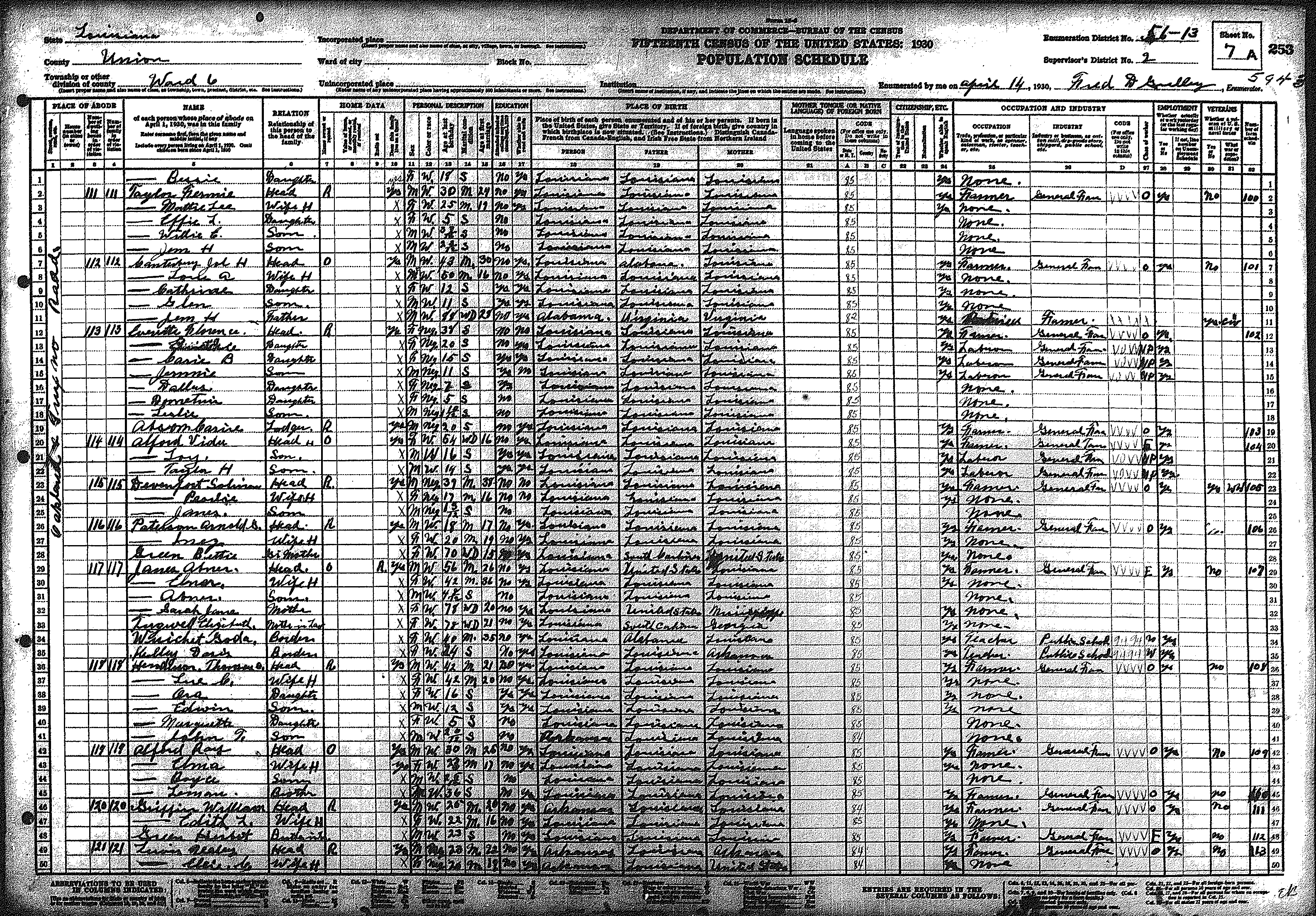
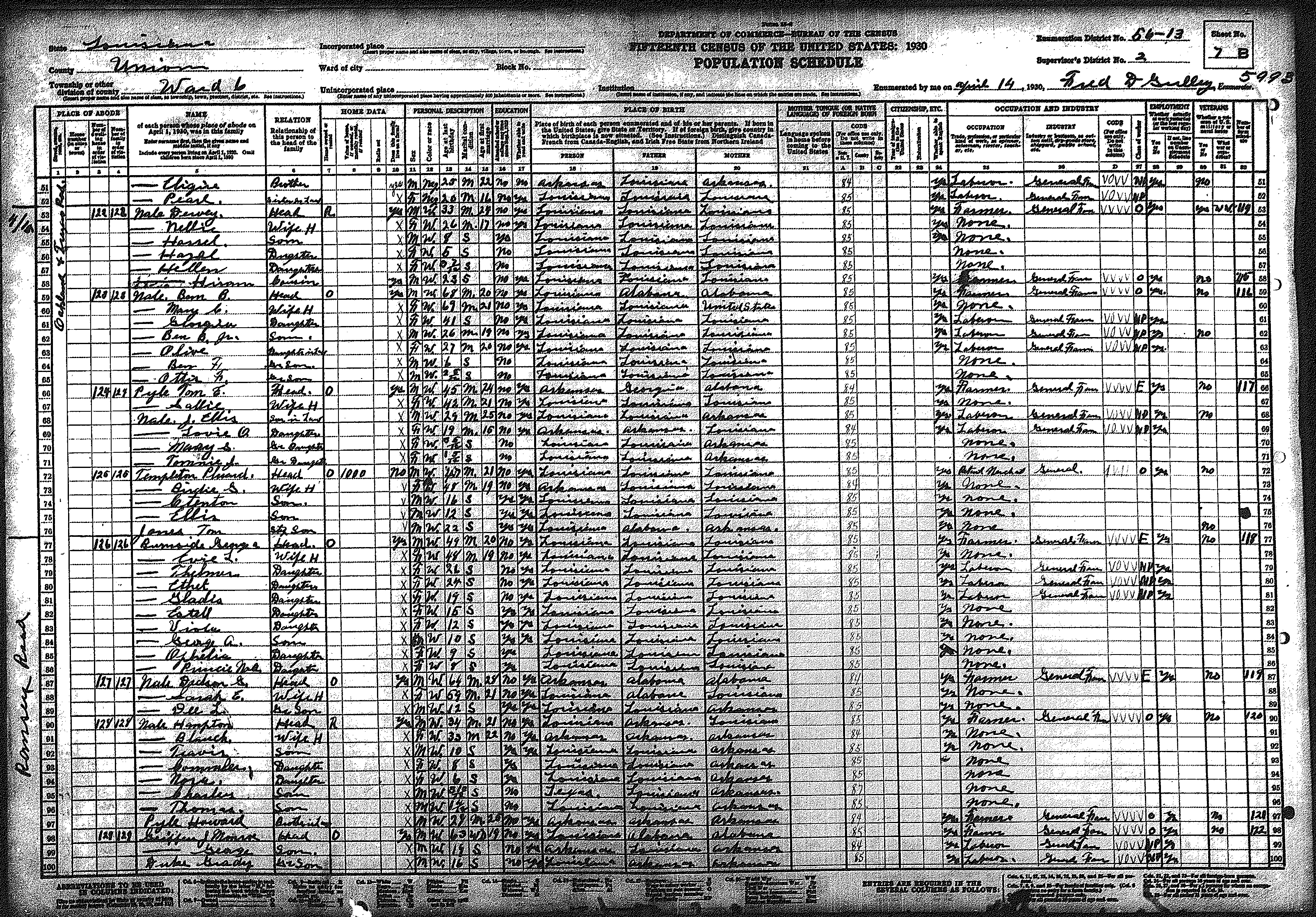
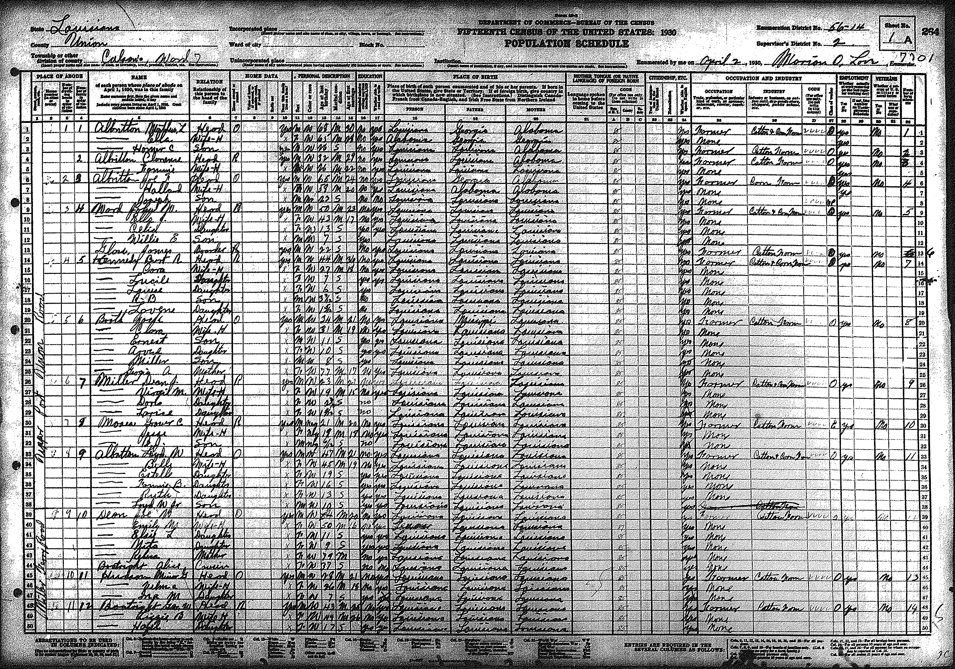
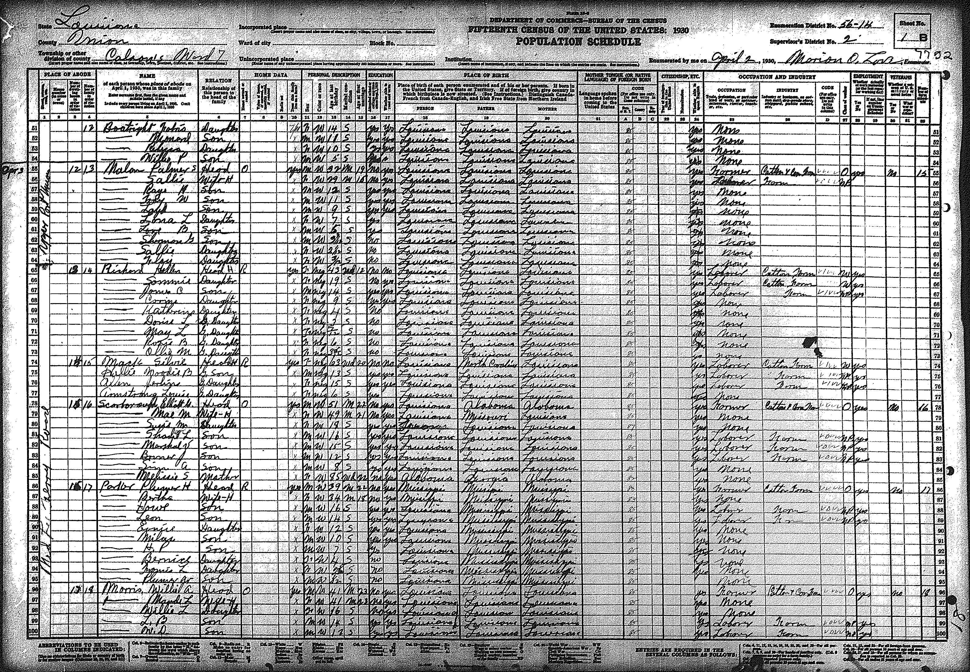
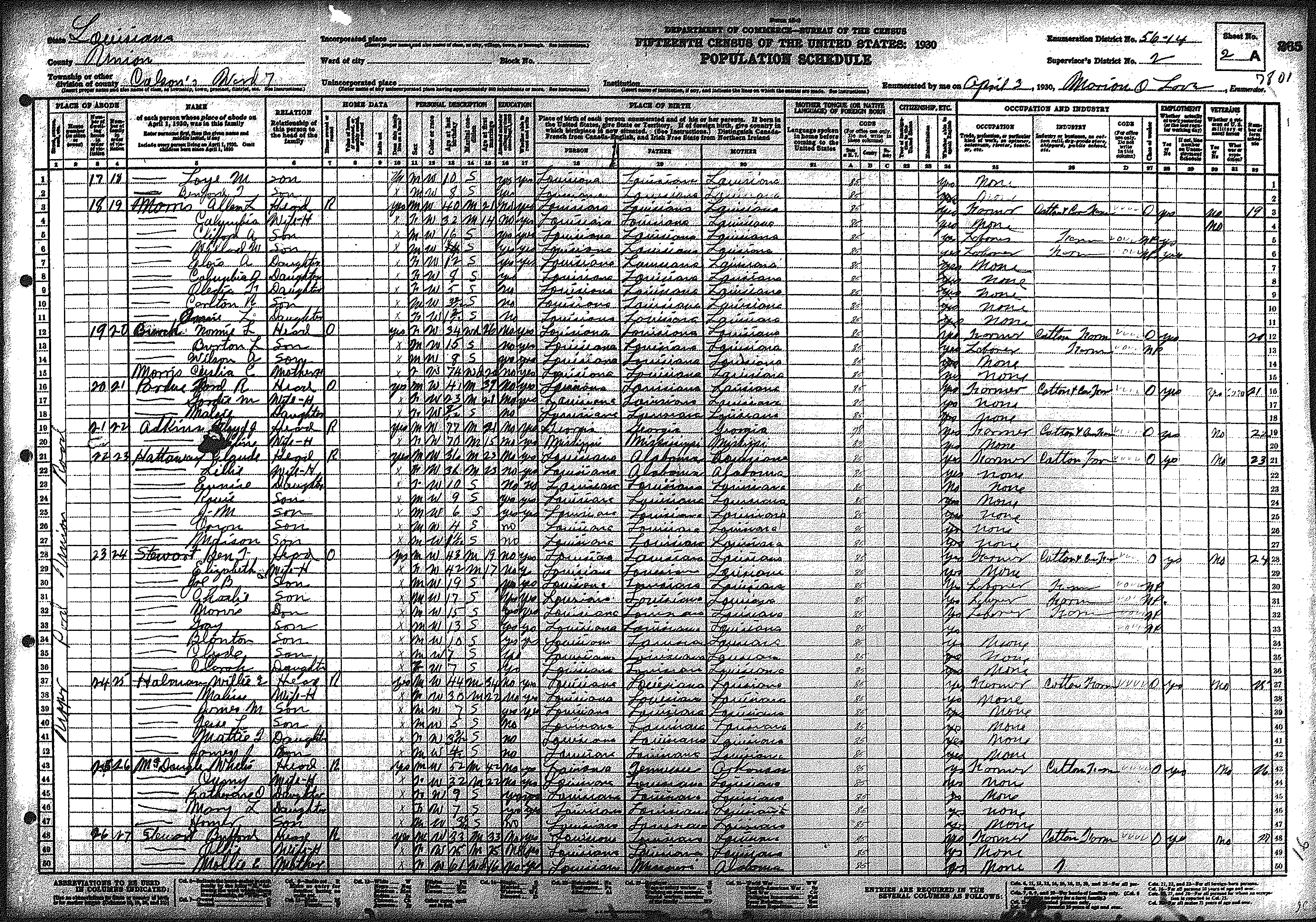
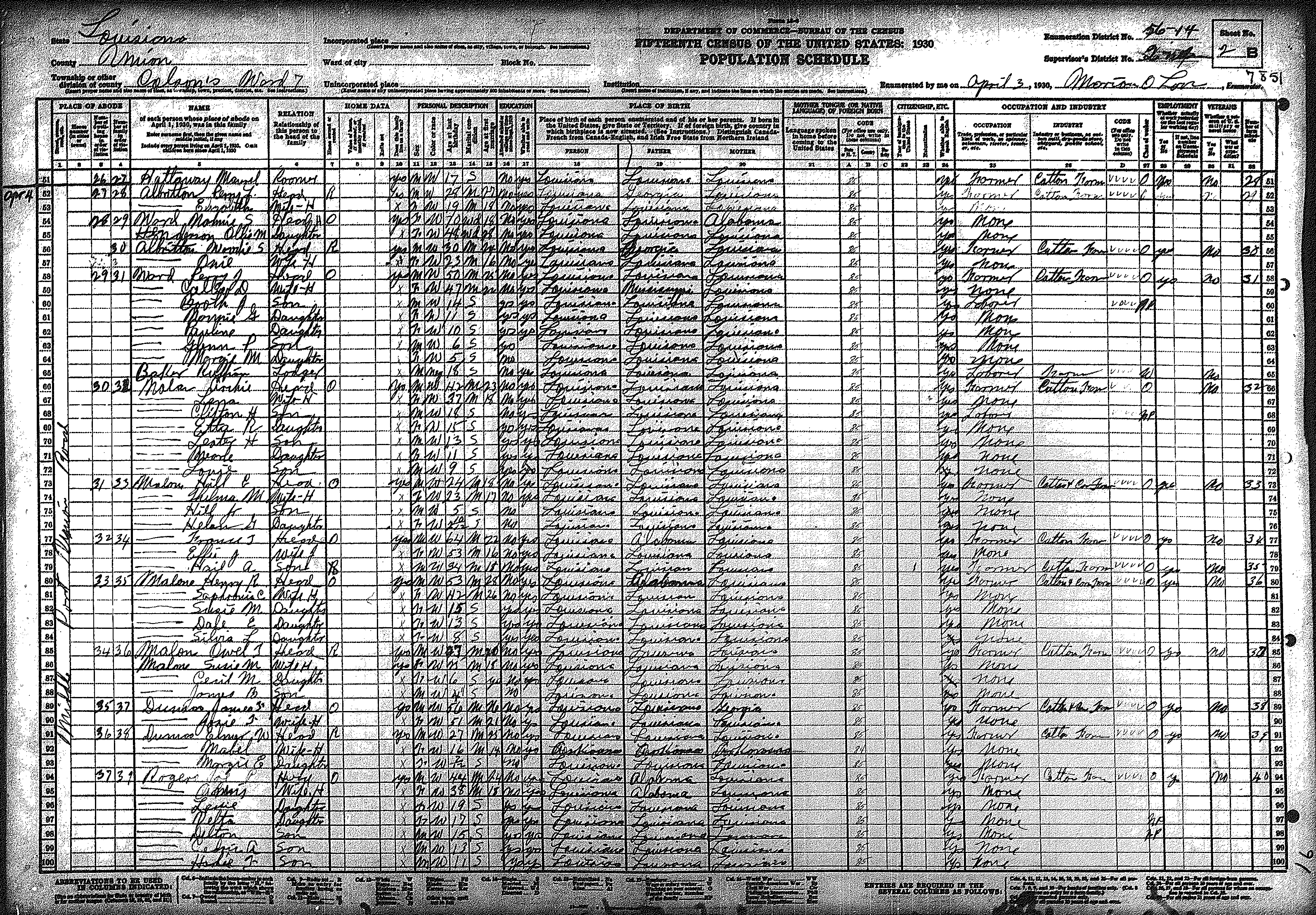
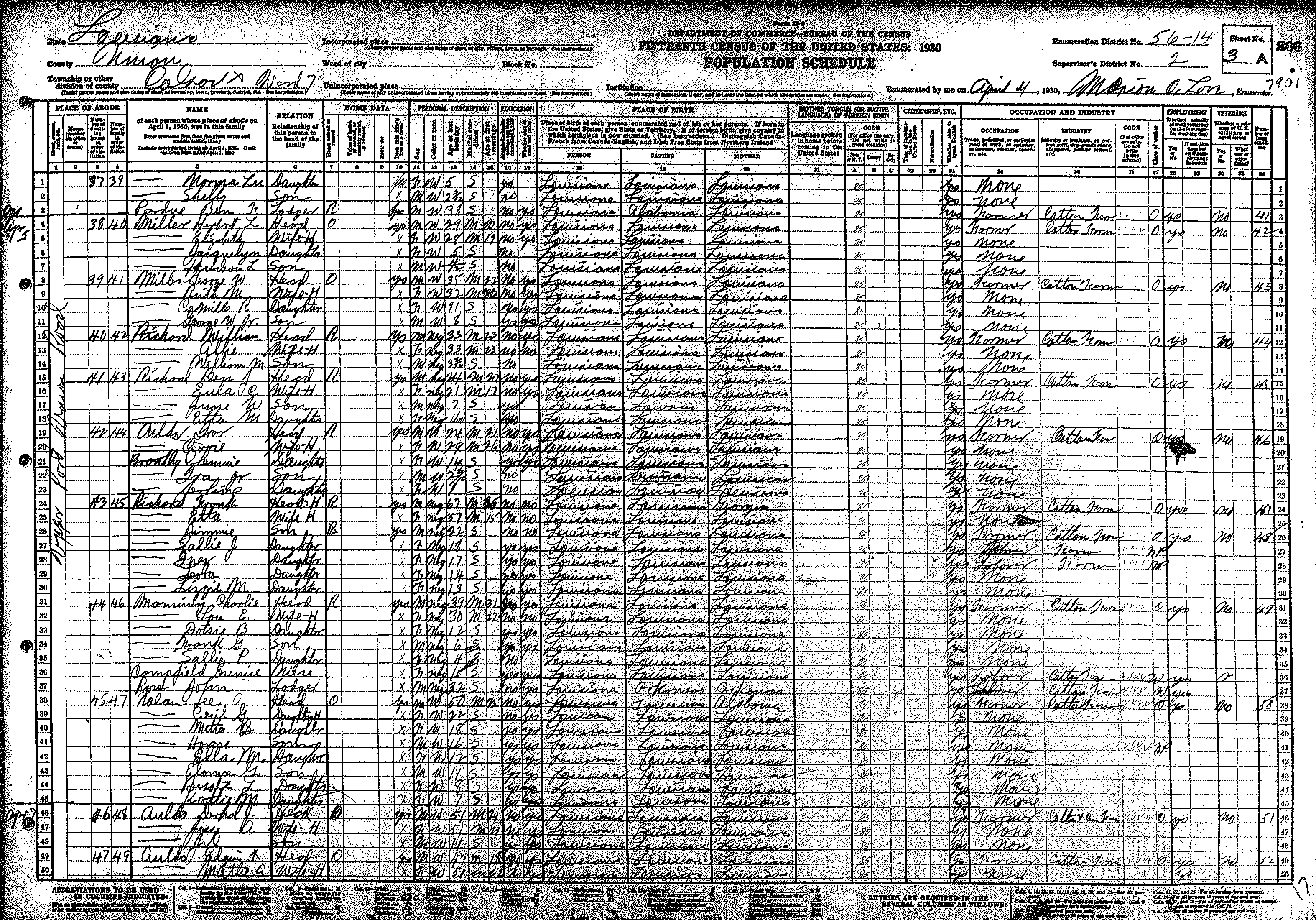
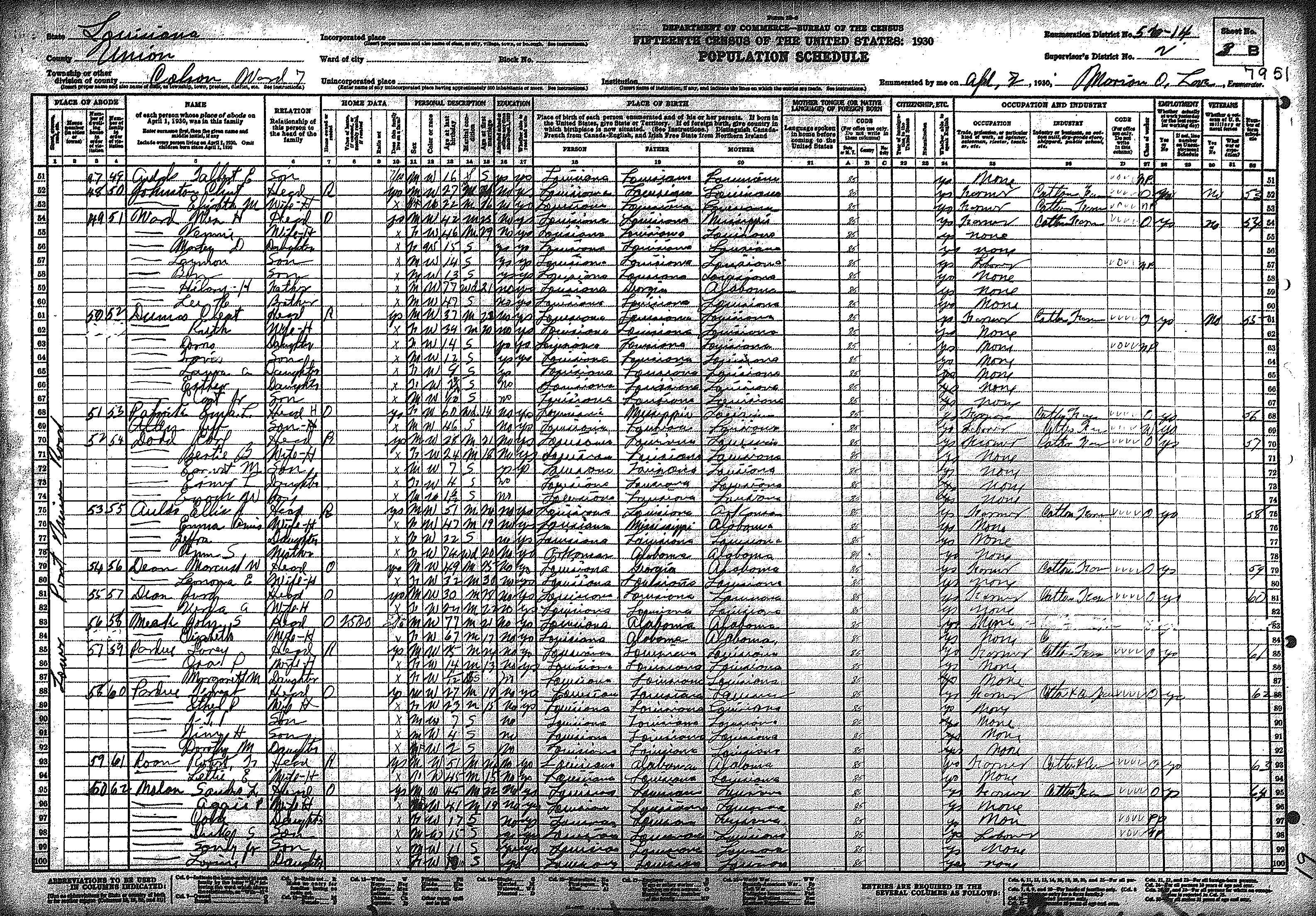
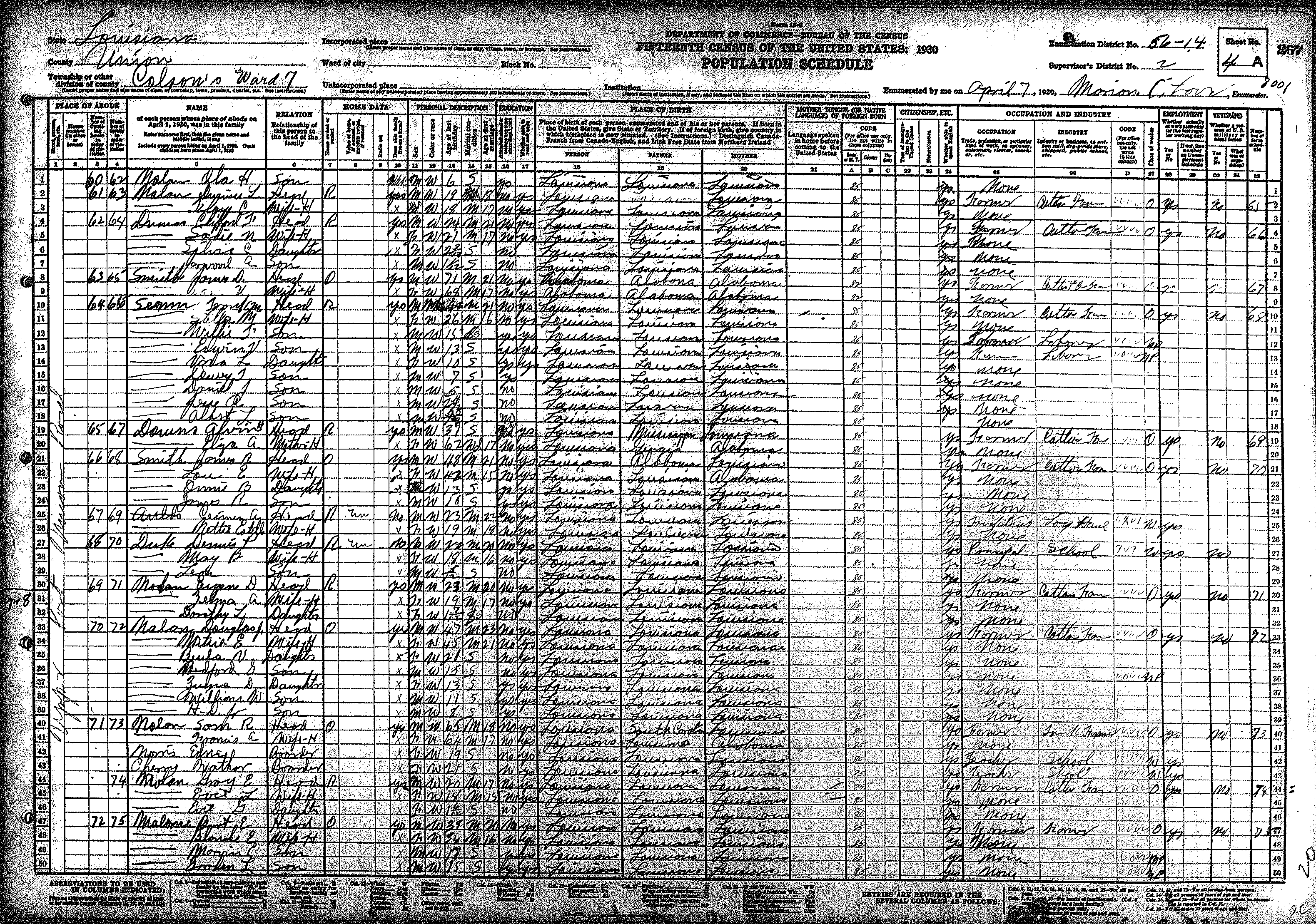
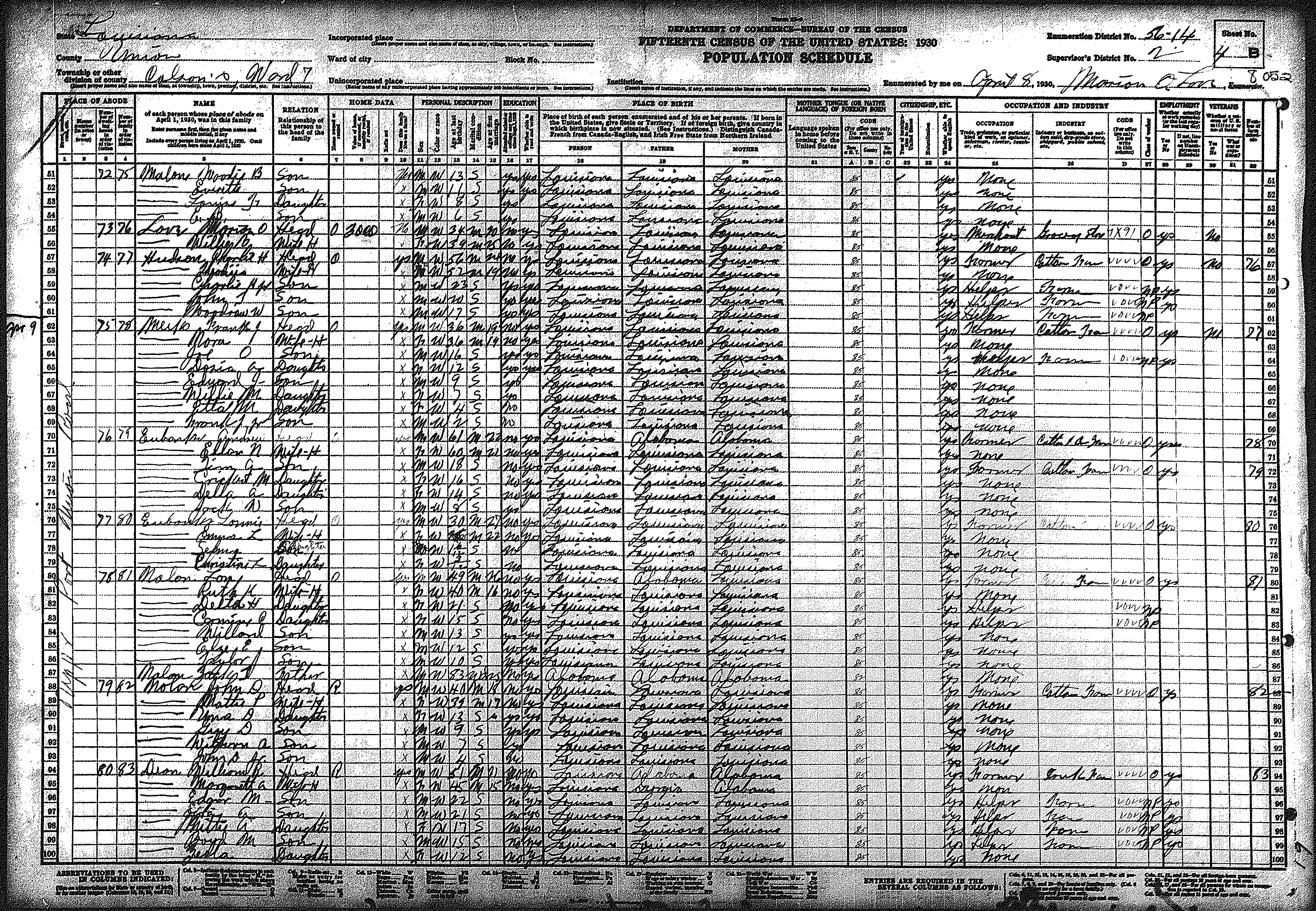
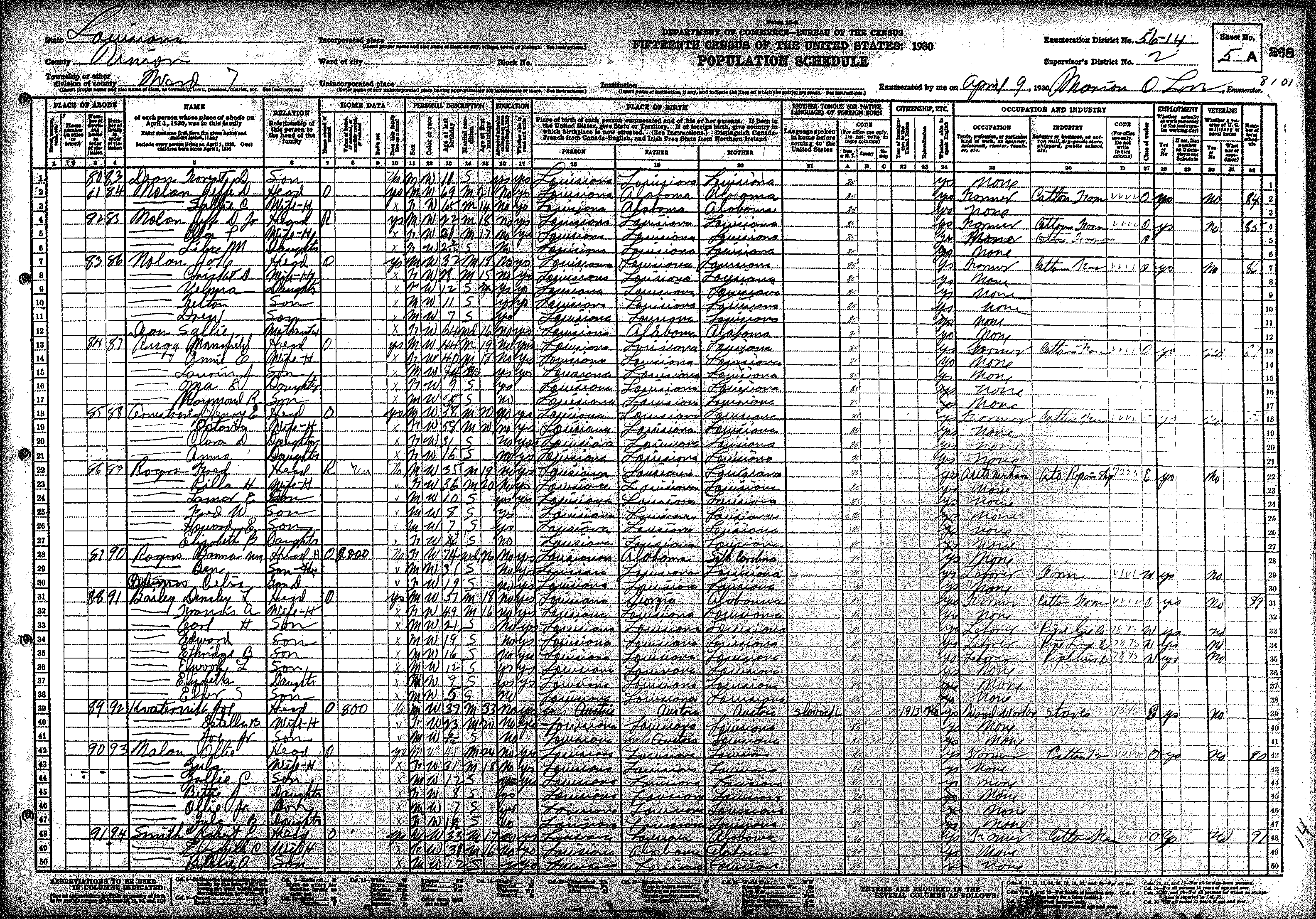
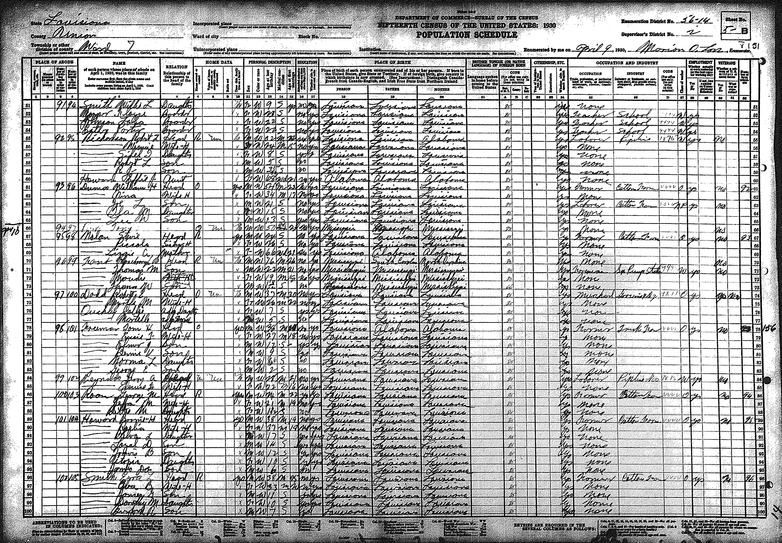
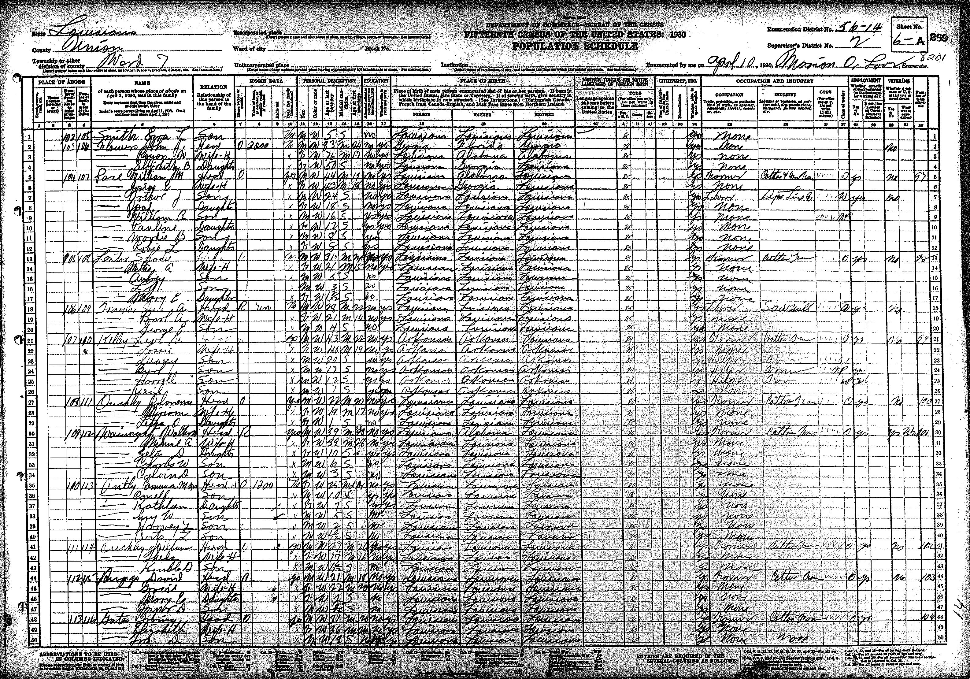
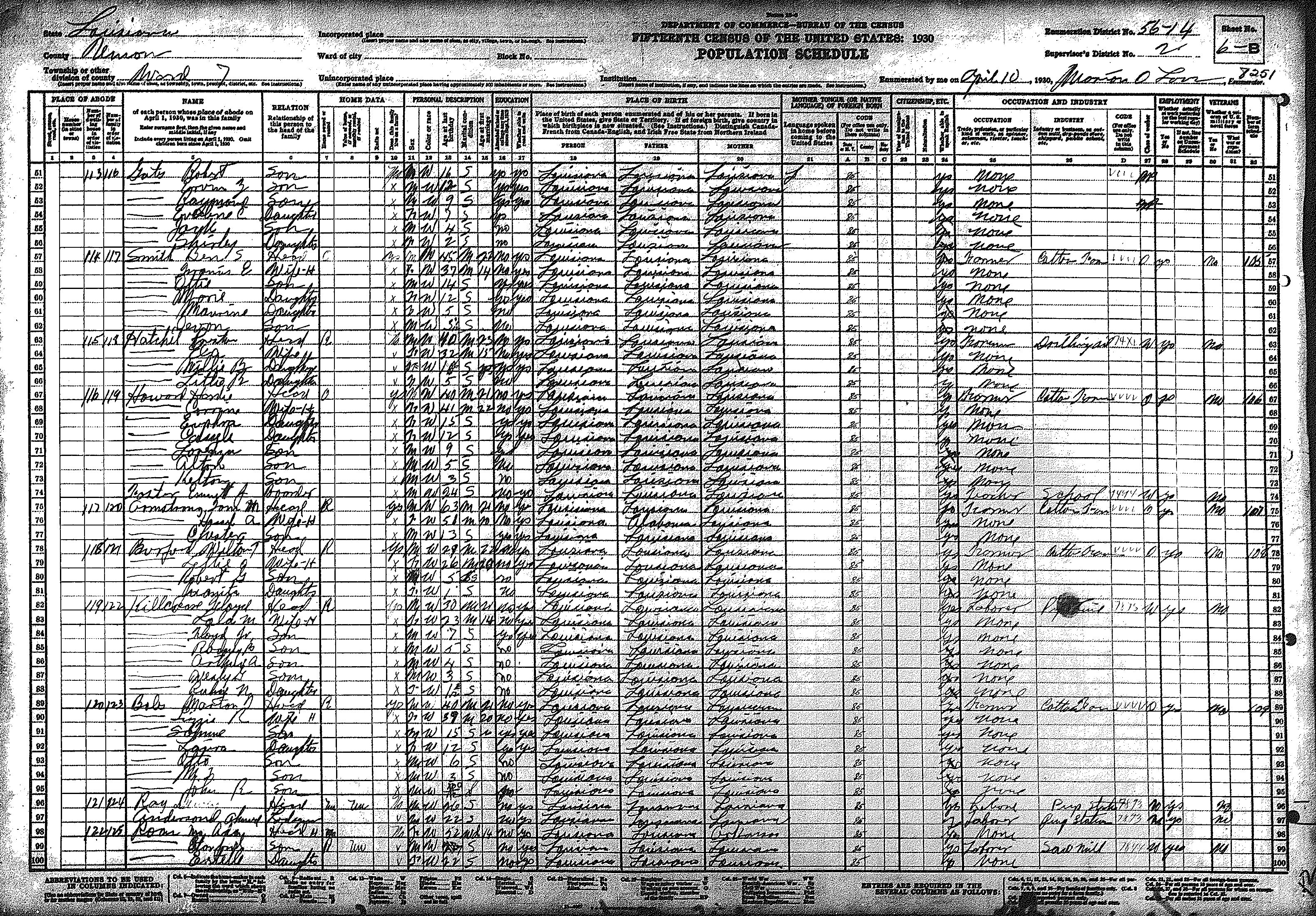
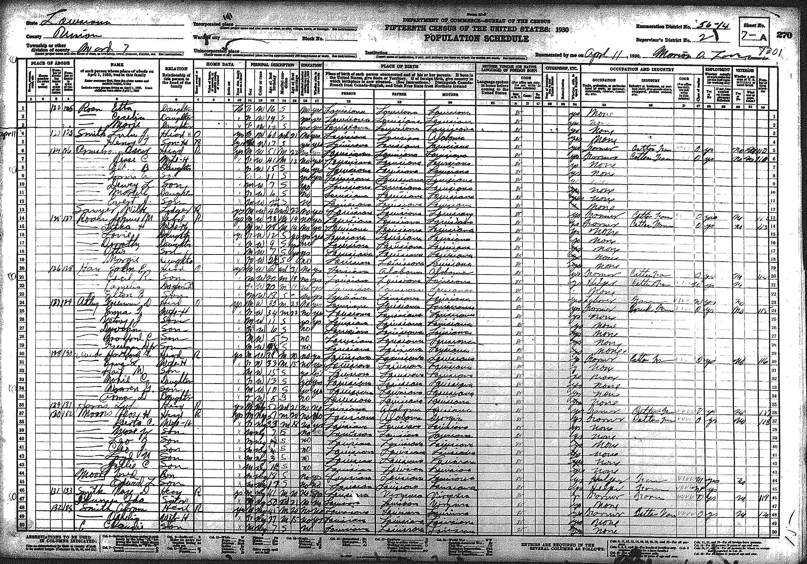
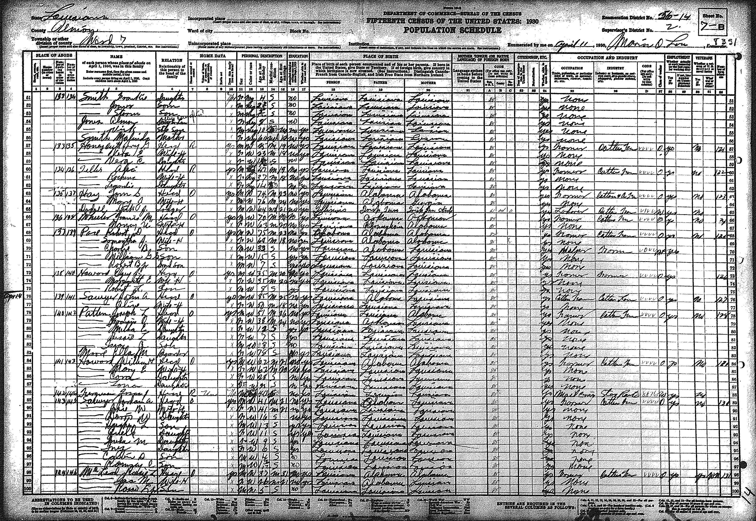
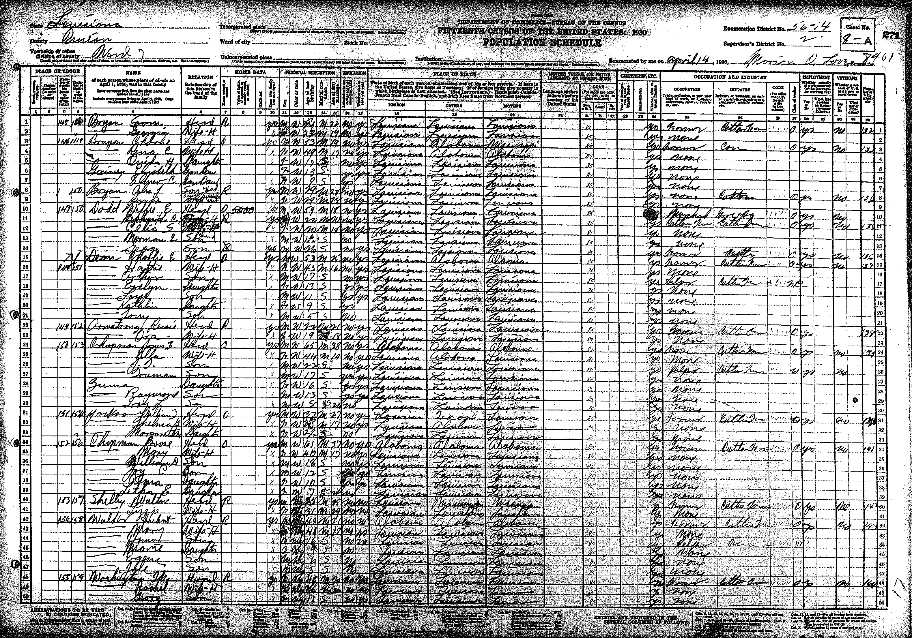
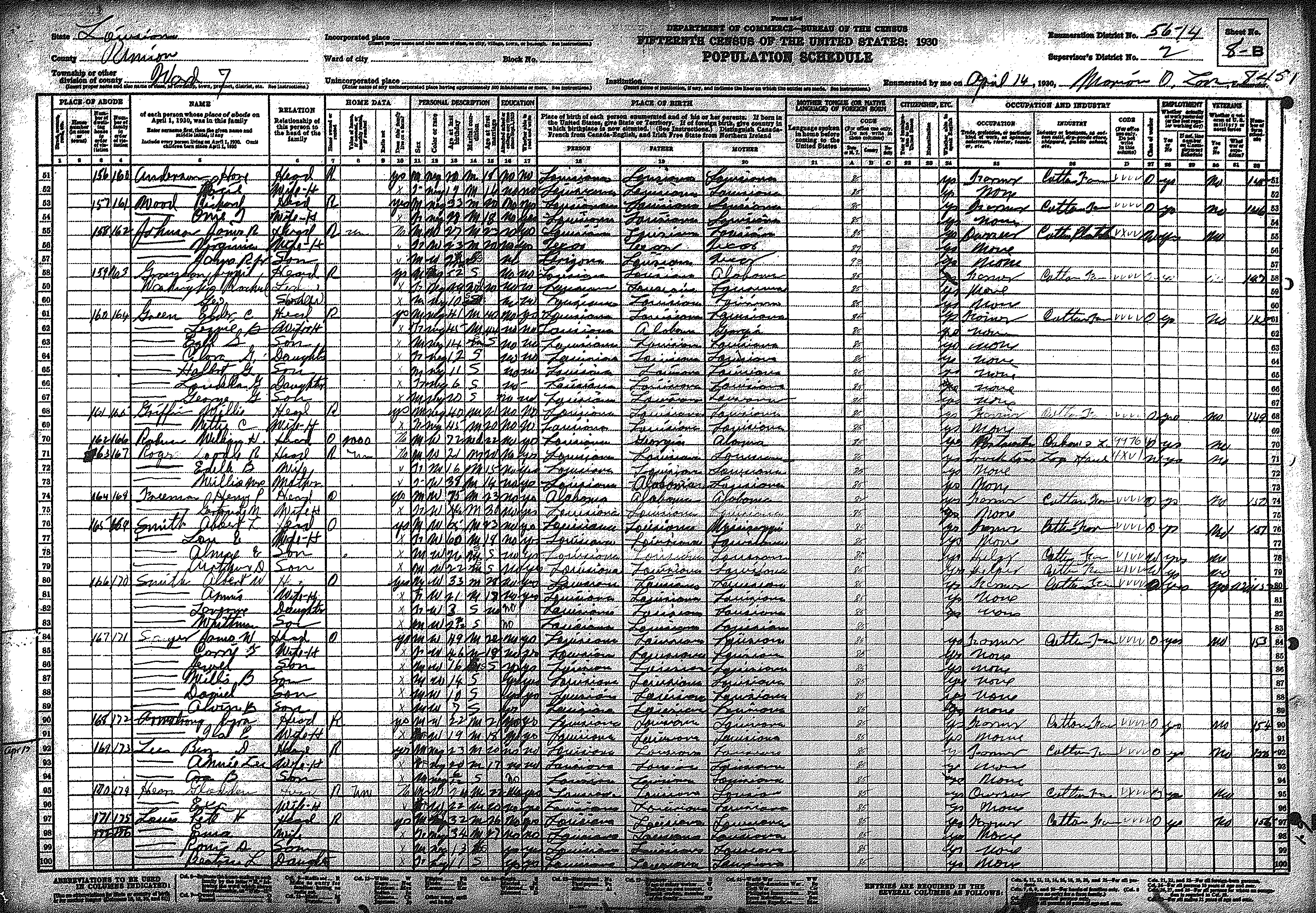
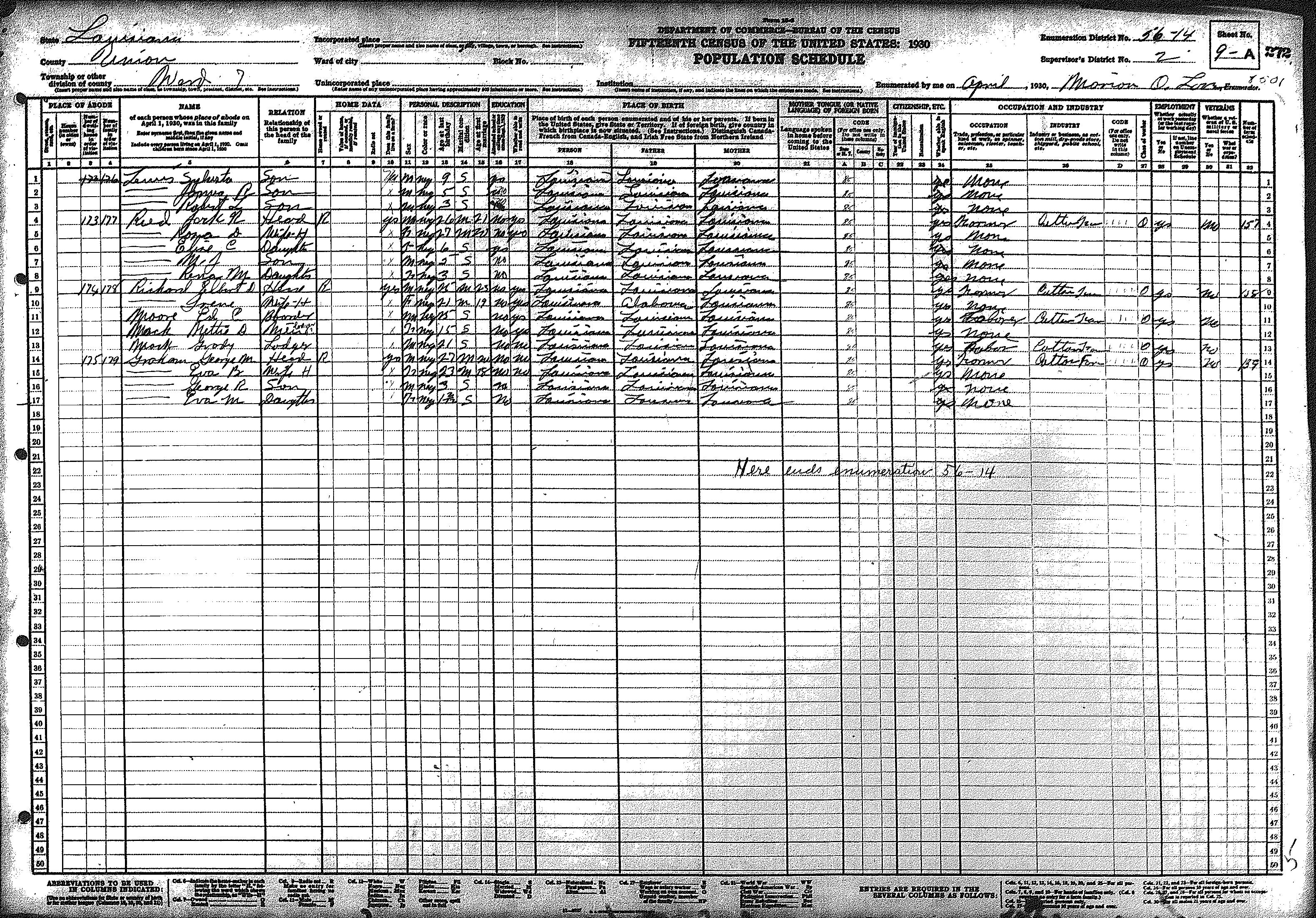
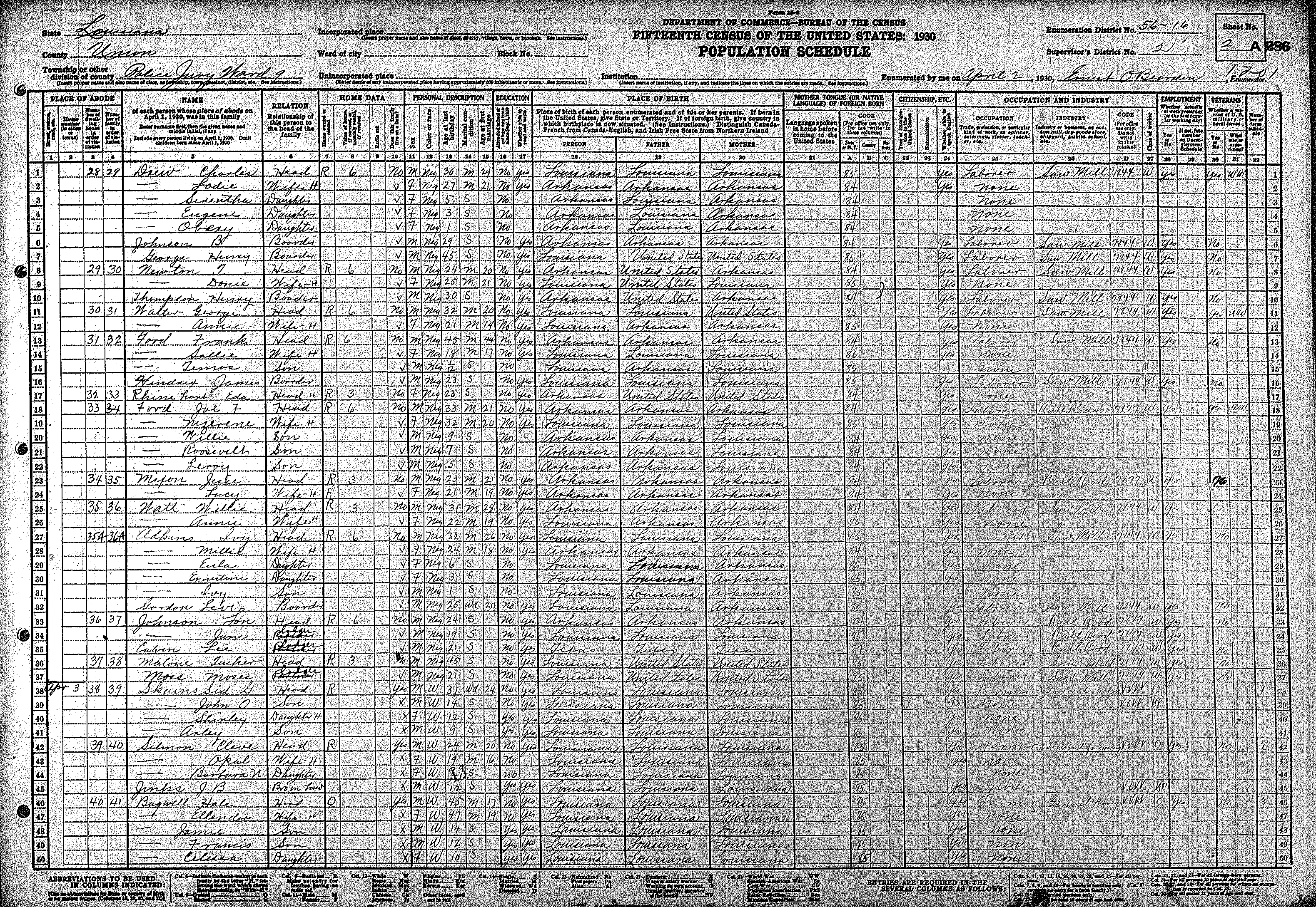
| 7 | 56 – 14 | East/central Union Parish along Ward's Chapel Road; Colson's & Rocky Branch | |||||||||||||||||
| 355 | 356 | 357 | 358 | 359 | 360 | 361 | 362 | 363 | 364 | 365 | 366 | 367 | 368 | 369 | |||||
| 370 | 371 | 372 | |||||||||||||||||
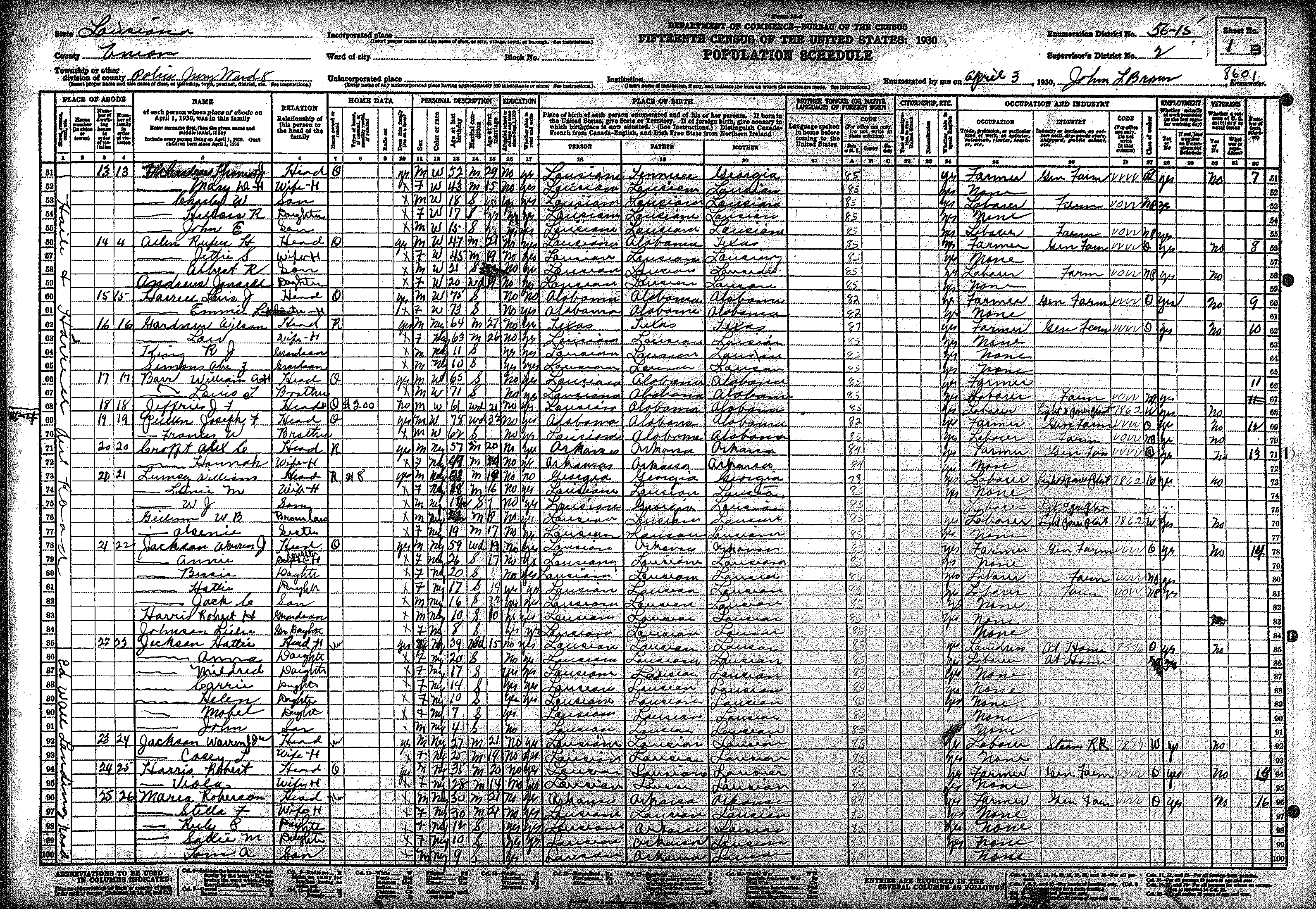
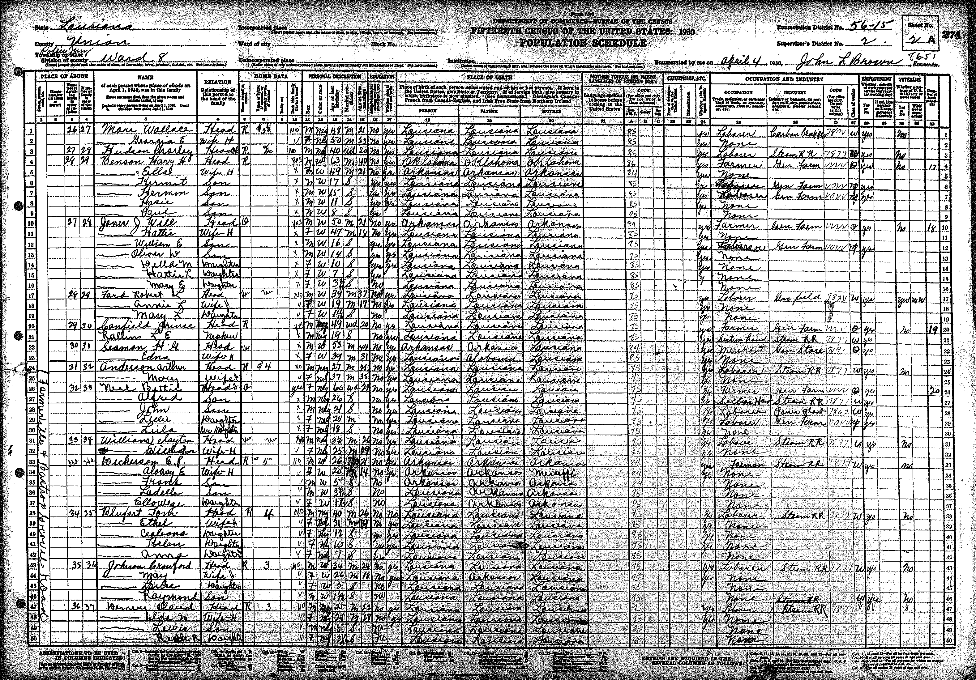
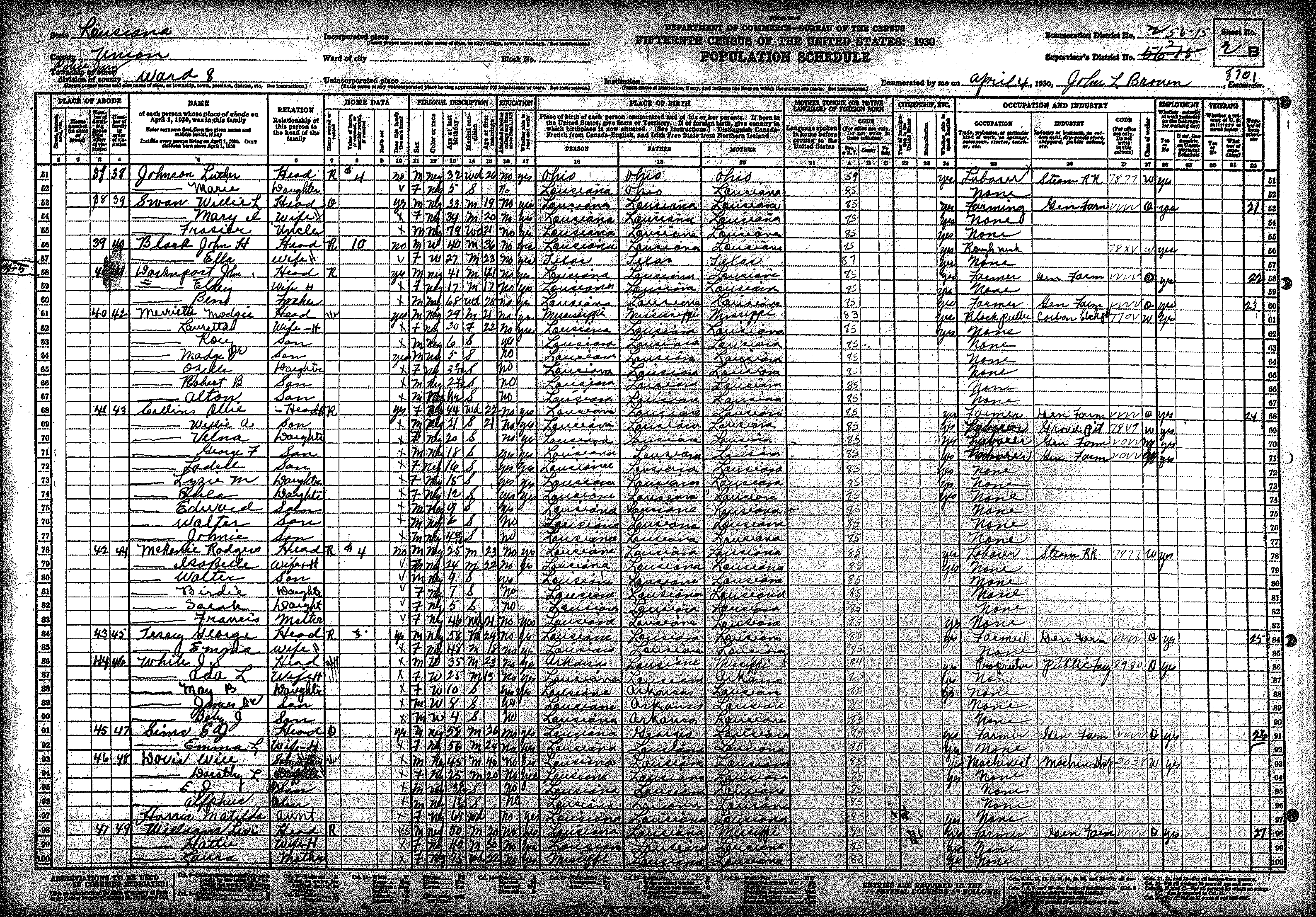
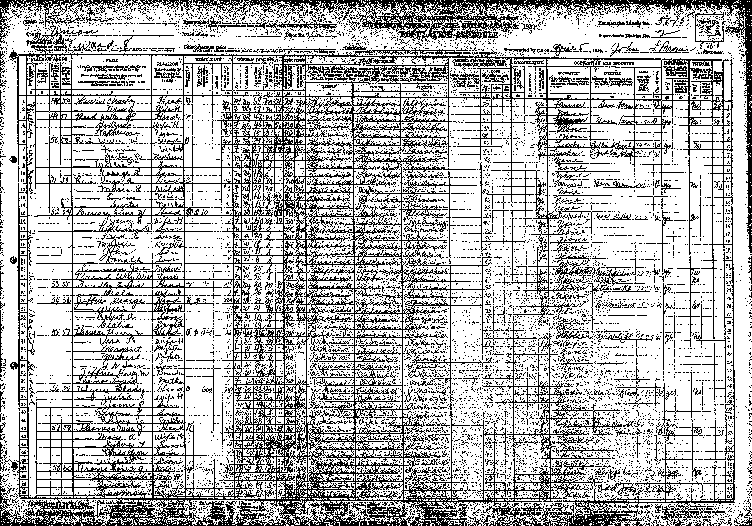
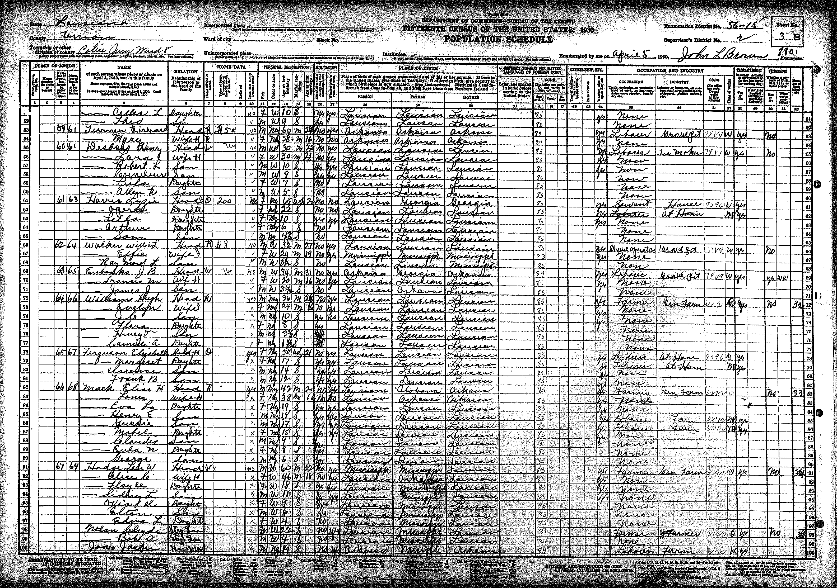
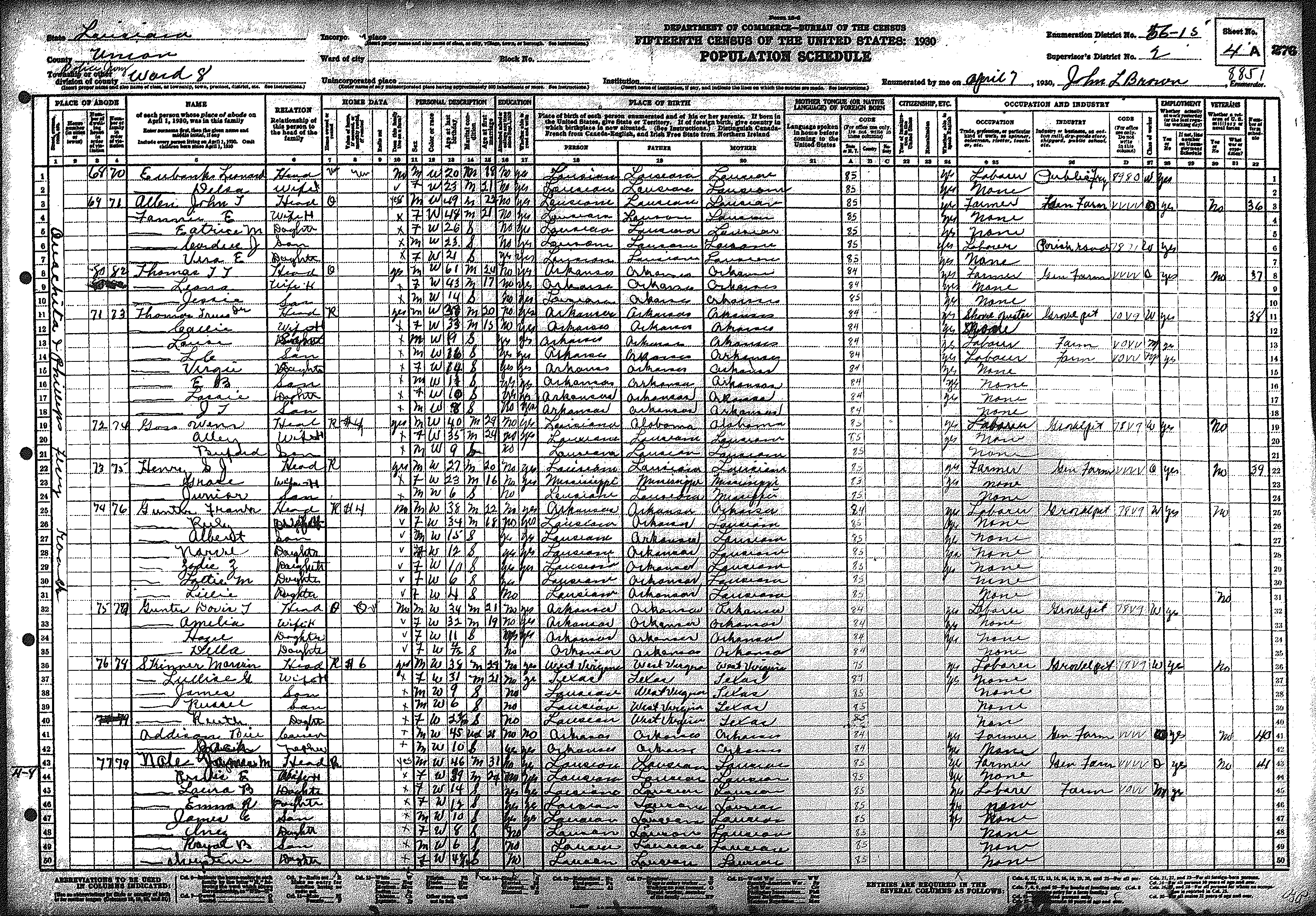
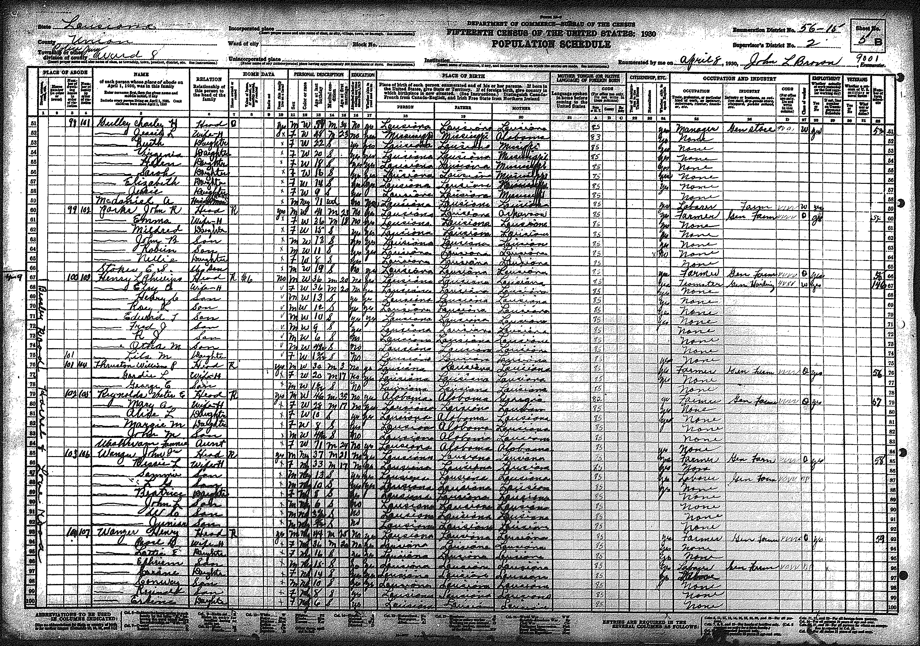
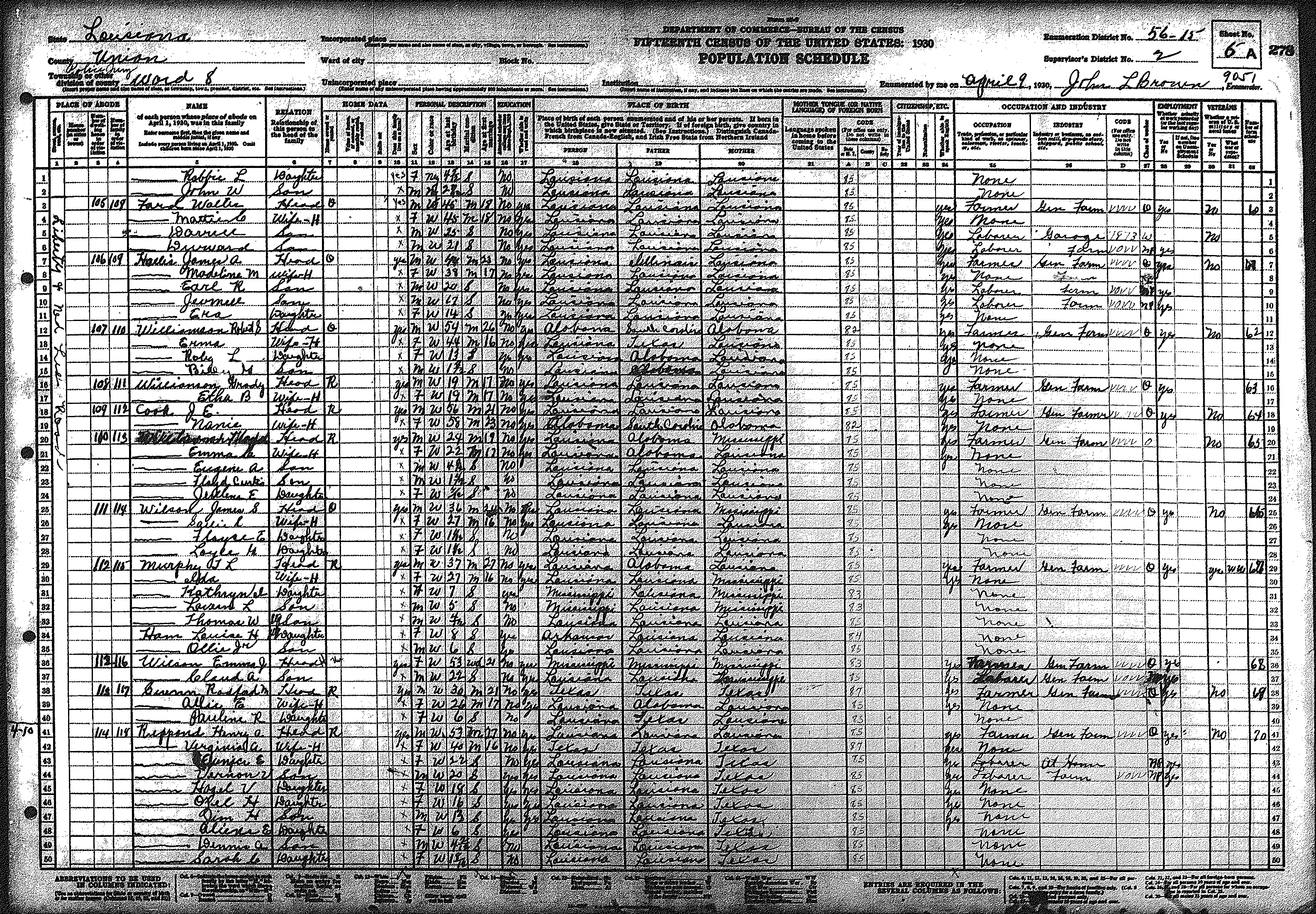
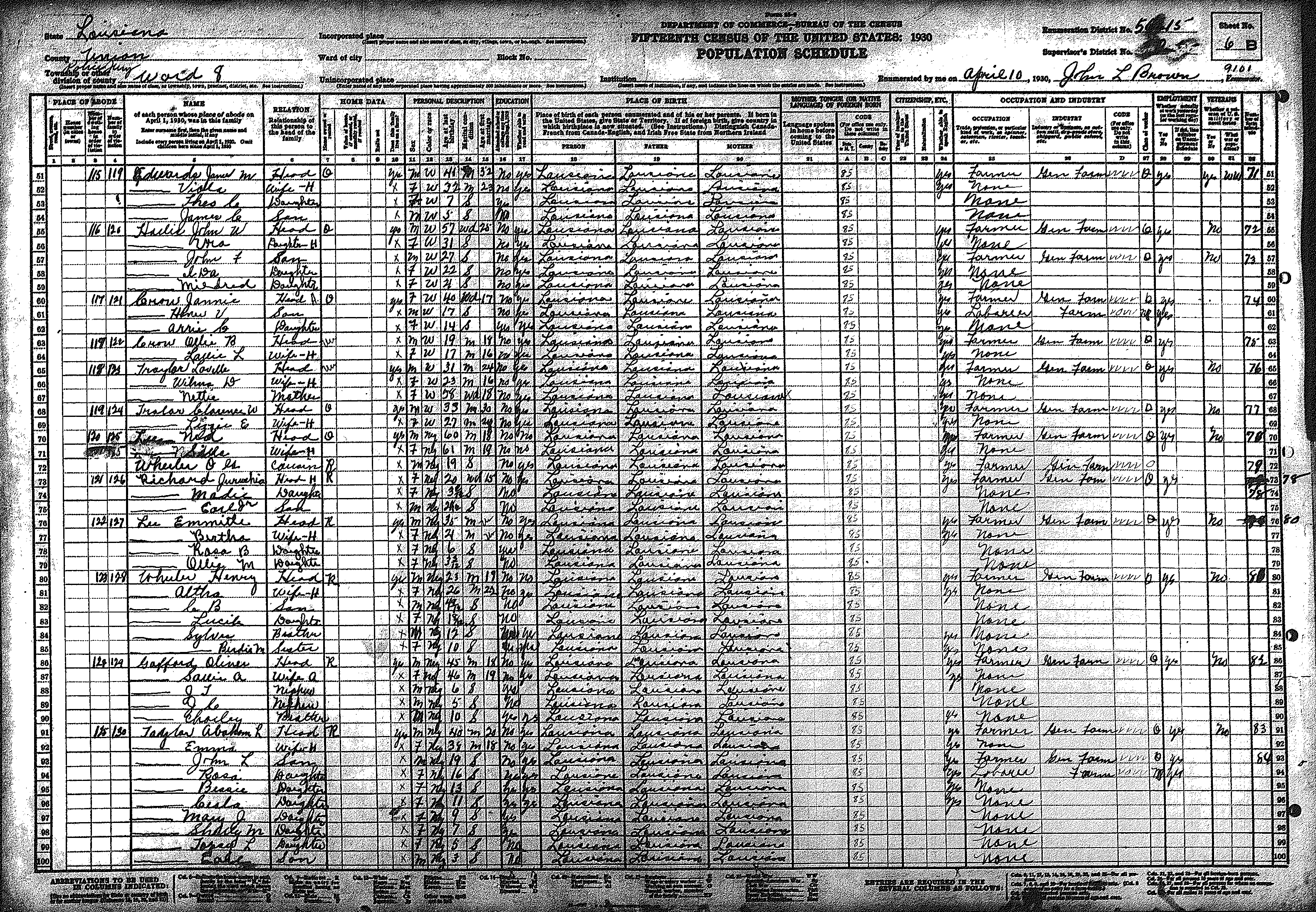
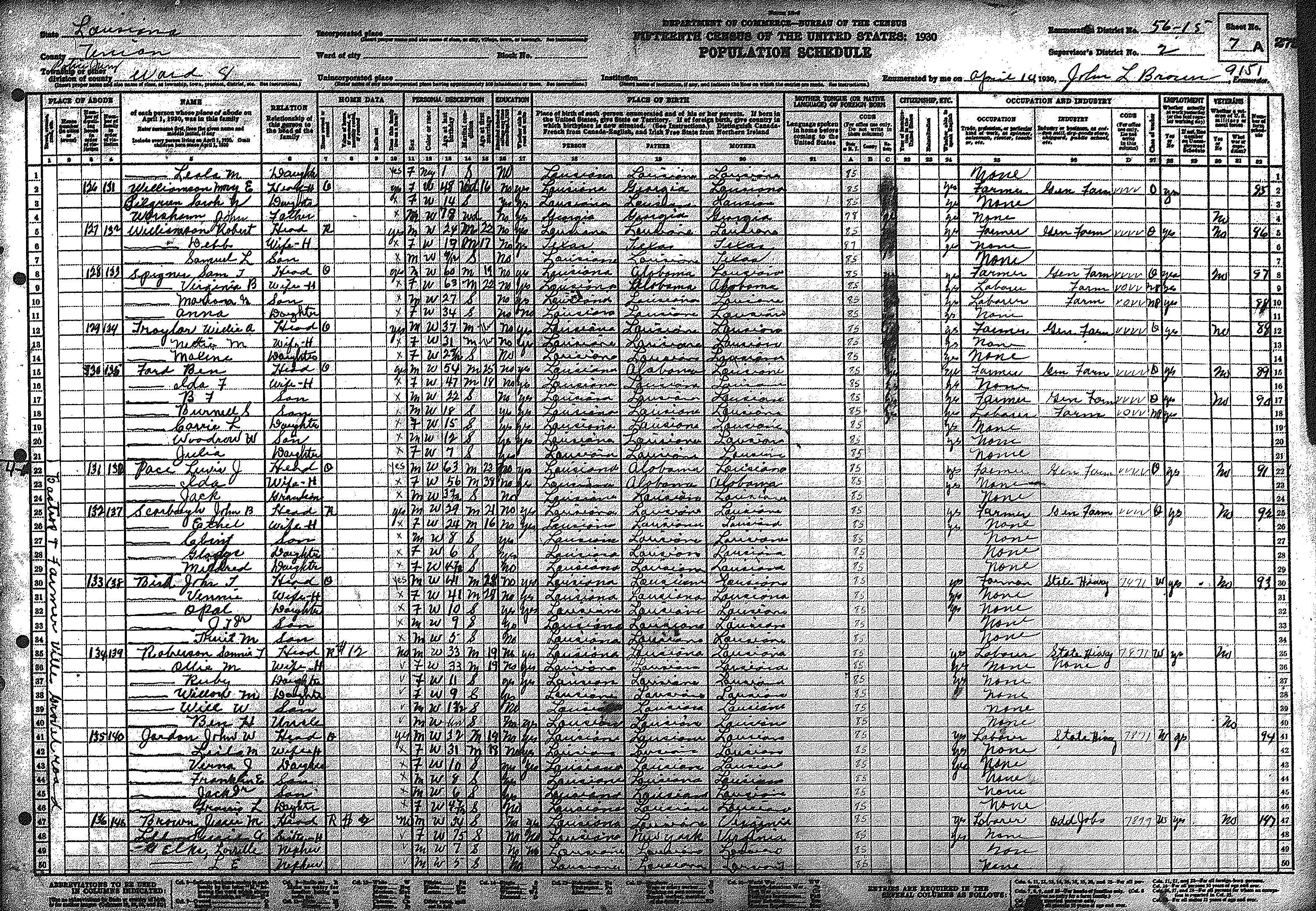
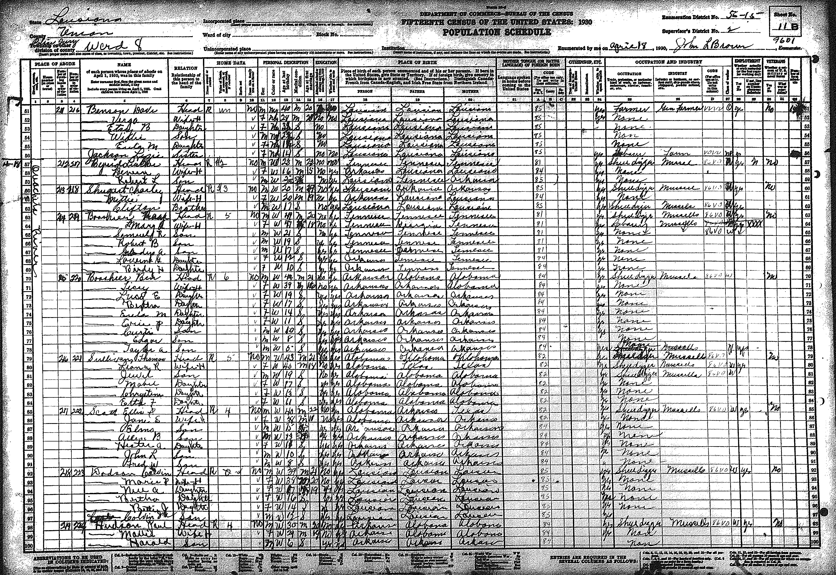
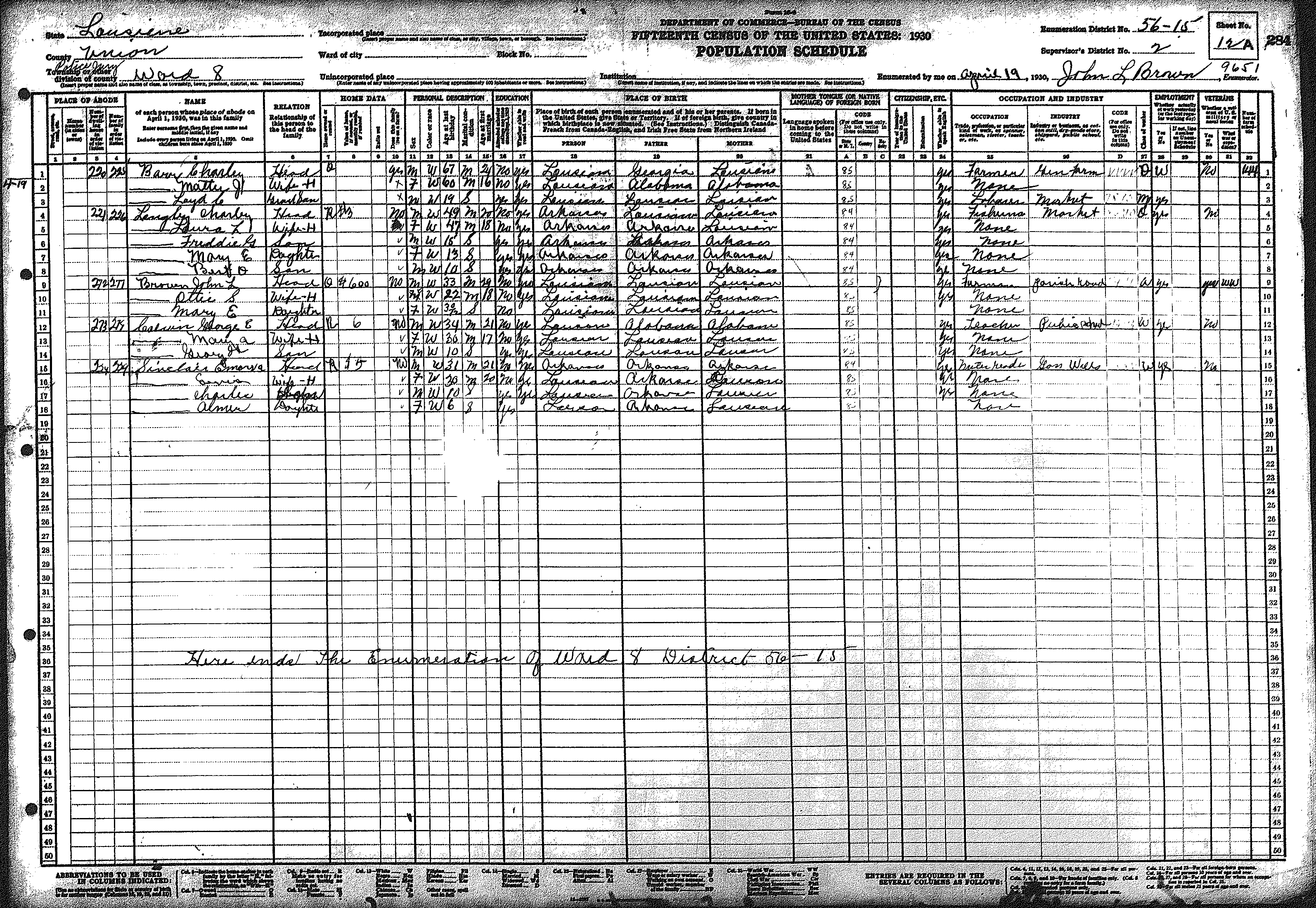
| 8 | 56 – 15 | Eastern Union Parish along the Ouachita River, including Spencer & Ouachita City | |||||||||||||||||
| 374 | 375 | 376 | 378 | 378 | 379 | 380 | 381 | 382 | 383 | 384 | 385 | 386 | 387 | 388 | |||||
| 389 | 390 | 391 | 392 | 393 | 394 | 395 | 396 | 397 | |||||||||||
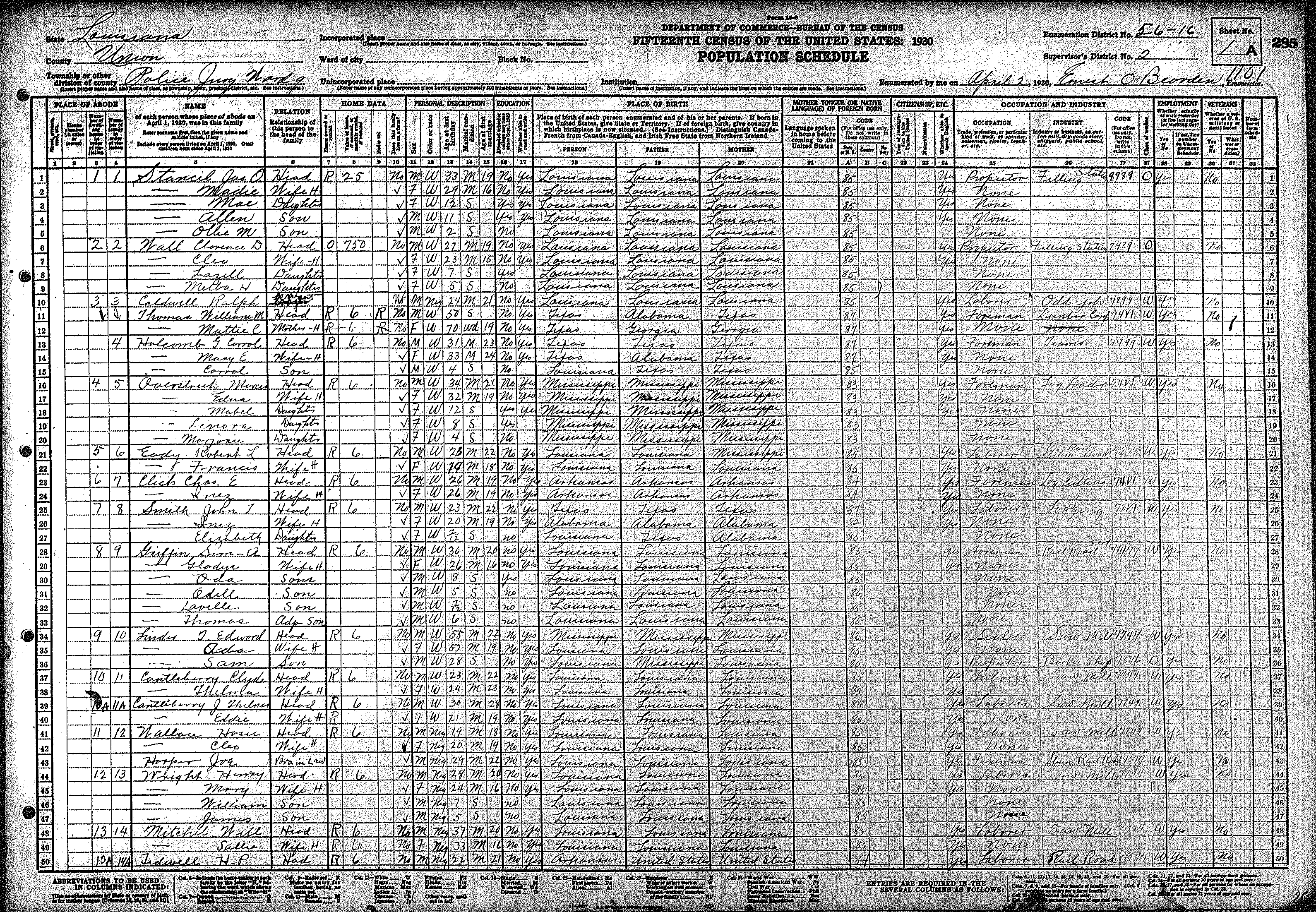
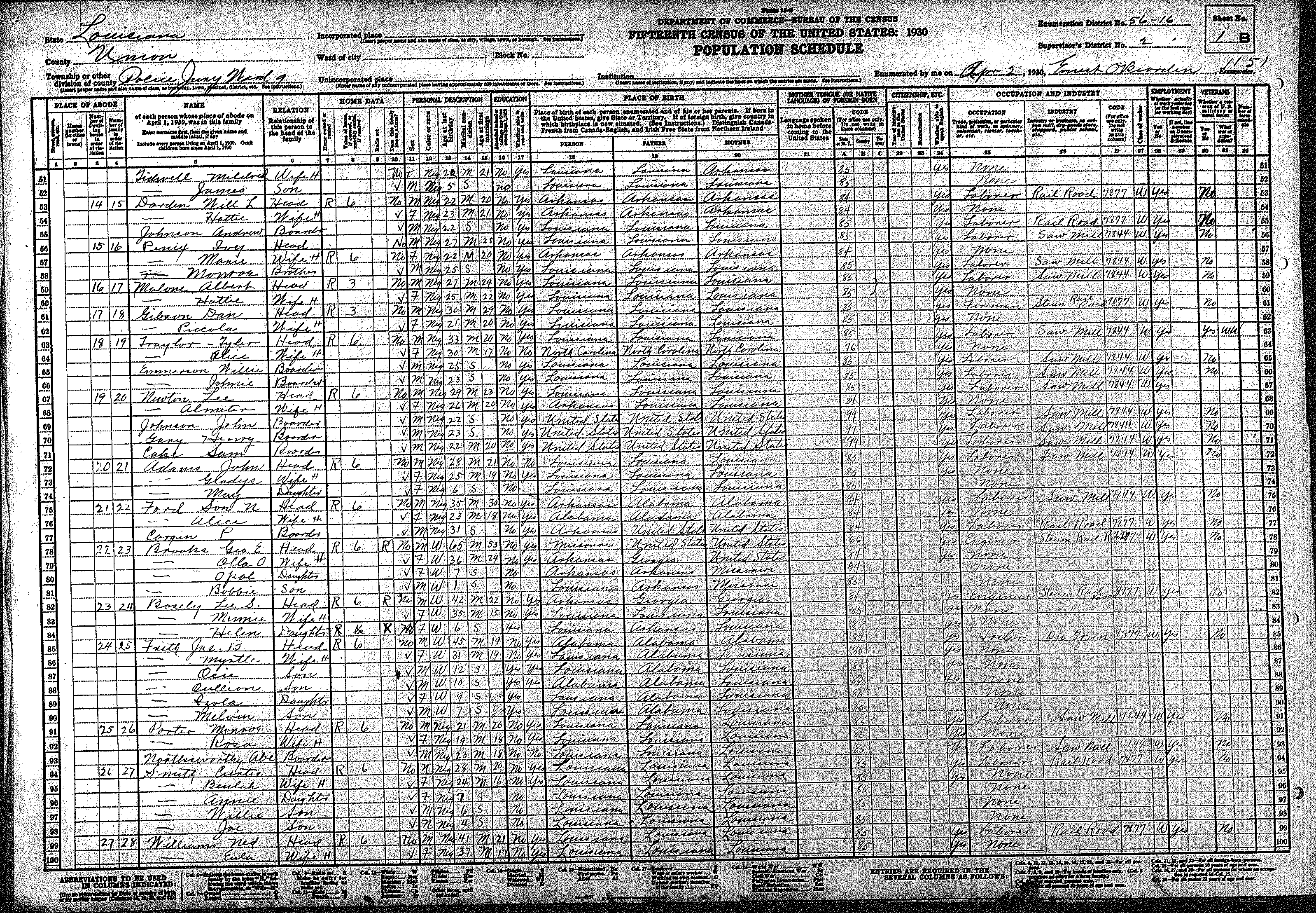
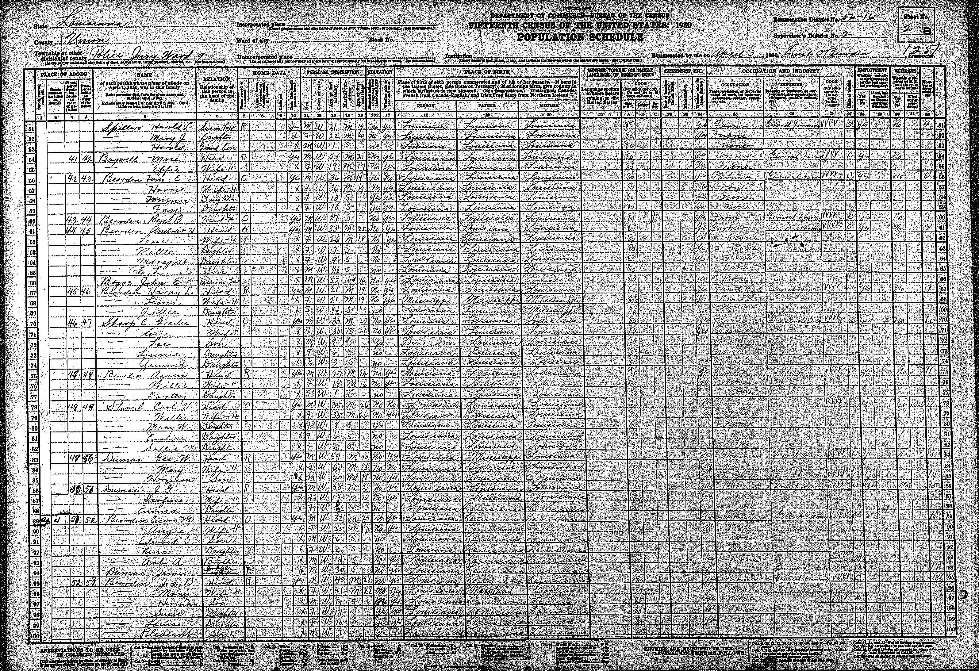
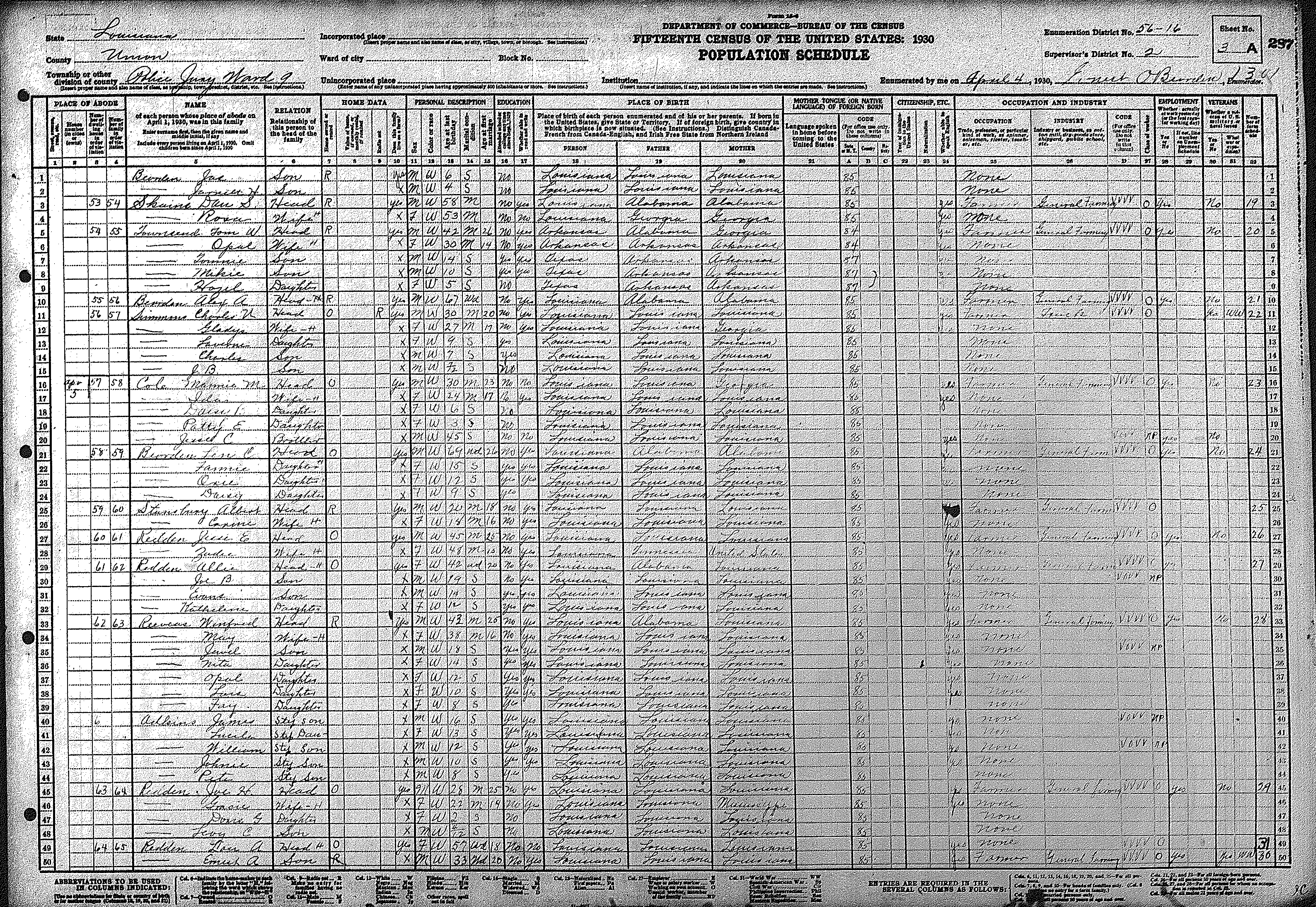
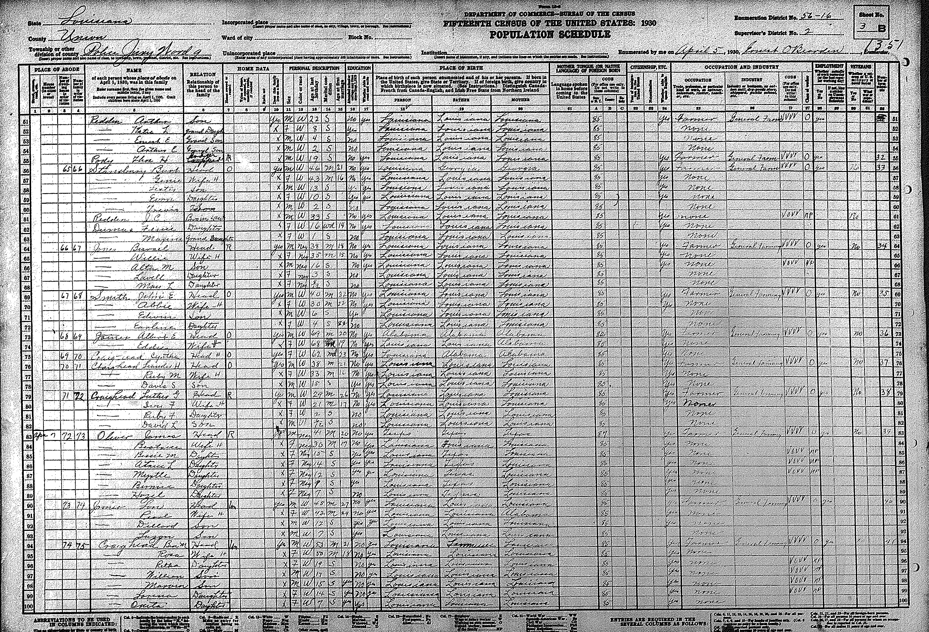
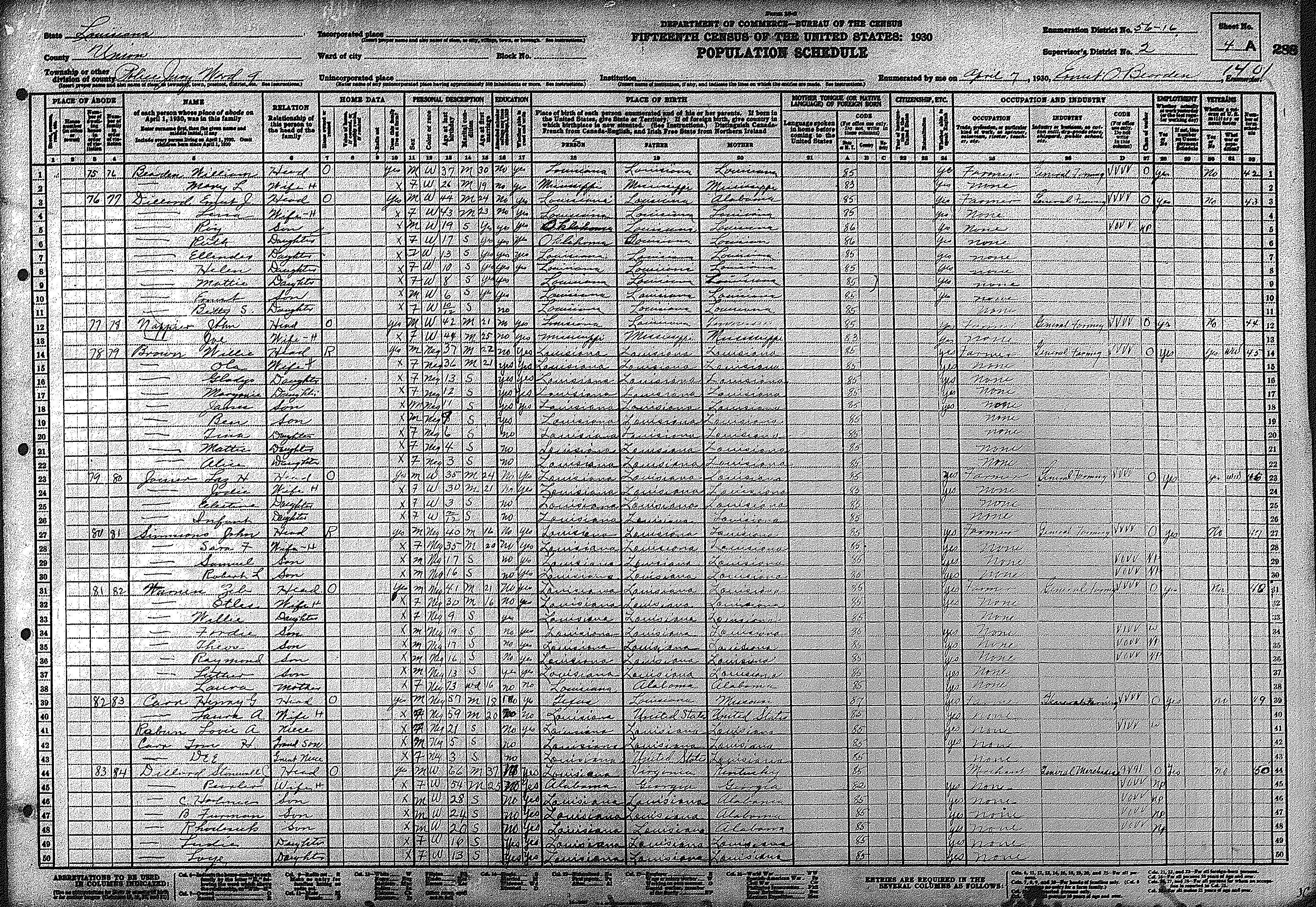
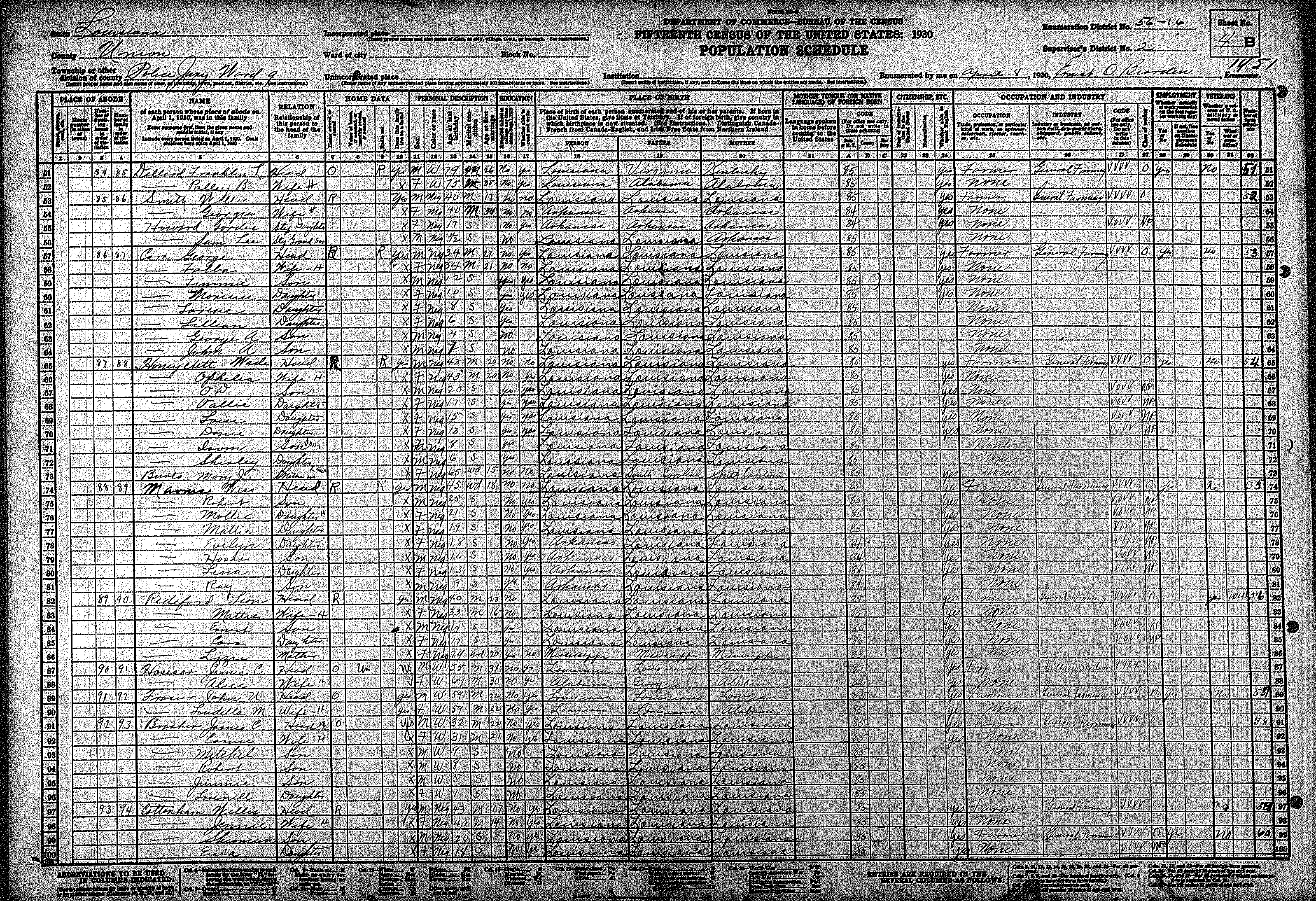
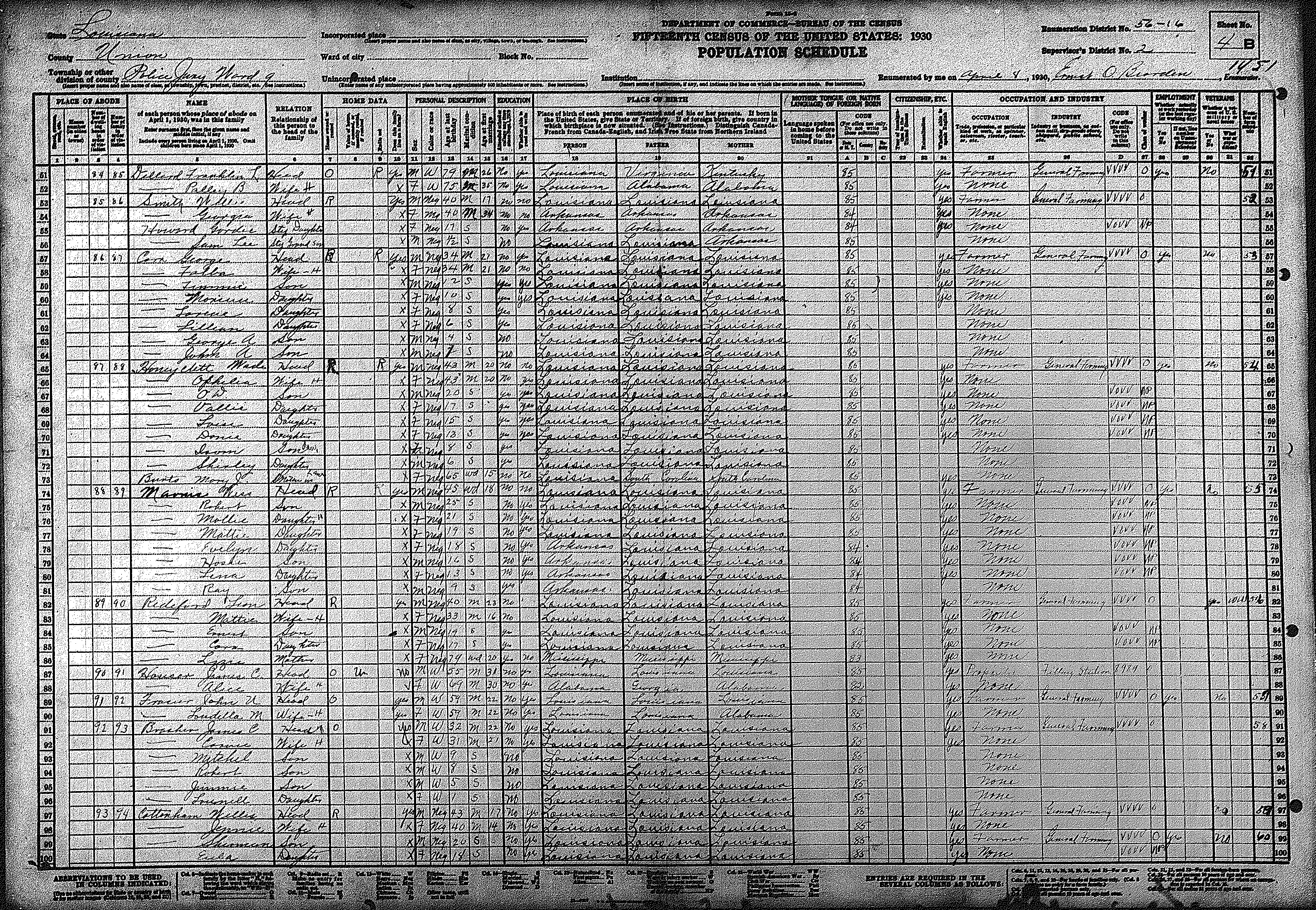
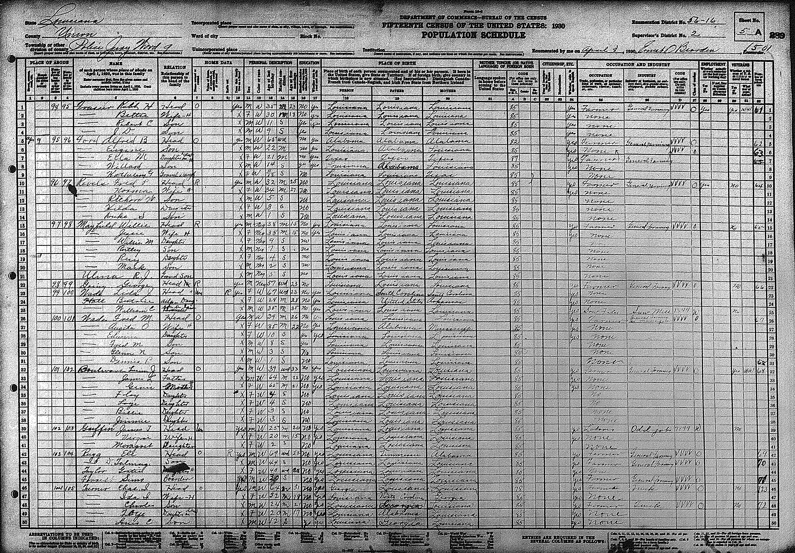
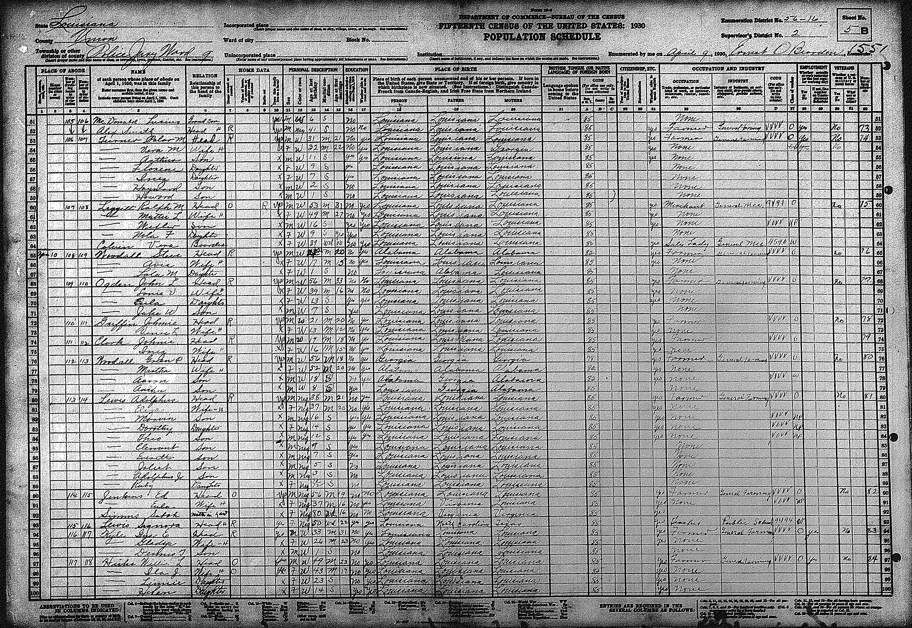
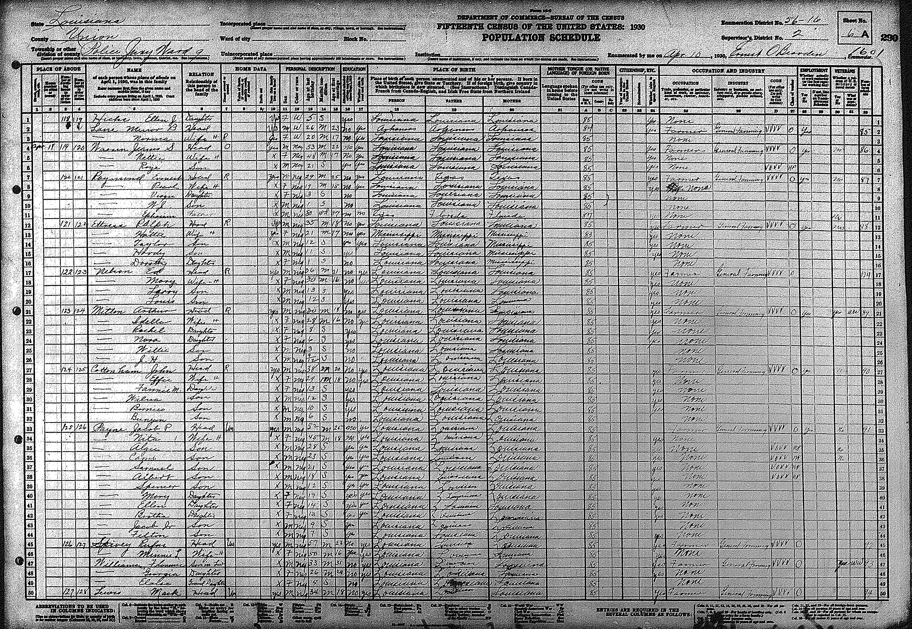
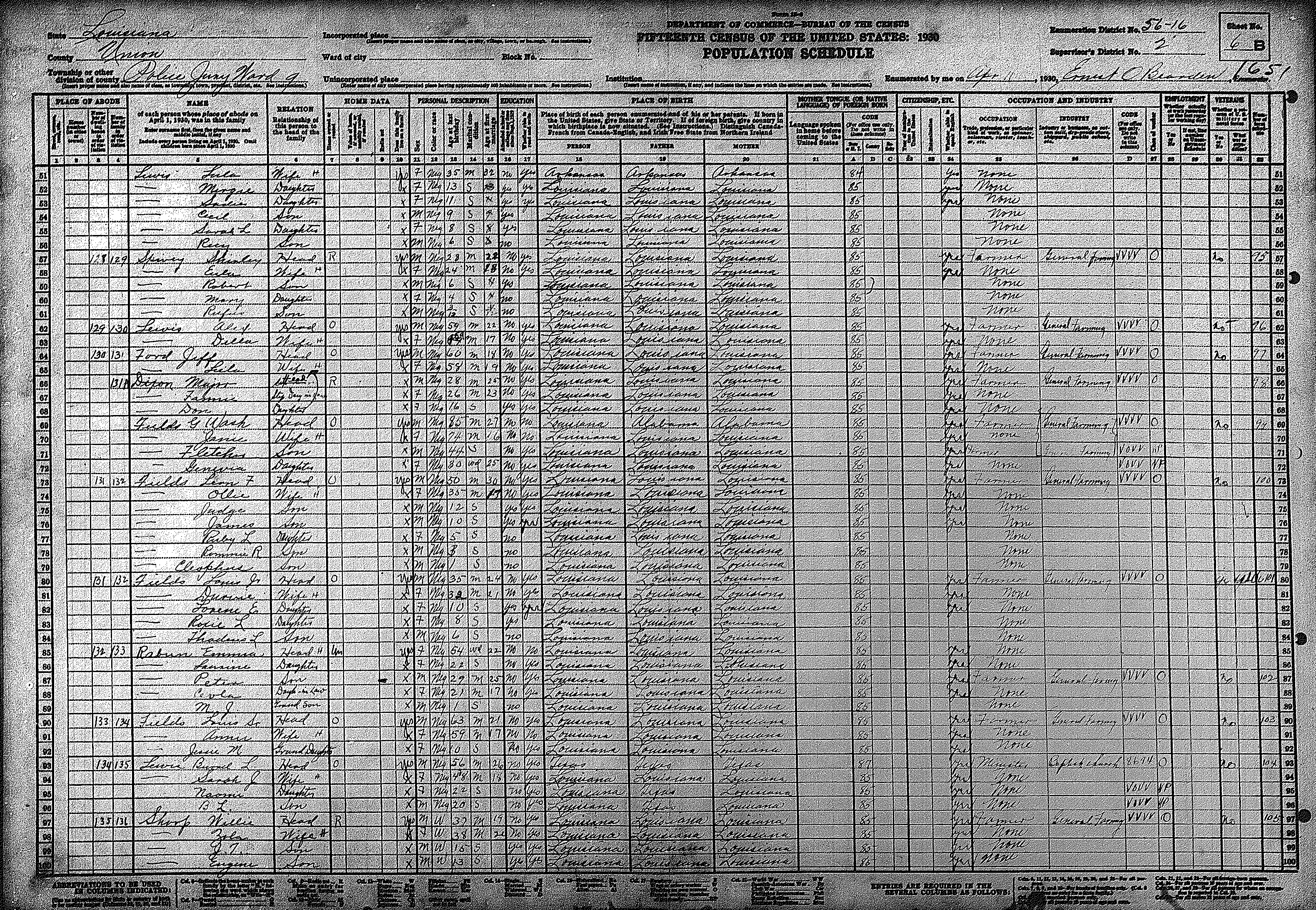
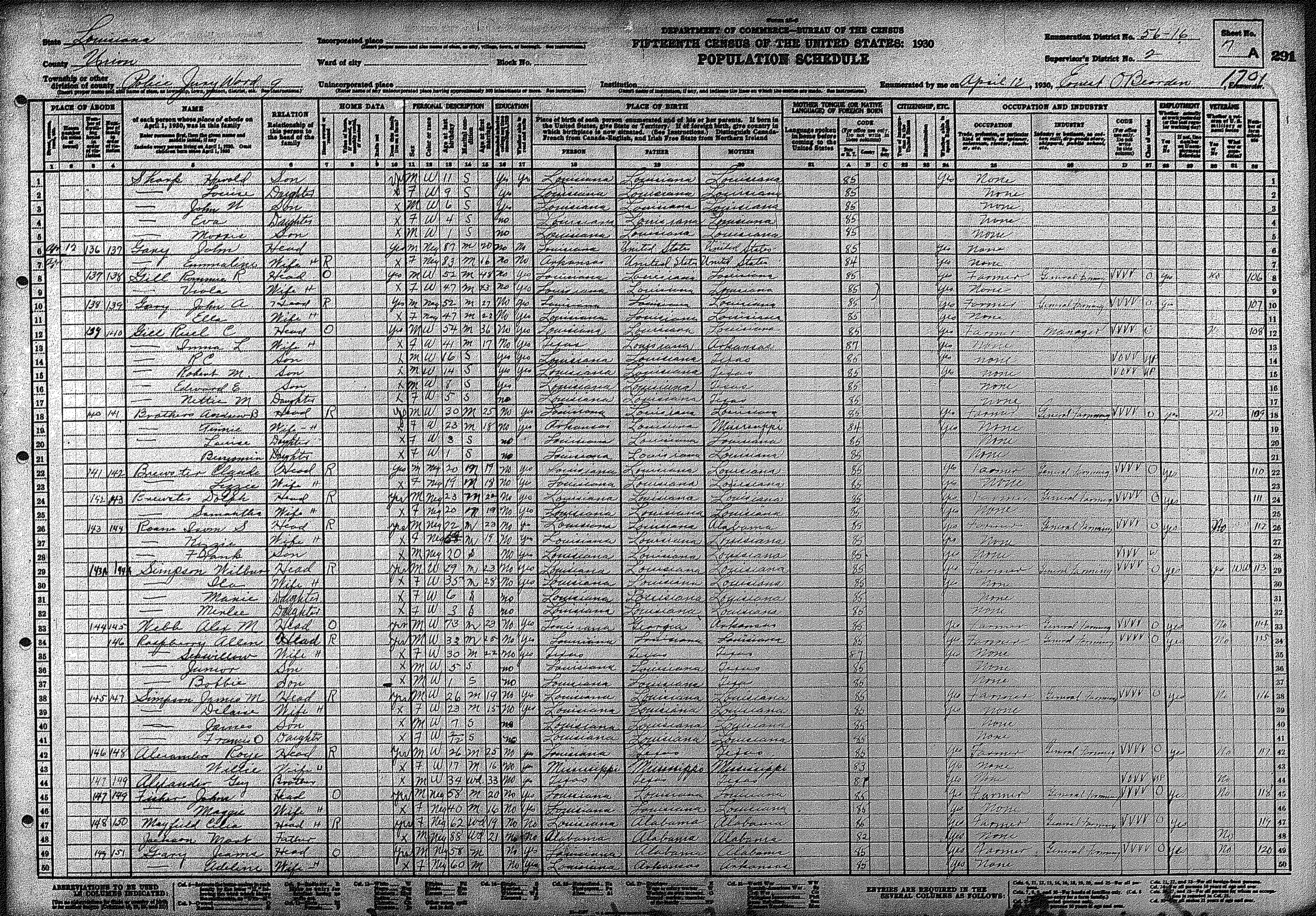
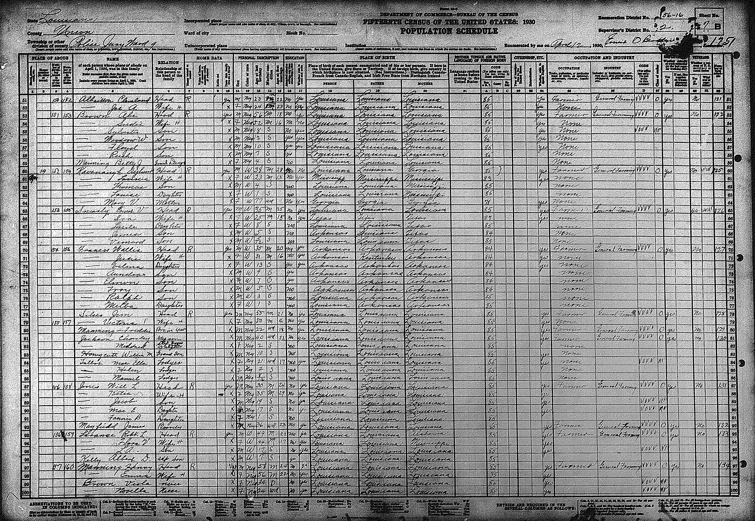
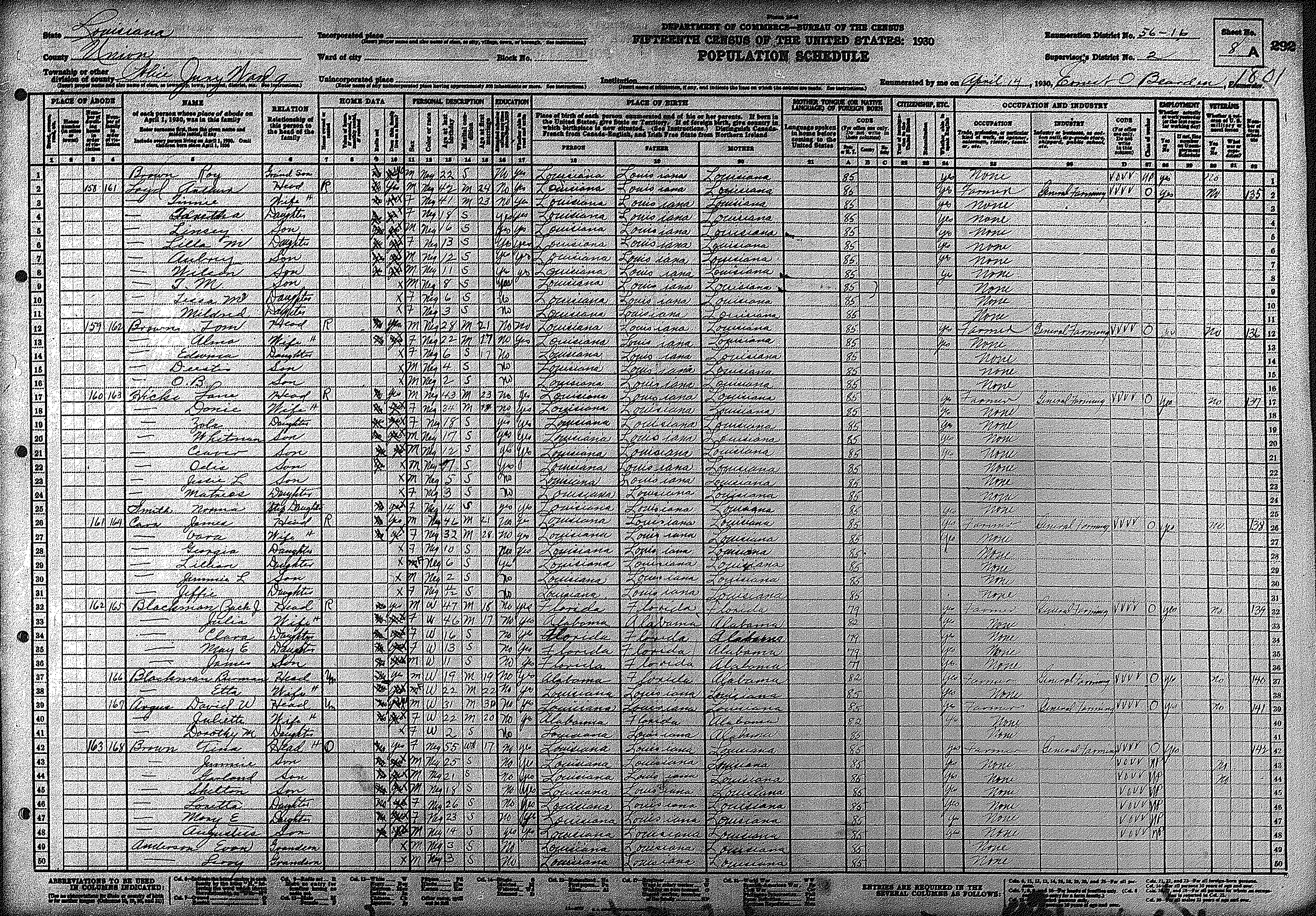
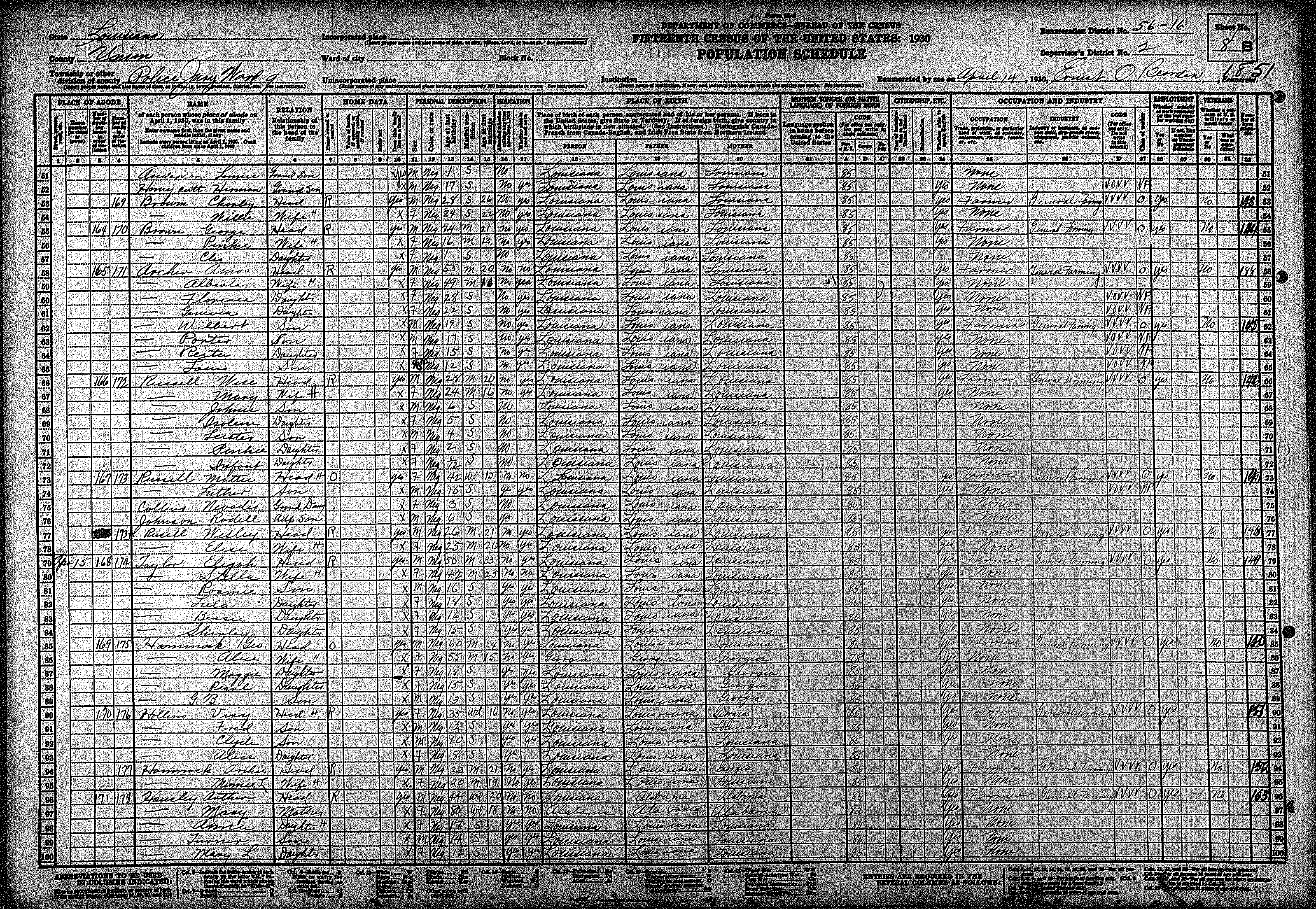
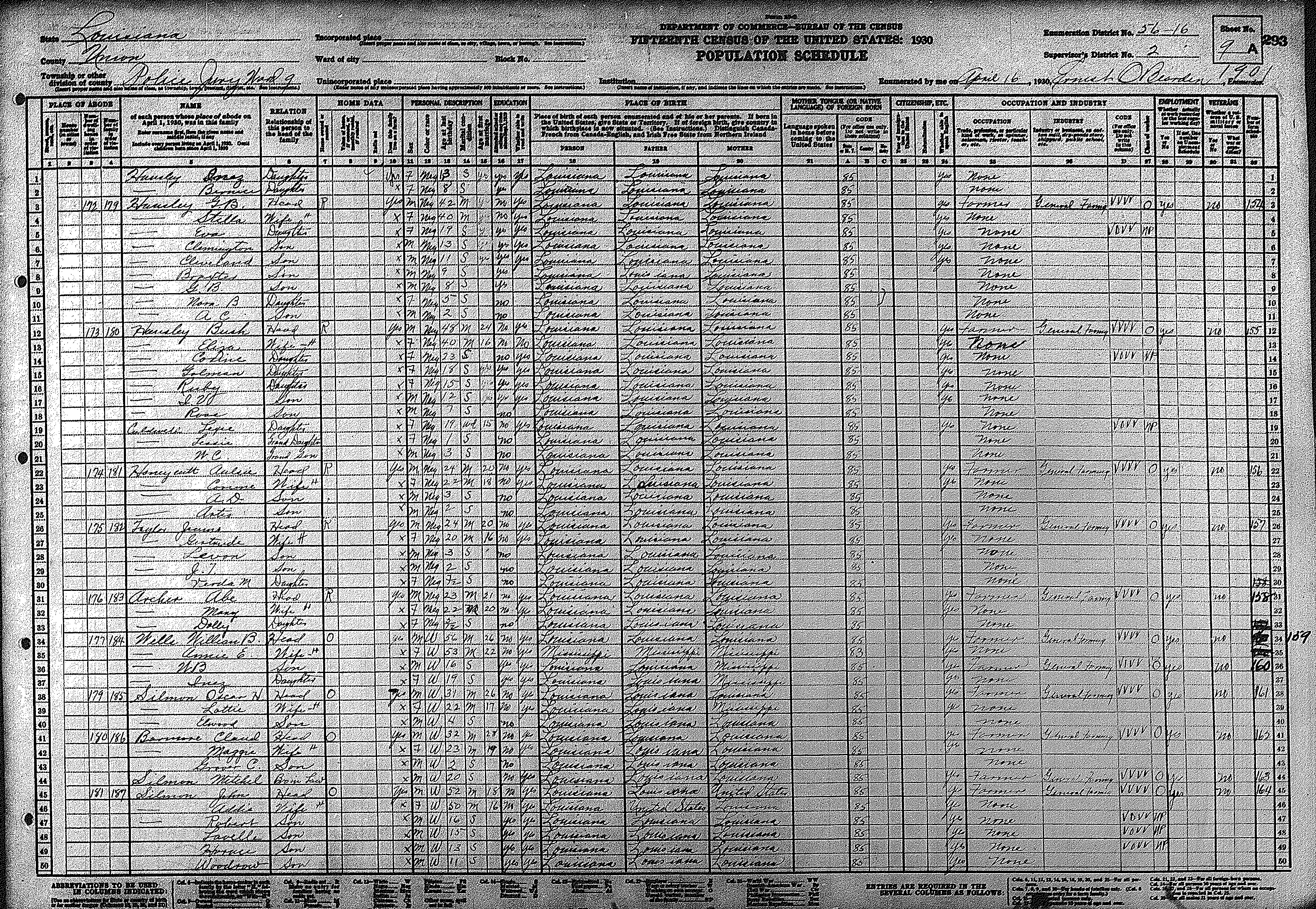
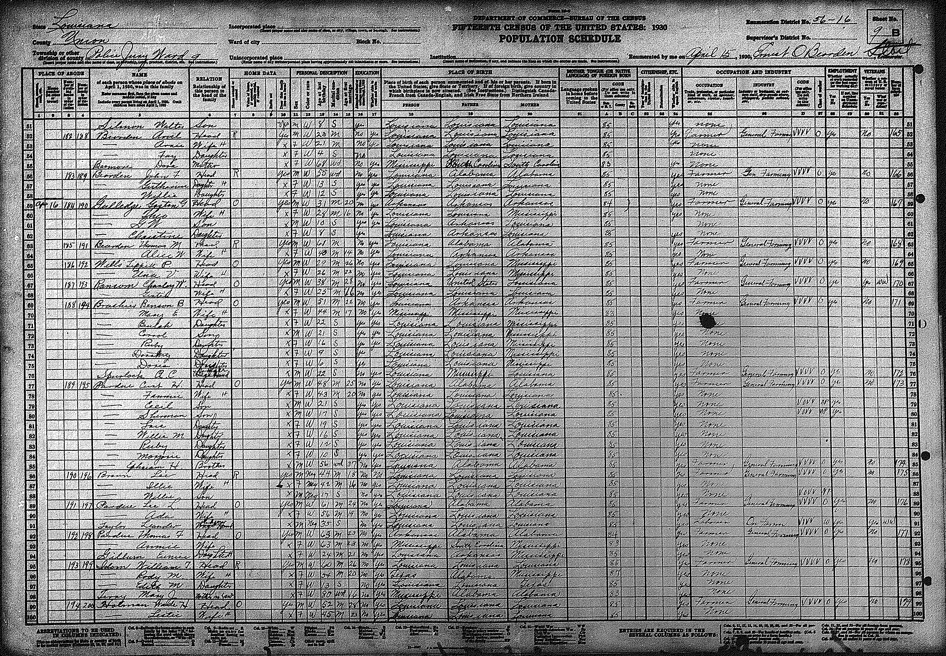
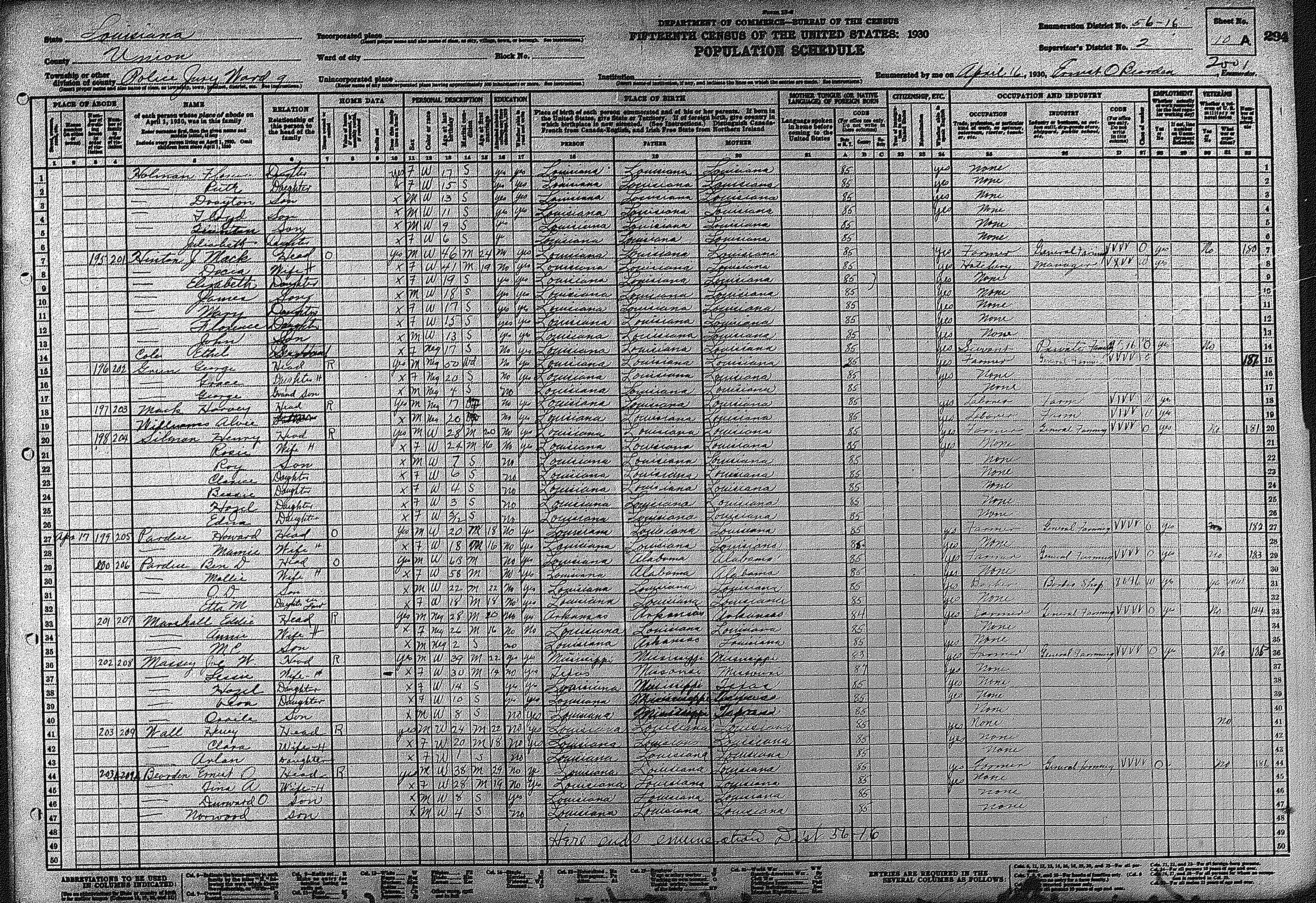
| 9 | 56 – 16 | Township 20 North, Range 1 West & adjoining region south of Bayou d'Arbonne | |||||||||||||||||
| 398 | 399 | 400 | 401 | 402 | 403 | 404 | 405 | 406 | 407 | 408 | 409 | 410 | 411 | 412 | |||||
| 413 | 414 | 415 | 416 | 417 | 418 | ||||||||||||||
| 10 | 56 – 17 | The Union Parish portion of Junction City | |||||||||||||||||
| 419 | 420 | 421 | 422 | 423 | 424 | ||||||||||||||
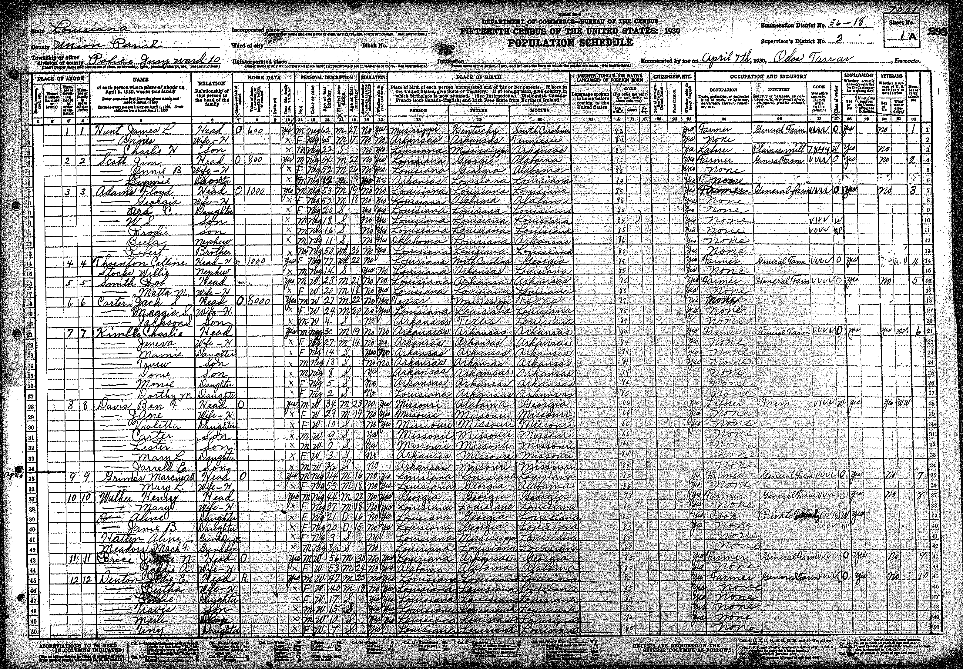
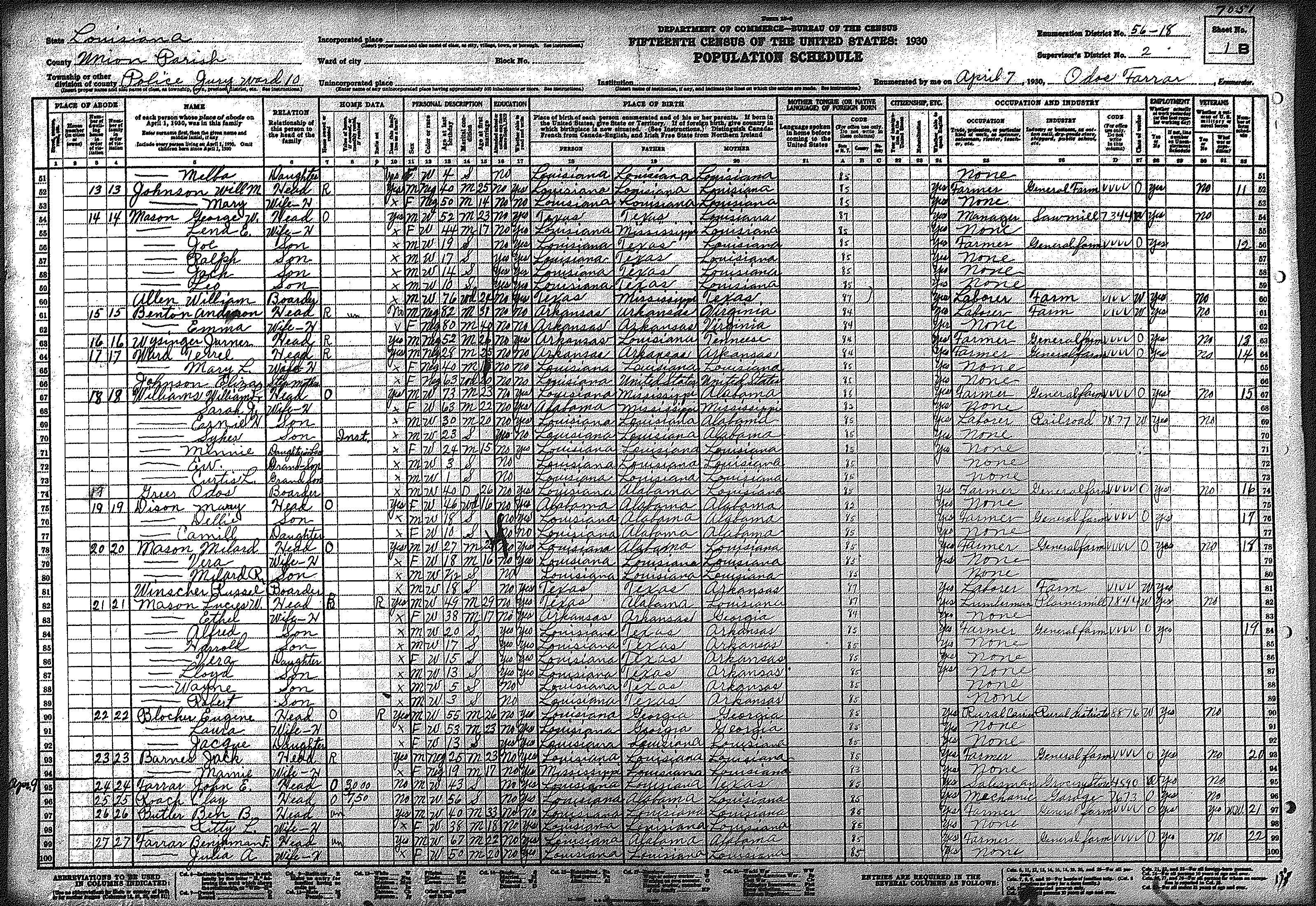
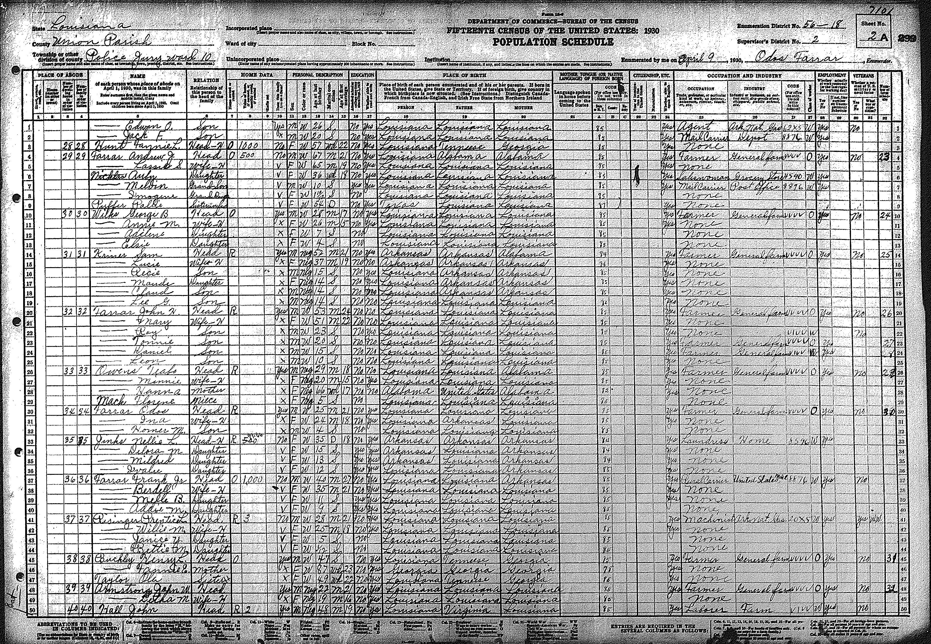
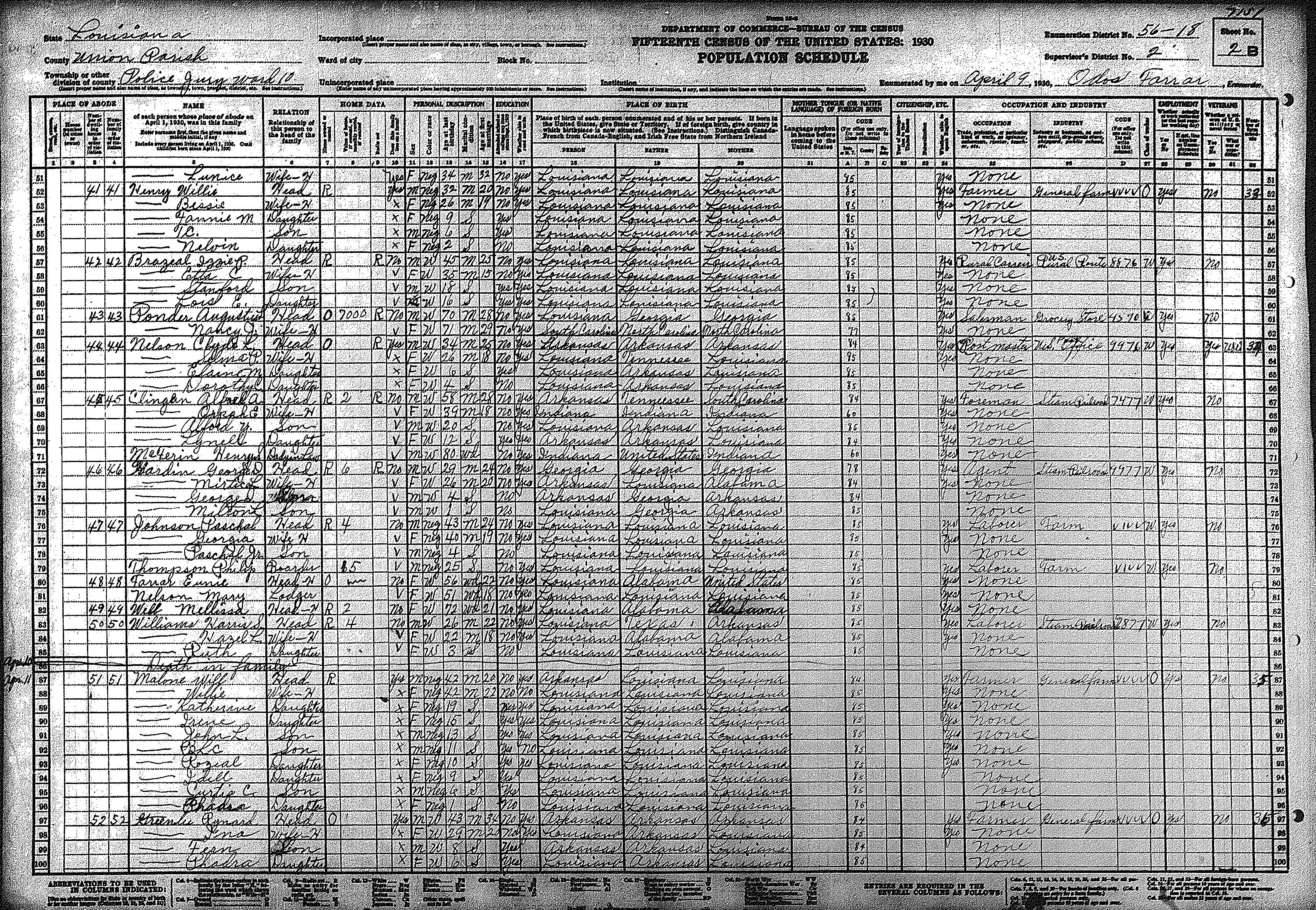
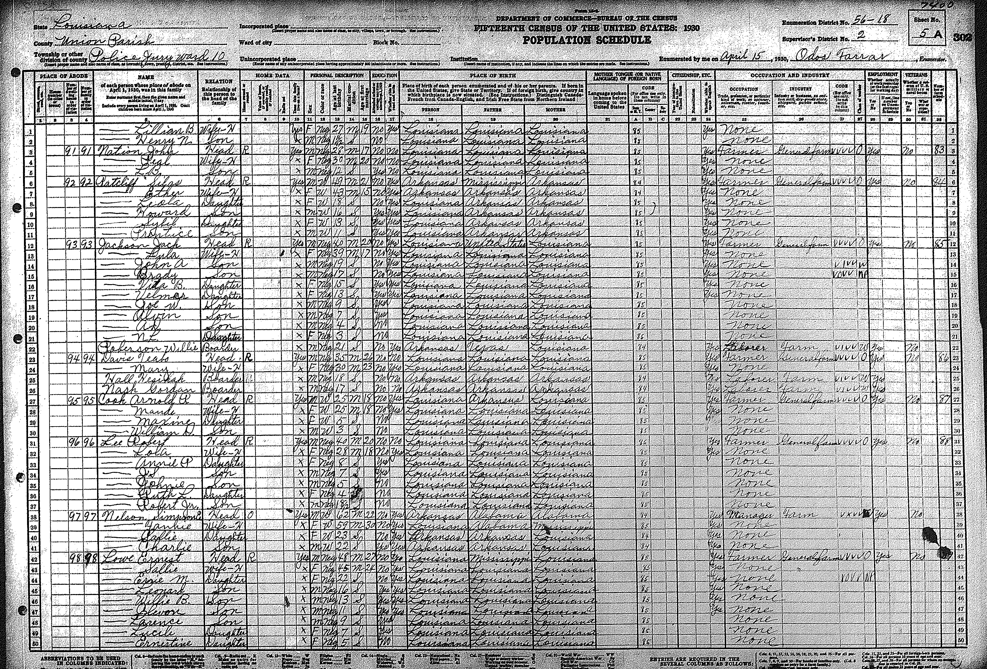
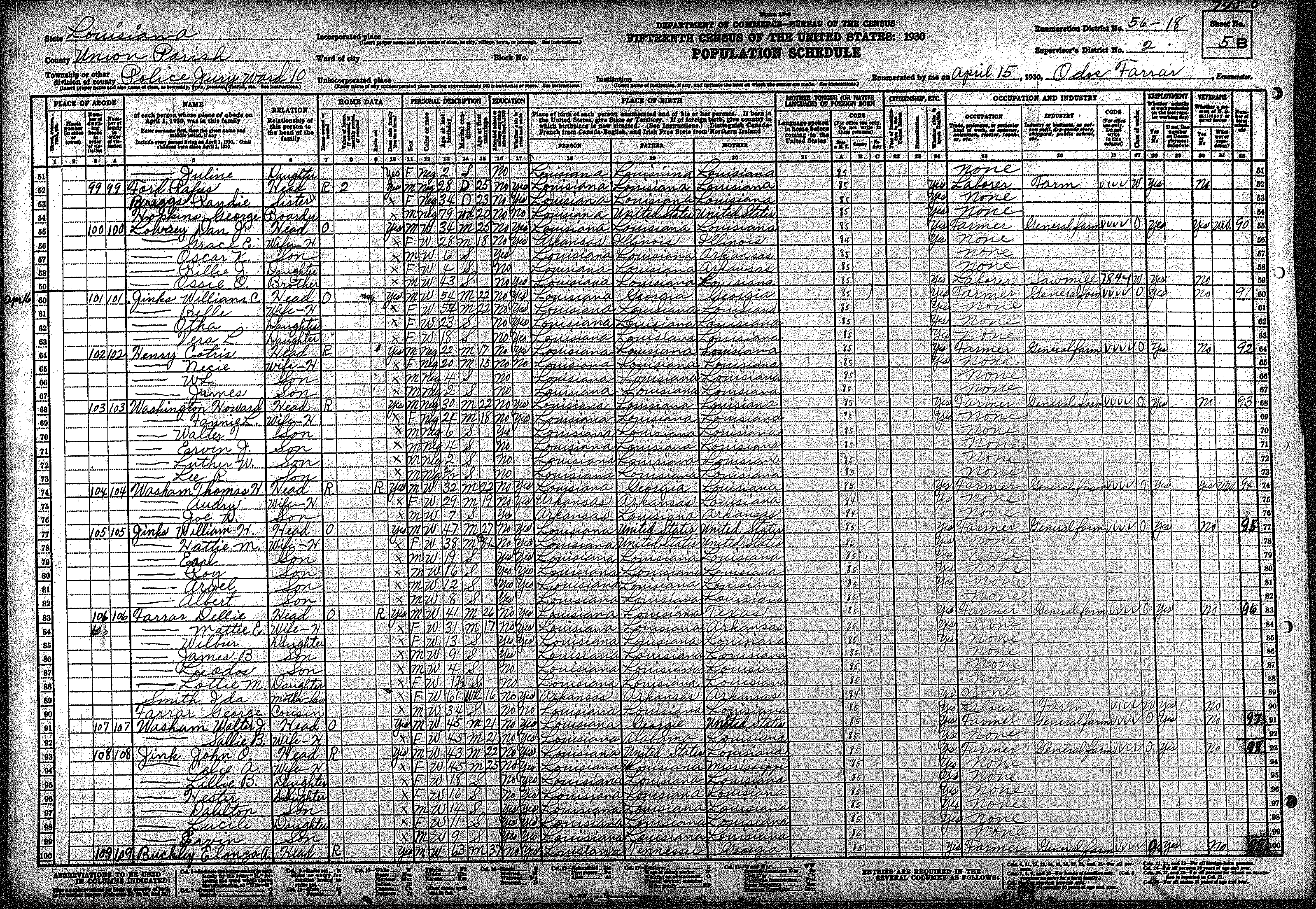
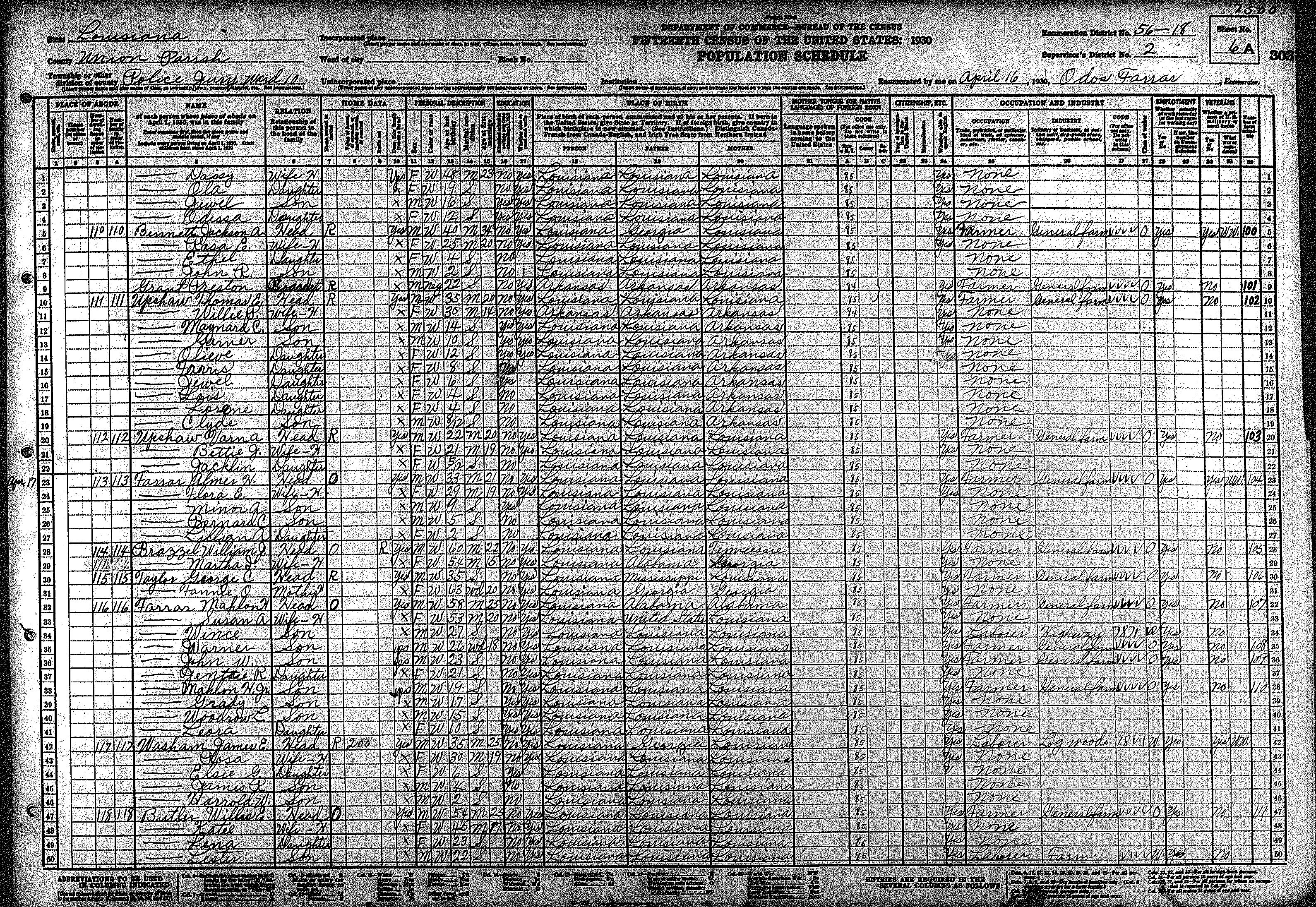
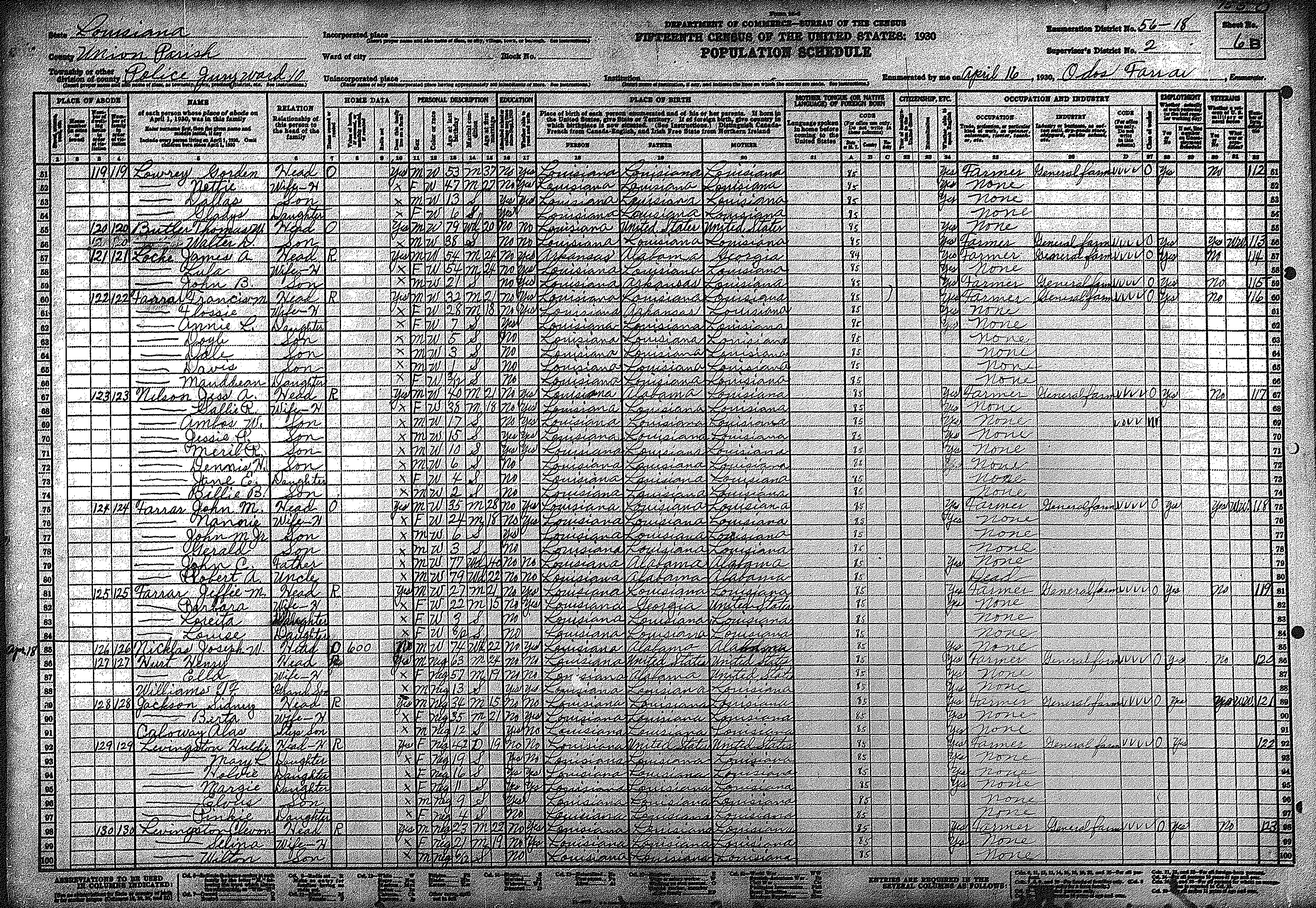
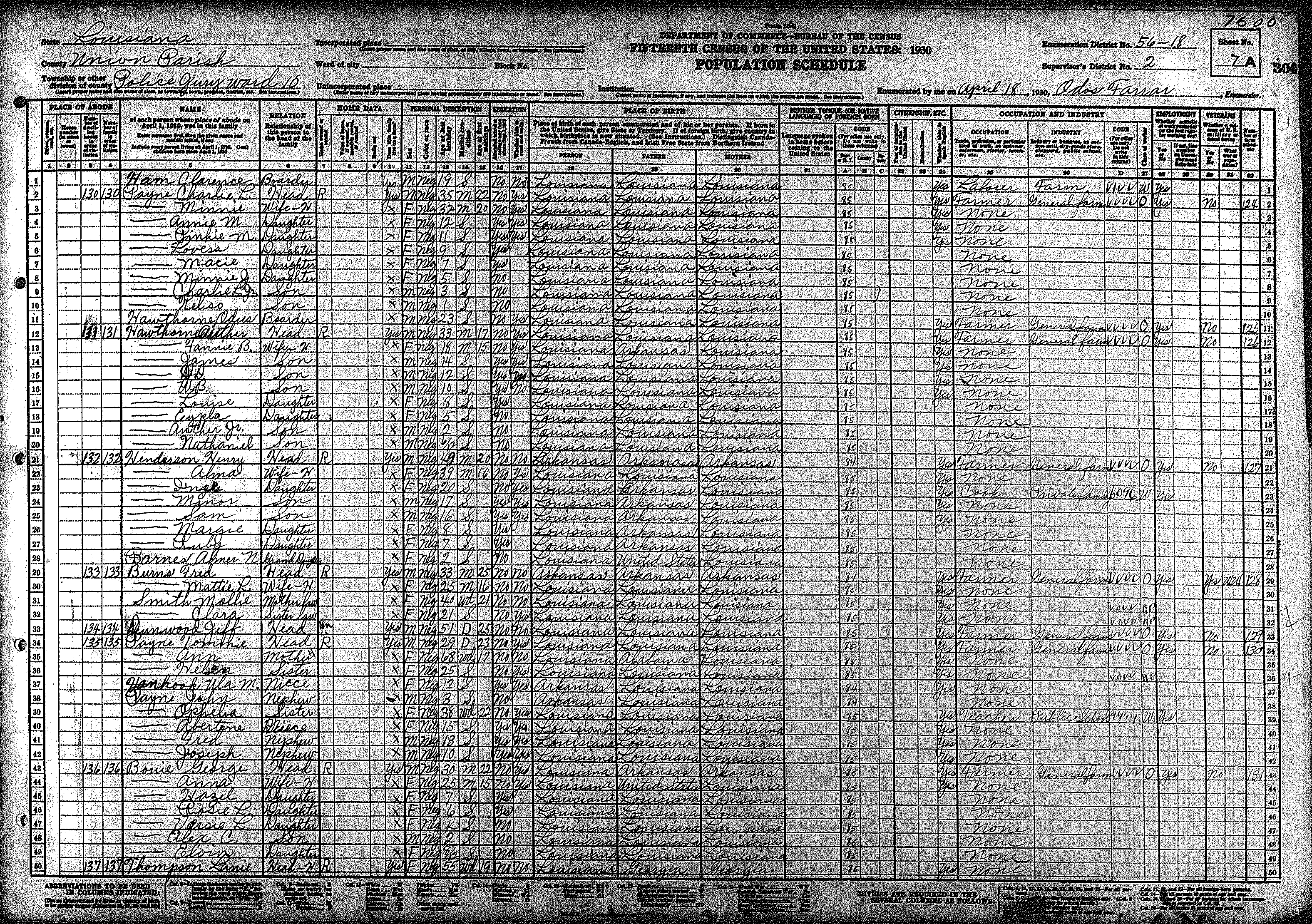
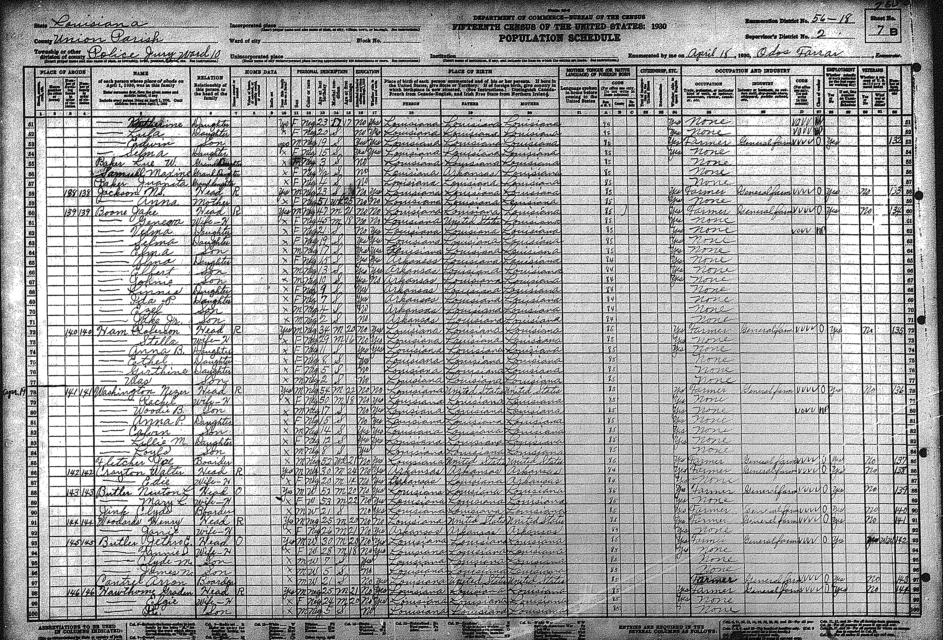
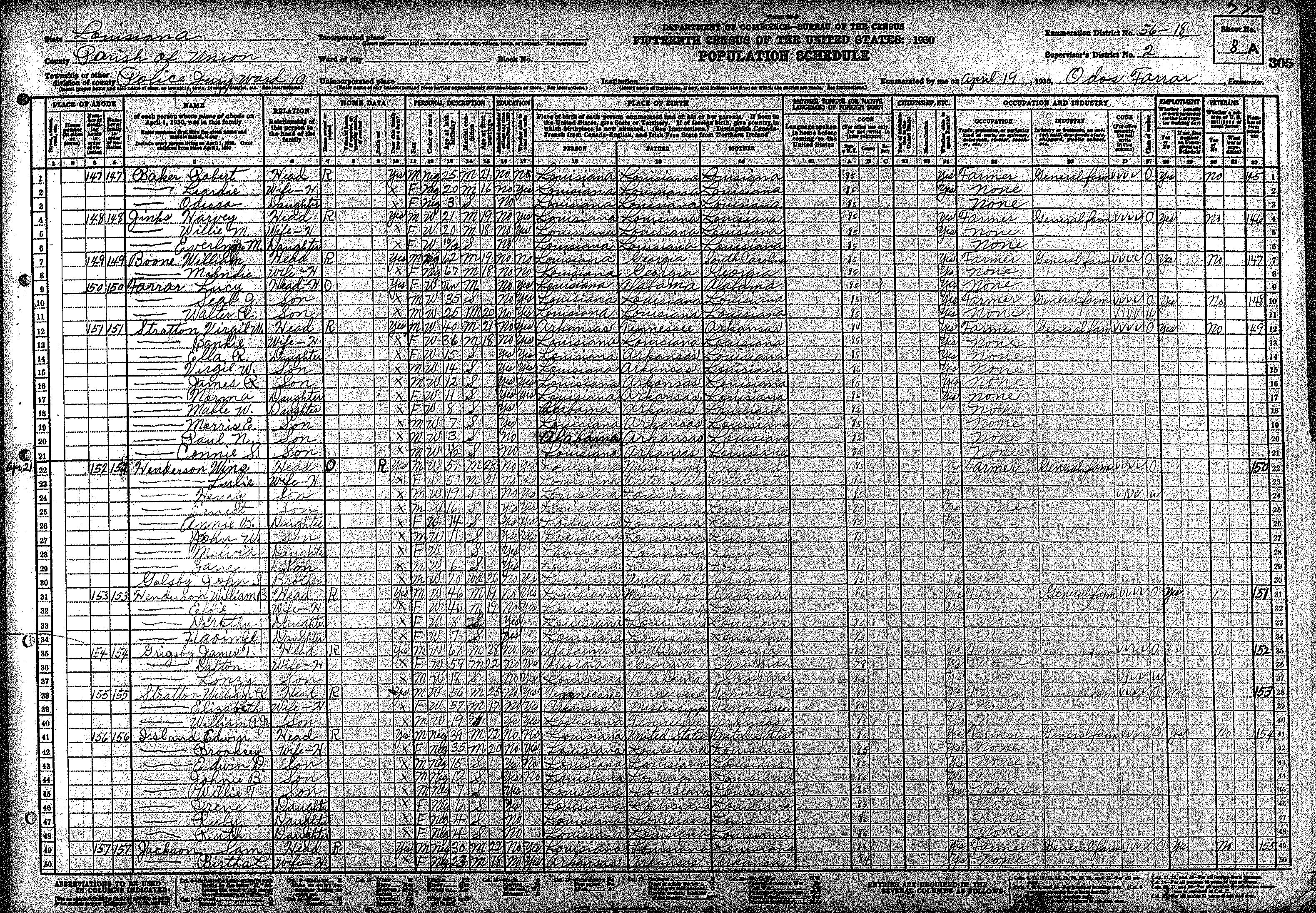
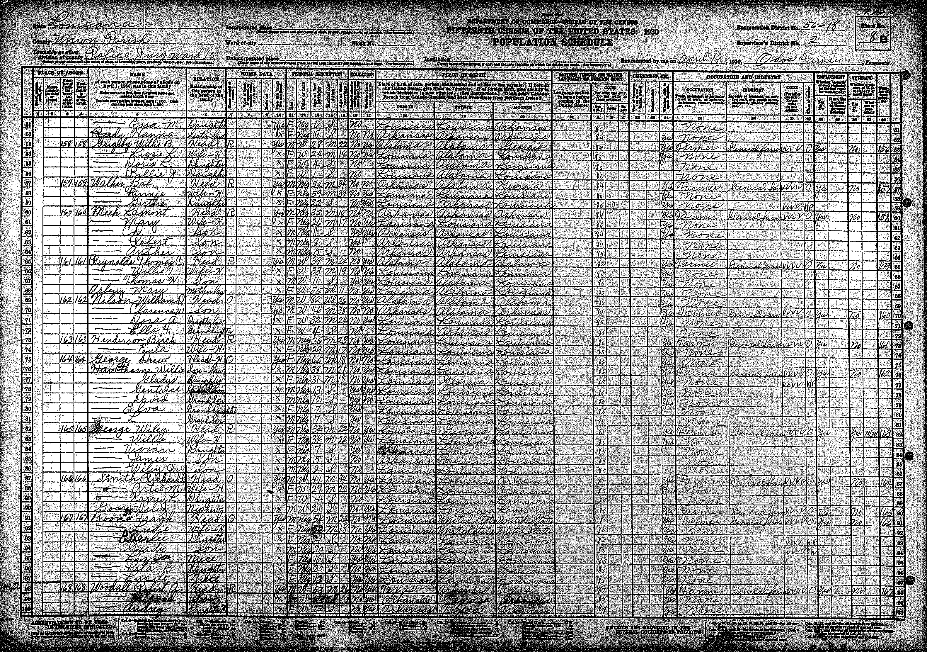
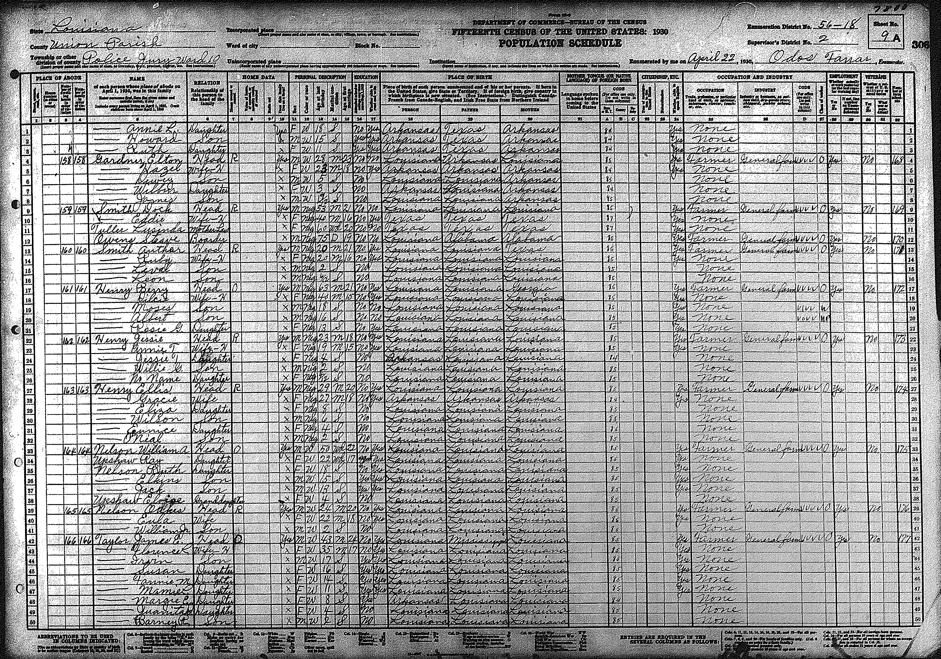
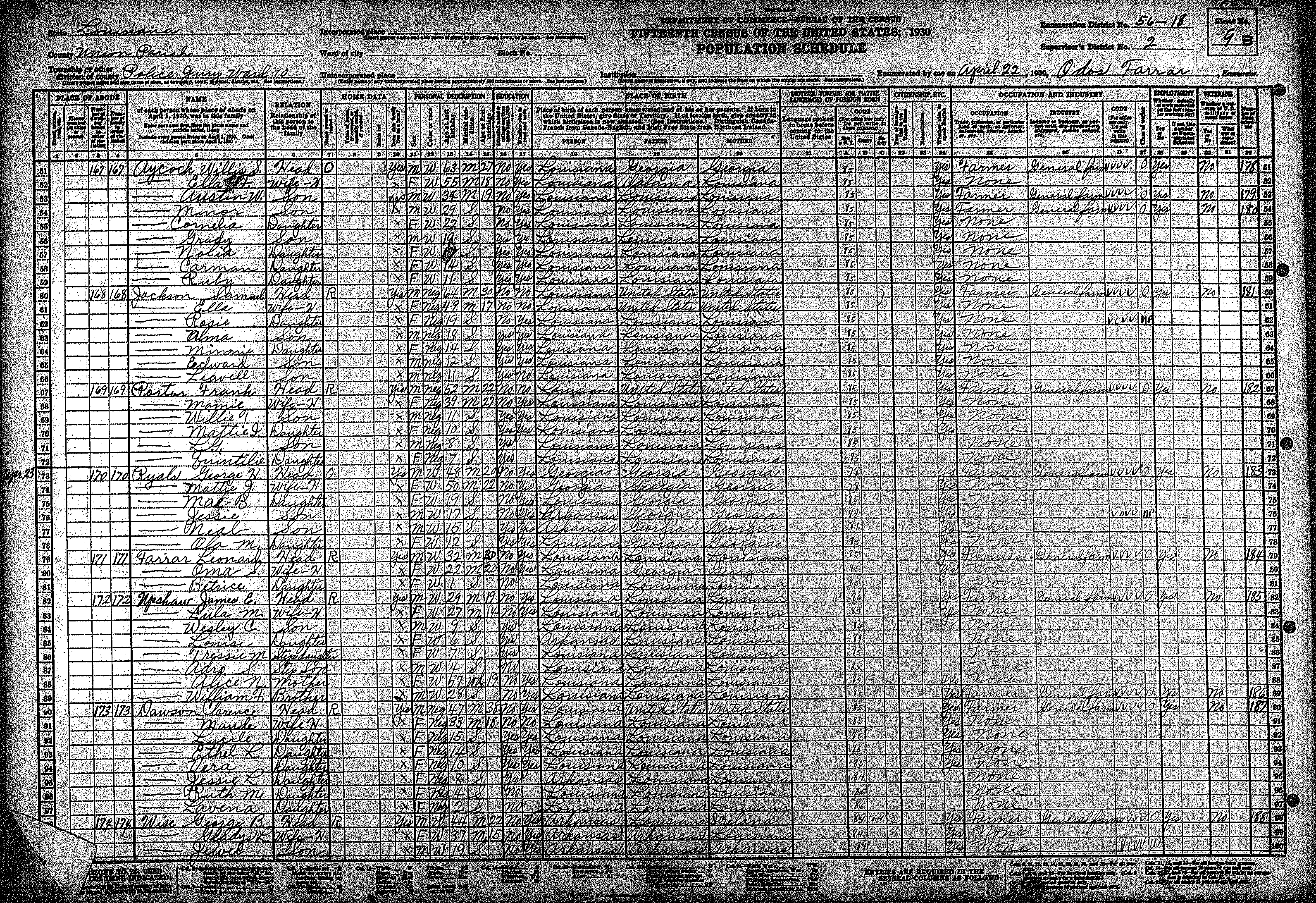
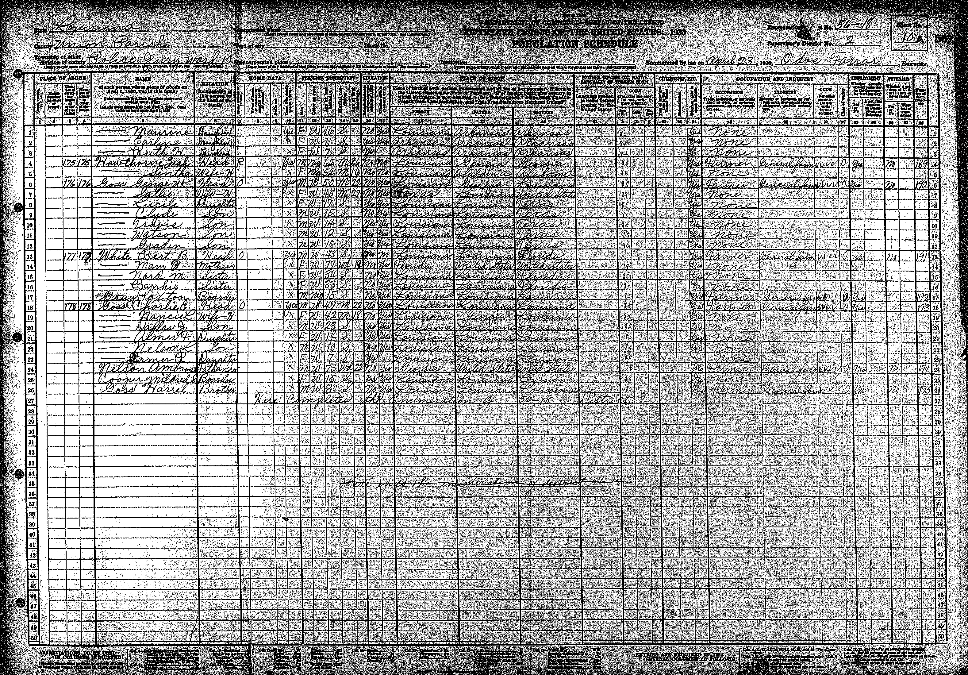
| 56 – 18 | Northwestern Union Parish outside Junction City, including Randolph | ||||||||||||||||||
| 426 | 427 | 428 | 429 | 430 | 431 | 432 | 433 | 434 | 435 | 436 | 437 | 438 | 439 | 440 | |||||
| 441 | 442 | 443 | 444 | 445 | |||||||||||||||
![]()
Go back to the
Union Parish Louisiana USGenWeb Archives Main Page
![]()
The 1930 census images were loaded on the Union Parish Archives in July 2004.
The 1930 census indices were loaded in August 2004.
![]()
| |