| Year |
Map |
Publisher/Owning Institution |
Importance |
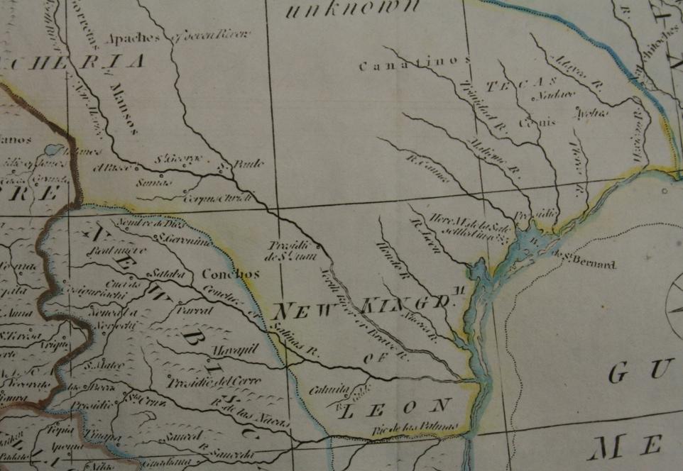
| 1777 |
Empty Space |
Thomas Kitchin |
|
| 1787 |
Empty Space |
Thomas Bowen |
|
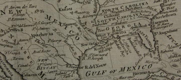
| 1841 |
Empty Space |
John Arrowsmith |
|
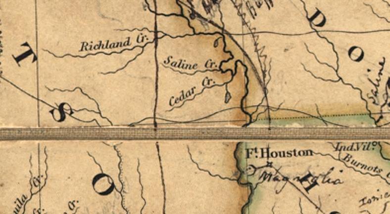
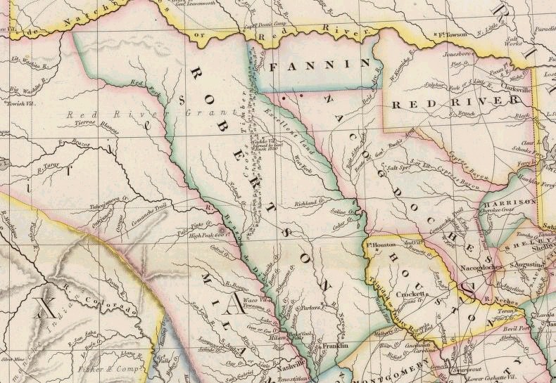
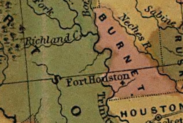
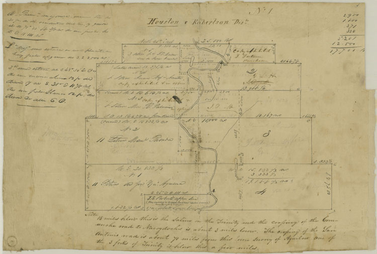
| 1844 |
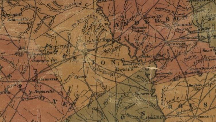
Was part of SE part of Robertson County |
Colonel J. J. Albert |
|
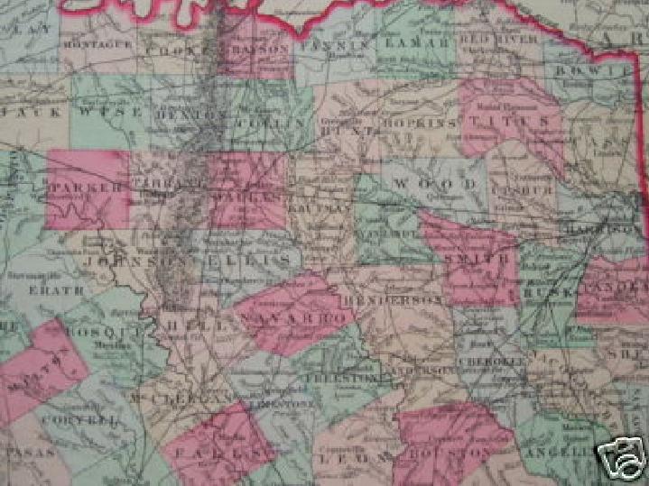
| 1846 |
Empty Space |
S. Augustus Mitchell |
|
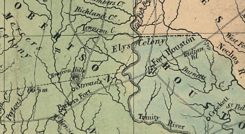
| abt 1848 |
Elys Colony |
Standidge & Co. |
|
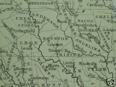
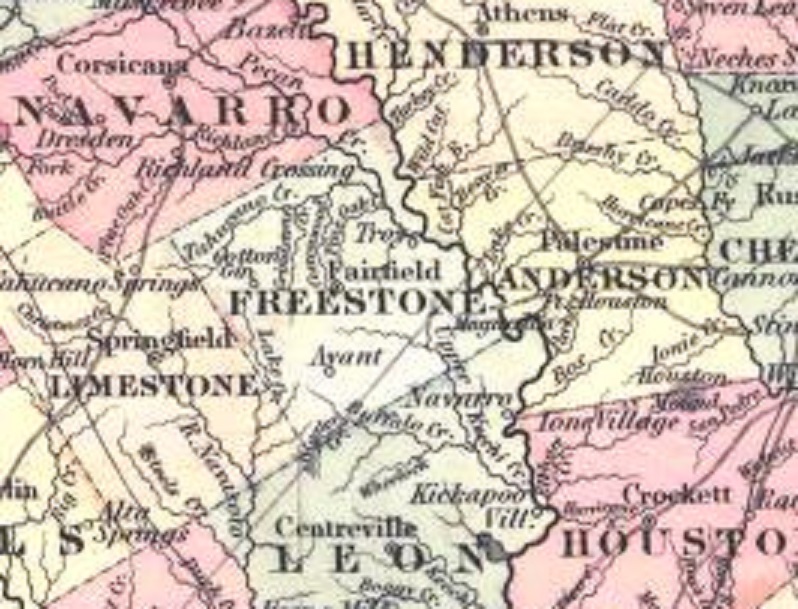
| 1852 |
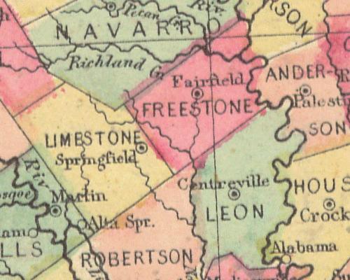
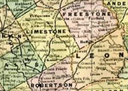
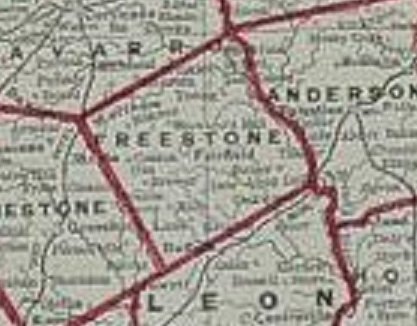
Freestone County |
Mitchell |
|
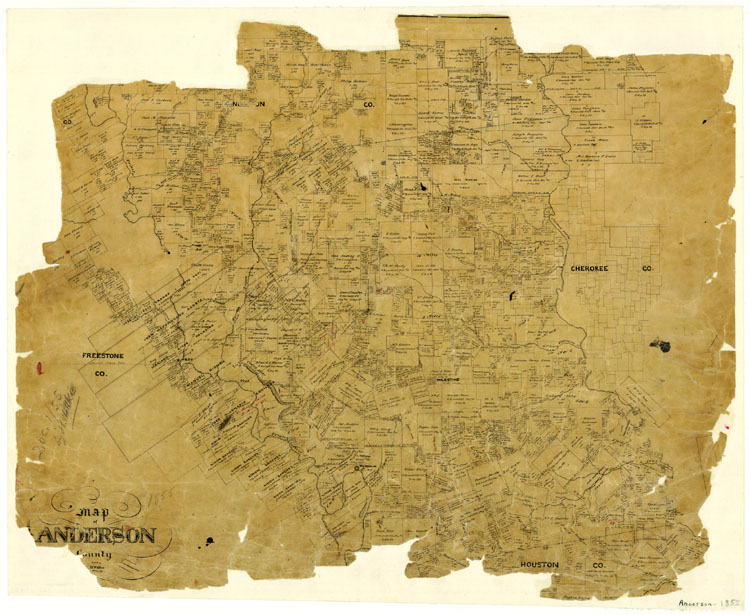
| 1855 |
Anderson County (note Troy) |
Texas GLO |
|
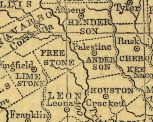
| 1855 |
Freestone County |
Texas GLO |
|
| 1855 |
Freestone County |
J.H. Colton of New York |
|
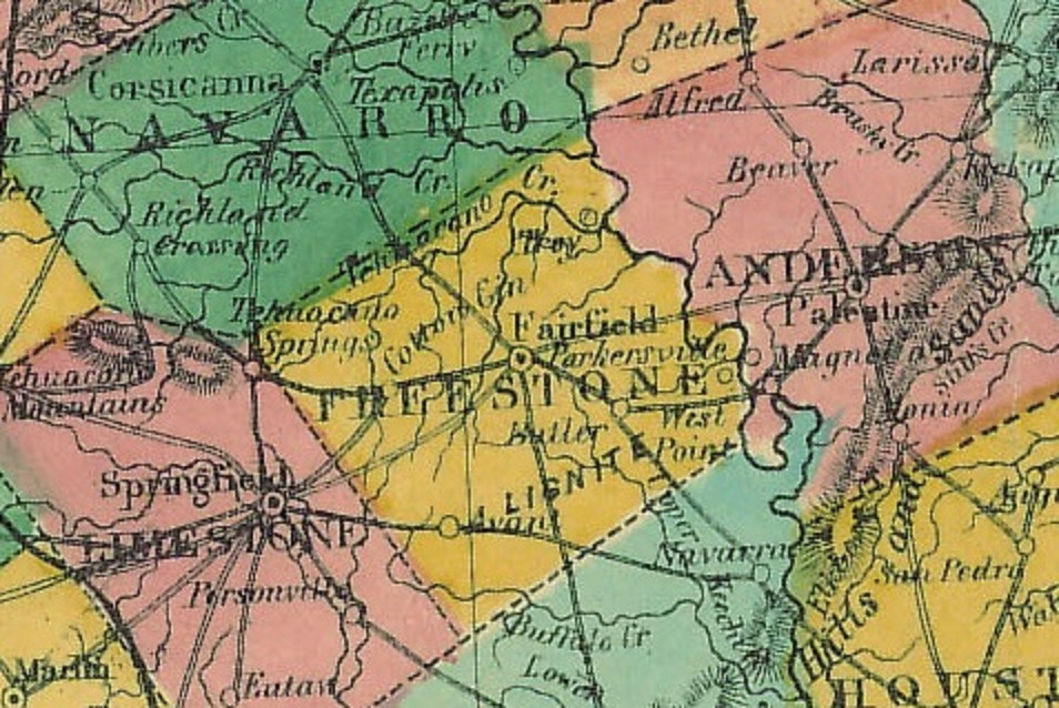
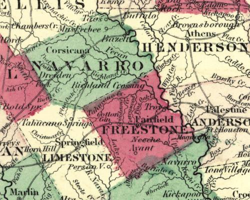
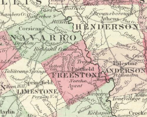
| 1855 |
Freestone County
(Fairfield, Cotton Gin, Troy, Avant) |
J.H. Colton of New York |
|
| 1855 |
Freestone County |
Daniel Burgess and Co. |
|
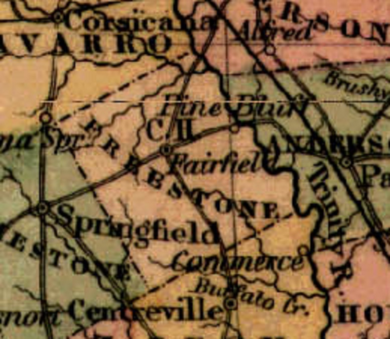
| 1855 |
Freestone County (Fairfield, Pine Bluff) |
Colton (J.H.) and Company, New York, [1855] |
|
| 1856 |
Freestone County |
unlisted |
|
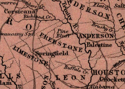
| 1856 |
Freestone County (Pine Bluff) |
Black, A. and C. of Edinburg, Scotland |
|
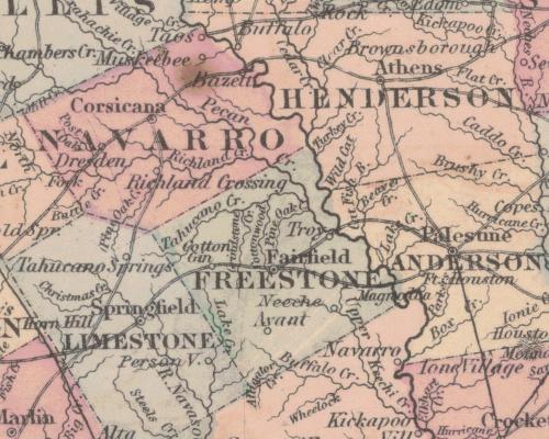
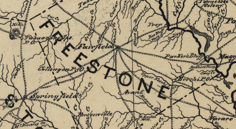
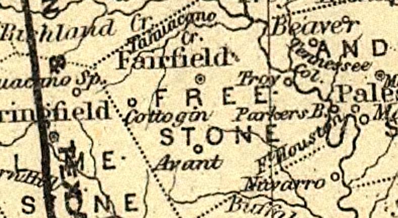
| 1857 |
Freestone County
(Fairfield, Cotton Gin, Troy, Avant, Neeche) |
J.H. Colton and Co. of New York |
|
| 1857 |
Freestone County (Fairfield, Troy, Avant)
(Fairfield, Cotton Gin, Troy, Avant, Neeche) |
Henry Darwin Rogers,
Edward Stanford |
|
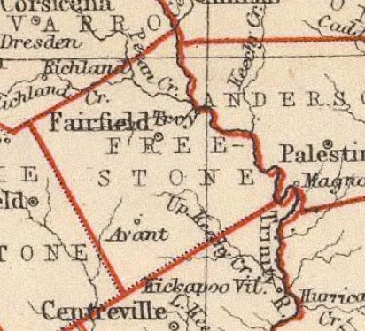
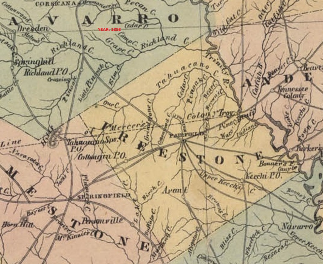
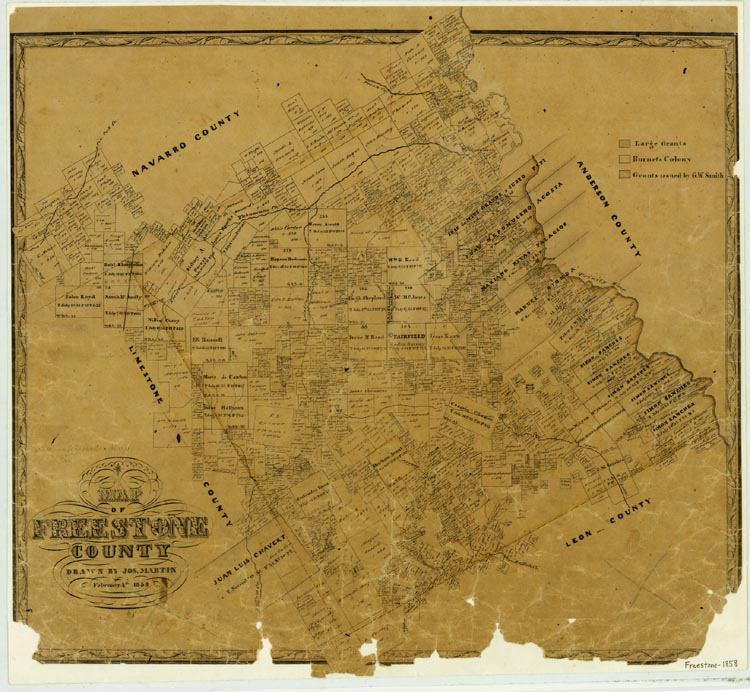
| 1858 |
Freestone County
(Fairfield, Cotton Gin, Troy, Pine Bluff, Bonner's Ferry, Keechi, Avant)
|
Jones, Roat and Company, Strand of Galveston, TX |
Pine Bluff to Troy transition
|
| 1858 |
Freestone County |
Texas GLO |
|
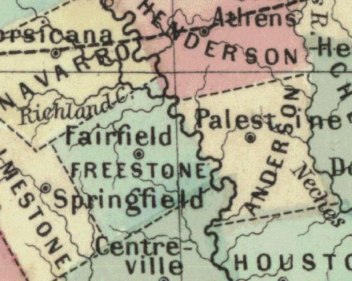
| 1860 |
Freestone County
(Fairfield) |
Mitchell |
|
| 1860 |
Freestone County
(Fairfield) |
Sch nberg and Co. of New York |
|
| 1860 |
Freestone County
(Fairfield, Butler, West Point, Troy, Cotton Gin, Avant)
|
Charles DeSilver of Philadelphia |
|
| 1861 |
Freestone County
(Fairfield) |
S. Augustus Mitchell, Jr. of Philadelphia |
|
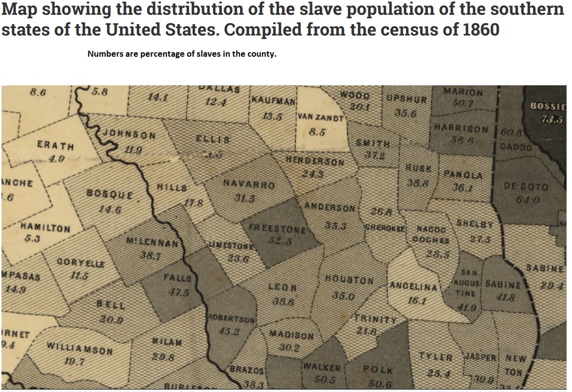
| 1861 |
Freestone County
|
Slaves per county, as per US census |
|
| 1862 |
Freestone County
(Troy, Avant, Keechi, Cotton Gin) |
Pressler |
|
| 1862 |
Freestone County
(Troy, Avant, Neeche, Cotton Gin) |
Johnson and Ward |
|
| 1864 |
Freestone County
(Troy, Avant, Neeche, Cotton Gin) |
Johnson and Ward of New York |
|
| 1865 |
Freestone County
(Troy, Avant, Keechi, Cotton Gin) |
Major G. L. Gillespie |
|
| 1866 |
Freestone County
(Troy, Avant, Neeche, Cotton Gin) |
Johnson and Ward of New York |
|
| 1867 |
Freestone County
(Troy, Cotton Gin, Avant) |
Colton |
|
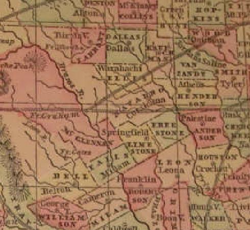
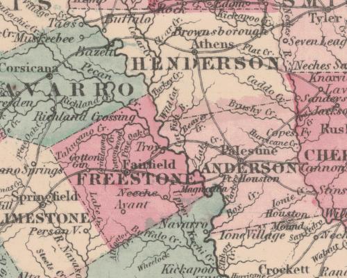
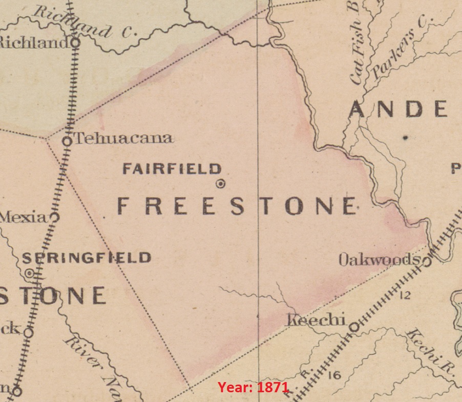
| 1871 |
Freestone County
(Tehnacana, Fairfield) |
Asher & Adams |
Railroad |
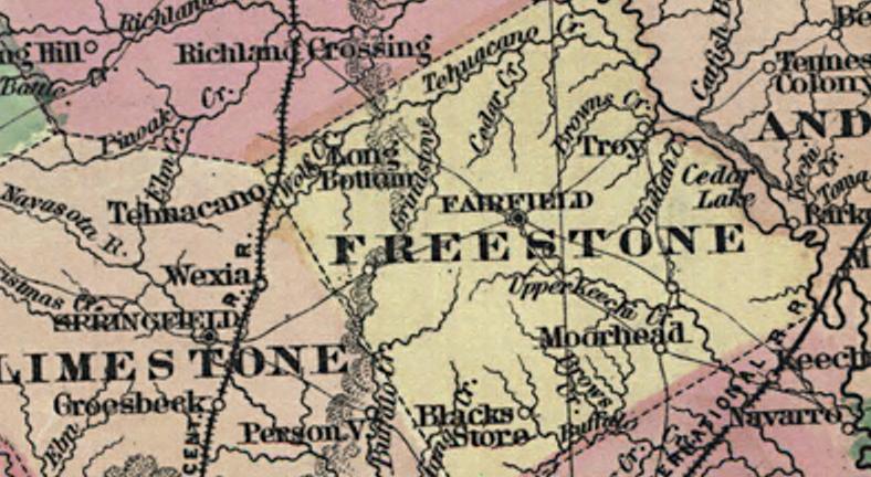
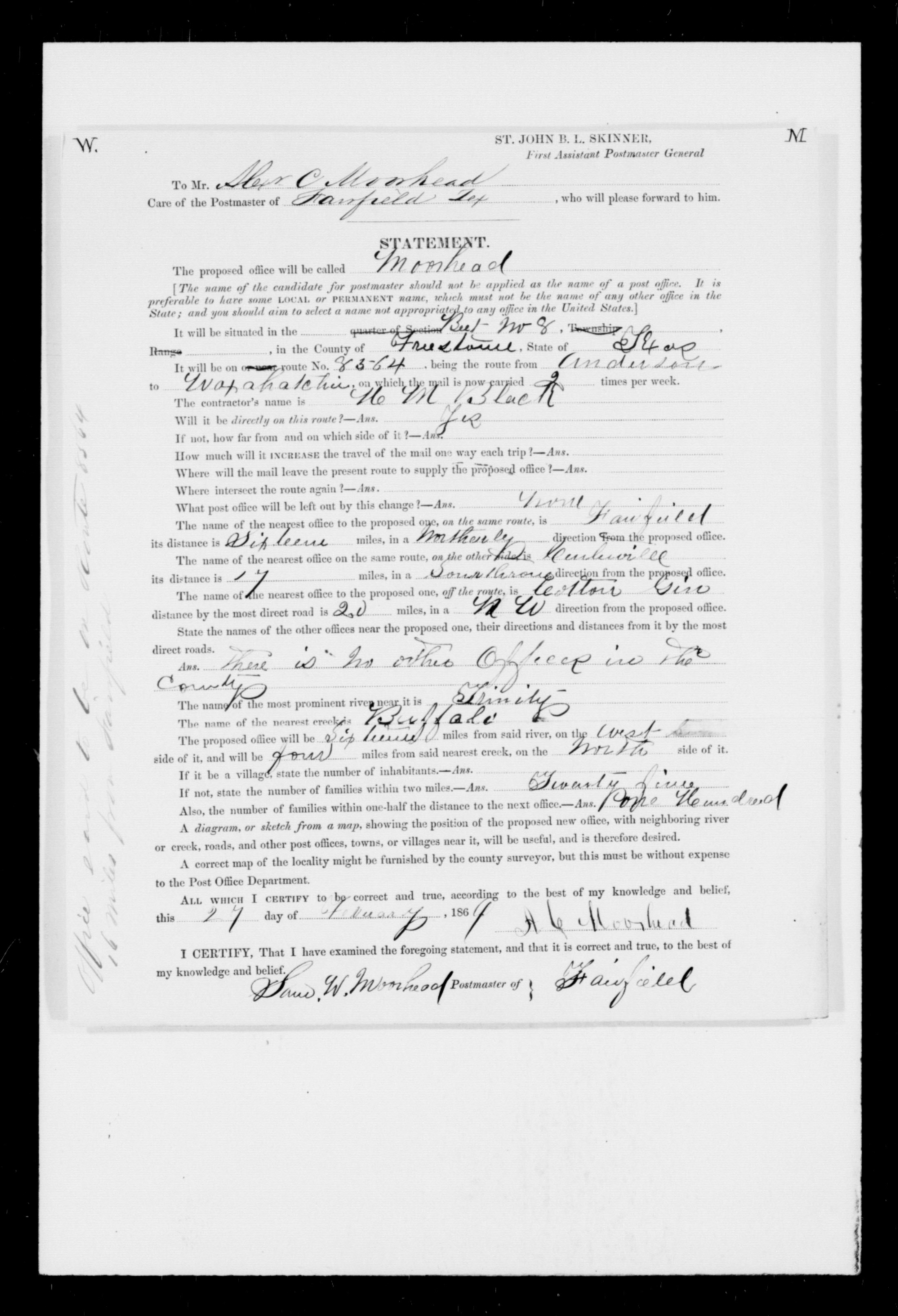
| 1872
|
Freestone County
(Troy, Tehnacano, Long Bottom, Moorhead, Blacks Store)
|
Colton/Pressler |
Avant to Blacks Store transition
|
| 1872 |
Freestone County |
H. F. Walling |
|
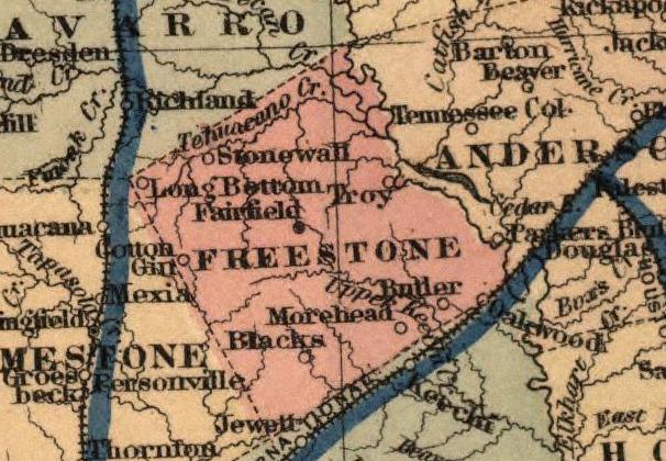
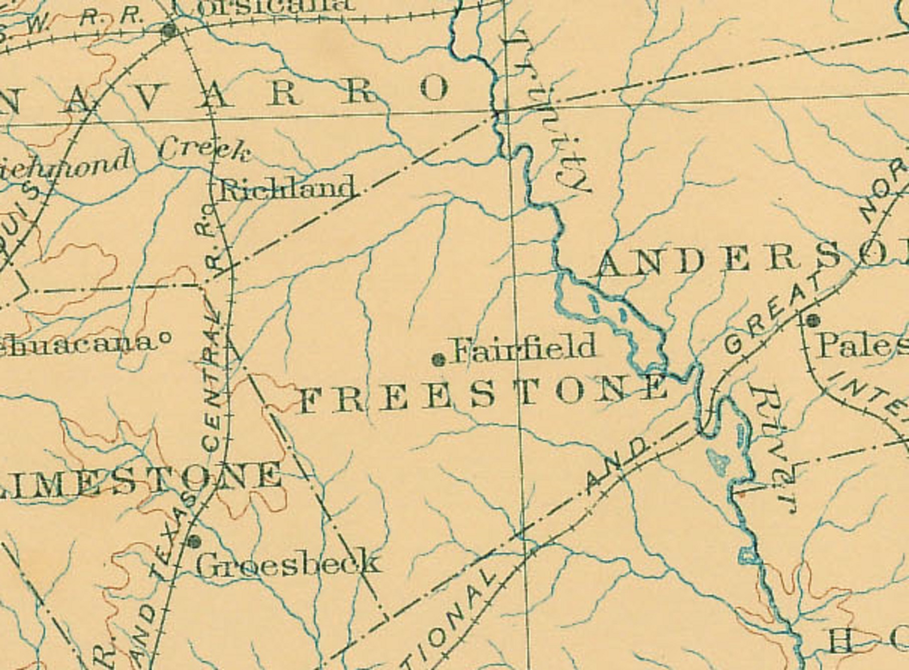
| 1873 |
Freestone County
(Stonewall, Long Bottom, Troy, Cotton Gin, Blacks, Morehead,
Butler)
|
G.W. and C.B. Colton of New York |
|
| 1874 |
Freestone County |
Texas GLO |
|
| 1876 |
Freestone County
(Fairfield, Wortham, Long Bottom, Oakwood, Moorehead, Blacks Store)
|
Rand, McNally, and Company of Chicago |
Long Bottom to Wortham transition |
| 1876 |
Freestone County
(Fairfield, Avant, Butler, Troy, Pearsonville)
|
Beers and Warner of Chicago |
|
| 1877 |
Freestone County
(Wortham) |
Gray |
|
| 1880 |
Freestone County
(Fairfield, Wortham, Cotton Gin, Steward's Mill, Butler, Troy, Morehead, Blacks Store)
|
William P. Northrup and Company of New York |
|
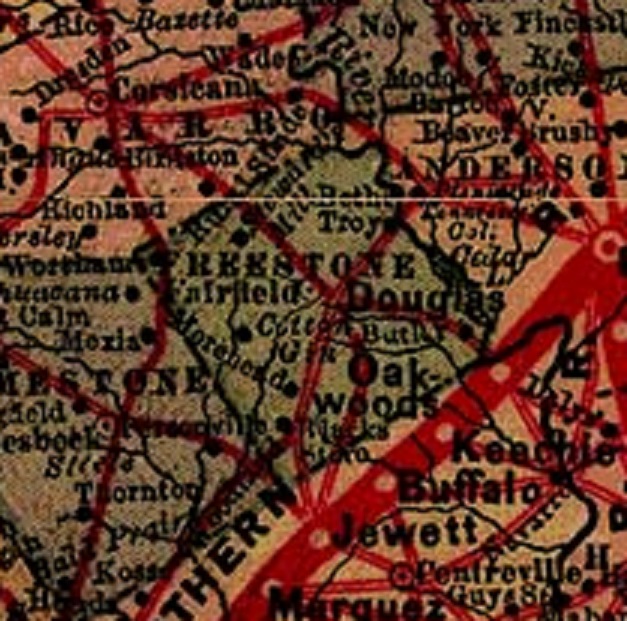
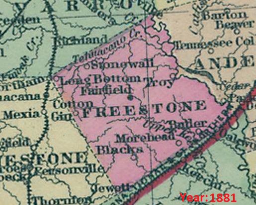
| 1881 |
Freestone County
(Stonewall, Long Bottom, Wortham, Troy, Cotton Gin,
Blacks,
Morehead, Butler)
|
German map of Colton |
|
| 1882 |
Freestone County |
Rand, McNally & Co. |
|
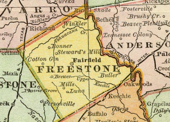
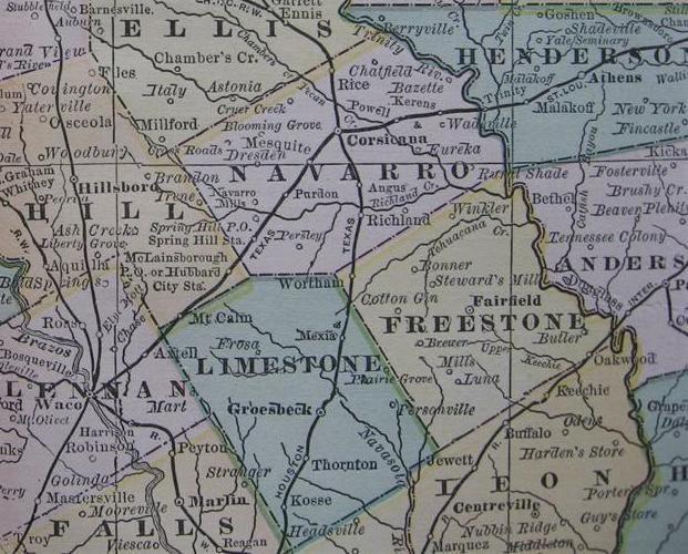
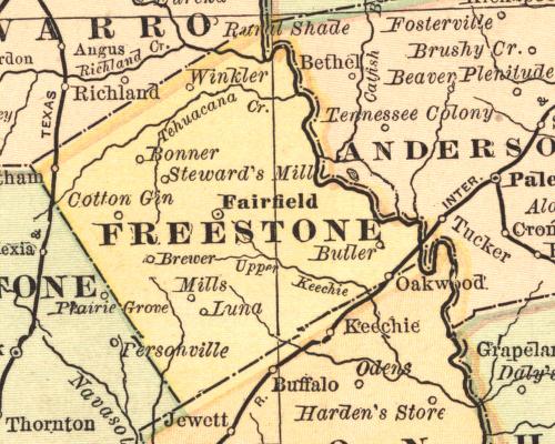
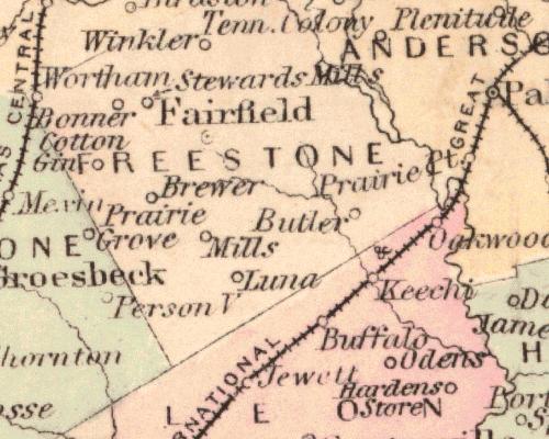
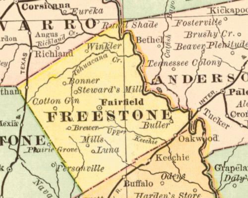
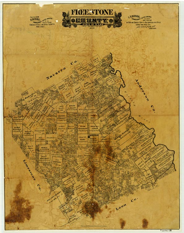
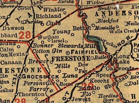
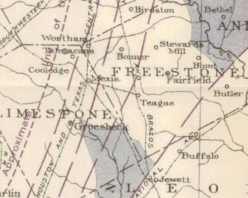
| 1883 |
Freestone County
(Wortham, Bonner, Stewards Mill, Winkler, Cotton Gin,
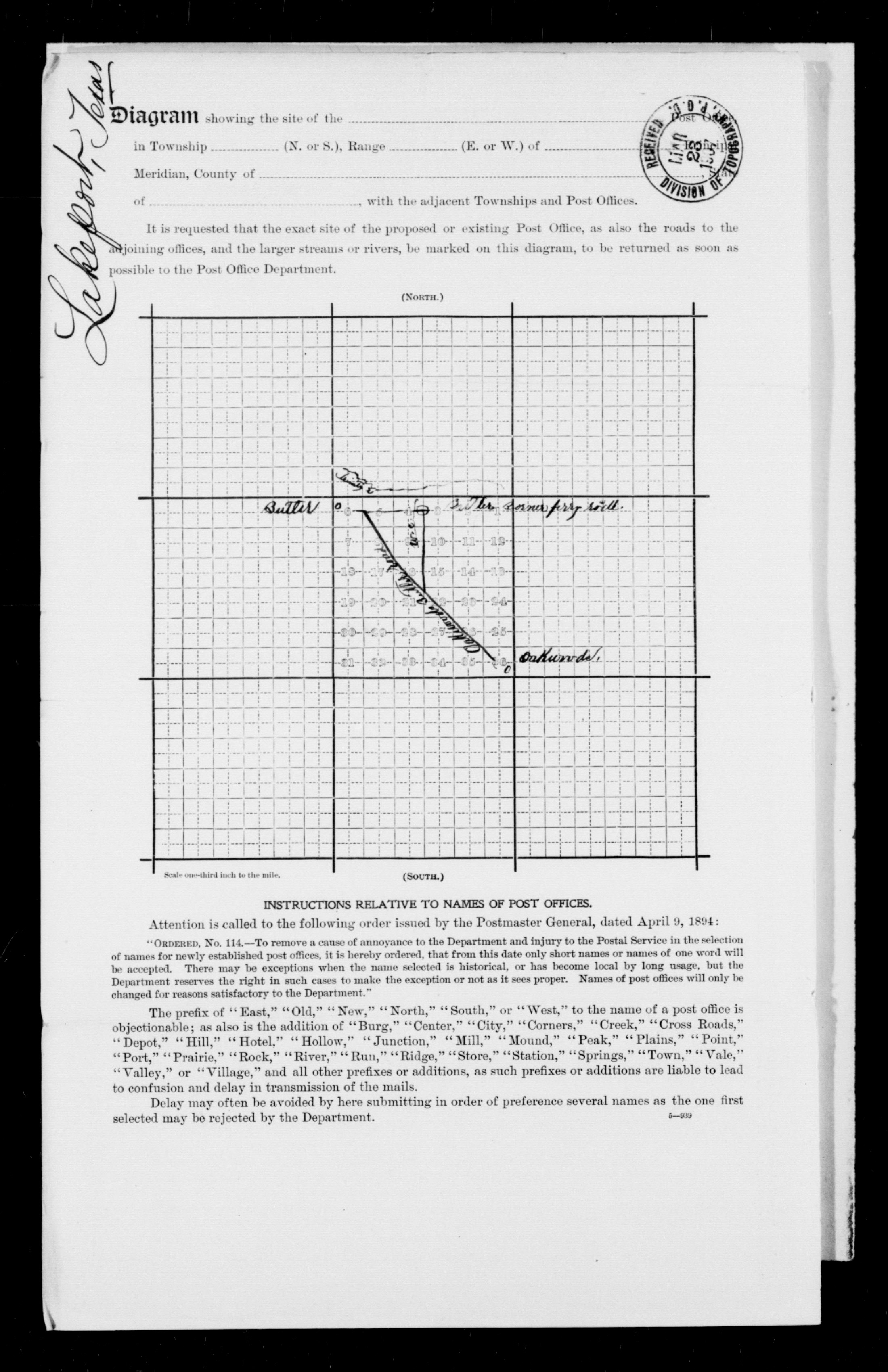
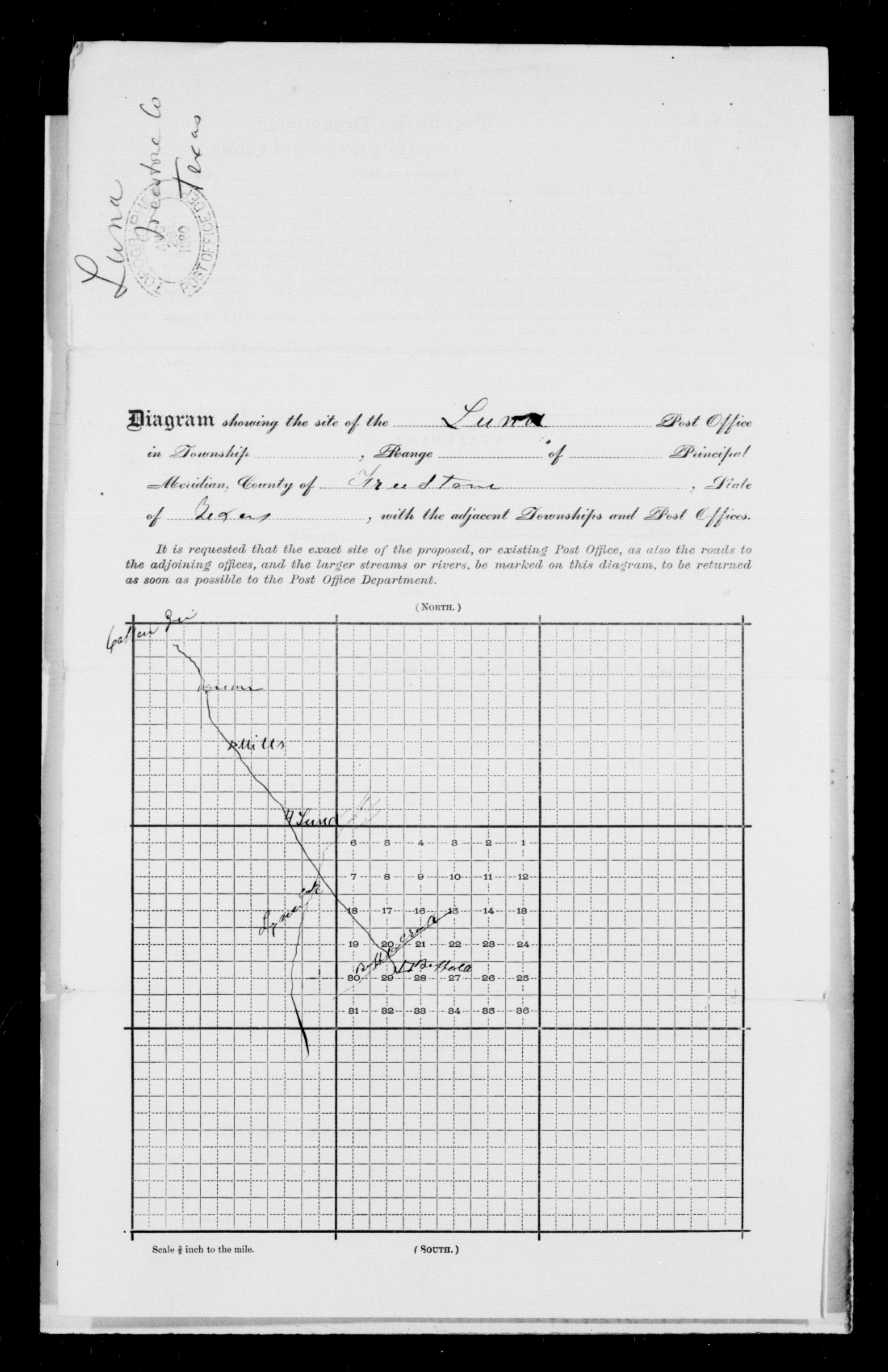
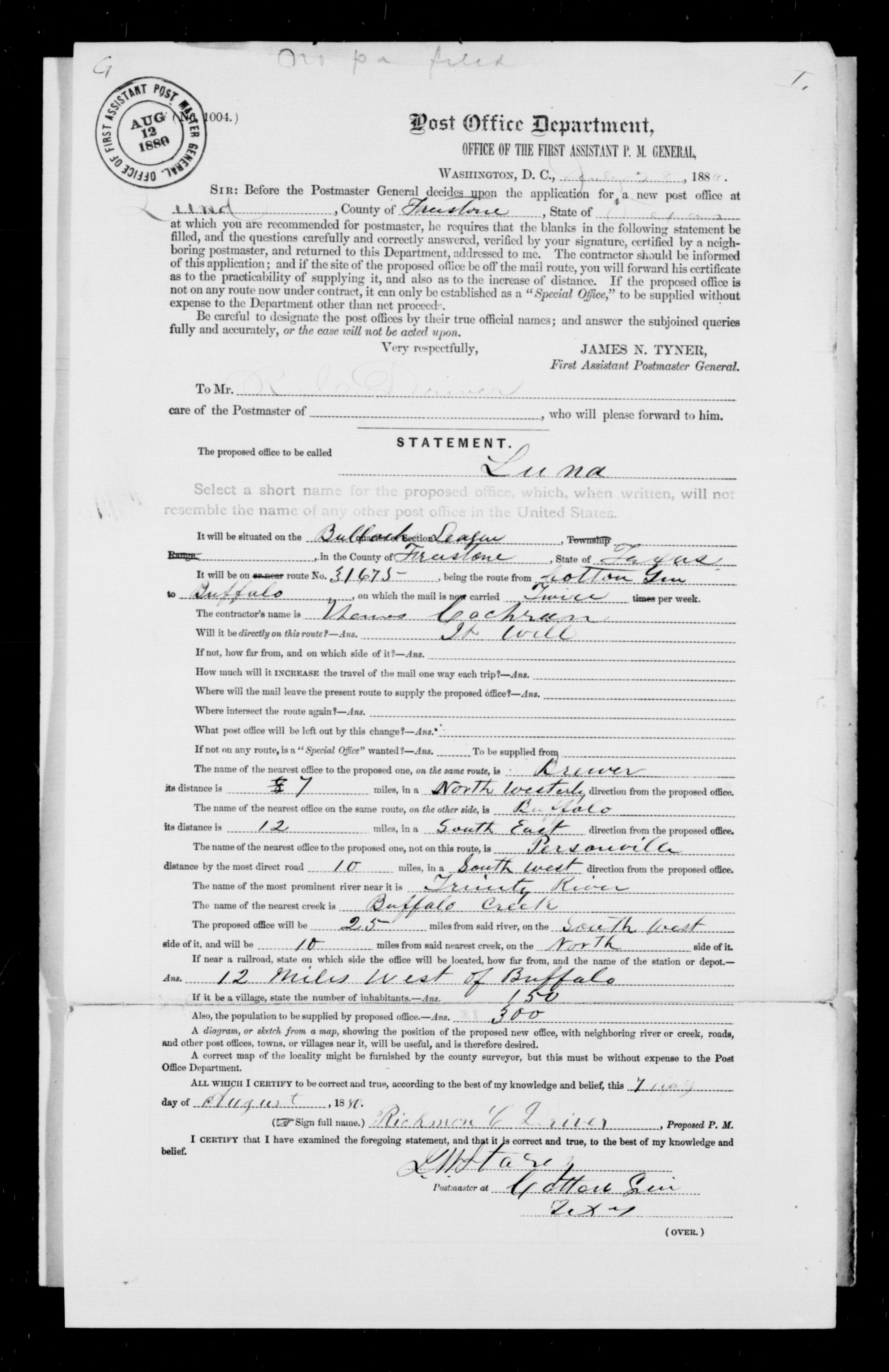
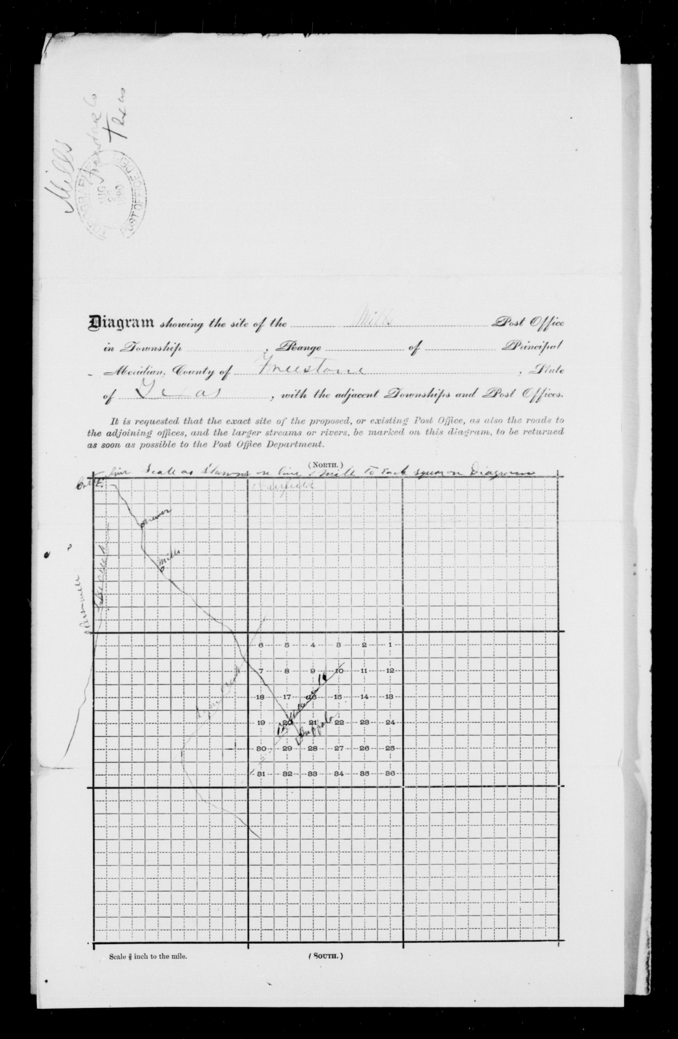
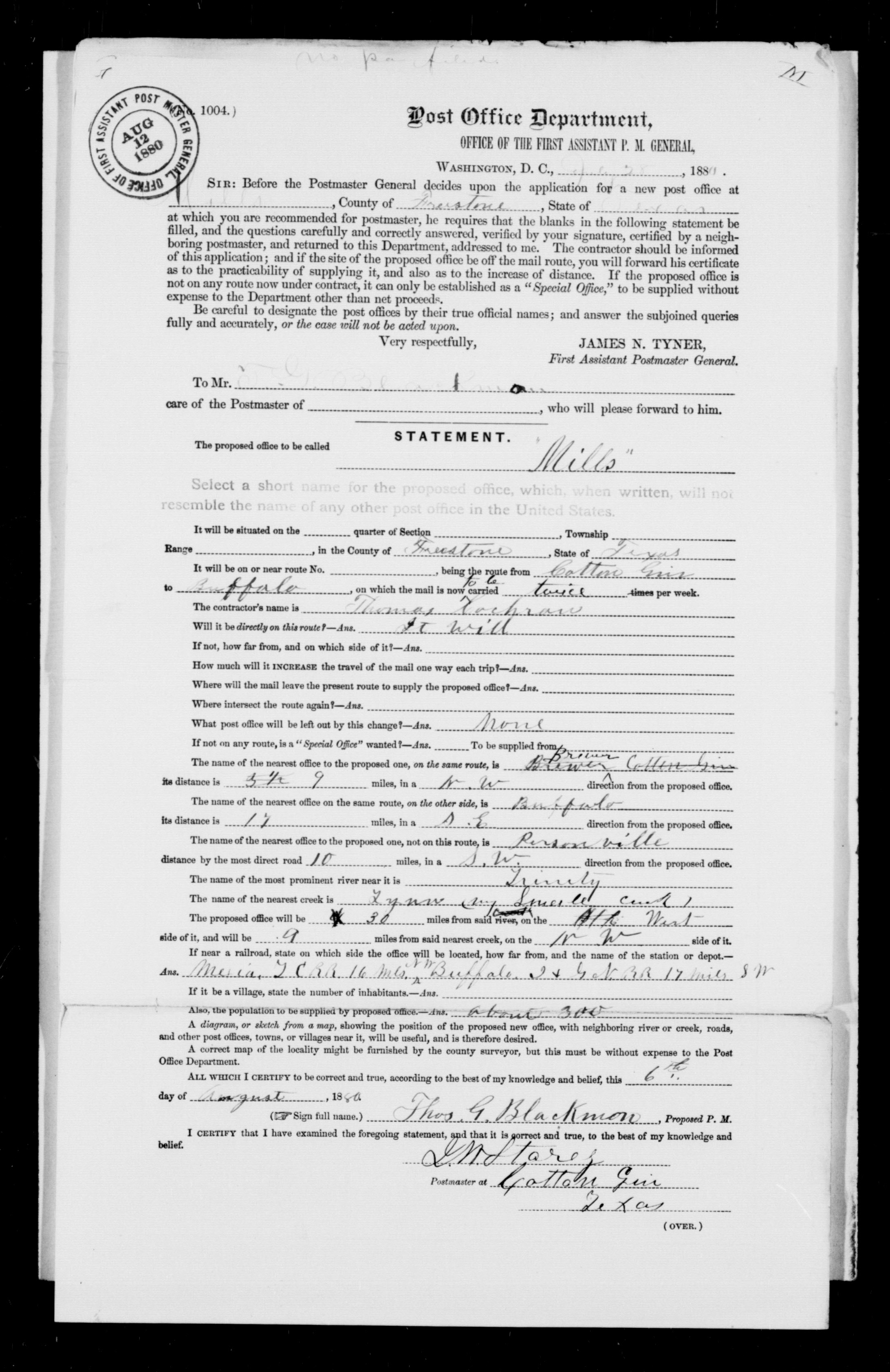
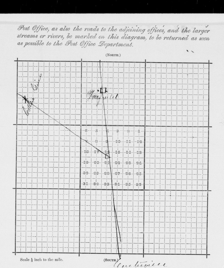
Brewer, Butler, Mills, Luna) |
Rand, McNally & Co. |
|
| 1883 |
Freestone County
(Wortham, Bonner, Stewards Mill, Winkler, Cotton Gin,
Brewer, Butler, Mills, Luna) |
H.H. Hardesty and Co. |
|
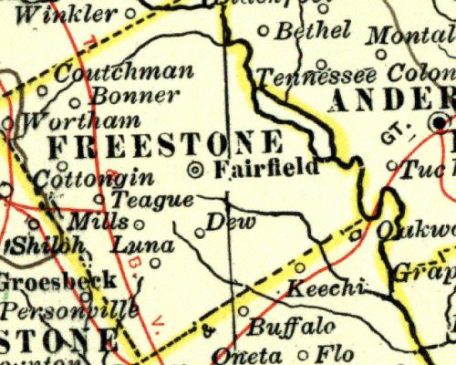
| 1883 |
Freestone County
(Wortham, Bonner, Stewards Mill, Winkler, Cotton Gin,
Brewer, Butler, Mills, Luna) |
O.W. Gray and Son |
|
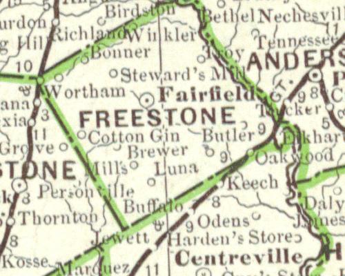
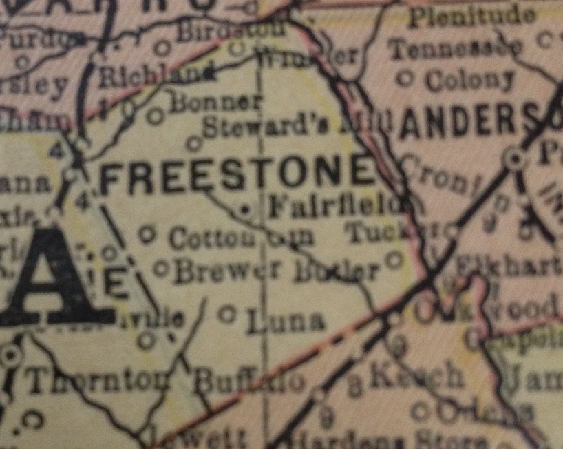
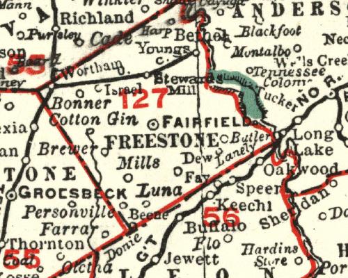
| 1885 |
Freestone County
(Wortham, Bonner, Stewards Mill, Winkler, Cotton Gin,
Brewer, Butler, Mills, Luna) |
H. H. Hardesty |
|
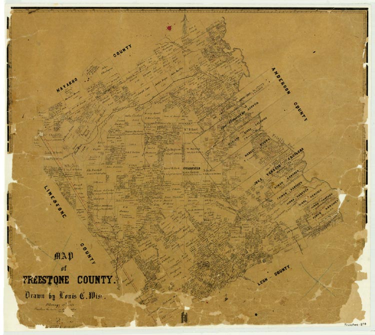
| 1888 |
Freestone County |
Texas GLO |
Land Ownership |
| 1889 |
Freestone County |
Henry S. Stebbins and
Geo. F. Cram & Co. |
|
| 1889 |
Freestone County |
Geo. F. Cram & Co. |
|
| 1889 |
Freestone County |
unknown |
|
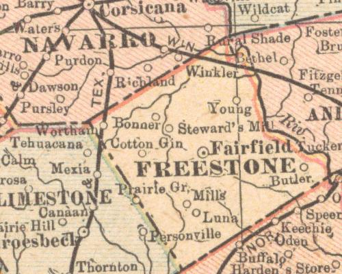
| 1890 |
Freestone County
(Wortham, Bonner, Steward's Mill, Winkler, Young, Cotton Gin,
Butler, Mills, Luna) |
Mast, Crowell and Kirkpatrick |
|
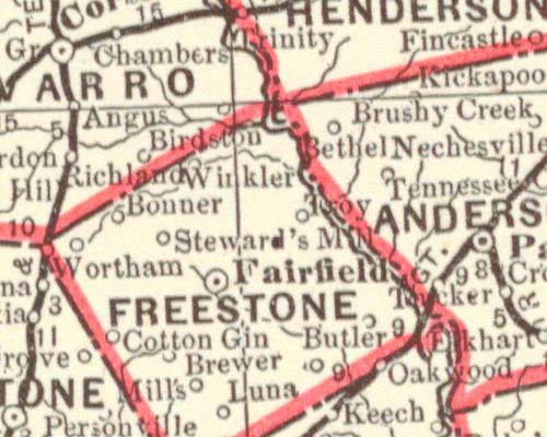
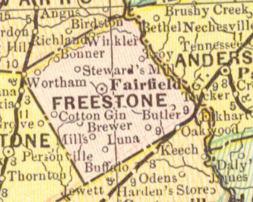
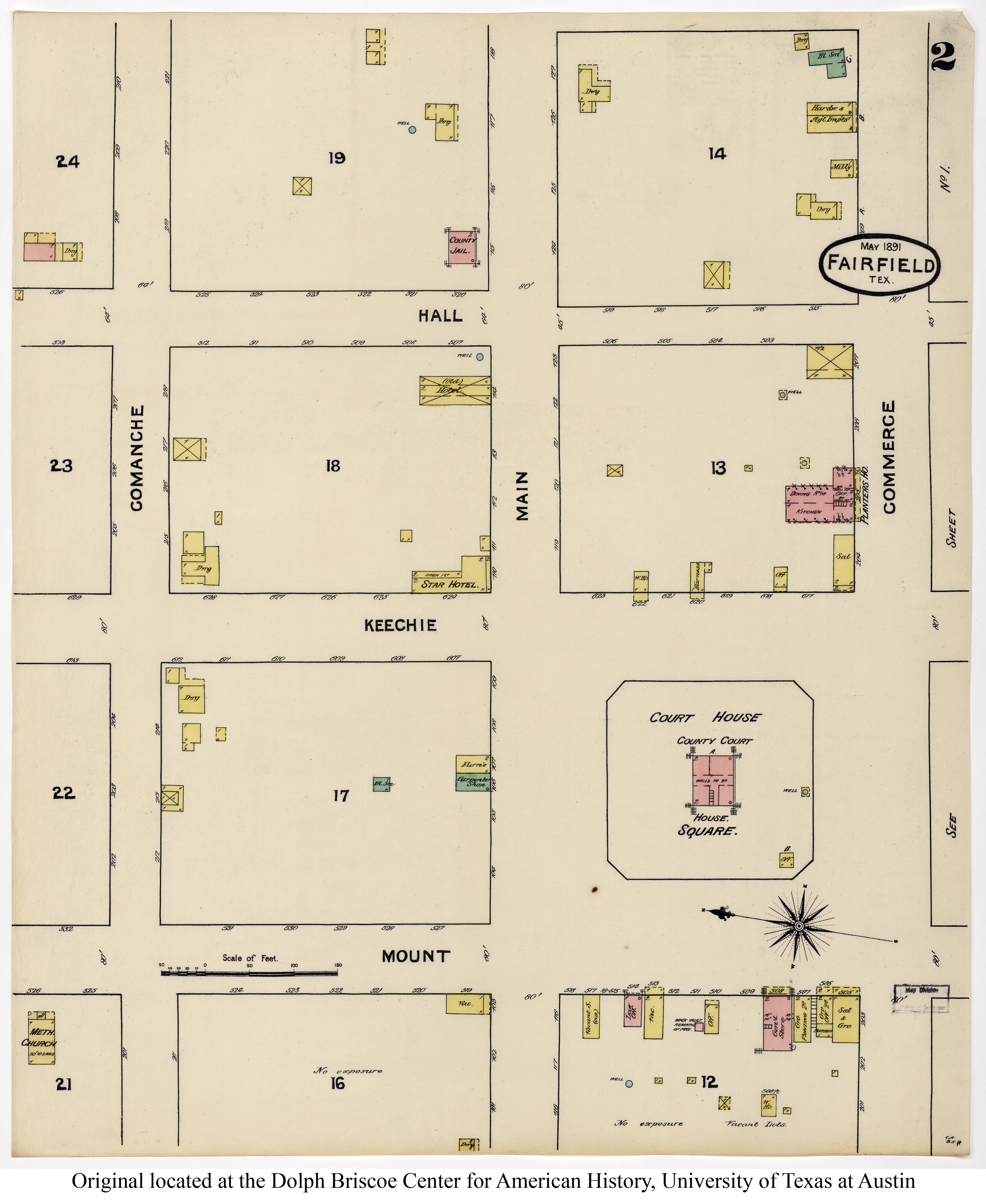
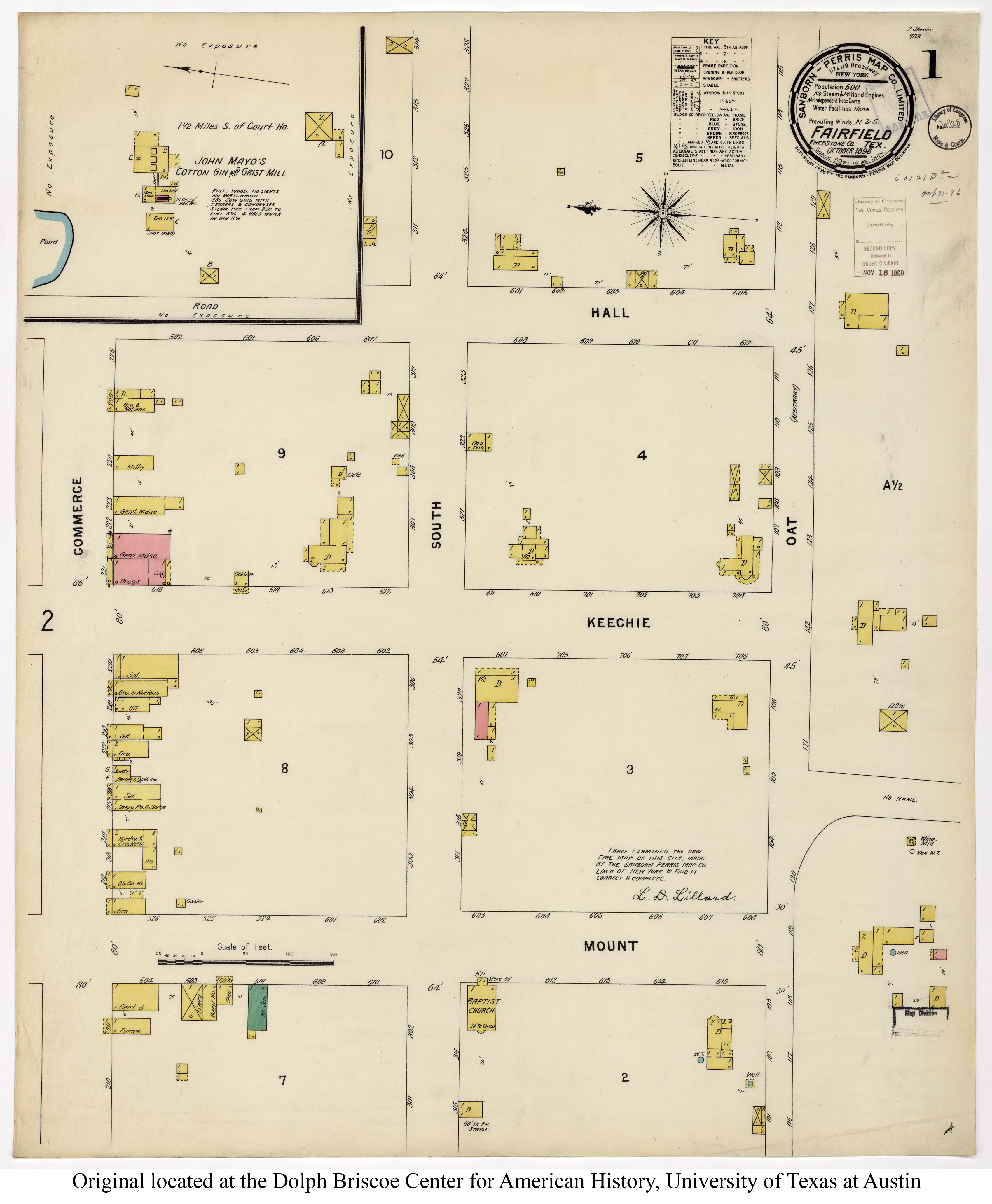
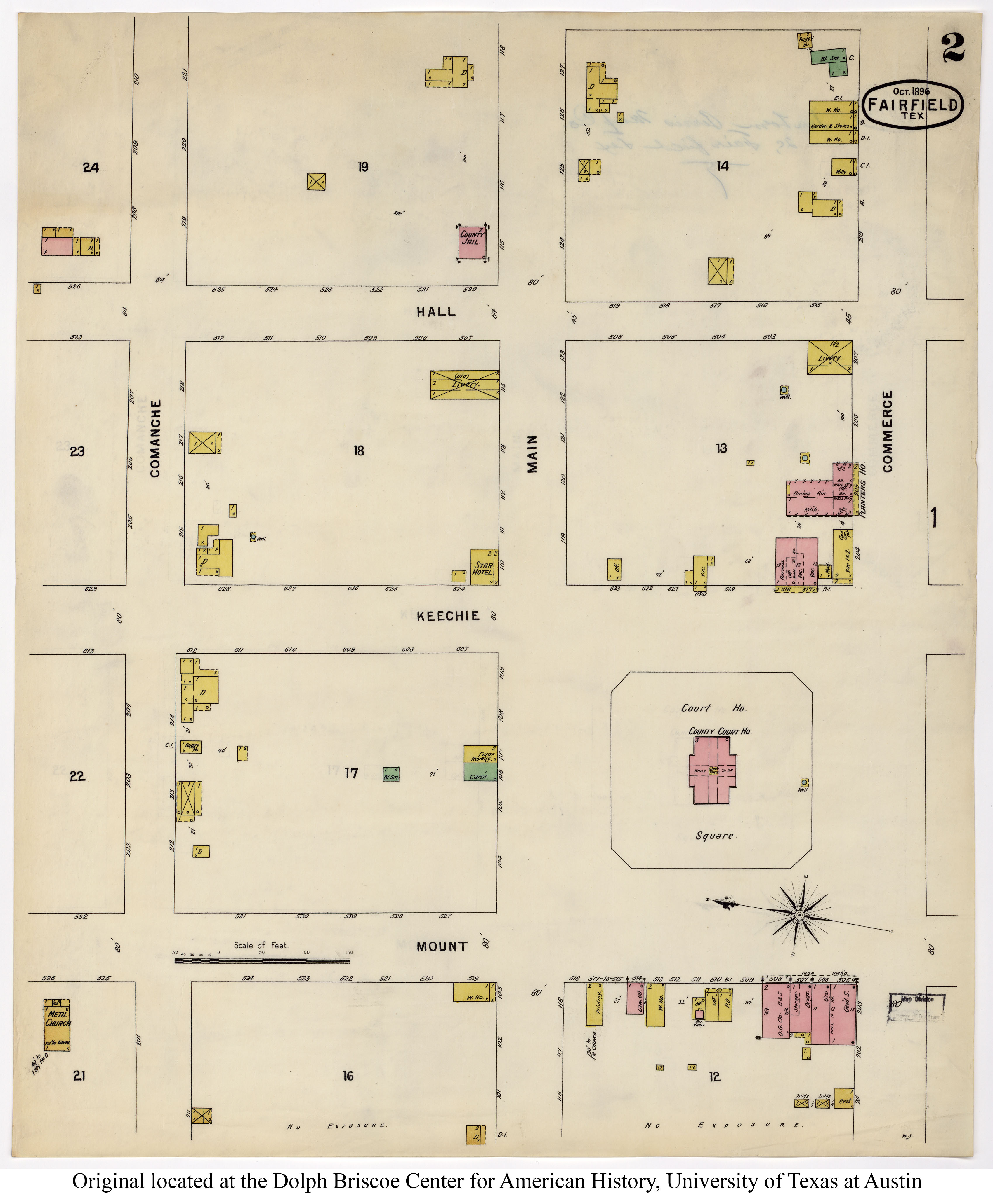
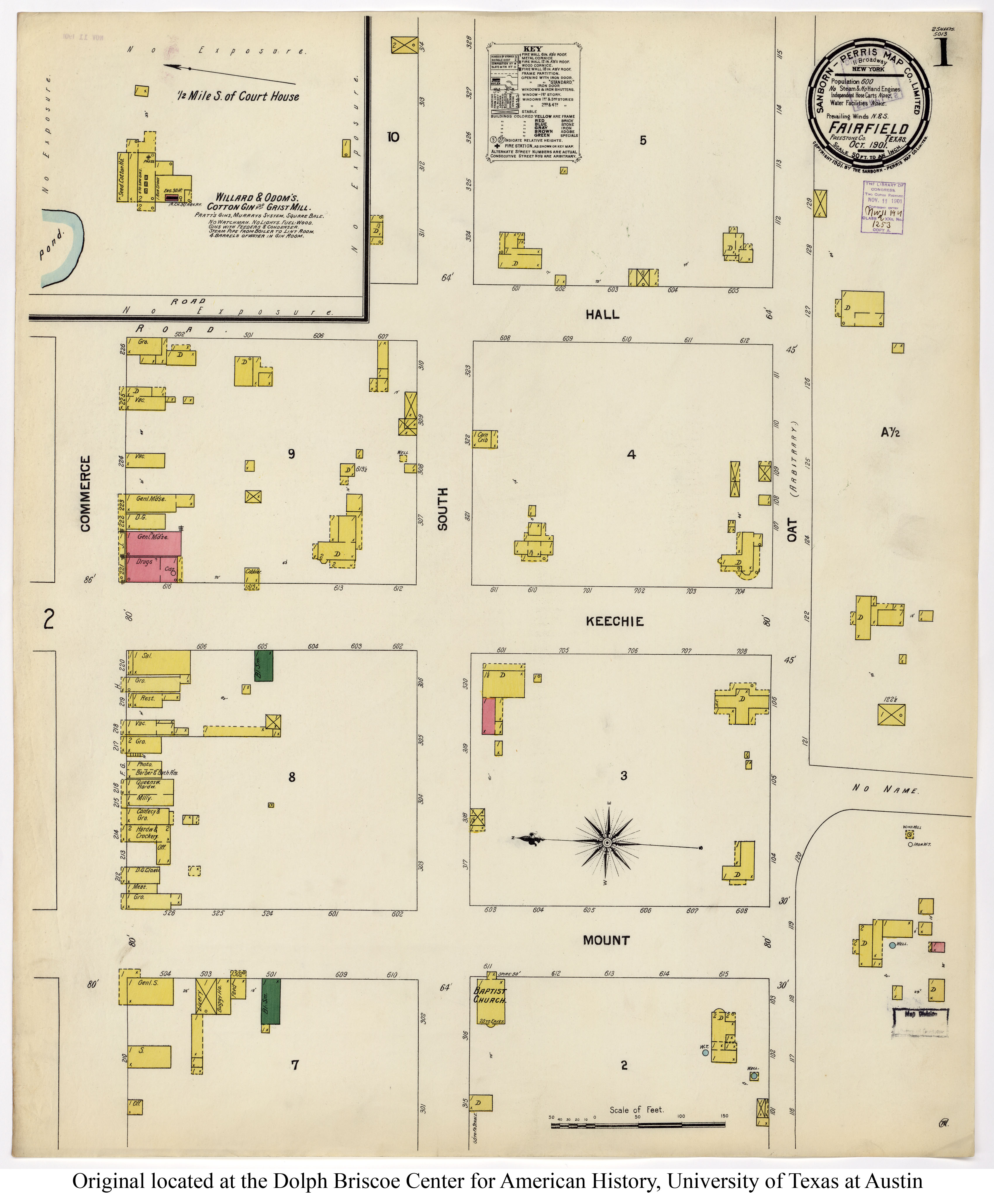
| 1891 |
Freestone County
|
Cram Atlas #1 |
|
| 1891 |
Freestone County |
Cram Atlas #2 |
|
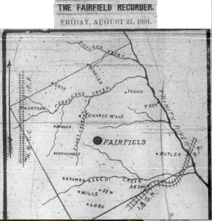
| 1891 |
Freestone County |
Fairfield Recorder newspaper |
|
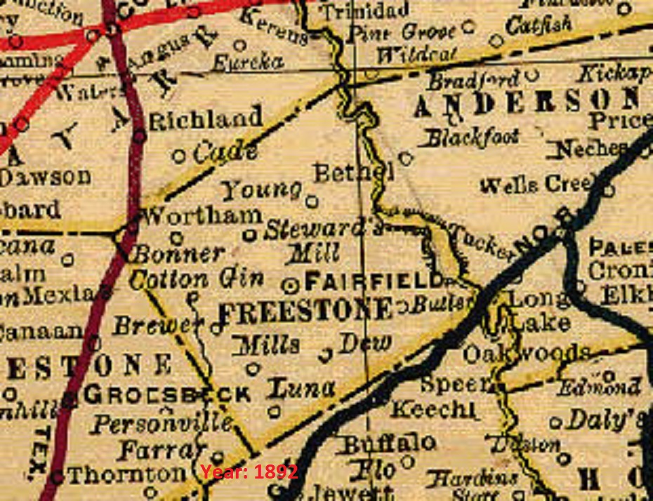
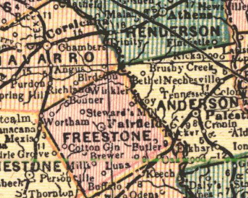
| 1892 |
Freestone County
(Wortham, Bonner, Steward's Mill, Winkler, Troy, Cotton Gin,
Butler, Mills, Luna) |
Mast, Crowell and Kirkpatrick |
|
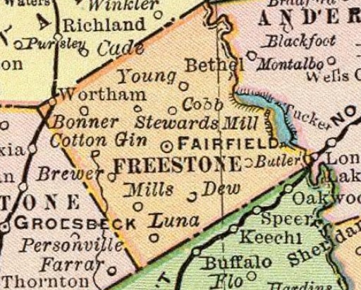
| 1892 |
Freestone County
(Fairfield, Wortham, Bonner, Cotton Gin, Steward's Mill, Young,
Butler, Brewer, Mills, Dew, Luna)
|
Rand, McNally and Co. |
|
| 1893 |
Freestone County
(Wortham, Bonner, Steward's Mill, Winkler, Troy, Cotton Gin,
Butler, Mills, Luna) |
John F. Waite |
|
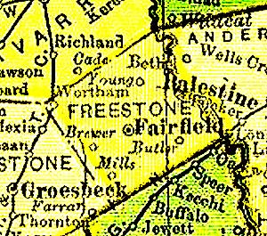
| 1895 |
Freestone County
(Young, Wortham, Brewer, Bulter, Mills)
|
Rand, McNally & Co. |
|
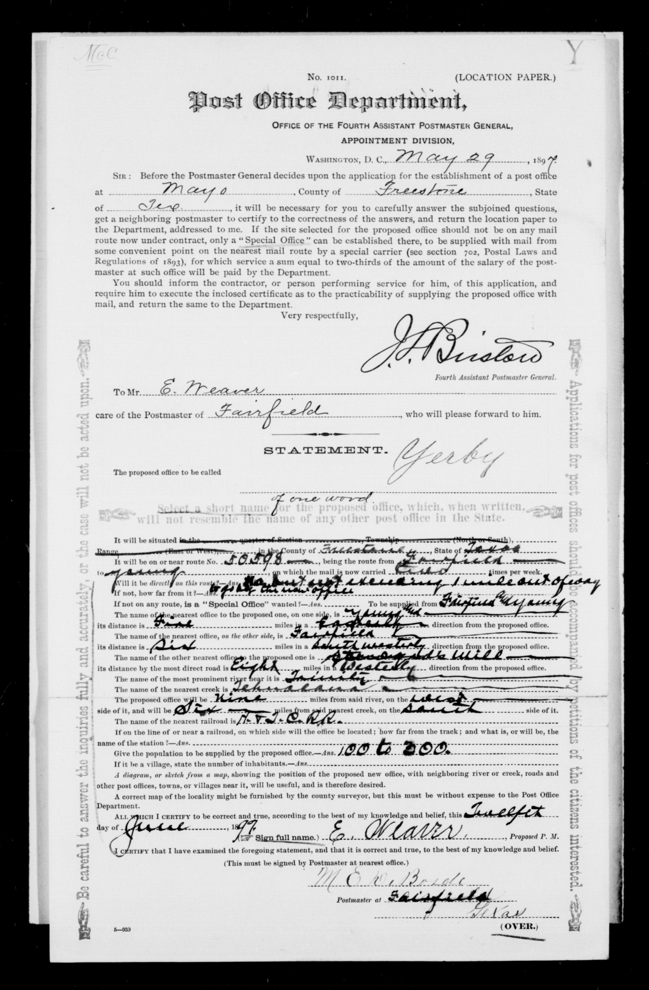
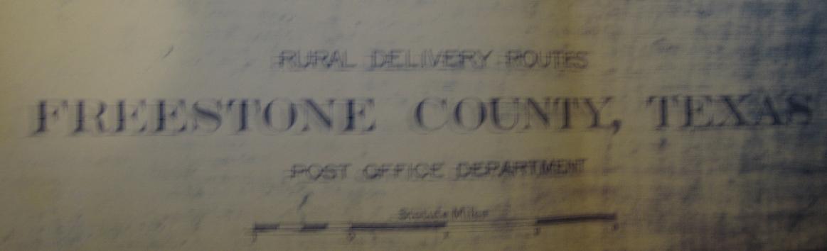
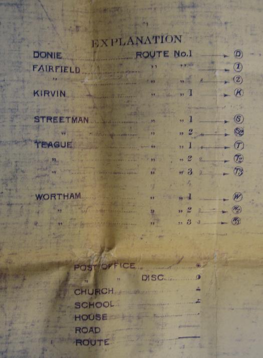
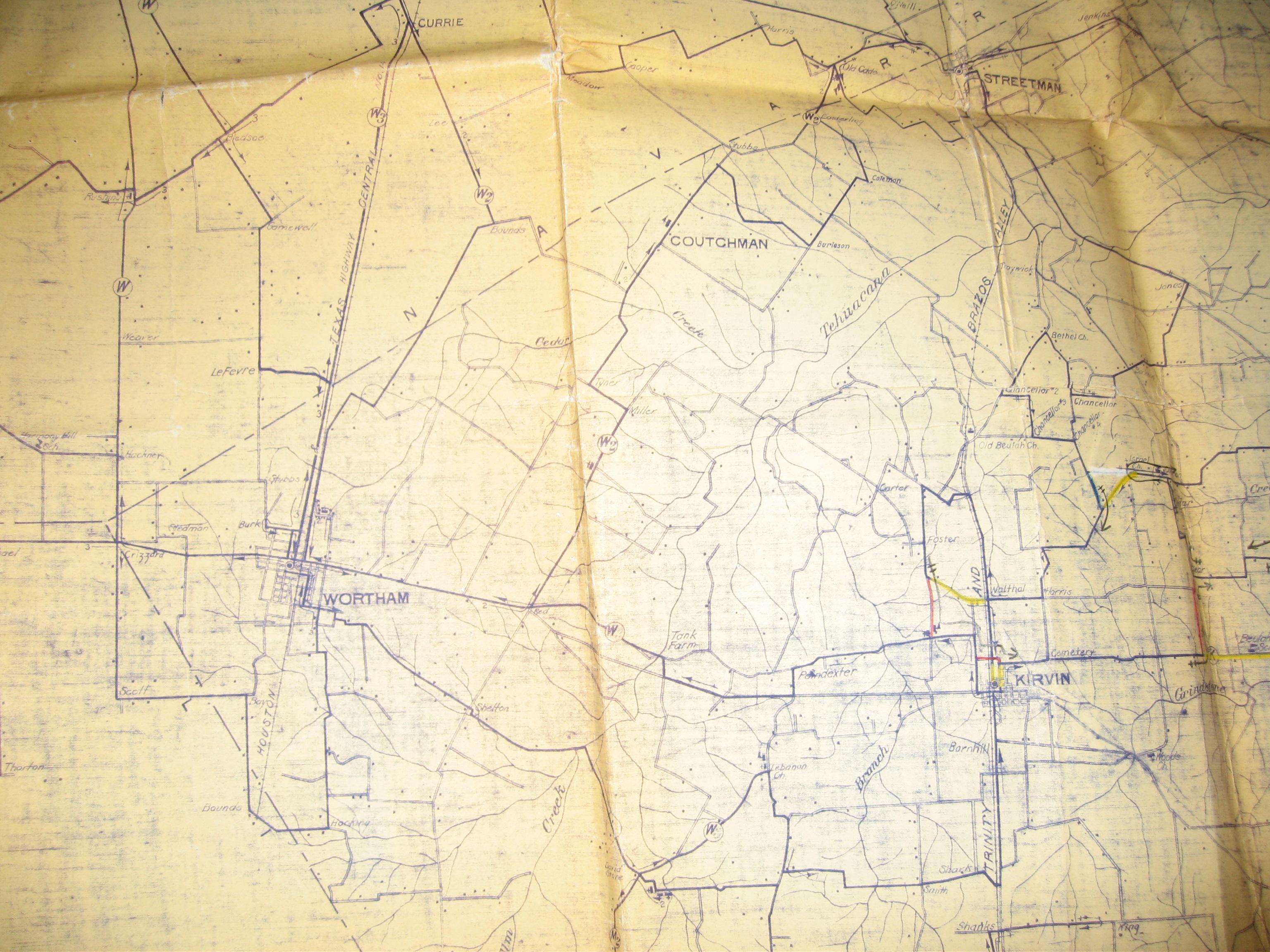
| 1897 |
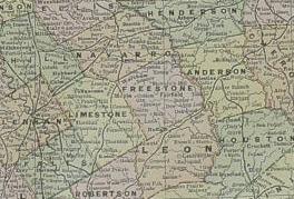
Freestone County |
Rand, McNally & Co. |
|
| 1900 |
Freestone County
(many) |
Rand, McNally & Co. |
|
| 1900 |
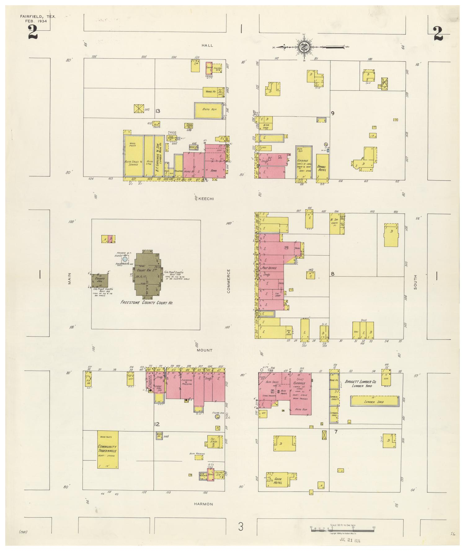
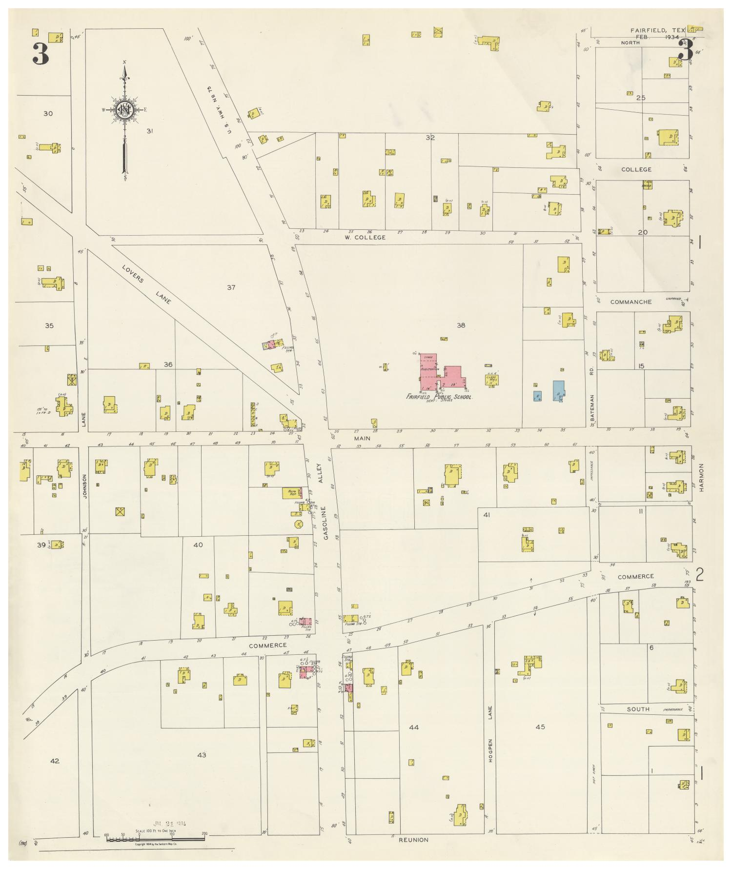
Freestone County (Fairfield) |
U.S. Geological Survey, Dept. of the Interior |
|
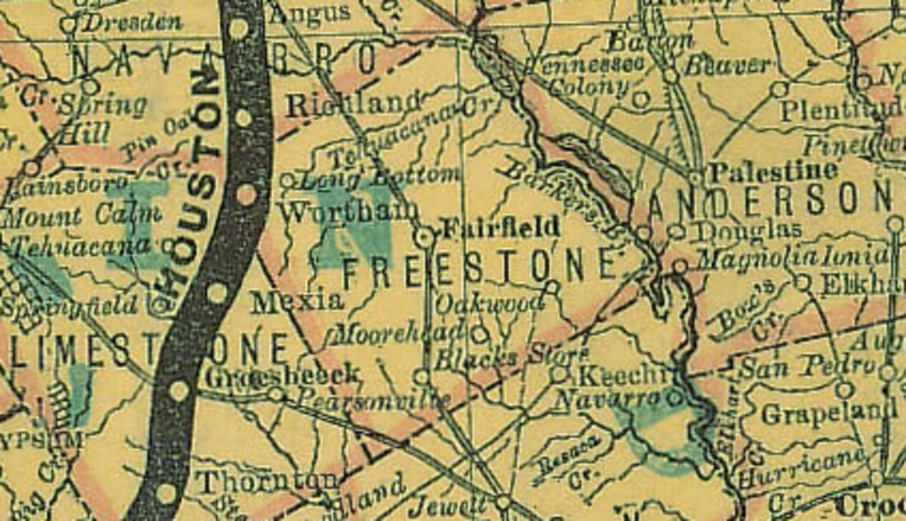
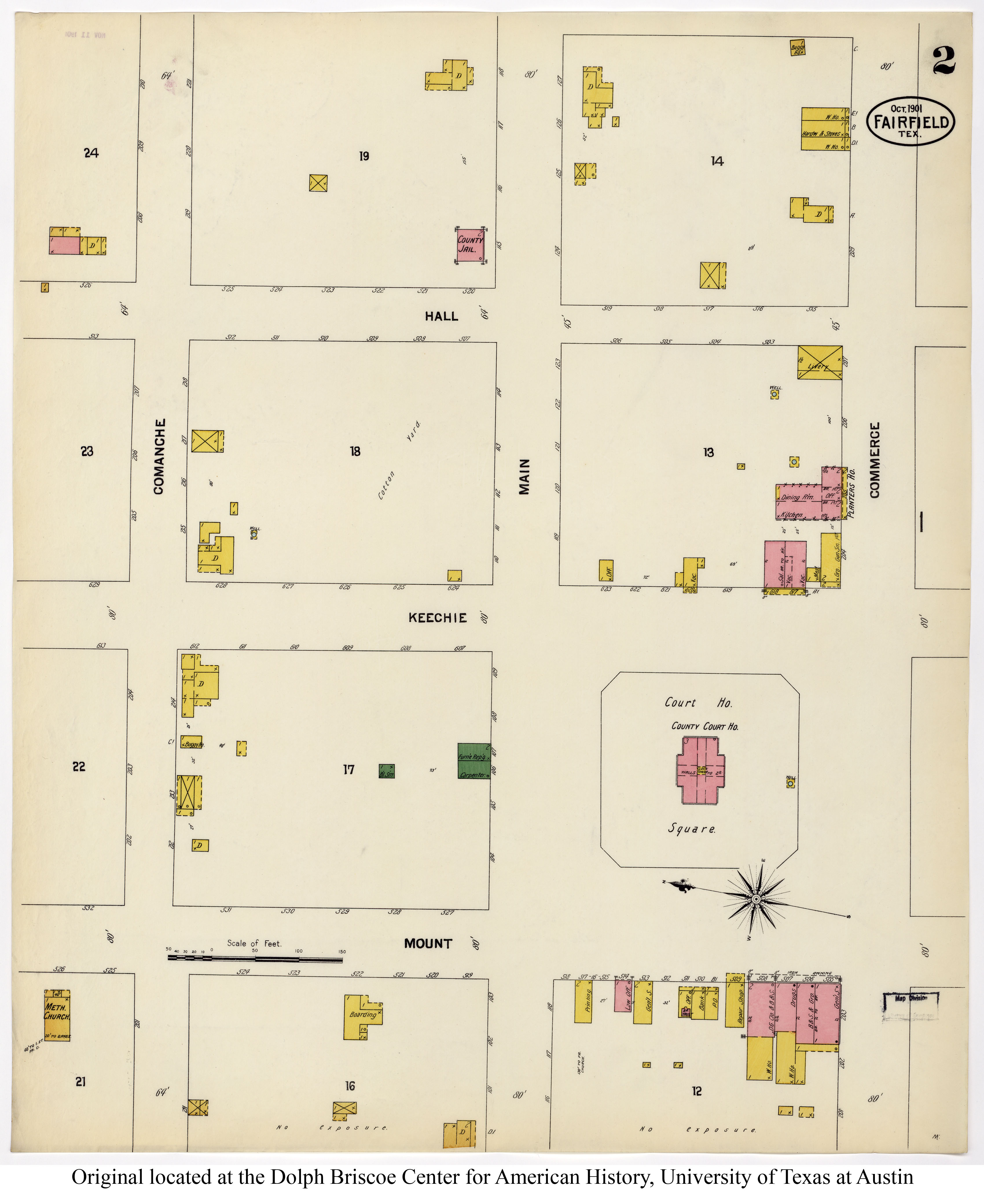
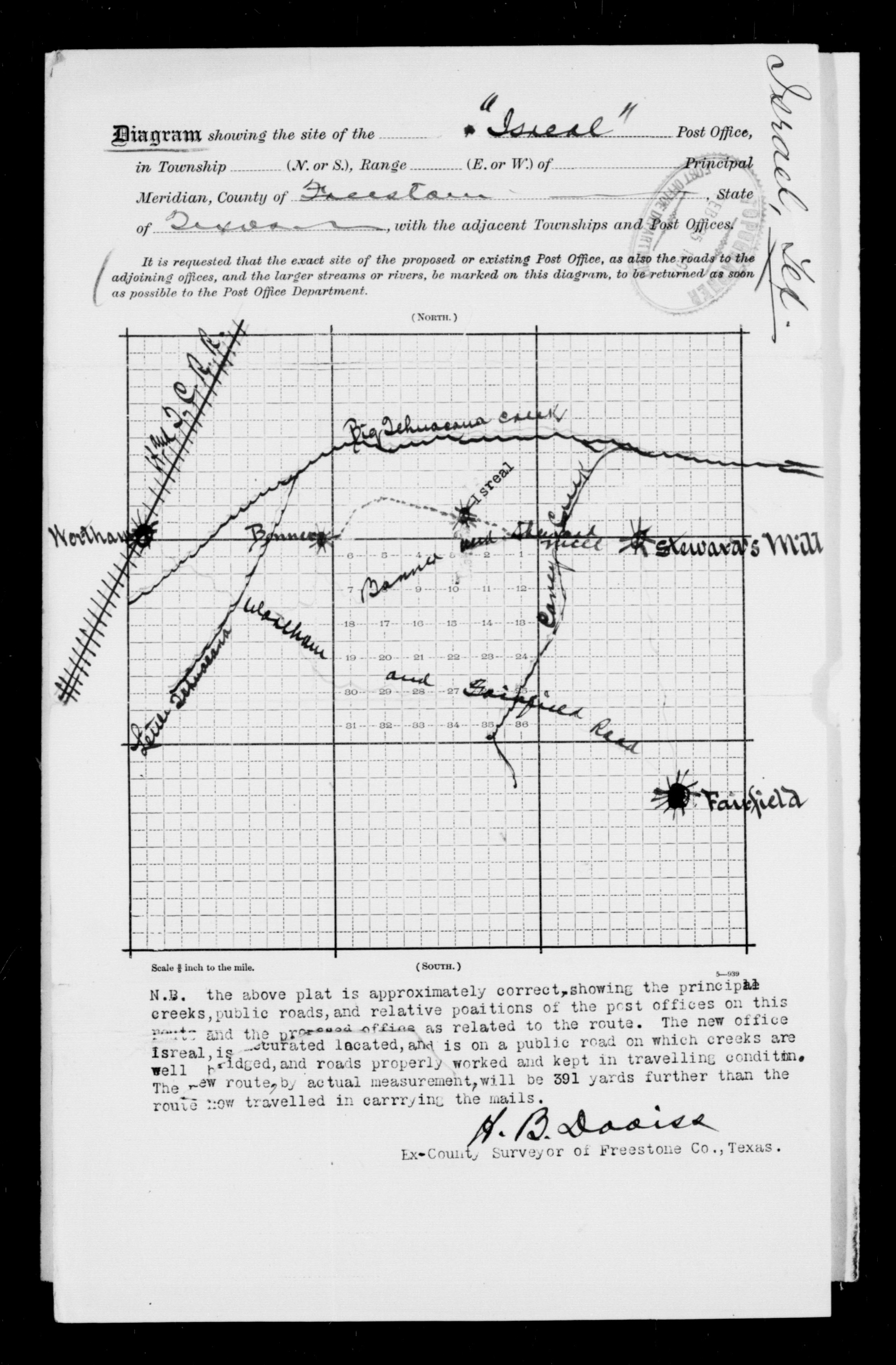
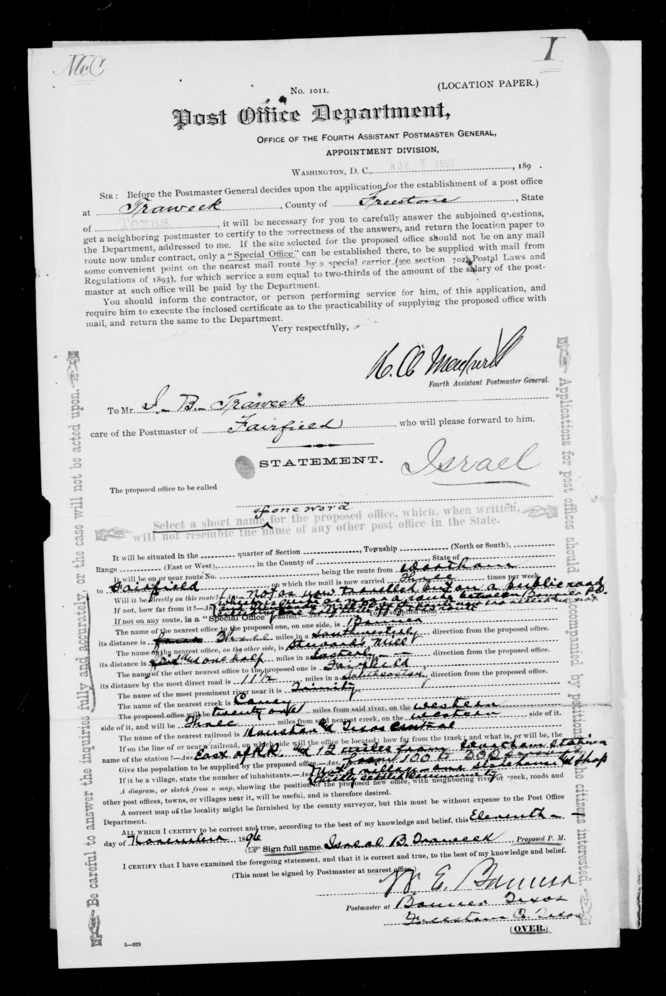
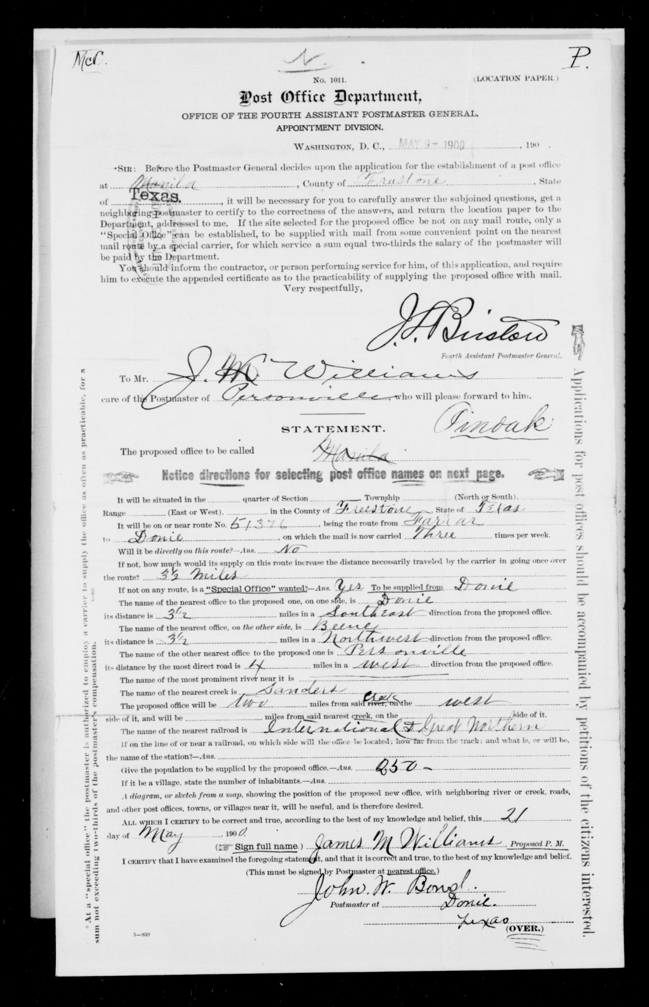
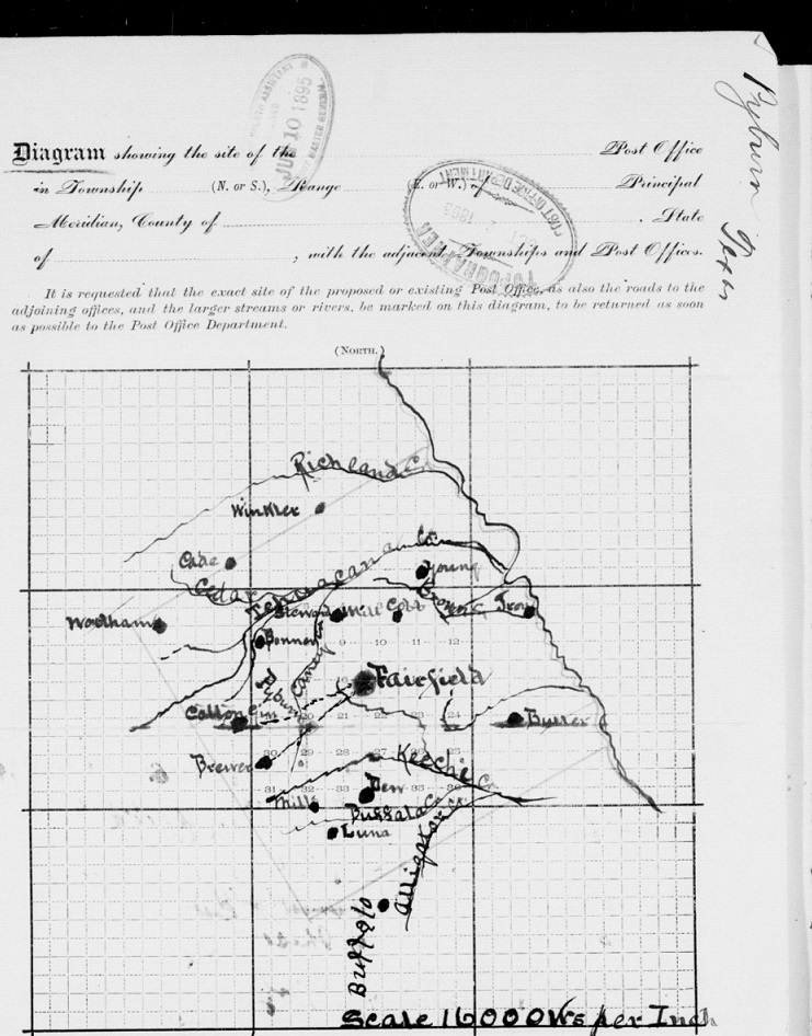
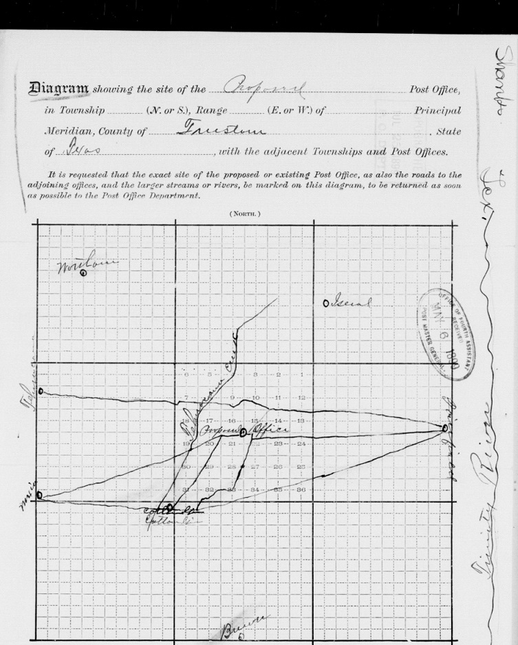
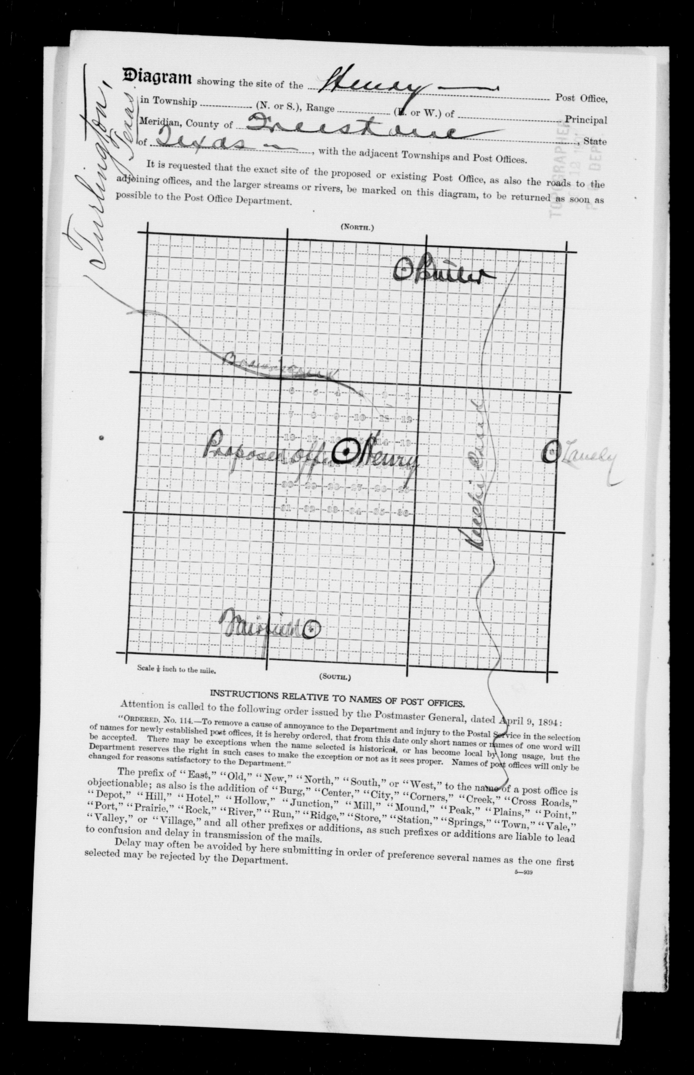
| 1901 |
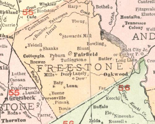
Freestone County
(Wortham, Bonner, Israel, Young, Stewards Mill, Harp, Fairfield, Butler,
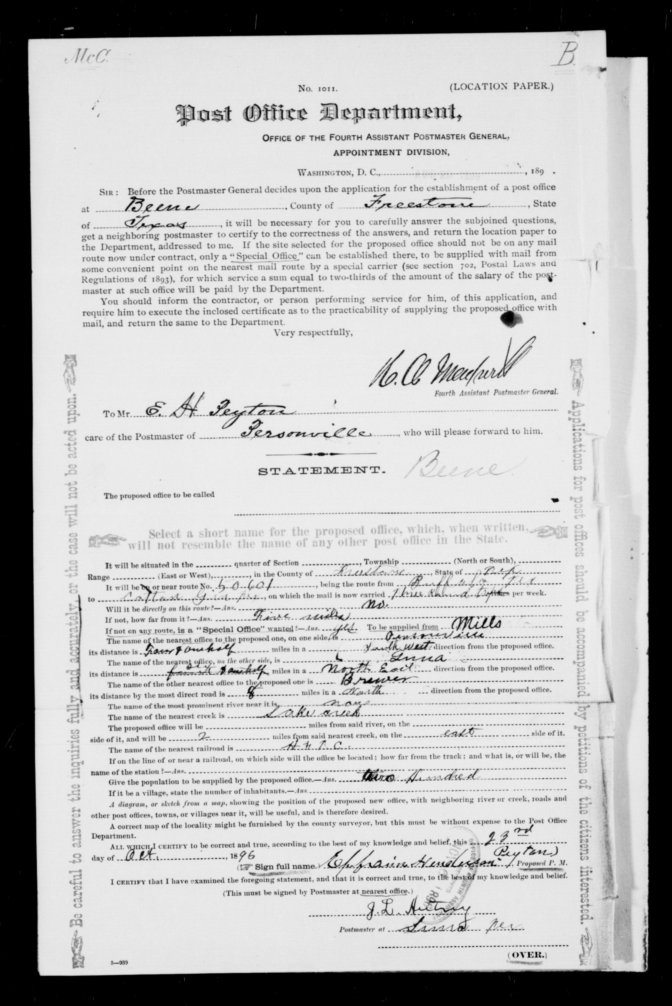
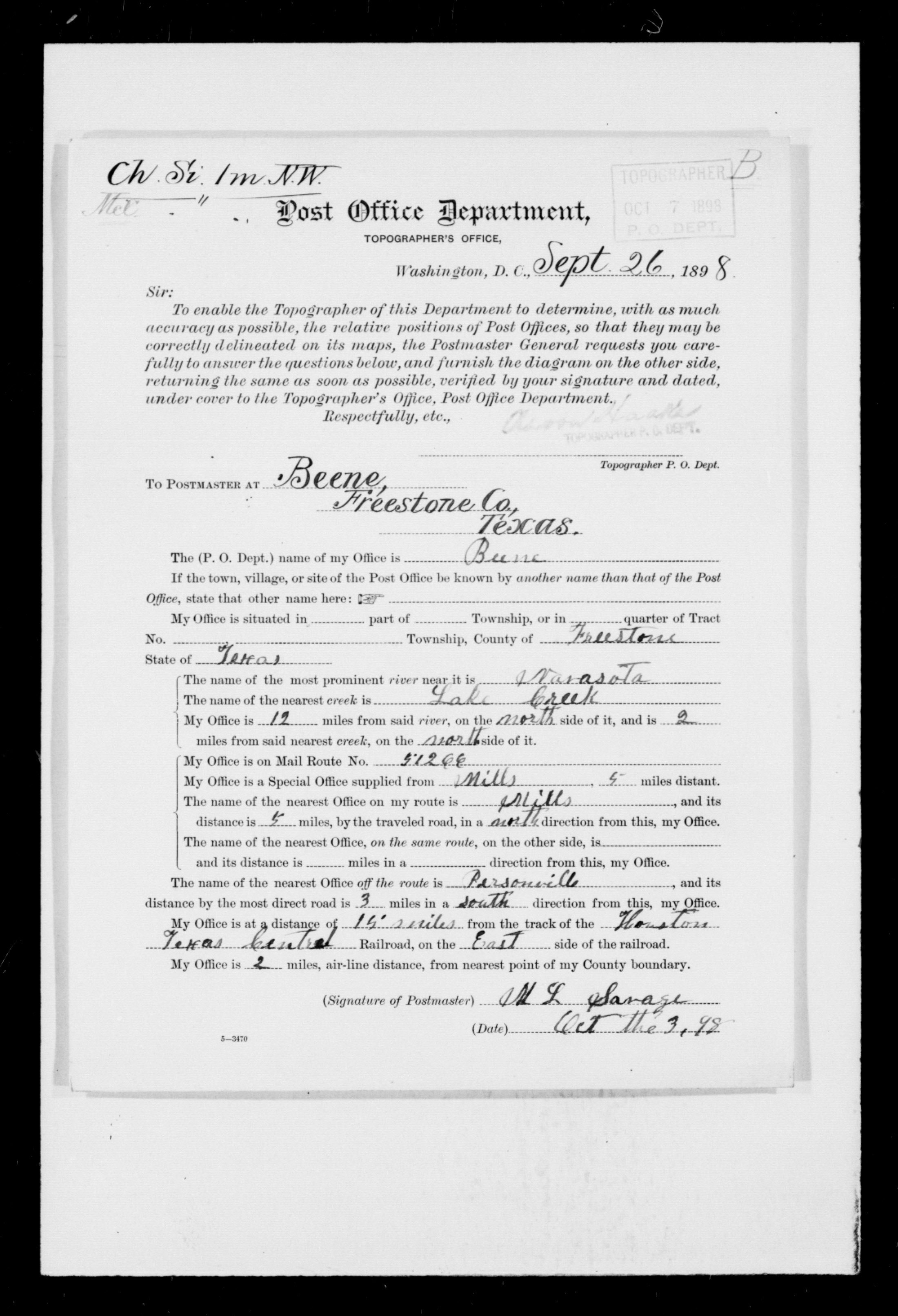
Brewer, Mills, Luna, Beene, Lanely) |
Rand McNally and Co. |
|
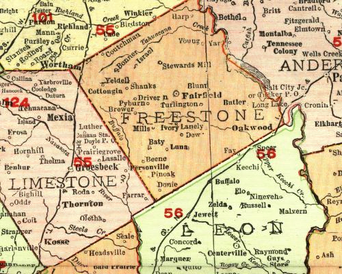
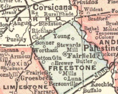
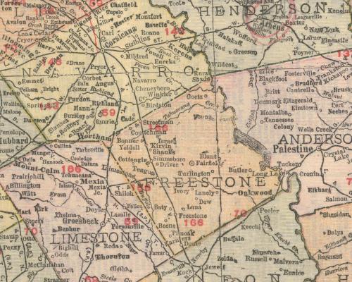
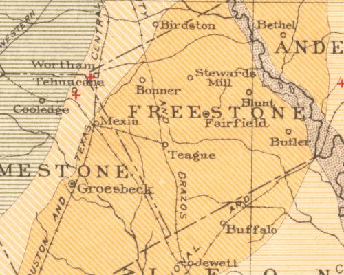
| 1904 |
Freestone County
(Wortham, Bonner, Stewards Mill, Troy, Fairfield, Cotton Gin, Brewer,
Luna, Butler, Brewer, Mills, Luna, Beene, Lanely) |
C.S. Hammond and Co. |
|
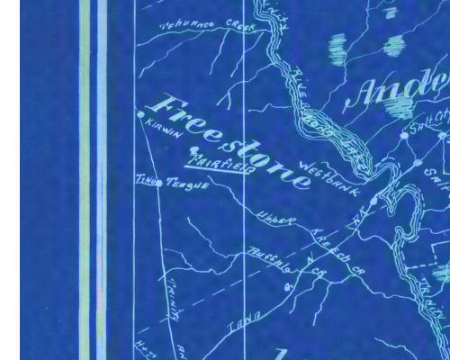
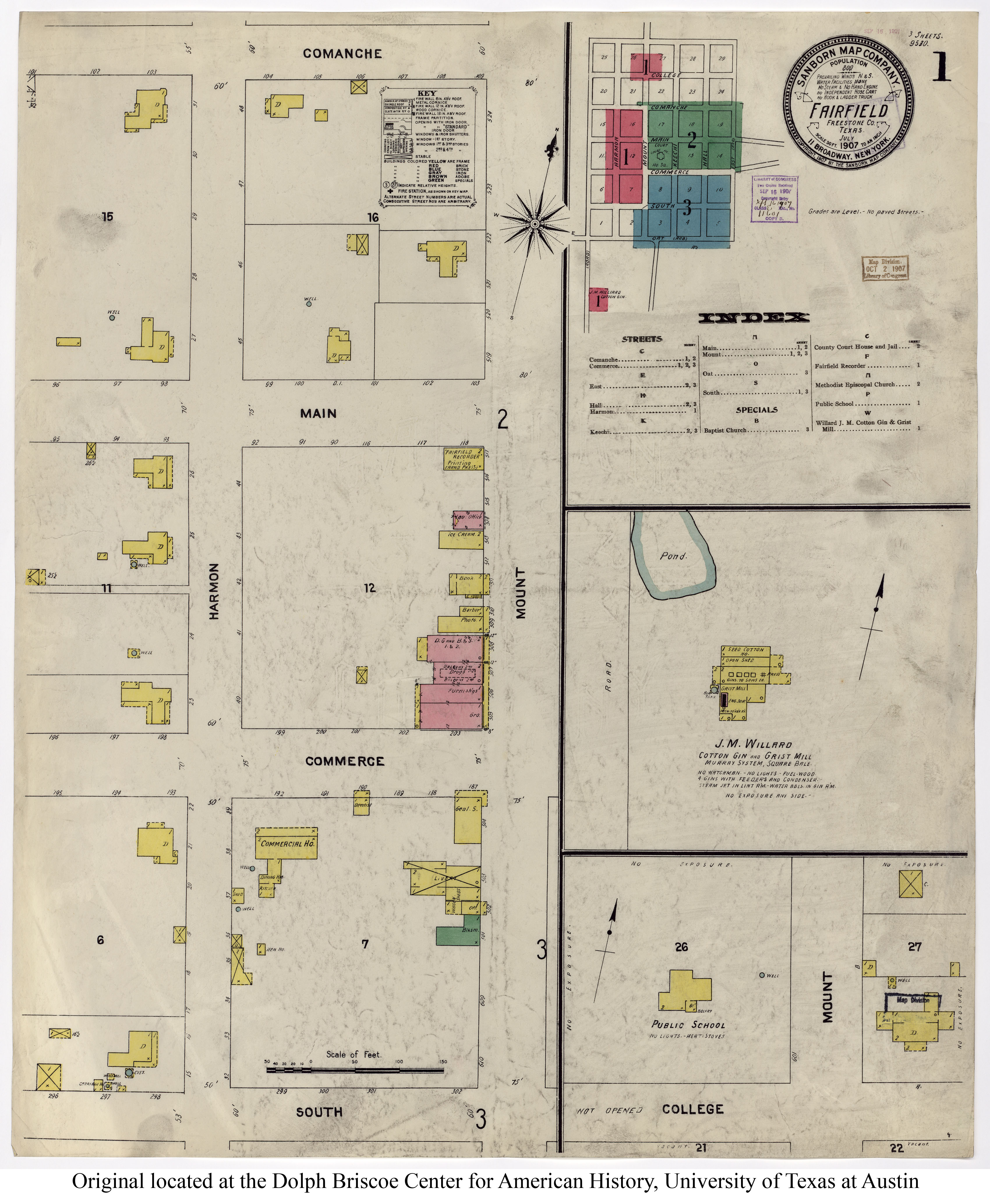
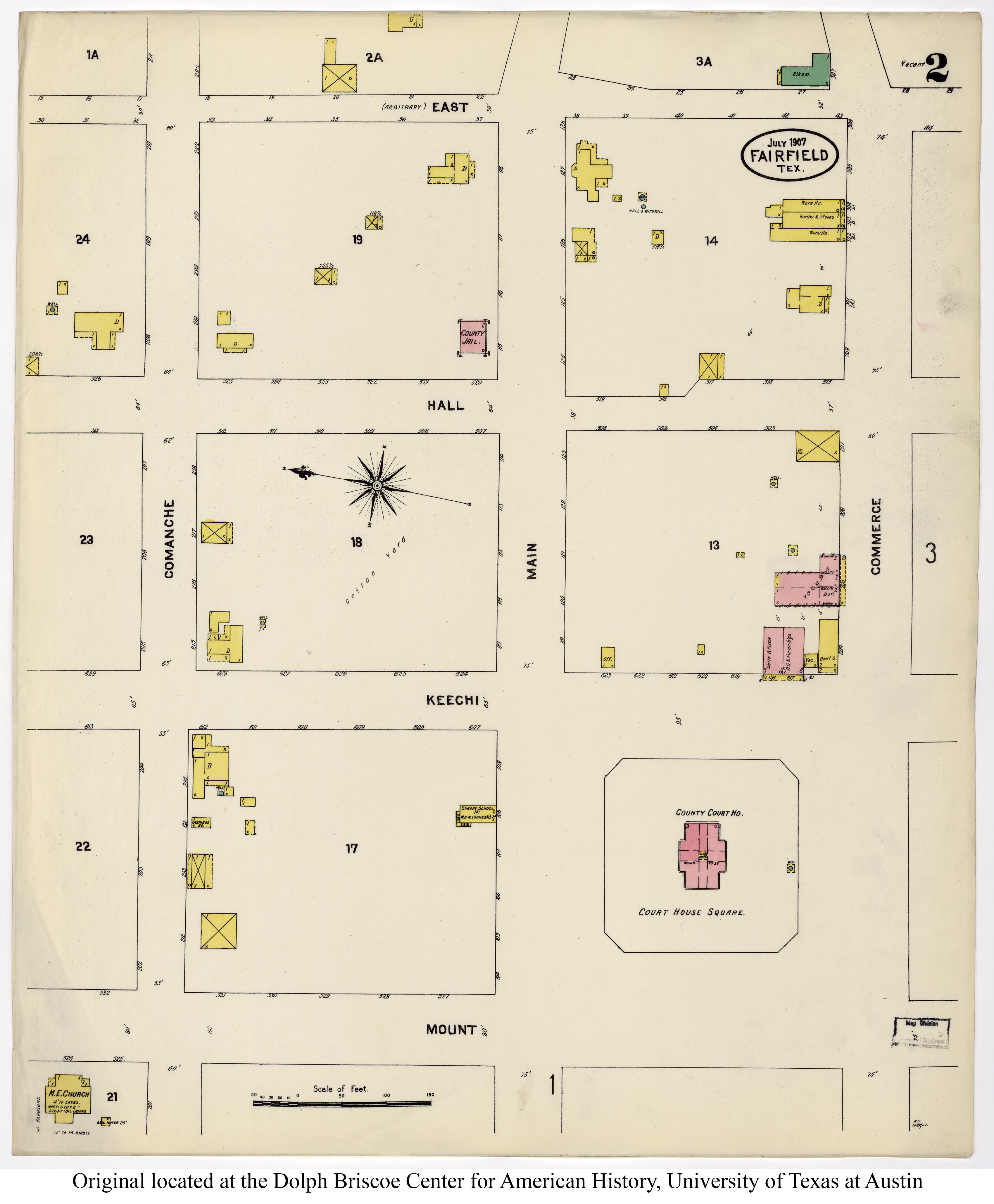
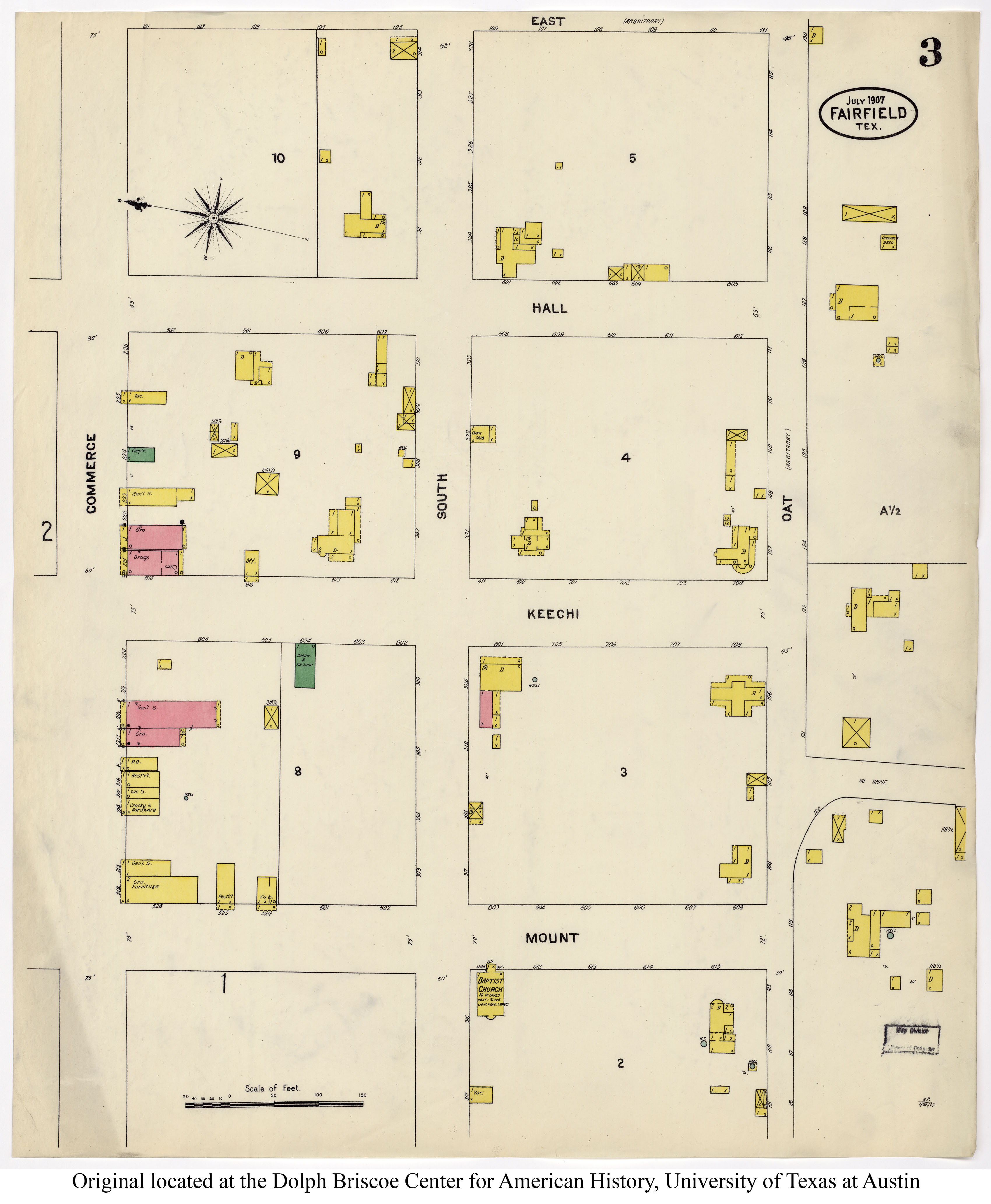
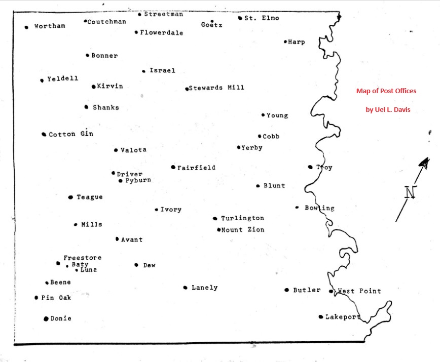
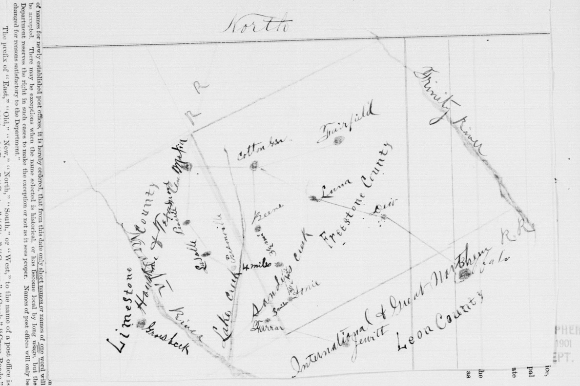
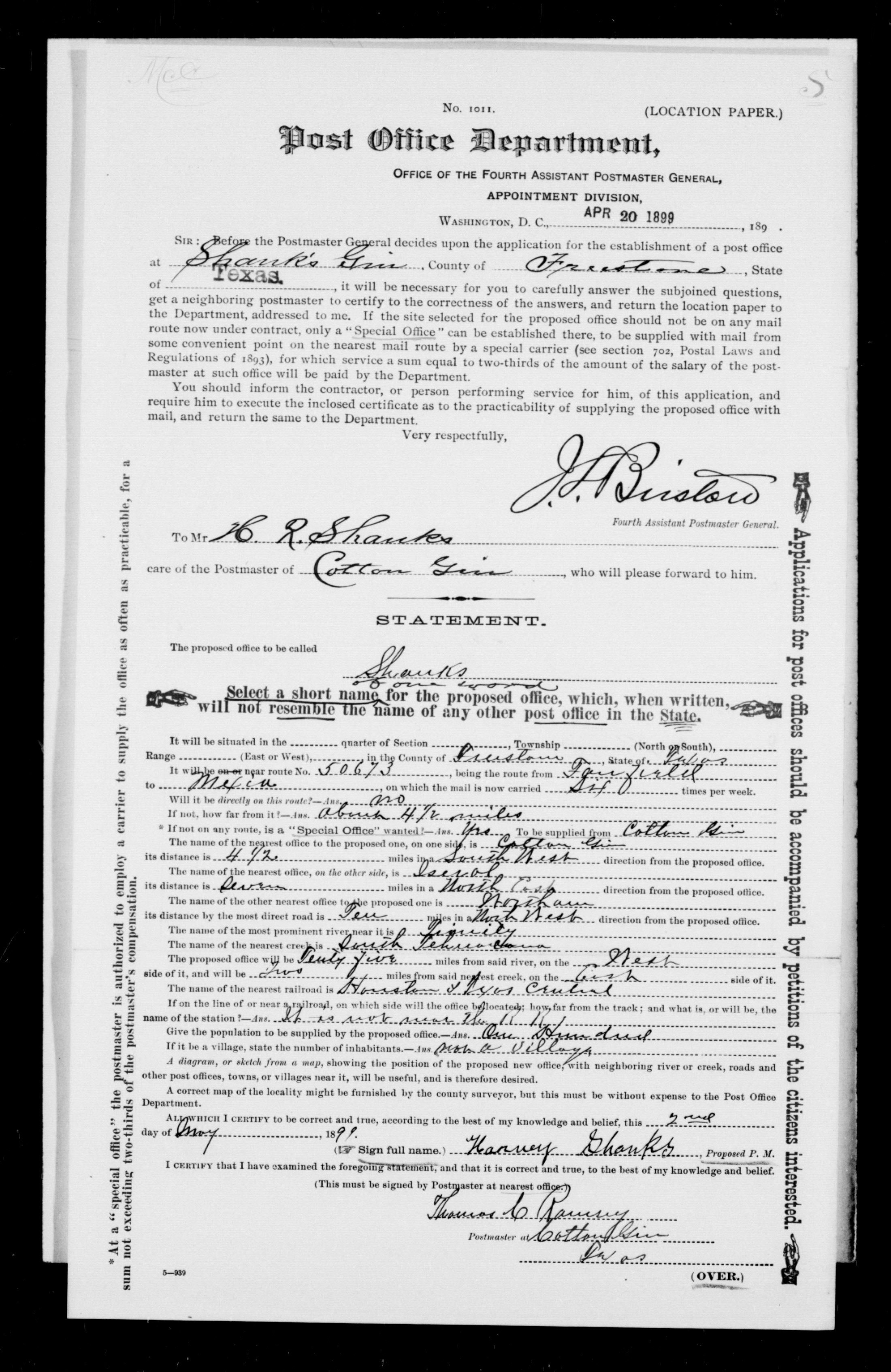
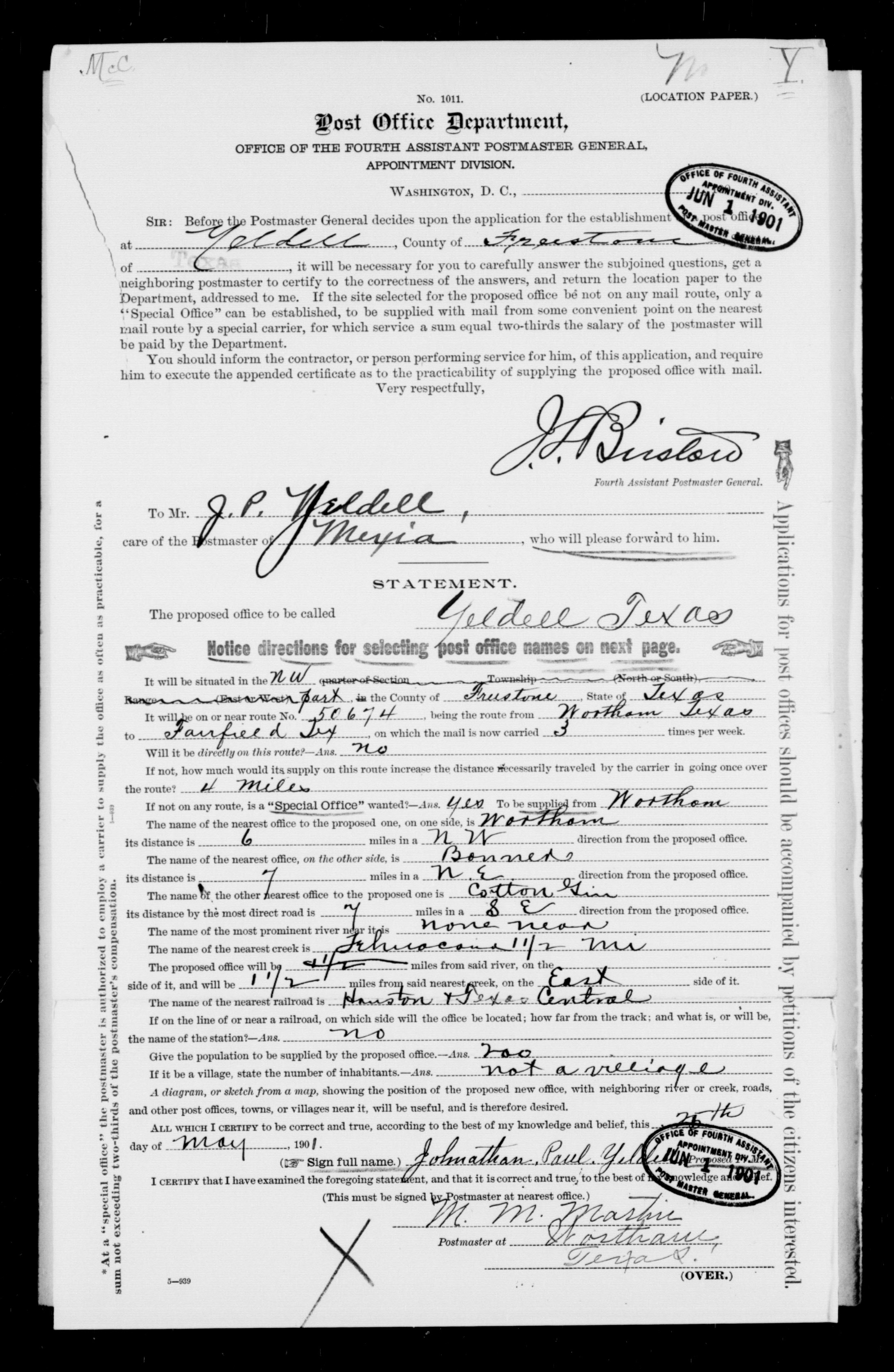
| 1905 |
Freestone County
(Harp, Streetman, Coutchman, Wortham, Bonner, Yeldell, Kirvin, Shanks,
Israel, Simmsboro, Blunt, Fairfield, Driver, Pyburn, Cotton Gin,
Teague, Baty, Beene, Luna, Donie, Pin Oak, Lanely, Dew, Ivory,
Butler, Turlington, Young) |
Rand McNally and Co. |
|
| 1906 |
Freestone County
(Harp, Streetman, Coutchman, Wortham, Bonner, Yeldell, Kirvin,
Shanks, Israel, Simmsboro, Blunt, Fairfield, Driver, Pyburn,
Cotton Gin, Teague, Baty, Beene, Luna, Donie, Pin Oak, Lanely, Dew,
Ivory, Butler, Turlington, Young) |
Rand McNally and Co. |
|
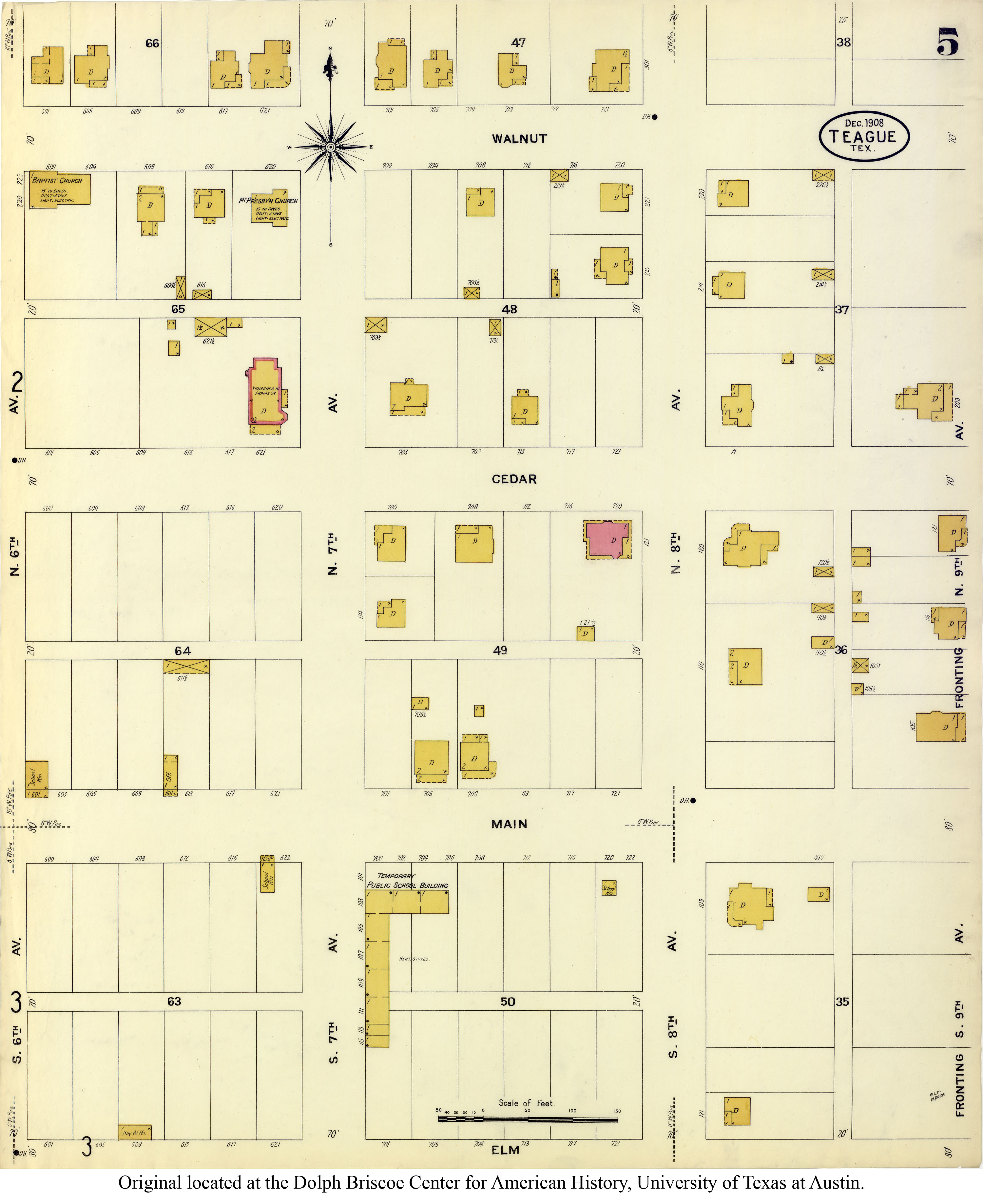
| 1908 |
Freestone County
(Bonner, Young, Stewards Mill, Wortham, Fairfield, Butler, Brewer, Mills, Luna) |
Crowell Publishing Co. |
|
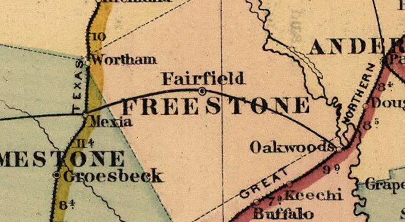
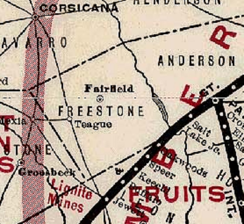
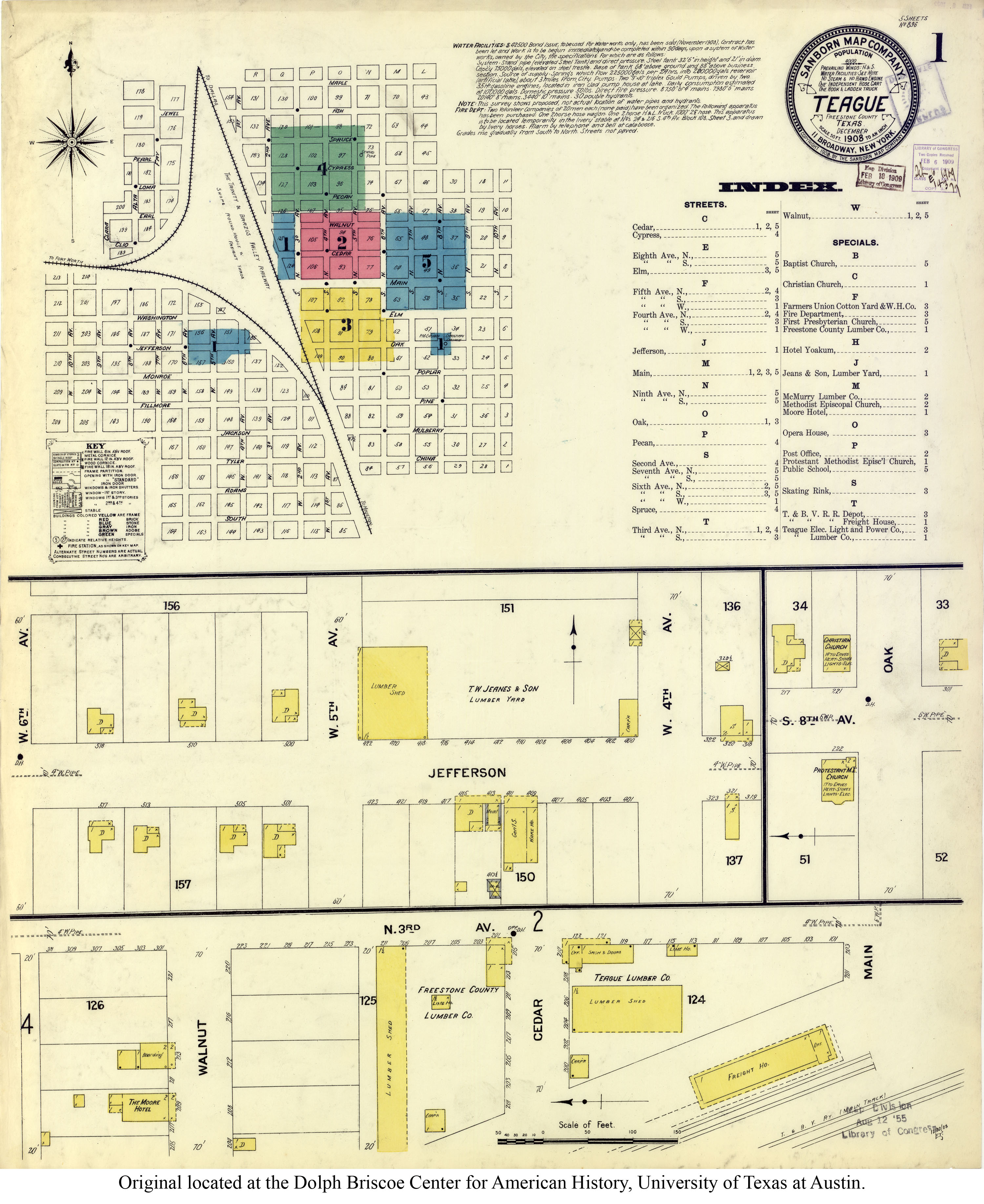
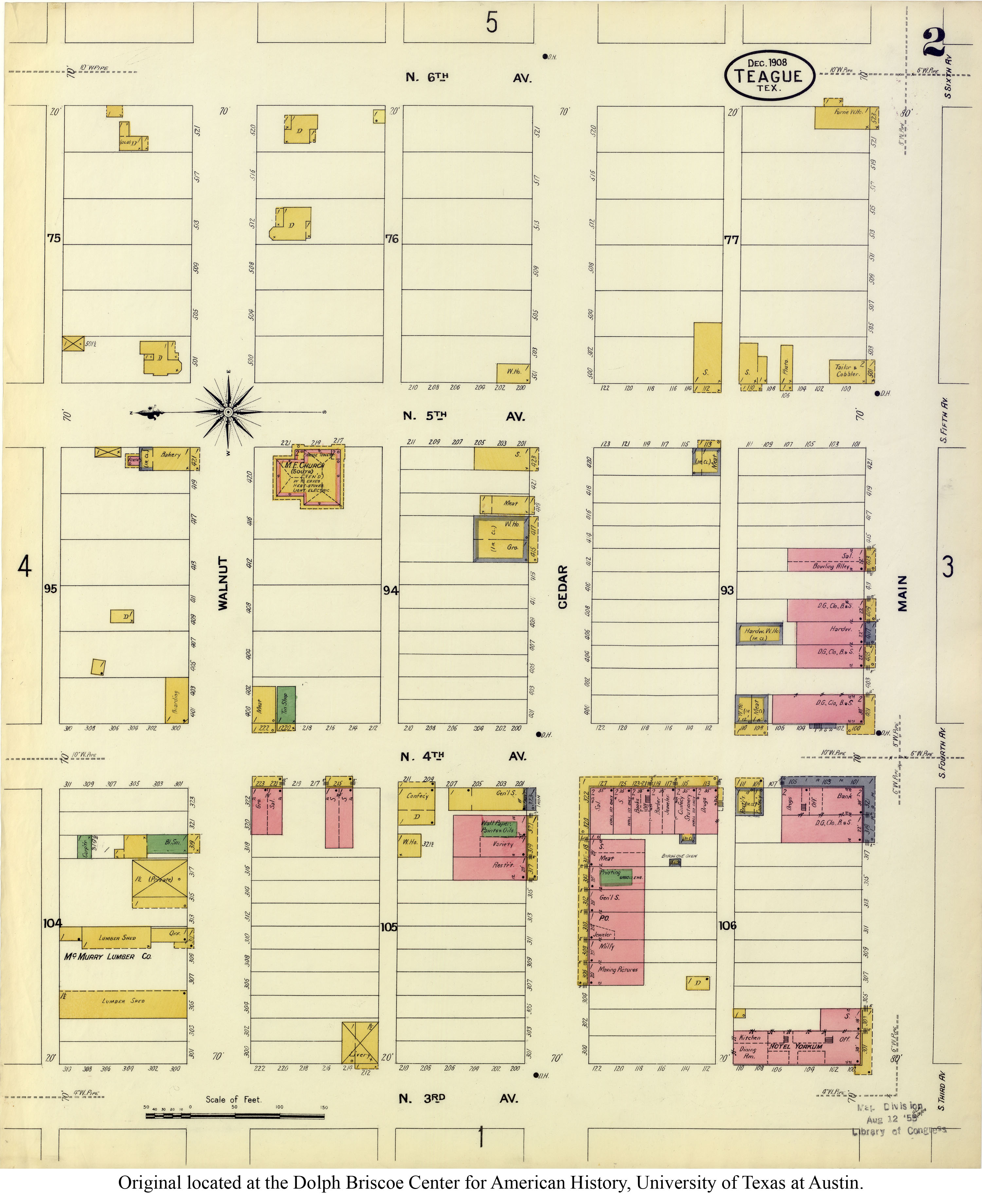
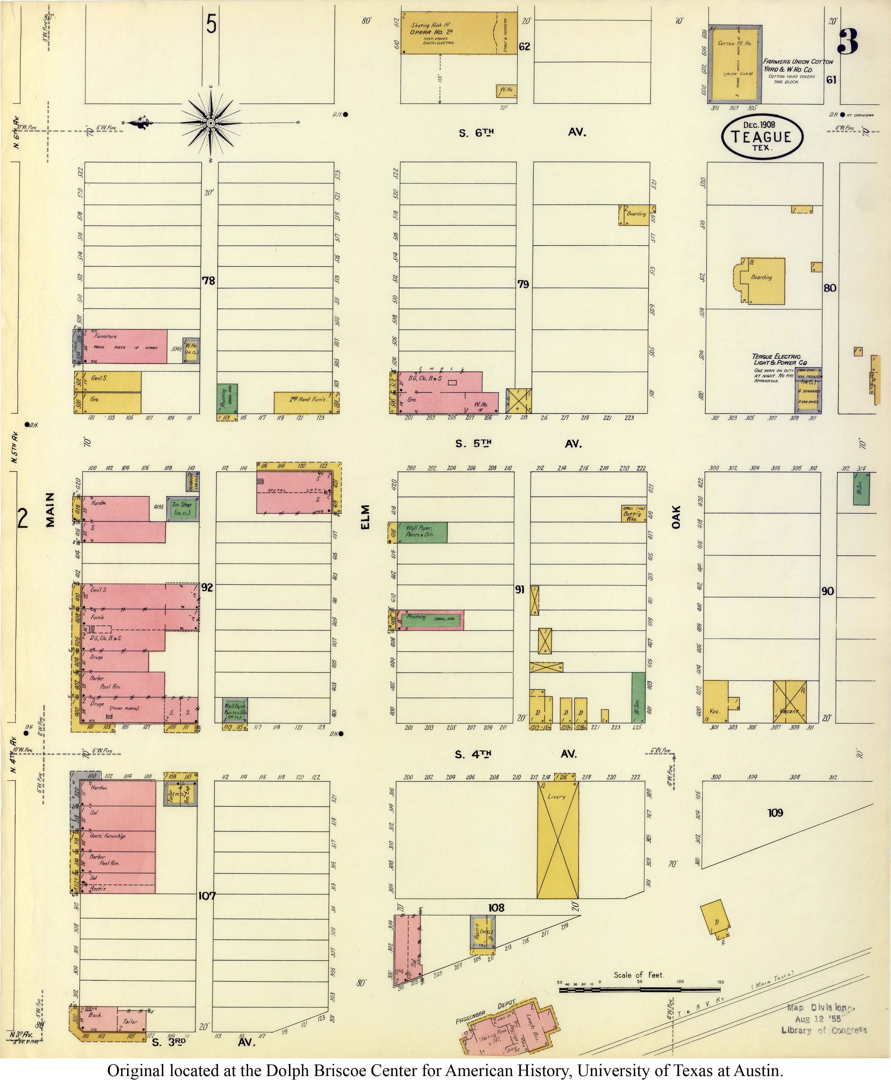
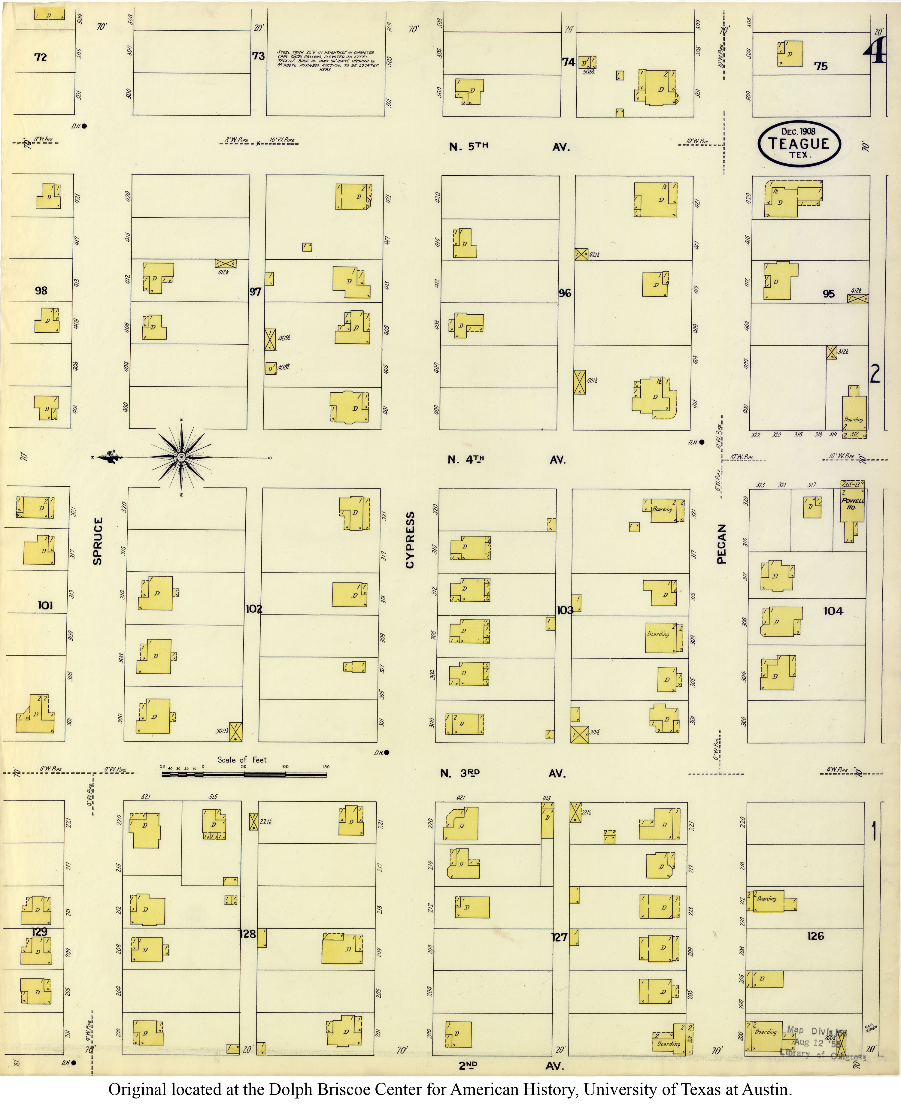
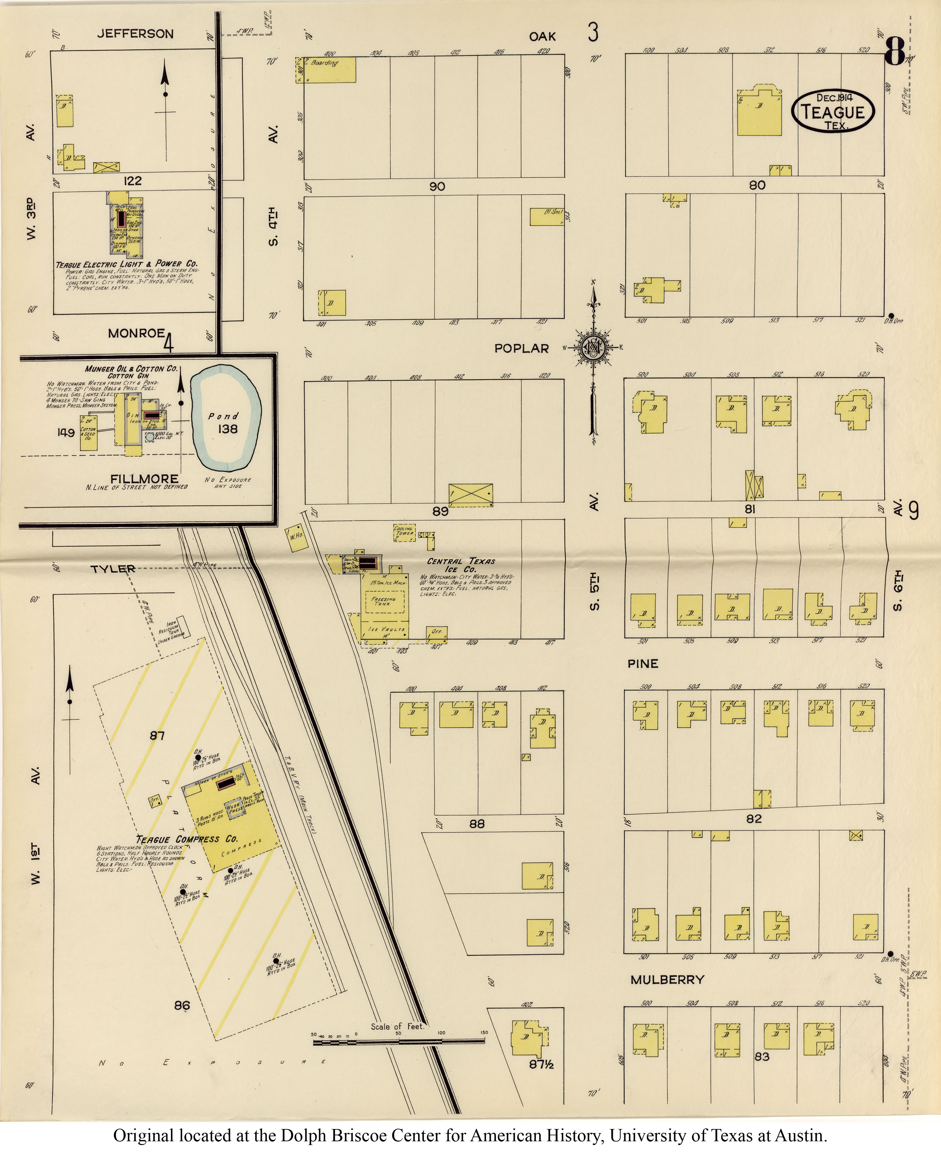
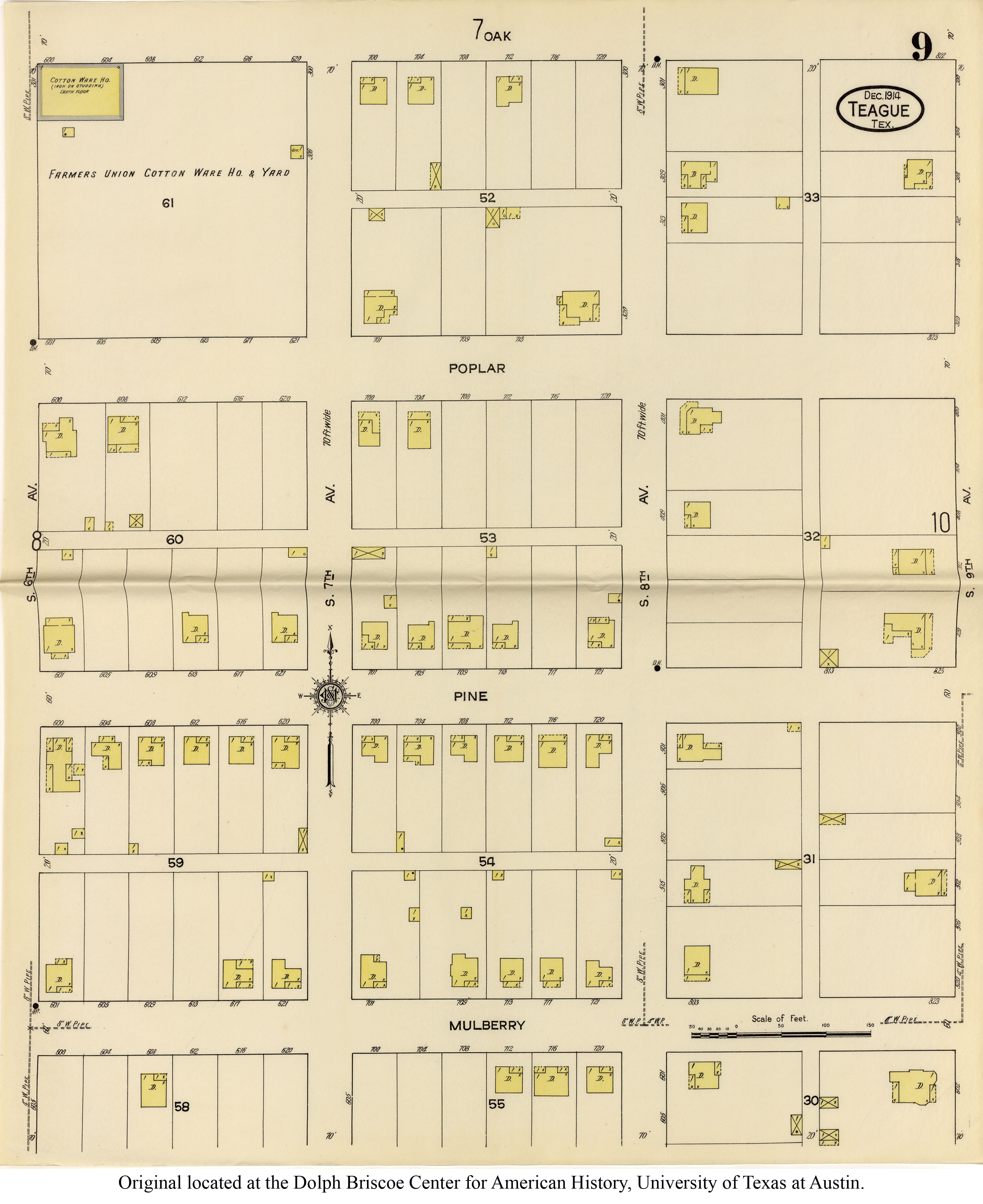
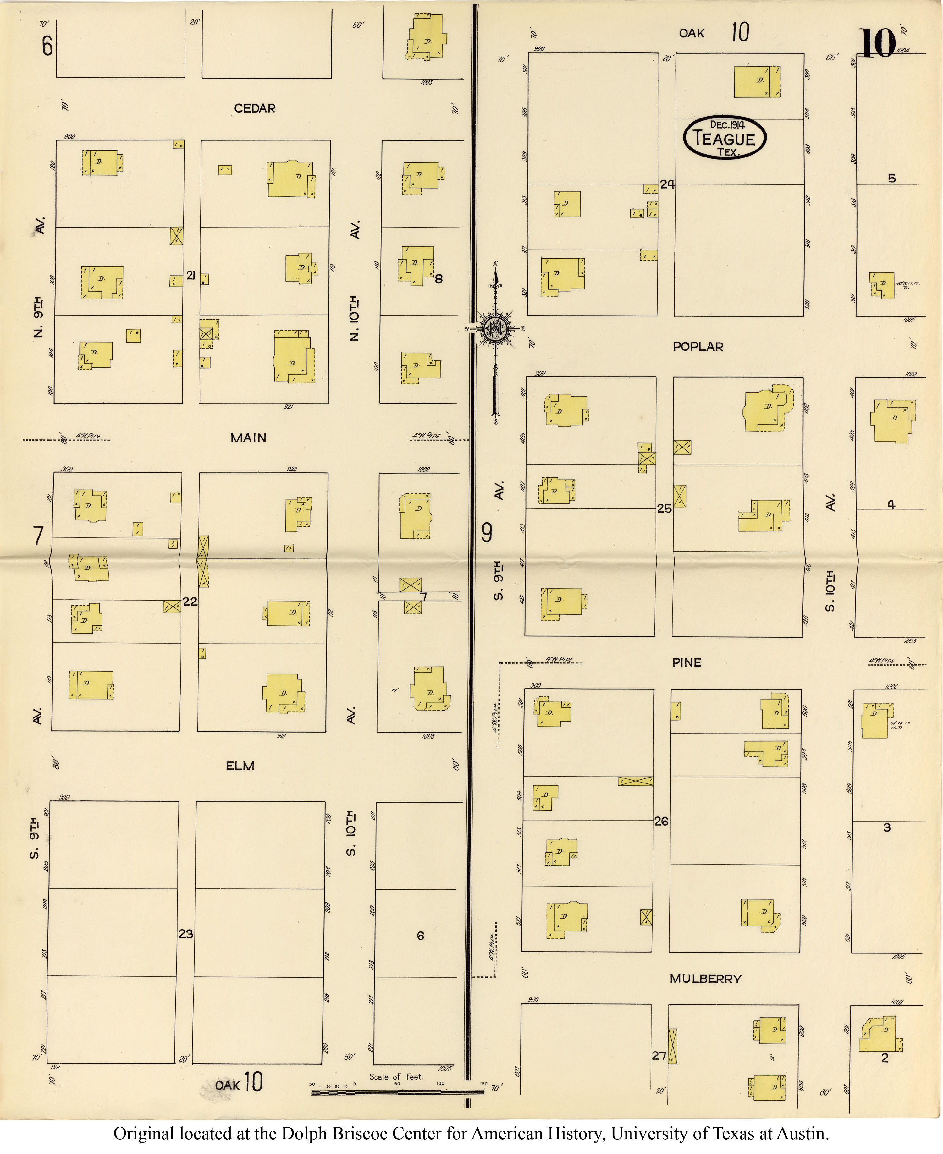
| 1909 |
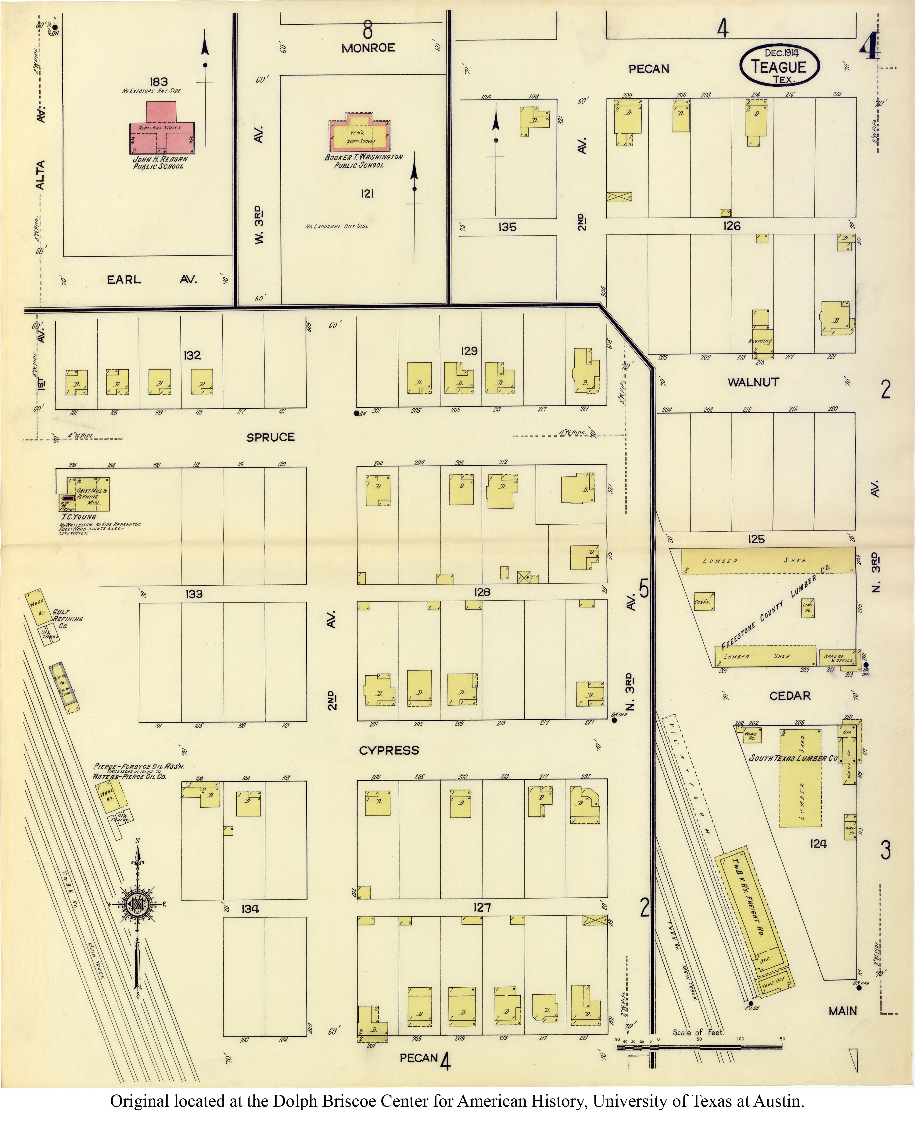
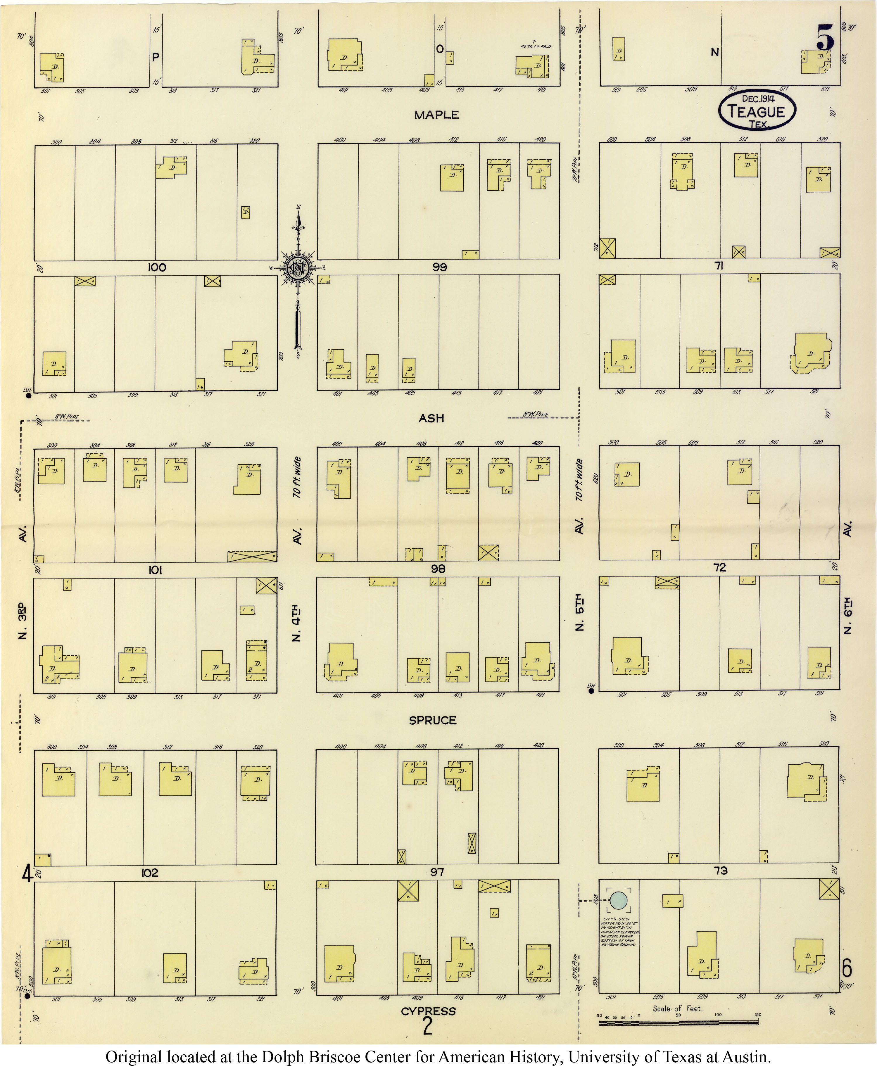
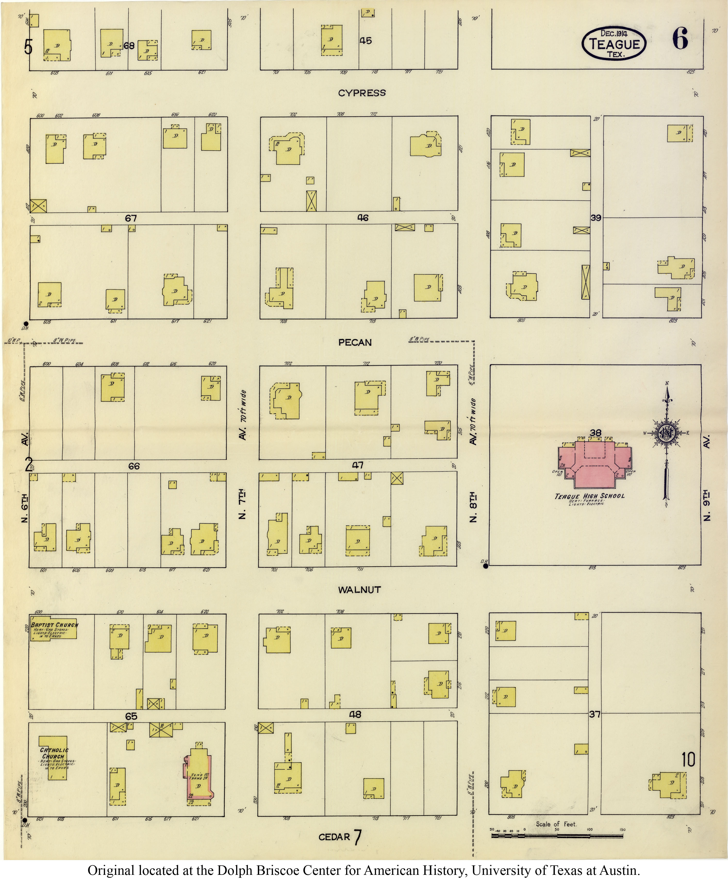
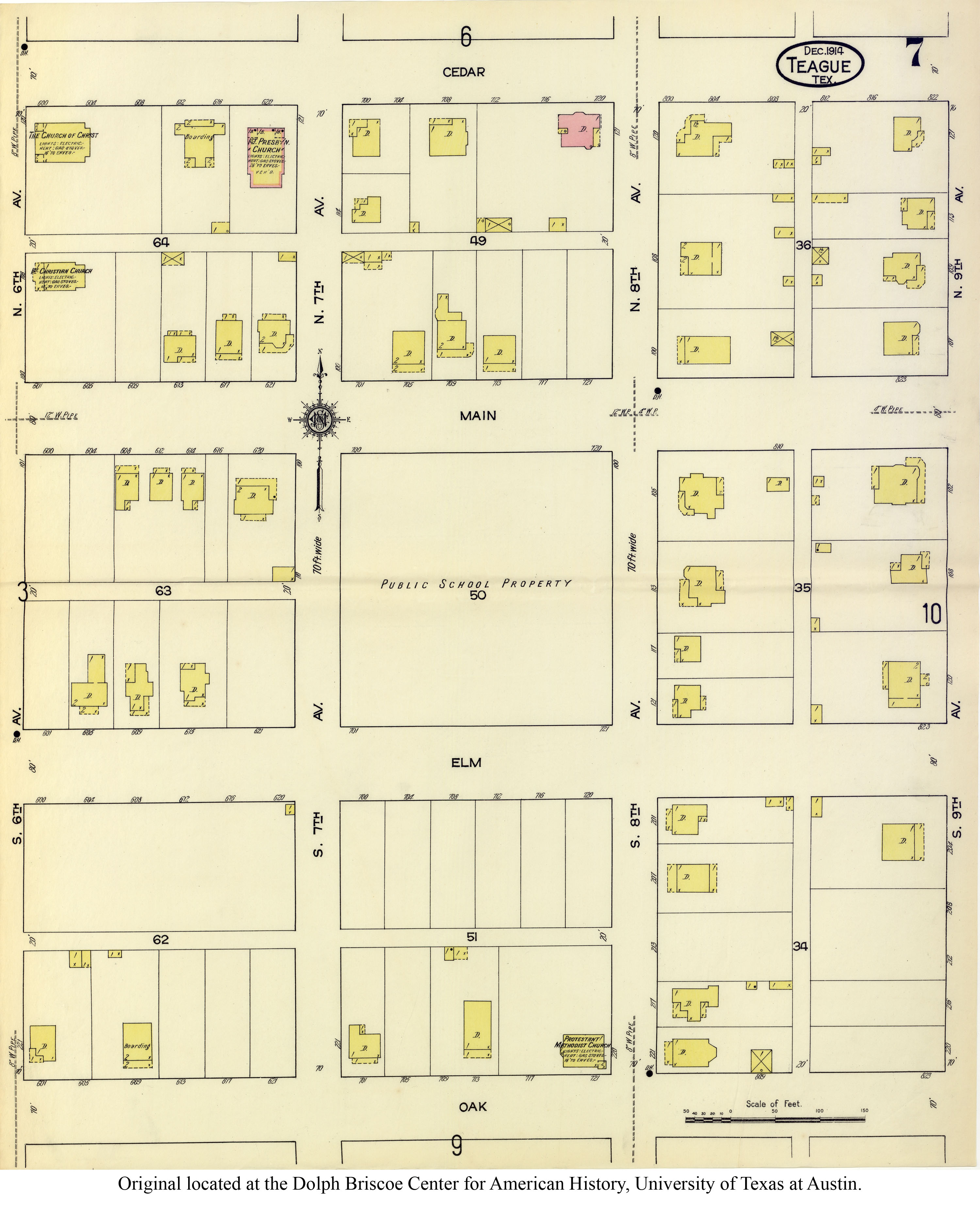
Freestone County (Fairfield, Teague) |
Poole Bros. of Chicago |
|
| 1911 |
Geologic Map of NE Texas
(Bonner, Steward's Mill, Blunt, Fairfield, Butler, Teague)
|
Dept. of the Interior, U.S. Geological Survey |
|
| 1912 |
Iron Ore Deposits, Blast Furnaces, Lignite Mines and Oil Fields in East Texas
(Fairfield, Kirvin, Teague) |
Bureau of Economic Geology and Technology |
|
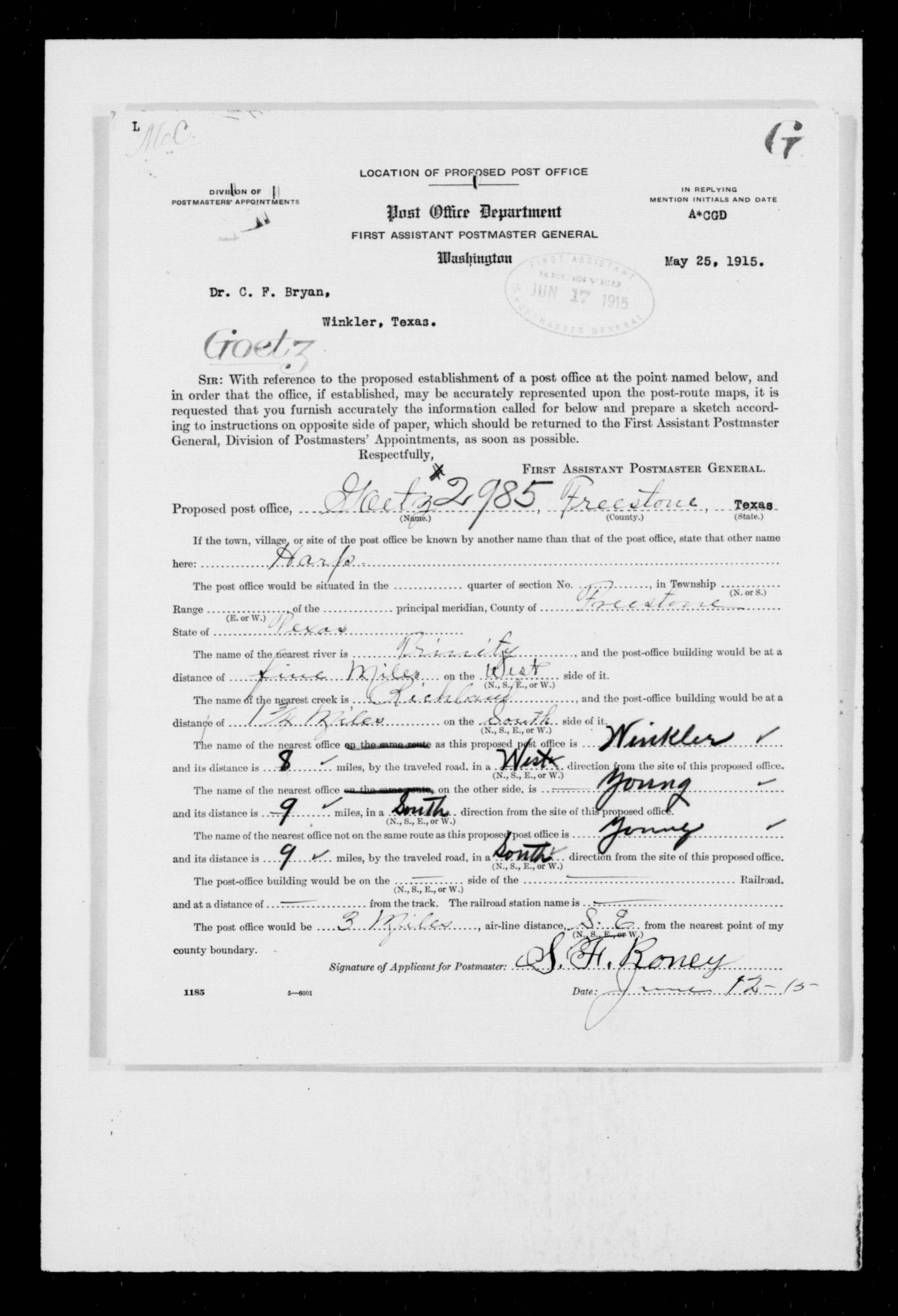
| 1912 |
Commercial Atlas
(Goetz, Streetman, Coutchman, Wortham, Bonner, Yeldell, Kirvin,
Shanks, Israel, Simmsboro, Blunt, Fairfield, Driver, Cotton Gin,
Teague, Baty, Beene, Donie, Pin Oak, Lanely, Dew, Ivory, Butler,
Turlington, Young) |
Rand McNally and Co. |
|
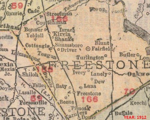
| 1912 |
Commercial Atlas
(Goetz, Streetman, Coutchman, Wortham, Bonner, Yeldell, Kirvin,
Shanks, Israel, Simmsboro, Blunt, Fairfield, Driver, Cotton Gin,
Teague, Baty, Beene, Donie, Pin Oak, Lanely, Dew, Ivory, Butler,
Turlington, Young) |
Rand McNally and Co. |
|
| 1913 |
Freestone County
(Coutchman, Bonner, Wortham, Cotton Gin, Teague, Mills, Luna, Dew, Fairfield)
|
The Century Company |
|
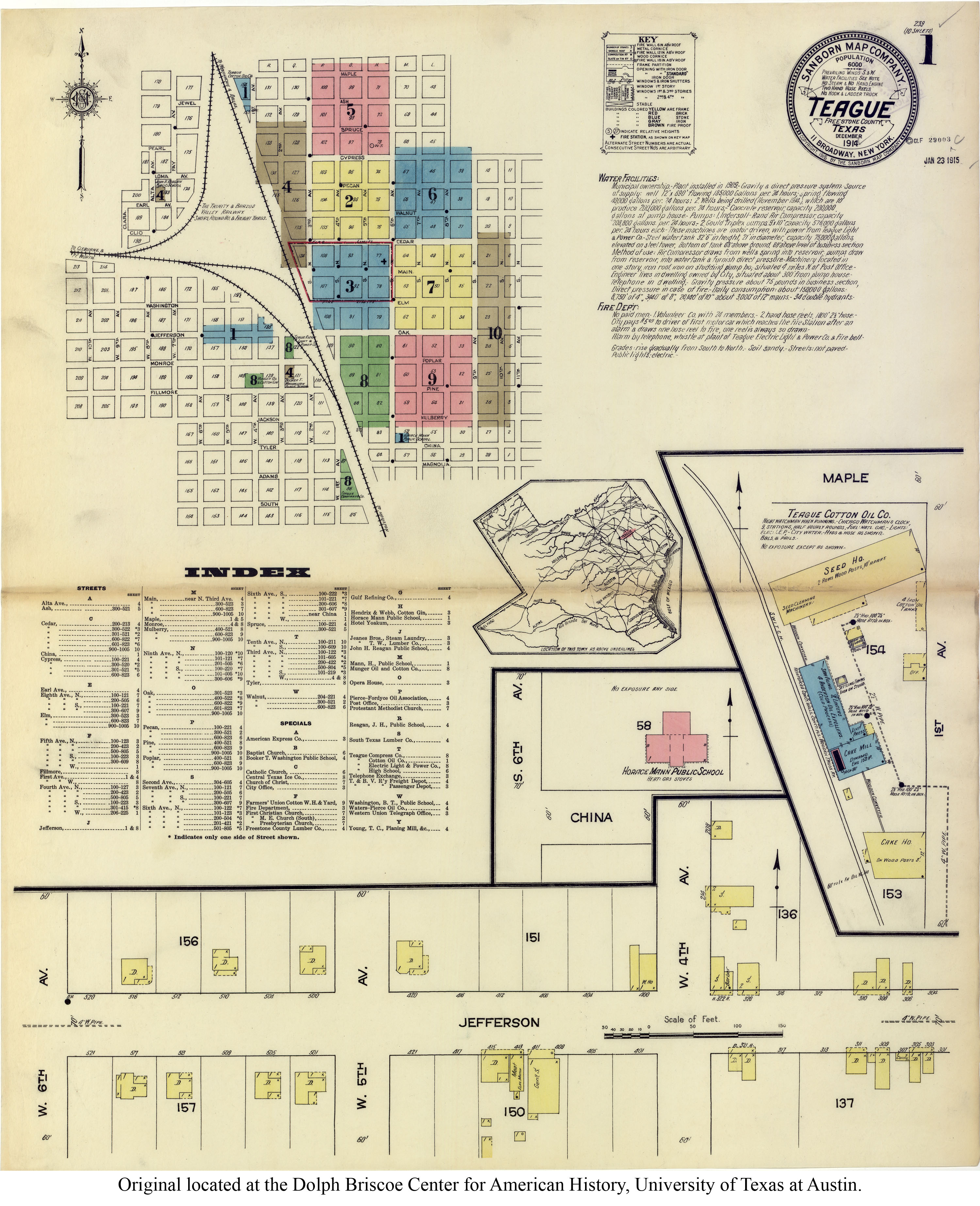
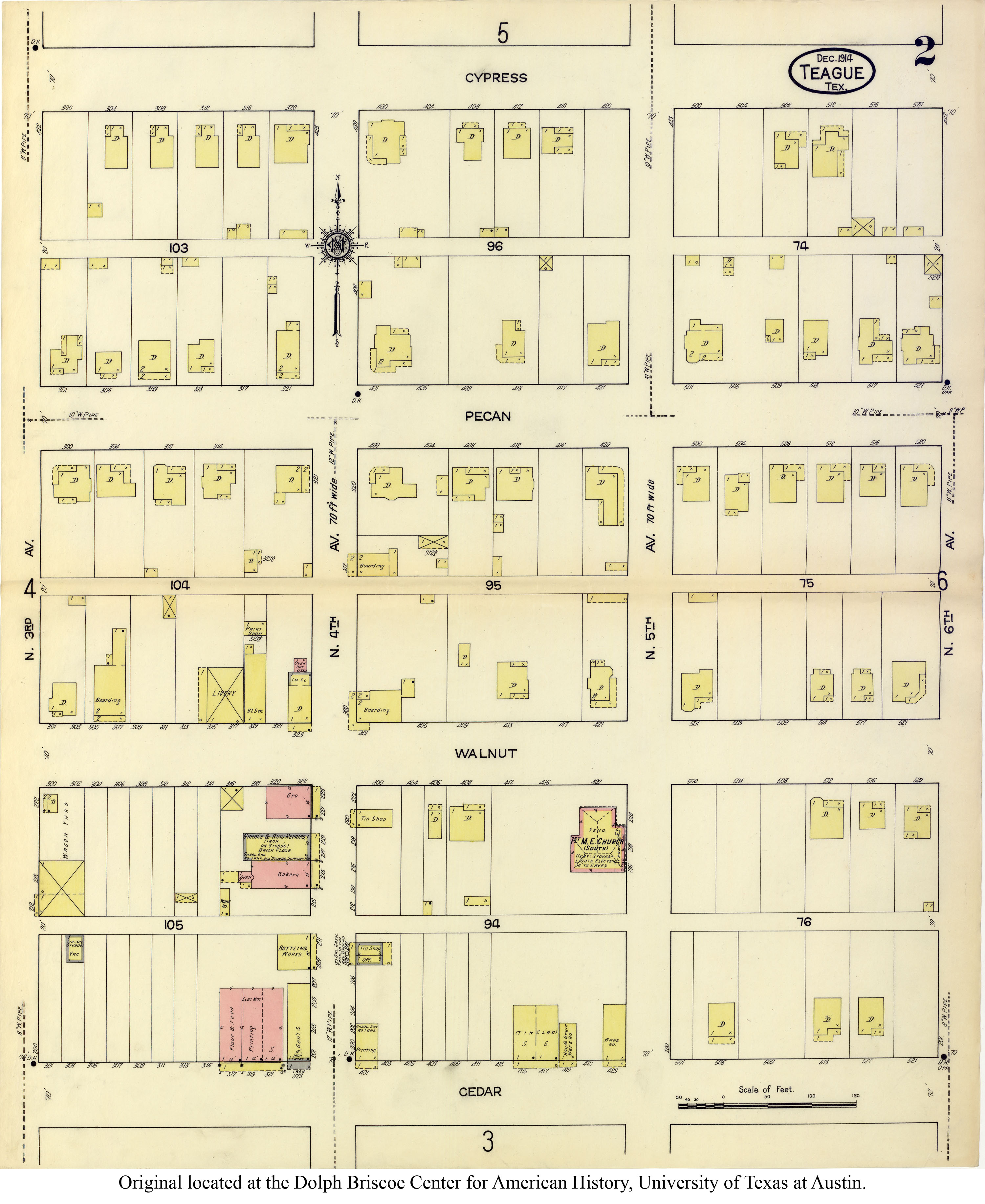
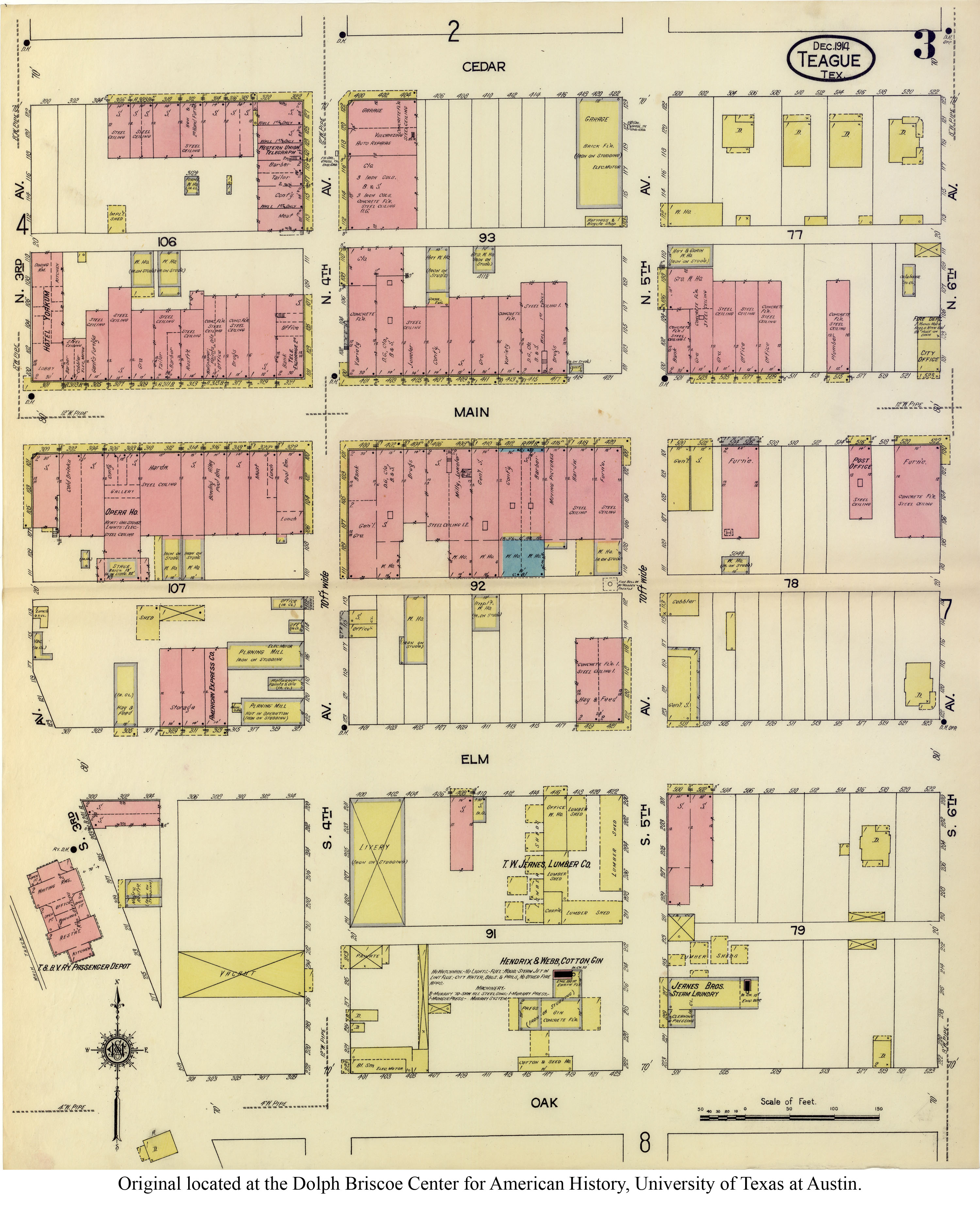
| 1914 |
Geological Survey
(Wortham, Bonner, Teague, Stewards Mill, Blunt, Fairfield, Butler)
|
Dept. of the Interior, U.S. Geological Survey |
|
| 1914 |
Artesian Reserviors
(Wortham, Bonner, Teague, Stewards Mill, Blunt, Fairfield, Butler)
|
Dept. of the Interior, U.S. Geological Survey |
|
| 1915 |
Mexia-Groesbeck Gas Field |
Dept. of the Interior, U.S. Geological Survey |
land owners |
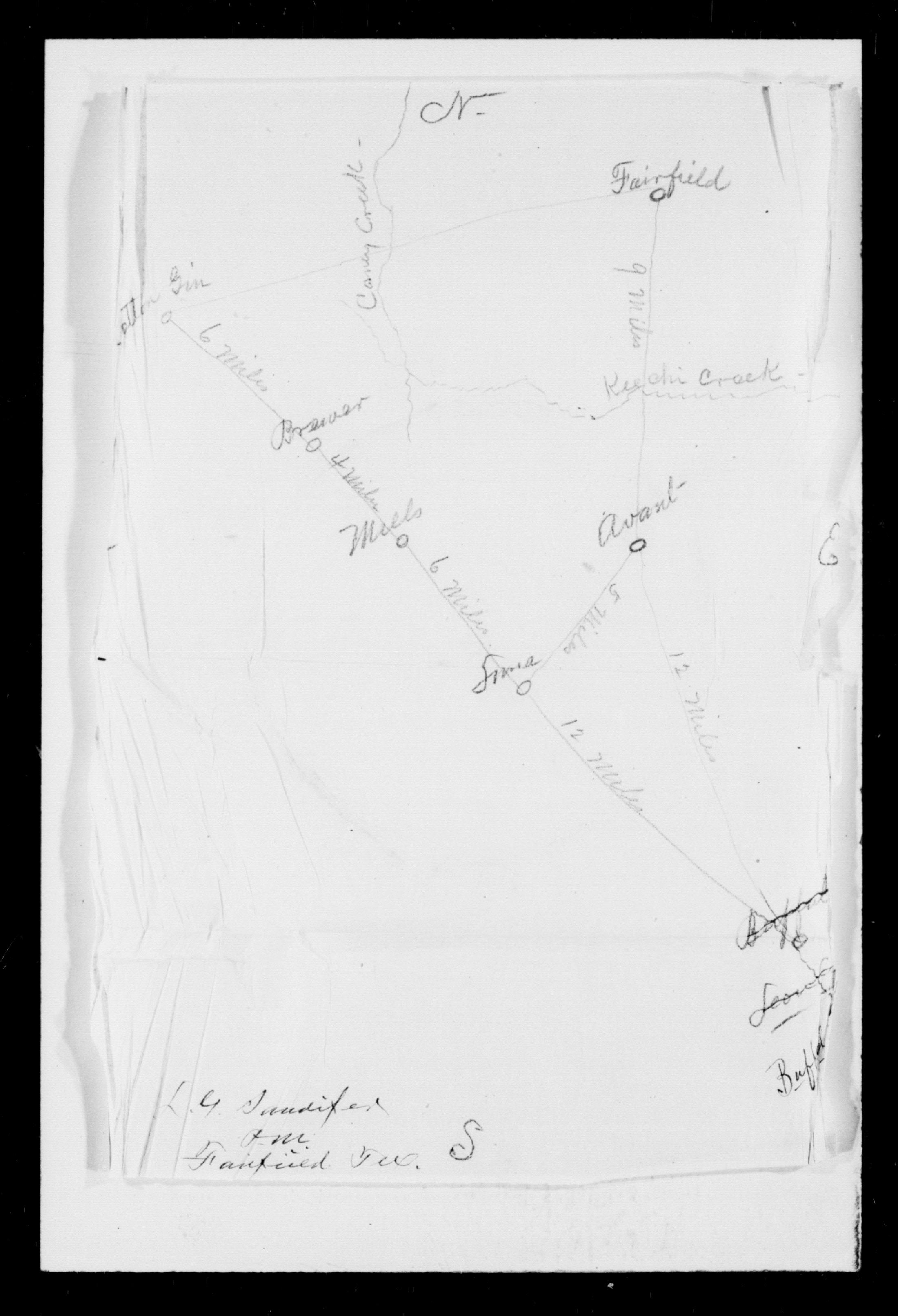
| 1915 |
Mexia-Groesbeck Gas Field (north) |
Dept. of the Interior, U.S. Geological Survey |
land owners |
| 1915 |
Mexia-Groesbeck Gas Field (south) |
Dept. of the Interior, U.S. Geological Survey |
land owners |
| 1917 |
Freestone County
(Kirvin, Brewer) |
The New Encyclopedic Atlas & Gazetteer of the World |
|
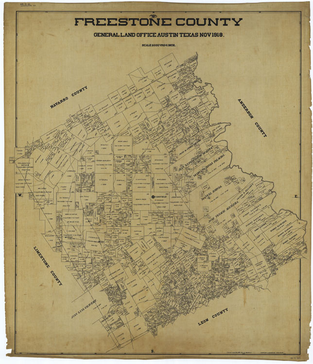
| 1918 |
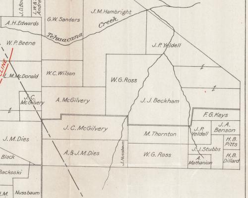
Freestone County (563 k) |
Texas GLO |
|
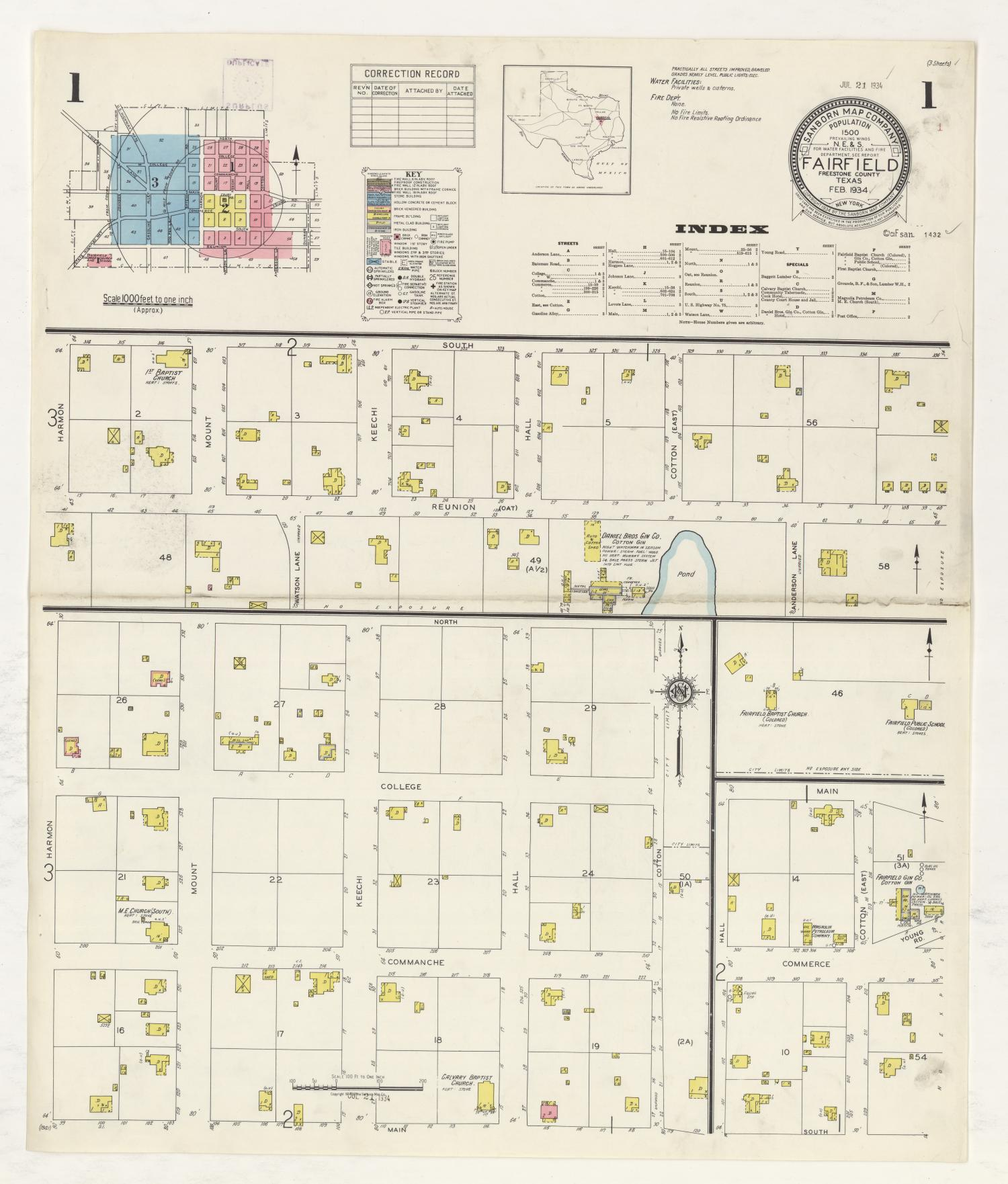
| 1918 |
Soil map of Freestone County
|
US Dept of Agriculture |
*** BEST MAP *** |
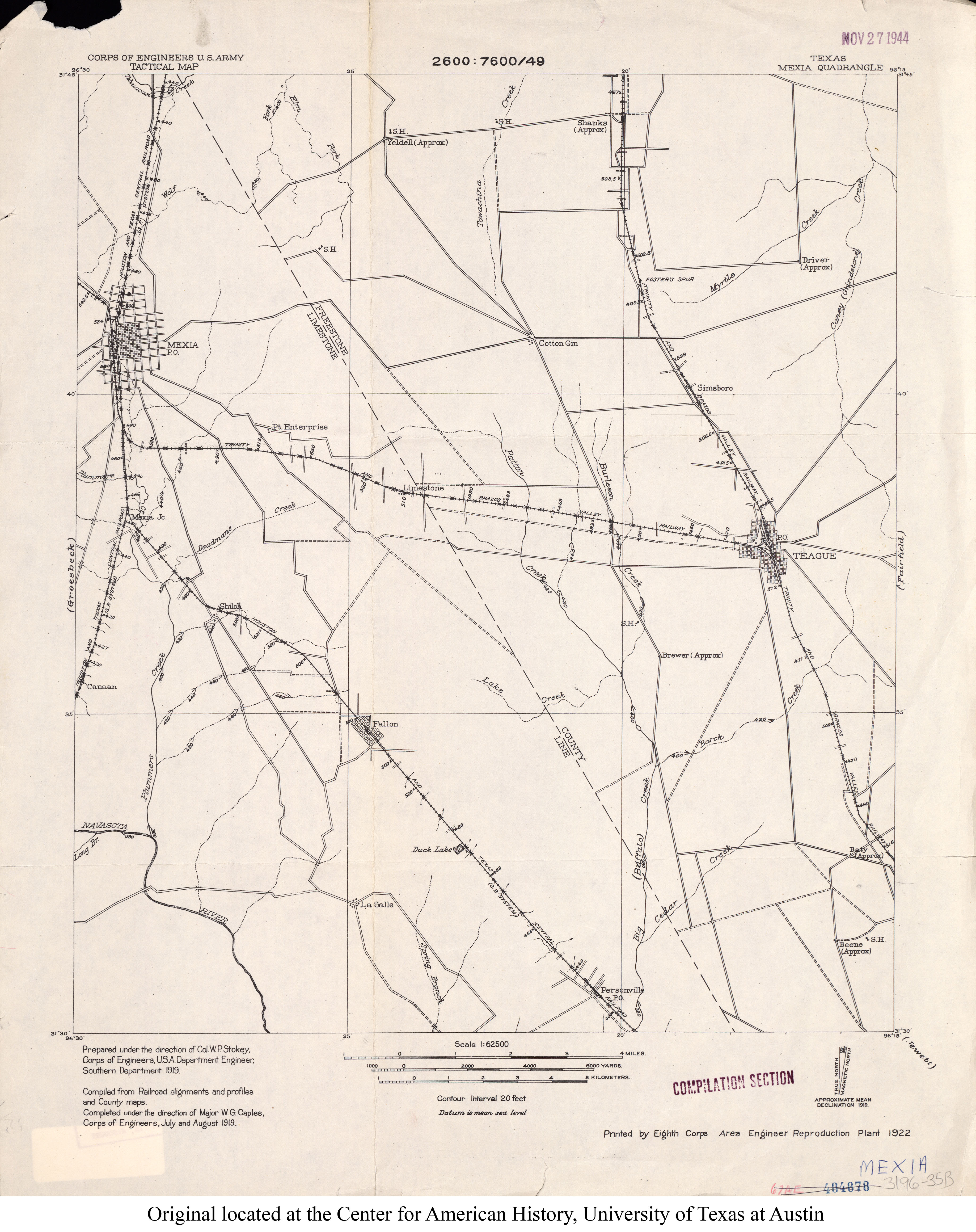
| 1919 |
Mexia Quadrant
(Yeldell, Driver, Shanks, Simsboro, Teague, Brewer, Baty, Beene)
|
US Army Corp of Engineers |
|
| 1921 |
Freestone County
(Goetz, Streetman, Coutchman, Wortham, Bonner, Yeldell, Kirvin,
Shanks, Israel, Simmsboro, Blunt, Fairfield, Driver, Cotton Gin,
Teague, Baty, Beene, Luna, Donie, Pin Oak, Lanely, Dew, Ivory,
Butler, Turlington, Young) |
Rand McNally and Co. |
|
| 1925 |
Wortham (top) |
L.B. Gamewell |
|
| 1925 |
Wortham (bottom) |
L.B. Gamewell |
|
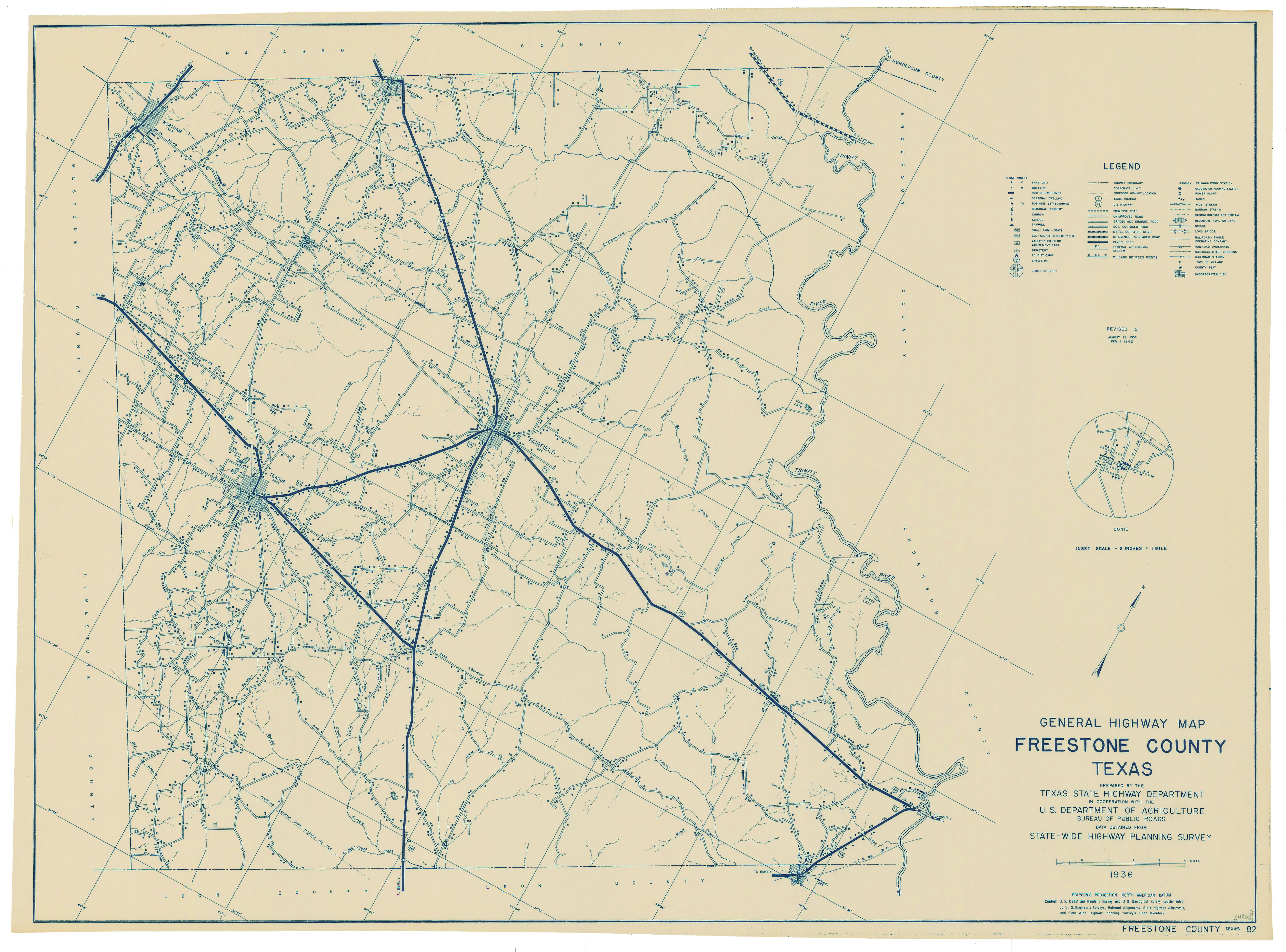
| 1936, revised to 1946 |
Freestone County (17 meg) |
Author: TX State Highway Dept. |
|
| 1940 |
Freestone County (3 meg) |
Author: TX State Highway Dept.; Digital Location: Texas Archives |
|
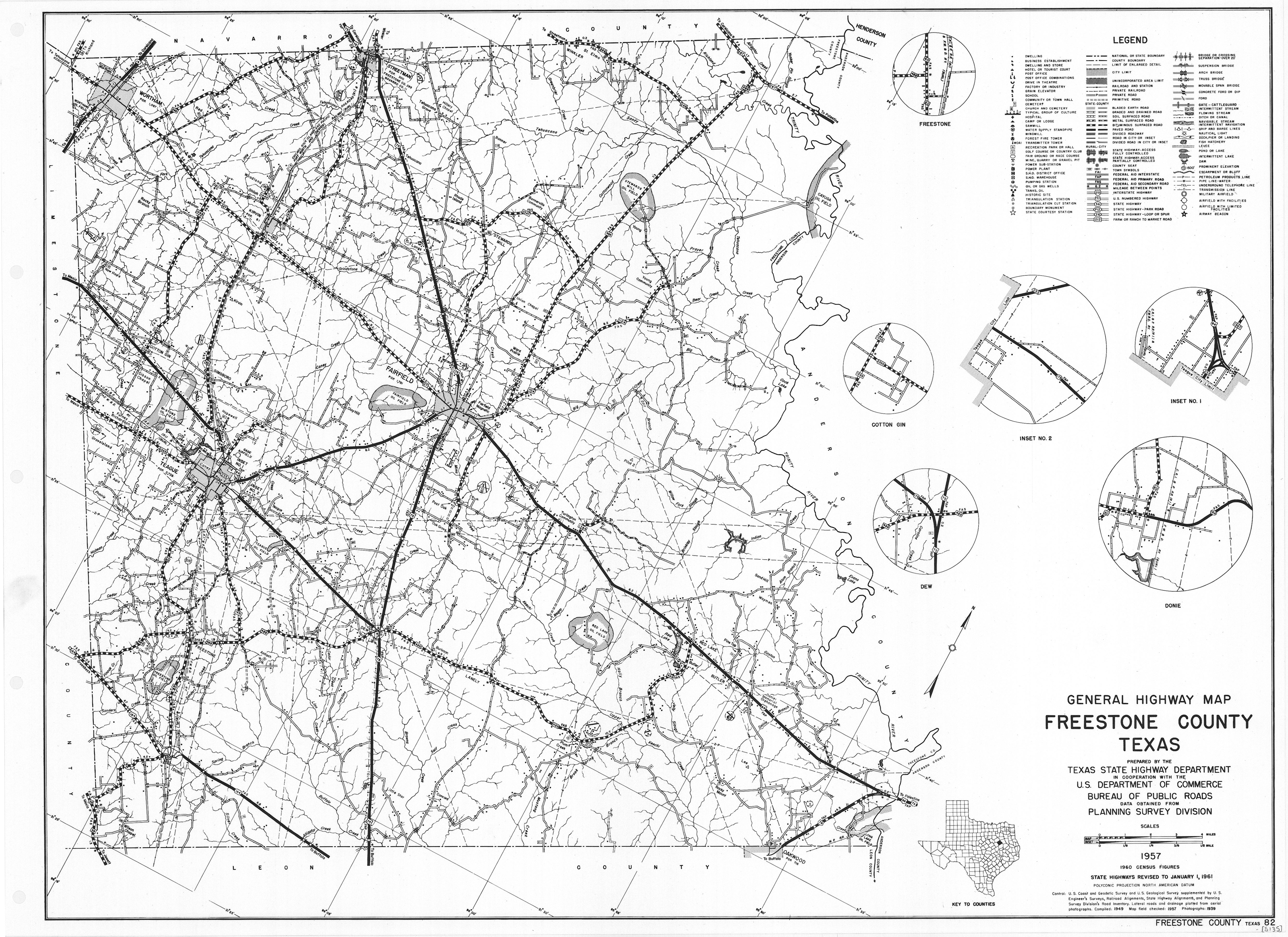
| 1961 |
Freestone County (3.5 meg) |
Author: TX State Highway Dept.; Digital Location: Texas Archives |
|
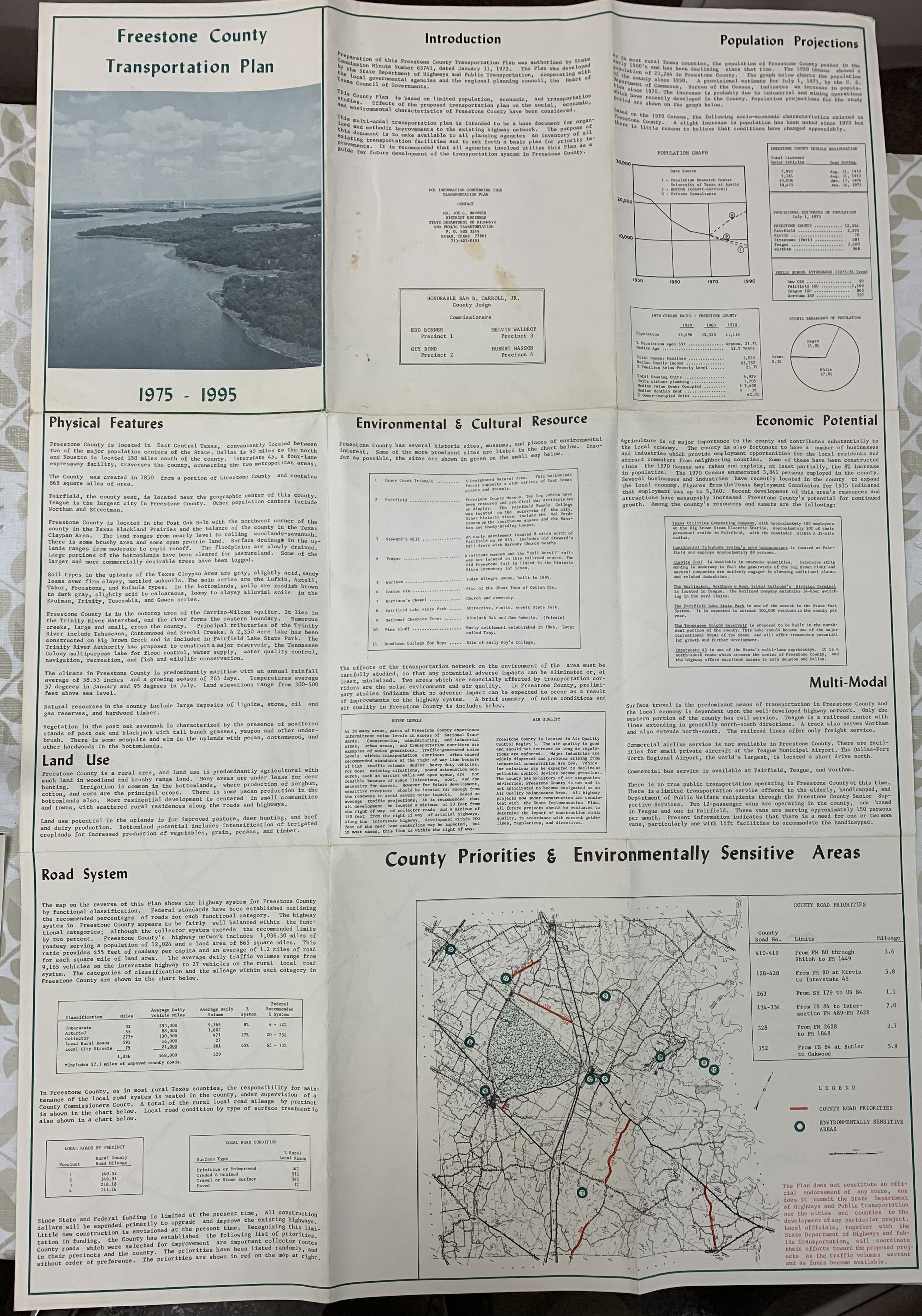
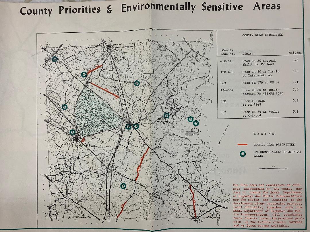
| 1975 |
Freestone County Transportation Plan
(Front page) (2.6 meg) |
Author: TX State Highway Dept.; Location: Freestone County Museum |
|
| 1975 |
Freestone County Transportation Plan
(Back page) (2.37 meg) |
Author: TX State Highway Dept.; Location: Freestone County Museum |
|
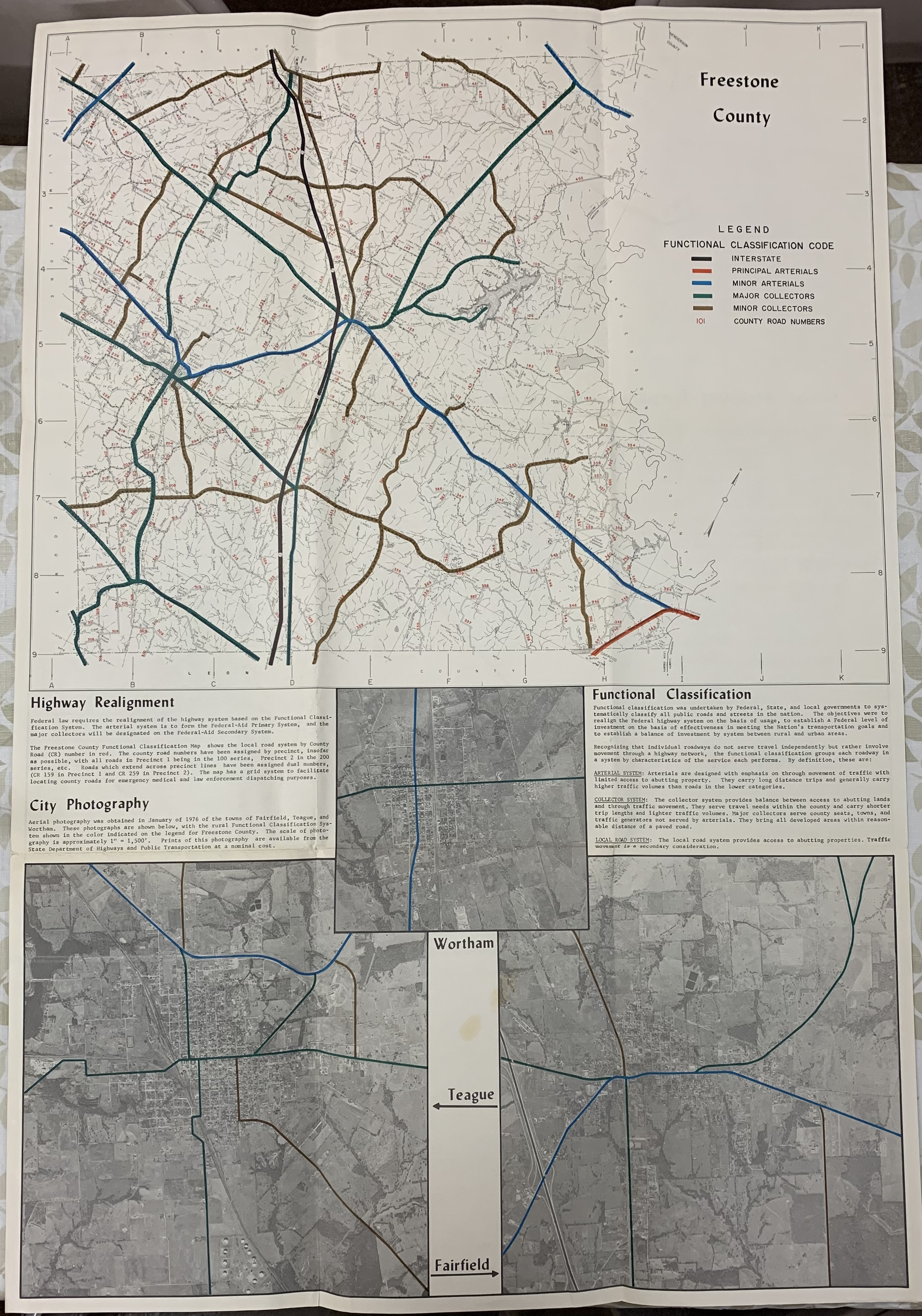
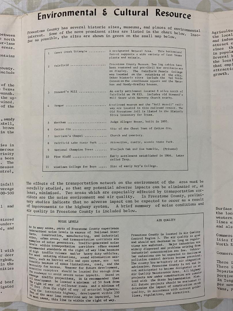
| 1975 |
Freestone County Transportation Plan
(Zoom of Environmentally Sensitive Areas) (216 K) |
Author: TX State Highway Dept.; Location: Freestone County Museum |
|
| 1975 |
Freestone County Transportation Plan
(Zoom 2 of Environmentally Sensitive Areas) (200 K) |
Author: TX State Highway Dept.; Location: Freestone County Museum |
|

