
Smith County
Cemetery Photographs
| Description Link | Photo Link | Date | Submitter |
|---|---|---|---|
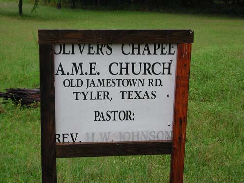
| Church Sign | Image | Lawrence E Oliver | |
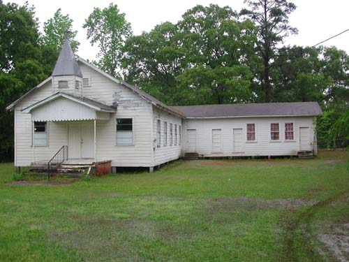
| Church | Image | Lawrence E Oliver | |
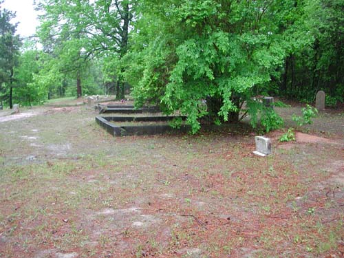
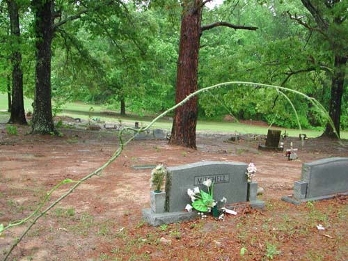
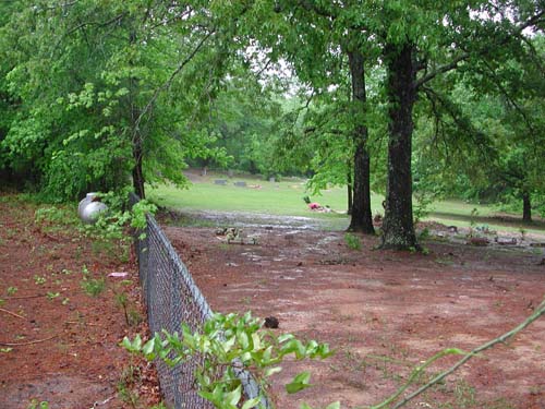
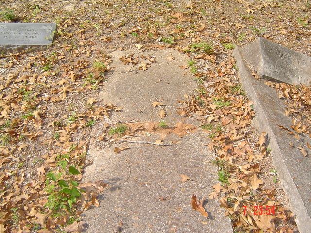
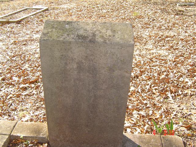
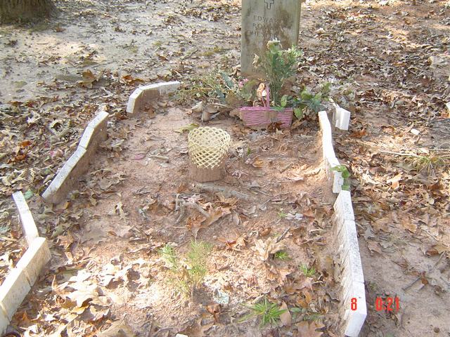
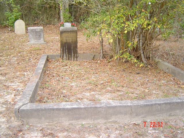
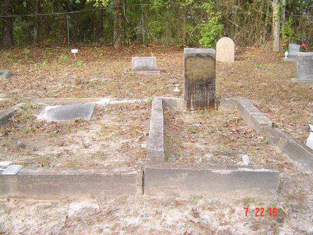
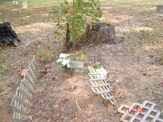
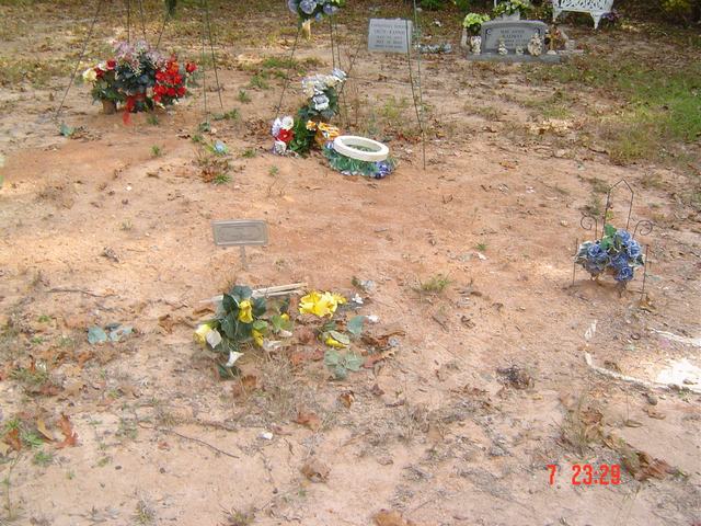
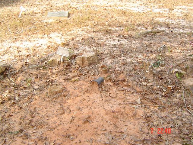
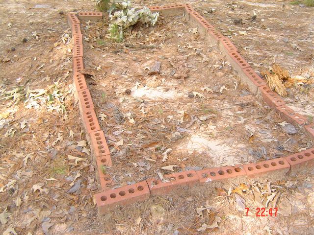
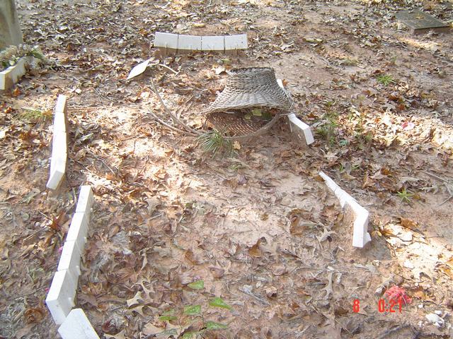
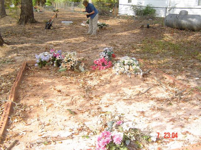
| Cemetery | Image | Lawrence E Oliver | |
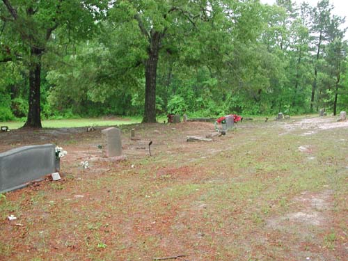
| Cemetery | Image | Lawrence E Oliver | |
| Cemetery | Image | Lawrence E Oliver | |
| Cemetery | Image | Lawrence E Oliver | |
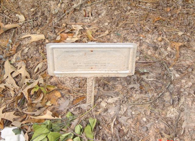
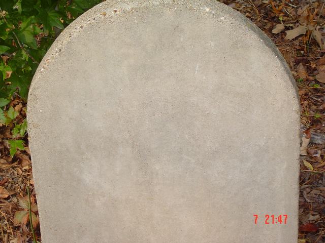
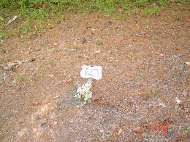
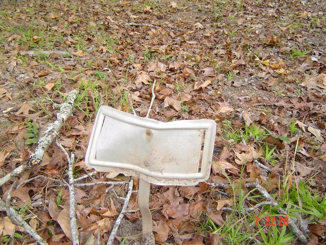
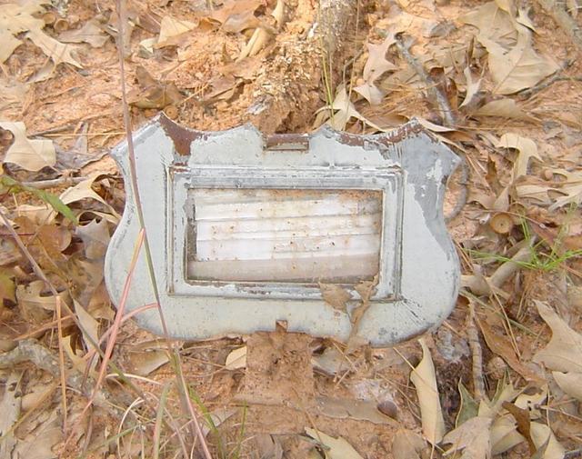
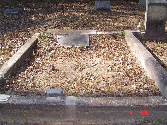
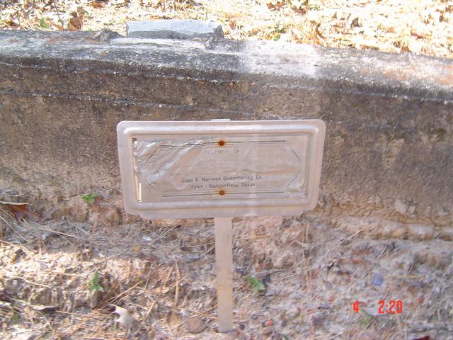
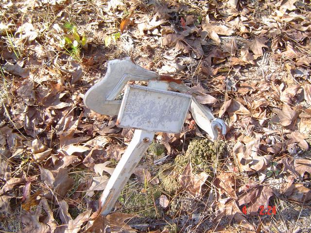
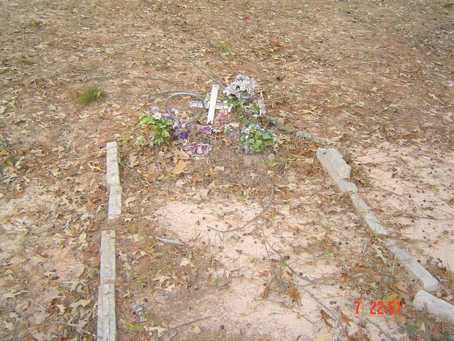
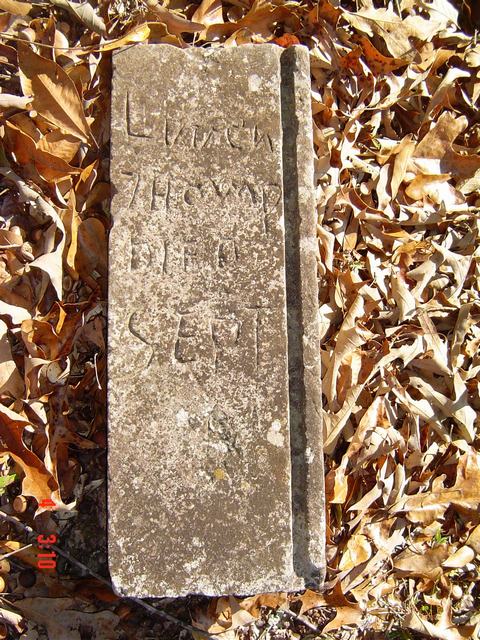
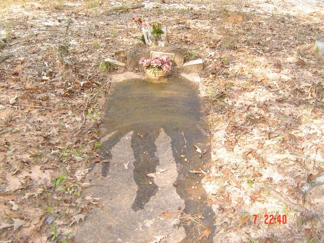
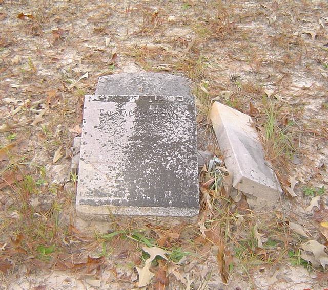
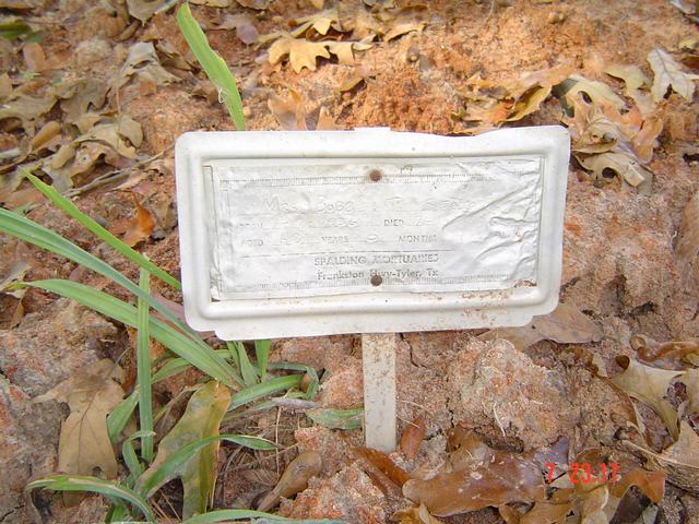
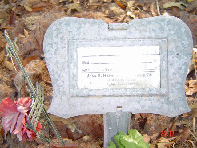
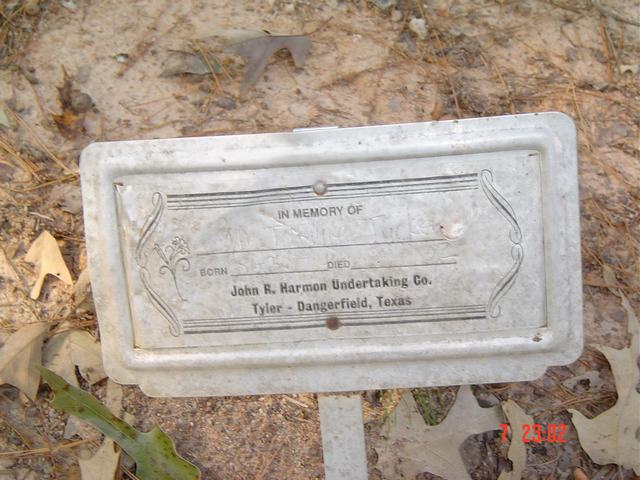
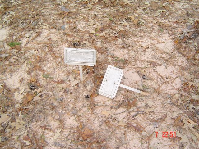
| Unknown | Image | Jim & Jeanie Sellers | |
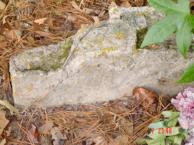
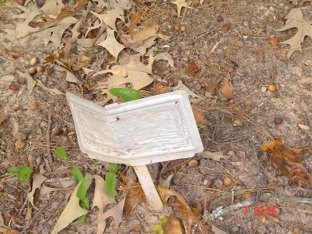
| Unknown | Image | Jim & Jeanie Sellers | |
| Unknown | Image | Jim & Jeanie Sellers | |
| Unknown | Image | Jim & Jeanie Sellers | |
| Unknown | Image | Jim & Jeanie Sellers | |
| Unknown | Image | Jim & Jeanie Sellers | |
| Unknown | Image | Jim & Jeanie Sellers | |
| Unknown | Image | Jim & Jeanie Sellers | |
| Unknown | Image | Jim & Jeanie Sellers | |
| Unknown | Image | Jim & Jeanie Sellers | |
| Unknown | Image | Jim & Jeanie Sellers | |
| Unknown | Image | Jim & Jeanie Sellers | |
| Unknown | Image | Jim & Jeanie Sellers | |
| Unknown | Image | Jim & Jeanie Sellers | |
| Unknown | Image | Jim & Jeanie Sellers | |
| Unknown | Image | Jim & Jeanie Sellers | |
| Unknown | Image | Jim & Jeanie Sellers | |
| Unknown | Image | Jim & Jeanie Sellers | |
| Unknown | Image | Jim & Jeanie Sellers | |
| Unknown | Image | Jim & Jeanie Sellers | |
| Unknown | Image | Jim & Jeanie Sellers | |
| Unknown | Image | Jim & Jeanie Sellers | |
| Unknown | Image | Jim & Jeanie Sellers | |
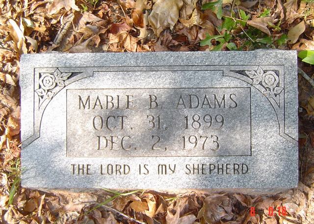
| Mable B Adams | Image | Jim & Jeanie Sellers | |
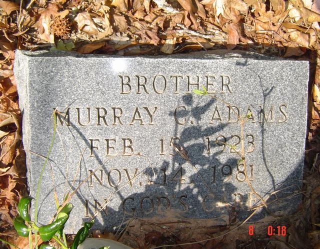
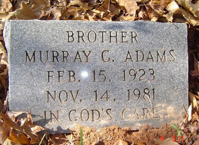
| Murray C Adams | Image | Jim & Jeanie Sellers | |
| Murray C Adams | Image | Jim & Jeanie Sellers | |
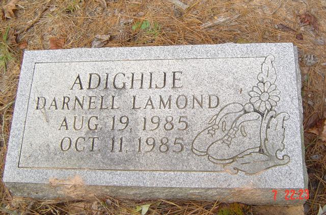
| Darnell Lamond Adighije | Image | Jim & Jeanie Sellers | |
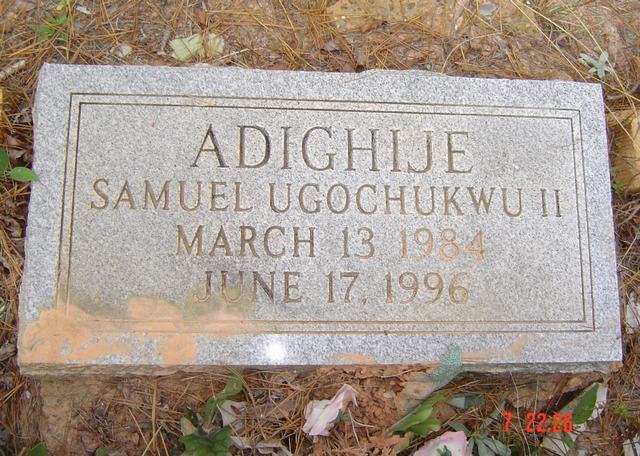
| Samuel Ugochukwu II Adighije | Image | Jim & Jeanie Sellers | |
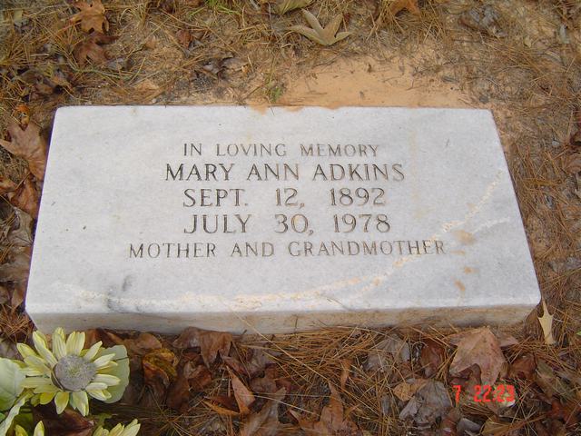
| Mary Ann Adkins | Image | Jim & Jeanie Sellers | |
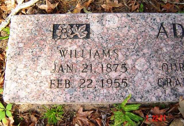
| William Adkins | Image | Jim & Jeanie Sellers | |
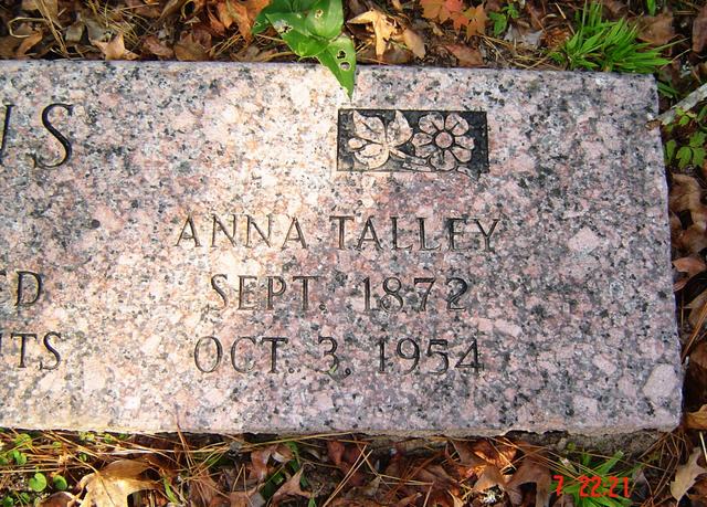
| Anna Talley Adkins | Image | Jim & Jeanie Sellers | |
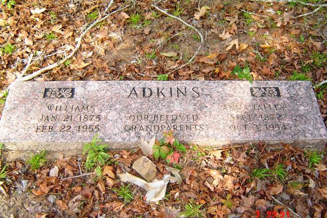
| William & Anna Adkins | Image | Jim & Jeanie Sellers | |
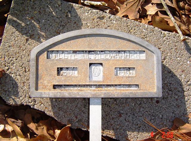
| Willie M Alexander | Image | Jim & Jeanie Sellers | |
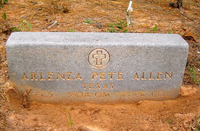
| Arlenza Pete Allen | Image | Jim & Jeanie Sellers | |
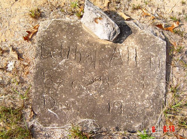
| Delthia Allen | Image | Jim & Jeanie Sellers | |
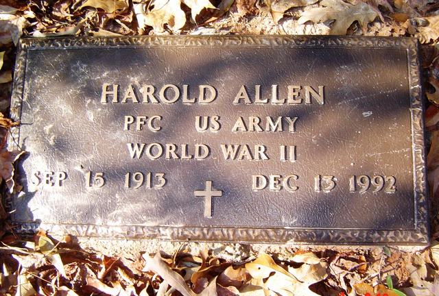
| Harold Allen | Image | Jim & Jeanie Sellers | |
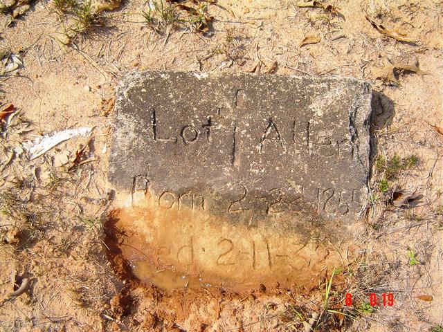
| Lot Allen | Image | Jim & Jeanie Sellers | |
| Lois Allen | Image | Jim & Jeanie Sellers | |
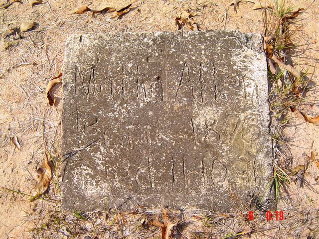
| Mattie Allen | Image | Jim & Jeanie Sellers | |
| Dorothy Anderson | Image | Jim & Jeanie Sellers | |
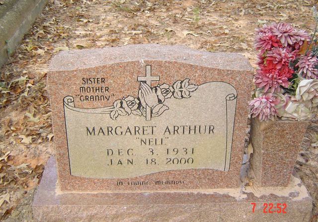
| Margaret (Nell) Arthur | Image | Jim & Jeanie Sellers | |
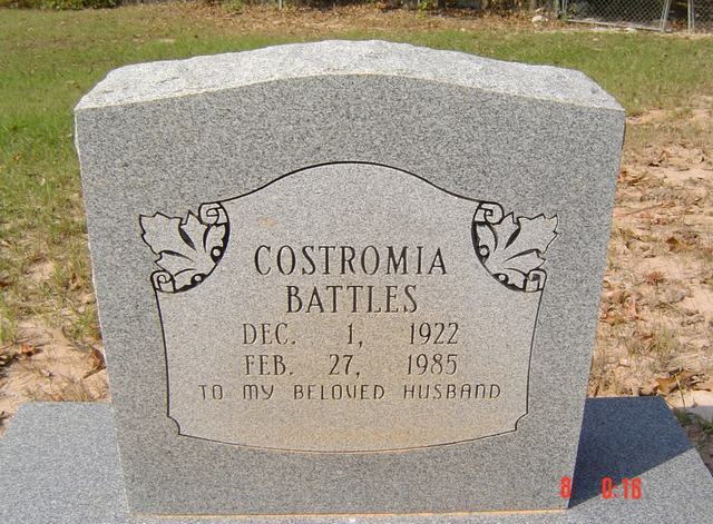
| Costromia Battles | Image | Jim & Jeanie Sellers | |
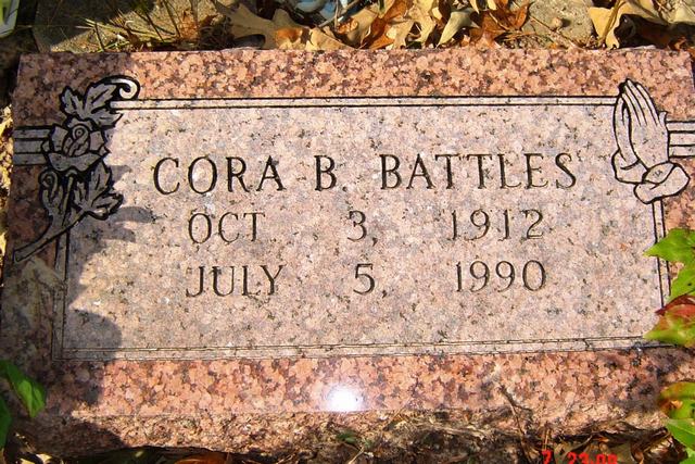
| Cora B. Battles | Image | Jim & Jeanie Sellers | |
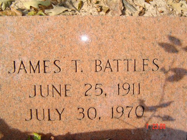
| James T. Battles | Image | Jim & Jeanie Sellers | |
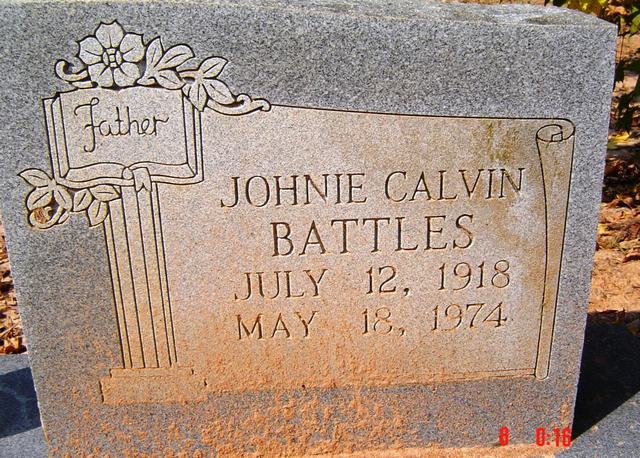
| Johnie Calvin Battles | Image | Jim & Jeanie Sellers | |
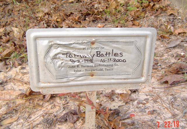
| Tommy Battles | Image | Jim & Jeanie Sellers | |
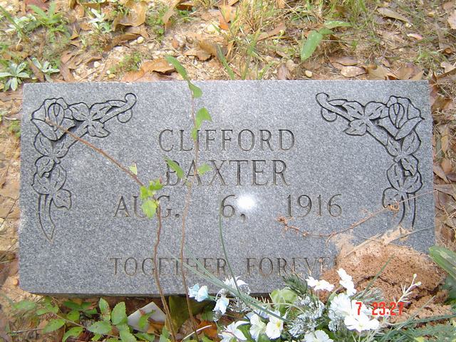
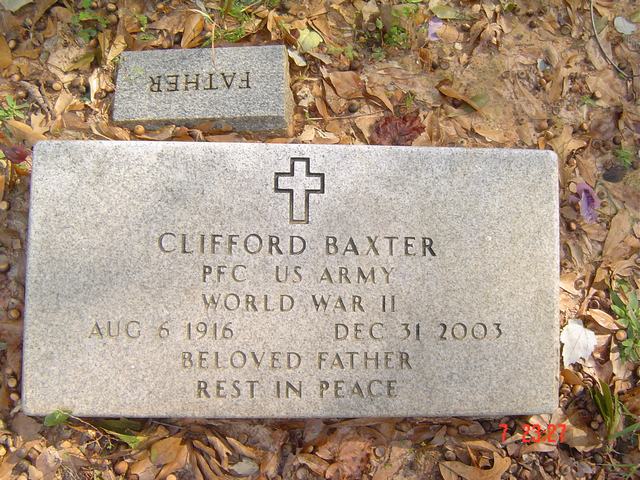
| Clifford Baxter | Image | Jim & Jeanie Sellers | |
| Clifford Baxter | Image | Jim & Jeanie Sellers | |
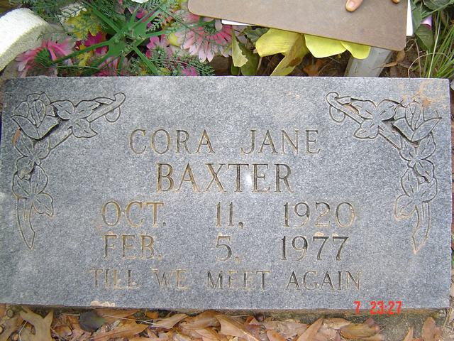
| Cora Jane Baxter | Image | Jim & Jeanie Sellers | |
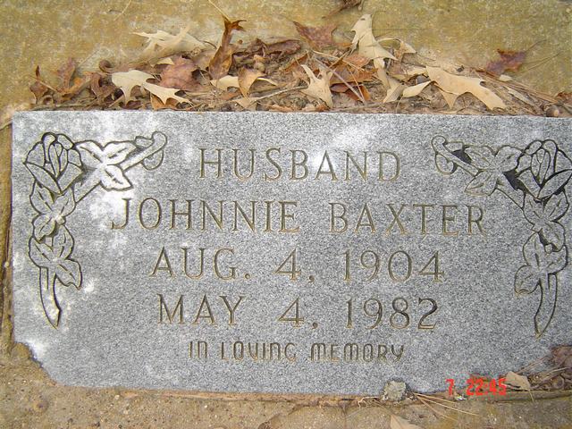
| Johnnie Baxter | Image | Jim & Jeanie Sellers | |
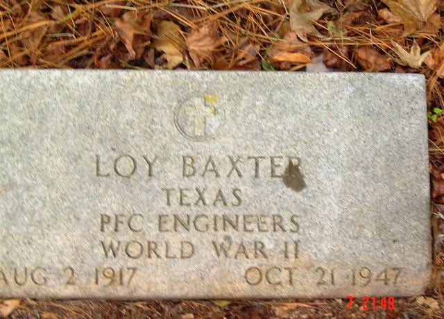
| Loy Baxter | Image | Jim & Jeanie Sellers | |
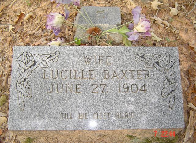
| Lucille Baxter | Image | Jim & Jeanie Sellers | |
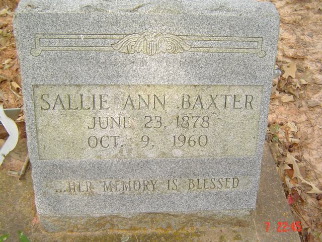
| Sallie Ann Baxter | Image | Jim & Jeanie Sellers | |
| Howard Bell | Image | Jim & Jeanie Sellers | |
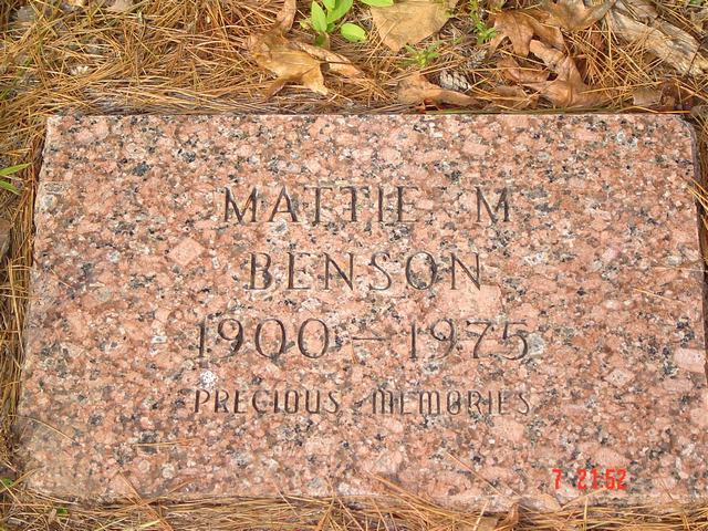
| Mattie M. Benson | Image | Jim & Jeanie Sellers | |
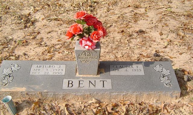
| Arturo J. & Claudia F. Bent | Image | Jim & Jeanie Sellers | |
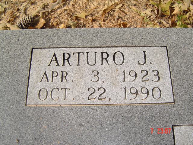
| Arturo J. Bent | Image | Jim & Jeanie Sellers | |
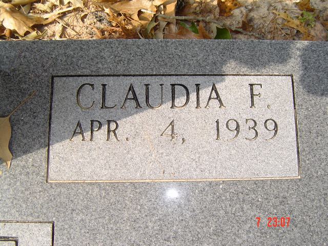
| Claudia F. Bent | Image | Jim & Jeanie Sellers | |
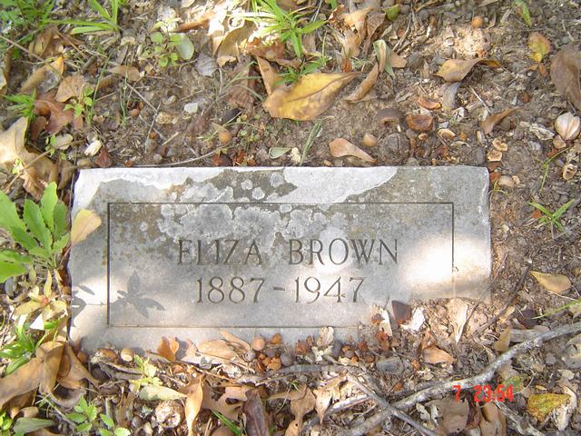
| Eliza Brown | Image | Jim & Jeanie Sellers | |
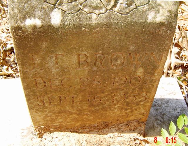
| J. T. Brown | Image | Jim & Jeanie Sellers | |
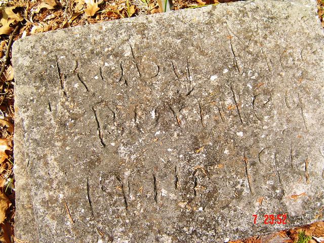
| Ruby Mae Burnley | Image | Jim & Jeanie Sellers | |
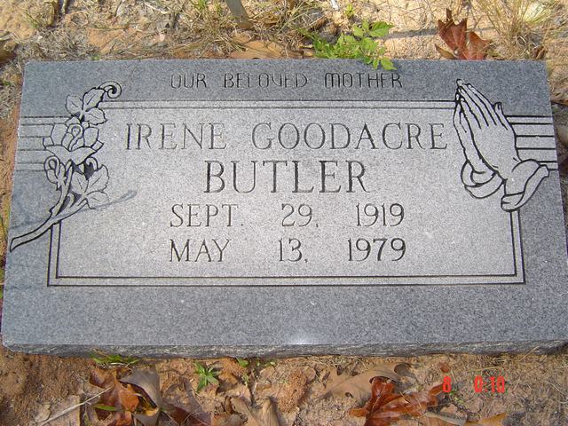
| Irene Goodacre Butler | Image | Jim & Jeanie Sellers | |
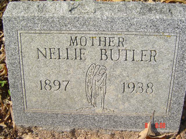
| Nellie Butler | Image | Jim & Jeanie Sellers | |
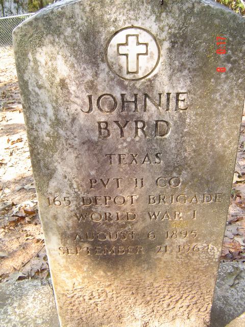
| Johnie Byrd | Image | Jim & Jeanie Sellers | |
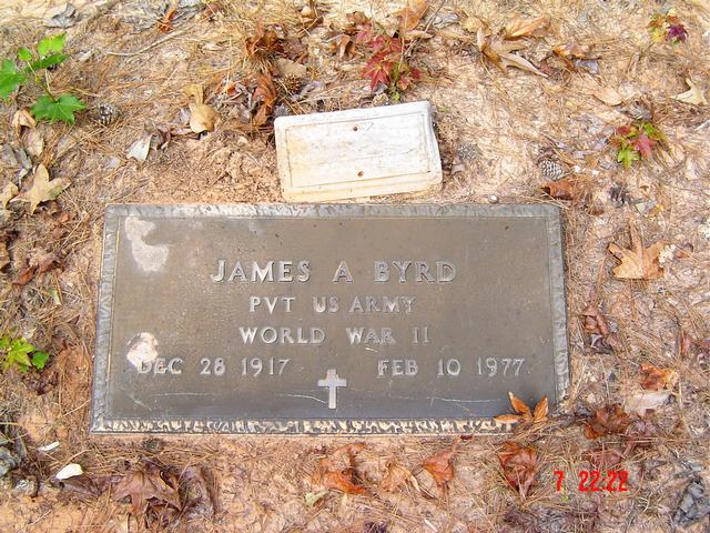
| James A. Byrd | Image | Jim & Jeanie Sellers | |
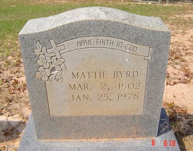
| Mattie Byrd | Image | Jim & Jeanie Sellers | |
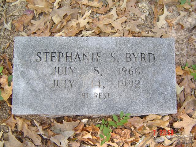
| Stephanie S. Byrd | Image | Jim & Jeanie Sellers | |
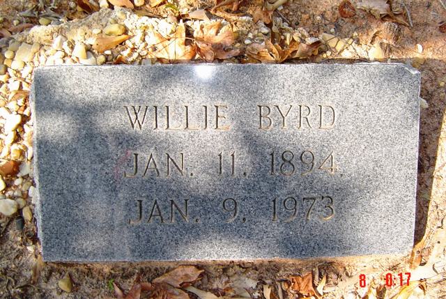
| Willie Byrd | Image | Jim & Jeanie Sellers | |
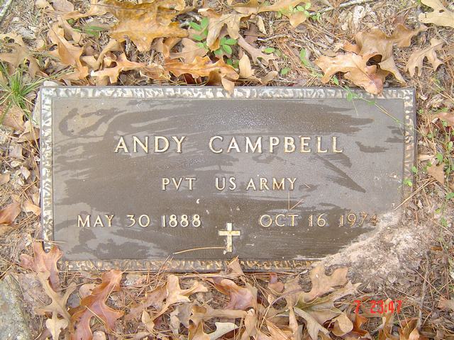
| Andy Campbell | Image | Jim & Jeanie Sellers | |
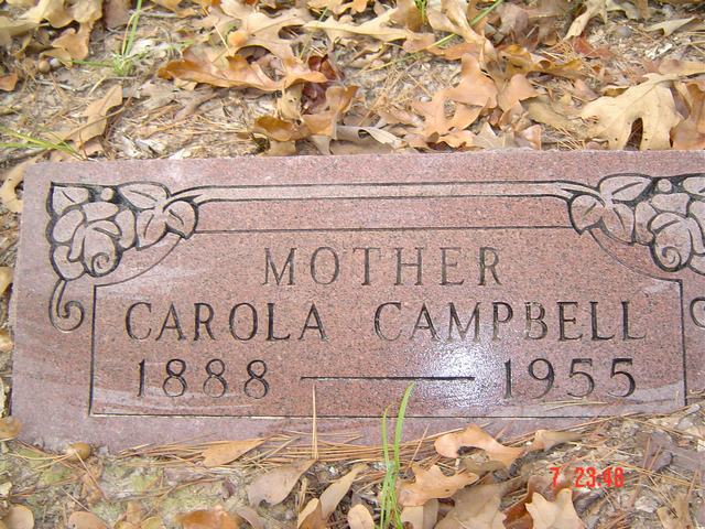
| Carola Campbell | Image | Jim & Jeanie Sellers | |
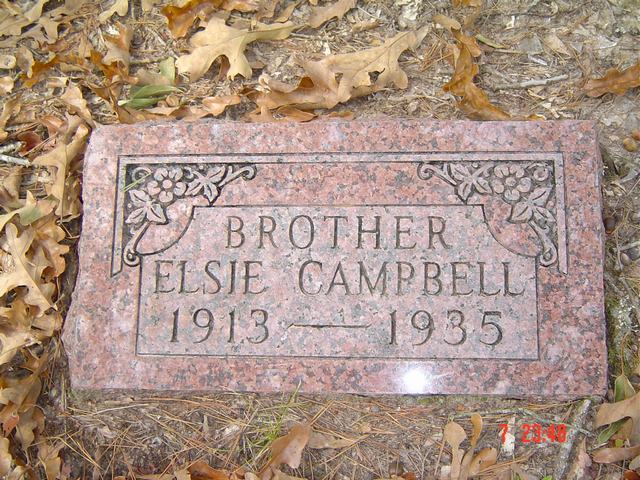
| Elsie Campbell | Image | Jim & Jeanie Sellers | |
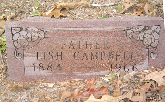
| Lish Campbell | Image | Jim & Jeanie Sellers | |
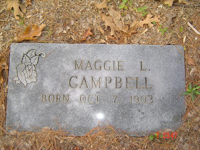
| Maggie L. Campbell | Image | Jim & Jeanie Sellers | |
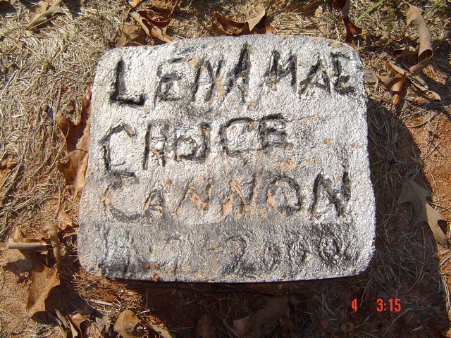
| Lena Mae Choice Cannon | Image | Jim & Jeanie Sellers | |
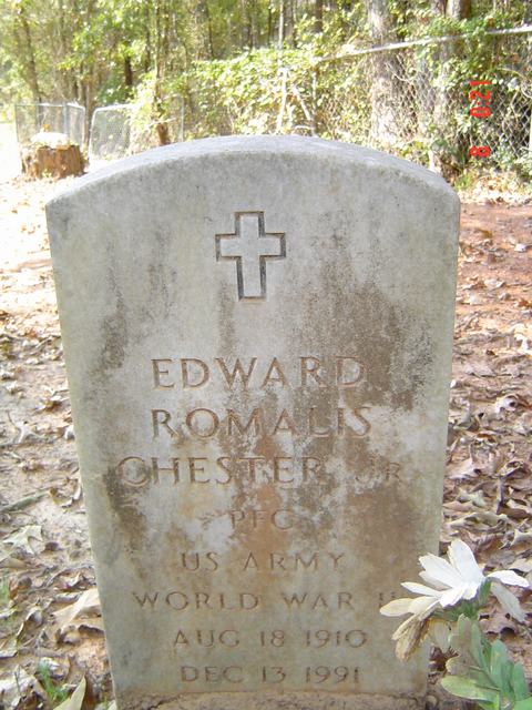
| Edward Romalis Chester | Image | Jim & Jeanie Sellers | |
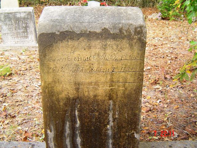
| Annie Choice | Image | Jim & Jeanie Sellers | |
| Annie Choice | Image | Jim & Jeanie Sellers | |
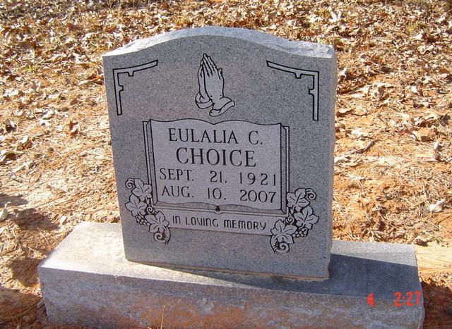
| Eulalia C. Choice | Image | Jim & Jeanie Sellers | |
| Eulalia C. Choice | Image | Jim & Jeanie Sellers | |
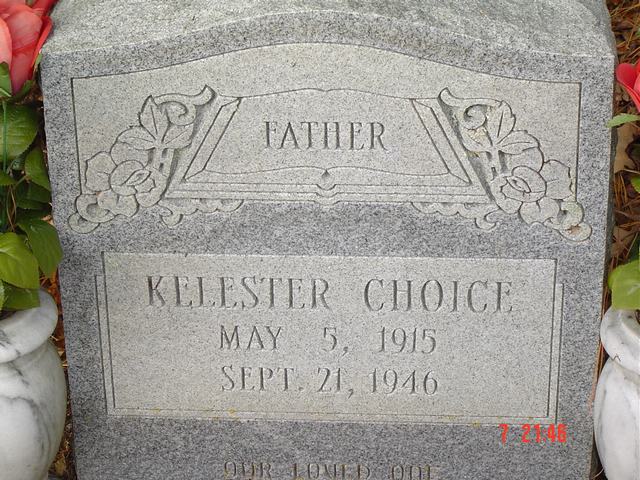
| Kelester Choice | Image | Jim & Jeanie Sellers | |
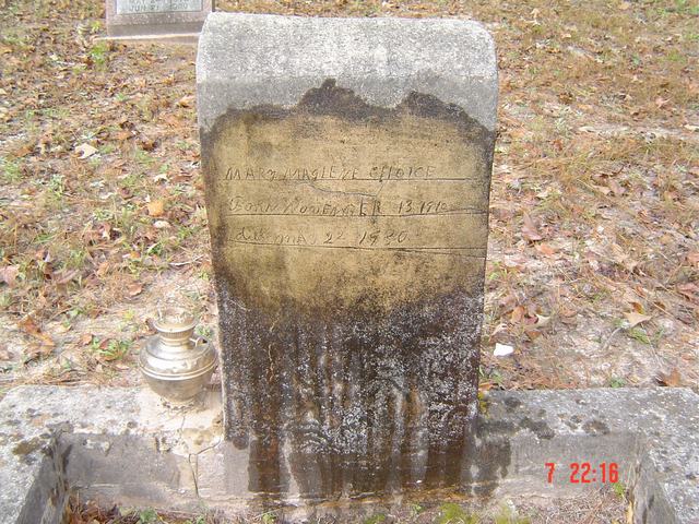
| Mary Choice | Image | Jim & Jeanie Sellers | |
| Mary Choice | Image | Jim & Jeanie Sellers | |
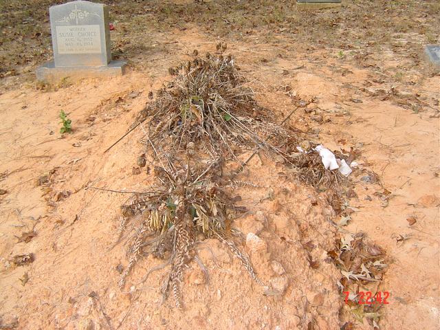
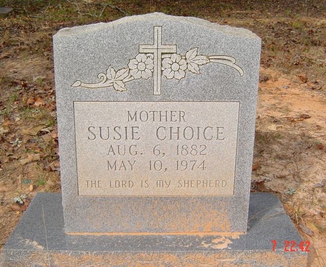
| Susie Choice | Image | Jim & Jeanie Sellers | |
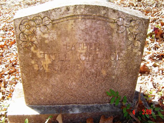
| Tull Choice | Image | Jim & Jeanie Sellers | |
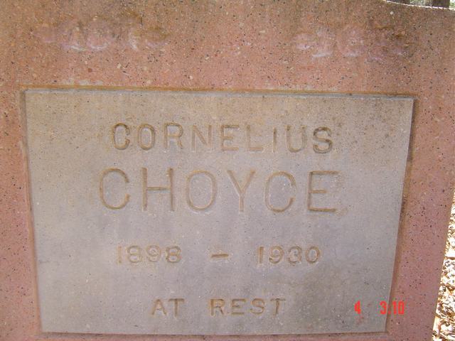
| Cornelius Choyce | Image | Jim & Jeanie Sellers | |
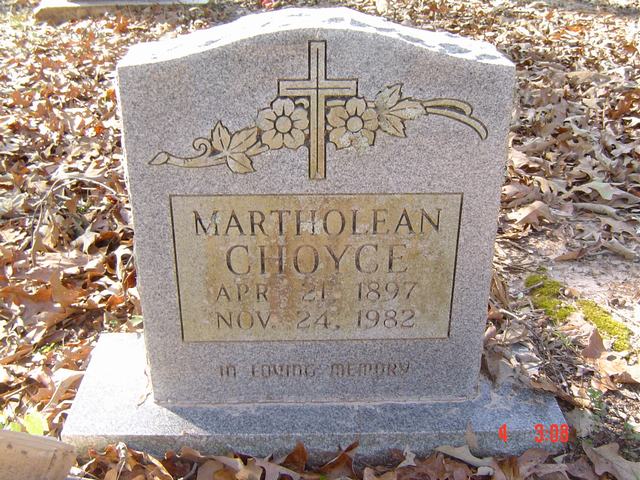
| Martholean Choyce | Image | Jim & Jeanie Sellers | |
| M. C. Coleman | Image | Jim & Jeanie Sellers | |
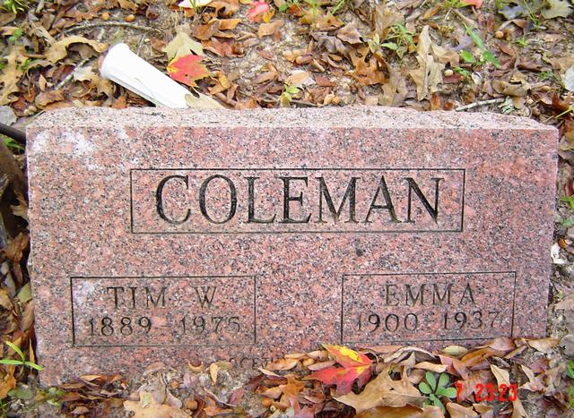
| Tim W. & Emma Coleman | Image | Jim & Jeanie Sellers | |
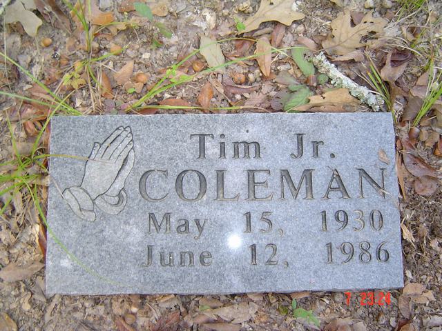
| Tim Coleman, Jr. | Image | Jim & Jeanie Sellers | |
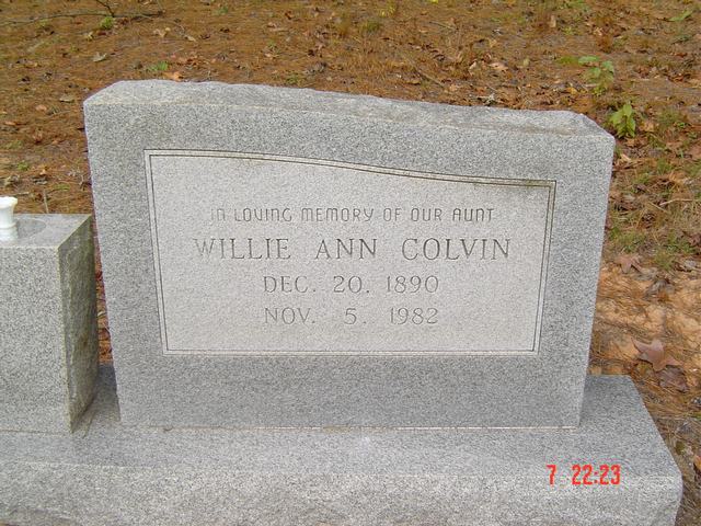
| Willie Ann Colvin | Image | Jim & Jeanie Sellers | |
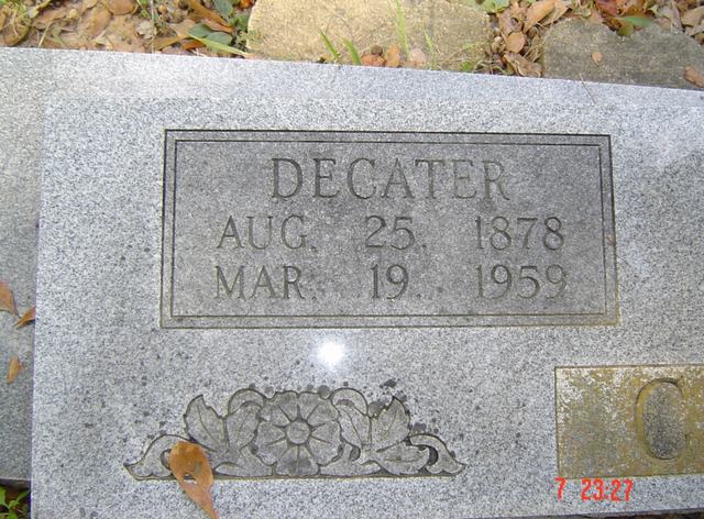
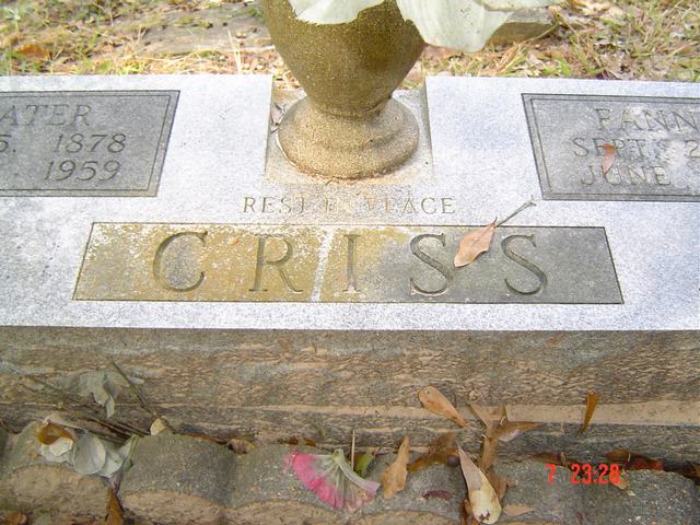
| Decater Criss | Image | Jim & Jeanie Sellers | |
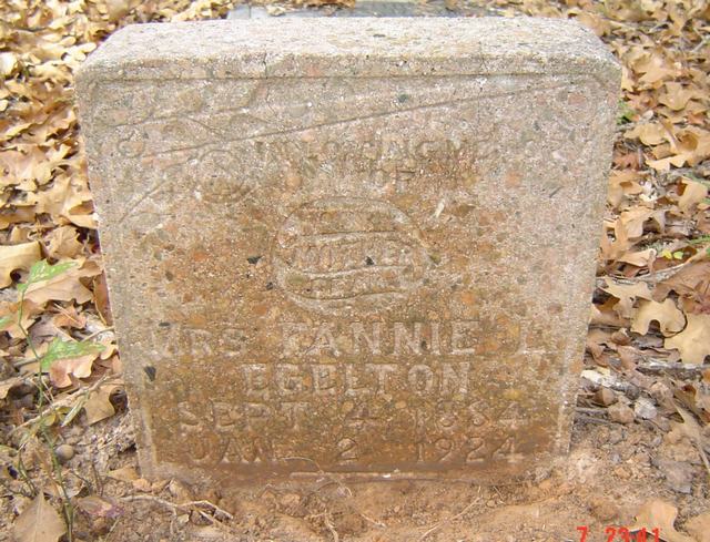
| Decater & Fannie L. Criss | Image | Jim & Jeanie Sellers | |
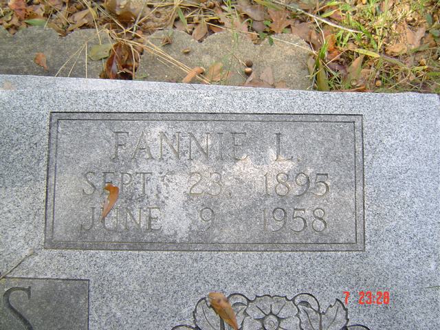
| Fannie L. Criss | Image | Jim & Jeanie Sellers | |
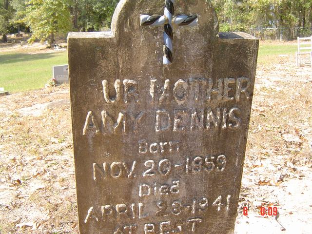
| Amy Dennis | Image | Jim & Jeanie Sellers | |
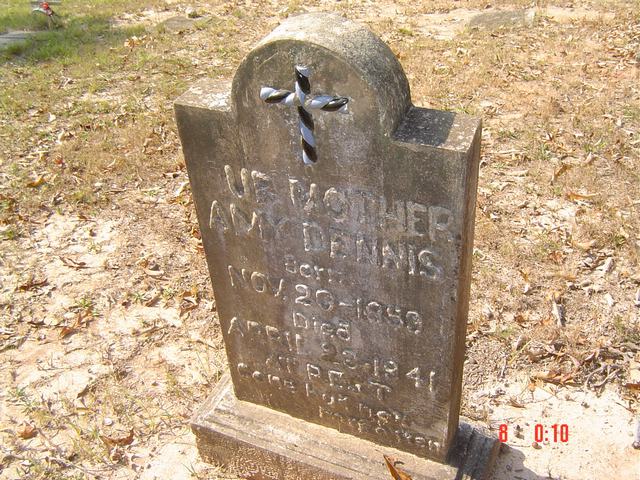
| Amy Dennis | Image | Jim & Jeanie Sellers | |
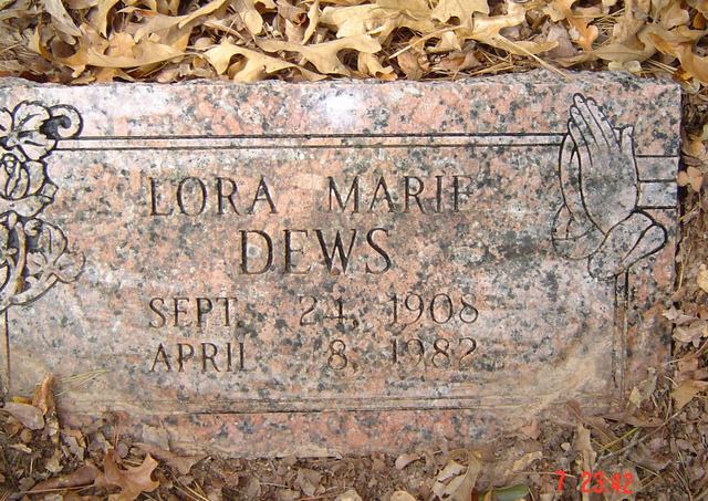
| Lora Marie Dews | Image | Jim & Jeanie Sellers | |
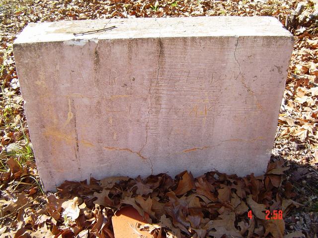
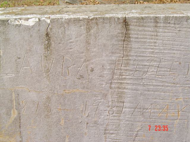
| Laura Eggleton | Image | Jim & Jeanie Sellers | |
| Laura Eggleton | Image | Jim & Jeanie Sellers | |
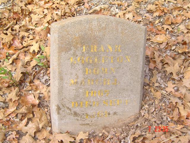
| Frank Eggleton | Image | Jim & Jeanie Sellers | |
| Annie Eggleton | Image | Jim & Jeanie Sellers | |
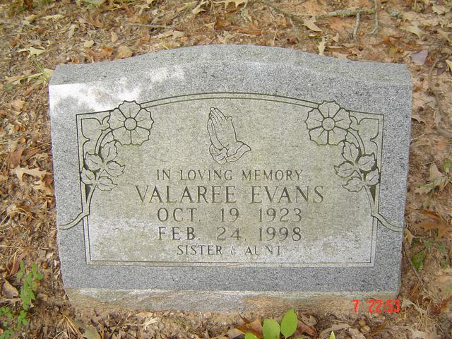
| Valaree Evans | Image | Jim & Jeanie Sellers | |
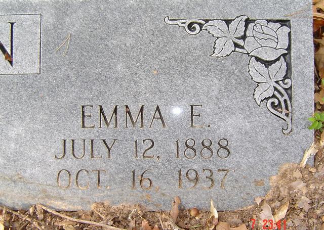
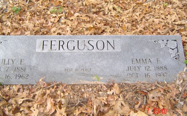
| Emma F. Ferguson | Image | Jim & Jeanie Sellers | |
| Tully & Emma Ferguson | Image | Jim & Jeanie Sellers | |
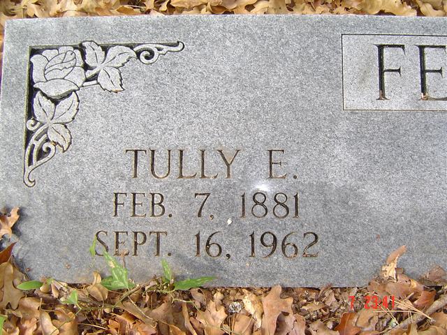
| Tully E. Ferguson | Image | Jim & Jeanie Sellers | |
| Ronnie Fields | Image | Jim & Jeanie Sellers | |
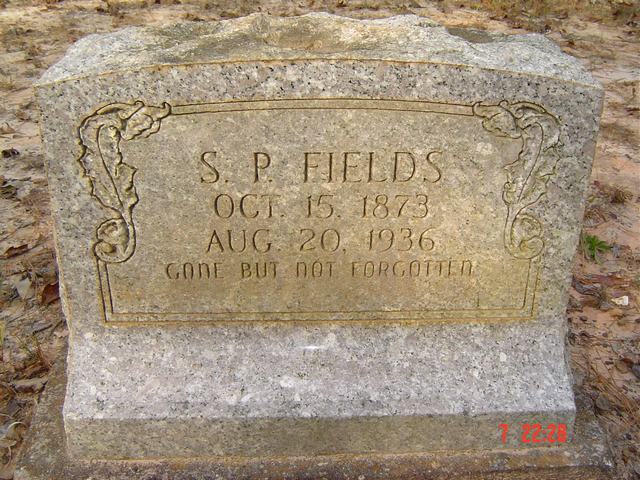
| S. P. Fields | Image | Jim & Jeanie Sellers | |
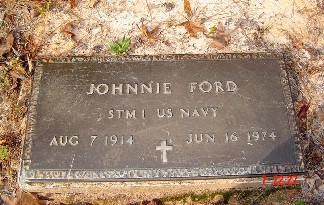
| Johnnie Ford | Image | Jim & Jeanie Sellers | |
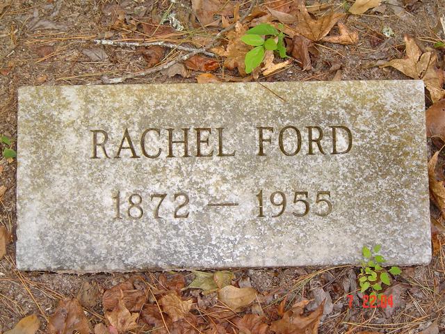
| Rachel Ford | Image | Jim & Jeanie Sellers | |
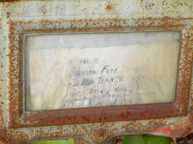
| Sus___ Ford | Image | Jim & Jeanie Sellers | |
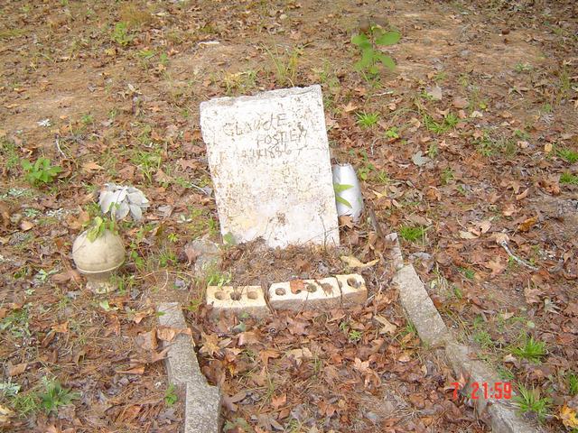
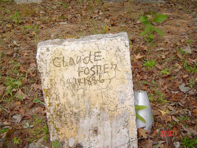
| Claude Foster | Image | Jim & Jeanie Sellers | |
| Claude Foster | Image | Jim & Jeanie Sellers | |
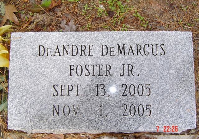
| DeAndre DeMarcus Foster, Jr. | Image | Jim & Jeanie Sellers | |
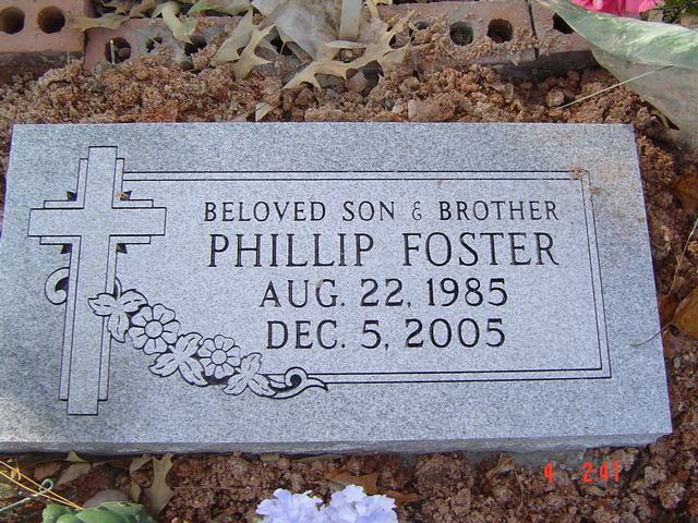
| Phillip Foster | Image | Jim & Jeanie Sellers | |
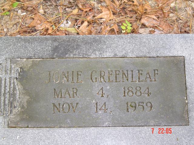
| Jonie Greenleaf | Image | Jim & Jeanie Sellers | |
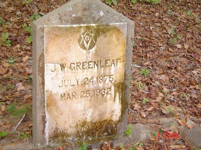
| J. W. Greenleaf | Image | Jim & Jeanie Sellers | |
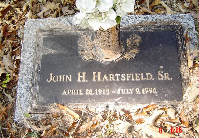
| John H. Hartsfield, Sr. | Image | Jim & Jeanie Sellers | |
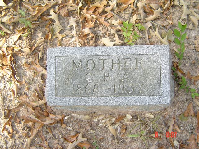
| Mother Hartsfield | Image | Jim & Jeanie Sellers | |
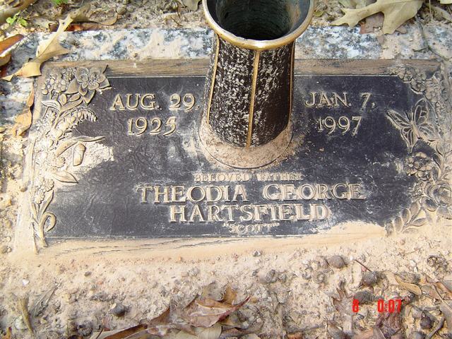
| Theodia George Hartsfield | Image | Jim & Jeanie Sellers | |
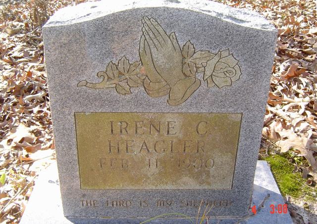
| Irene C. Heagler | Image | Jim & Jeanie Sellers | |
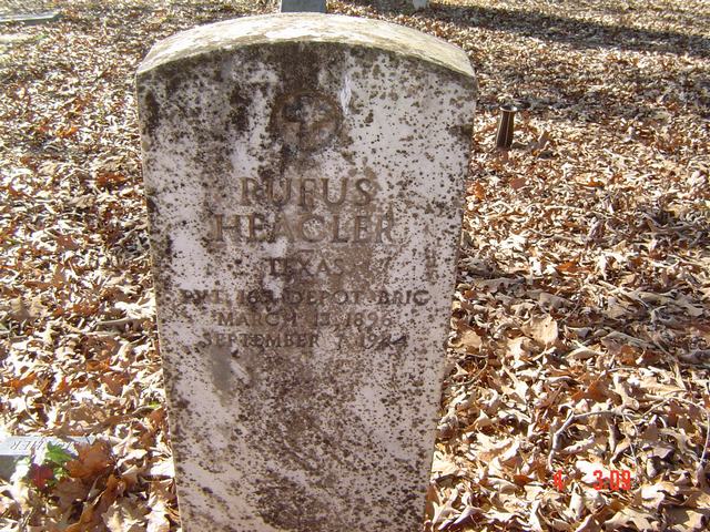
| Rufus Heagler | Image | Jim & Jeanie Sellers | |
| Leilou Henderson | Image | Jim & Jeanie Sellers | |
| Mrs. Theola Henderson | Image | Jim & Jeanie Sellers | |
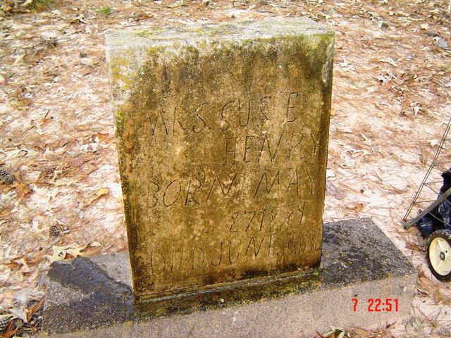
| Mrs. Susie Henry | Image | Jim & Jeanie Sellers | |
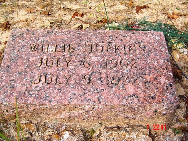
| Willie Hopkins | Image | Jim & Jeanie Sellers | |
| Unreadable Howard | Image | Jim & Jeanie Sellers | |
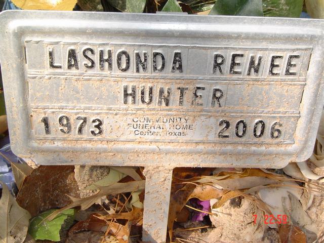
| Lashonda Renee Hunter | Image | Jim & Jeanie Sellers | |
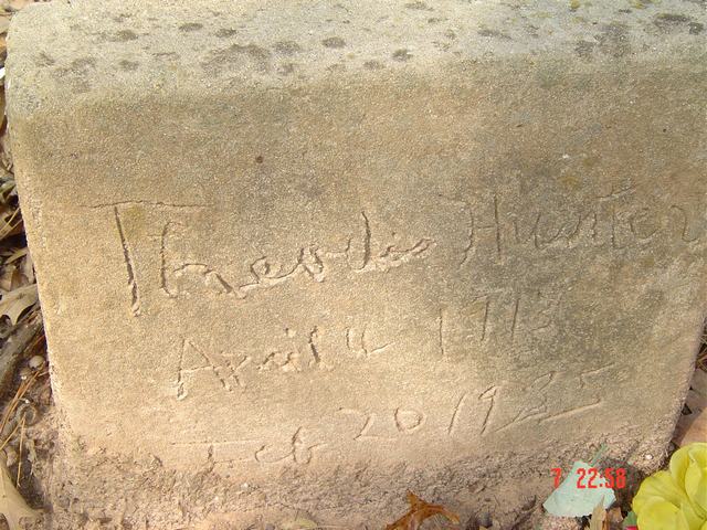
| Theodis Hunter | Image | Jim & Jeanie Sellers | |
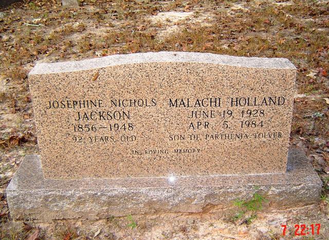
| Malachi Holland | Image | Jim & Jeanie Sellers | |
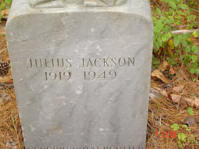
| Julius Jackson | Image | Jim & Jeanie Sellers | |
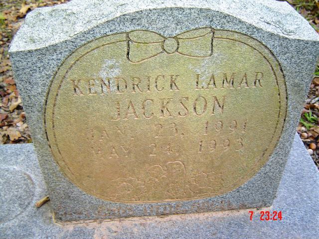
| Kendrick Lamar Jackson | Image | Jim & Jeanie Sellers | |
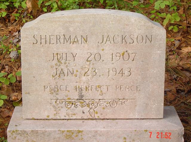
| Sherman Jackson | Image | Jim & Jeanie Sellers | |
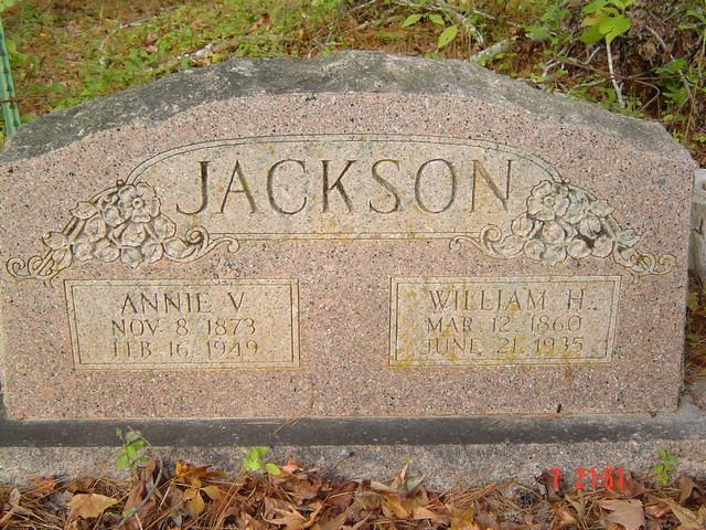
| William H. & Annie V. Jackson | Image | Jim & Jeanie Sellers | |
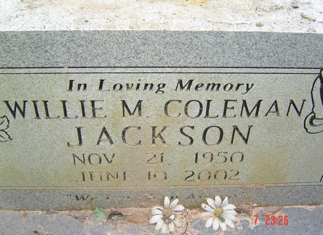
| William M. Coleman Jackson | Image | Jim & Jeanie Sellers | |
| Josephine Nichols Jackson | Image | Jim & Jeanie Sellers | |
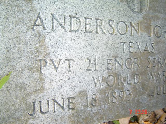
| Anderson Johnson | Image | Jim & Jeanie Sellers | |
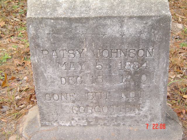
| Patsy Johnson | Image | Jim & Jeanie Sellers | |
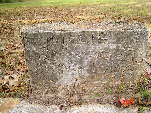
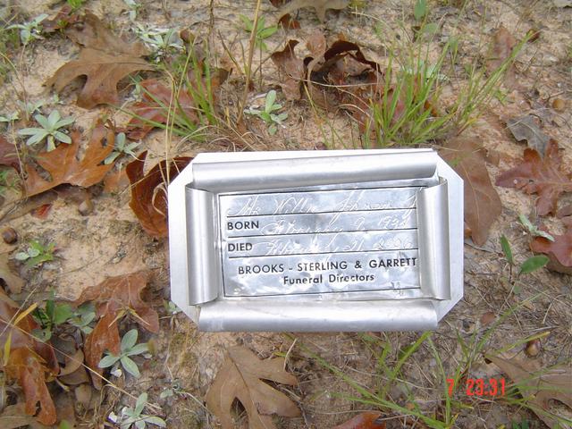
| Willie Johnson | Image | Jim & Jeanie Sellers | |
| Willie Johnson | Image | Jim & Jeanie Sellers | |
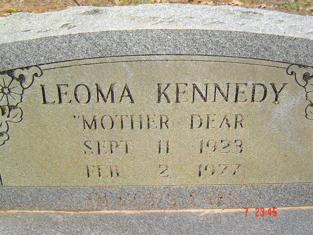
| Leoma Kennedy | Image | Jim & Jeanie Sellers | |
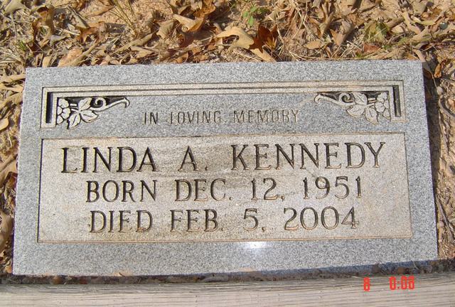
| Linda A. Kennedy | Image | Jim & Jeanie Sellers | |
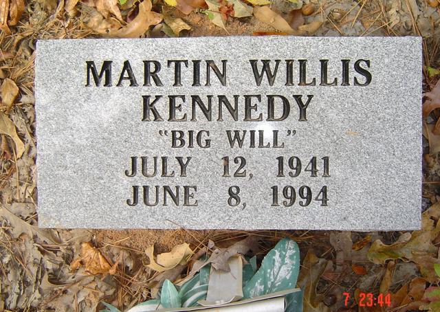
| Martin Willis Kennedy | Image | Jim & Jeanie Sellers | |
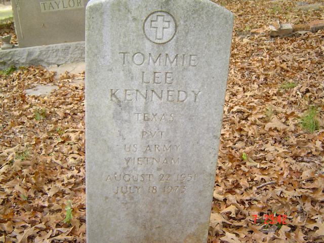
| Tommie Lee Kennedy | Image | Jim & Jeanie Sellers | |
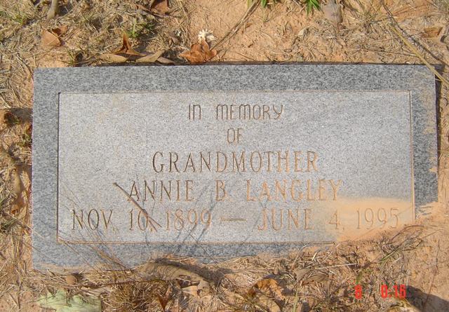
| Annie B. Langley | Image | Jim & Jeanie Sellers | |
| Alonzo Lee | Image | Jim & Jeanie Sellers | |
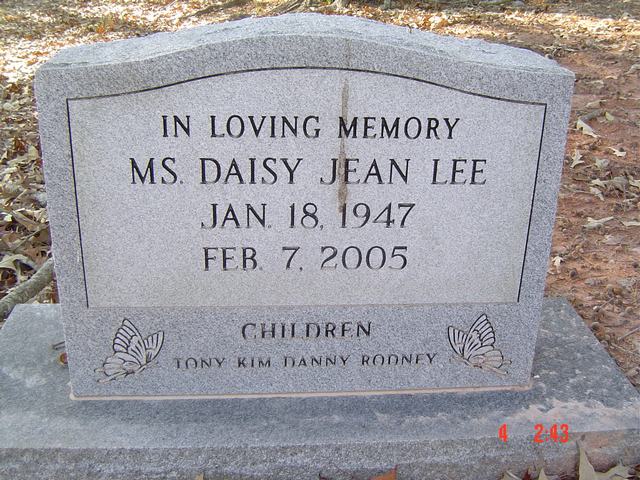
| Daisy Jean Lee | Image | Jim & Jeanie Sellers | |
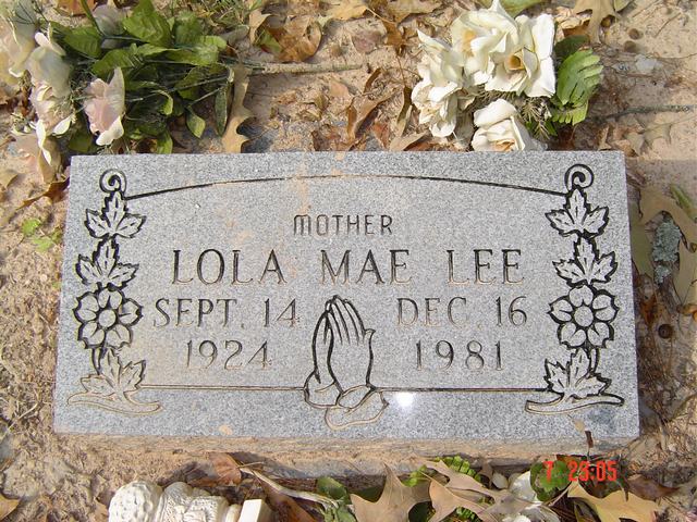
| Lola Mae Lee | Image | Jim & Jeanie Sellers | |
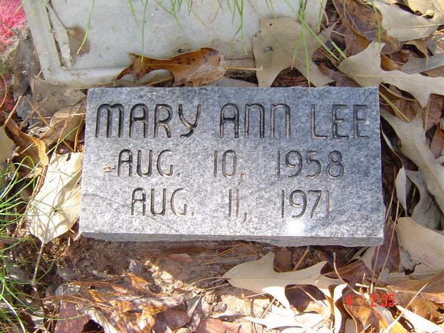
| Mary Ann Lee | Image | Jim & Jeanie Sellers | |
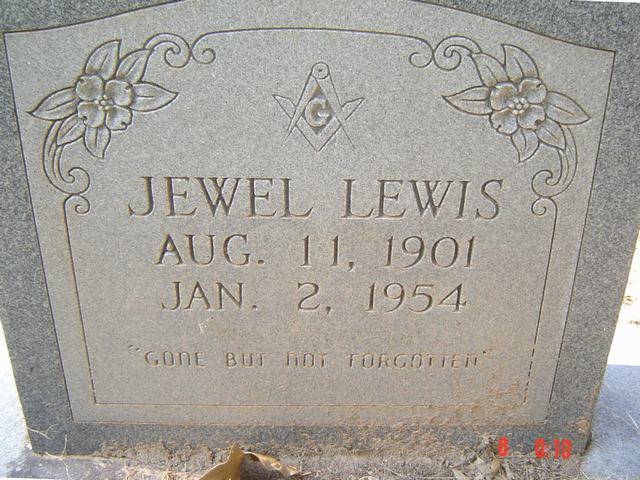
| Jewel Lewis | Image | Jim & Jeanie Sellers | |
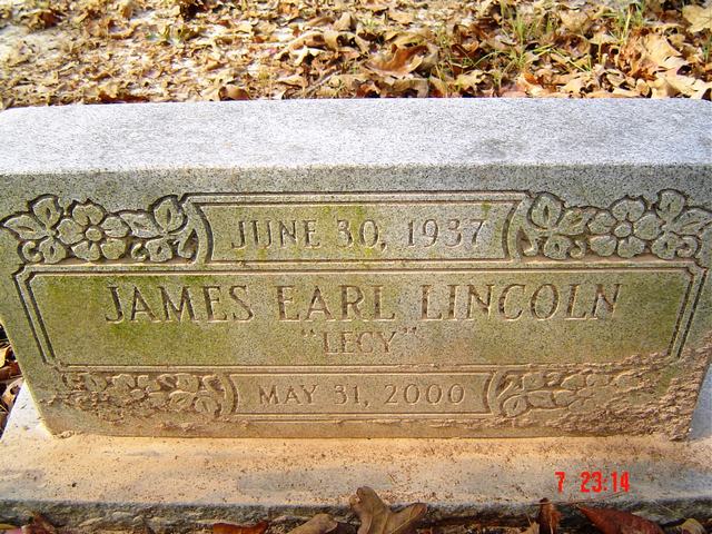
| James Earl Lincoln | Image | Jim & Jeanie Sellers | |
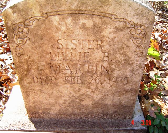
| Lillie B. Martin | Image | Jim & Jeanie Sellers | |
| JaCory McMillery | Image | Jim & Jeanie Sellers | |
| John Mills | Image | Jim & Jeanie Sellers | |
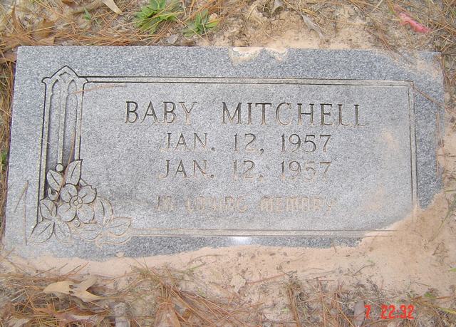
| Baby Mitchell | Image | Jim & Jeanie Sellers | |
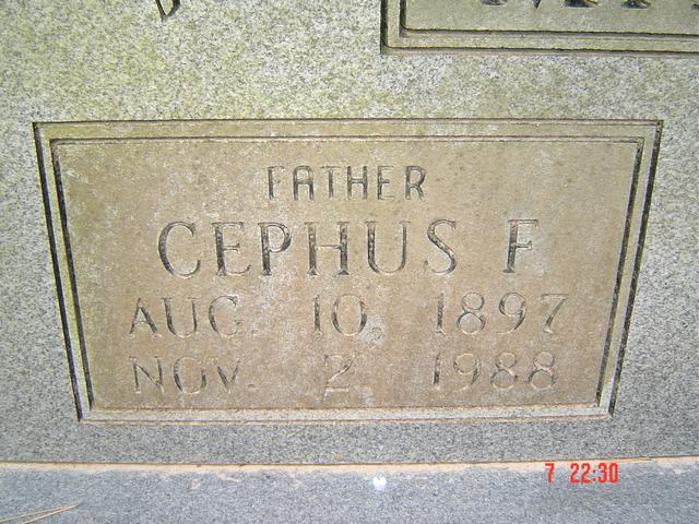
| Cephus F Mitchell | Image | Jim & Jeanie Sellers | |
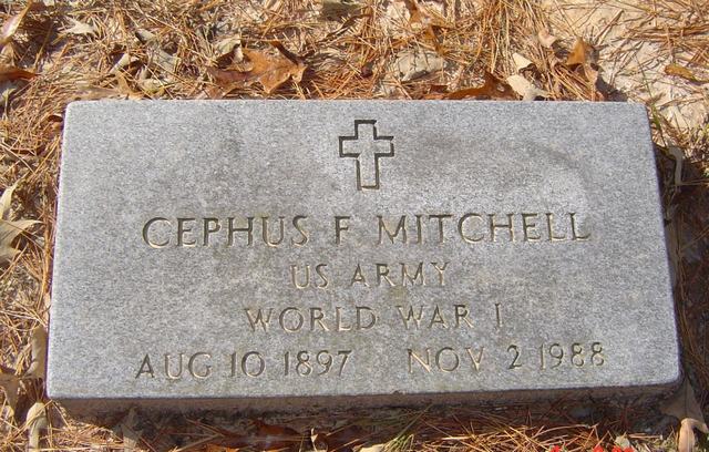
| Cephus F. Mitchell | Image | Jim & Jeanie Sellers | |
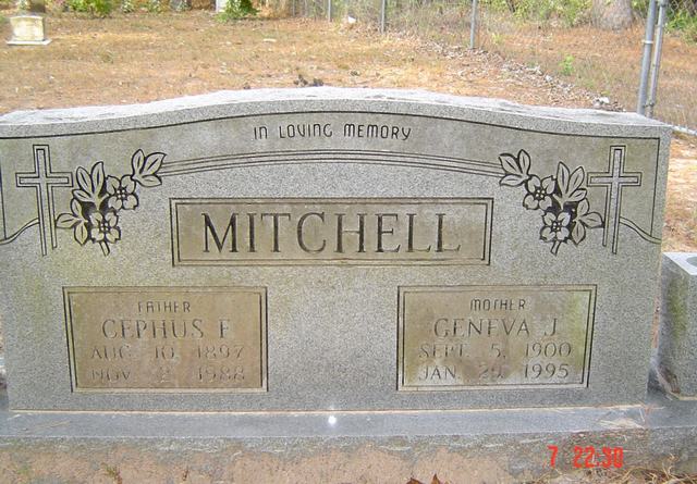
| Cephus F. & Geneva J. Mitchell | Image | Jim & Jeanie Sellers | |
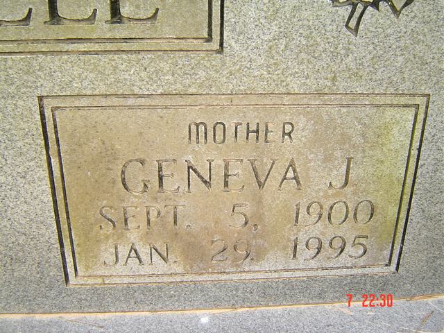
| Geneva J. Mitchell | Image | Jim & Jeanie Sellers | |
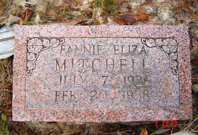
| Fannie Eliza Mitchell | Image | Jim & Jeanie Sellers | |
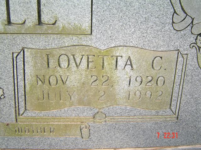
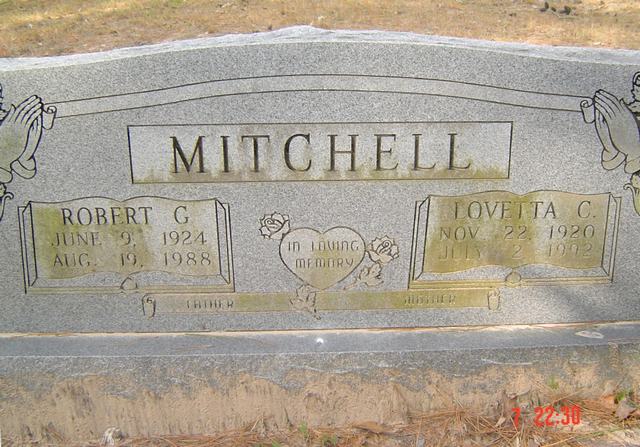
| Lovetta C. Mitchell | Image | Jim & Jeanie Sellers | |
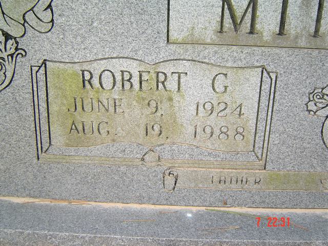
| Robert G. Mitchell | Image | Jim & Jeanie Sellers | |
| Robert G. & Lovetta C. Mitchell | Image | Jim & Jeanie Sellers | |
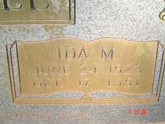
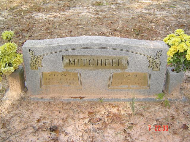
| Ida M. Mitchell | Image | Jim & Jeanie Sellers | |
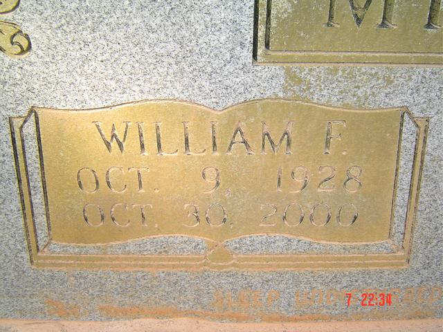
| William F. Mitchell | Image | Jim & Jeanie Sellers | |
| William F. & Ida M. Mitchell | Image | Jim & Jeanie Sellers | |
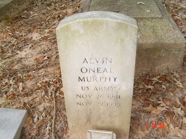
| Alvin ONeal Murphy | Image | Jim & Jeanie Sellers | |
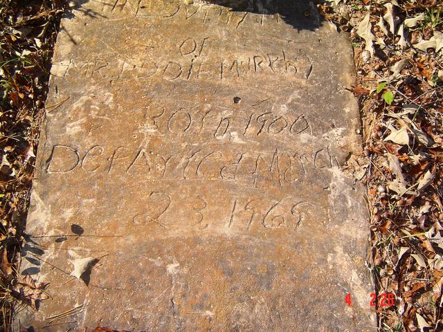
| Unknown Murphy | Image | Jim & Jeanie Sellers | |
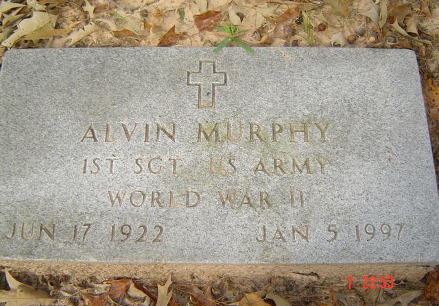
| Alvin Murphy | Image | Jim & Jeanie Sellers | |
| Augusta Murphy | Image | Jim & Jeanie Sellers | |
| Baby Girl Murphy | Image | Jim & Jeanie Sellers | |
| Eddie Murphy | Image | Jim & Jeanie Sellers | |
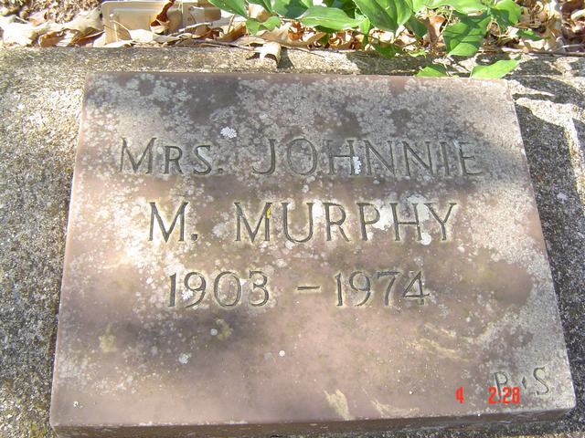
| Mrs. Johnnie M. Murphy | Image | Jim & Jeanie Sellers | |
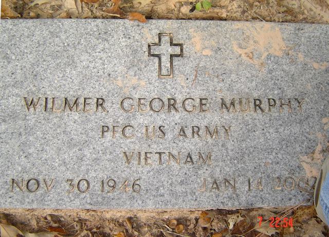
| Wilmer George Murphy | Image | Jim & Jeanie Sellers | |
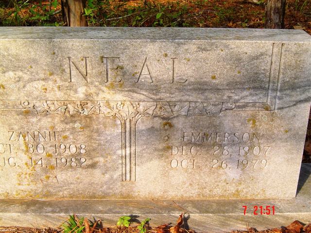
| Emmerson & Zannie Neal | Image | Jim & Jeanie Sellers | |
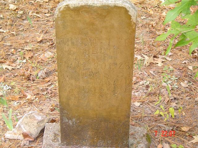
| Minnie Lee Neal | Image | Jim & Jeanie Sellers | |
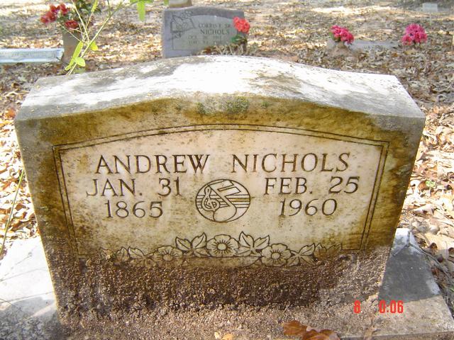
| Andrew Nichols | Image | Jim & Jeanie Sellers | |
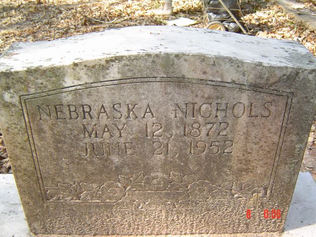
| Nebraska Nichols | Image | Jim & Jeanie Sellers | |
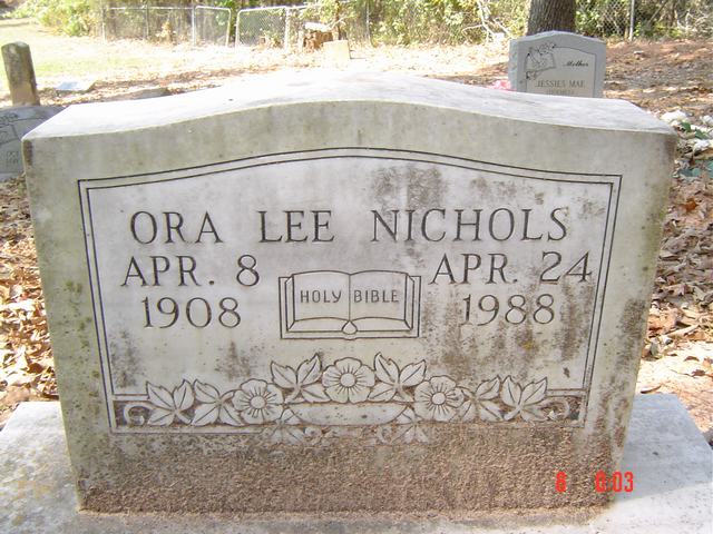
| Ora Lee Nichols | Image | Jim & Jeanie Sellers | |
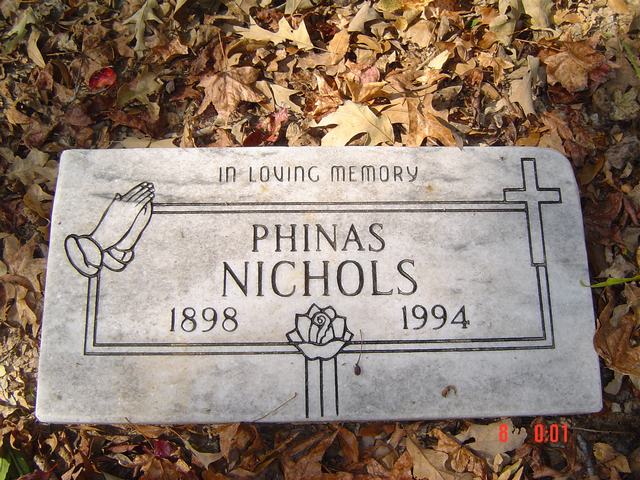
| Phinas Nichols | Image | Jim & Jeanie Sellers | |
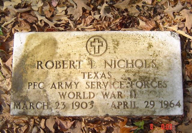
| Robert L. Nichols | Image | Jim & Jeanie Sellers | |
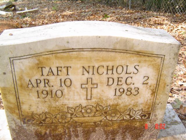
| Taft Nichols | Image | Jim & Jeanie Sellers | |
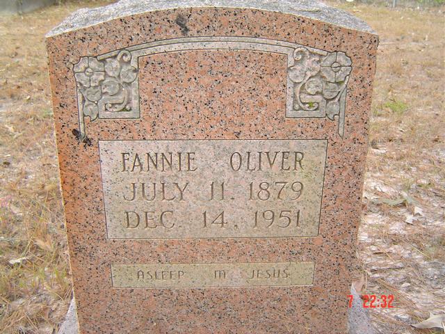
| Fannie Oliver | Image | Jim & Jeanie Sellers | |
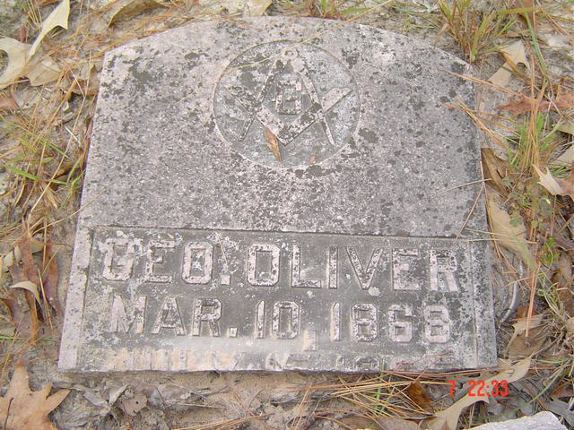
| Geo Oliver | Image | Jim & Jeanie Sellers | |
| Geo Oliver | Image | Jim & Jeanie Sellers | |
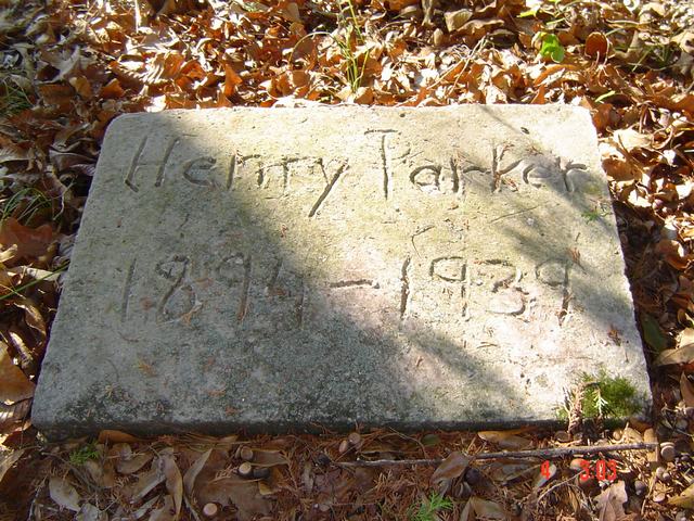
| Henry Parker | Image | Jim & Jeanie Sellers | |
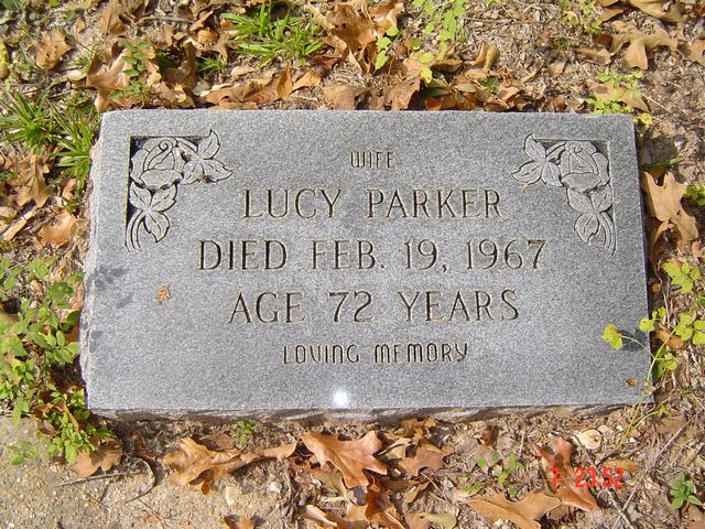
| Lucy Parker | Image | Jim & Jeanie Sellers | |
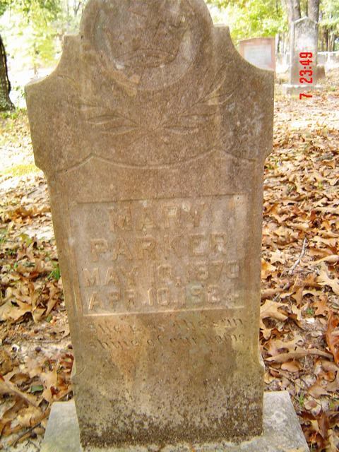
| Mary Parker | Image | Jim & Jeanie Sellers | |
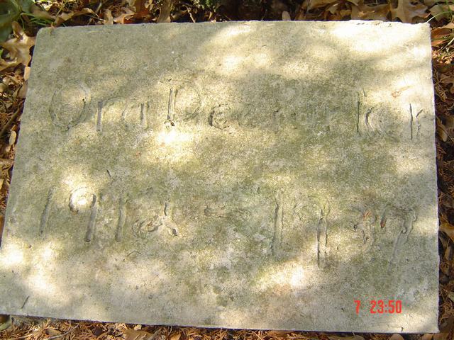
| Ora Dee Parker | Image | Jim & Jeanie Sellers | |
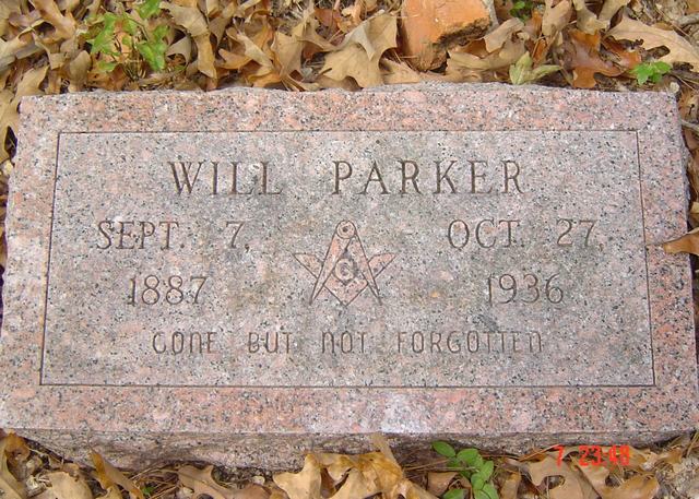
| Will Parker | Image | Jim & Jeanie Sellers | |
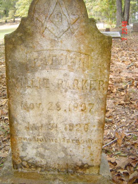
| Willie Parker | Image | Jim & Jeanie Sellers | |
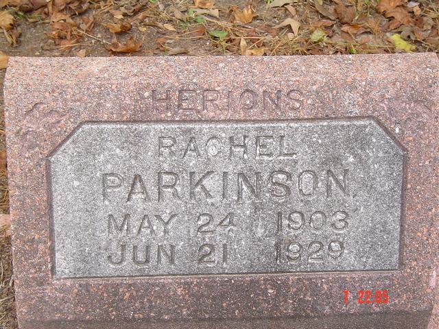
| Rachel Parkinson | Image | Jim & Jeanie Sellers | |
| Perry | Image | Jim & Jeanie Sellers | |
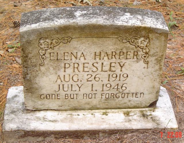
| Elena Harper Presley | Image | Jim & Jeanie Sellers | |
| J. Quin | Image | Jim & Jeanie Sellers | |
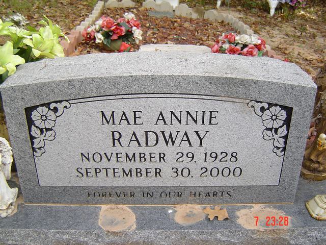
| Mae Annie Radwa | Image | Jim & Jeanie Sellers | |
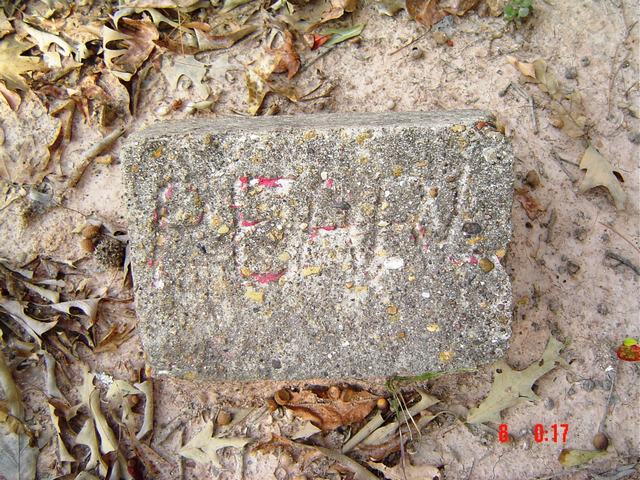
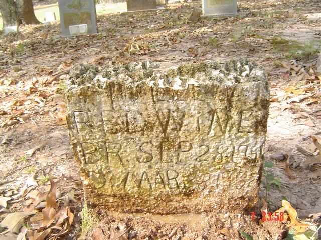
| Redwine | Image | Jim & Jeanie Sellers | |
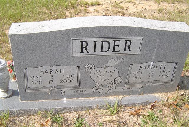
| Barnett & Sarah Rider | Image | Jim & Jeanie Sellers | |
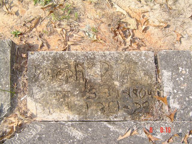
| Joseph Rider | Image | Jim & Jeanie Sellers | |
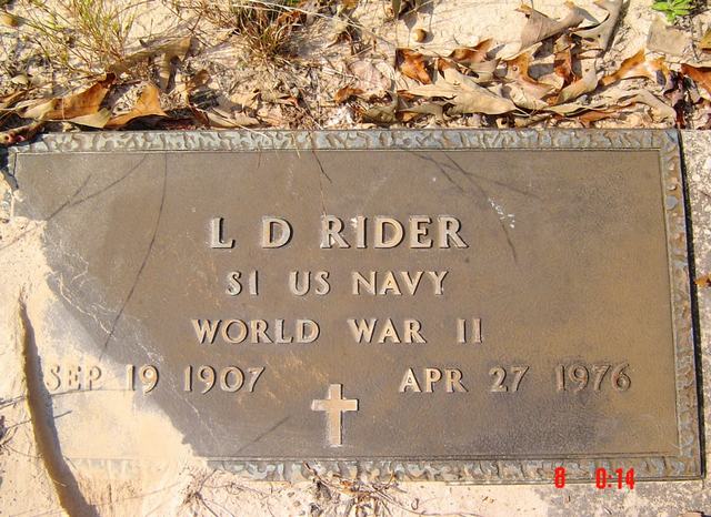
| L. D. Rider | Image | Jim & Jeanie Sellers | |
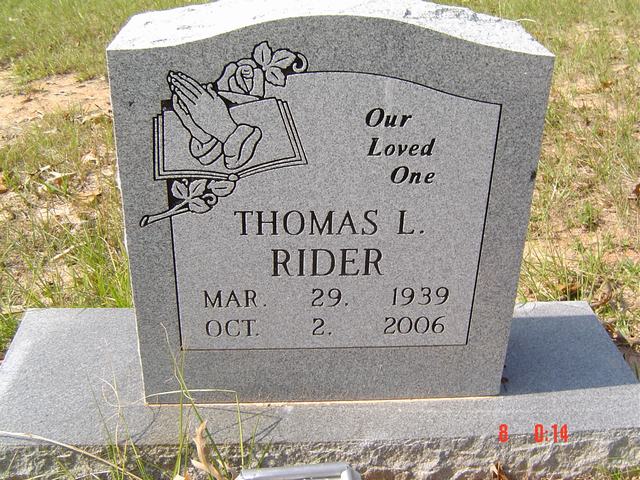
| Thomas L. Rider | Image | Jim & Jeanie Sellers | |
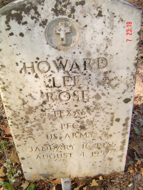
| Howard Lee Rose | Image | Jim & Jeanie Sellers | |
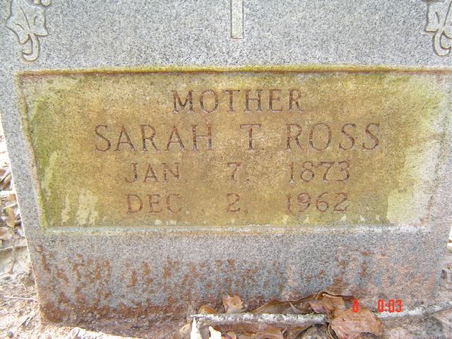
| Sarah T. Ross | Image | Jim & Jeanie Sellers | |
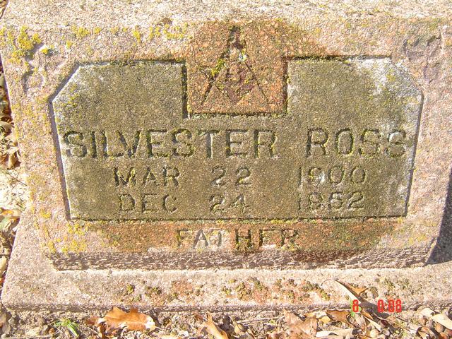
| Silvester Ross | Image | Jim & Jeanie Sellers | |
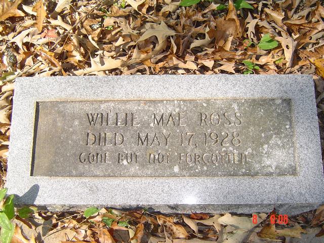
| Willie Mae Ross | Image | Jim & Jeanie Sellers | |
| Stokie Russeau | Image | Jim & Jeanie Sellers | |
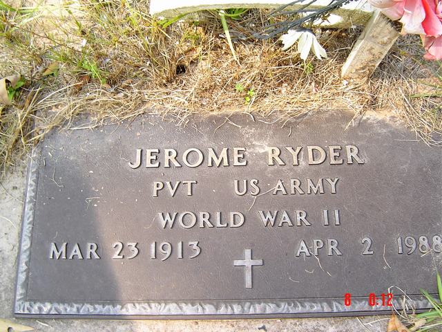
| Jerome Ryder | Image | Jim & Jeanie Sellers | |
| Bobbie Seaton | Image | Jim & Jeanie Sellers | |
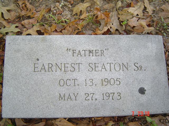
| Earnest Seaton, Sr. | Image | Jim & Jeanie Sellers | |
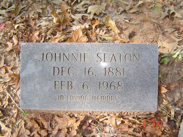
| Johnnie Seaton | Image | Jim & Jeanie Sellers | |
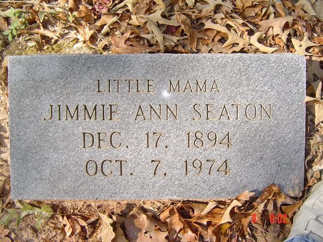
| Jimmie Ann Seaton | Image | Jim & Jeanie Sellers | |
| Marvin J. Seaton | Image | Jim & Jeanie Sellers | |
| Milton Seaton | Image | Jim & Jeanie Sellers | |
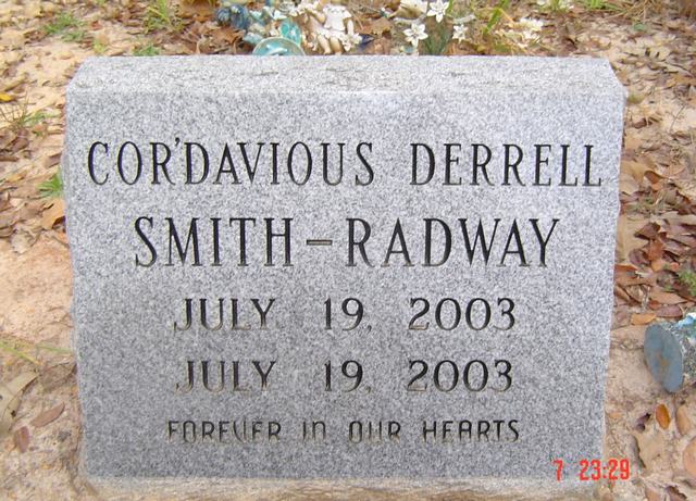
| Cor'davious Derrell Smith-Radway | Image | Jim & Jeanie Sellers | |
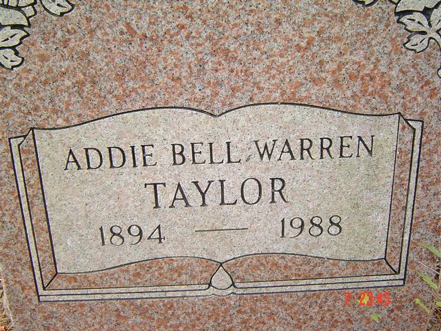
| Addie Bell Warren Taylor | Image | Jim & Jeanie Sellers | |
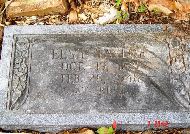
| Elsie Taylor | Image | Jim & Jeanie Sellers | |
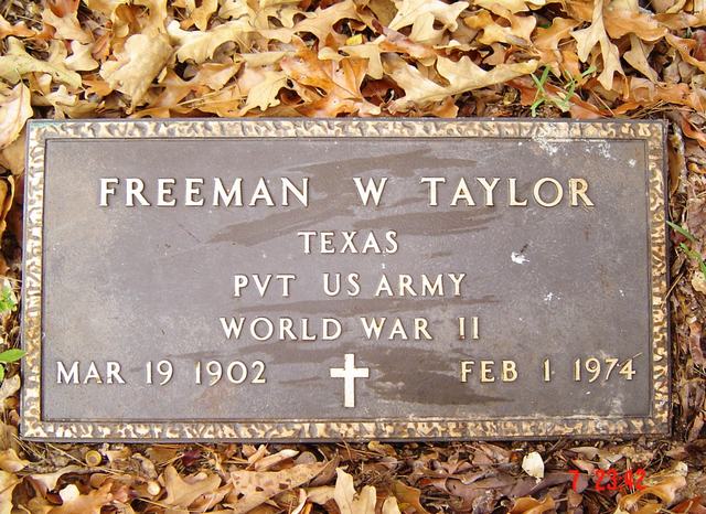
| Freeman W. Taylor | Image | Jim & Jeanie Sellers | |
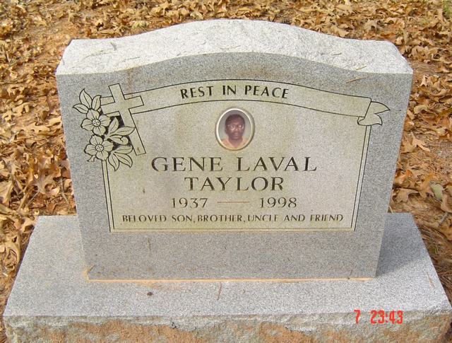
| Gene Laval Taylor | Image | Jim & Jeanie Sellers | |
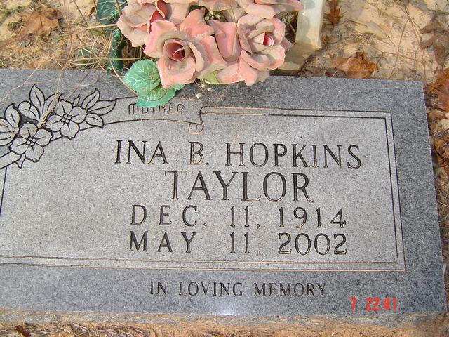
| Ina B. Hopkins Taylor | Image | Jim & Jeanie Sellers | |
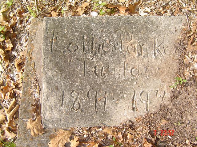
| Cotton Parker Taylor | Image | Jim & Jeanie Sellers | |
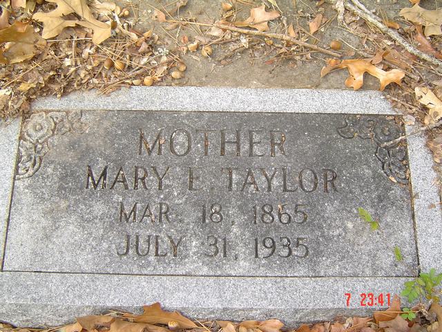
| Mary E. Taylor | Image | Jim & Jeanie Sellers | |
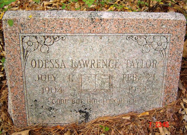
| Odessa Lawrence Taylor | Image | Jim & Jeanie Sellers | |
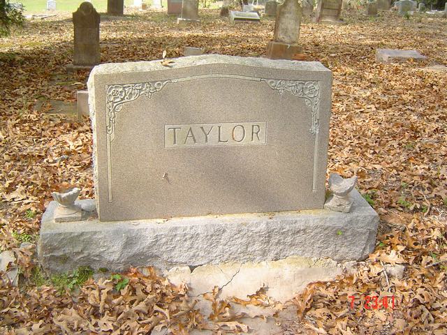
| Taylor Plot | Image | Jim & Jeanie Sellers | |
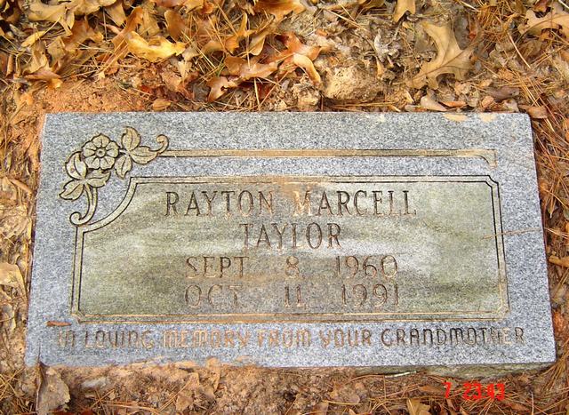
| Rayton Marcell Taylor | Image | Jim & Jeanie Sellers | |
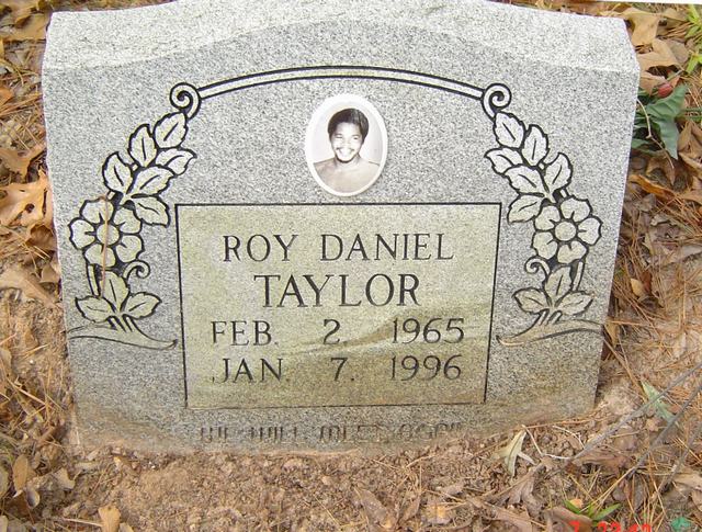
| Roy Daniel Taylor | Image | Jim & Jeanie Sellers | |
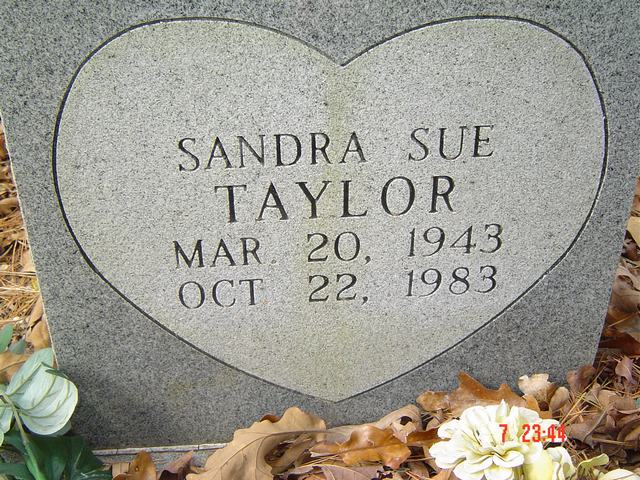
| Sandra Sue Taylor | Image | Jim & Jeanie Sellers | |
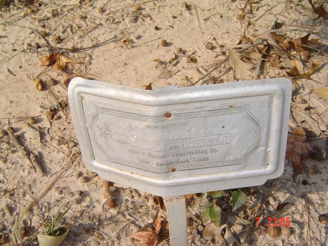
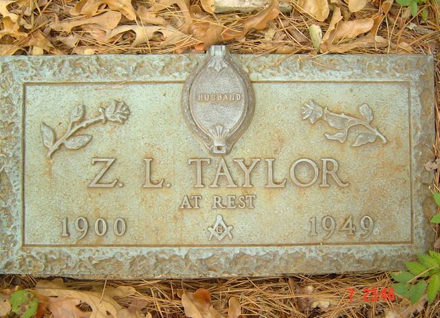
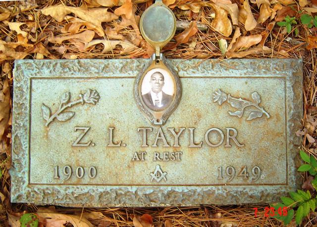
| Z. L. Taylor | Image | Jim & Jeanie Sellers | |
| Z. L. Taylor | Image | Jim & Jeanie Sellers | |
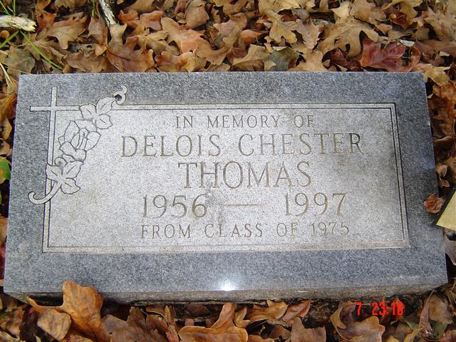
| Delois Chester Thomas | Image | Jim & Jeanie Sellers | |
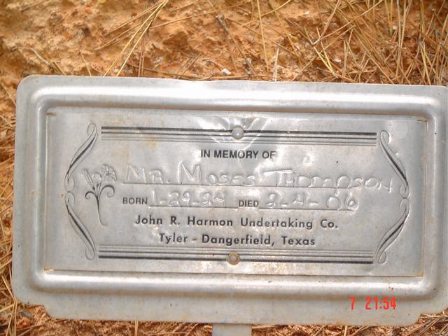
| Moses Thompson | Image | Jim & Jeanie Sellers | |
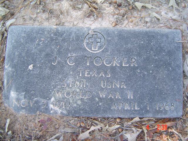
| J. C. Tocker | Image | Jim & Jeanie Sellers | |
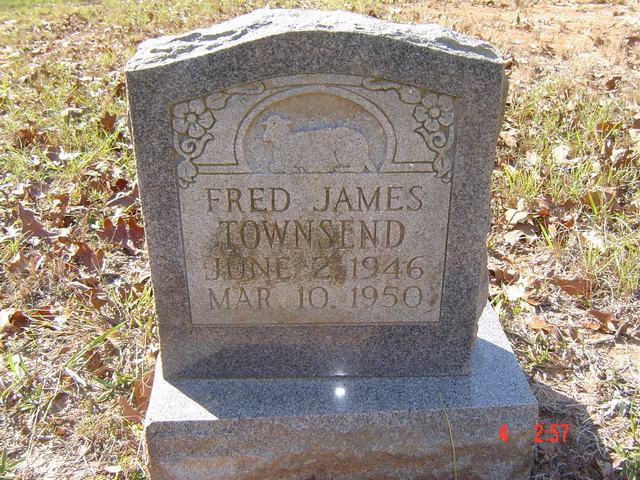
| Fred James Townsend | Image | Jim & Jeanie Sellers | |
| Johnie Tucker | Image | Jim & Jeanie Sellers | |
| Timothy Tucker | Image | Jim & Jeanie Sellers | |
| Arvie Vickers | Image | Jim & Jeanie Sellers | |
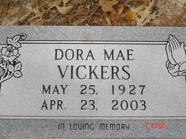
| Dora Mae Vickers | Image | Jim & Jeanie Sellers | |
| Stelvin Vickers | Image | Jim & Jeanie Sellers | |
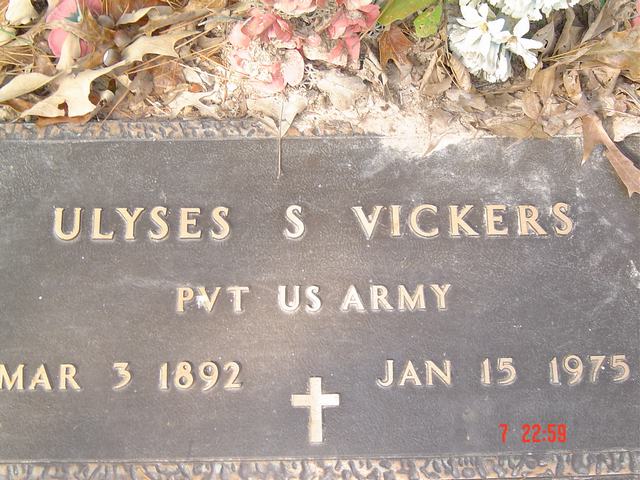
| Ulyses S. Vickers | Image | Jim & Jeanie Sellers | |
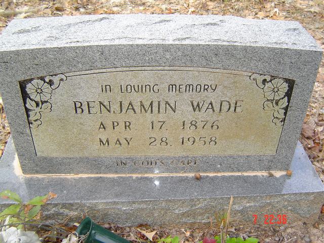
| Benjamin Wade | Image | Jim & Jeanie Sellers | |
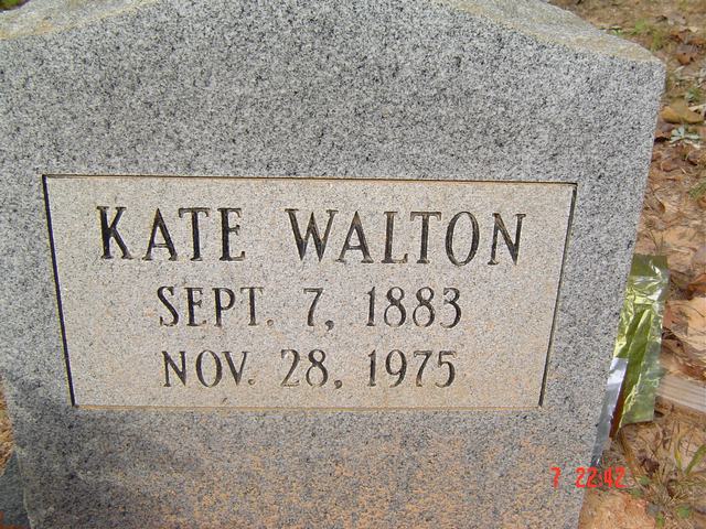
| Kate Walton | Image | Jim & Jeanie Sellers | |
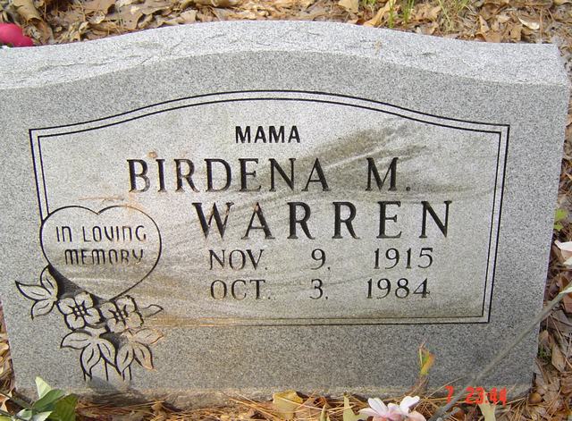
| Birdena M. Warren | Image | Jim & Jeanie Sellers | |
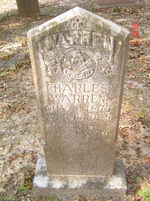
| Charles Warren | Image | Jim & Jeanie Sellers | |
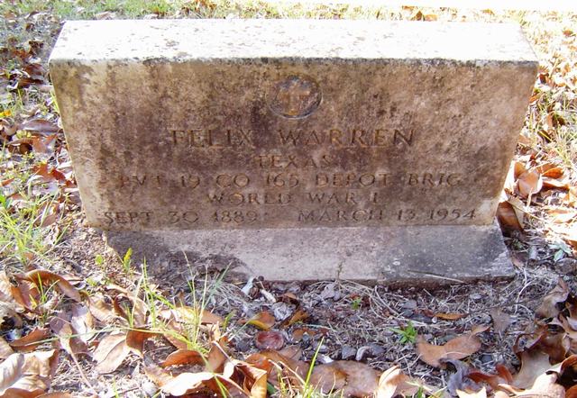
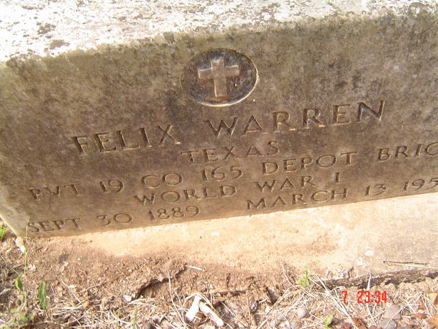
| Felix Warren | Image | Jim & Jeanie Sellers | |
| Felix Warren | Image | Jim & Jeanie Sellers | |
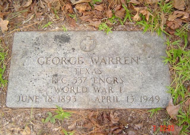
| George Warren | Image | Jim & Jeanie Sellers | |
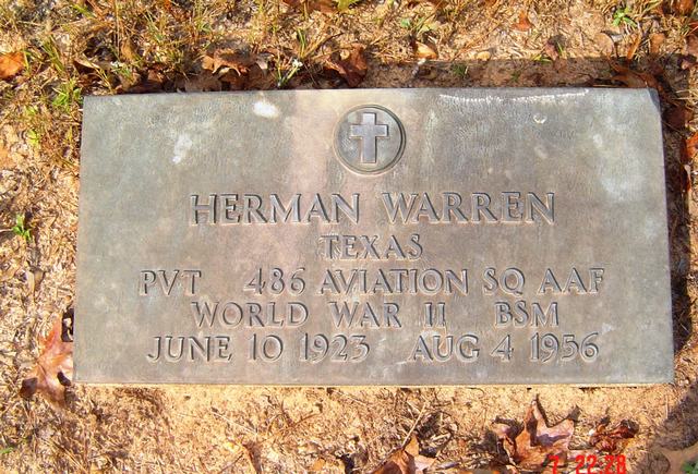
| Herman Warren | Image | Jim & Jeanie Sellers | |
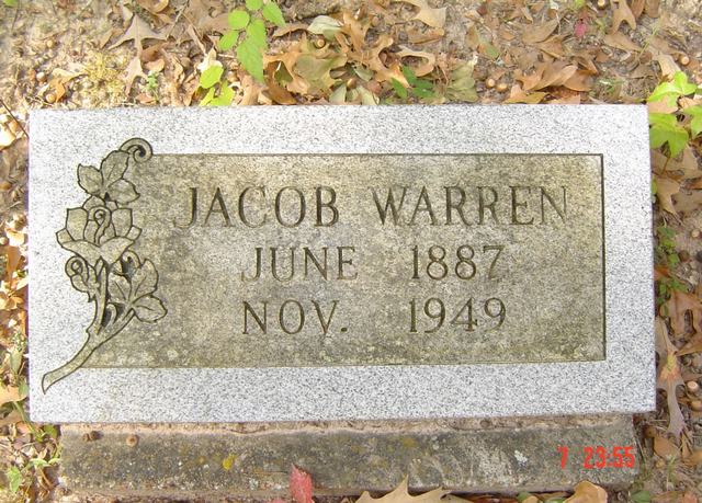
| Jacob Warren | Image | Jim & Jeanie Sellers | |
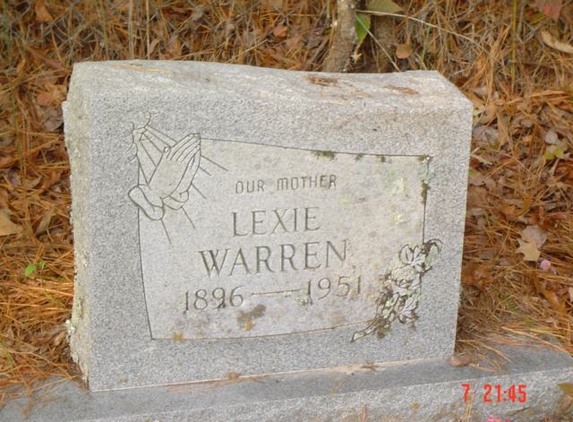
| Lexie Warren | Image | Jim & Jeanie Sellers | |
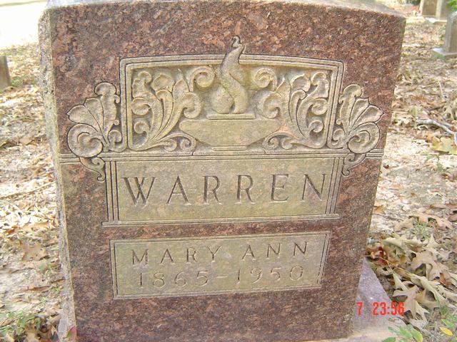
| Mary Ann Warren | Image | Jim & Jeanie Sellers | |
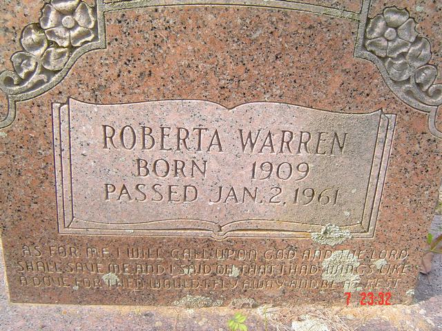
| Roberta Warren | Image | Jim & Jeanie Sellers | |
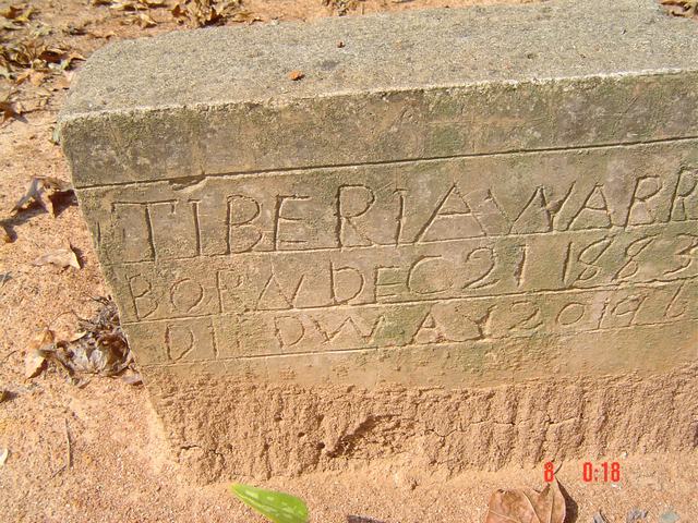
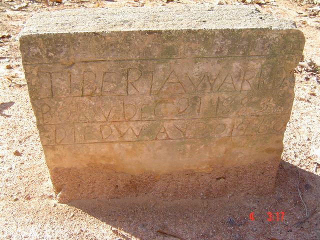
| Tiberia Warren | Image | Jim & Jeanie Sellers | |
| Tiberia Warren | Image | Jim & Jeanie Sellers | |
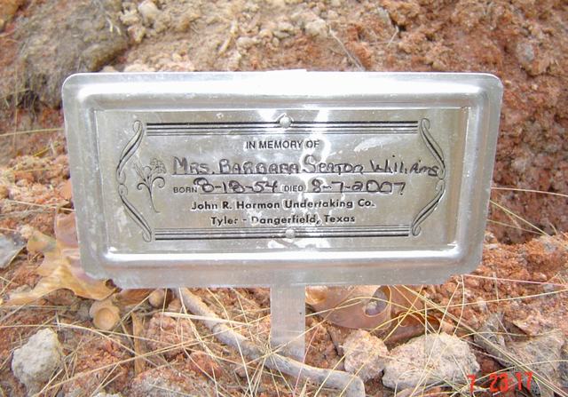
| Barbara Seaton Williams | Image | Jim & Jeanie Sellers | |
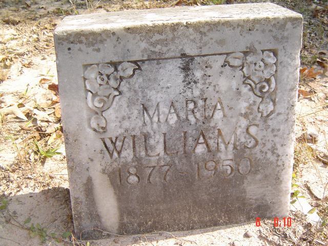
| Maria Williams | Image | Jim & Jeanie Sellers | |
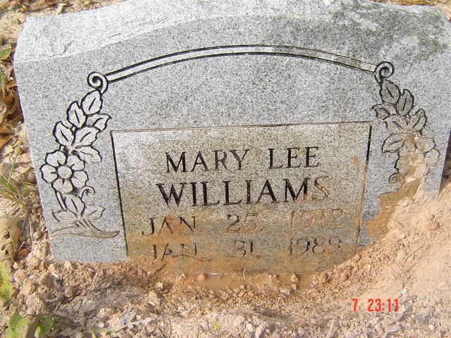
| Mary Lee Williams | Image | Jim & Jeanie Sellers | |
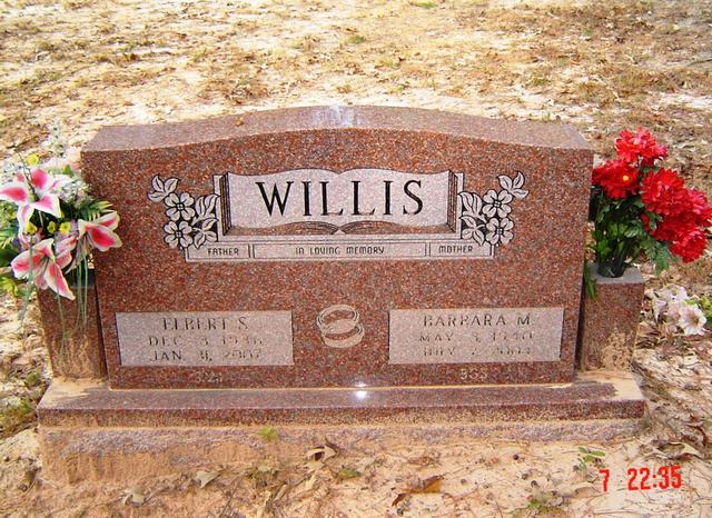
| Elbert S. & Barbara M. Willis | Image | Jim & Jeanie Sellers | |
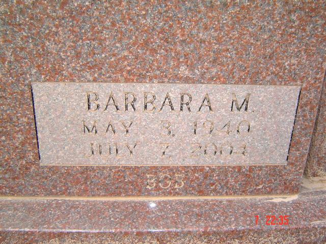
| Barbara M. Willis | Image | Jim & Jeanie Sellers | |
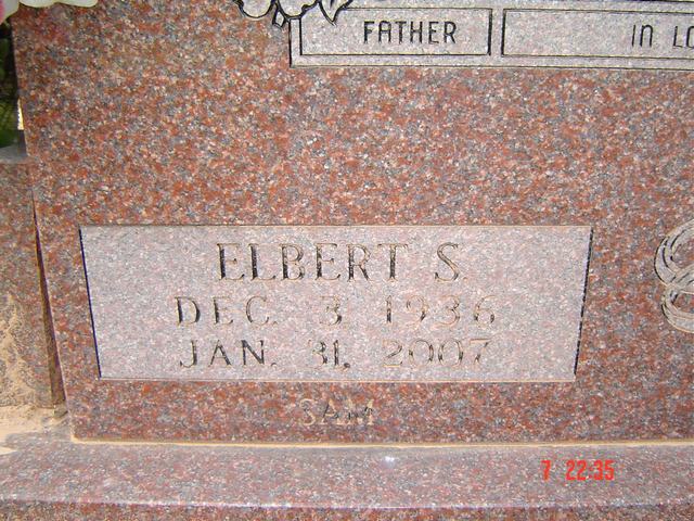
| Elbert S. Willis | Image | Jim & Jeanie Sellers | |
| Larry Willis | Image | Jim & Jeanie Sellers | |
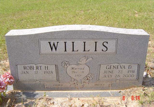
| Robert H. & Geneva D. Willis | Image | Jim & Jeanie Sellers | |
| John C. Willis | Image | Jim & Jeanie Sellers | |
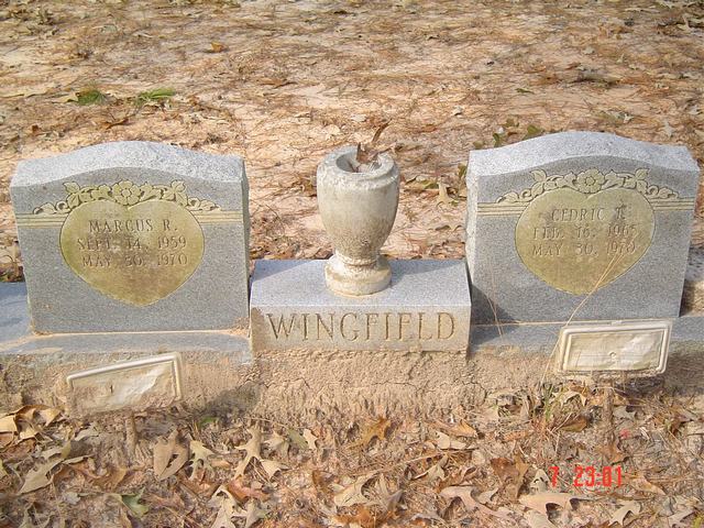
| Marcus R. & Cedric T. Wingfield | Image | Jim & Jeanie Sellers | |
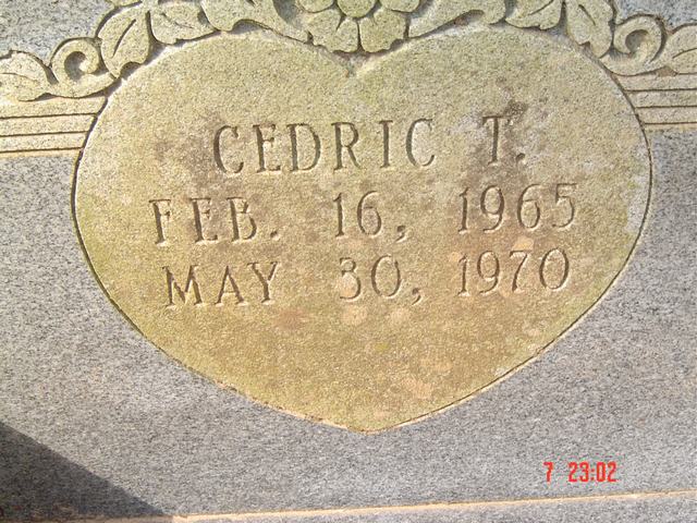
| Cedric T. Wingfield | Image | Jim & Jeanie Sellers | |
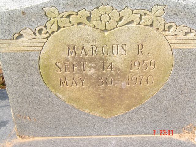
| Marcus R. Wingfield | Image | Jim & Jeanie Sellers | |
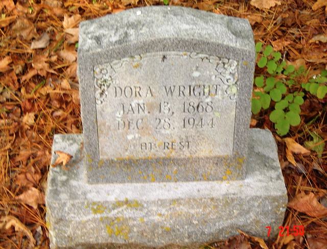
| Dora Wright | Image | Jim & Jeanie Sellers | |
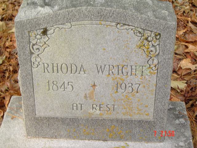
| Rhoda Wright | Image | Jim & Jeanie Sellers | |
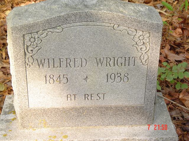
| Wilfred Wright | Image | Jim & Jeanie Sellers | |
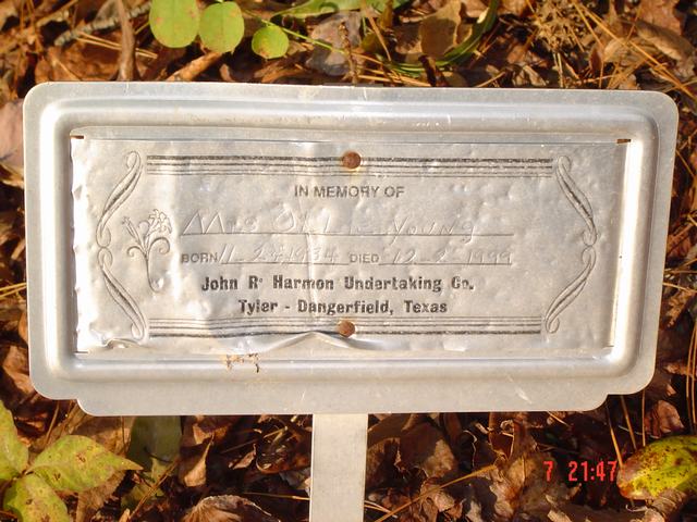
| Mrs. Ollie Young | Image | Jim & Jeanie Sellers |