

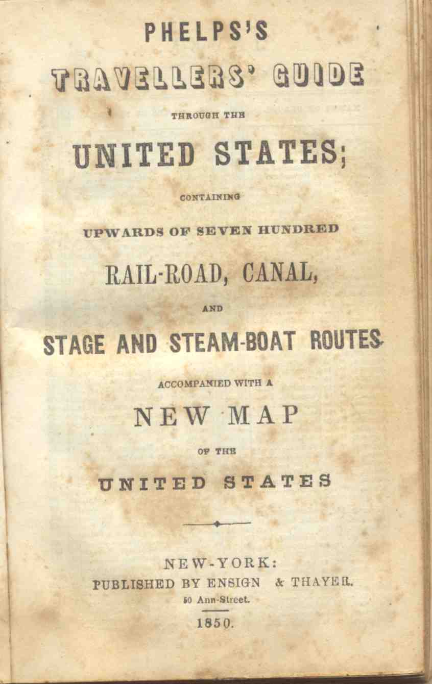
Railroad, Canal, Stage and Steam-Boat Routes,
Accompanied by a new map of the United States
Published in New York by Ensign & Thayer, 1850
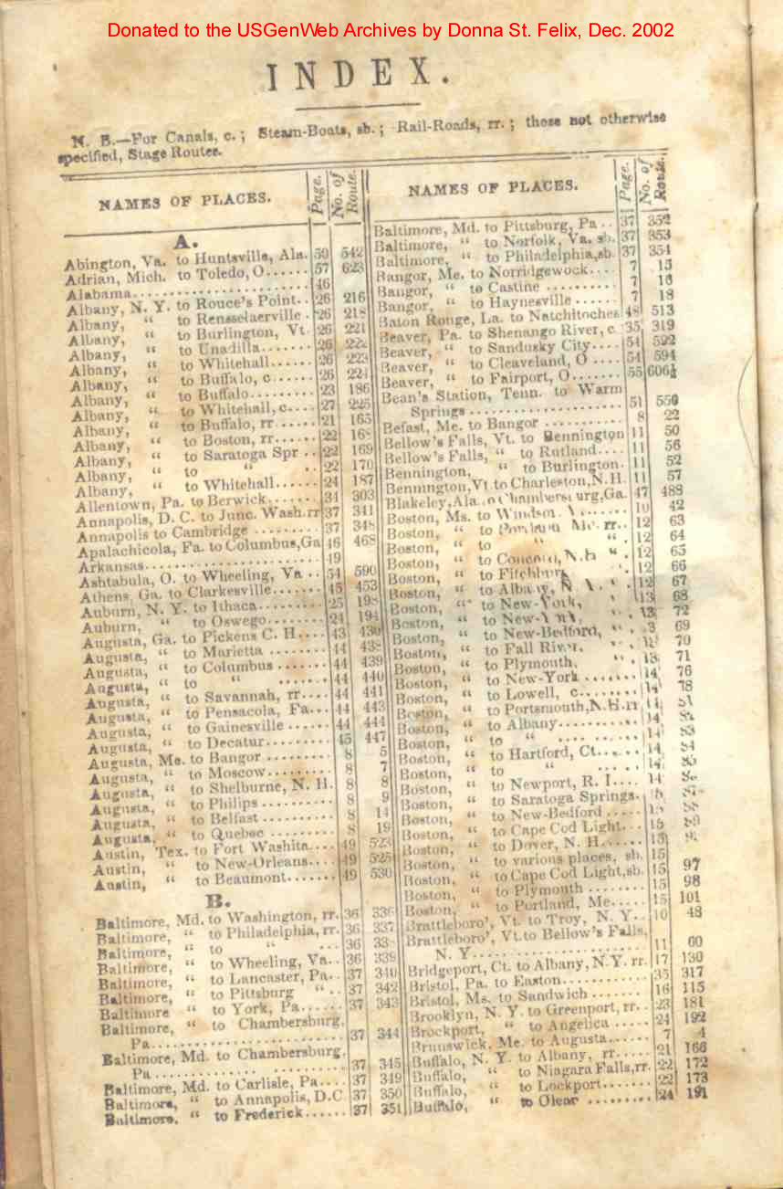
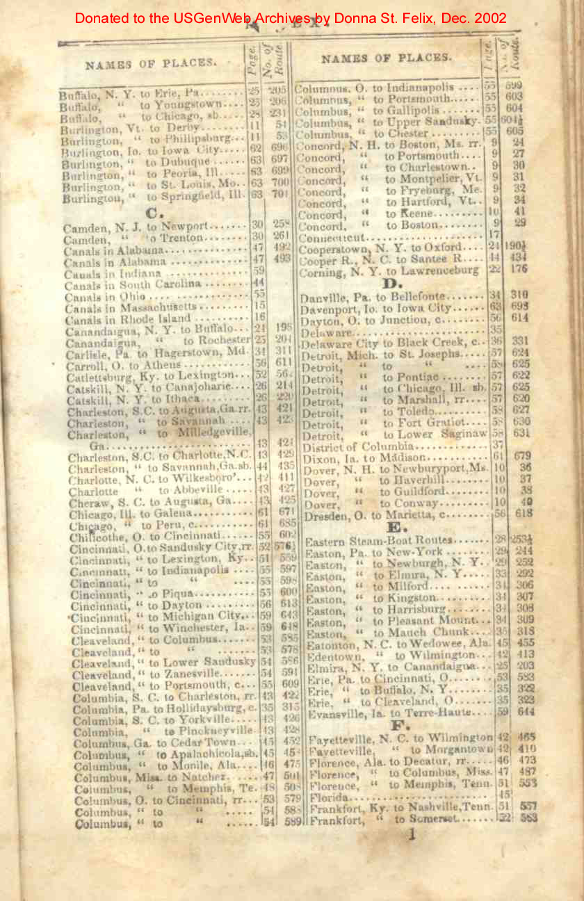
Contributed to the USGenWeb Archives by Donna St. Felix
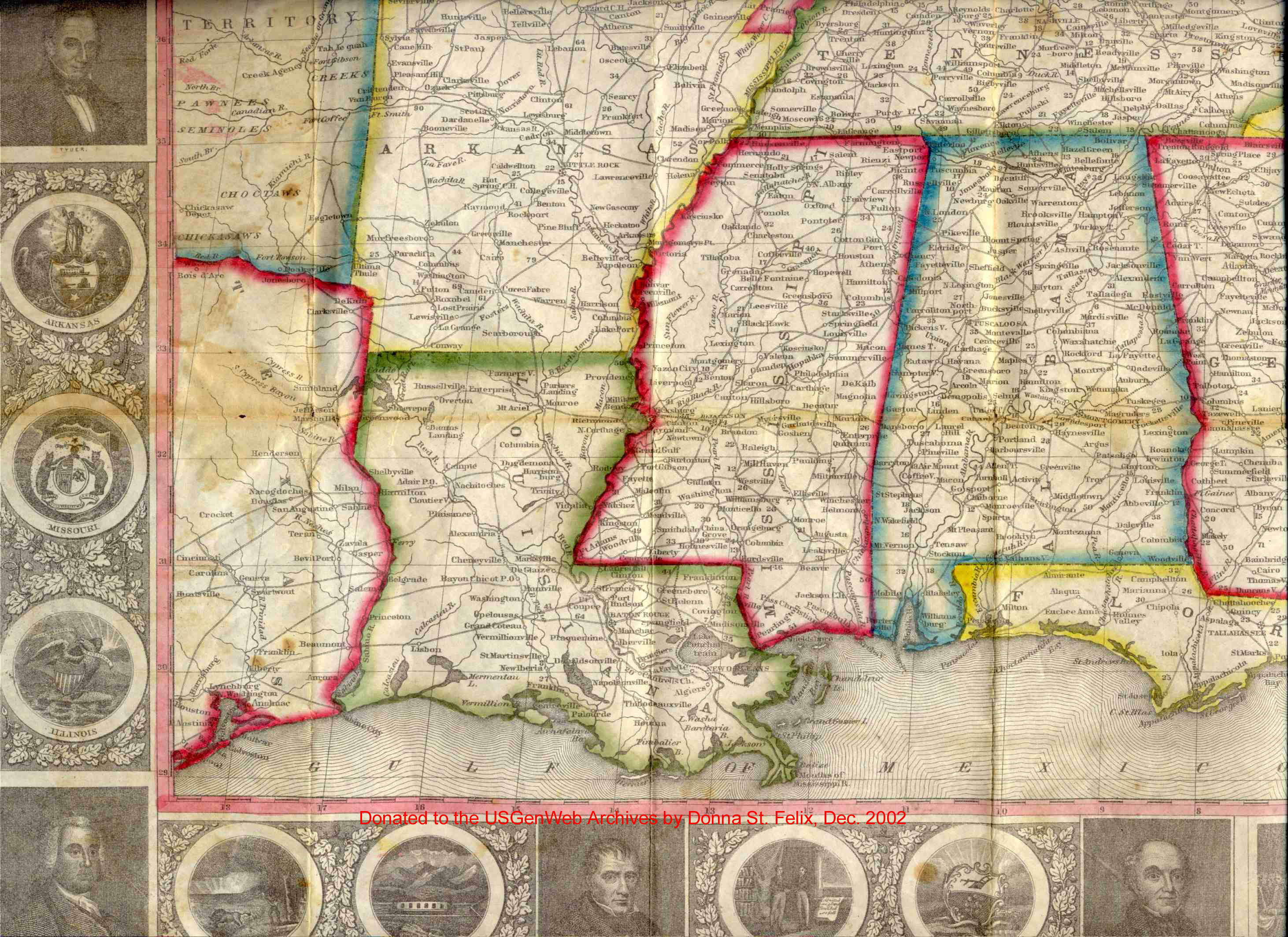
This book is 70 pages, and lists routes between cities, mode of travel, and the number of miles to the destinations. I've scanned the index pages, as well as the maps (broken down into 9 files) so they can be referred to. If more than one state is on a page, I've split the file into sections (top and bottom, a & b) so they can be divided by states. Page numbers referred to in the index match the jpg file names.
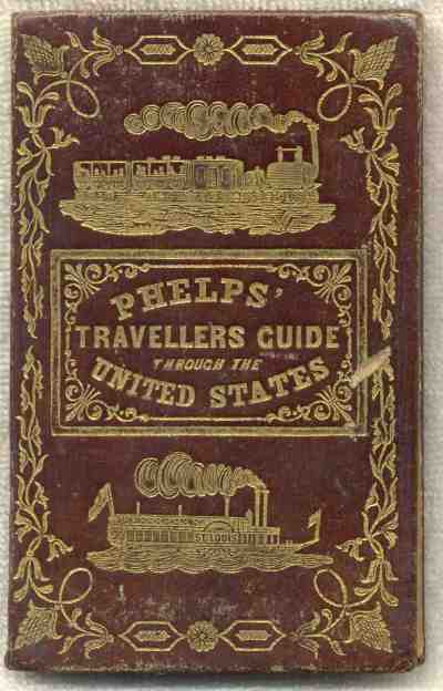
| Cover | cover |
| Title Page | title |
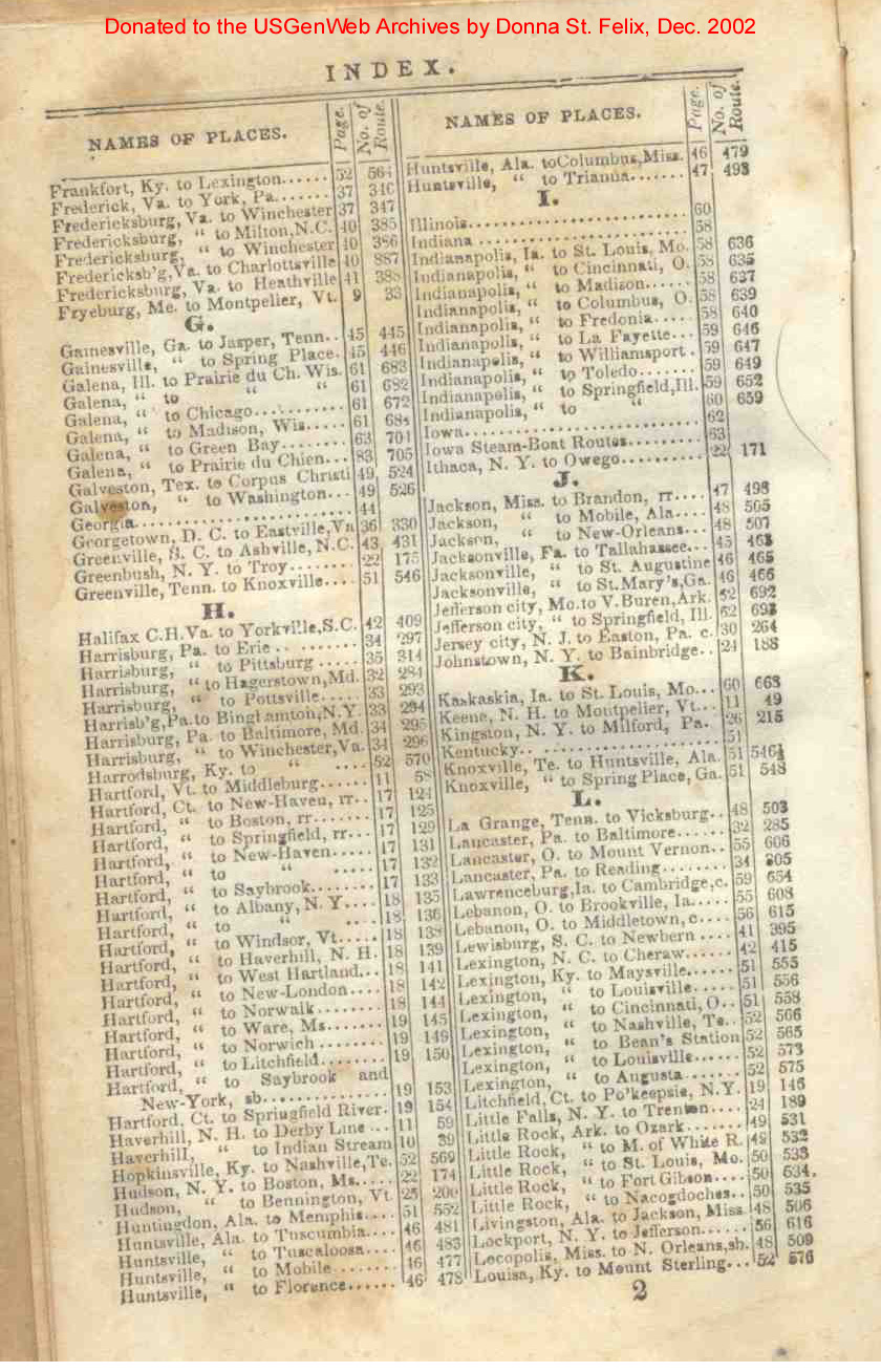
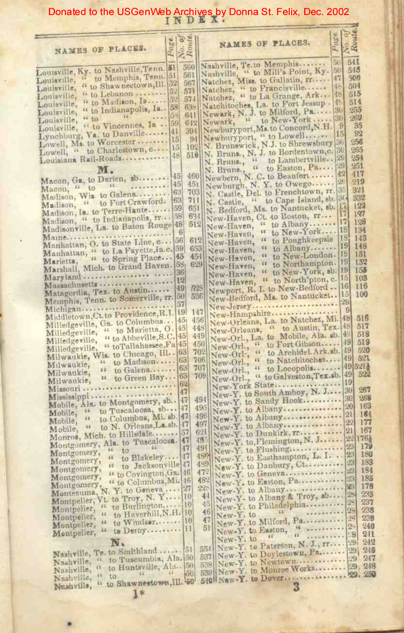
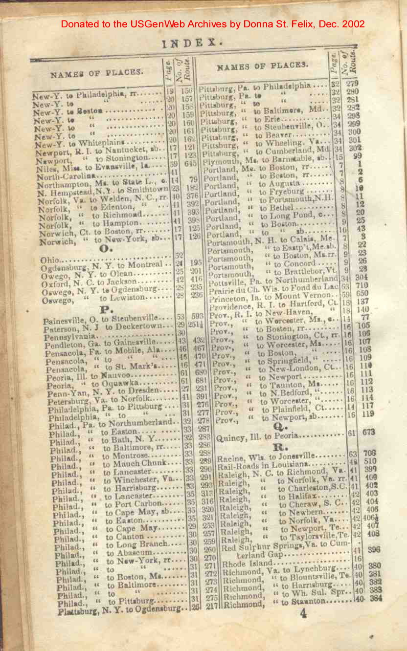
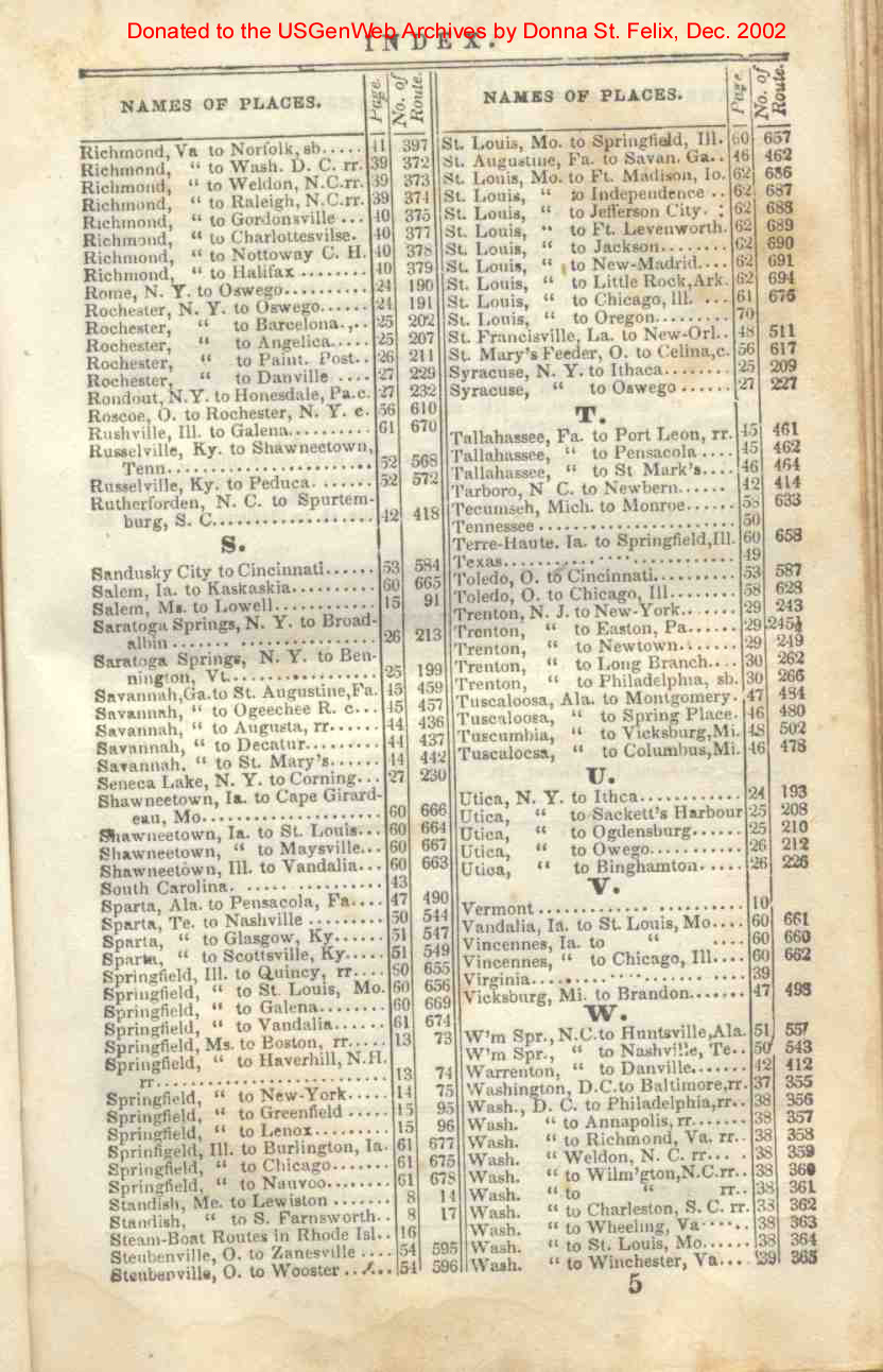
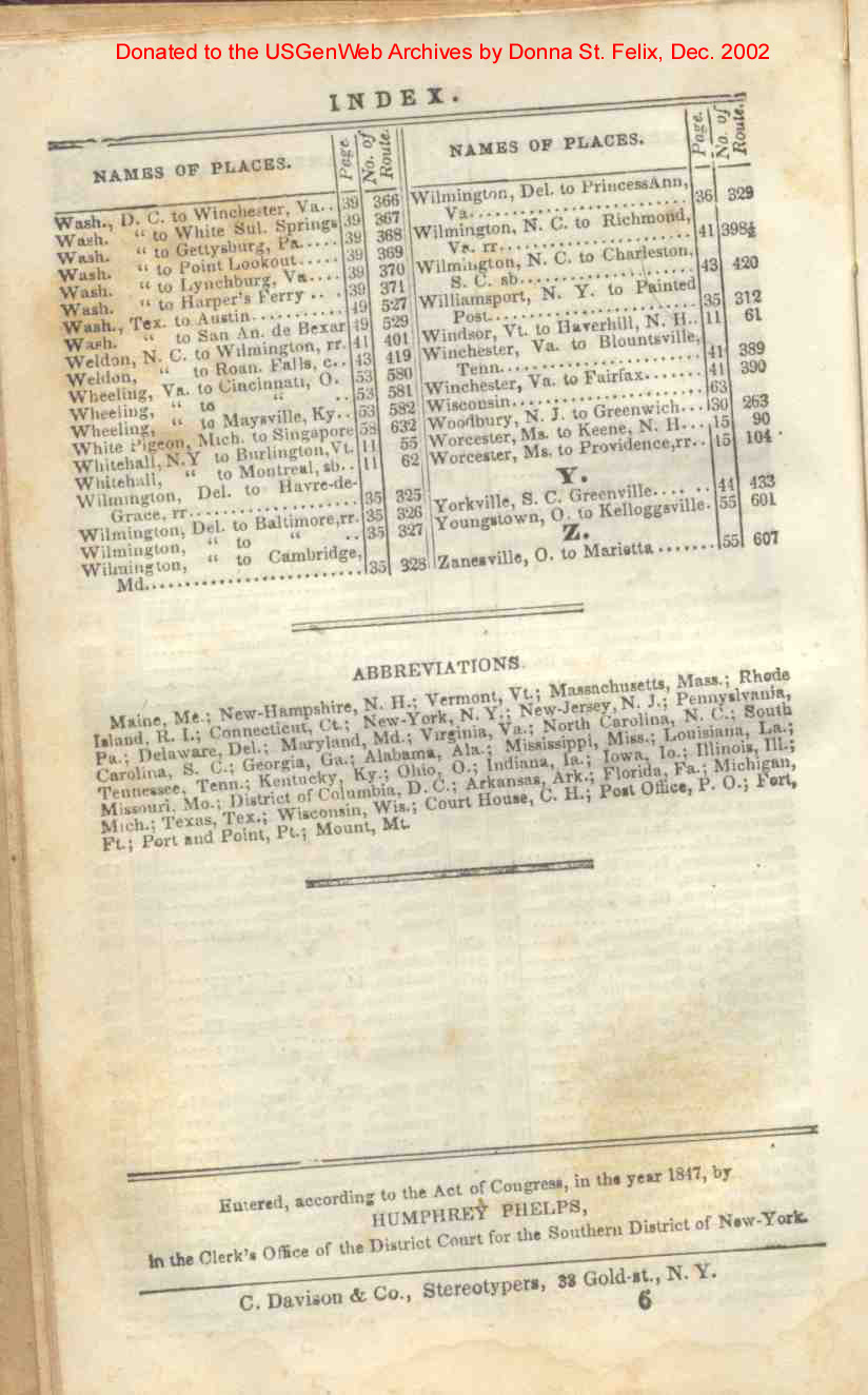
| Index | 1a, 1b, 2, 3 4, 5, 6 |
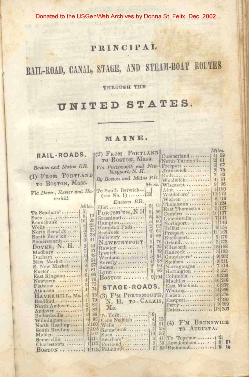
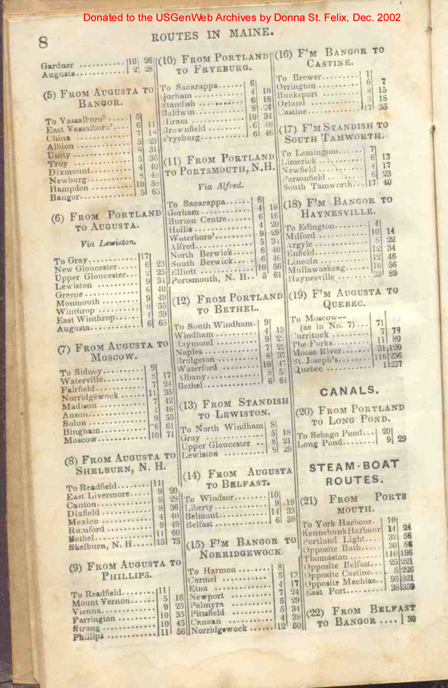
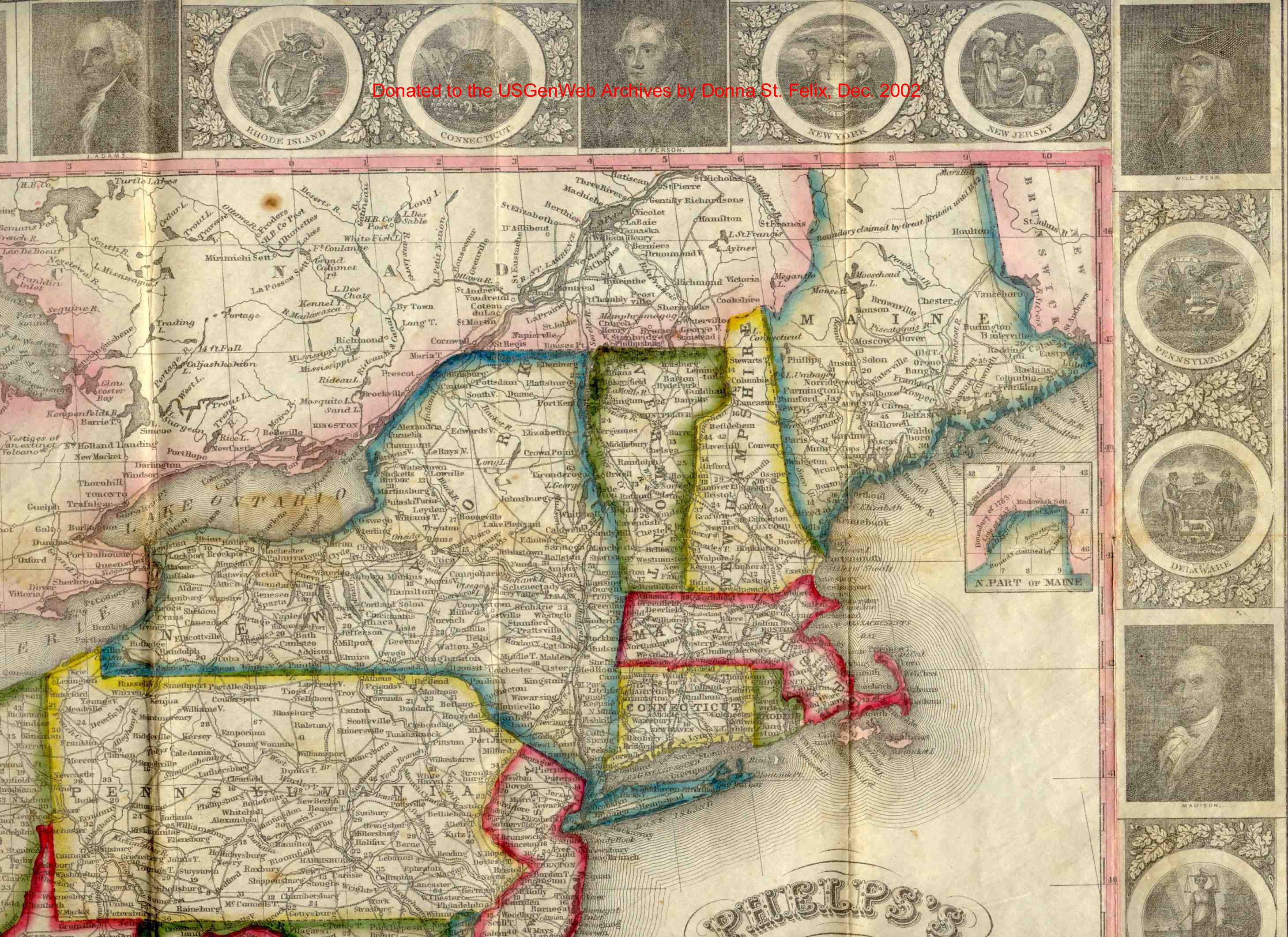
| Maine | 7, 8 |
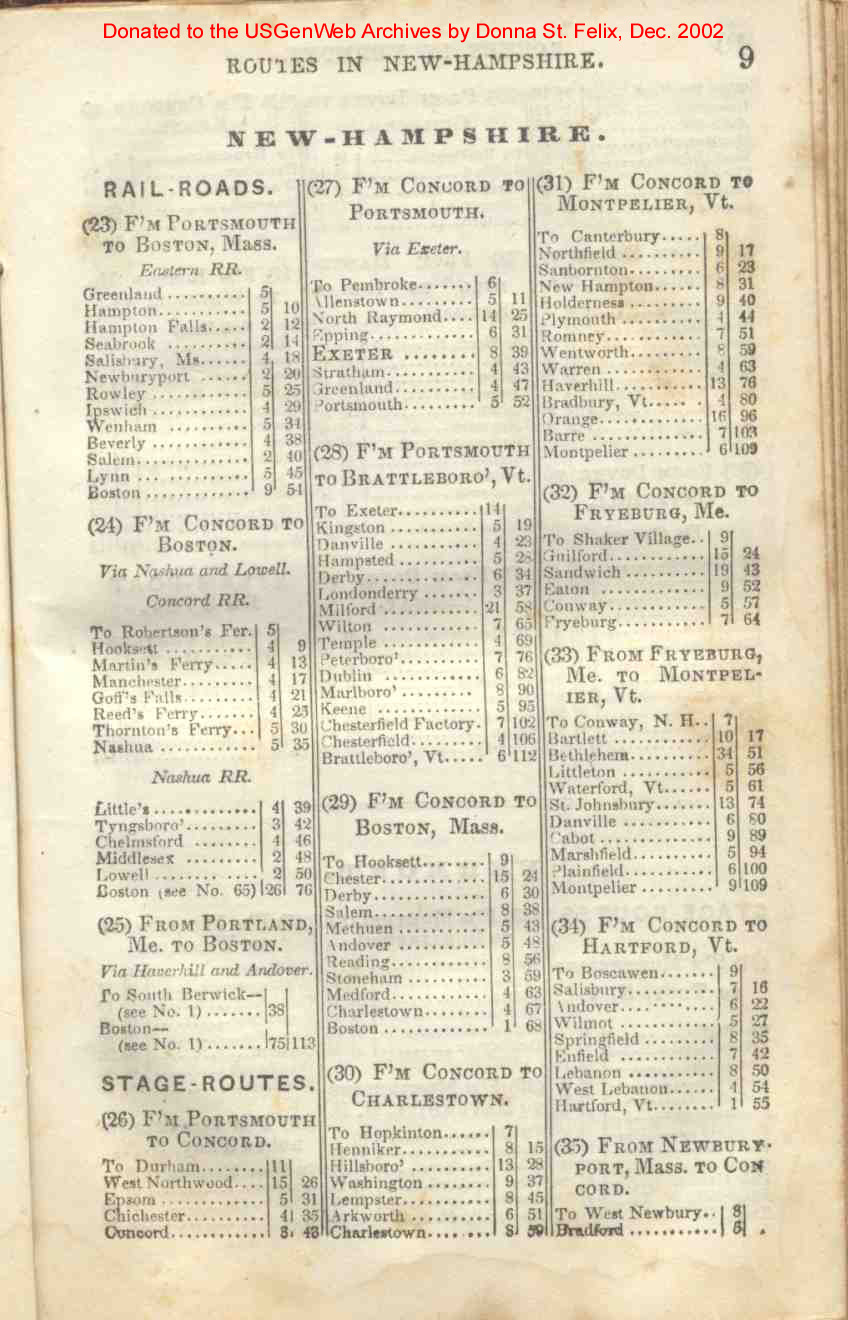
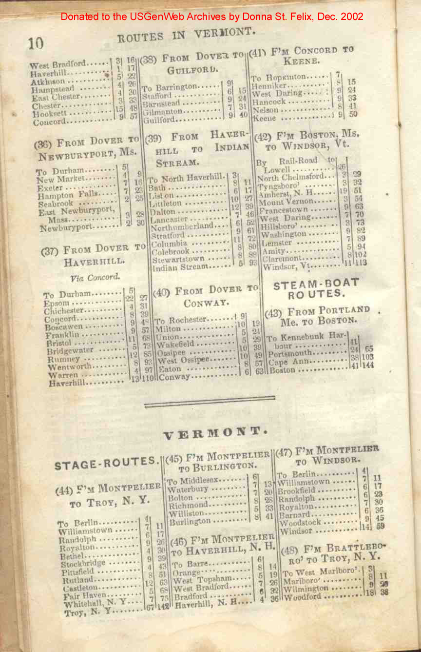
| New-Hampshire | 9, 10 |
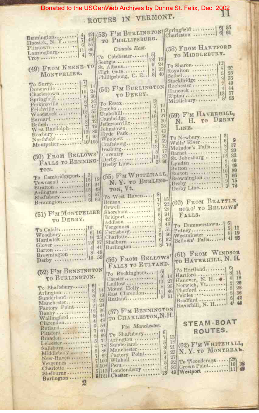
| Vermont | 10, 11, 12 |
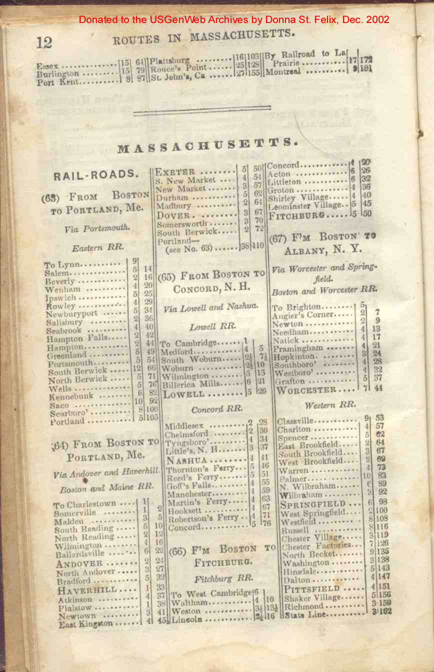
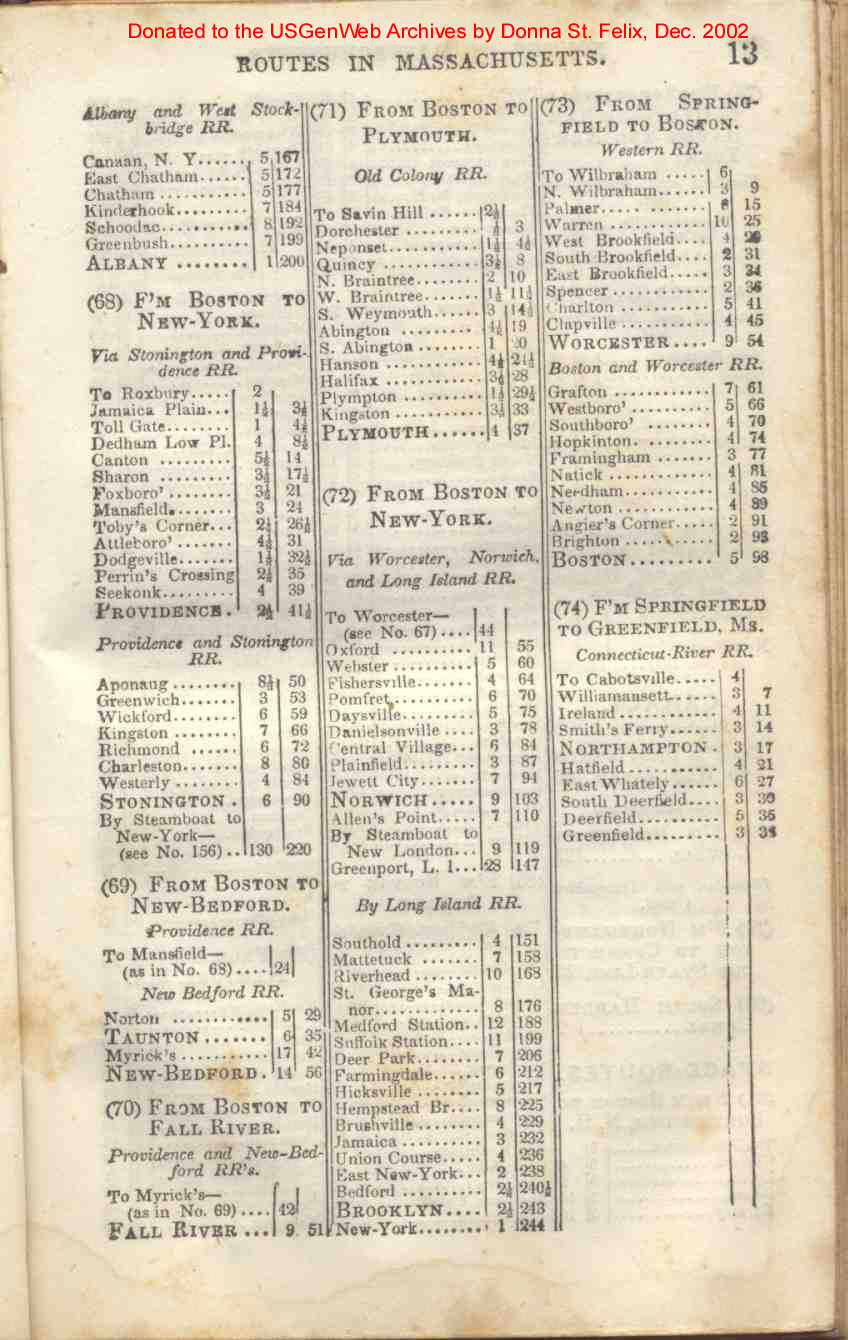
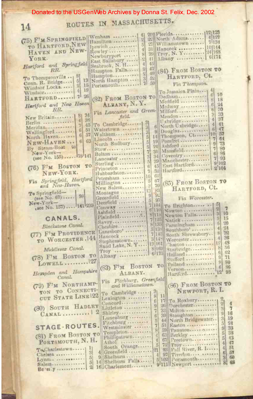
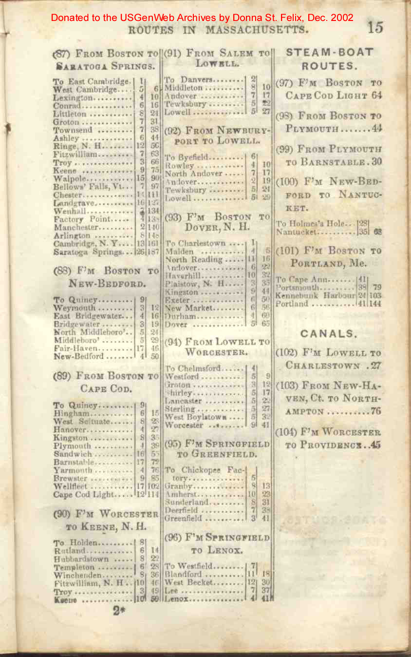
| Massachusetts | 12, 13, 14, 15 |
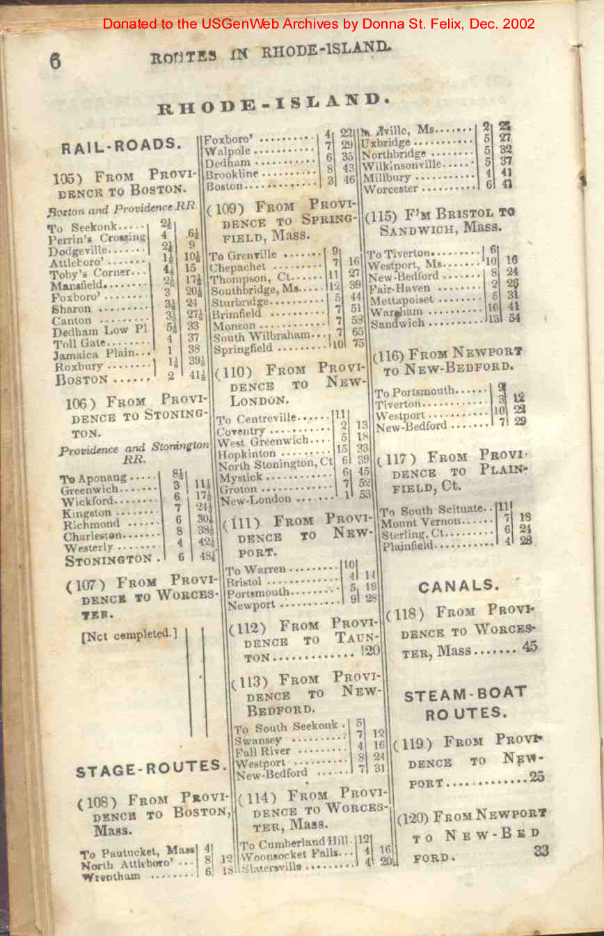
| Rhode Island | 16, 17 |
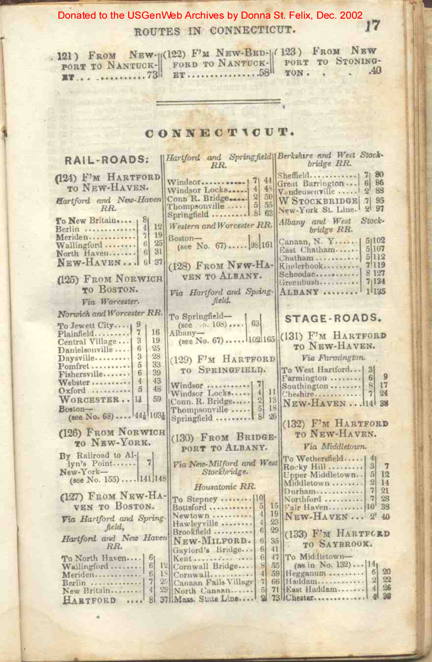
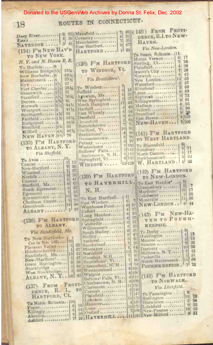
| Connecticut | 17, 18, 19 |
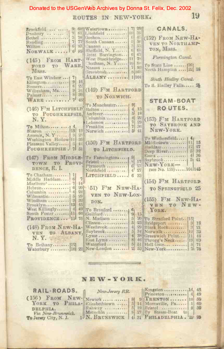
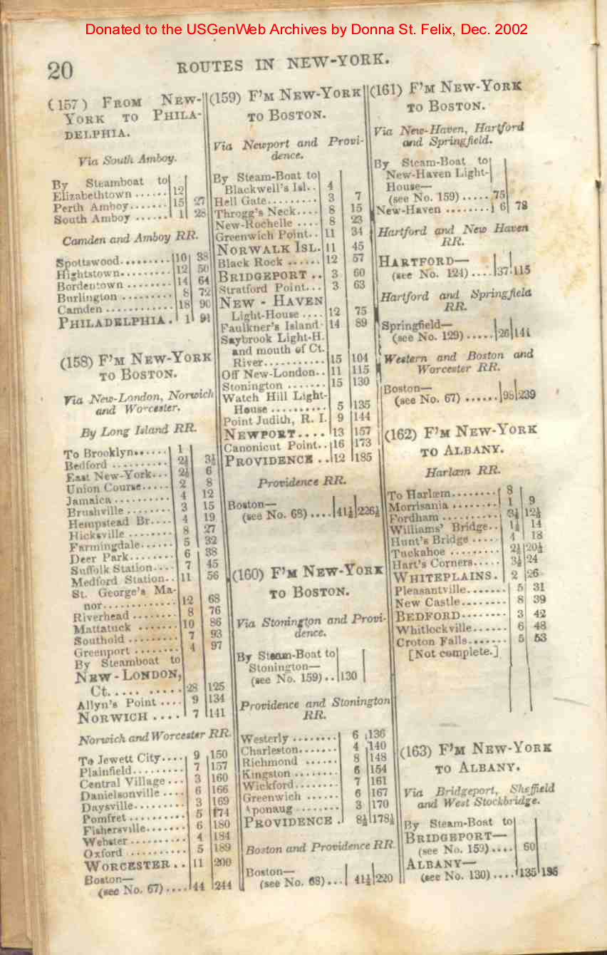
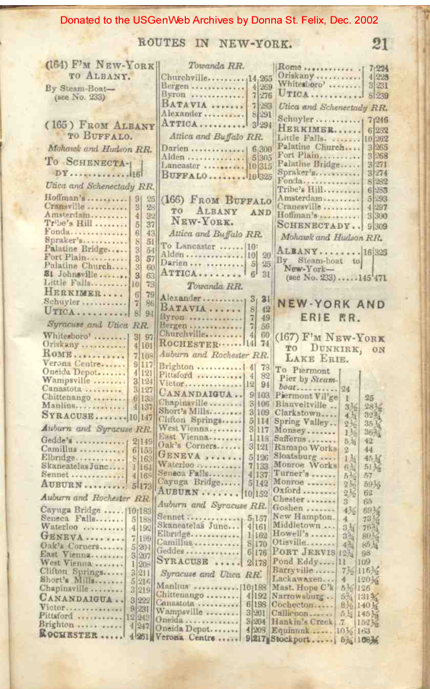
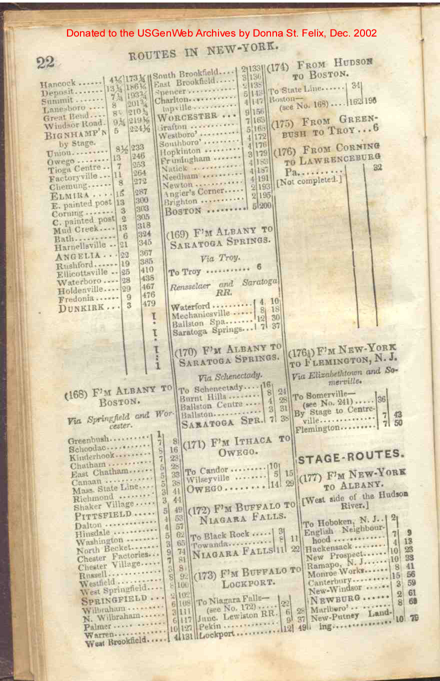
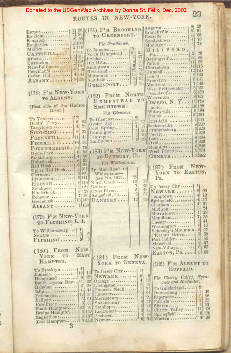
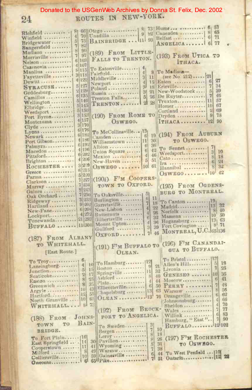
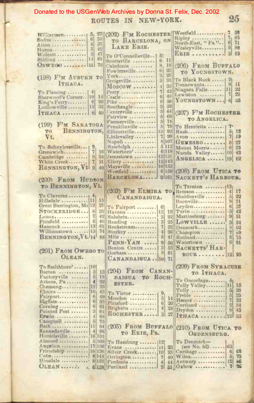
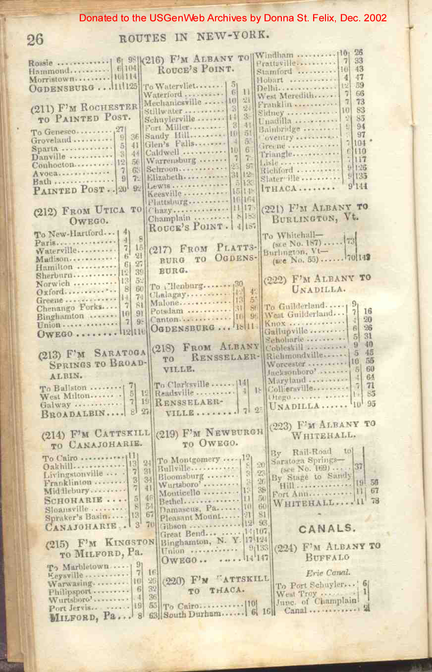
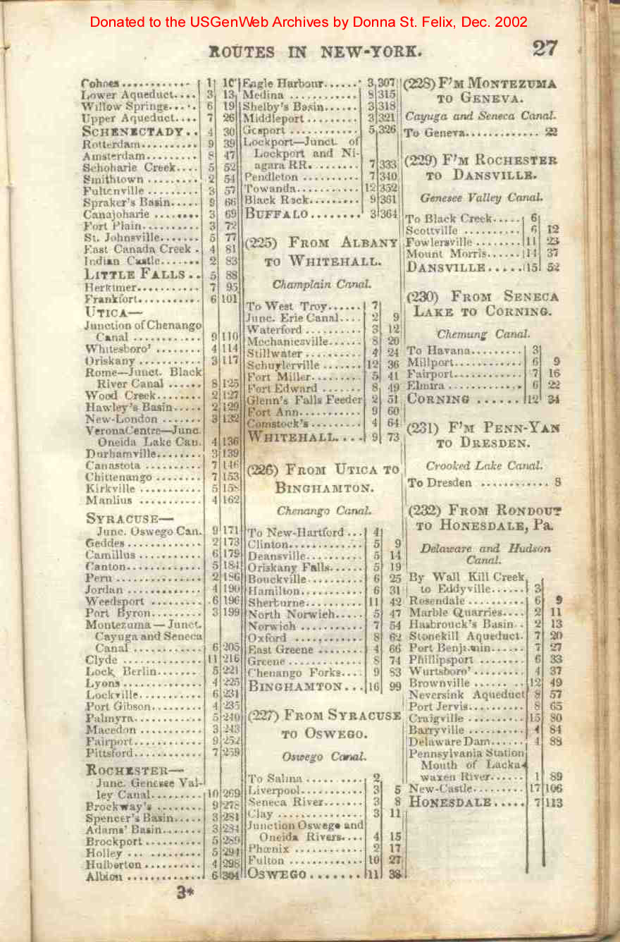
| New York | 19, 20, 21, 22, 23, 24, 25, 26, 27, 28 |
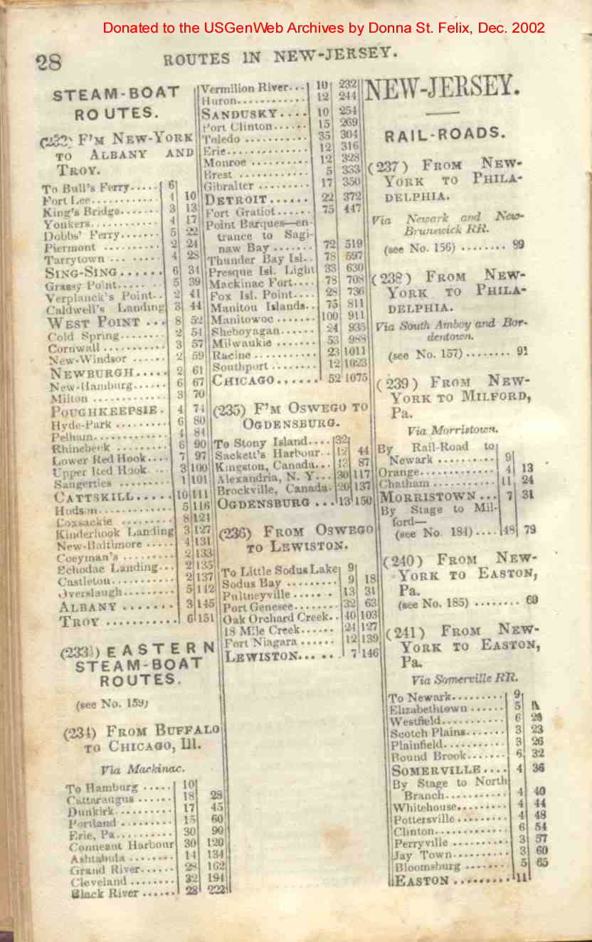
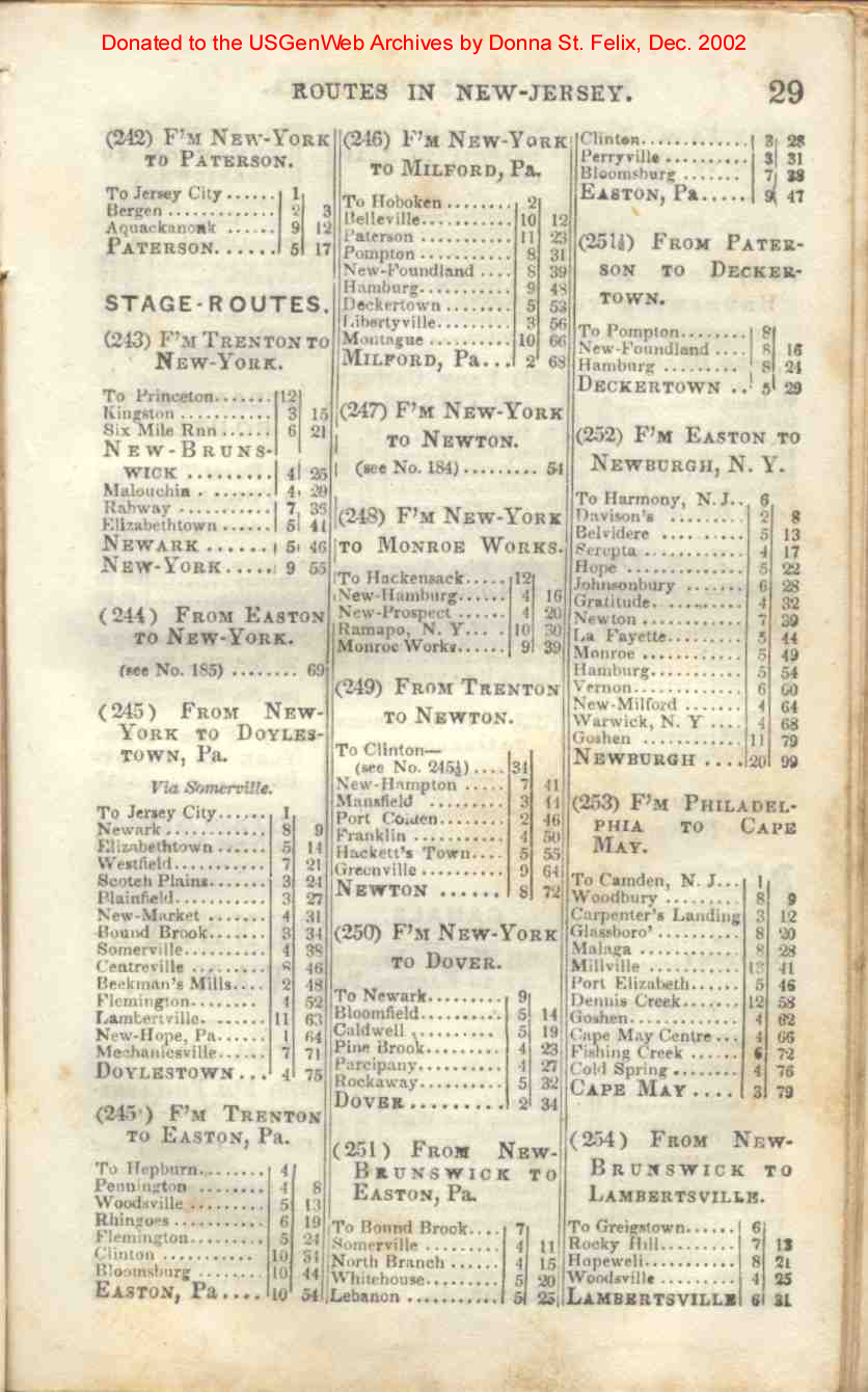
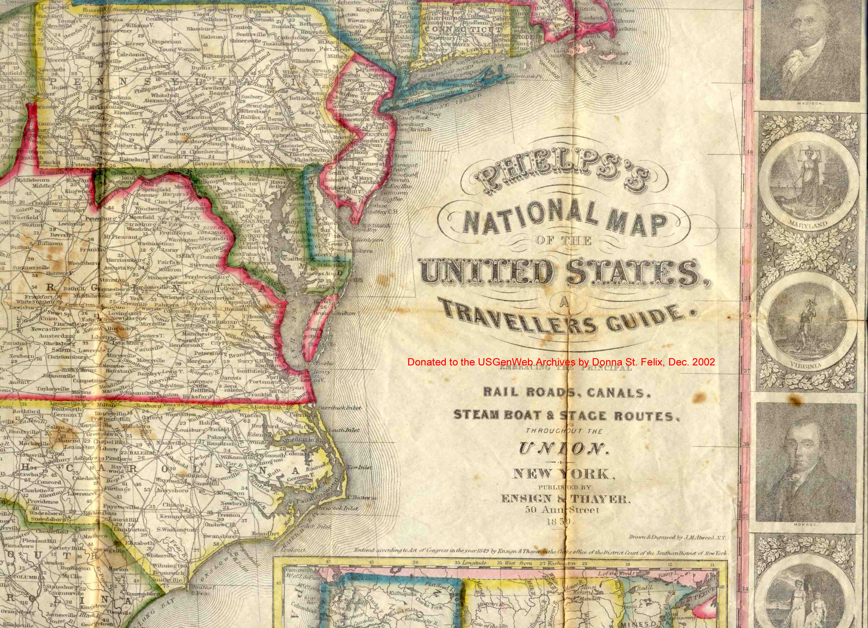
| New Jersey | 28, 29, 30 |
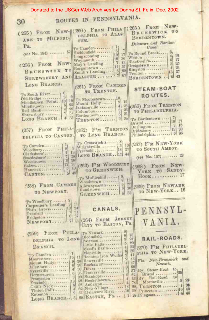
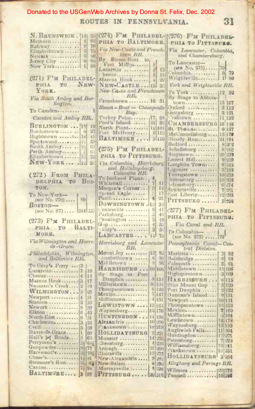
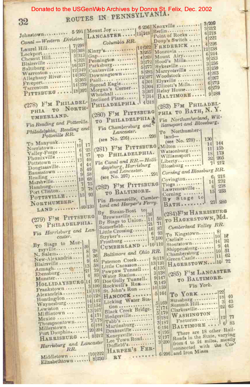
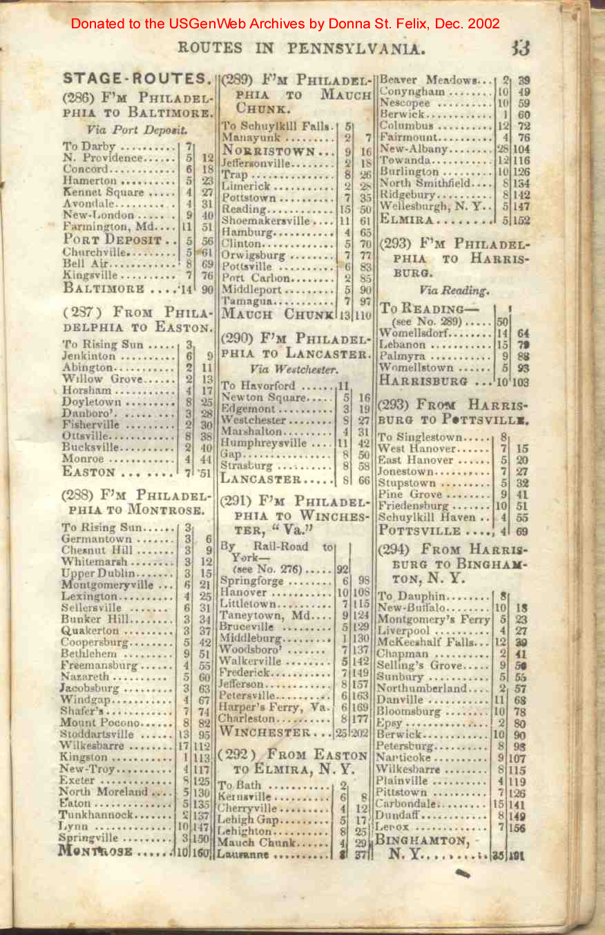
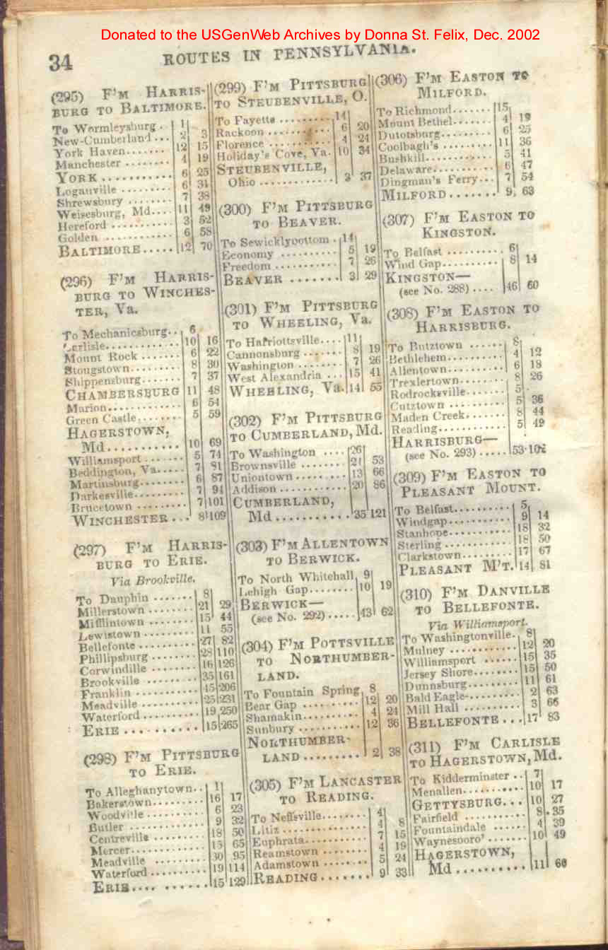
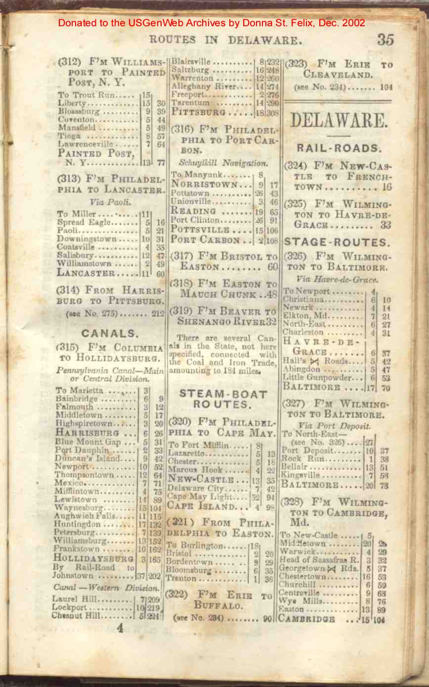
| Pennsylvania | 30, 31, 32, 33, 34, 35 |
| Delaware | 35, 36 |
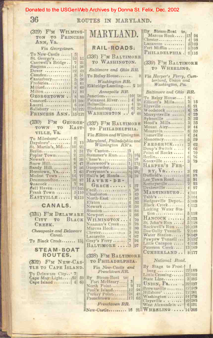
| Maryland | 36, 37 |
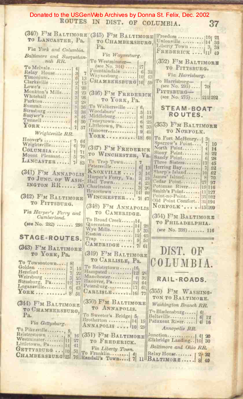
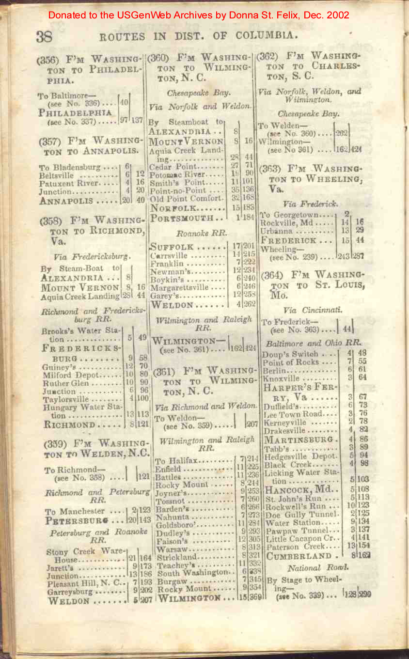
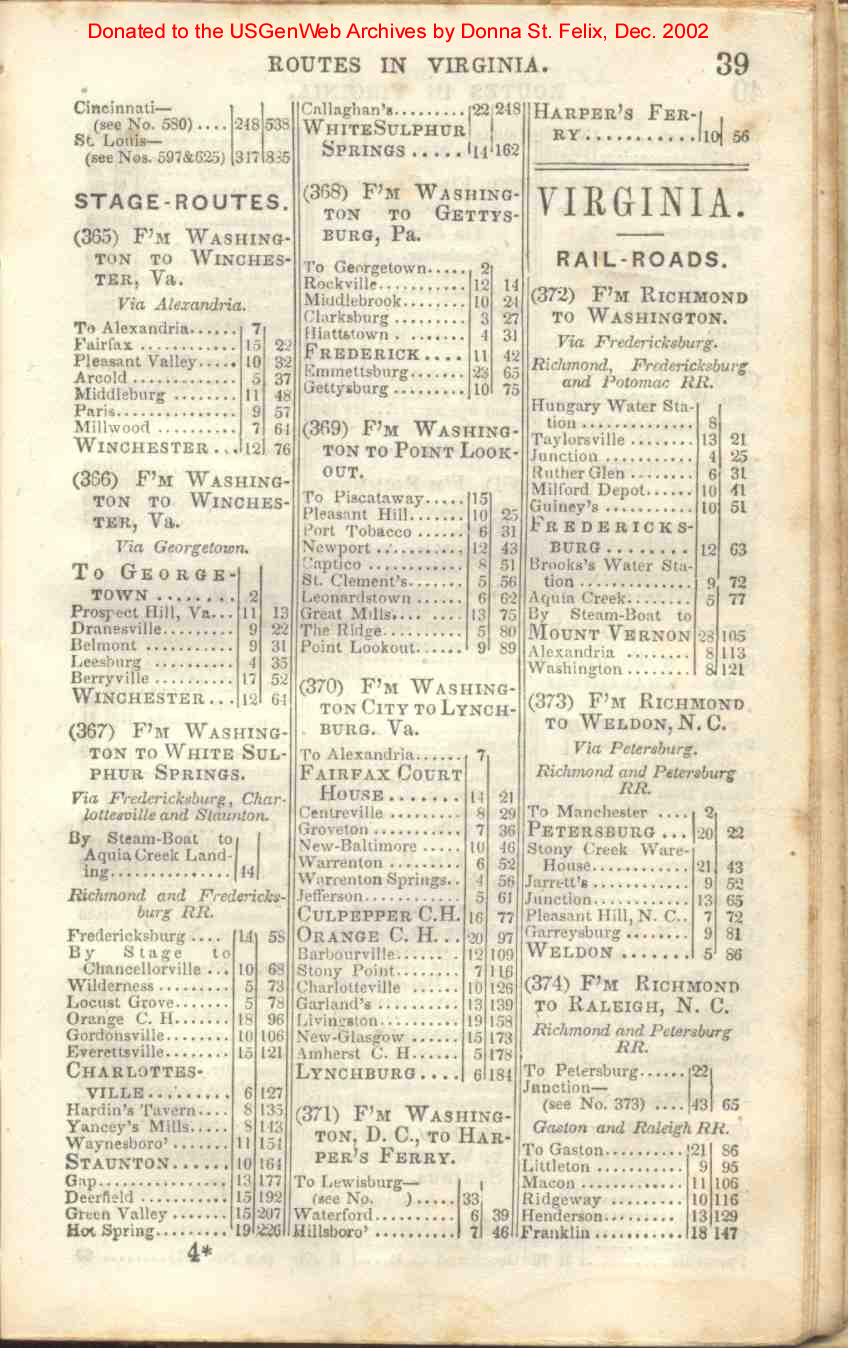
| District of Columbia | 37, 38, 39 |
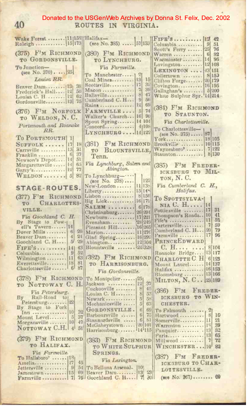
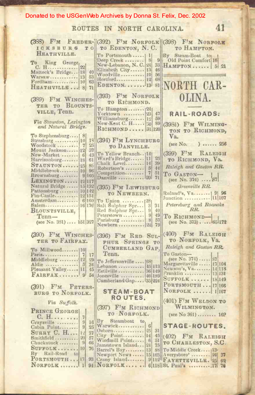
| Virginia | 39, 40, 41 |
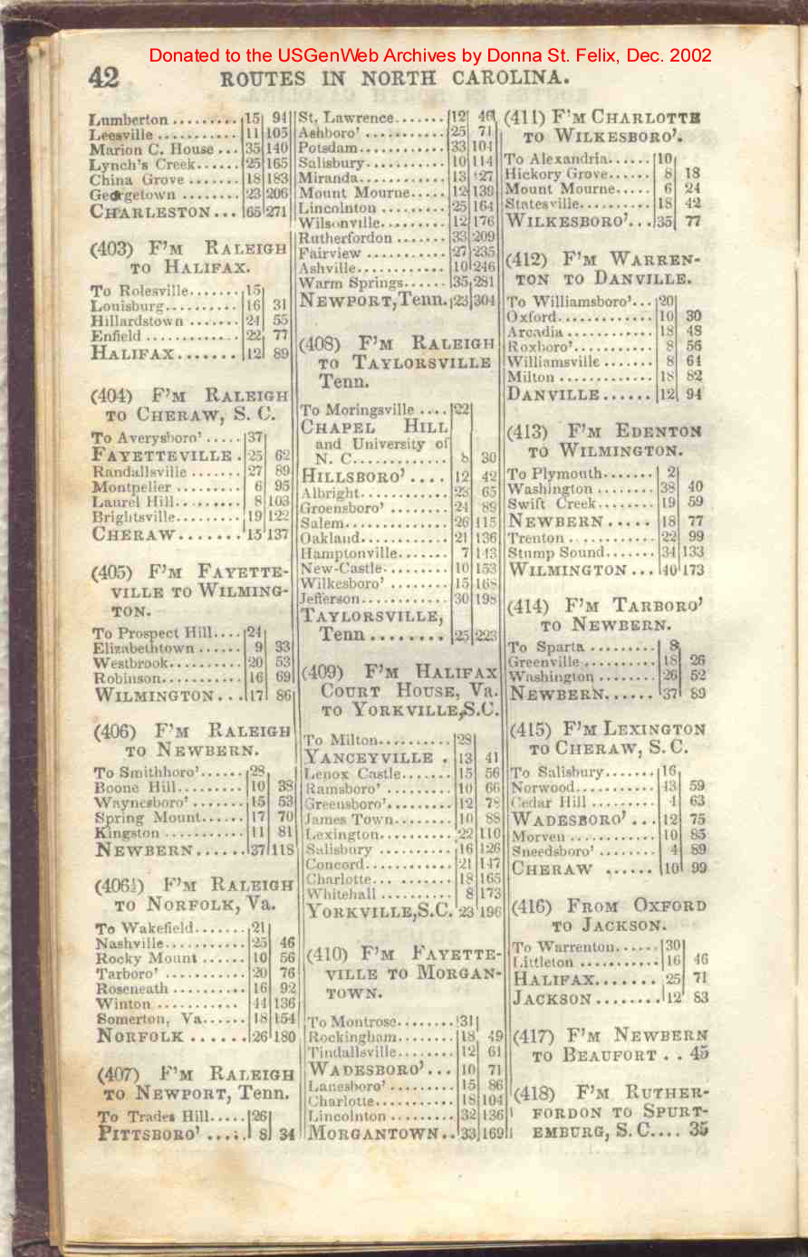
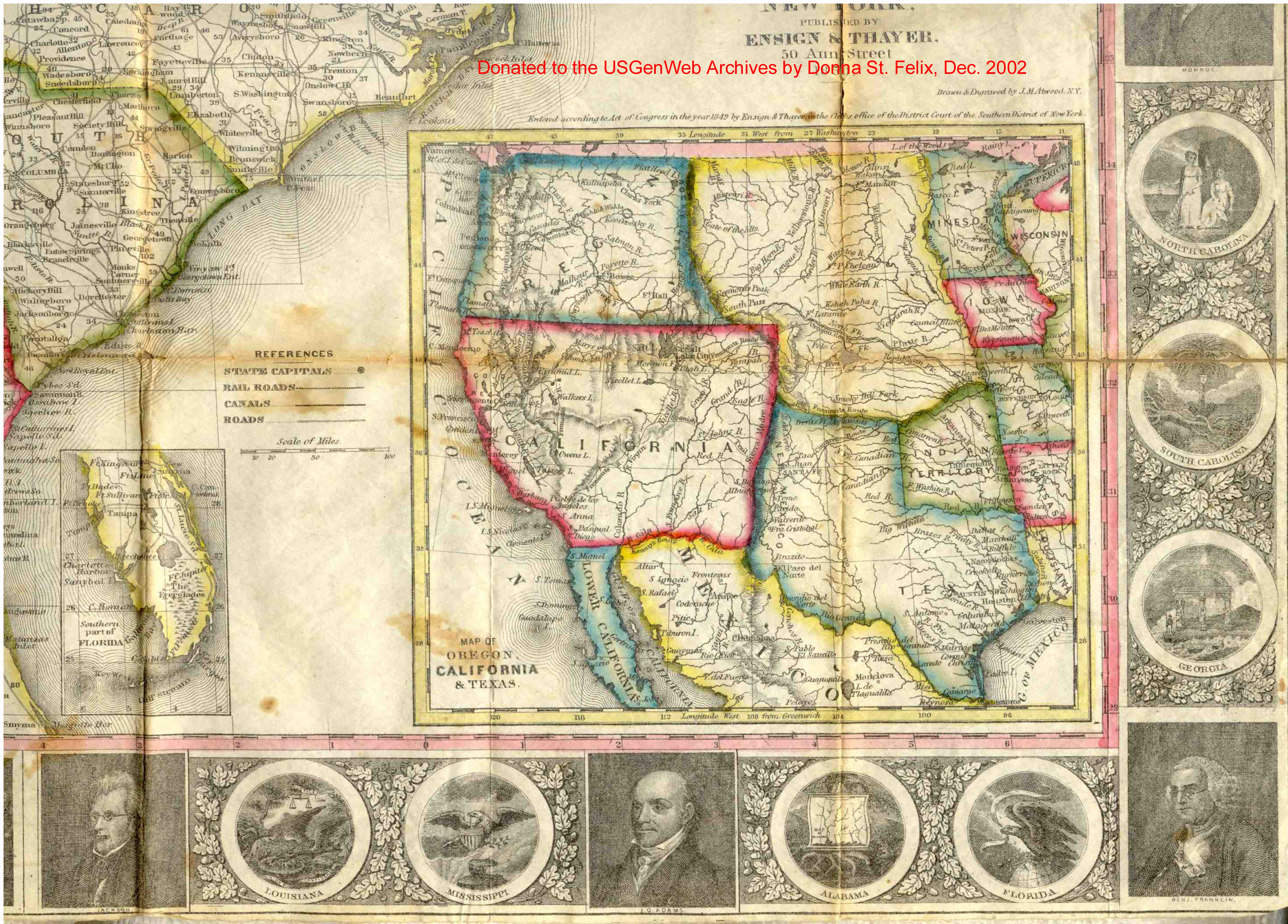
| North Carolina | 41, 42, 43 |
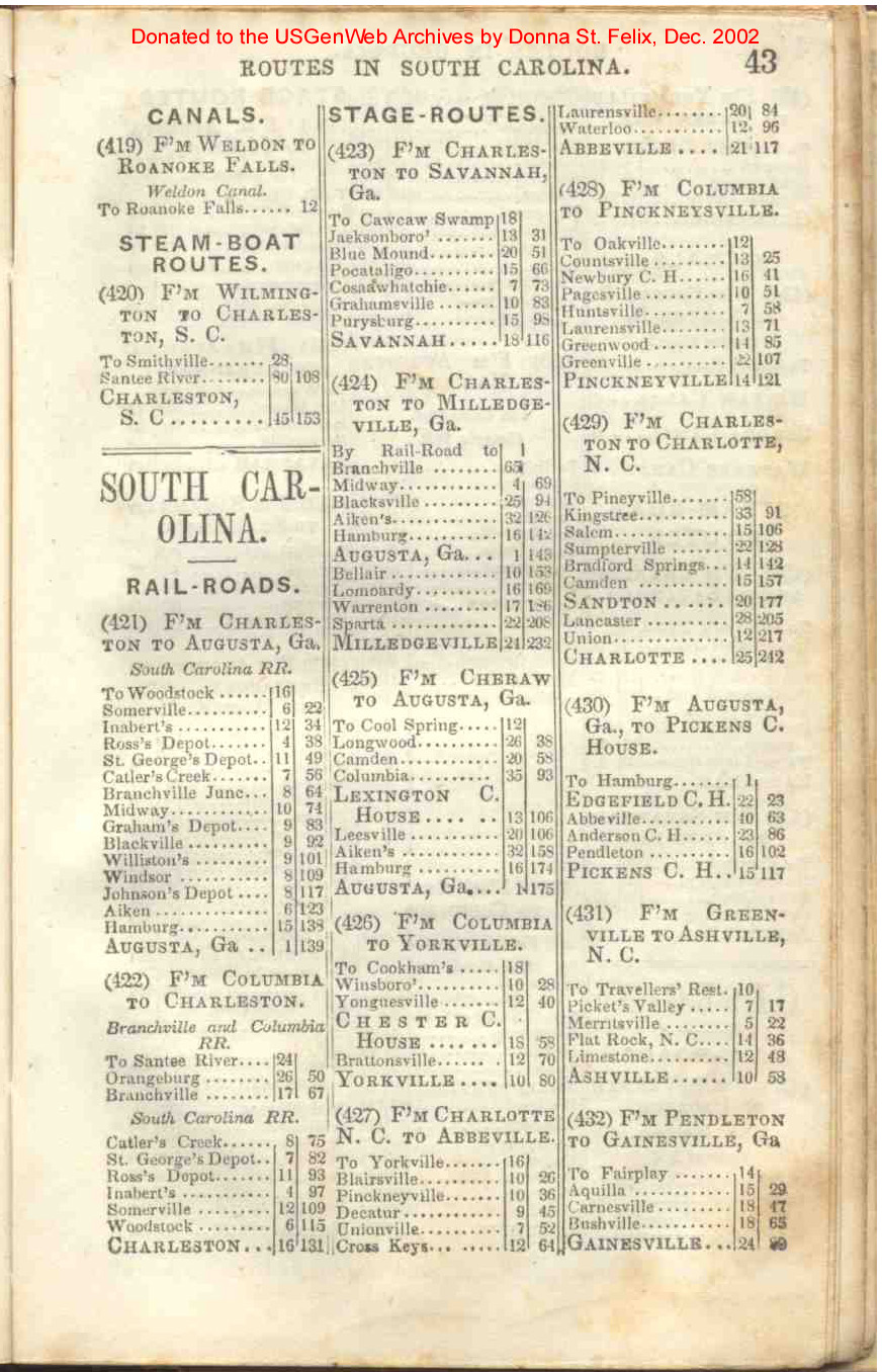
| South Carolina | 43, 44 |
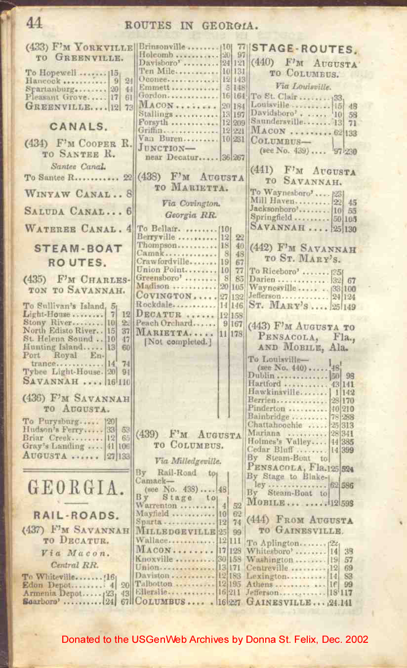
| Georgia | 44, 45 |
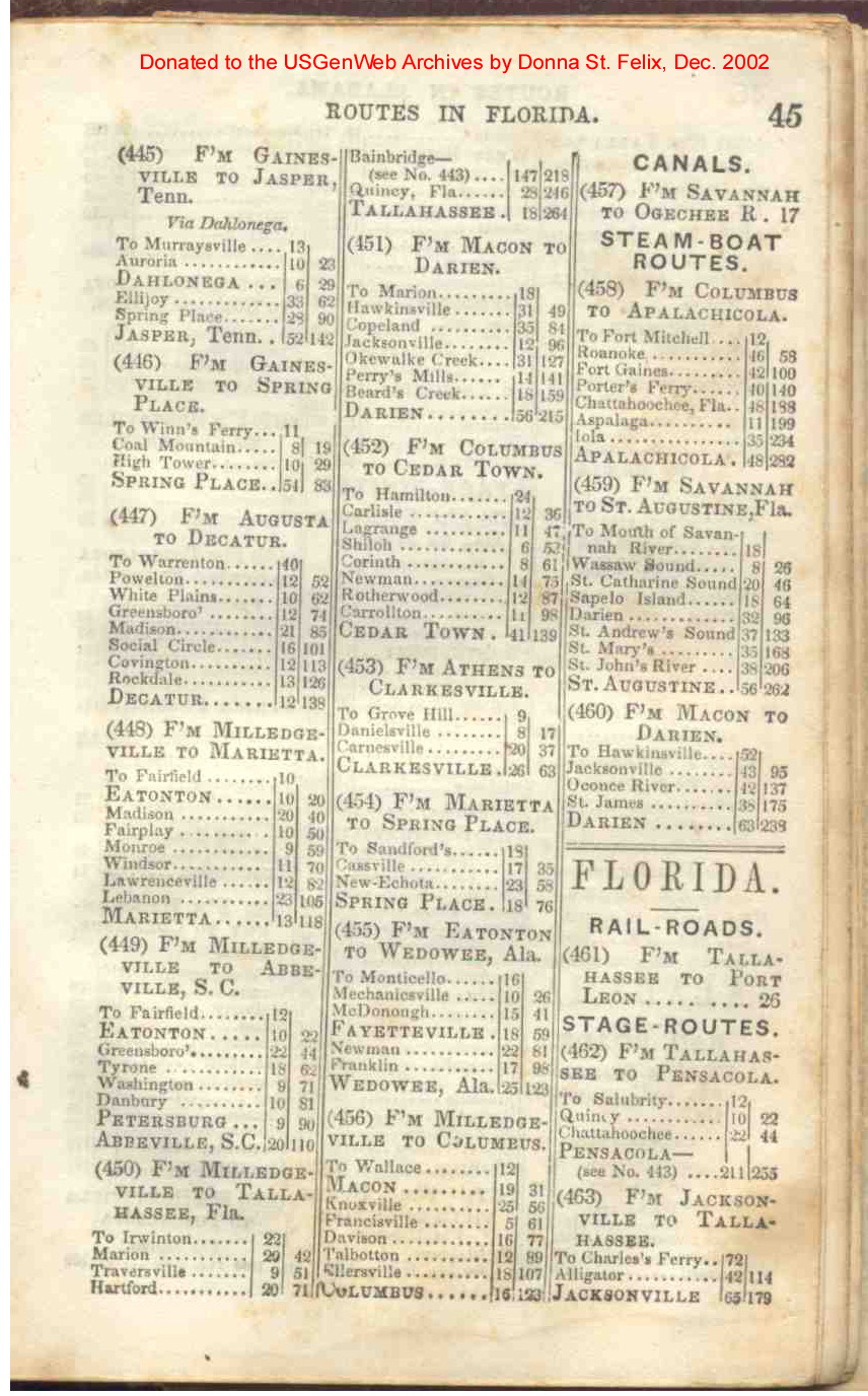
| Florida | 45, 46 |
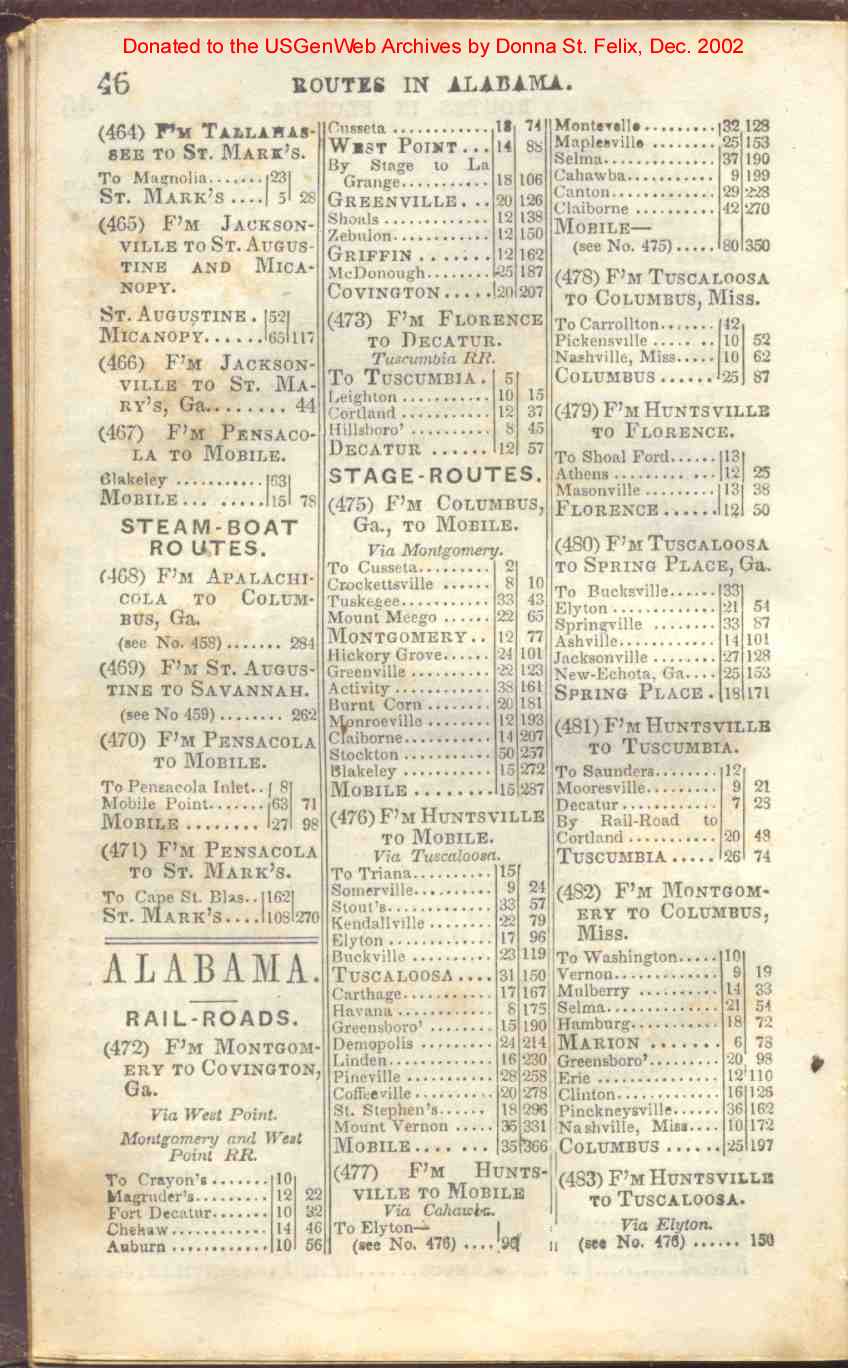
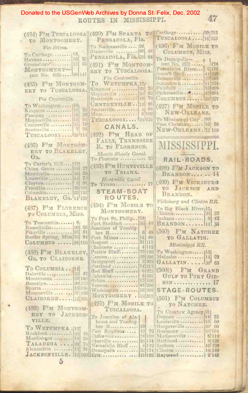
| Alabama | 46, 47 |
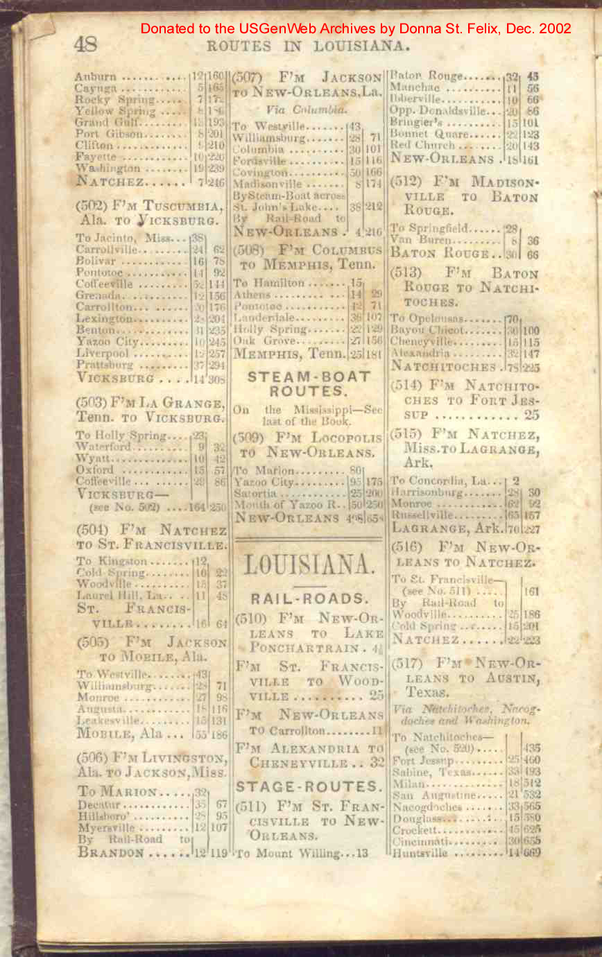
| Mississippi | 47, 48 |
| Louisana | 48, 49 |
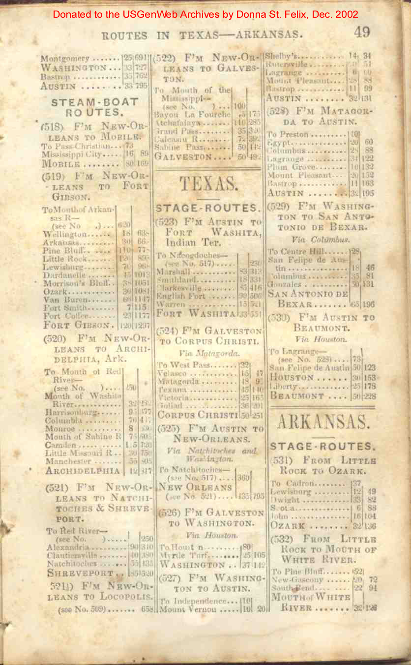
| Texas | 49 |
| Arkansas | 49, 50 |
| Indian Territories | 49, 50 |
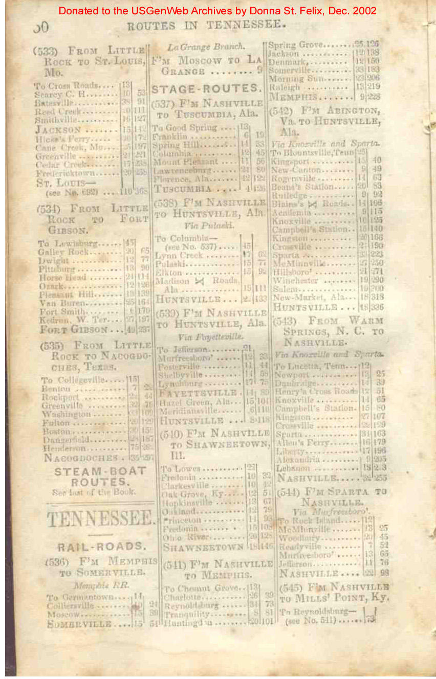
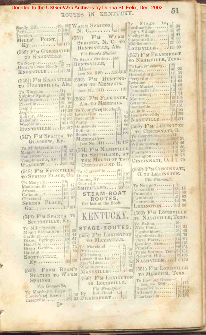
| Tennessee | 50, 51 |
| Kentucky | 51, 52 |
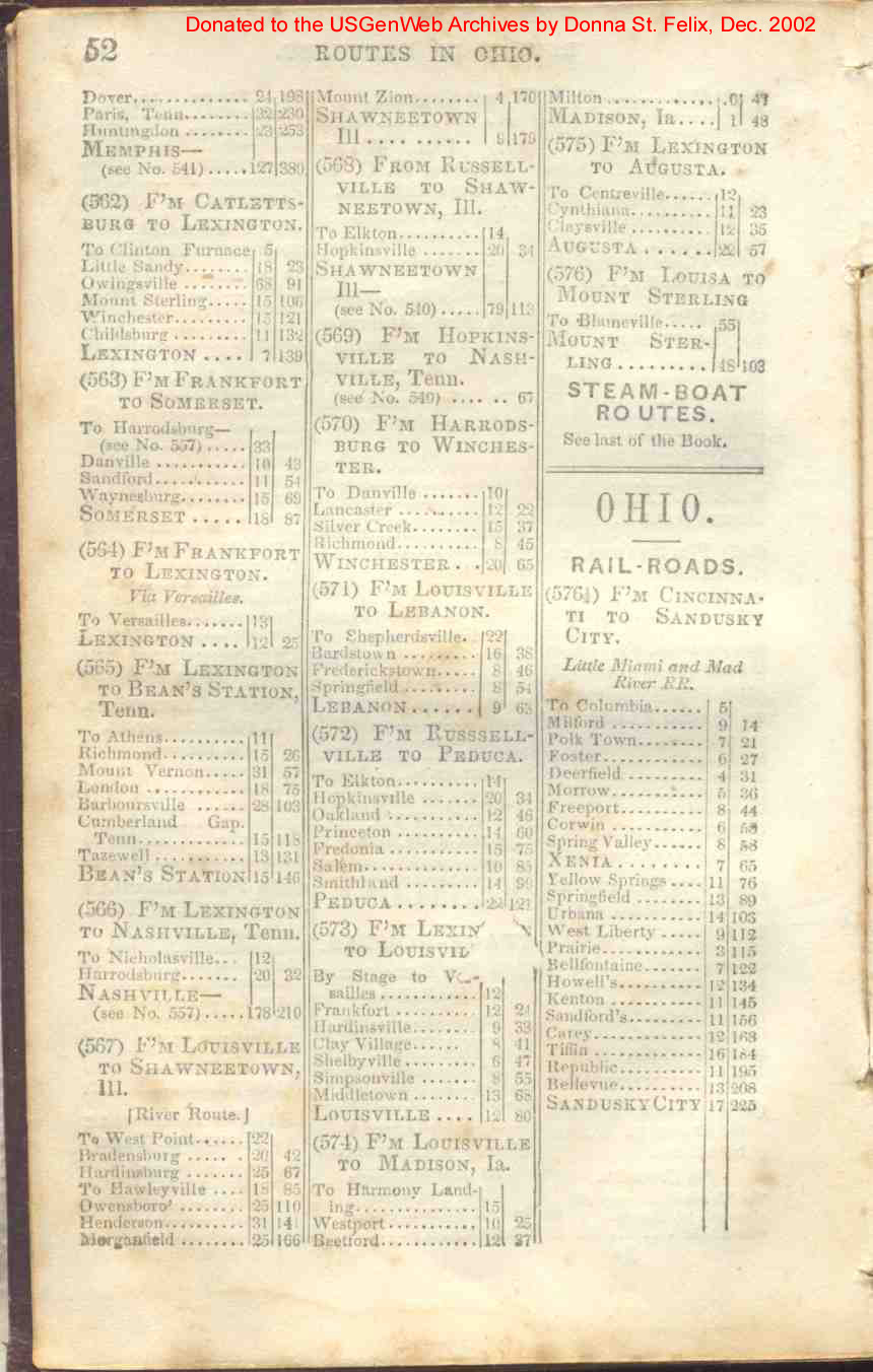
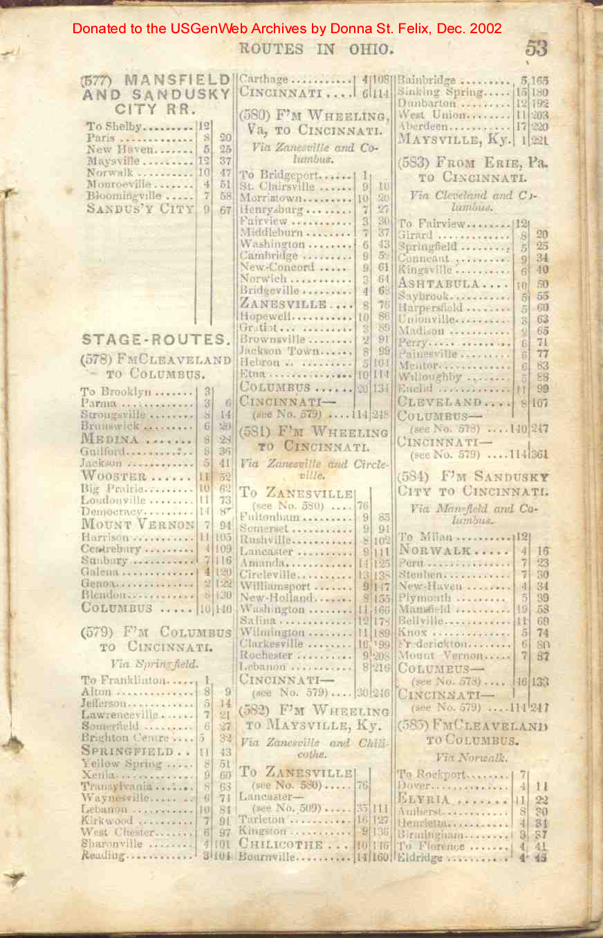
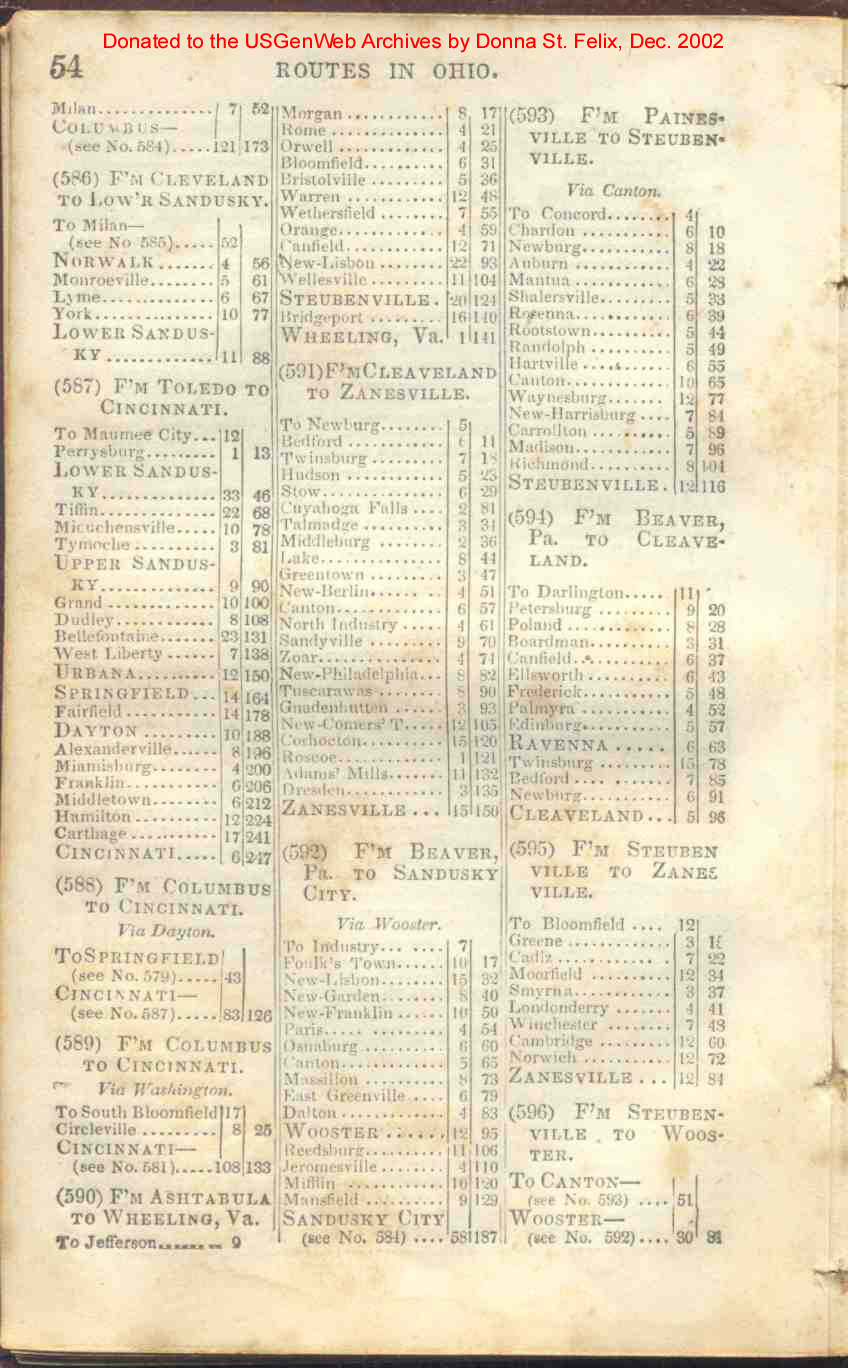
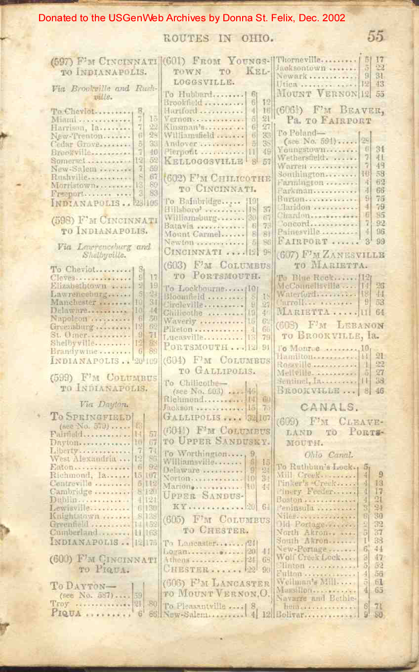
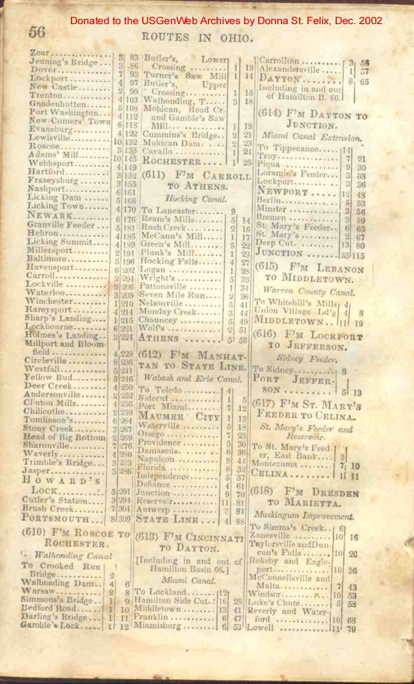
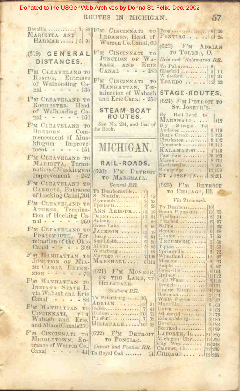
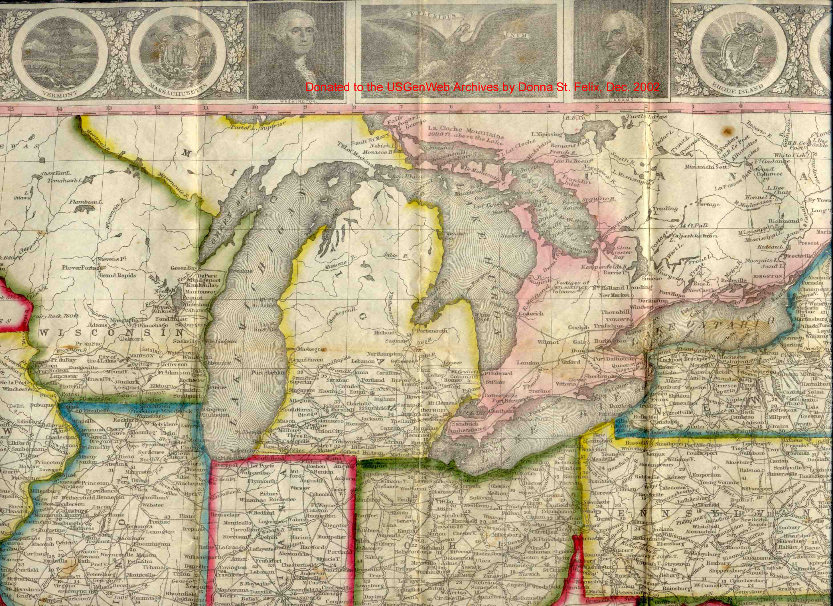
| Ohio | 52, 53, 54, 55, 56, 57 |
| Michigan | 57, 58 |
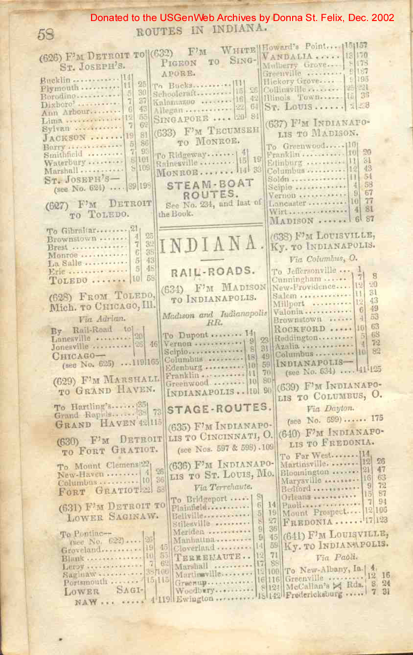
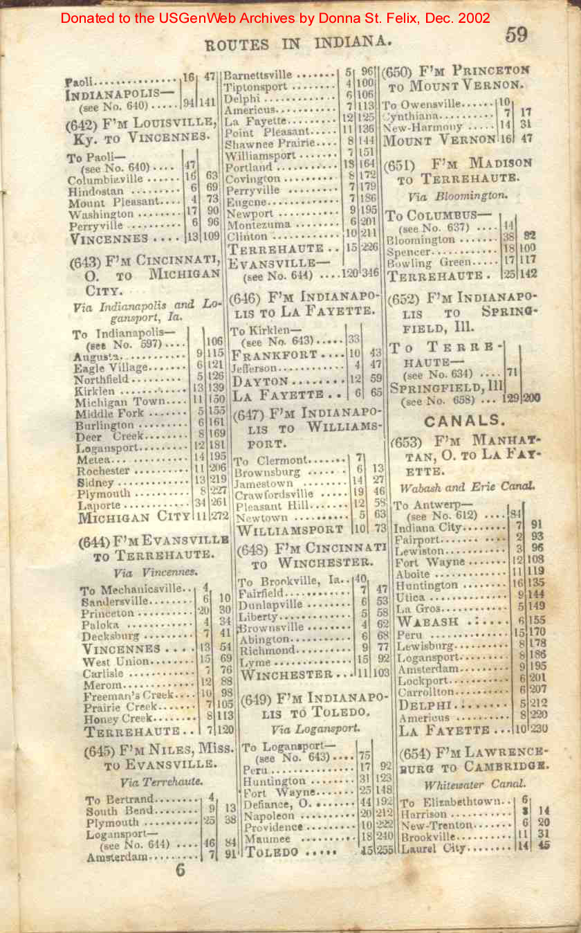
| Indiana | 58, 59, 60 |
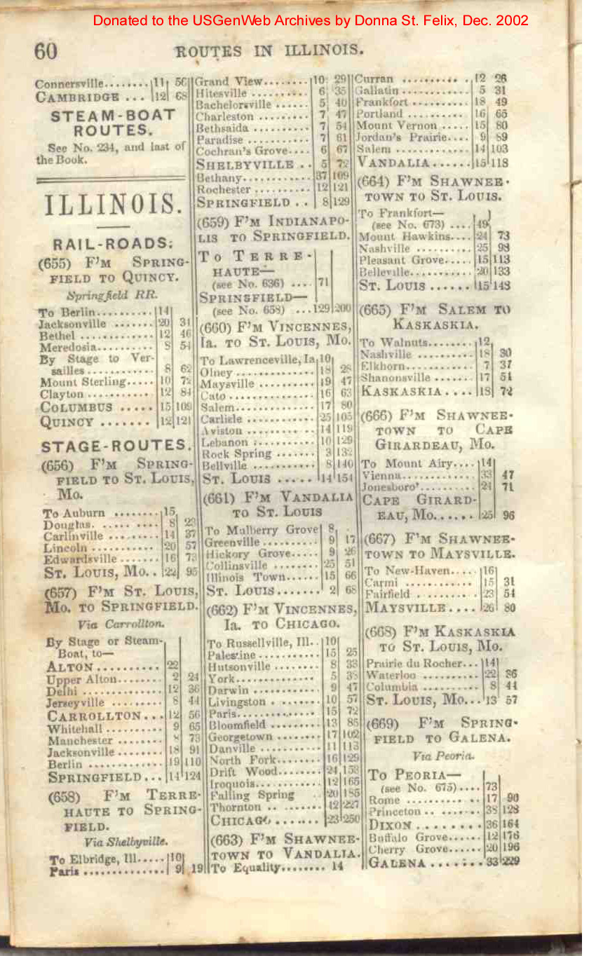
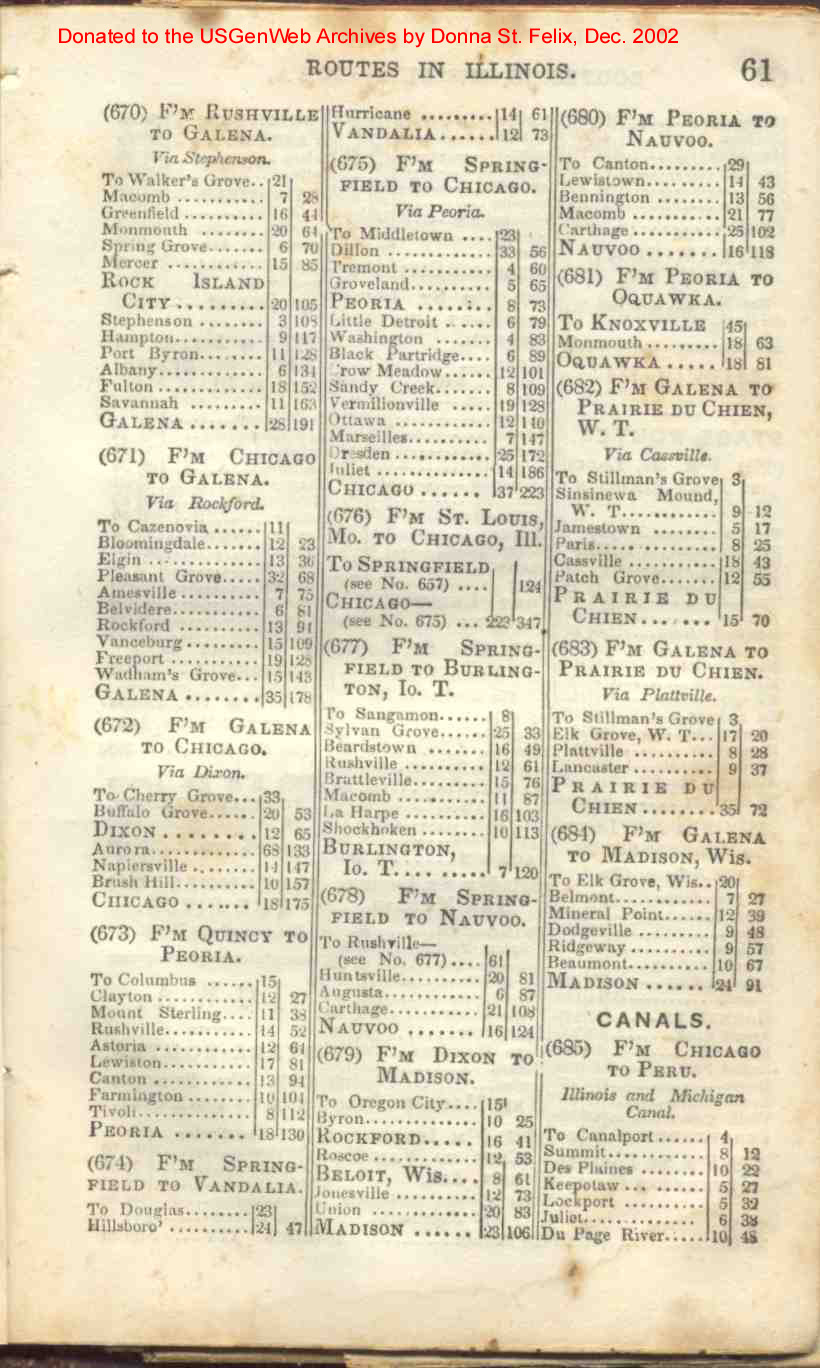
| Illinois | 60, 61, 62 |
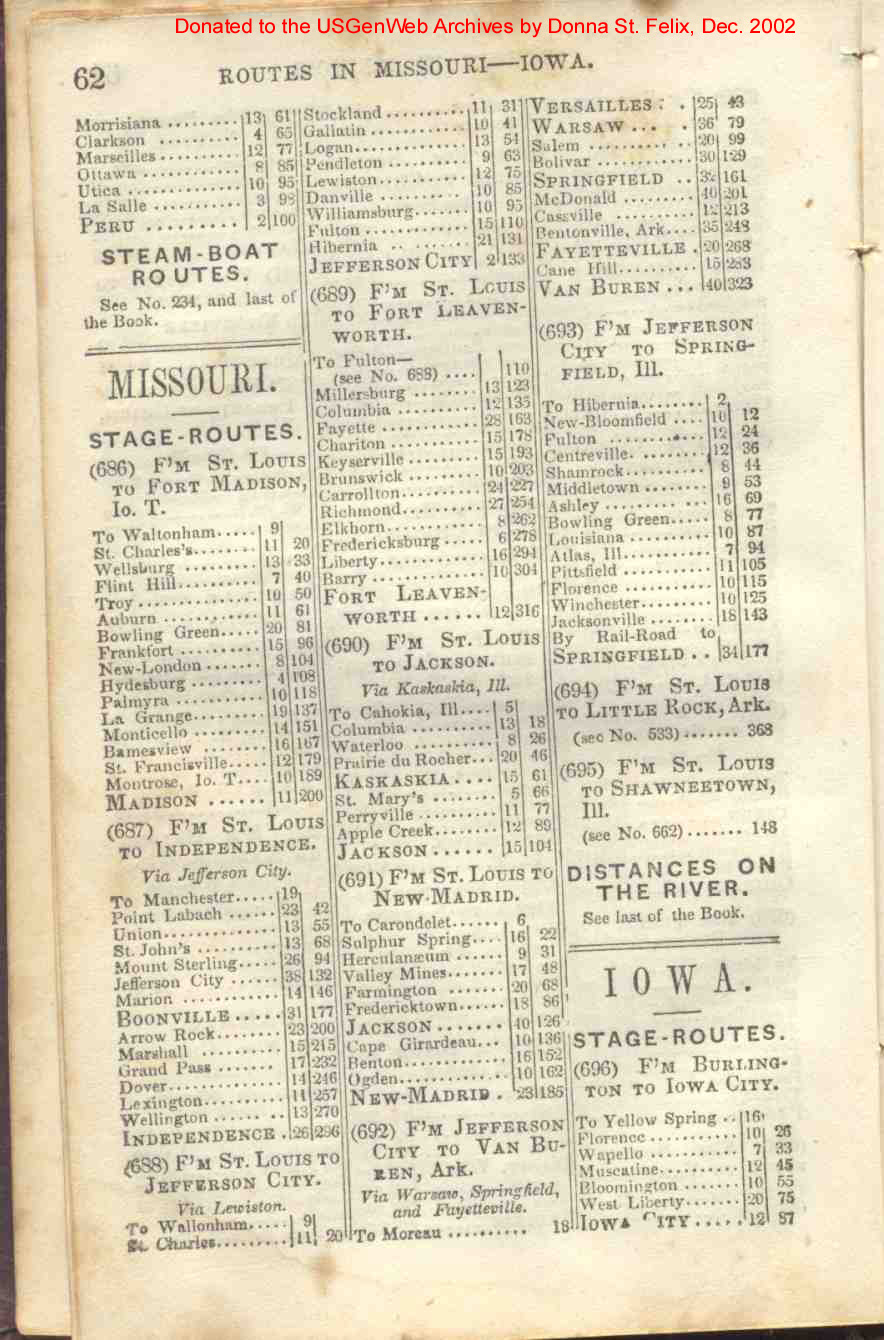
| Missouri | 62, 63 |
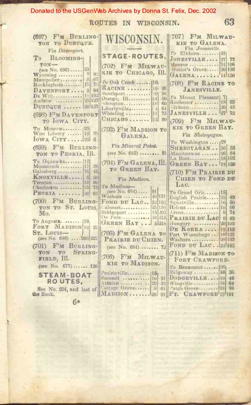
| Wisconsin | 63 |
| Miscellaneous Other Information & Maps | |
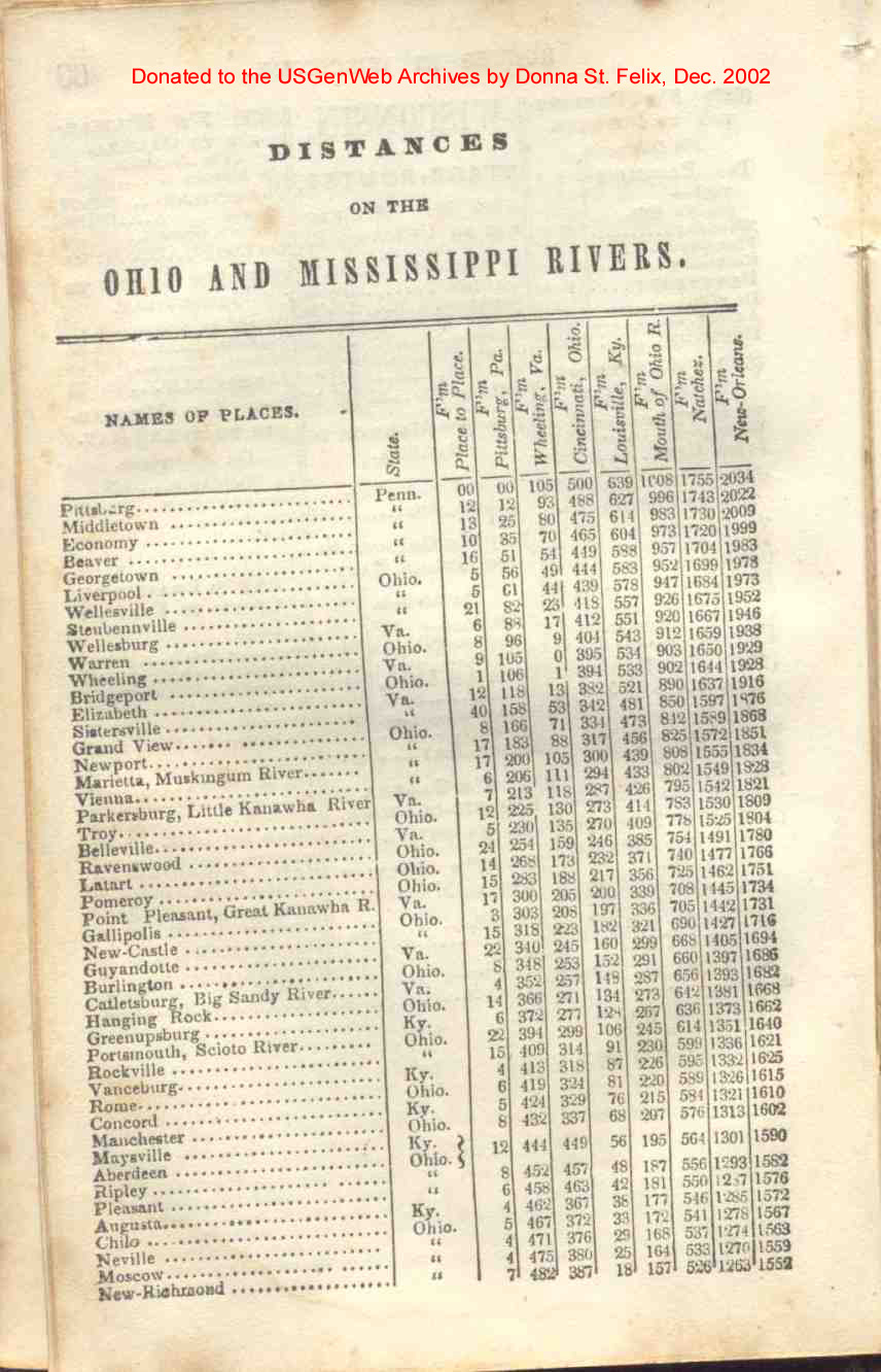
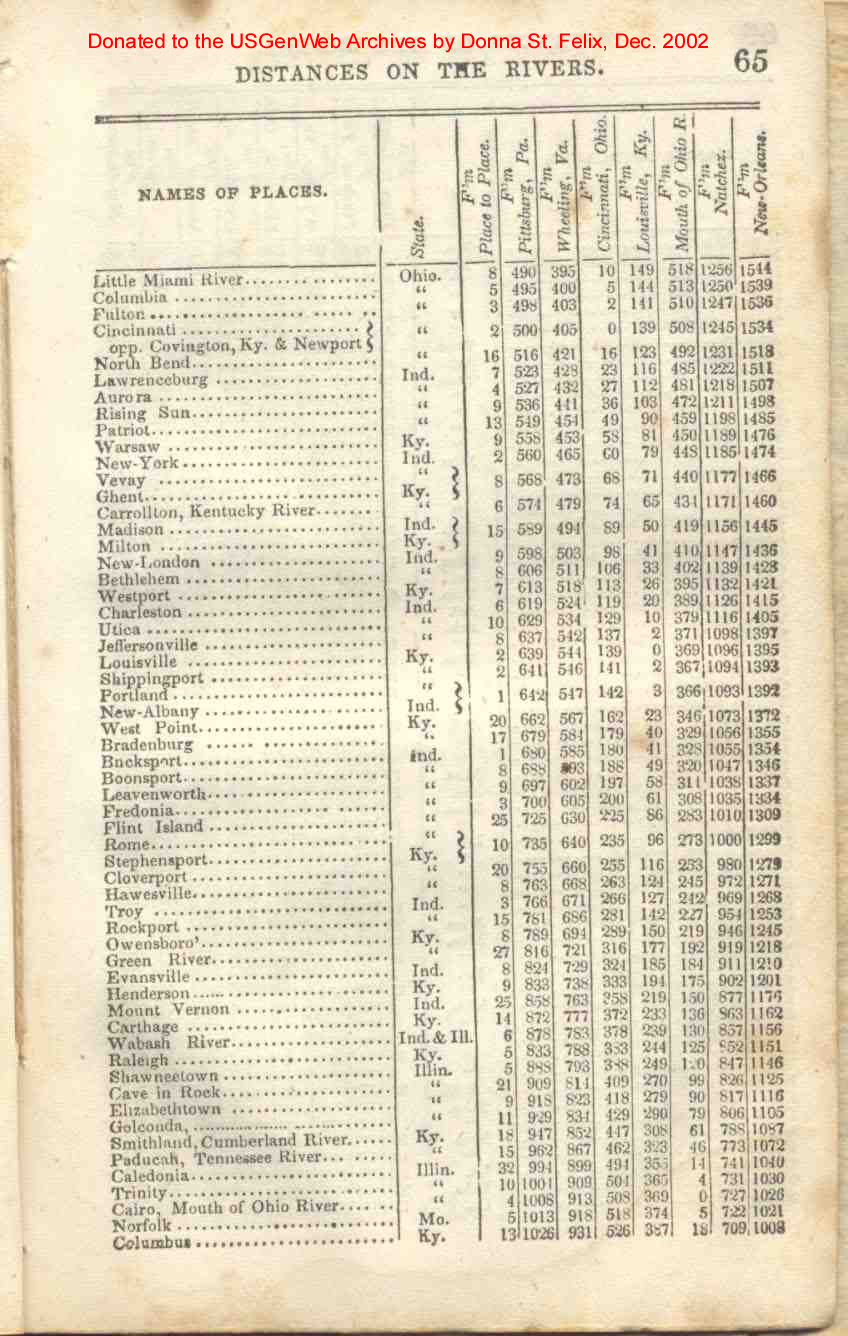
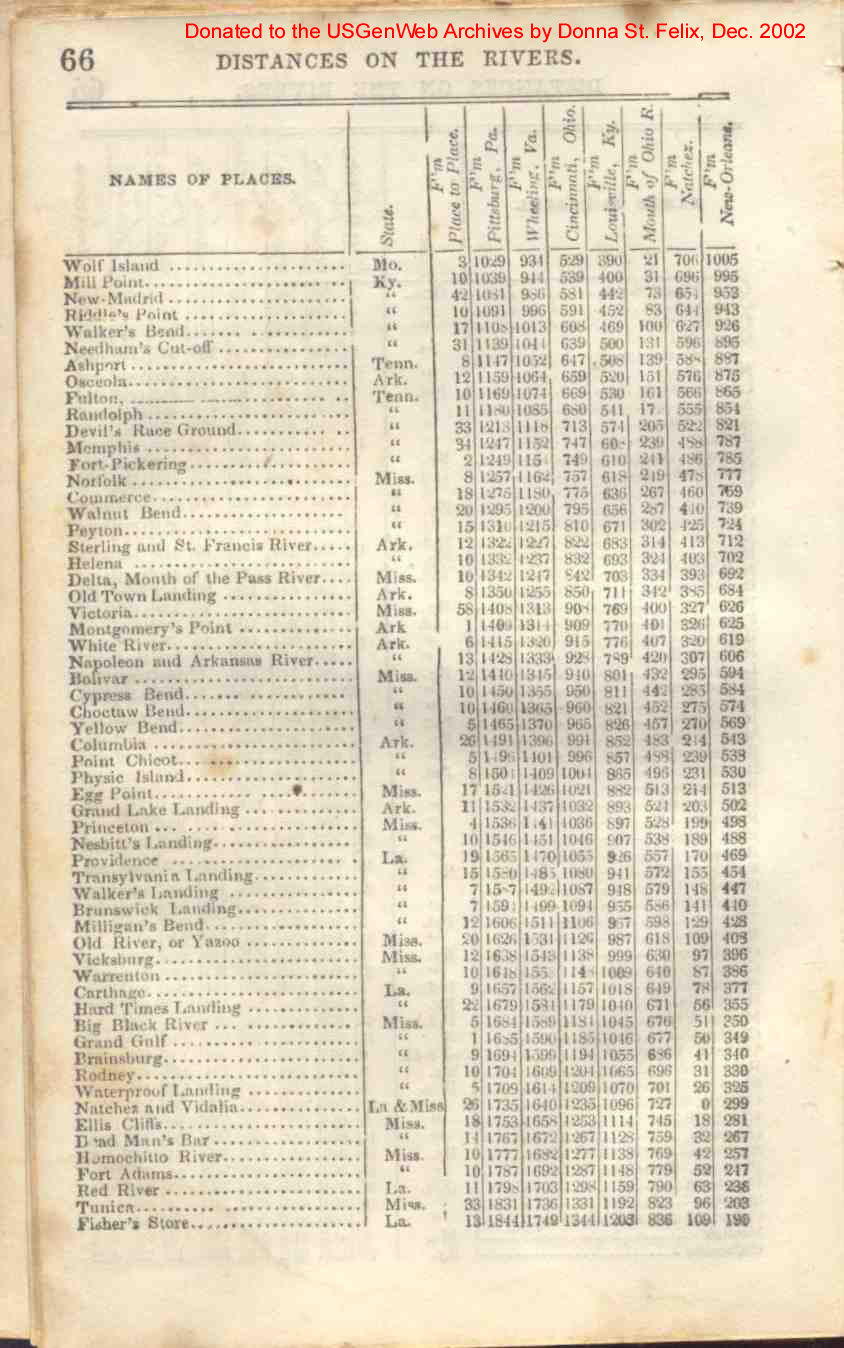
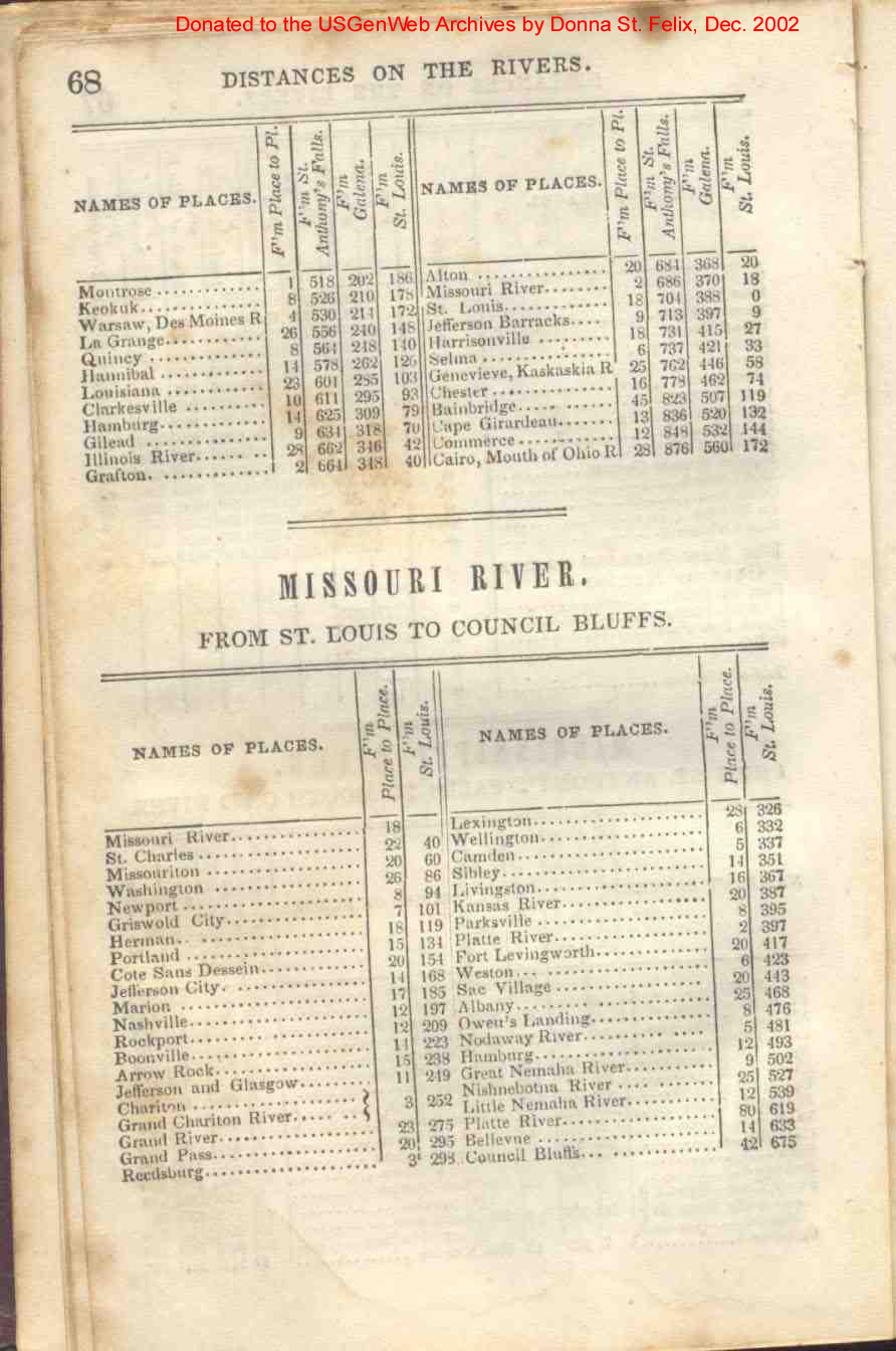
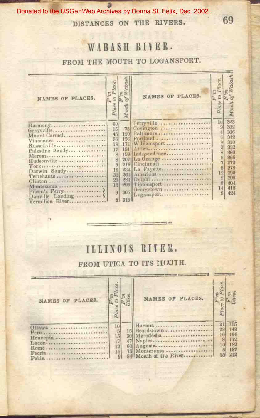
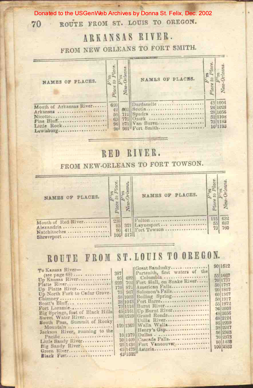
| Distances on the Rivers | 64, 65, 66, 67, 68 69, 70 |
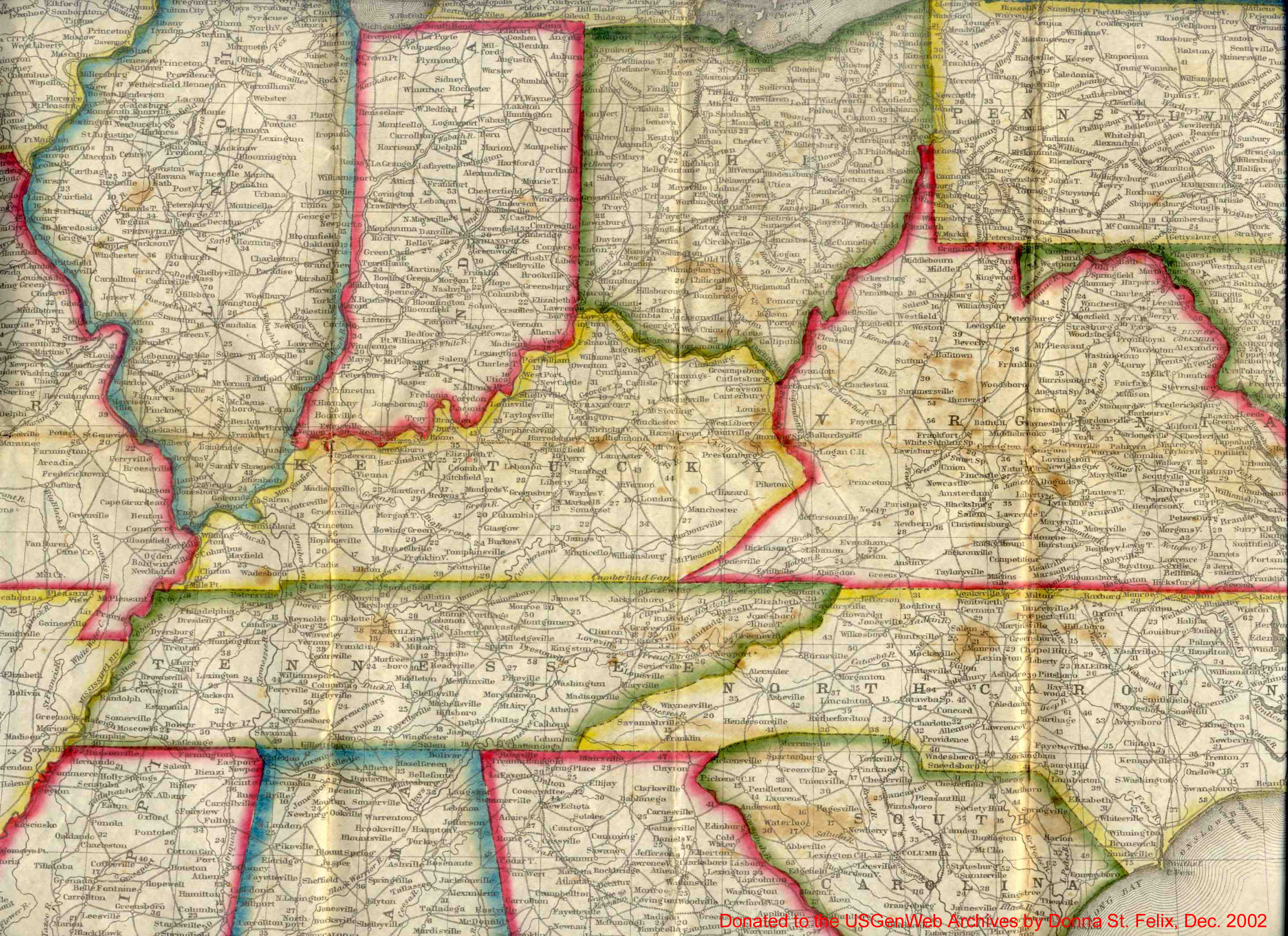
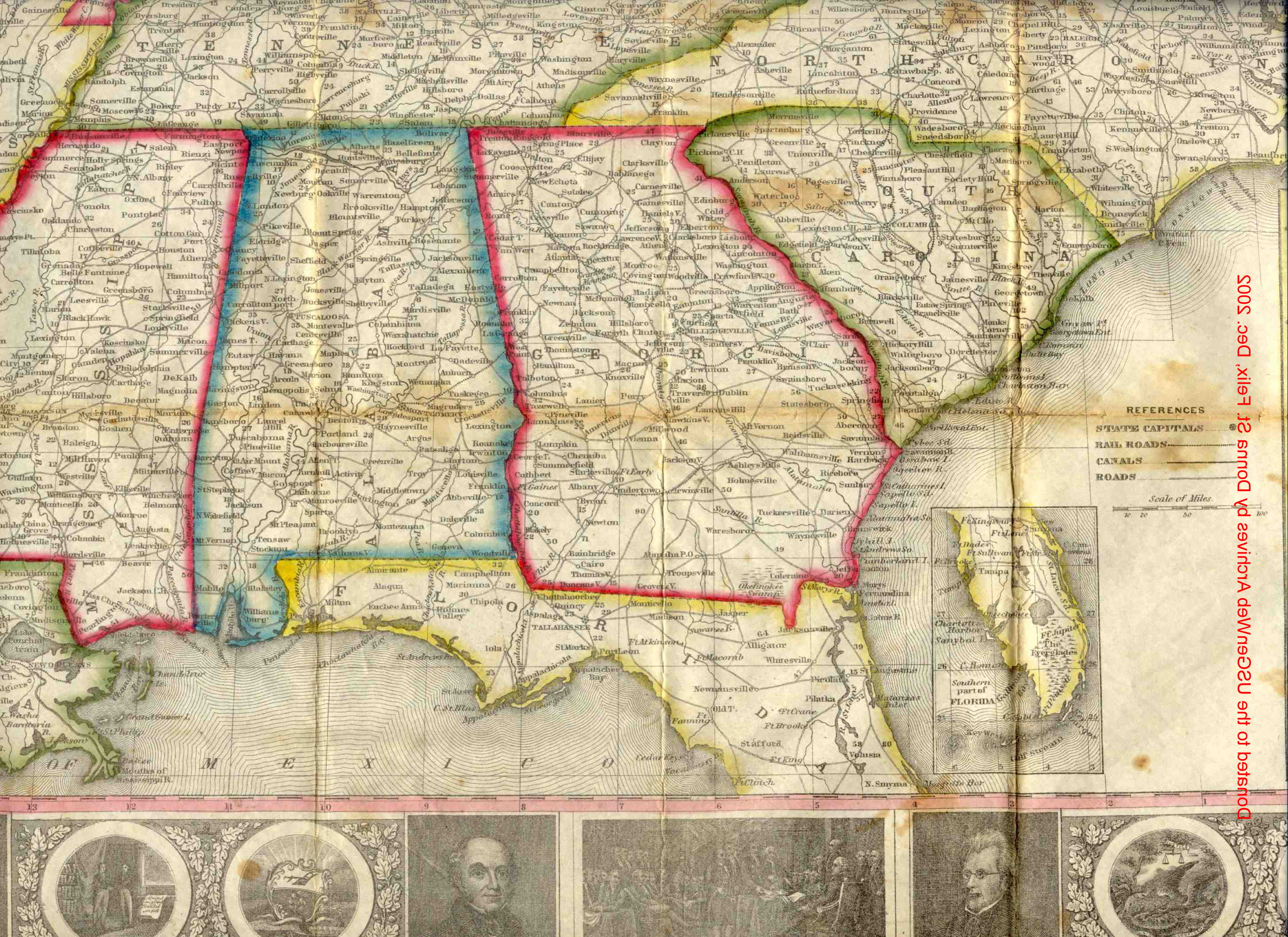
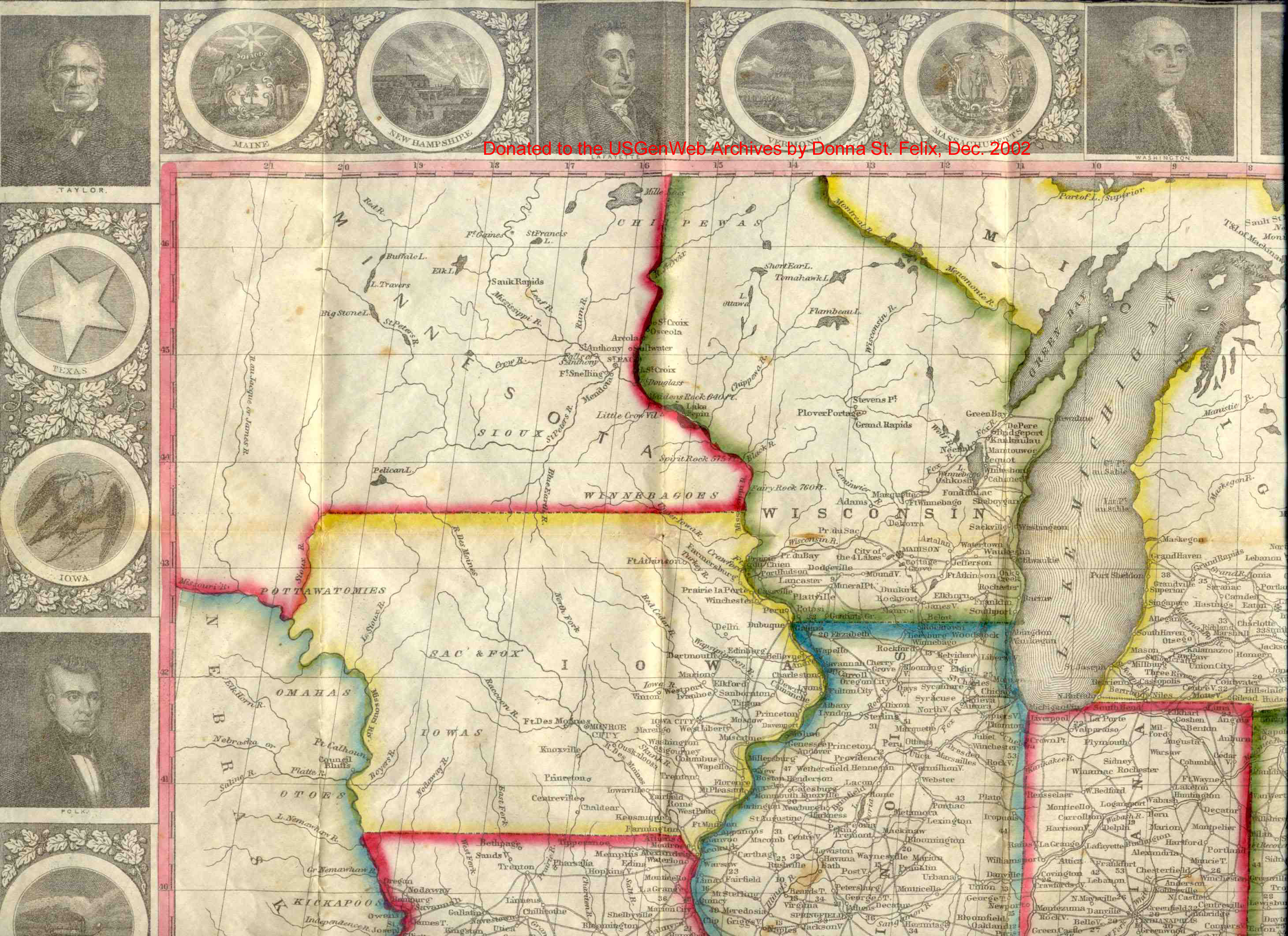
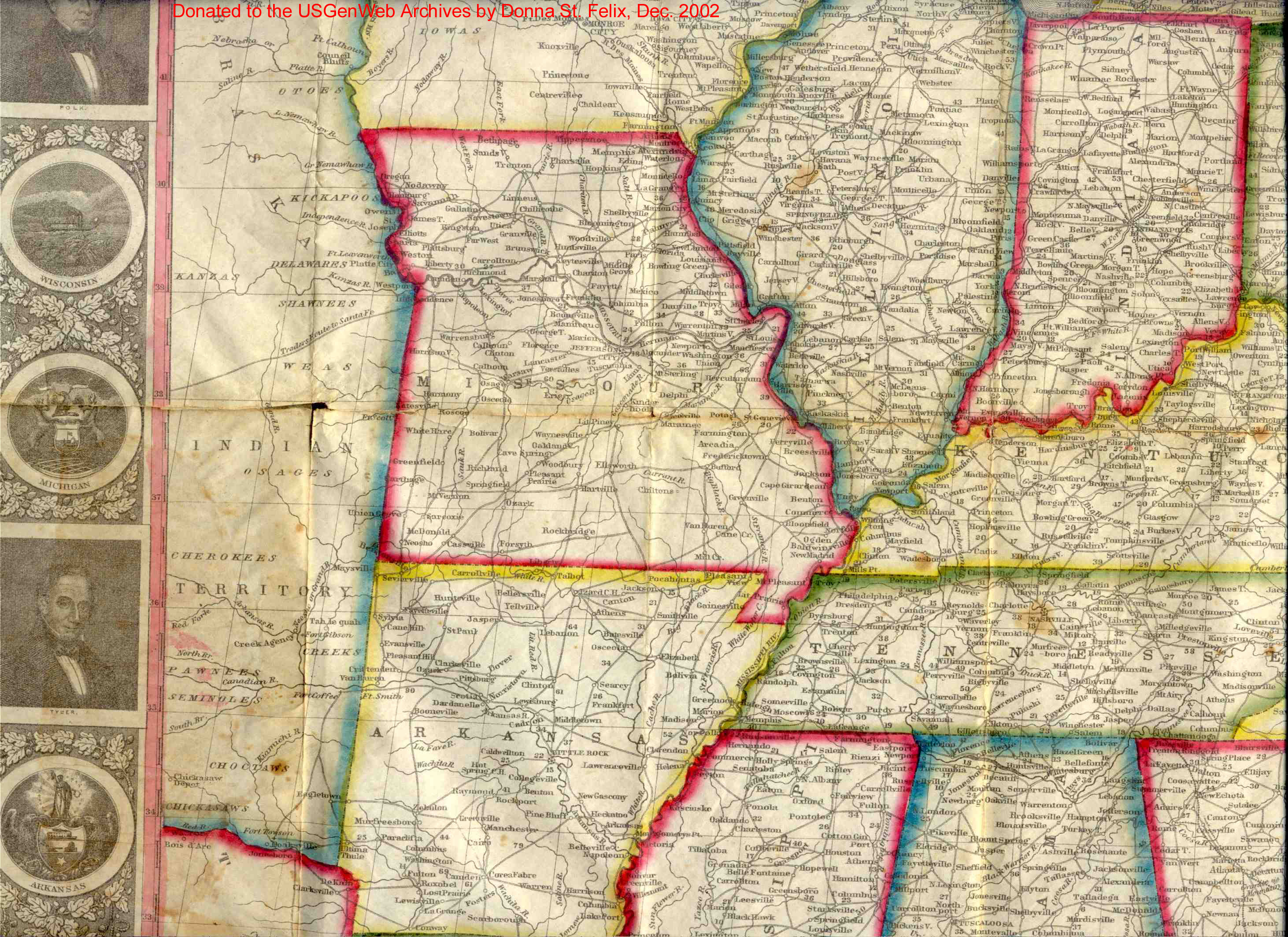
| Maps | 1, 2, 3, 4, 5, 6, 7, 8, 9 |
Back to USGenWeb Archives Special Collections
Page created by Sherri Hall