 |
The USGenWeb Archives -
|
 |
|
The USGenWeb Archives -
|
|
| Description | Date Submitted | Submitter |
|---|---|---|
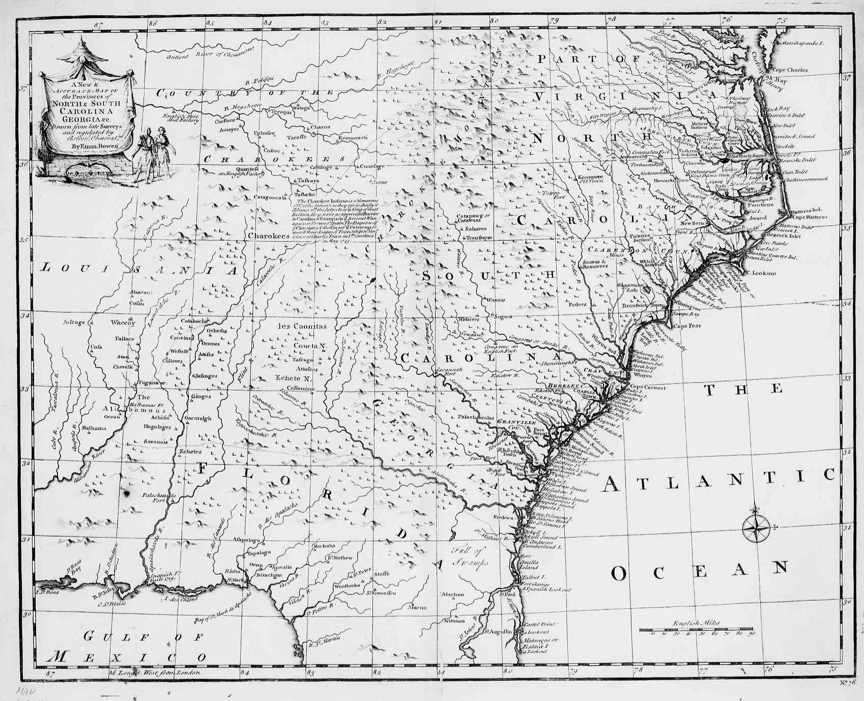
| Bowen
Map of 1747 A New and Accurate, Map of the Provinces of North & South Carolinas, Georgia. Drawn from Late Survey & Regulated by Ernie Bowen, 1747. |
Jan 1998 | Paul R. Sarrett, Jr. |
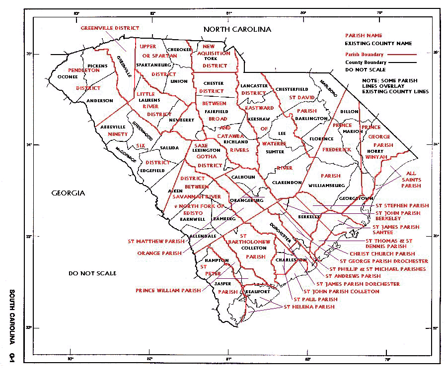
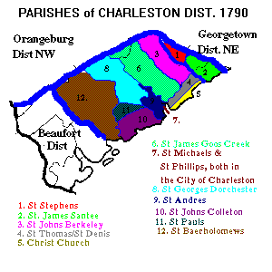
| Parish
Map of South Carolina State of SC. with "Parish" Lines in Red and District lines in Black. |
Jan 1998 | Paul R. Sarrett, Jr. |
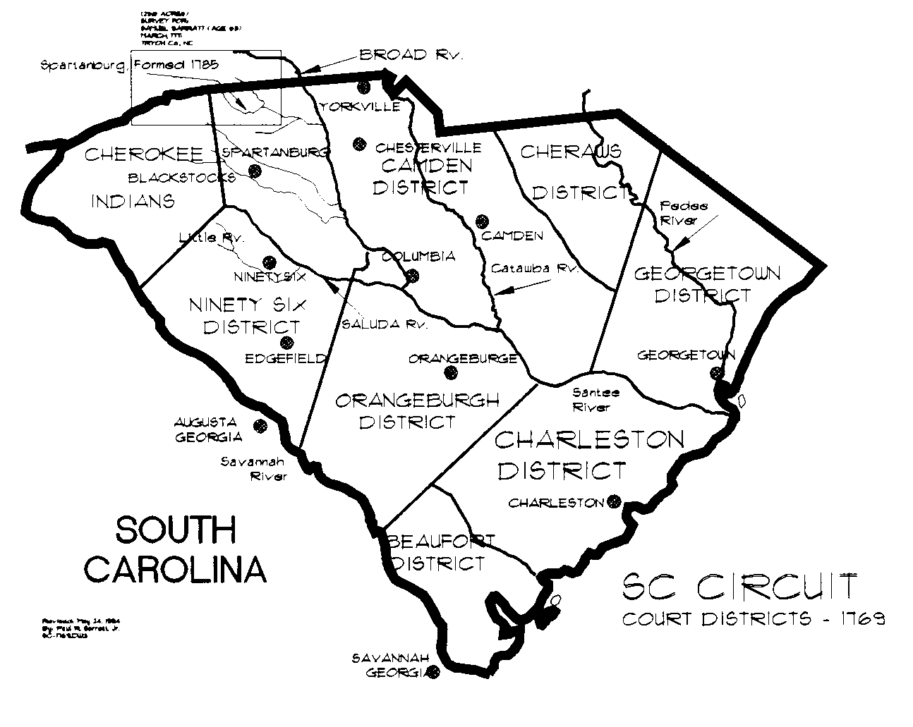
| South
Carolina With 1769 Judicial Districts A home drawn map of South Carolina by Paul R. Sarrett, showing the 1769 "Judicial Districts" and major Citys & Towns. |
Jan 1998 | Paul R. Sarrett, Jr. |
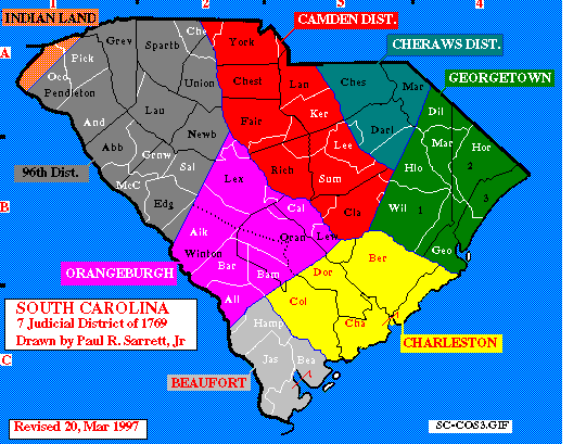
| 1790
Counties Map The 1790 South Carolina federal census was prolonged into 1792. It employed the seven districts then existing, shown as blue lines on the map. Within the districts were differing census subdivision, shown as black lines and lettering. The white lines and lettering show the present day counties. * A. Camden, Cheraws, and 96th districts used their county subdivision. * B. Charleston district employed their parish bounds. Its counties of 1790 never functioned. Due to its size there is a separate page for Charleston. Go to Parish of Charleston District! * C. Georgetown district employed their parish bounds. Their counties of 1790 never functioned. * c-1. Prince Fredericks Parish. * c-2. Prince-George - Winyaw Parish. * c-3. All saints Parish * D. Beaufort district was not enumerated by subdivisions in 1790. Its counties of 1790 never functioned. * D. Orangeburg district had four active counties, but the census enumerator ignored them. Orangeburg for this 1790 census was divided into North and South, shown as a dotted line on the map. This division was the road to in the forks of the Edisto from Edgefield County to the town of Orangeburg and then down the North Edisto and Edisto to the Charleston District line. |
Jan 1998 | Paul R. Sarrett, Jr. |
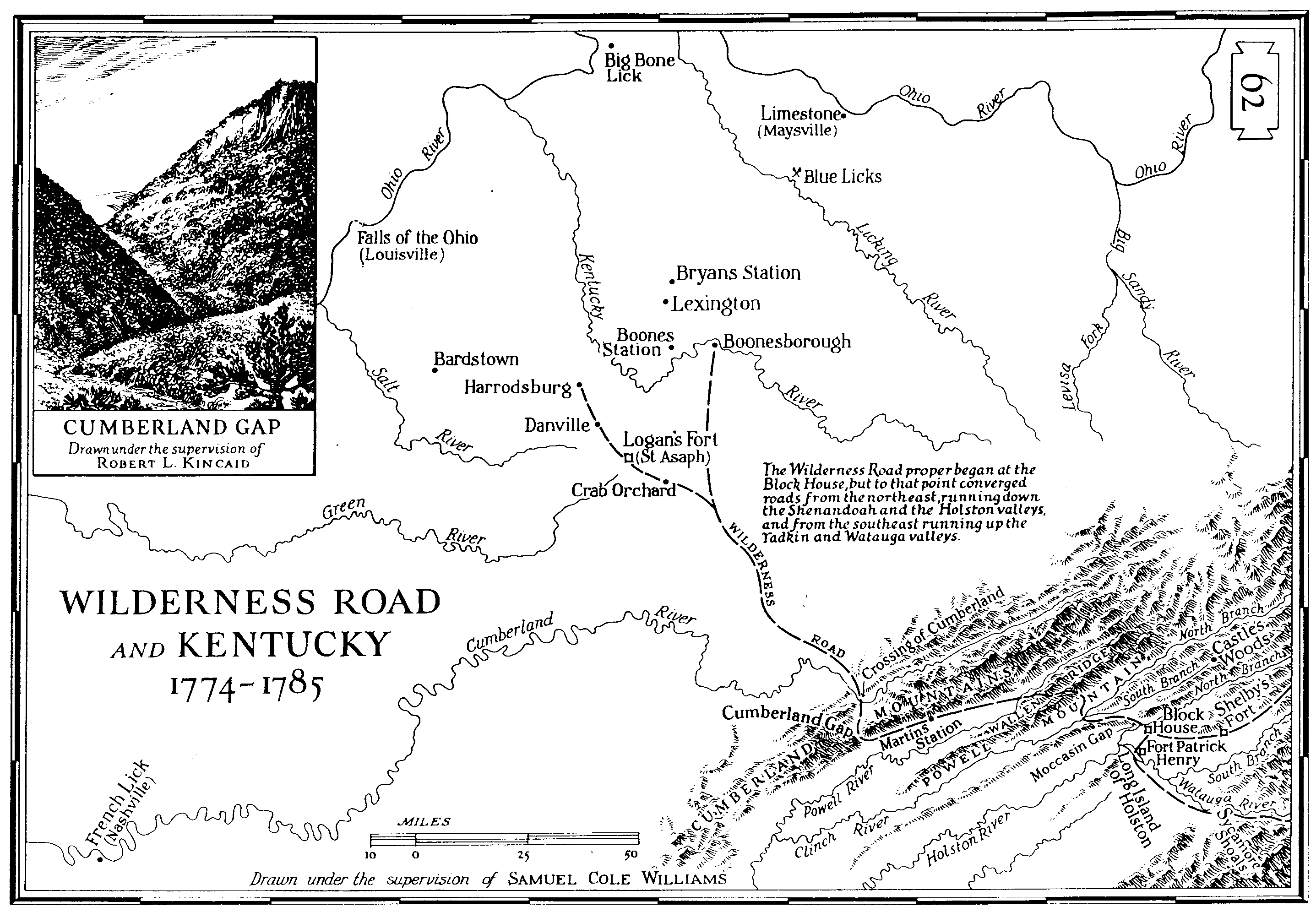
| Wilderness
Road And Kentucky 1774-1785 Drawn under supervision Samuel Cole WILLIAMS, Pg #62 Enlargement, showing Rivers, Towns, Villages, Forts and Cumberland Gap. |
Jan 1998 | Paul R. Sarrett, Jr. |
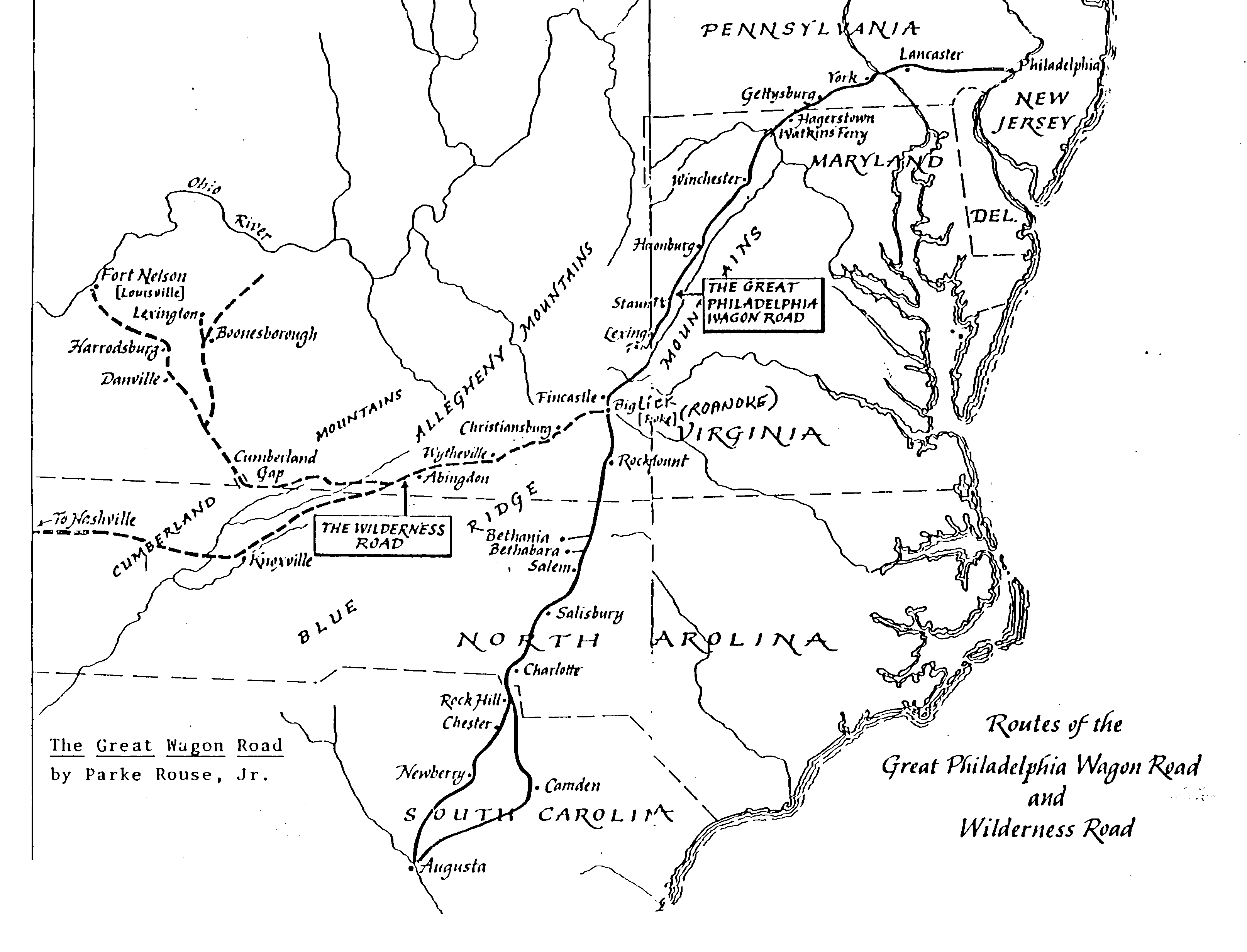
| Great
Philadelpha Wagon Road and Wilderness Road Routes of the Great Philadelpha Wagon Road and Wilderness Road. By Parke Rouse, Jr. dated Unknown; Shows the Wagon Road from Philadelpha, Lancaster, York, down to Charlotte, NC. on into Rock Hill, Chester, and Newberry, SC on to Augusta, GA. |
Jan 1998 | Paul R. Sarrett, Jr. |
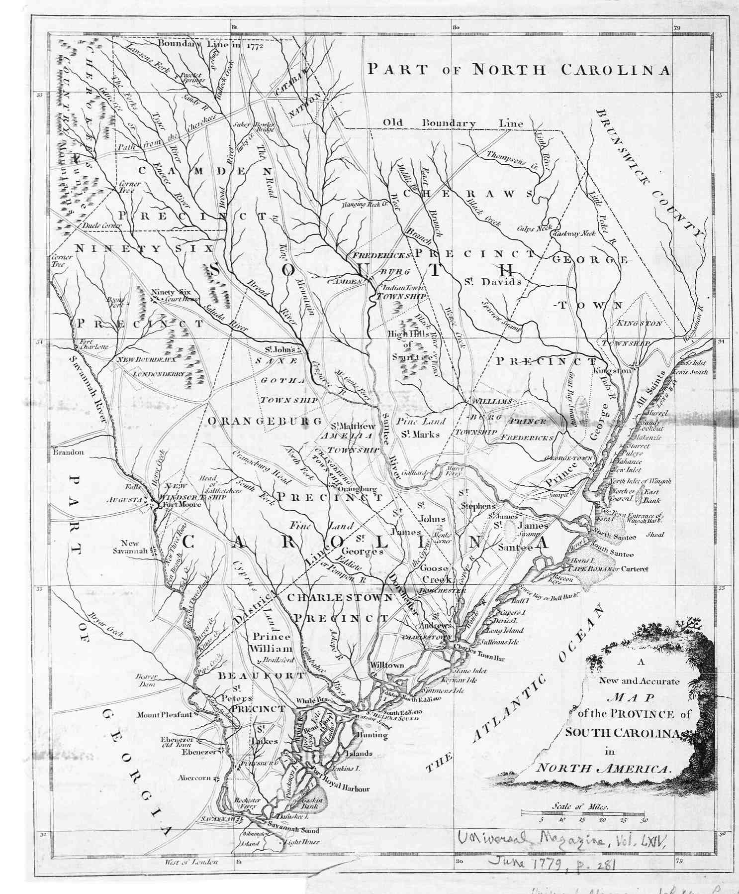
| South
Carolina 1779 Map A New and Accurate, Map of the Provinces of South Carolina in North America Universal Magazine, Vol. LXIV June 1779, Pg 281. |
Jan 1998 | Paul R. Sarrett, Jr. |
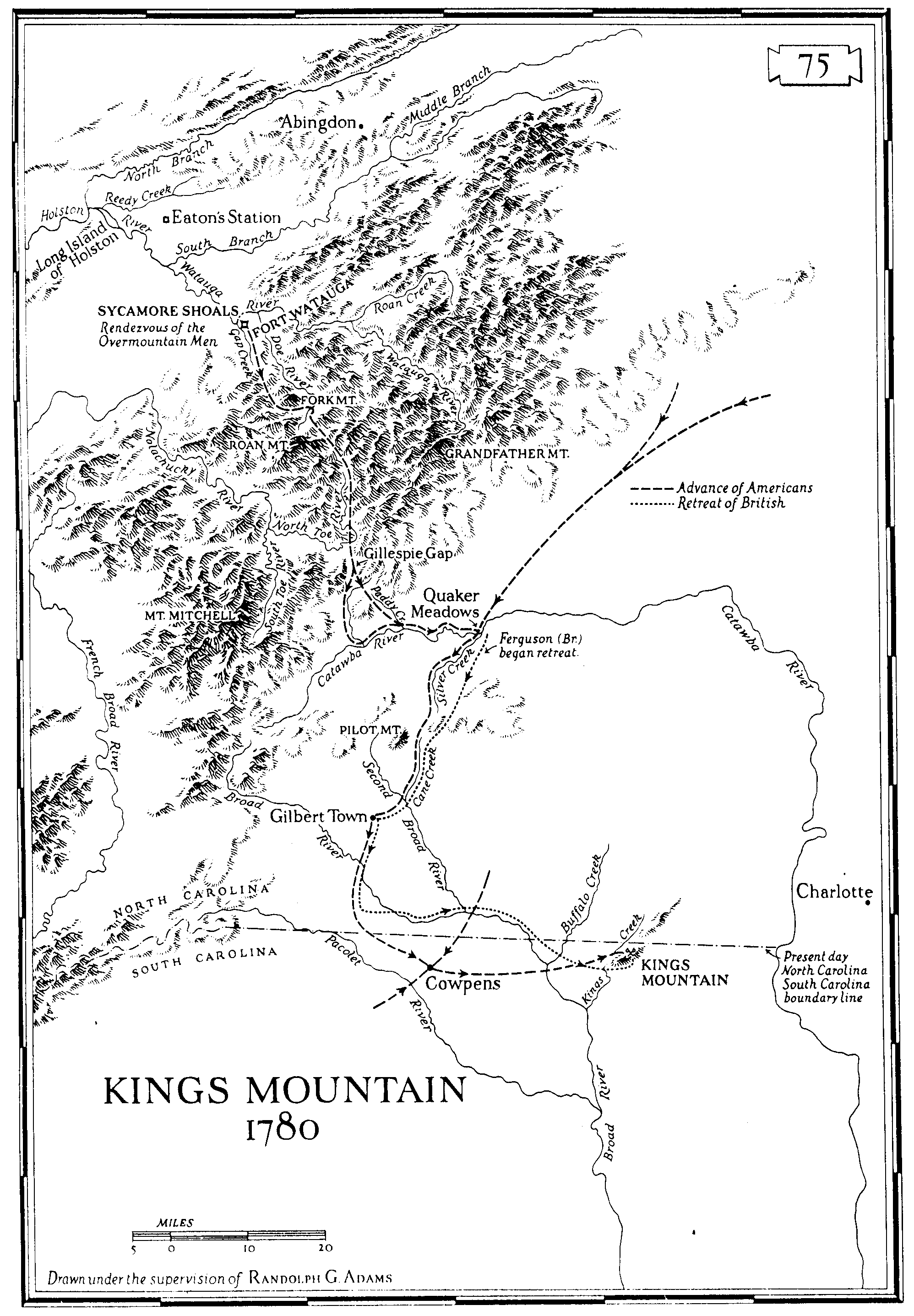
| Kings
Mountain Map Drawn under supervision Randolph G. ADAMS Enlargement, showing Rivers, Towns, Villages, Advancements of the Americans and British troops. |
Jan 1998 | Paul R. Sarrett, Jr. |
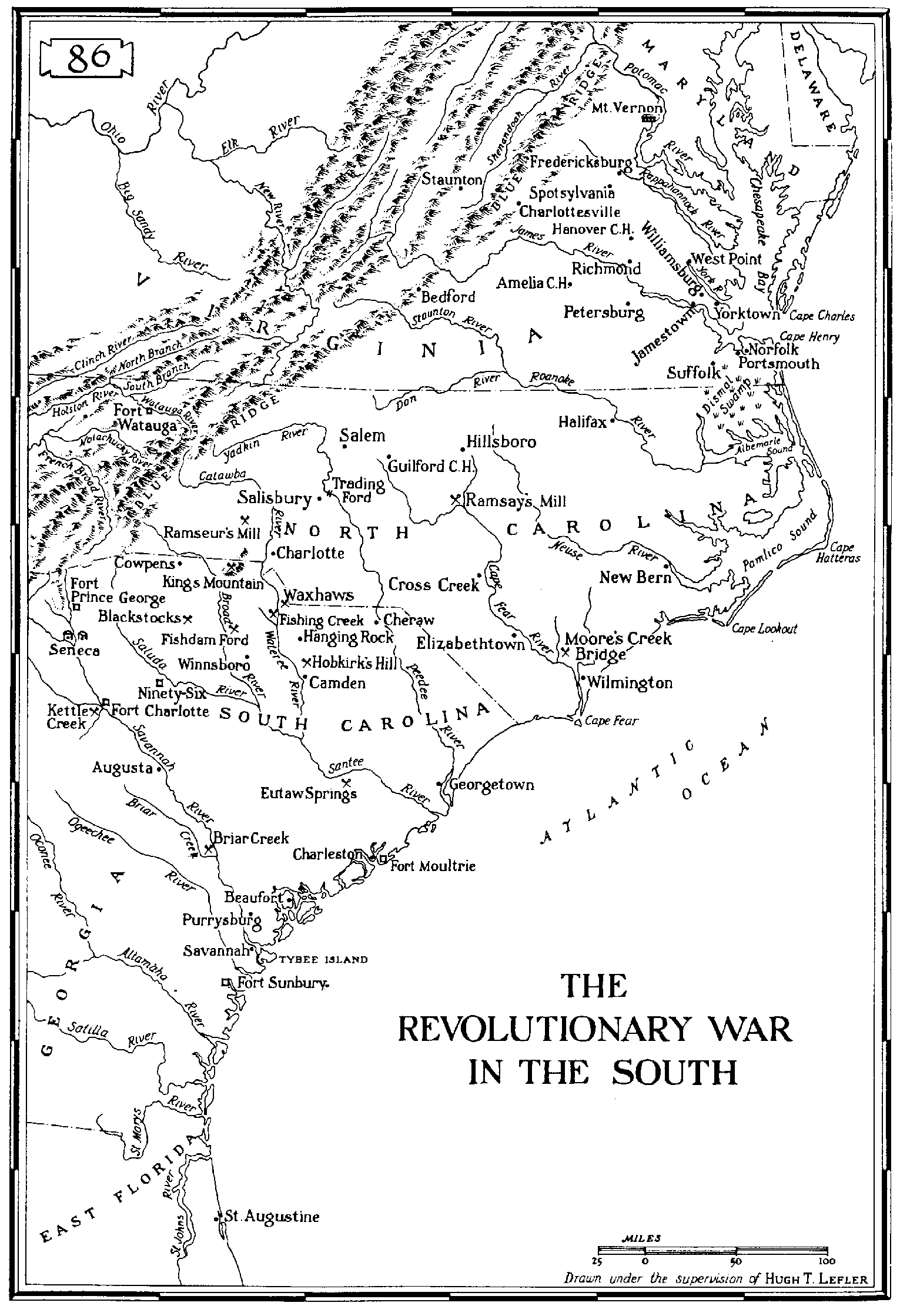
| The
Revolutionary War in the South 1780-1782 Drawn under supervision Hugh T. LEFLER, Pg. 86 Enlargement, showing Rivers, Towns, Villages, Advancements of the Americans and British troops in South and North Carolina. |
Jan 1998 | Paul R. Sarrett, Jr. |
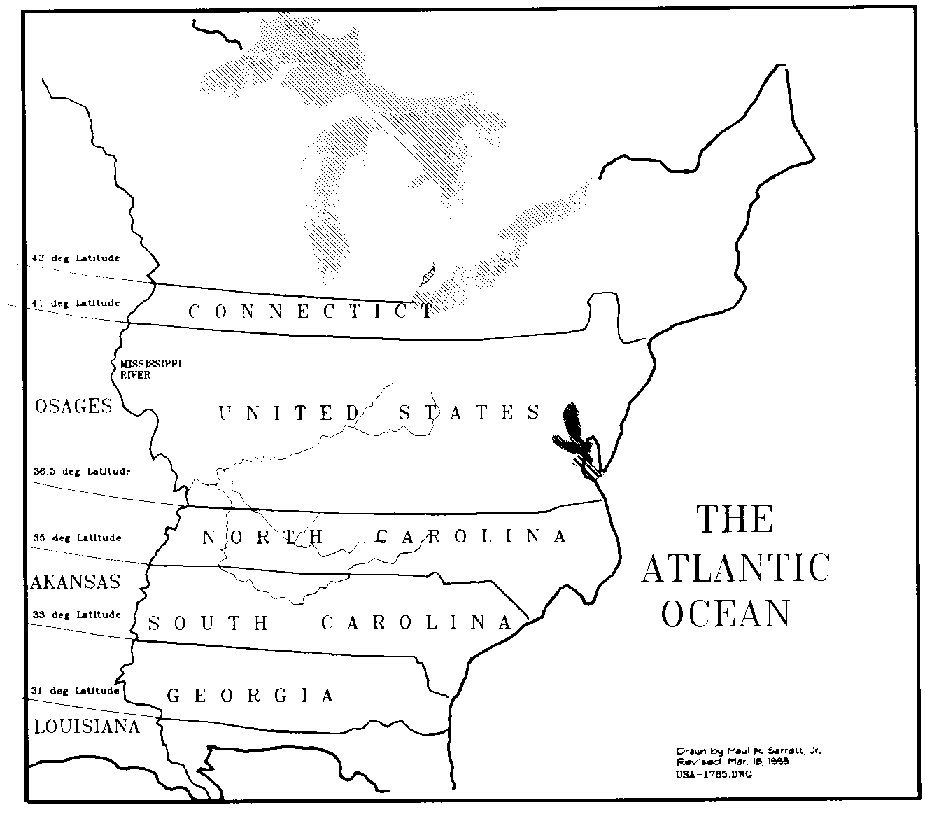
| Eastern
United States 1785 Home made map by Paul R. Sarrett, Jr. Mar. 18, 1995 showing the Eastern part of the United States in 1785. |
Jan 1998 | Paul R. Sarrett, Jr. |
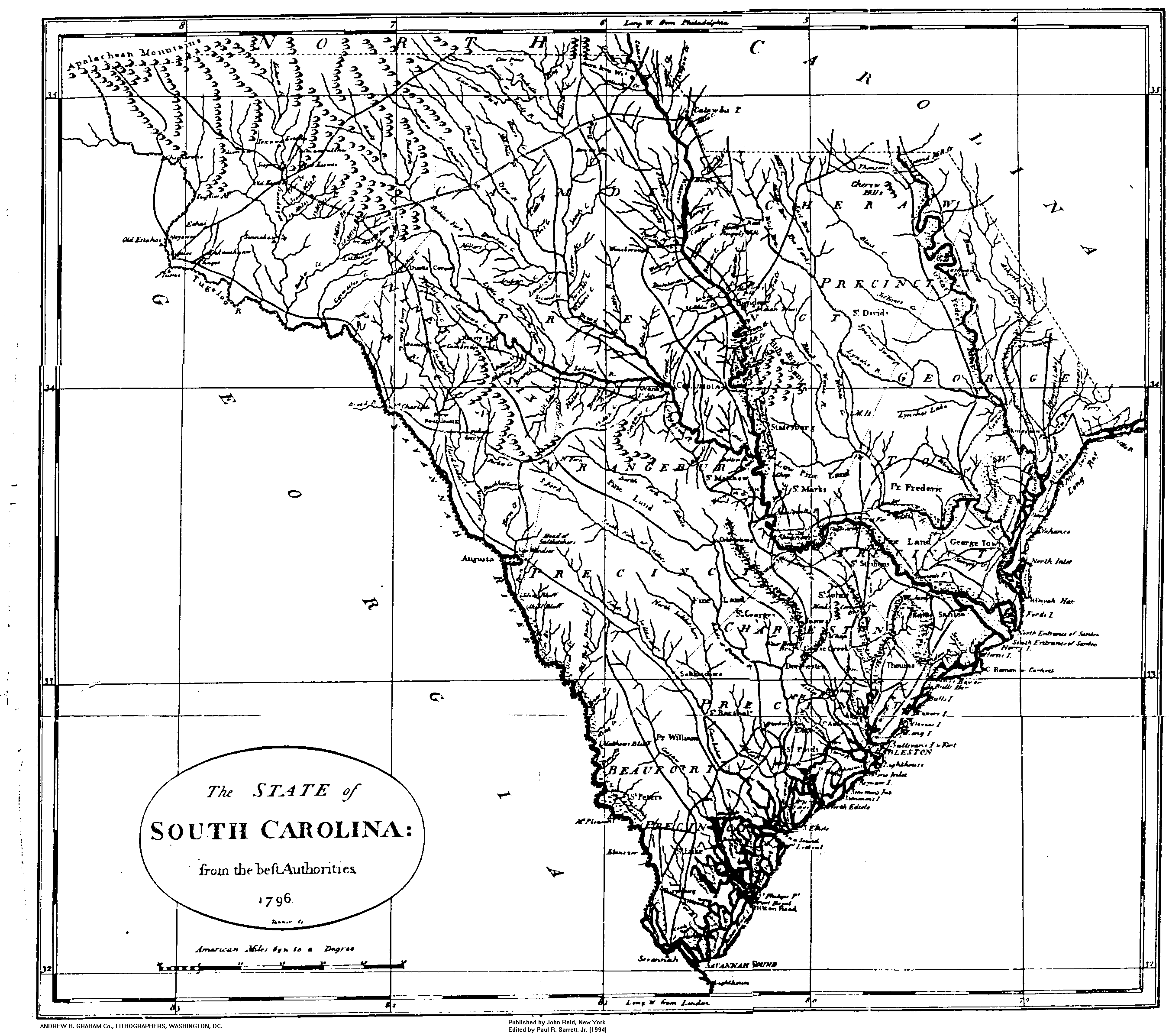
| South
Carolina 1796 The State of South Carolina from "beft AUTHORITIES" 1796 By Andrew B. Graham, Lithographers, Washington, D.C. |
Jan 1998 | Paul R. Sarrett, Jr. |
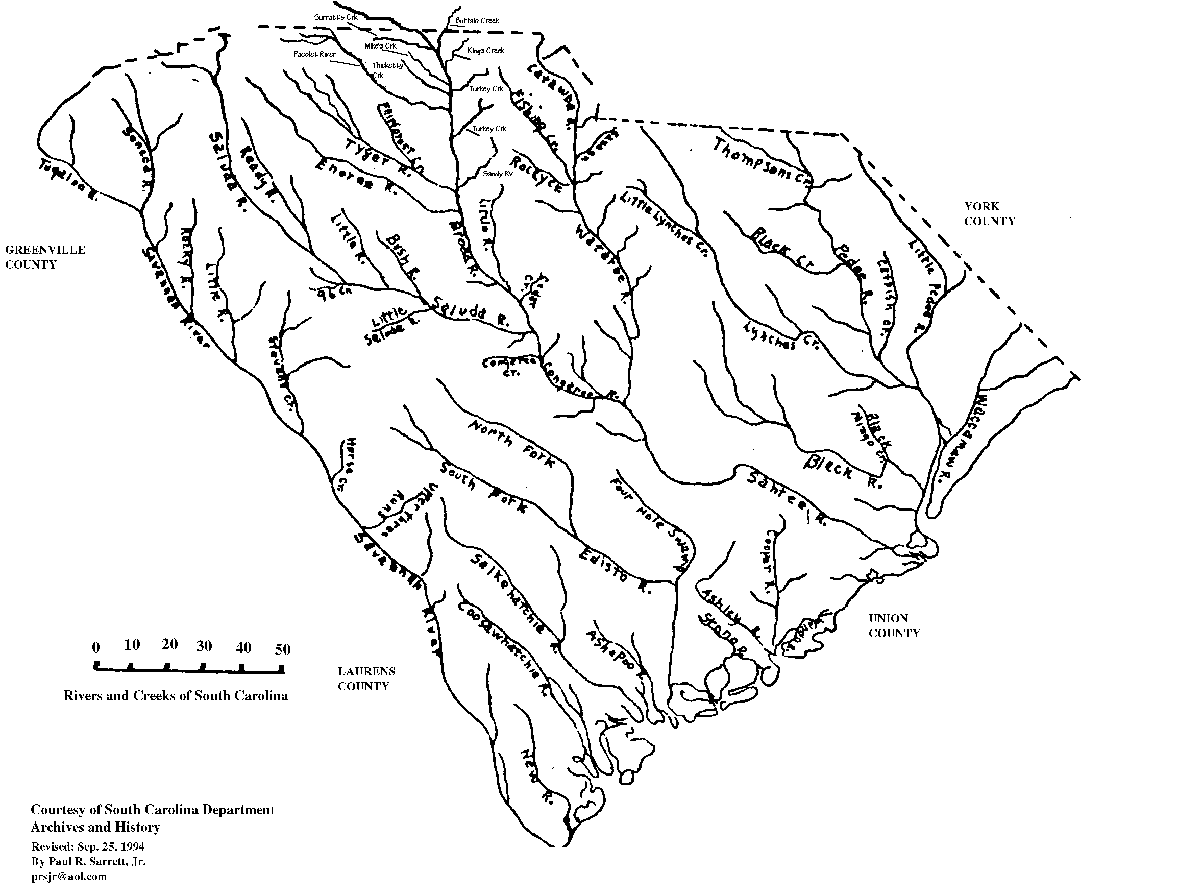
| South
Carolina Rivers and Creeks South Carolina "Rivers & Creeks" courtesy of S.C. Dept. Archives and History, dated unknown; Edited by Paul R. Sarrett, Jr. 1994. |
Jan 1998 | Paul R. Sarrett, Jr. |
| Spartanburg
District - Mills Atlas 1820 SPARTANBURG DISTRICT - South Carolina; Surveyed by J. Whitten, 1820. "Improved for Mills Atlas Bros." Shows Cities, Principal Towns, Railroads, and Rivers. |
Jan 1998 | Paul R. Sarrett, Jr. |
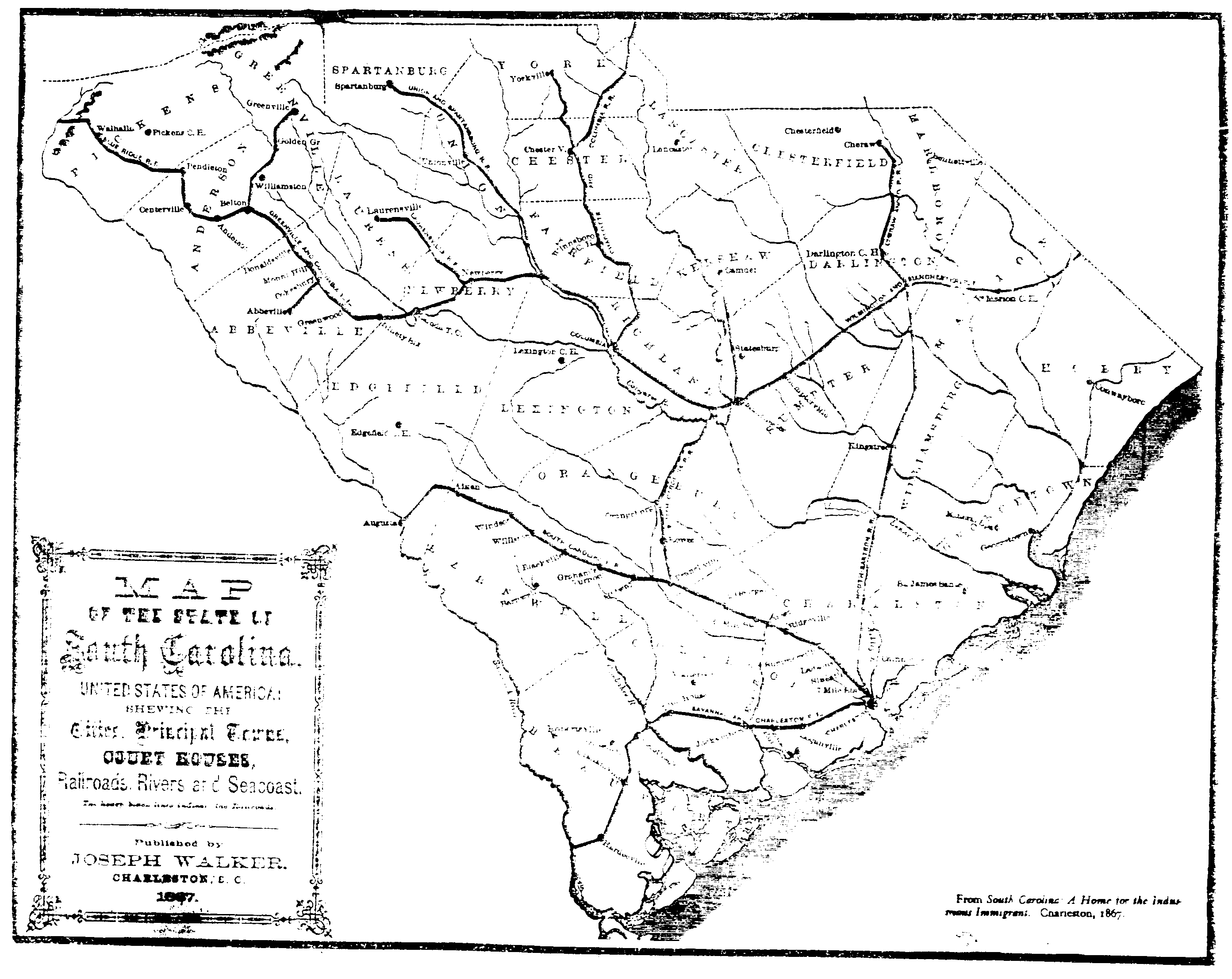
| South
Carolina 1867 South Carolina, of United States of America; Showing the Cities, Principal Towns, COURT HOUSES, Railroads, Rivers, & SeaCoast. Published by Joseph Walker, Charleston, SC. 1867. |
Jan 1998 | Paul R. Sarrett, Jr. |
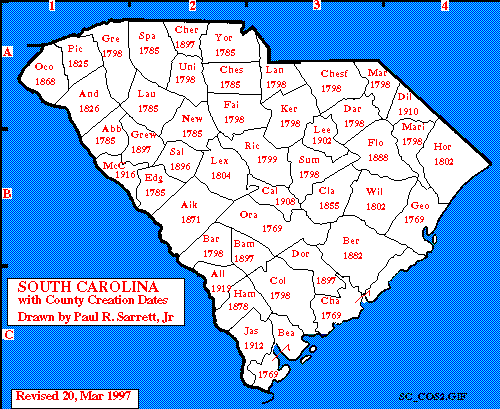
| South
Carolina County Creation Dates A homemade Map of the State of South Carolina with the creation dates of each County. by Paul R. Sarrett, Jr. |
Jan 1998 | Paul R. Sarrett, Jr. |
| South Carolina Highways | Jan 1998 | Paul R. Sarrett, Jr. |
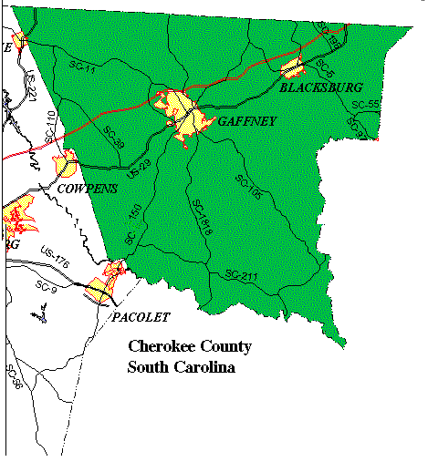
| Present Day Cherokee County | Jan 1998 | Paul R. Sarrett, Jr. |
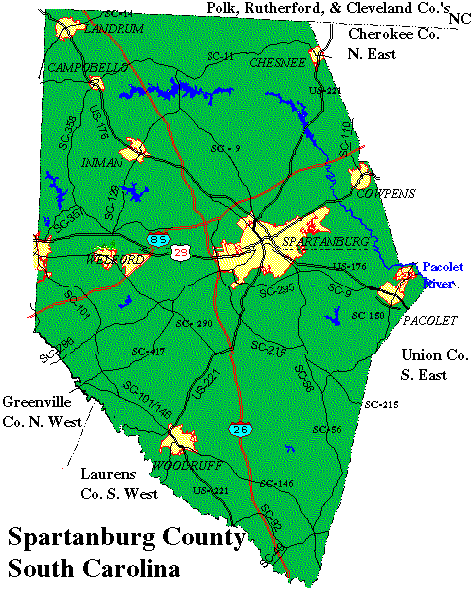
| Present Day Spartanburg County | Jan 1998 | Paul R. Sarrett, Jr. |
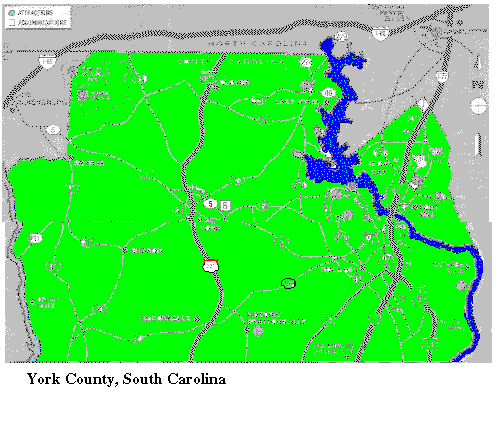
| Present Day York County | Jan 1998 | Paul R. Sarrett, Jr. |
Return to The USGenWeb Archives Project - South Carolina Statewide Pages
Return to:
The USGenWeb Archives Project- South Carolina Main Page
The USGenWeb Tombstone Project - South Carolina Main Page
Email Registry For Contributors
Any time you see this
symbol ![]() next to a name, they
have registered their e-mail address at The Registry.
next to a name, they
have registered their e-mail address at The Registry.
This will be their current address.
PLEASE HELP!
Click here or here to submit to the USGenWeb Archives Project - South Carolina
[ Guidelines ] [ Help for Submitters ]
or send your text files
directly to Carolyn Golowka,
the USGenWeb Archives Project - South Carolina Manager.
This page maintained by Carolyn Golowka
Copyright © The USGenWeb Archives Project, 1997-2025. All rights reserved.
You are our 14867
visitor
since we moved to our new location.
Thanks for stopping by!
Page Updated Saturday, 02-Oct-2010 11:12:10 EDT