Somerset County, PA
The Cemeteries of Somerset County
Vought Cemetery 1
Black Township
A Project of Somerset County PAGenWeb Archives Copyright Information
|
Contributed for use by the Meyersdale Public Library, with support from the Somerset County Federated Library System and the Laurel Highlands Visitors Bureau Meyersdale Public Library 210 Center Street P.O. Box 98 Meyersdale, PA 15552 Researchers are reminded to be respectful before entering a cemetery that lies on private land. Always ask permission from the owner before entering their property.
|
|
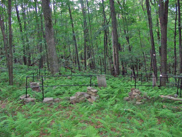
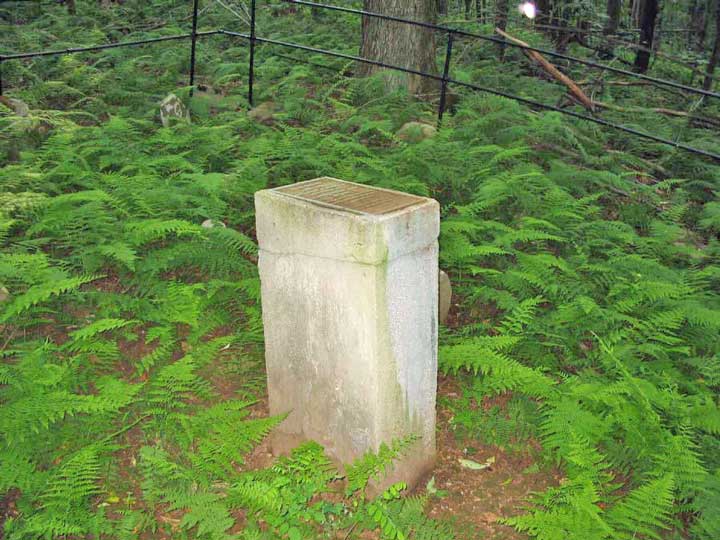
VOUGHT CEMETERY 1 NO ACCESS TO CEMETERY EXCEPT BY PERMISSION OF OWNER TOPO# 6 LOCATION/ADDRESS: Rockwell's, Woodpecker Rd, Garrett, PA DIRECTIONS: At intersection of Mt. Davis Rd and Rockdale Rd, take Rockdale Rd to Johnson Rd, go left on Johnson Rd SW for 1.7 mi, turn right onto Old Mule Trail Rd, go about 150 yds and turn left onto Vought Rock Rd. Go 0.8 mi to Rockwell gate. Cemetery in woods left of Rockwell's dam. 5 graves.
INFO SOURCE: Somerset Planning Commission WPA - AKA: Jacob Vought farm LATITUDE: 39 49 18N ADDITIONAL COMMENTS: No access to cemetery except by permission of owner. PHOTOS: 2
Vought Farm Cemetery mark |
Thank you to April Phillips and Connie Burkett!
Somerset County PAGenWeb Archives File Manager Martha A C Graham
Copyright 2010-present. All rights reserved.
Somerset County PAGenWeb Archives