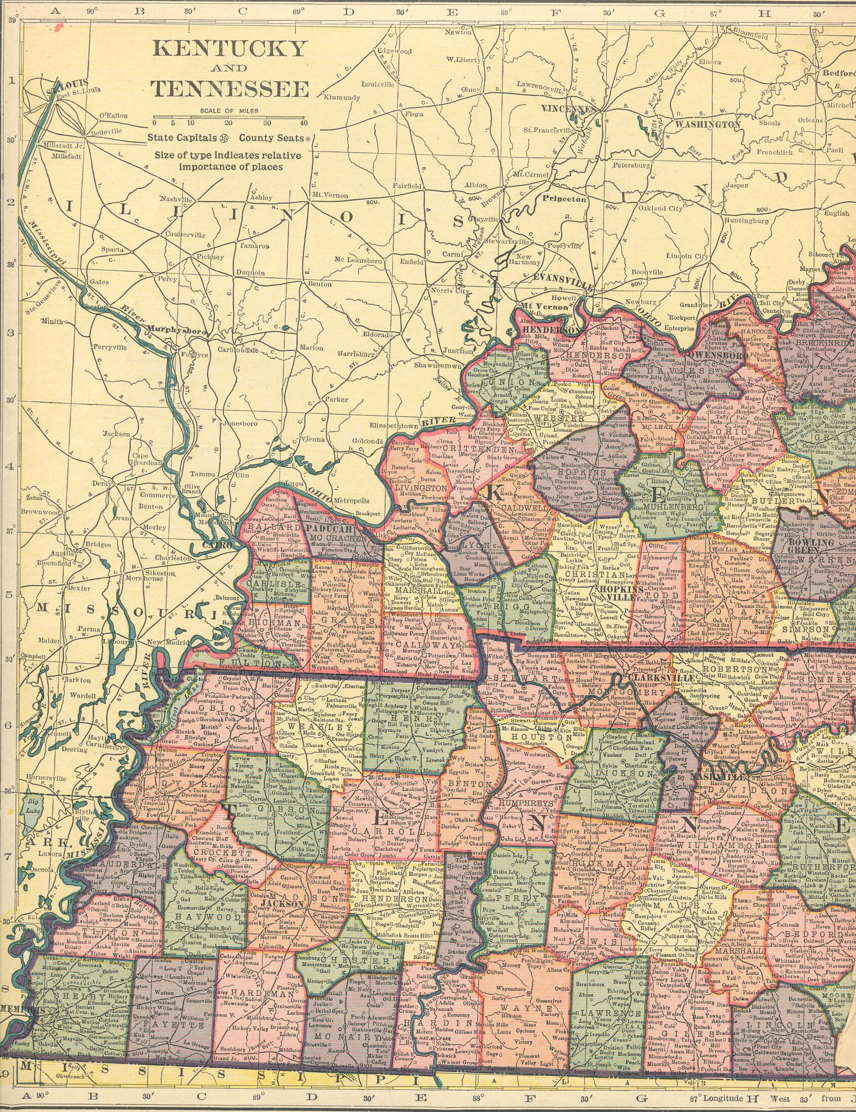
spacer
Hosted by RootsWeb
United States Digital Map Archives
USGenWeb
National Map Table of Content

Hammonds 1910 Atlas
Kentucky/ Tennessee


Kentucky Tennessee West Kentucky Tennessee East

The Hammonds 1910 Atlas Table of Contents is part of the United States Digital Map Library

This project and its all-volunteer staff are dedicated to free, online access for the general public. We rely on contributions, and if you would like to be part of the Digital Map Library team, make contributions, have questions about our copyright policy, or the use of our graphics, please visit our Contributor & Copyright Page .

Our map graphics require long download times because the file sizes are quite large. Although they are normally around 500k or less, they can run as high as 1.5 megs. If you experienced difficulty with downloading any of the maps, please visit our Advice Page.

USGenweb Logo Other National Links USGenWeb Archives Logo


This page was last updated Sunday, 24-May-2009 06:35:08 EDT

You are the since Sunday, October 06, 2002

This page was first posted on:October 06, 2002
Copyright © 1999-2002, Kelly Mullins & Mary Ann Hetrick
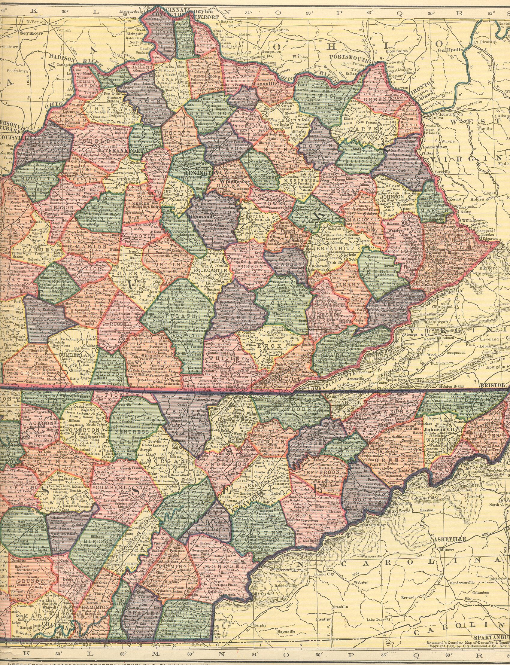