|
|
|
|
|
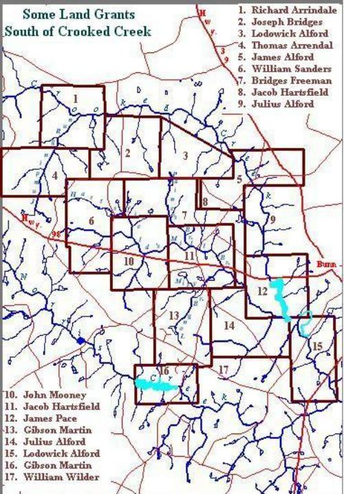
USGENWEB NOTICE: In keeping with our policy of providing free information on the Internet, this map may be used by non-commercial entities, as long as this message remains on all copied material. This image may NOT be reproduced in any format for profit or for presentation for profit by other persons or organizations.
Persons or organizations desiring to use this image for purposes other than stated above must obtain the written consent of the contributor. The submitter has given permission to the USGenWeb to store the file permanently for free access.
Return to the NC Map Project.