|
||
|


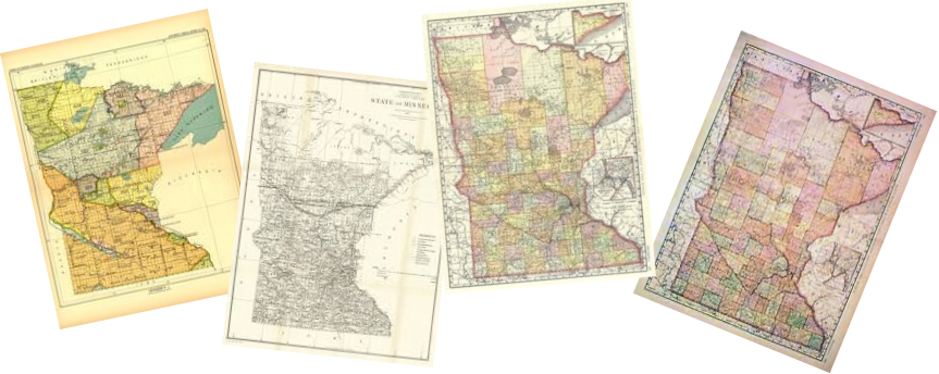
| Red Lake County, Minnesota Maps |
|
|
|
Click Map for Larger View
1916 - TOWNSHIPS / PLATS / LANDOWNERS |
||||||
|
Note:In Township 152, Ranges 43 through 45, there are only 12 sections (25-36). Sections 1 through 24 are in Pennington County, north of Red Lake and each county has named their portions of the Townships differently. In Township 152, Ranges 40 through 42, there are only 12 sections (25-36) and in these three ranges, Red Lake has appended the sections to Township 151, Ranges 40-42. |
||||||
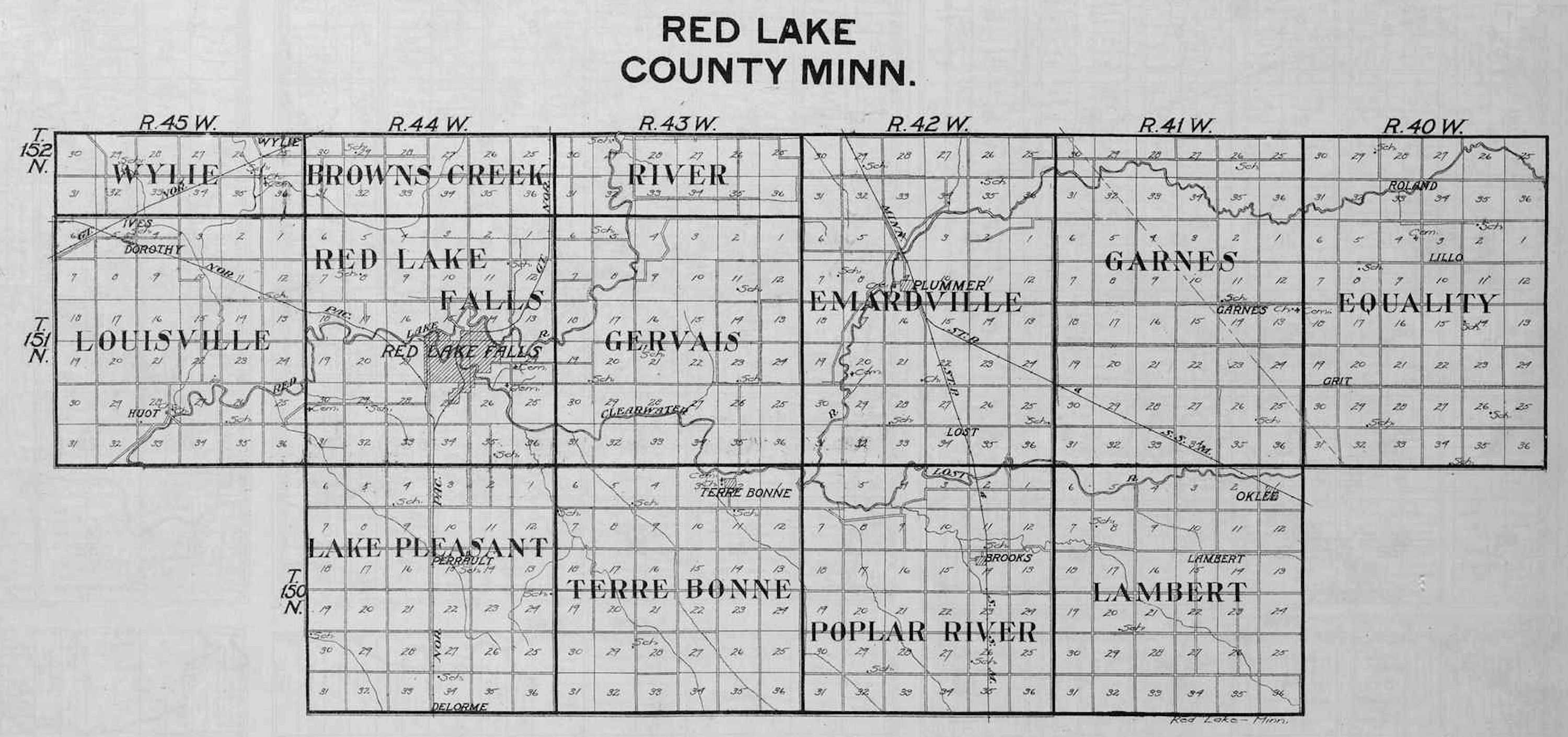
Townships County Overview |
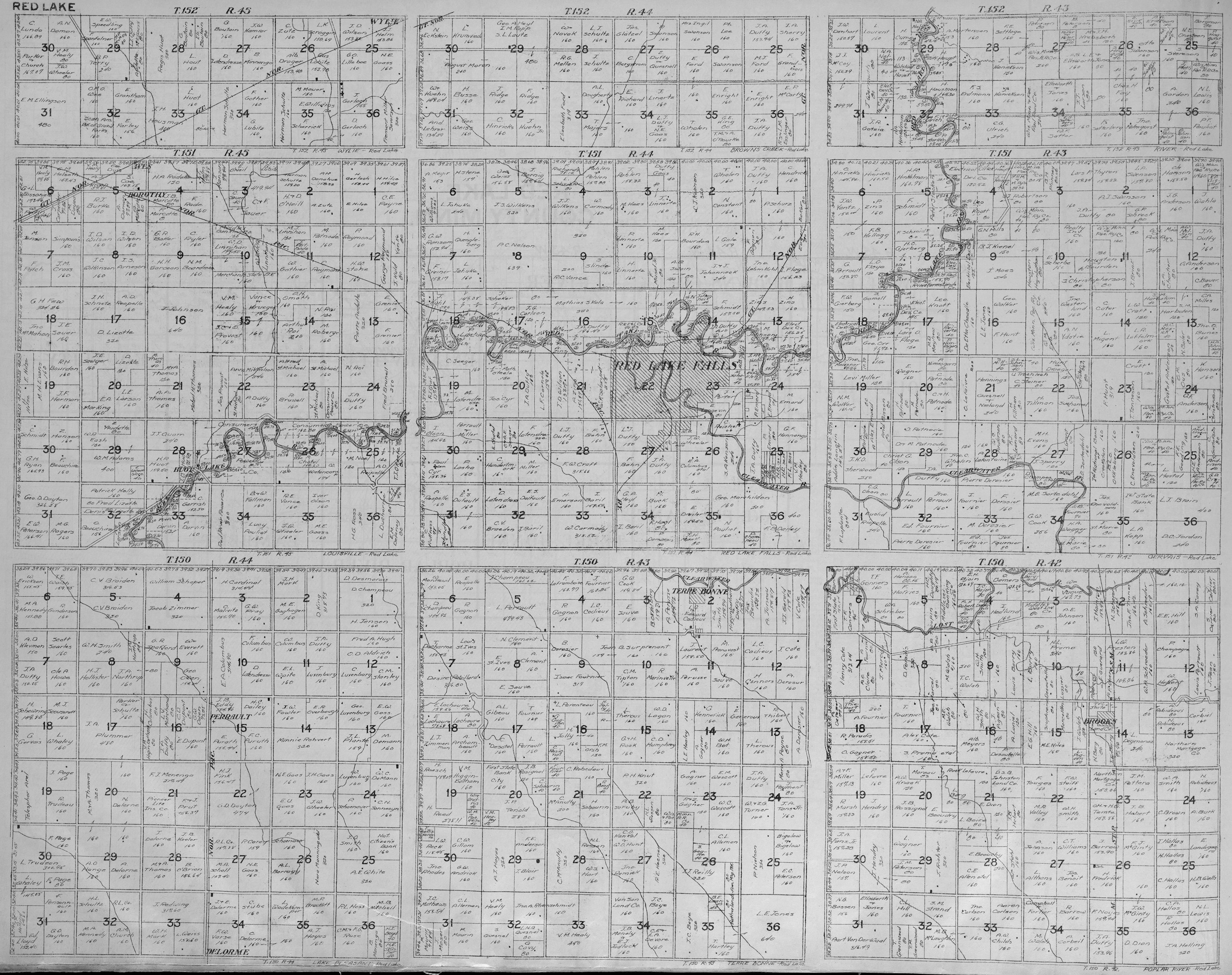
1st Row: Wylie - T152 R45 (12 Sections) Browns Creek - T152 R44 (12 Sections) River - T152 R43 (12 Sections) 2nd Row: Louisville - T151 R45 Red Lake Falls - T151 R44 Gervale - T151 R43 3rd Row: Lake Pleasant - T150 R44 Terre Bonne - T150 R43 Poplar River - T150 R42 |
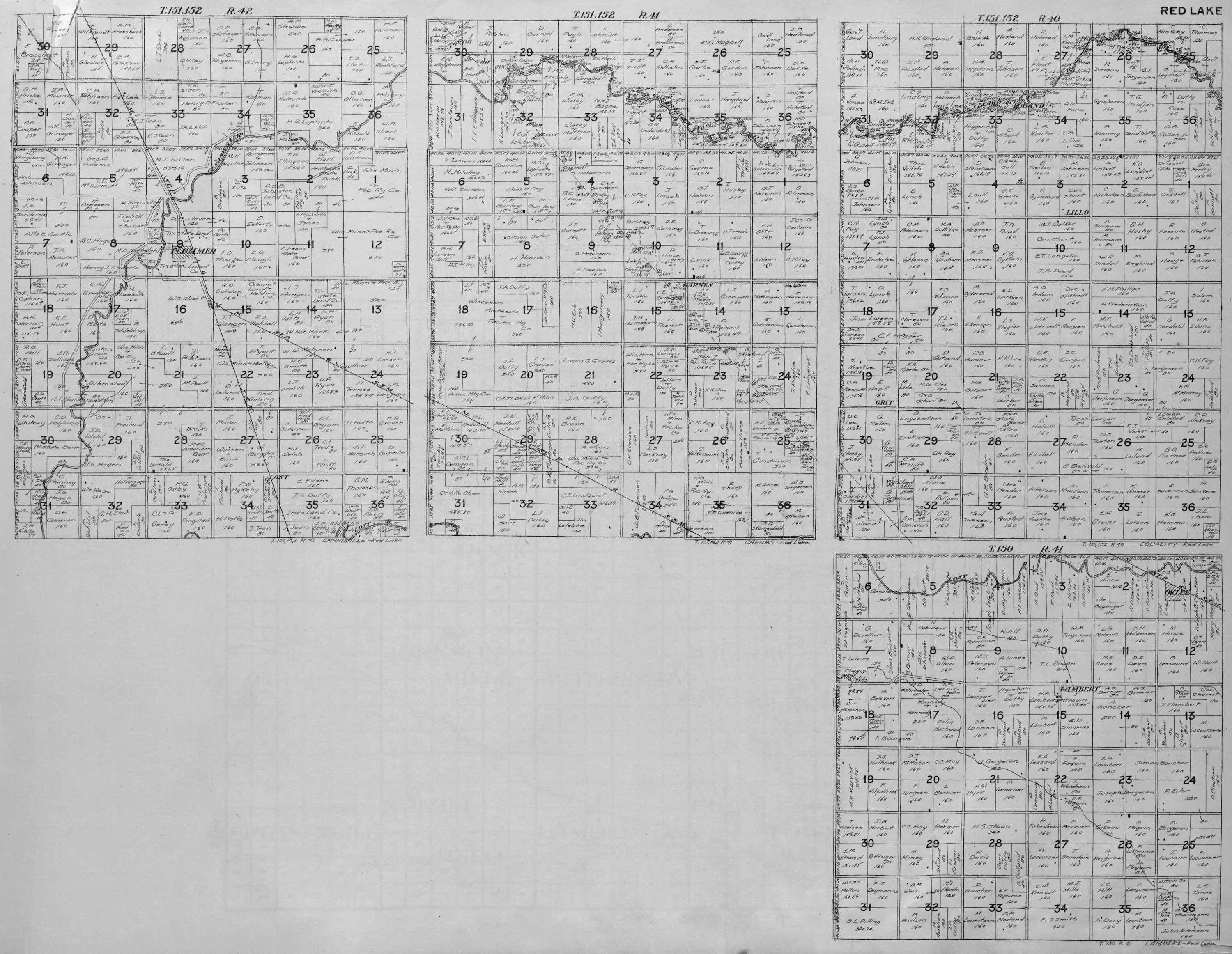
1st Row: Emardville - T151 R42 (48 Sections) Garnes - T151 R41 (48 Sections) Equality - T151 R40 (48 Sections) 2nd Row: Lambert - T150 R41 |
||||
USGenWeb Archives Minnesota Digital Maps Index
|
We welcome your contributions! Contact Mike Peterson, Minnesota Digital Maps Library Coordinator Updated 5 December 2019 |
|
|