|
||
|


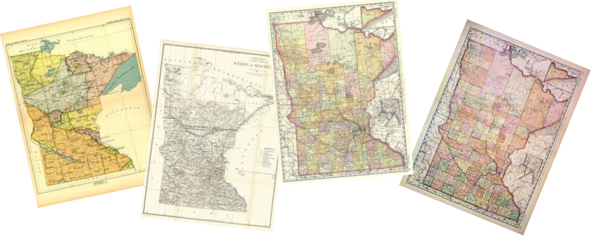
| Pope County, Minnesota Maps |
|
|
|
Click Map for Larger View
1916 - TOWNSHIPS / PLATS / LANDOWNERS |
||||||
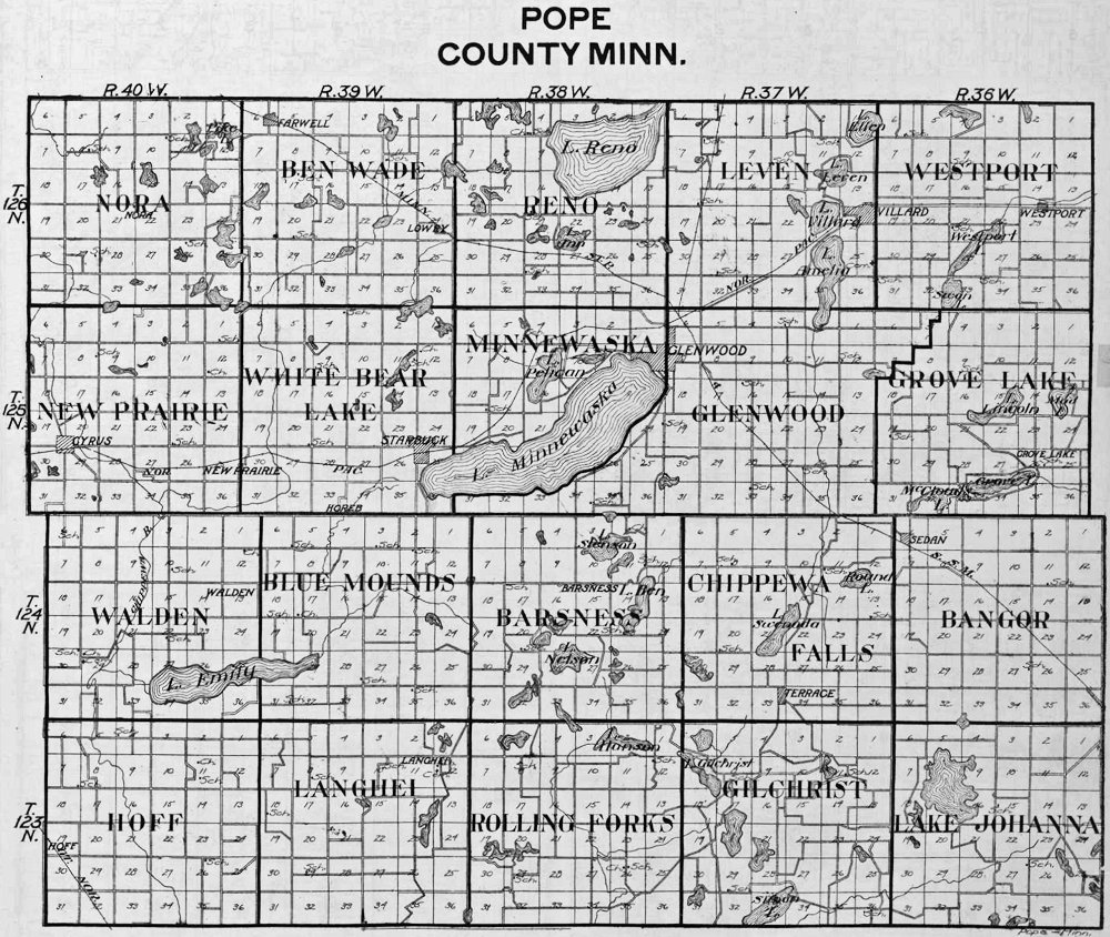
Townships County Overview |
||||||
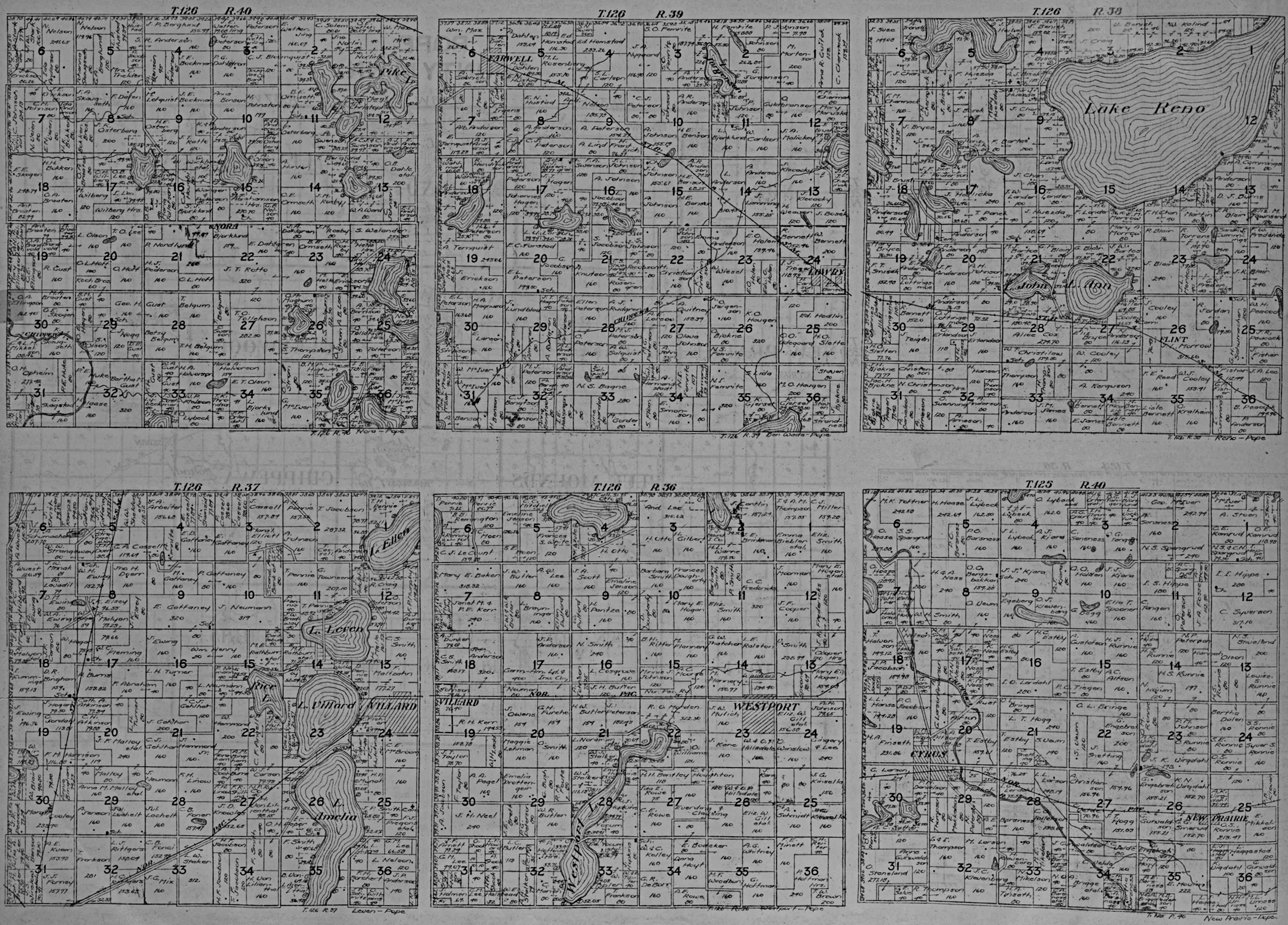
1st Row: Nora - T126 R40 Ben Wade - T126 R39 Reno - T126 R38 2nd Row: Leven - T126 R37 Westport - T126 R36 New Prairie - T125 R40 |
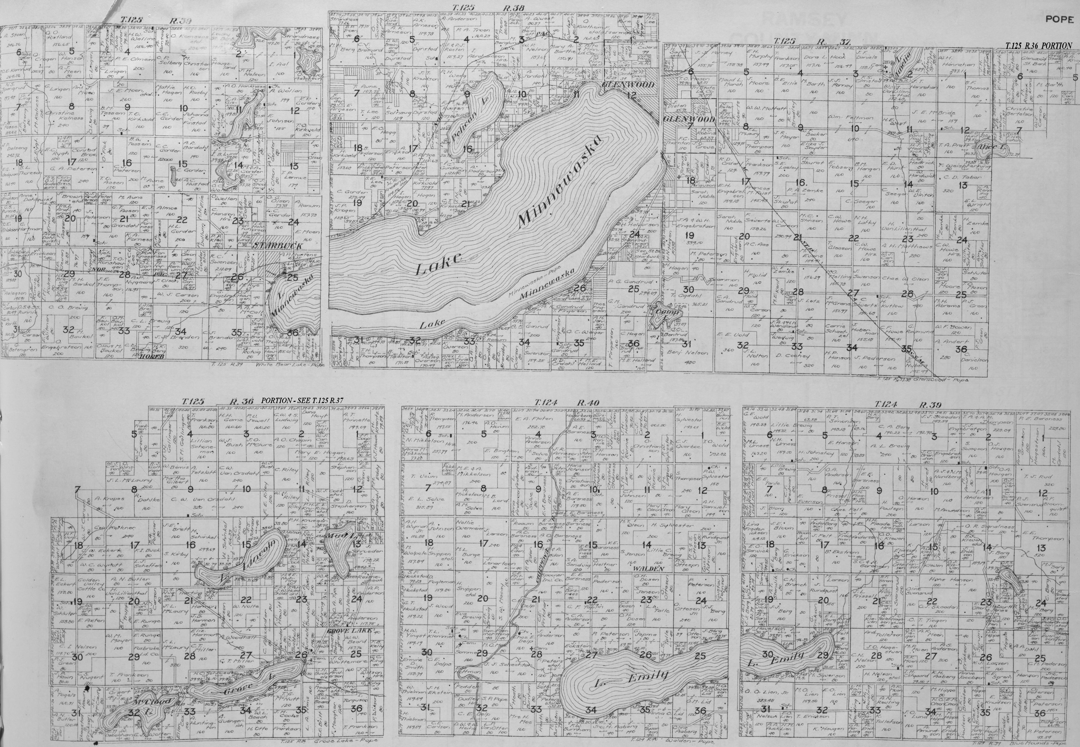
1st Row: White Bear Lake - T125 R39 Minnewaska - T125 R38 Glenwood - T125 R37** 2nd Row: Grove Lake - T125 R36** Walden - T124 R40 Blue Mounds - T124 R39 |
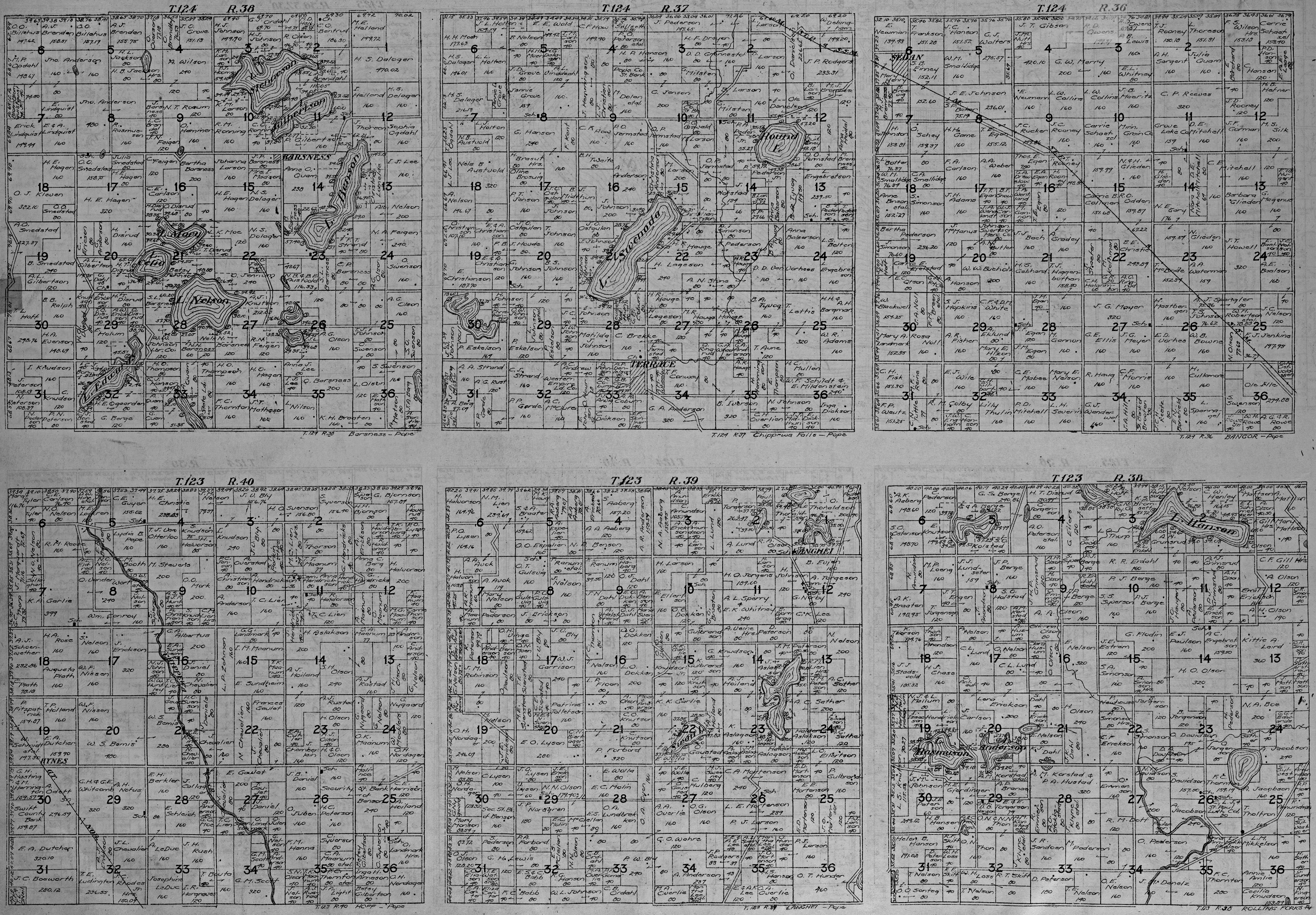
1st Row: Barsness - T124 R38 Chippewa Falls - T124 R37 Bangor - T124 R36 2nd Row: Hoff - T123 R40 Langhei - T123 R39 Rolling Forks - T123 R38 |
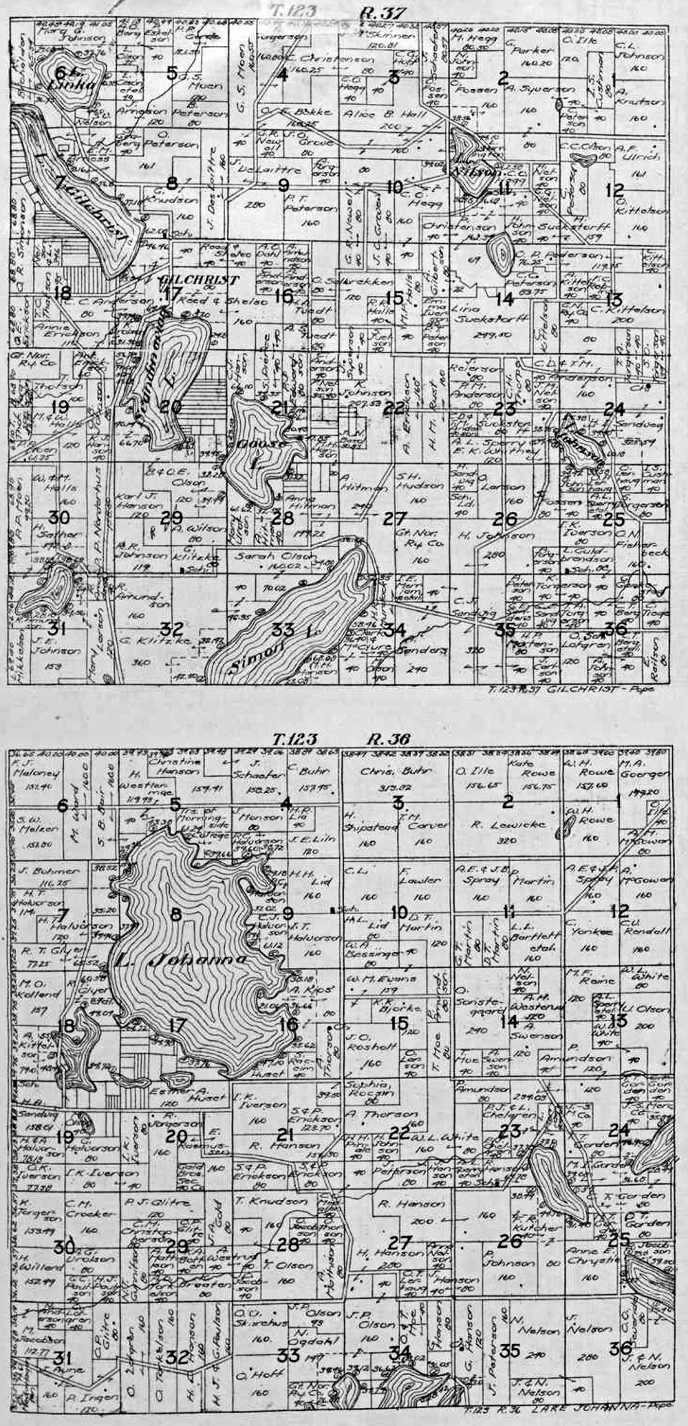
Gilchrist - T23 R37 Lake Johanna - T123 R36 |
|||
| ** = Township T125, Range 37 (Glenwood) Map shows portions of Township T125, Range 36 (Grove Lake) instead of on the Grove Lake Map. | ||||||
USGenWeb Archives Minnesota Digital Maps Index
|
We welcome your contributions! Contact Mike Peterson, Minnesota Digital Maps Library Coordinator Updated 24 May 2021 |
|
|