|
||
|


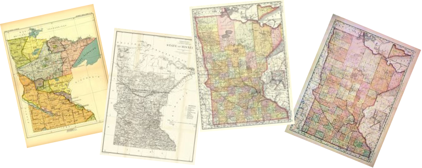
| Pennington County, Minnesota Maps |
|
|
|
Click Map for Larger View
1916 - TOWNSHIPS / PLATS / LANDOWNERS |
||||||
|
Note: Sections 1 through 11 in all Ranges within Township 154 are actually part of Marshall County north of Pennington. Sections 25 through 36 in Ranges 40 through 45 of Township 152 are actually part of Red Lake County south of Pennington.
|
||||||
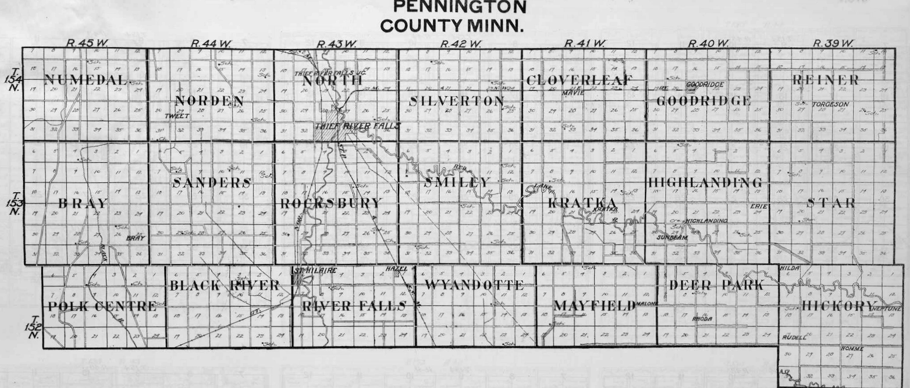
Pennington Townships |
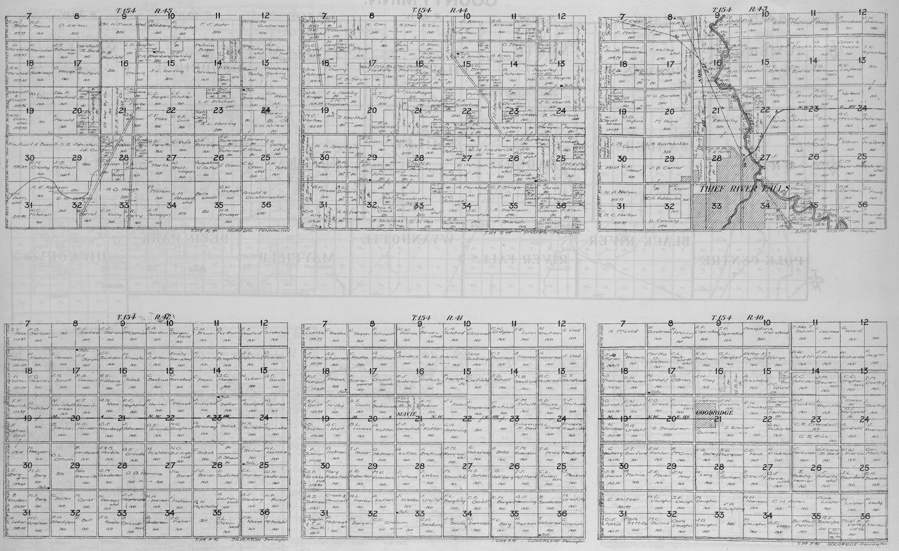
Numedal - T154 R45 Norden - T154 R44 North - T154 R43 Silverton - T154 R42 Cloverleaf - T154 R41 Goodridge - T154 R40 |
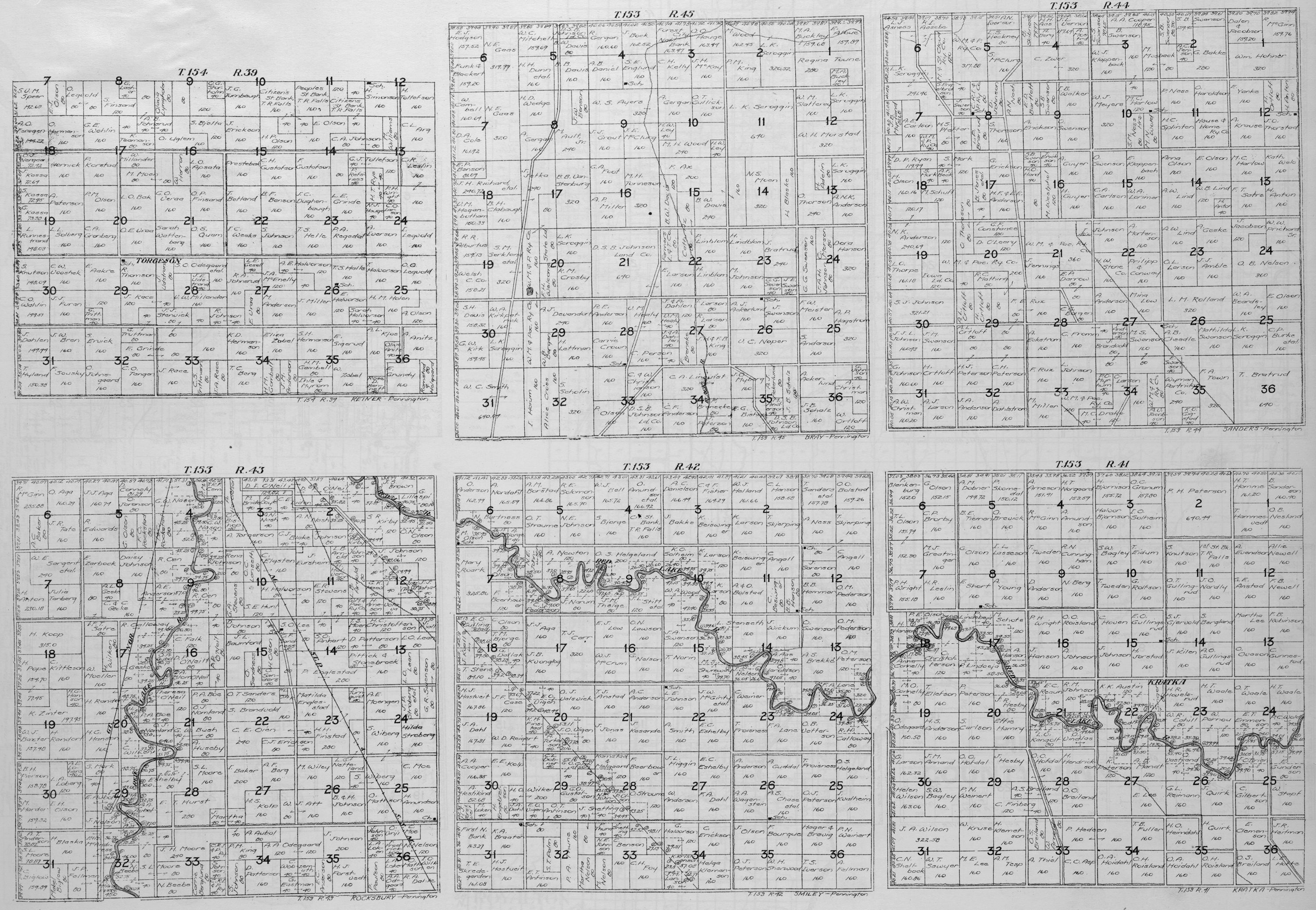
Reiner - T154 R39 Bray - T153 R45 Sanders - T153 R44 Rocksbury - T153 R43 Smiley - T153 R42 Kratka - T153 R41 |
||||
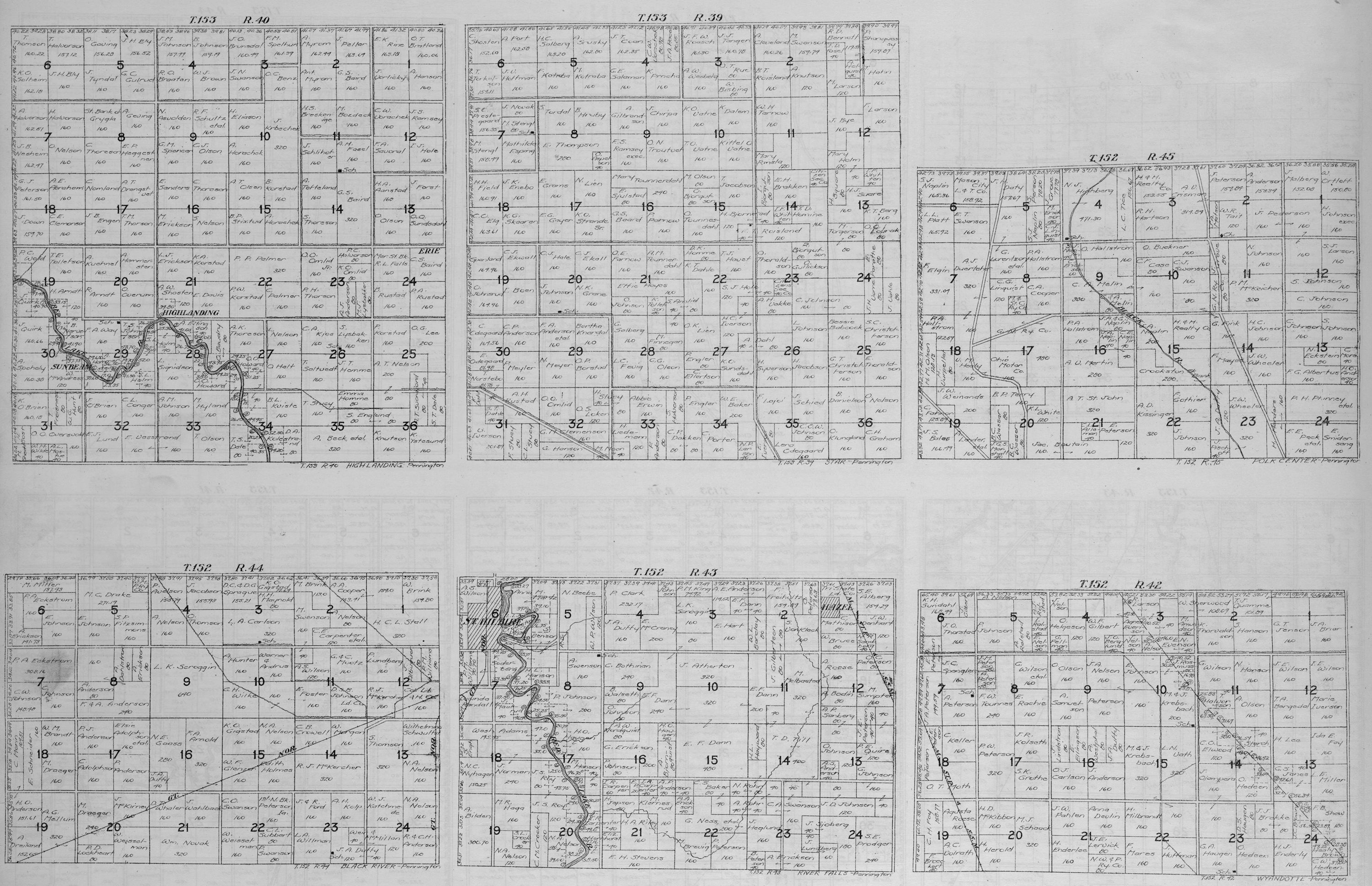
Highlanding - T153 R40 Star - T153 R39 Polk Centre - T152 R45 Black River - T152 R44 River Falls - T152 R43 Wyandotte - T152 R42 |
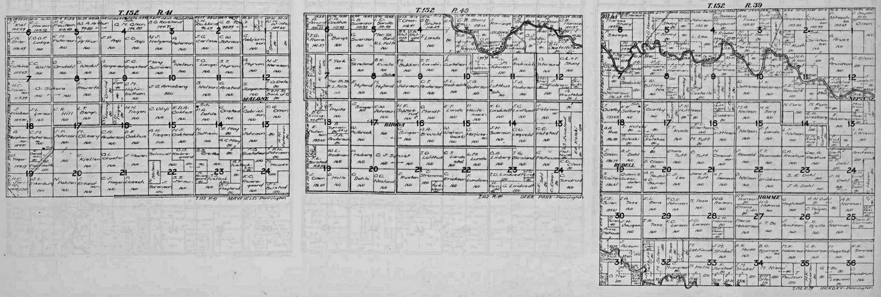
Mayfield - T152 R41 Deer Park - T152 R40 Hickory - T152 R39 |
|||||
USGenWeb Archives Minnesota Digital Maps Index
|
We welcome your contributions! Contact Mike Peterson, Minnesota Digital Maps Library Coordinator Updated 22 January 2020 |
|
|