|
||
|


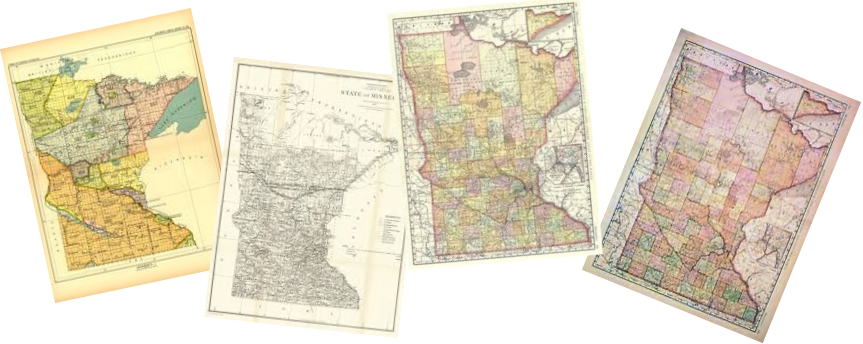
| Kittson County, Minnesota Maps |
|
|
|
Click Map for Larger View
1916 - TOWNSHIPS / PLATS / LANDOWNERS |
||||||
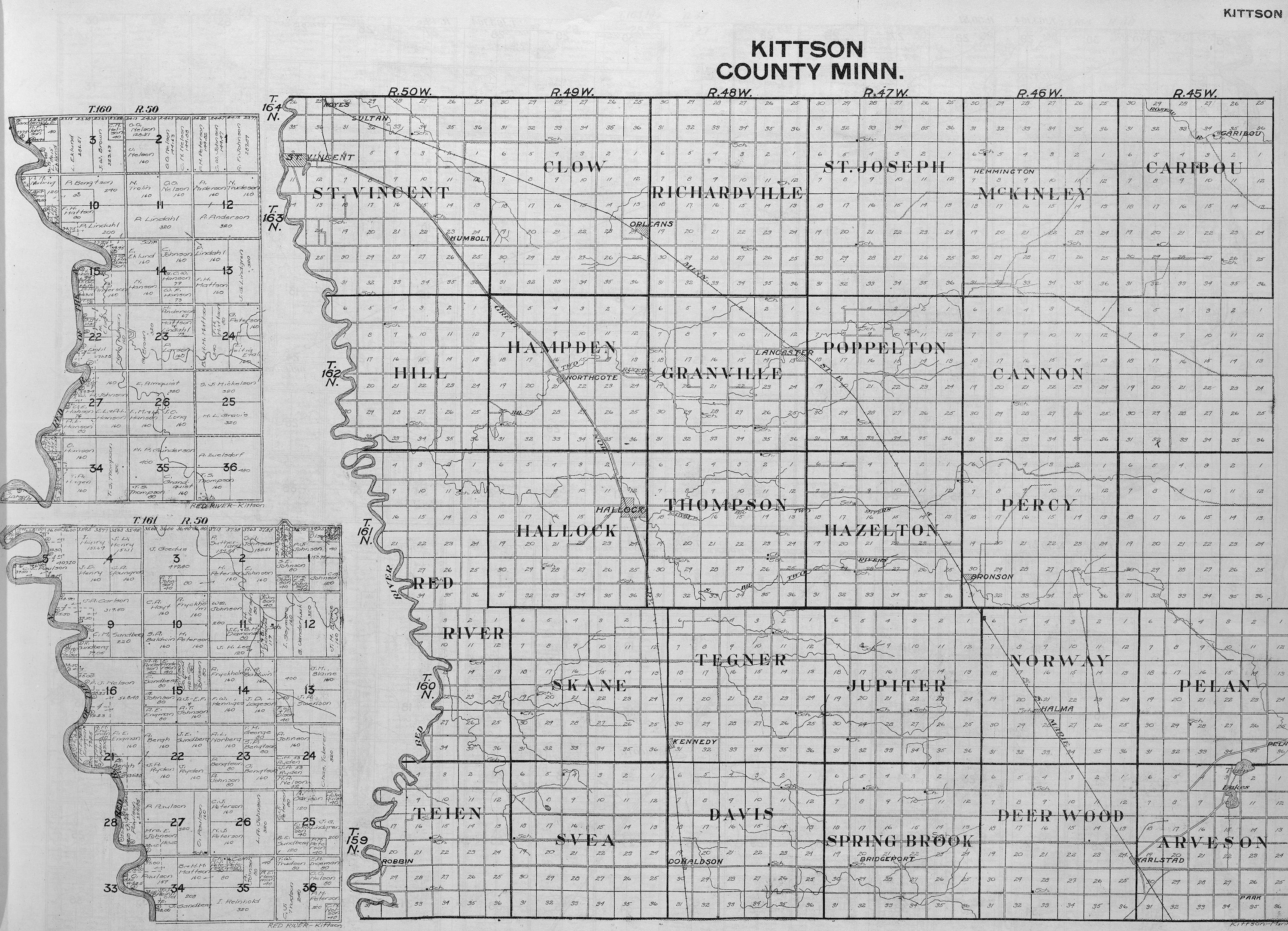
Townships Minnesota Portions-T160/161 R50 |
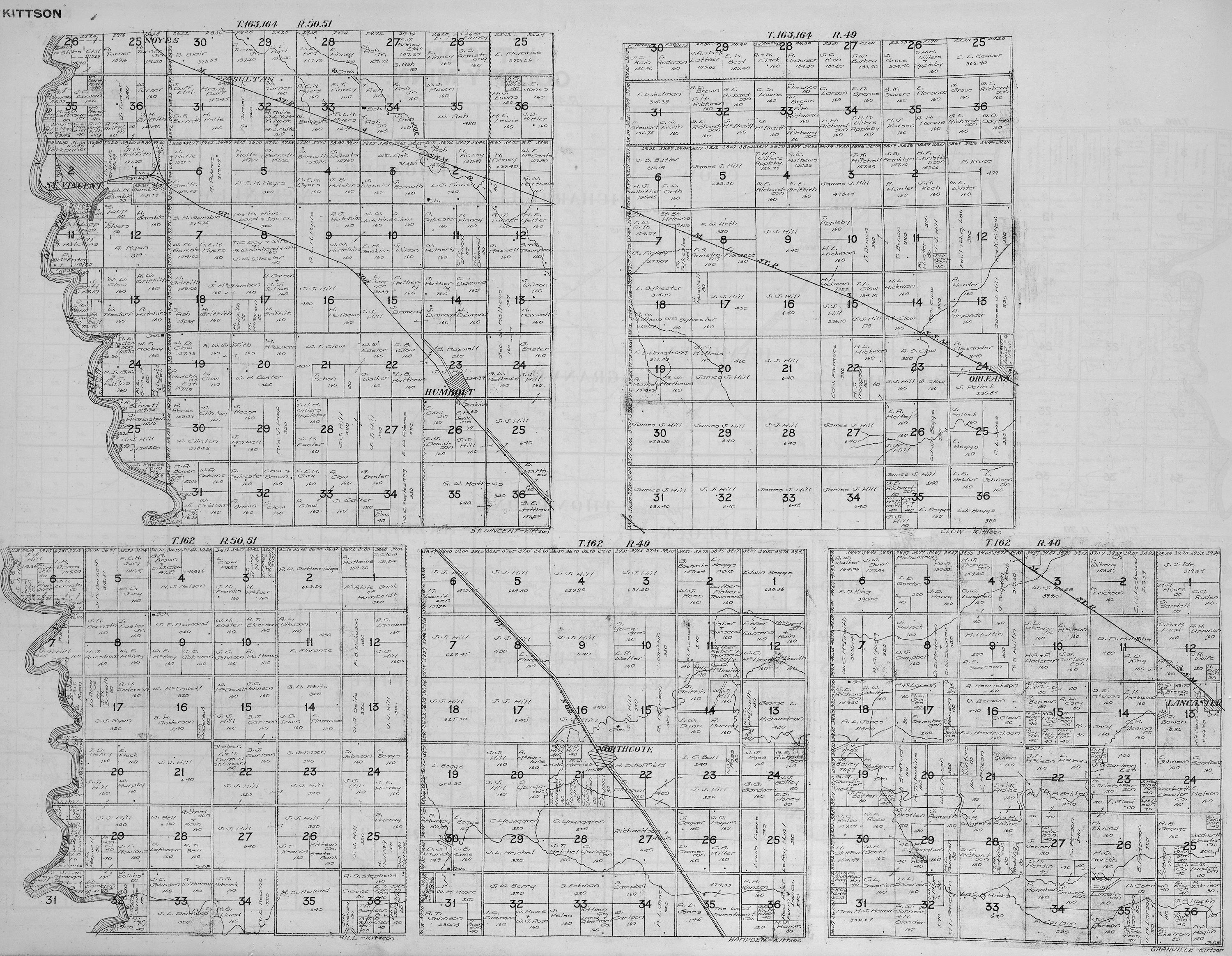
St. Vincent - T163/164 R50/51 Clow - T163/164 R49 Hill - T162 R50/51 Hampden - T162 R49 Granville - T162 R48 |
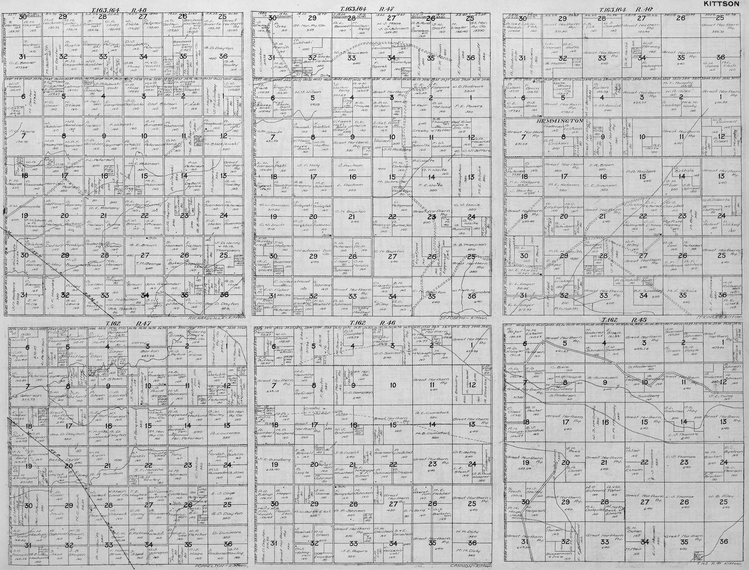
Richardville - T163/164 R48 St. Joseph - T163/164 R47 McKinley - T163/164 R46 Peppelton - T162 R47 Cannon - T162 R46 Unnamed - T162 R45 |
||||
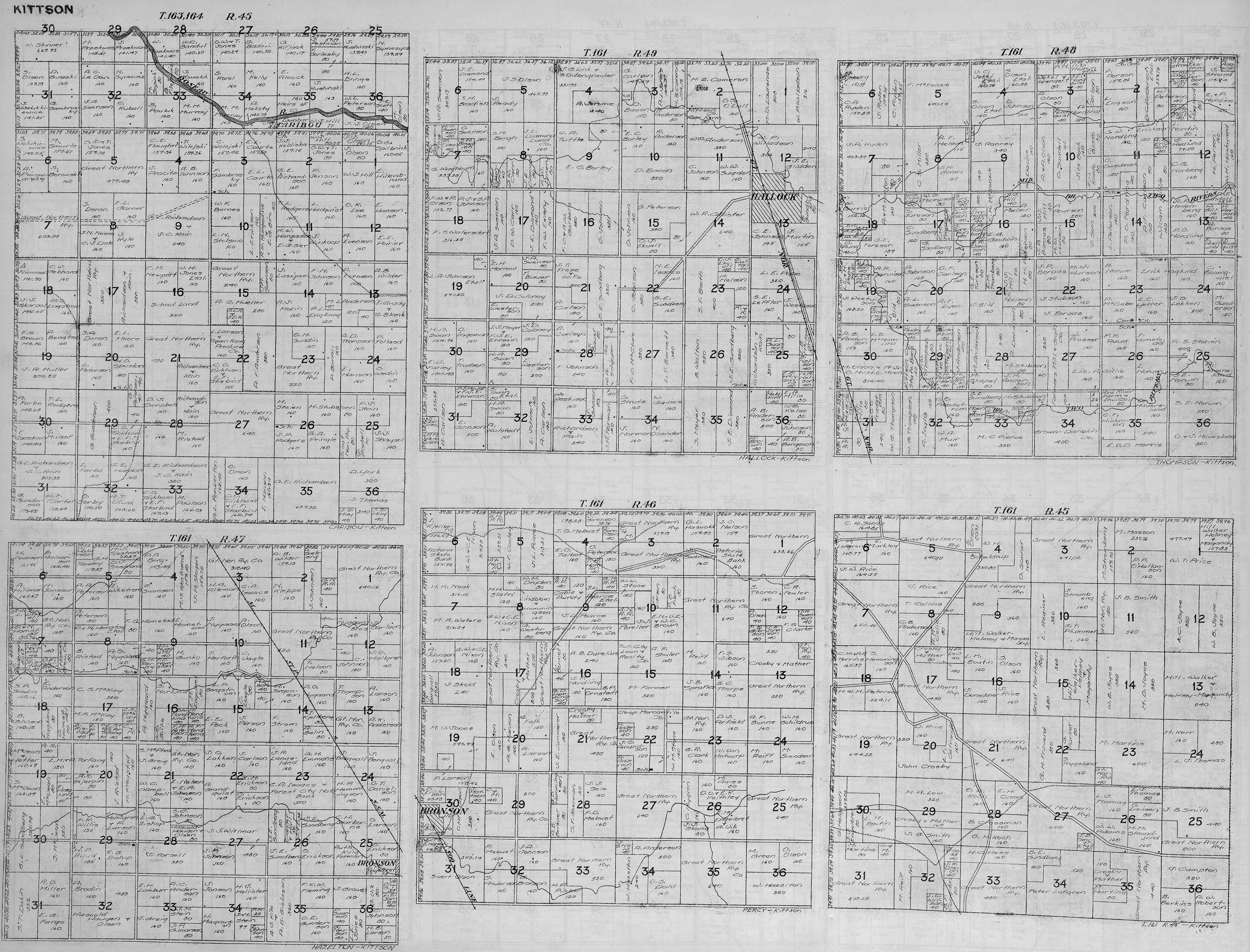
Caribou - T163/164 R45 Hallock - T161 R49 Thompson - T161 R48 Hazelton - T161 R47 Percy - T161 R46 Unnamed - T161 R45 |
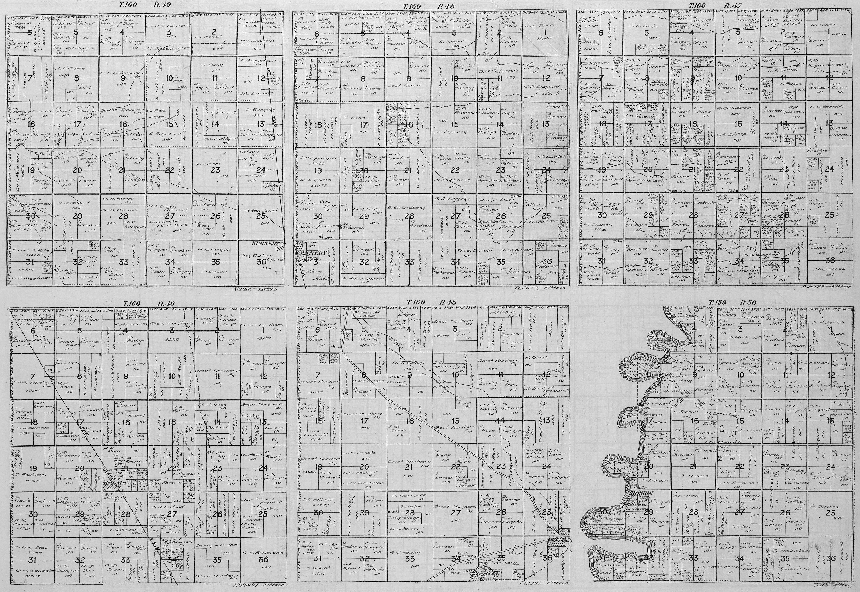
Skane - T160 R49 Tegner - T160 R48 Jupiter - T160 R47 Norway - T160 R46 Pelan - T160 R45 Teien - T159 R50 |
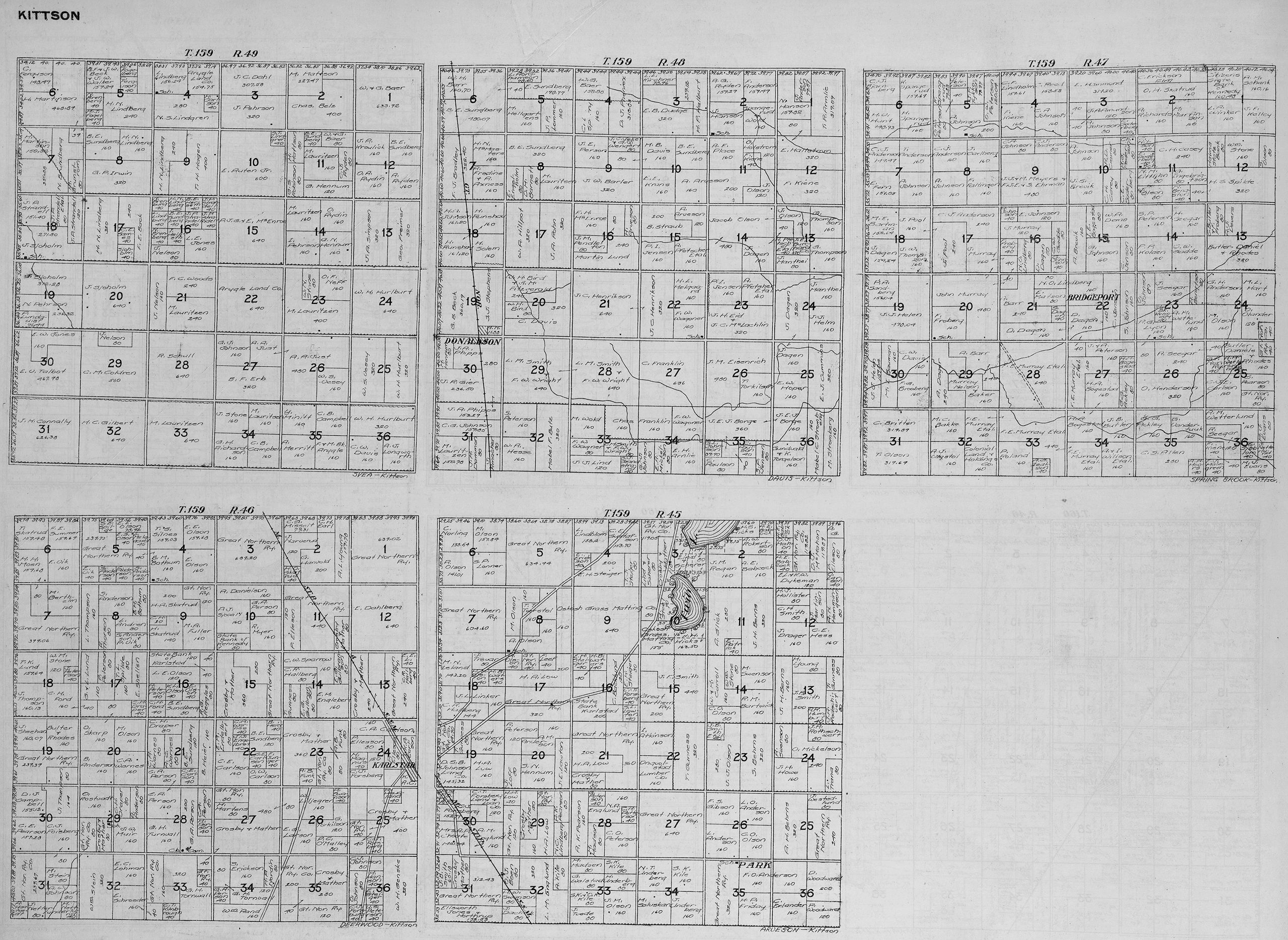
Svea - T159 R49 Davis - T159 R48 Spring Brook - T159 R47 Deerwood - T159 R46 Arveson - T159 R45 |
||||
USGenWeb Archives Minnesota Digital Maps Index
|
We welcome your contributions! Contact Mike Peterson, Minnesota Digital Maps Library Coordinator Updated 3 July 2019 |
|
|