|
||
|


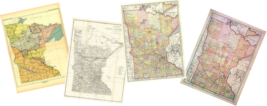
| Clearwater County, Minnesota Maps |
|
|
|
Click Map for Larger View
1916 - TOWNSHIPS / PLATS / LANDOWNERS |
||||||
|
Note:The individual township maps that show sections without landowners indicates those sections are part of either the Red Lake Indian Reservation (Miskwaagamiiwi-zaaga'igan) or the White Earth Indian Reservation.
|
||||||
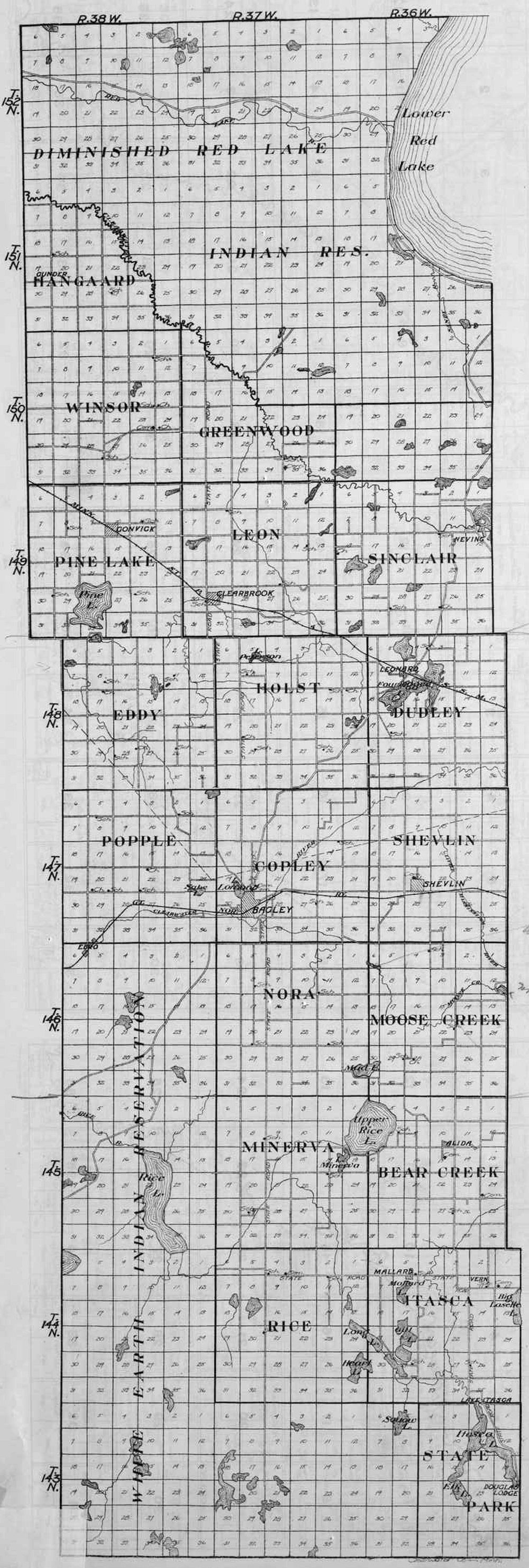
Townships County Overview |
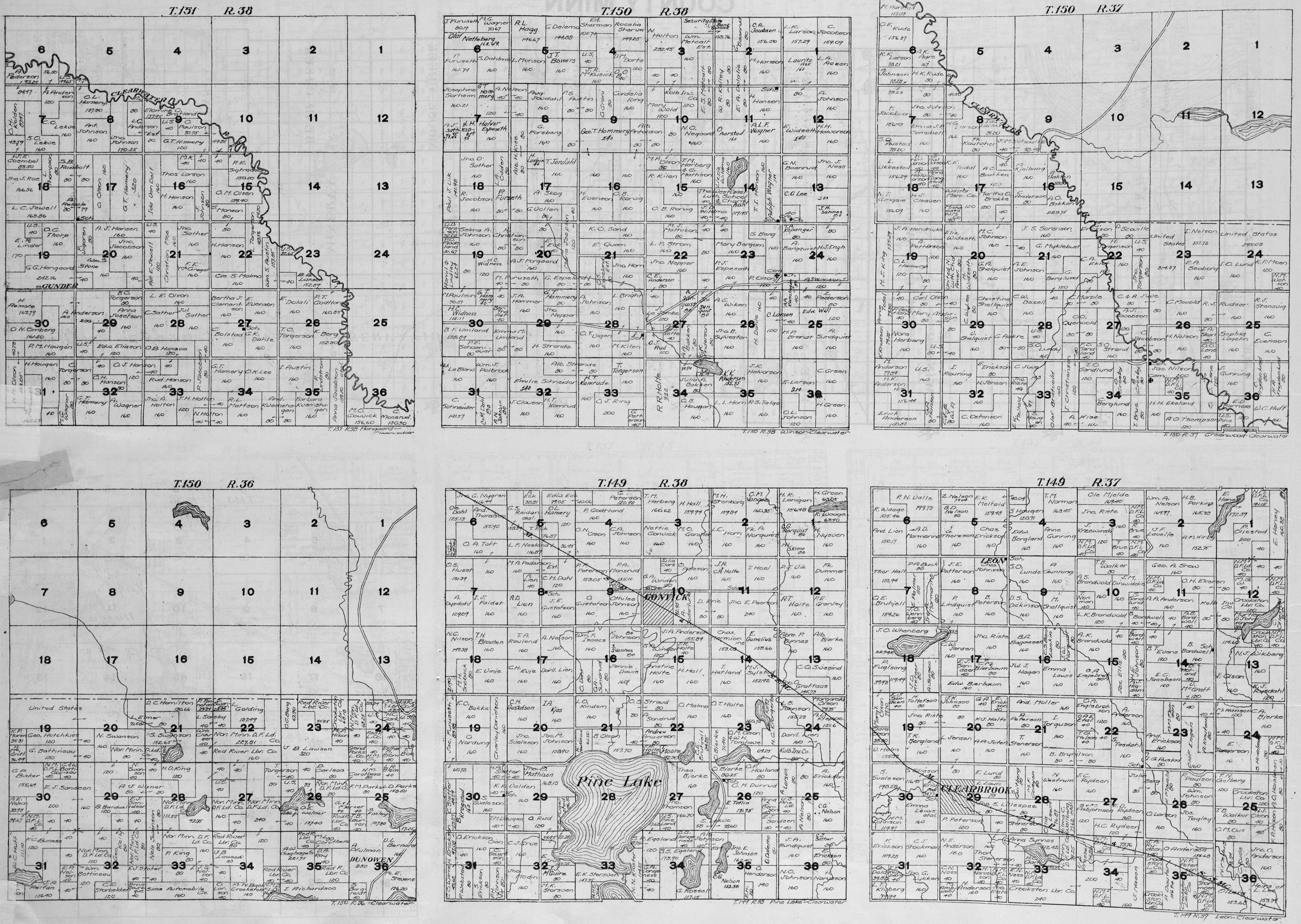
1st Row: Hangaard - T151 R38 Winsor - T150 R38 Greenwood - T150 R37 2nd Row: T150 R36 Pine Lake - T149 R38 Leon - T149 R37 |
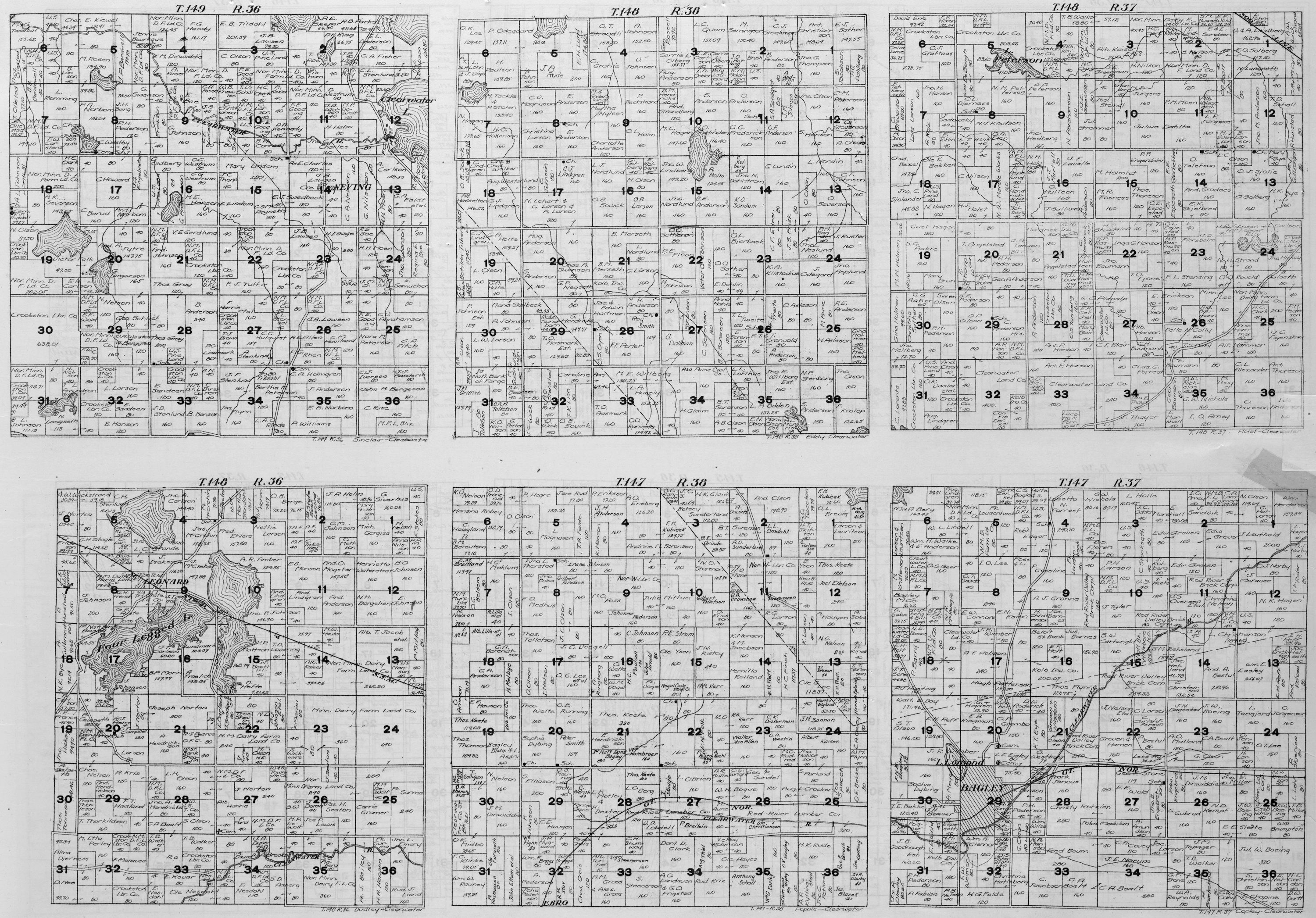
1st Row: Sinclair - T149 R36 Eddy - T148 R38 Holst - T148 R37 2nd Row: Dudley - T148 R36 Popple - T147 R38 Copley - T147 R37 |
||||
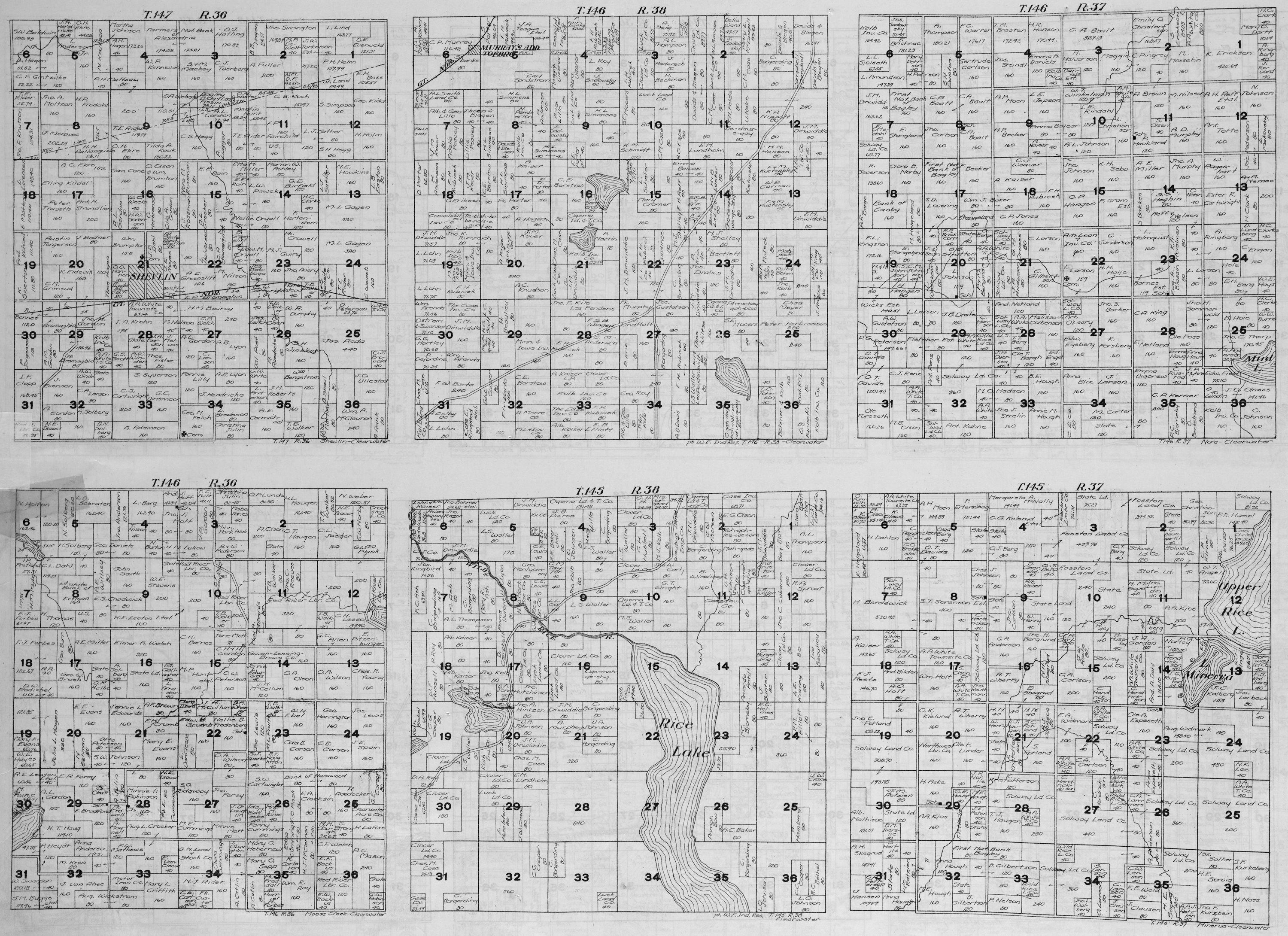
1st Row: Shevlin - T147 R36 T146 R38 Nora - T146 R37 2nd Row: Moose Creek - T14 R36 T145 R38 Minerva - T145 R37 |
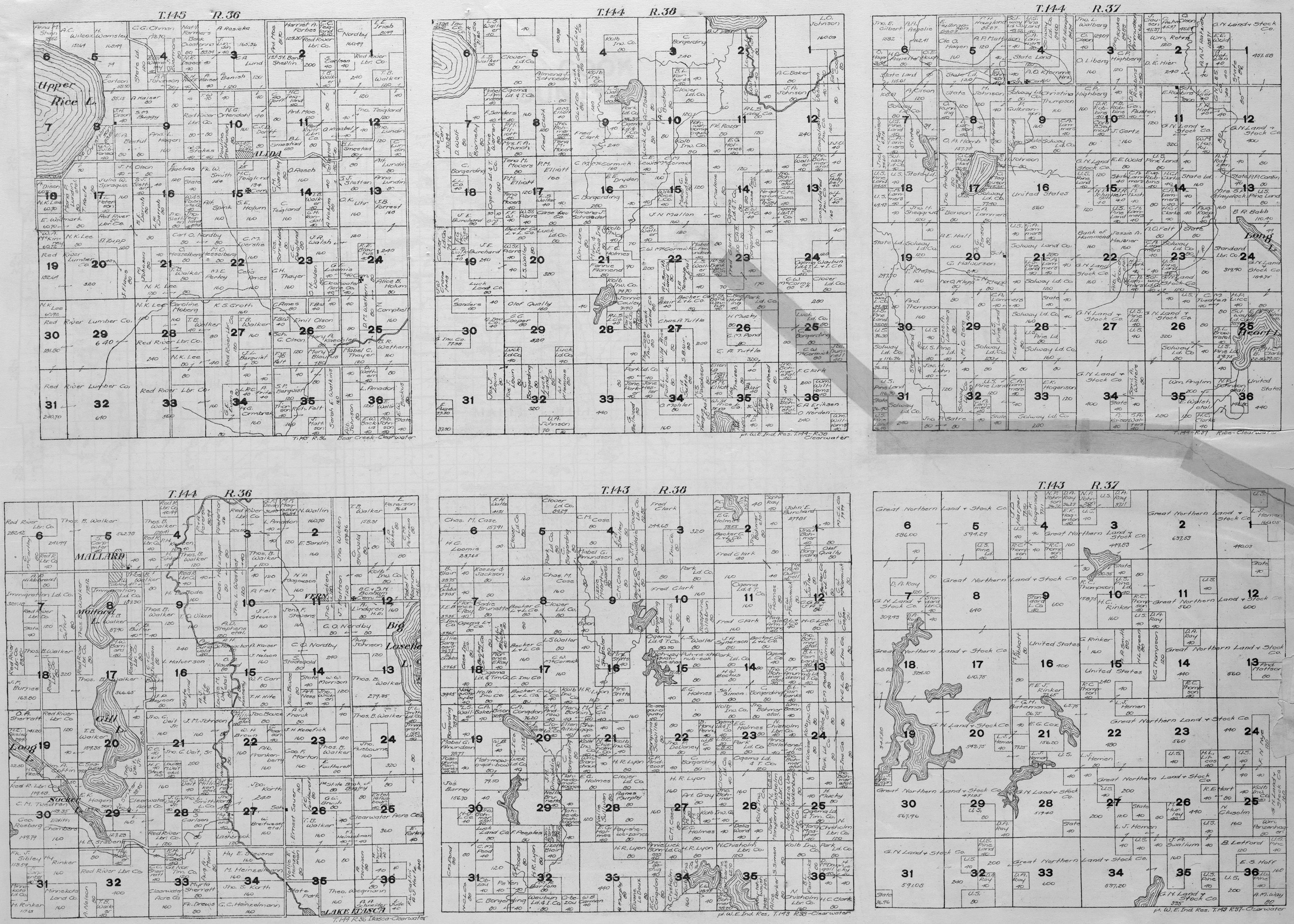
1st Row: Bear Creek - T145 R36 T144 R38 Rice - T144 R37 2nd Row: Itasca - T144 R36 T143 R38 T143 R37 |
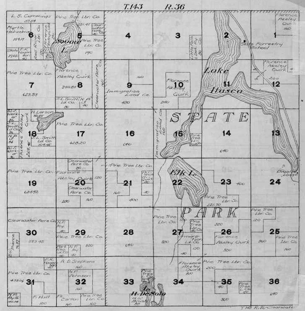
State Park - T143 R36 |
||||
USGenWeb Archives Minnesota Digital Maps Index
|
We welcome your contributions! Contact Mike Peterson, Minnesota Digital Maps Library Coordinator Updated 9 Octoberf 2020 |
|
|