1866 Map of Union Parish Louisiana
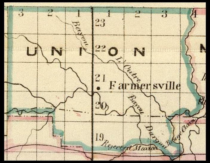
This map is marked with the township/range numbers for Union Parish. The heavy line in the middle is the Louisiana Meridian. The numbers beside it (from top to bottom) are the township numbers (they are always recorded as Twsp xxN for Union Parish). The numbers at the top that begin with "1" on either side of the Meridian are the Range lines. To the right are range lines East and to the left are range lines West. If you have the legal description of a piece of property you can locate the township/range it is in and the general area within it. This map is too small to show the division into sections. A township is a six mile square that contains thirty-six sections, each one mile square containing 640 acres. The sections are numbered 1 though 36 beginning at the top right corner and continuing to the west, drop down and continue to the east, etc. A typical property description looks like this: N½ SE¼ Sec. 26 T22N R1W (the north one-half of the southeast quarter of Section 26, Township 22 North, Range 1 West).
Map submitted to the Union Parish Louisiana USGenWeb Archives by Bruce Odom in April 2004.
Copyright. All rights reserved. http://www.usgwarchives.net/copyright.htm
http://www.usgwarchives.net/la/lafiles.htm