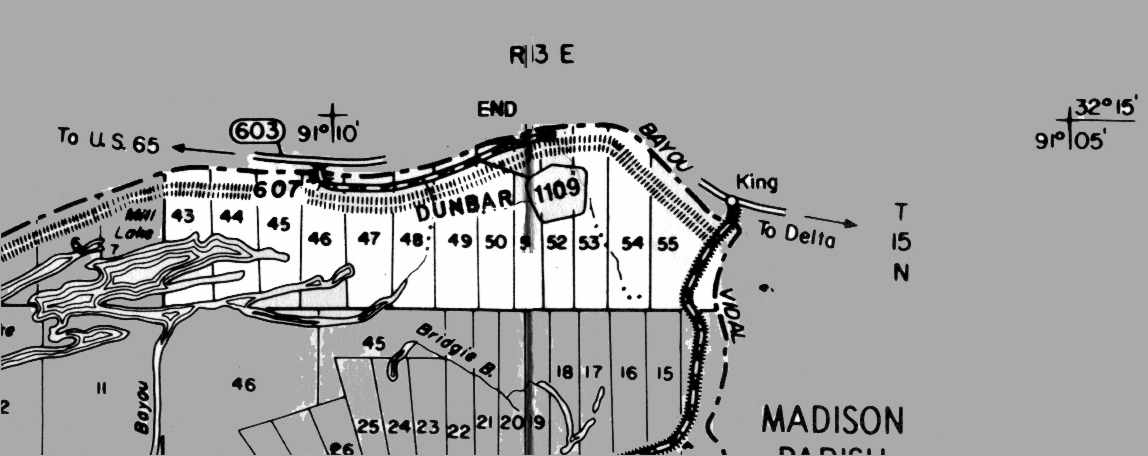
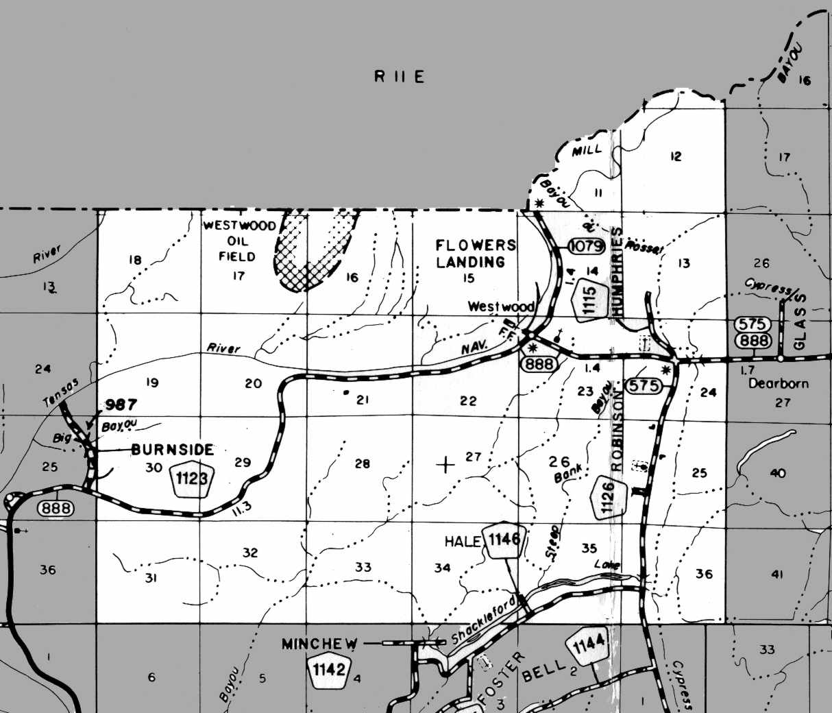
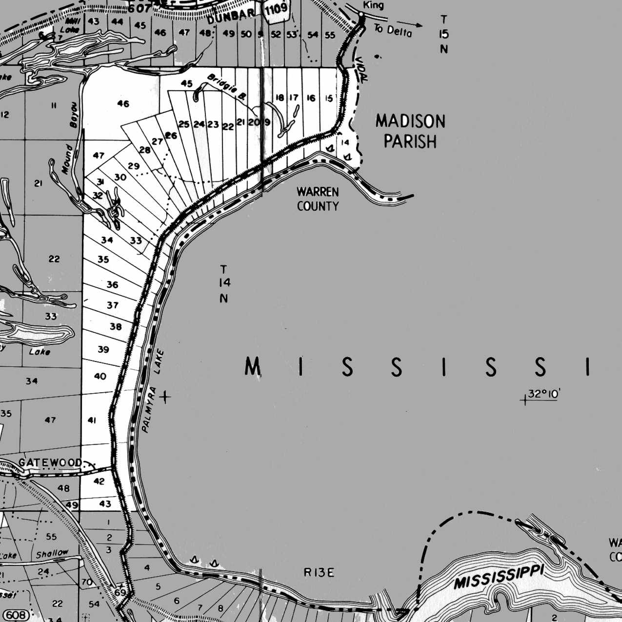
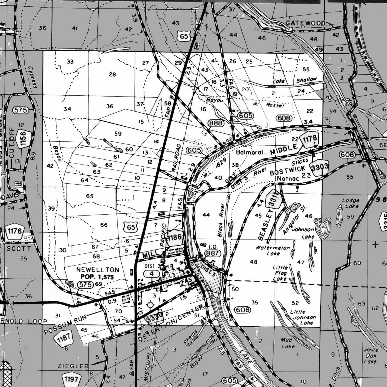
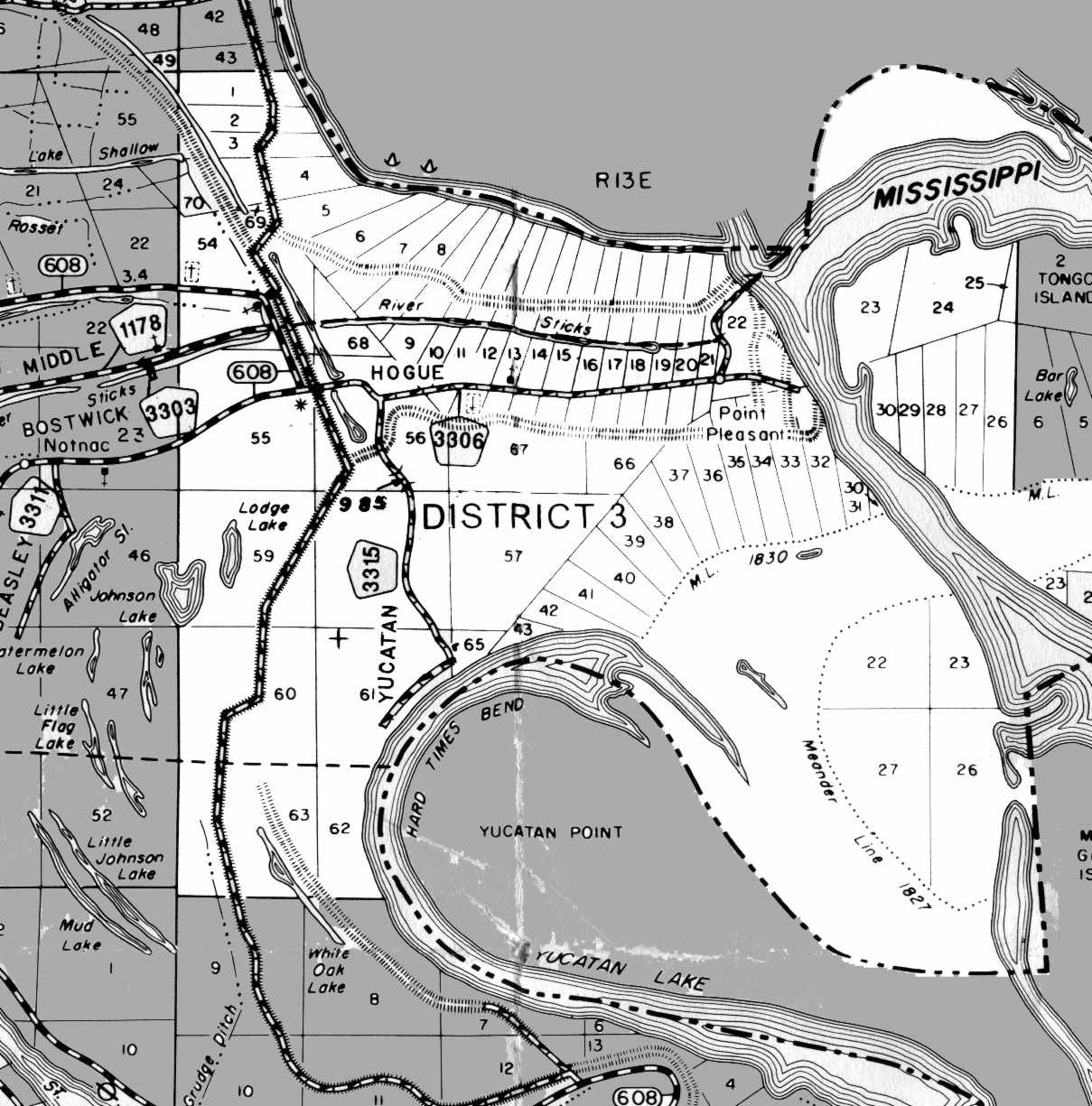
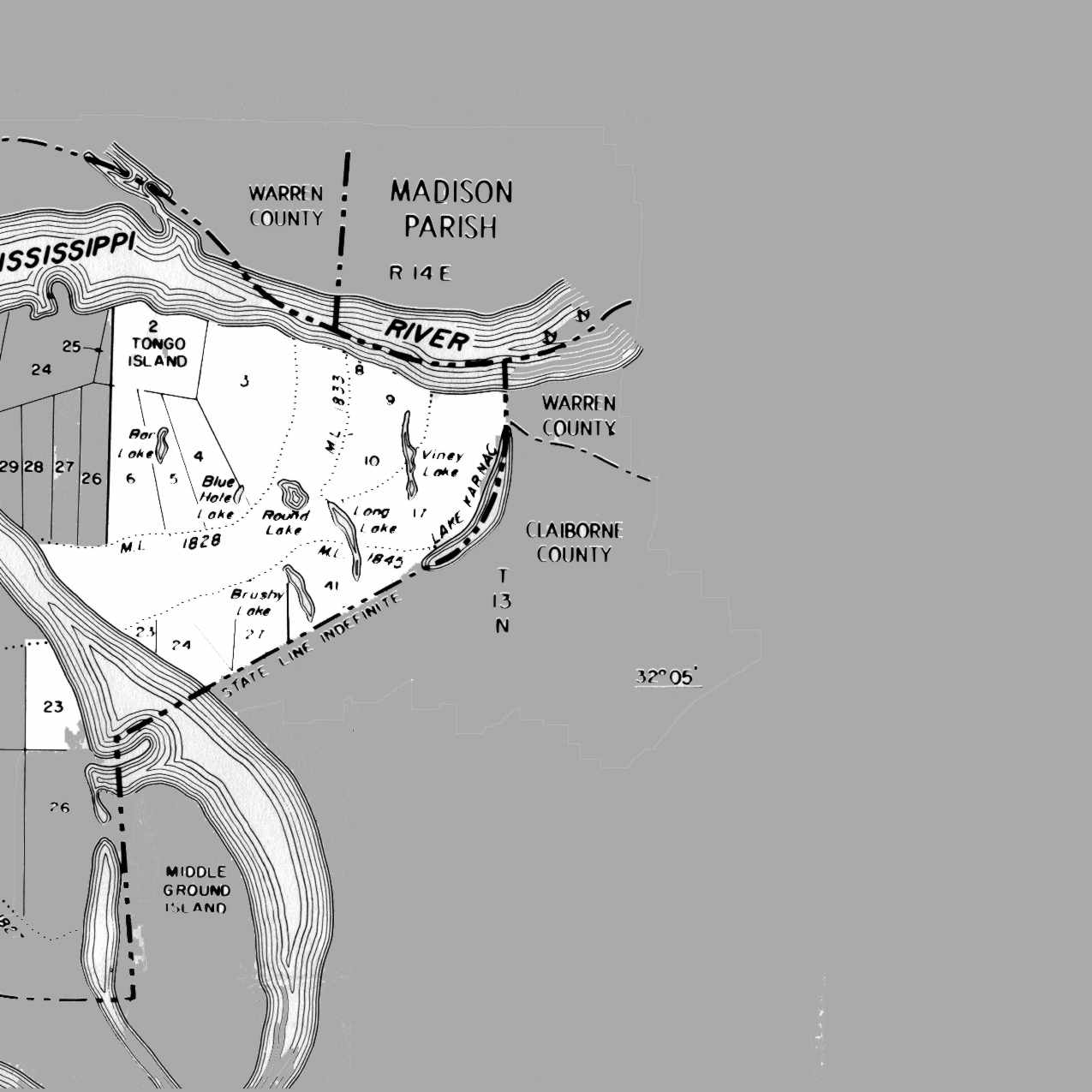
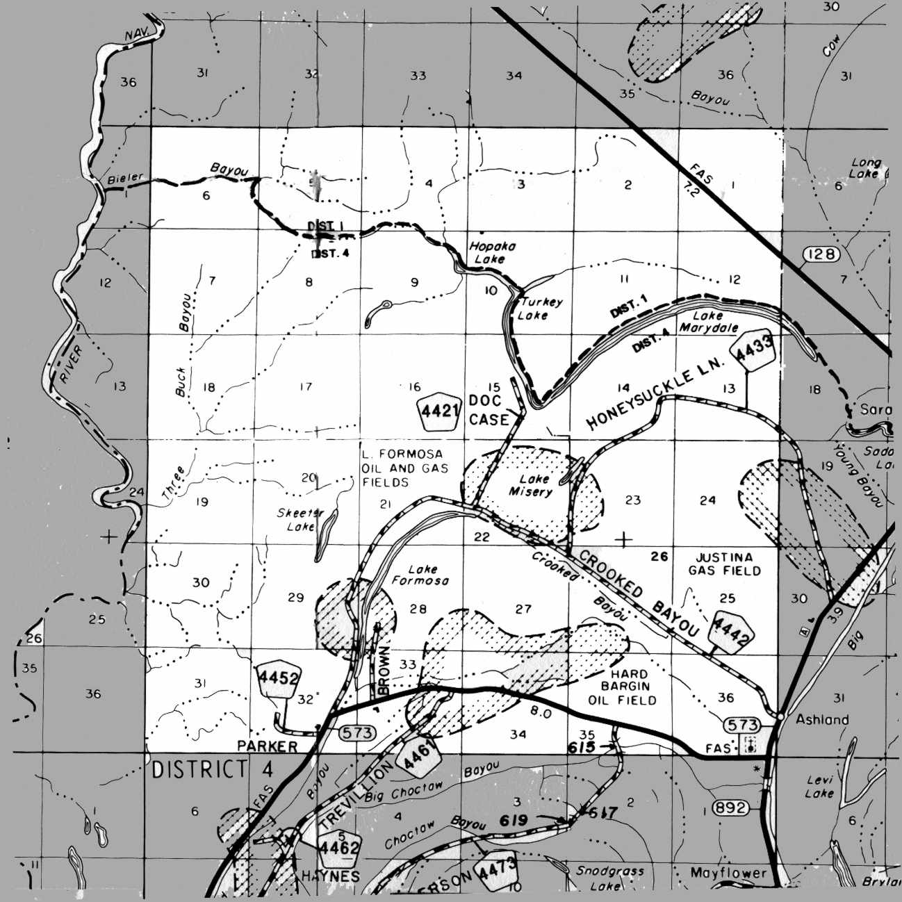
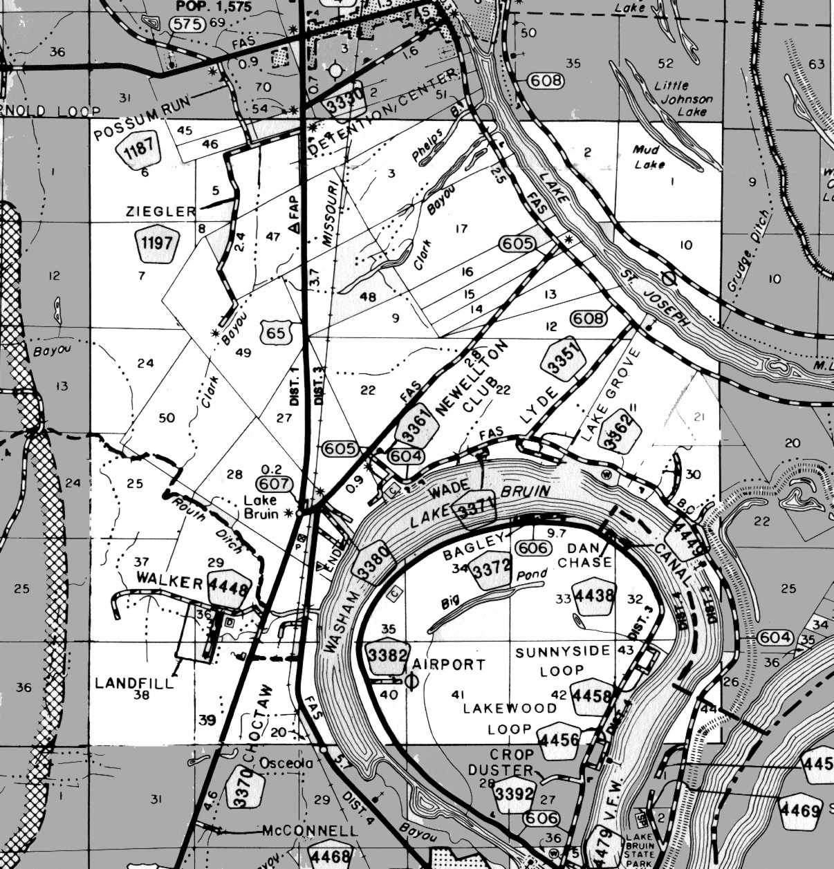
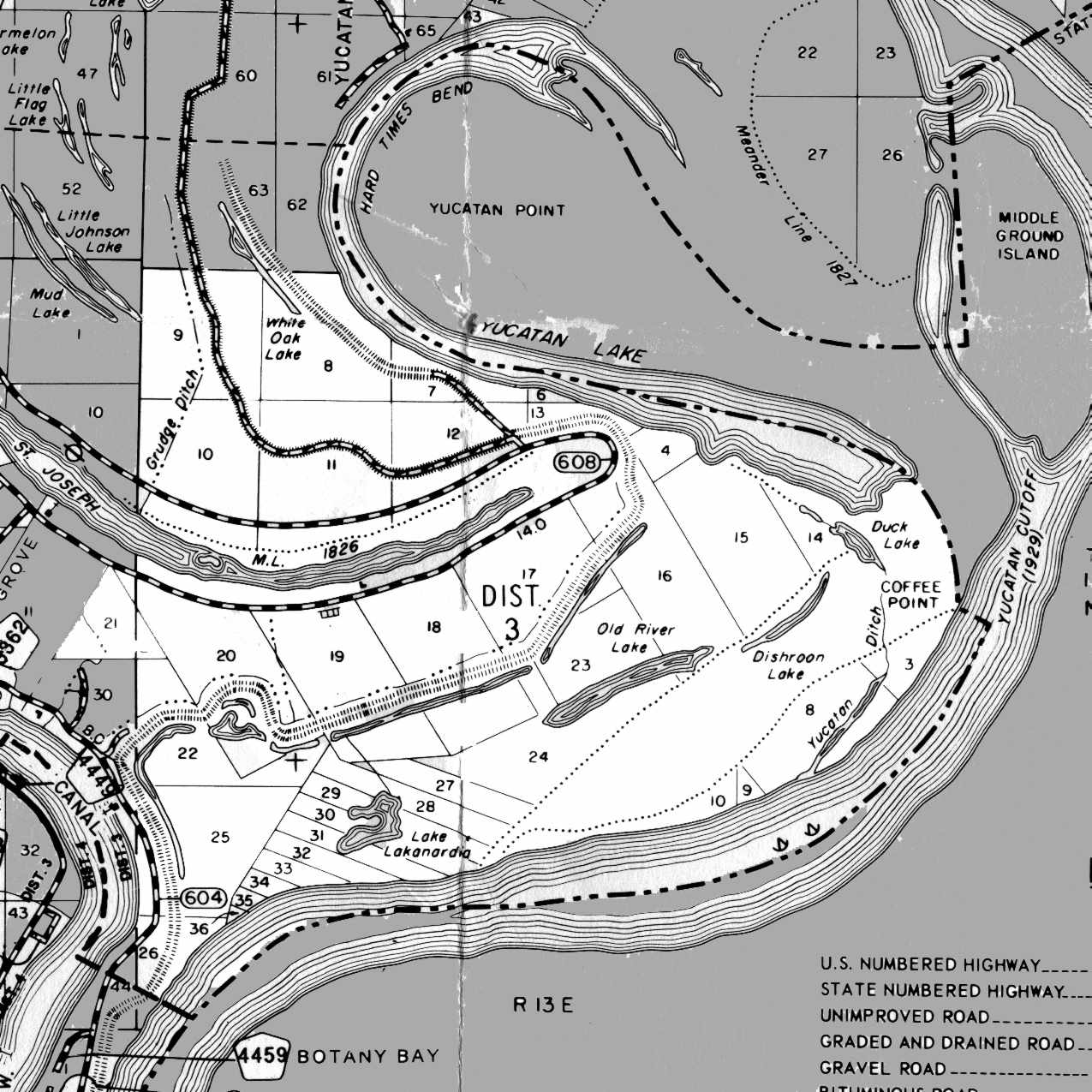
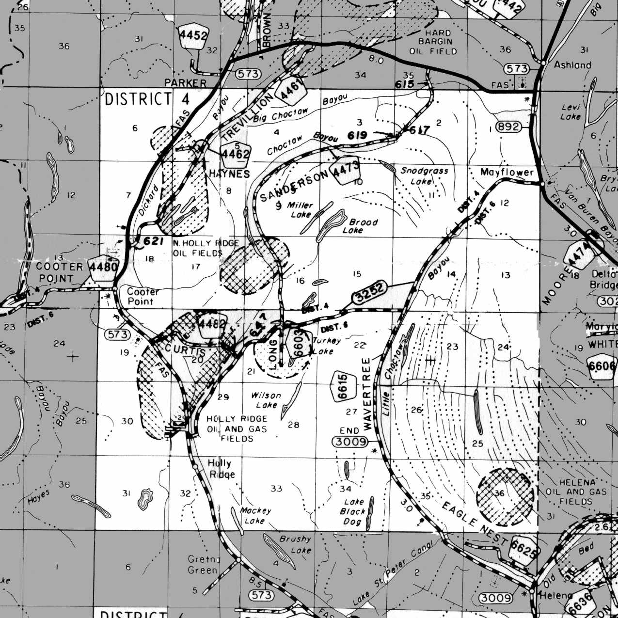
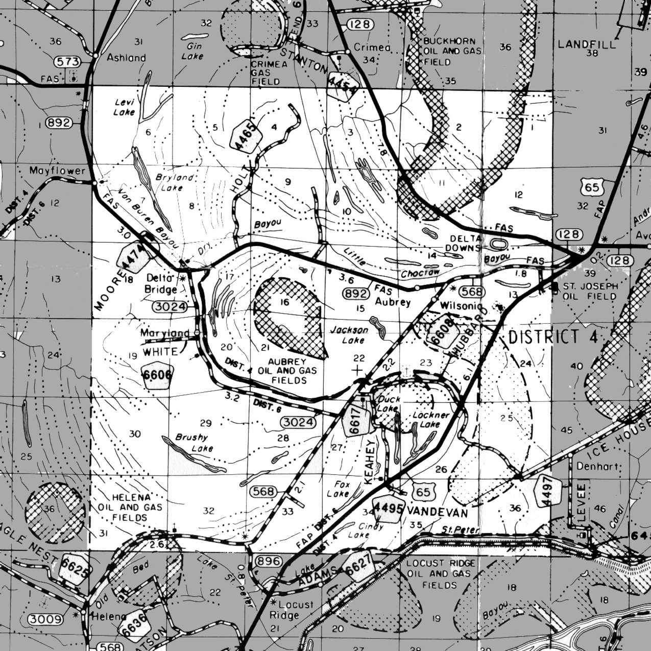
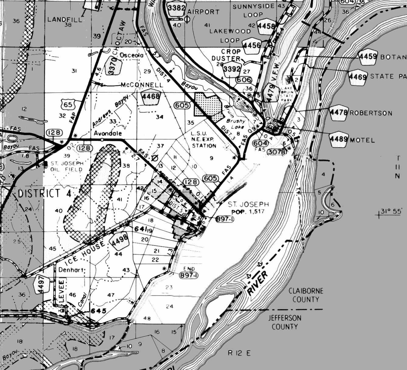
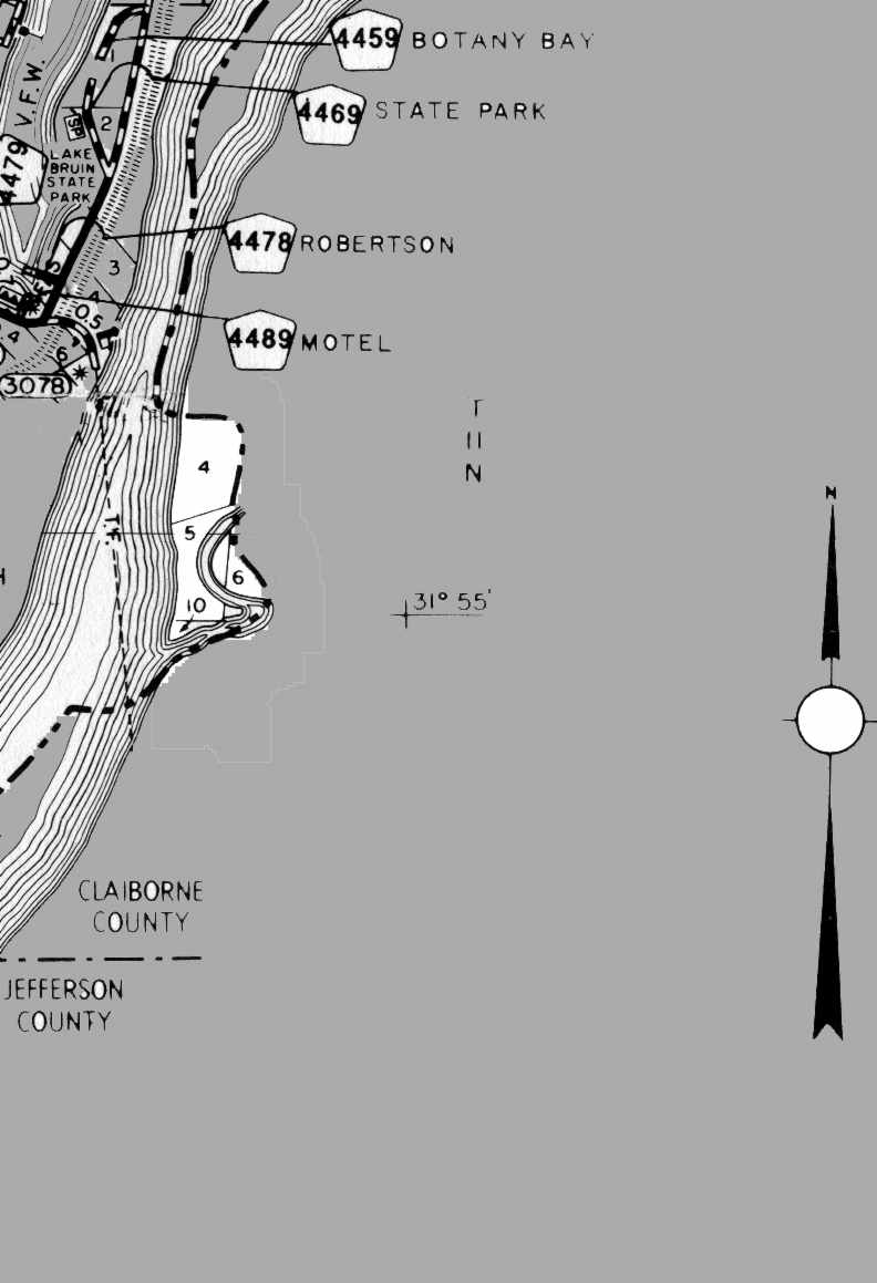
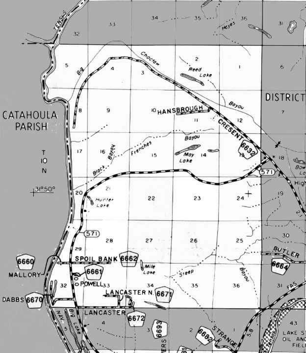
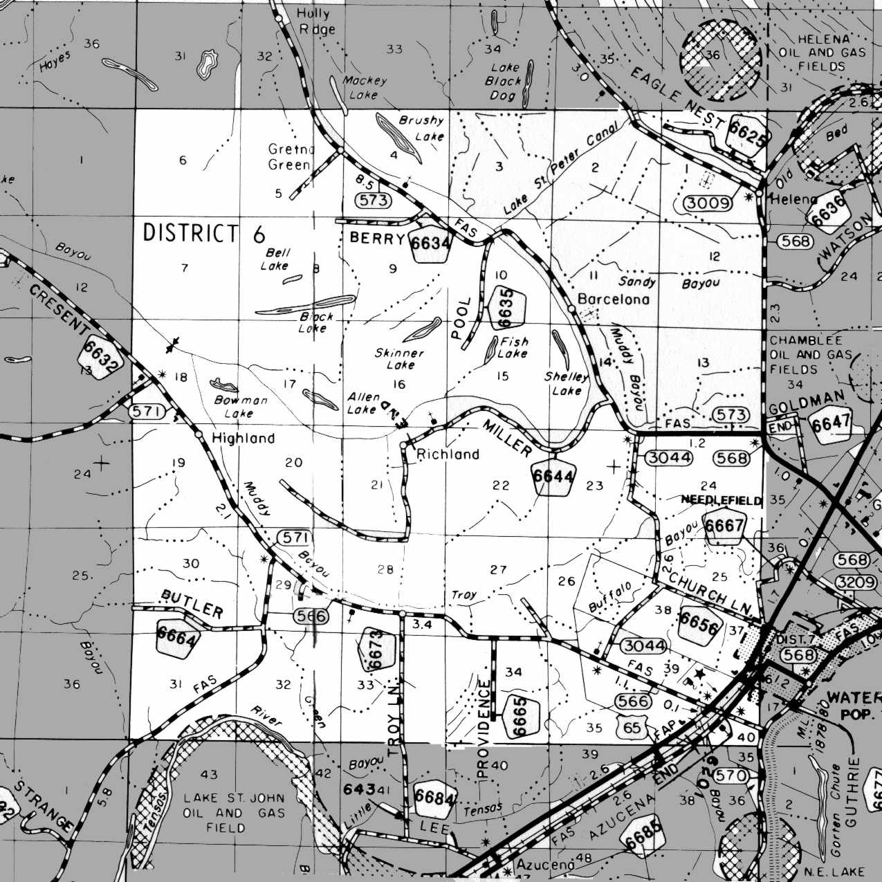
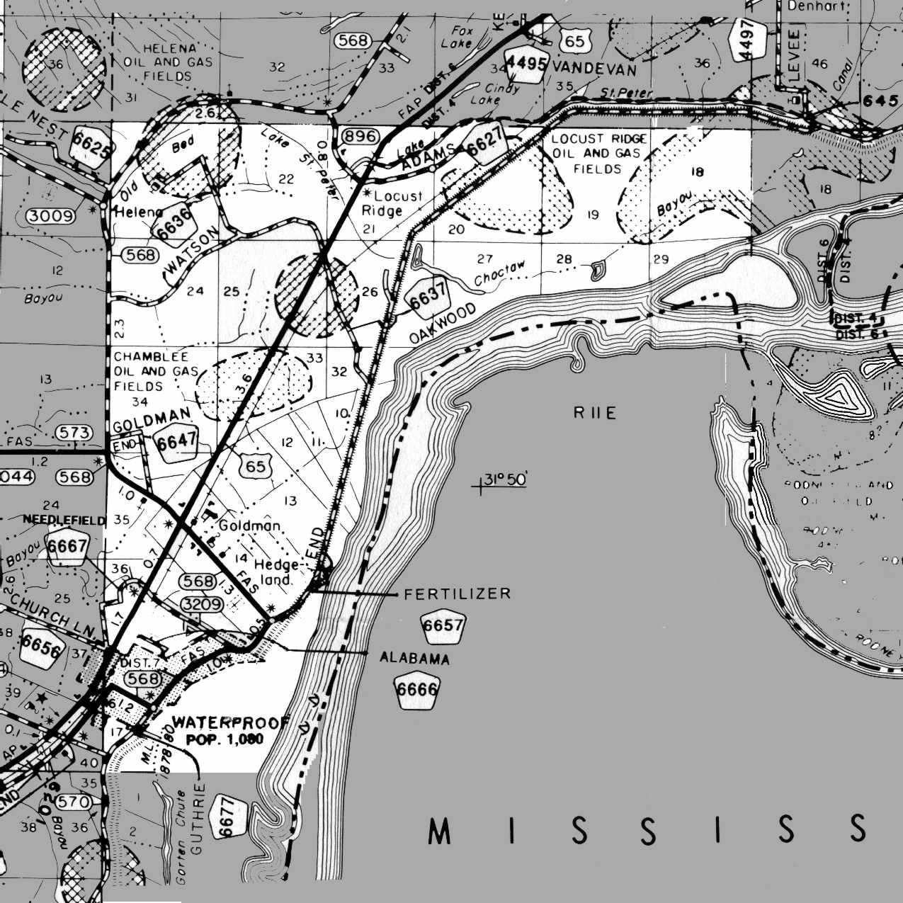
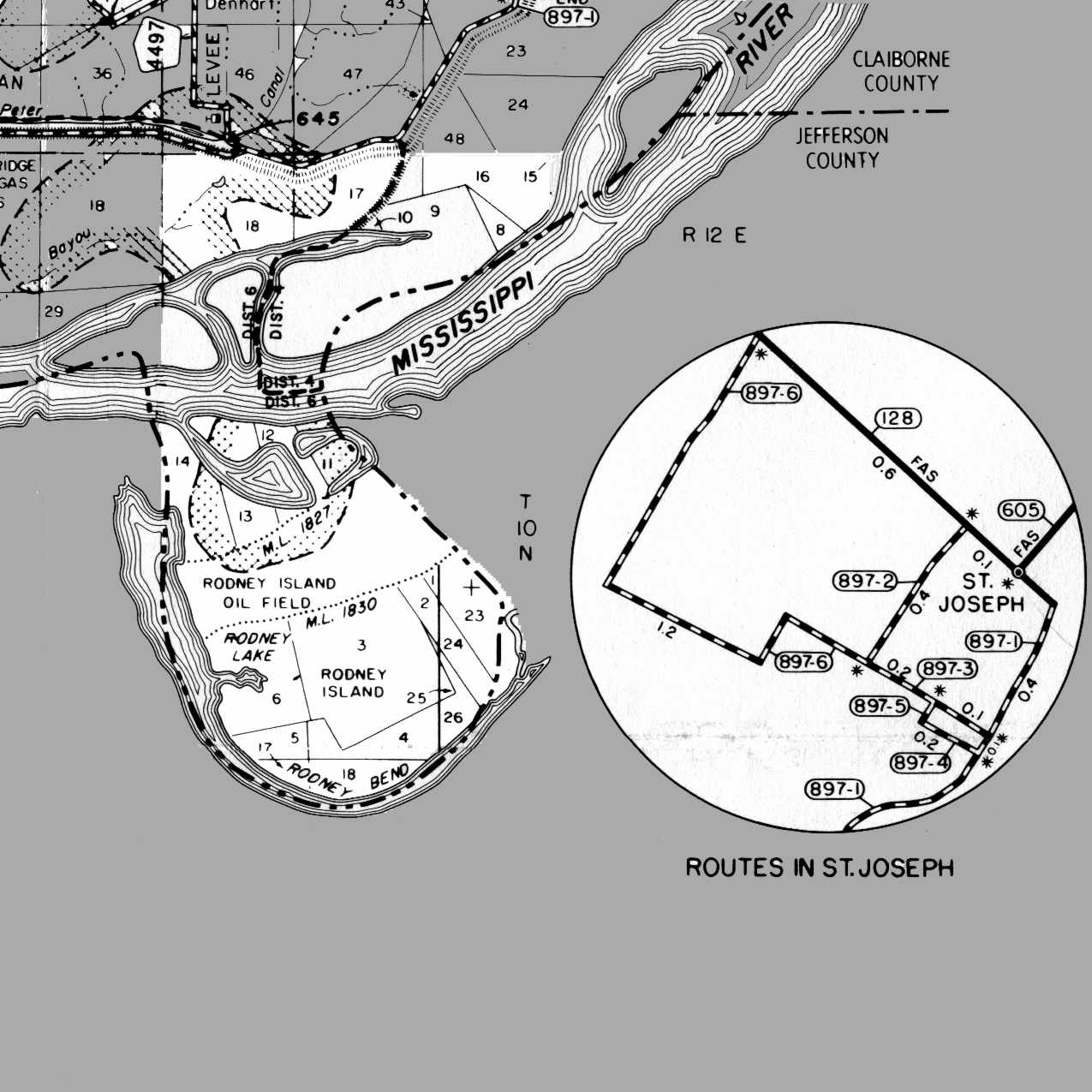
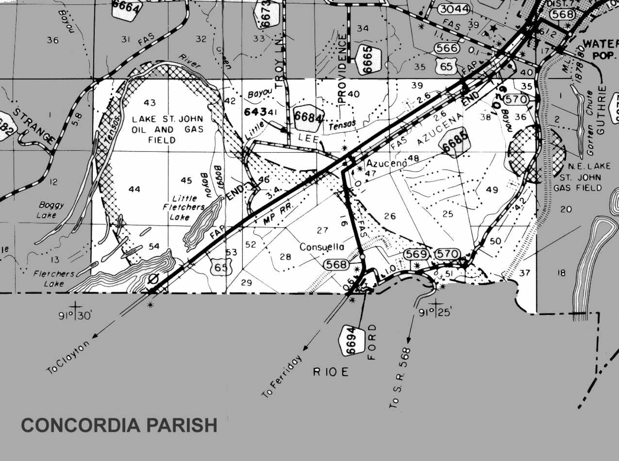
| MAP OF TENSAS PARISH LOUISIANA
"Base Map Provided by Office of Planning & Programming, Louisiana Department of Transportation and Development" | ||||||
|---|---|---|---|---|---|---|
| T15N... | 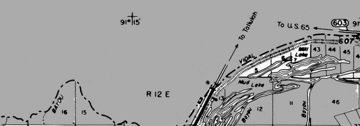 |
 |
||||
| T14N... | 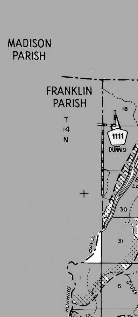 |
 |
 |
 |
 |
|
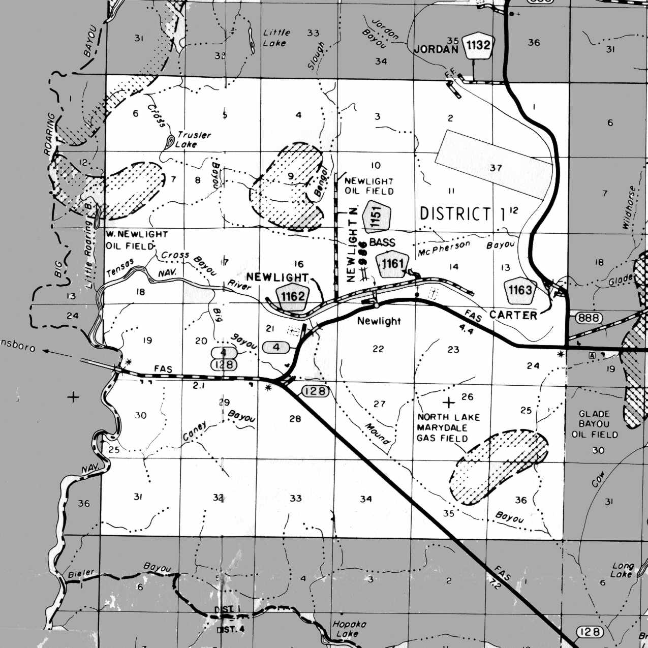
| T13N... | 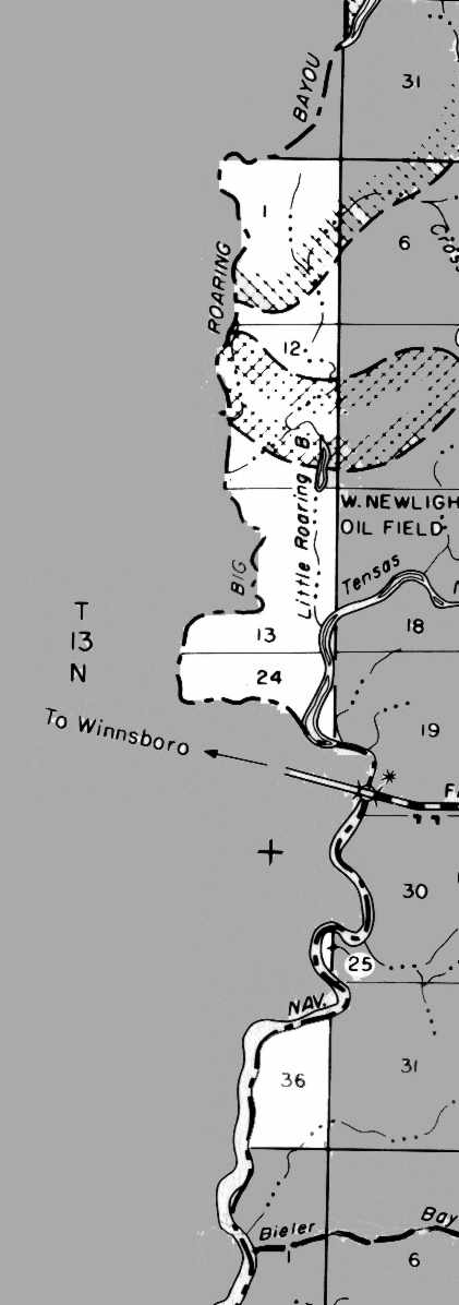 |
 |
 |
 |
 |
 |
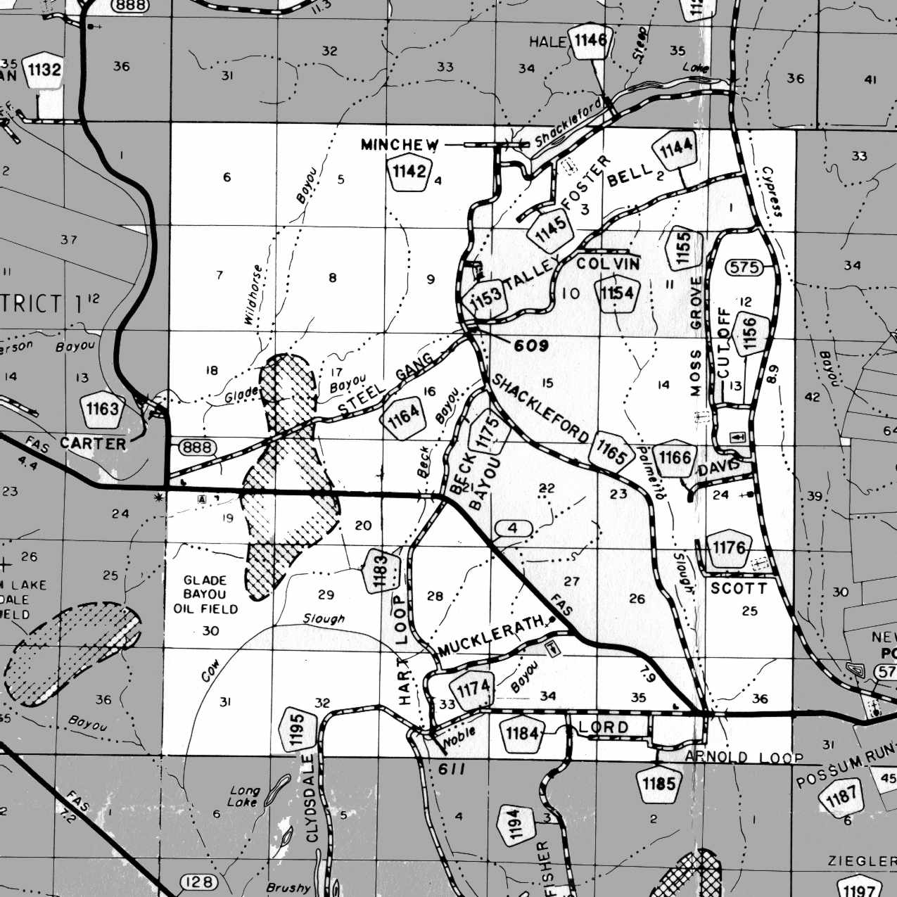
| T12N... | 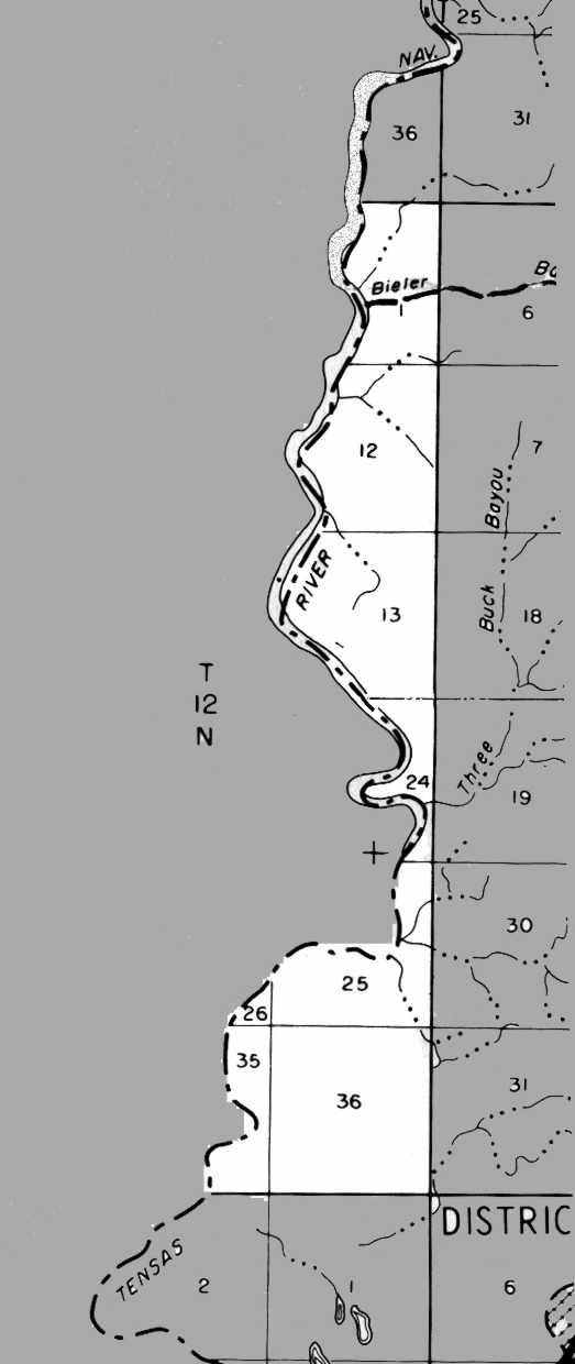 |
 |
 |
 |
 |
|
| T11N... | 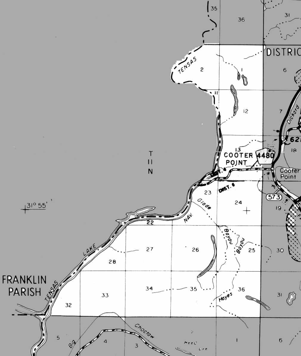 |
 |
 |
 |
 |
|
T10N... |
 |
 |
 |
 |
||
| T09N... |  |
 |
 |
|||
Roads and Bridges of Tensas Parish
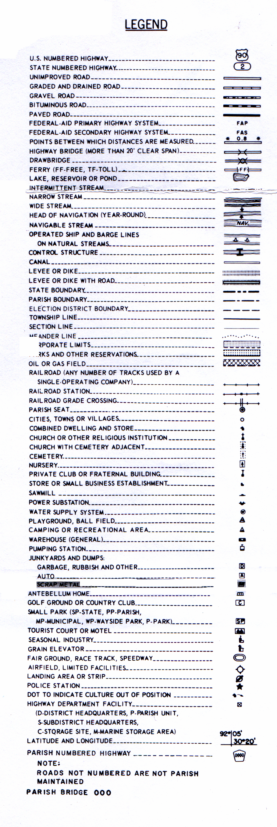
Map Legend
Images were scanned from the Official Highway Map for Tensas Parish Louisiana as prepared by the
Copies of this map are available for public use at nominal cost from:
DEPARTMENT OF TRANSPORTATION AND DEVELOPMENT PLANNING DIVISION
IN COOPERATION WITH THE U.S. DEPARTMENT OF TRANSPORTATION
FEDERAL HIGHWAY ADMINISTRATION
and as adopted by Tensas Parish Police Jury September 23, 1997
Members: James Wilkerson, President; Ples Bell, Vice President; Sam Dillard; Thomas Hale; Rufus Merriett; Ricky Rush; Woodrow Wiley, Jr.
Department of Transportation & Development
P.O. Box 44245, Capitol Station
Baton Rouge, Louisiana 70804
Tensas Parish, Louisiana Map No. 54
Reproduction or alteration without permission of the D.O.T.D. Planning Division is prohibited
©2003 by Frances Faitt
all rights reserved